
Forth Falls Dec 2017
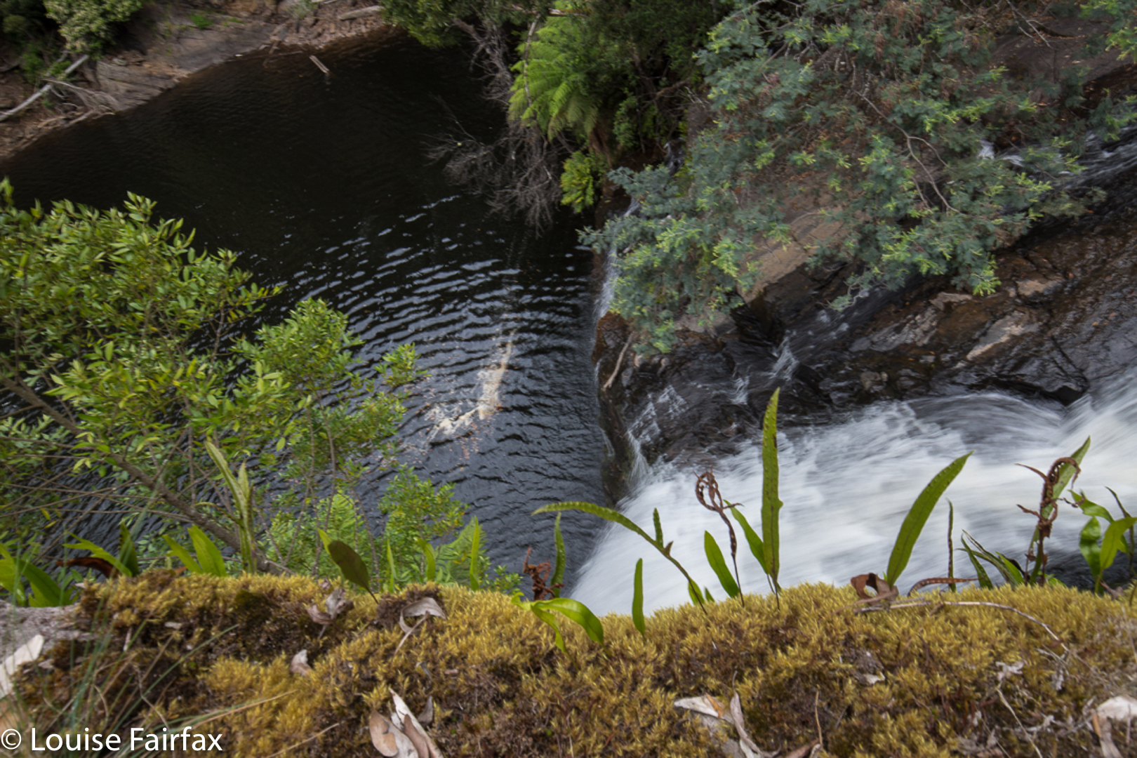
Upper Forth Falls
Forth Falls seemed to me a most curious phenomenon before I visited, as the web had many photos, all labelled “Forth Falls”, but many of these photos were manifestly not of the same waterfall. A bit of delving into history revealed that there had once been seven Forth Falls before the Forth River was dammed to become Lake Barrington, and the feeder creek that houses this series of falls, namely the Forth Falls Creek, had had its tail cut off, or its head drowned, whichever way you like to look at it. Three falls remain, it seems. Now, as there are three in a row, logic might dictate that these be called Forth Upper, Middle and Lower, but No. This is not the case. And neither are they called perhaps the next most logical names: viz. Forth Upper, Lower and Lowest. Apparently, their correct names are Upper Forth, Lower Forth and plain old Forth Falls. The Forth Falls flow directly into Lake Barrington, and are the most rarely seen of the three. So, at last I have clarified for myself the mysterious nomenclature, thanks to my waterfall-expert friend who seems to know all there is to know about Tassie waterfalls.
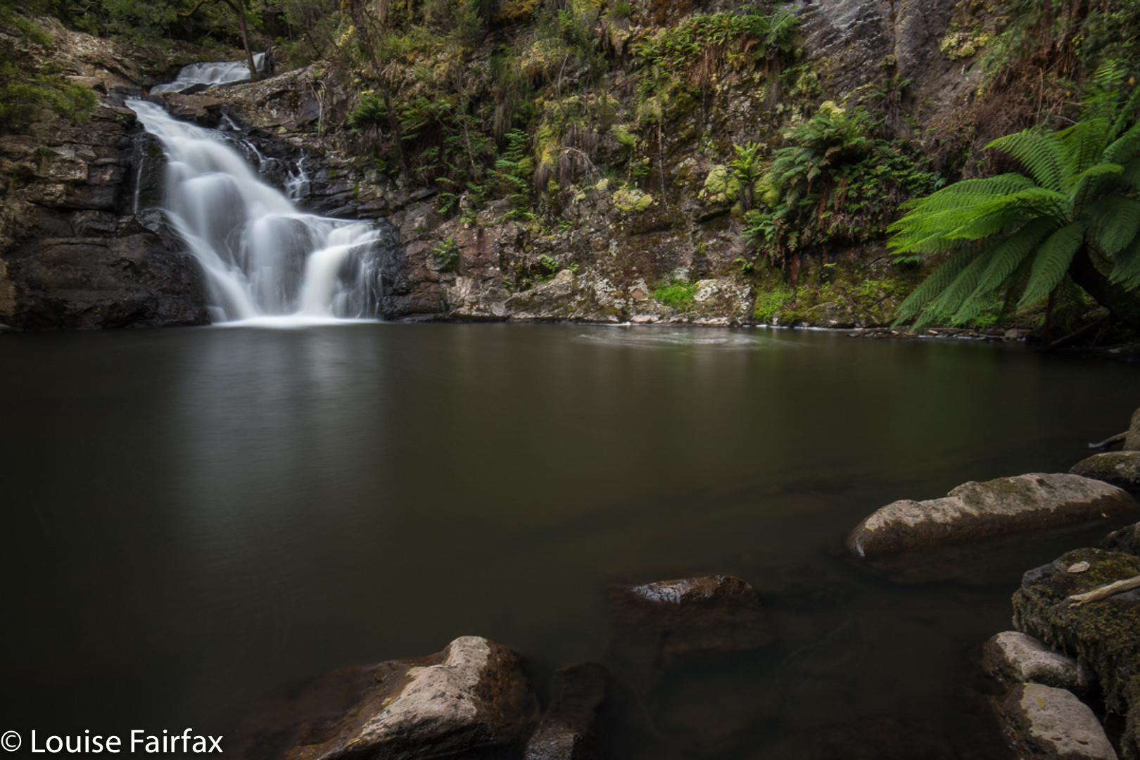 Lower Forth Falls.
Next my curiosity got me, as I was sure I had crossed the Forth River at Frog Flats when I did the Overland Track, and also when I climbed Perrins Bluff (we camped at Frog Flats on the first night). Correct. That’s a higher version of the same river. What fun. So where does it begin? Out with the good old paper map again. Ah, high on the flanks of another mountain I have climbed, Pelion West, and then it flows kind of in between that noble giant and Mt Achilles, so I guess I have inadvertently looked down on its source from two different mountains without realising.
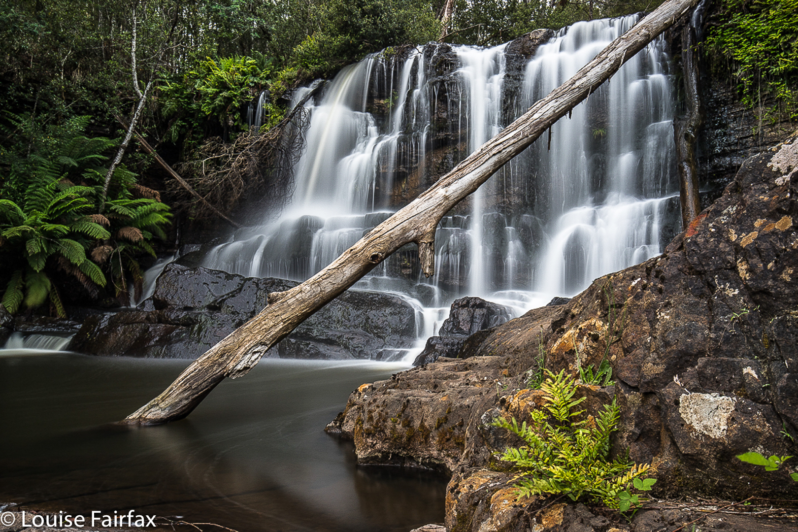
 Forth Falls.
And so, this pilgrimage to the Forth Falls that we made yesterday was one imbued with more history than most. We parked the car as instructed at the intersection of the bottom end of Buxtons Rd and Lower Barrington Rd, and followed the clear sign that pointed to the falls, and then the pink tapes that kept us on a little track / pad (it changed its characteristics from time to time). After twenty five minutes, we reached the forking in the track that the web mentioned. It said that the Upper Falls were twenty minutes away (we took ten), and that the lower were ten minutes away (we took four). I photographed, Angela explored and decided we could reach the next ones down, the Forth Falls that we’d been told you couldn’t reach without a kayak, so camera packed back away in its bag, off we set to shoot falls number three. It was a fun couple of hours.
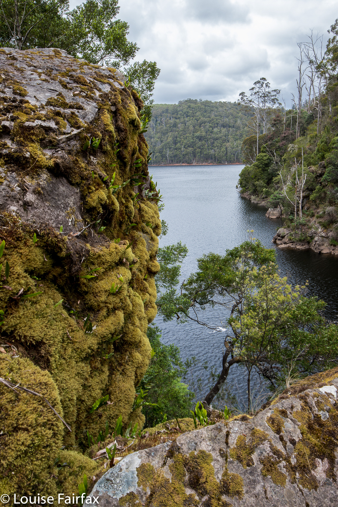
Lake Barrington from above the Forth Falls
I visited the Forth Falls before the river was dammed by the Hydro. The road lead across the Forth river and lead to a sort of parking area. To commence the walk you had to navigate a turnstile and then follow the track to a series of falls – I think we saw 4. I was in my mid teens and loved it and was extremely disappointed when we tried to find them some years later to find out they are beneath the lake. I have asked this on the Waterfalls site previously but not heard from anyone. The question was if there were any photos available of these falls and that turnstile before the drowning. We had just arrived from Switzerland and were amazed that you did not have to pay to go through the turnstile.
Hi Rudi. Thanks for the comment. I have been told that there were 9 waterfalls before they dammed the river. We are only left with the top ones. Rod How knows a great deal about the history of that area, having grown up not too far away. Adrian Bohl is very interested in old historical photos. You can probably ask them using Facebook messenger. Rod has produced some amazing YouTube videos of the big flood in the Meander area 3 or 4 years ago.