
Bastion Cascades 2018 September.
 Sometimes you have a beautiful waterfall on your bucket list for ages and ages, but the opportunity to go there just doesn’t quite arise, and so it was for me with Bastion Cascades. Something always got in the road when I thought I’d like to go there. The fact that the Waterfalls of Tasmania website says the circuit takes five and a half hours, and other sites say five, did not help. Unless one got a super-early start, one would be finishing in the dark when the drive was added to this large amount of walking time.
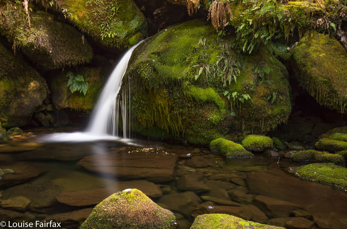
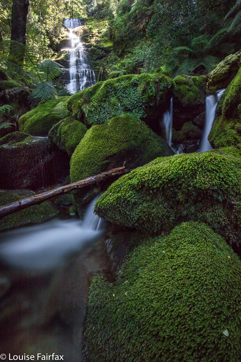
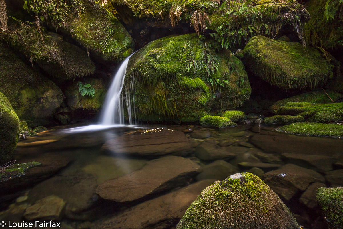 However, this morning Carrie and I went to the base of the Upper Falls of Sensation Gorge Falls (which greatly pleased us, as people said this couldn’t be done), but we were so disappointed with the small amount of flow there that I decided to abandon our earlier plans, and to head for Bastion Cascades, which always looked moist. Carrie agreed. Yet, once again, the stated time to do the walk put us off a bit, but we decided we’re fast, so we’d give it a go. We reached the first cascade in thirty six minutes. The second (that is, the actual Bastion Cascades) was seven minutes further. I’m glad I decided to risk it! After photographing small and large cascades, we continued on the circular track as it climbed above the falls, and had lunch at the amazing Stone Hut, not an exactly comfortable-looking place to stay in, but great fun to look at.
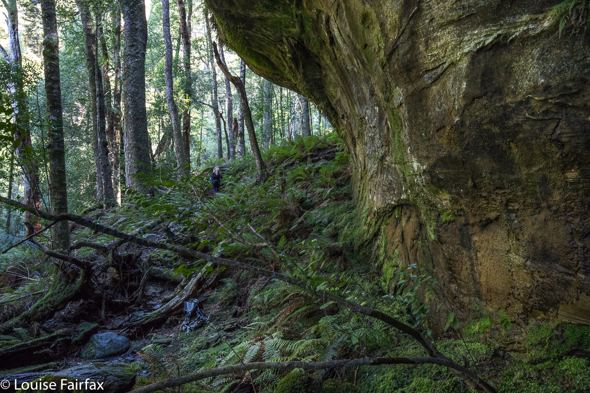 Carrie adding some scale, although she is standing under possibly the smallest of the overhangs.
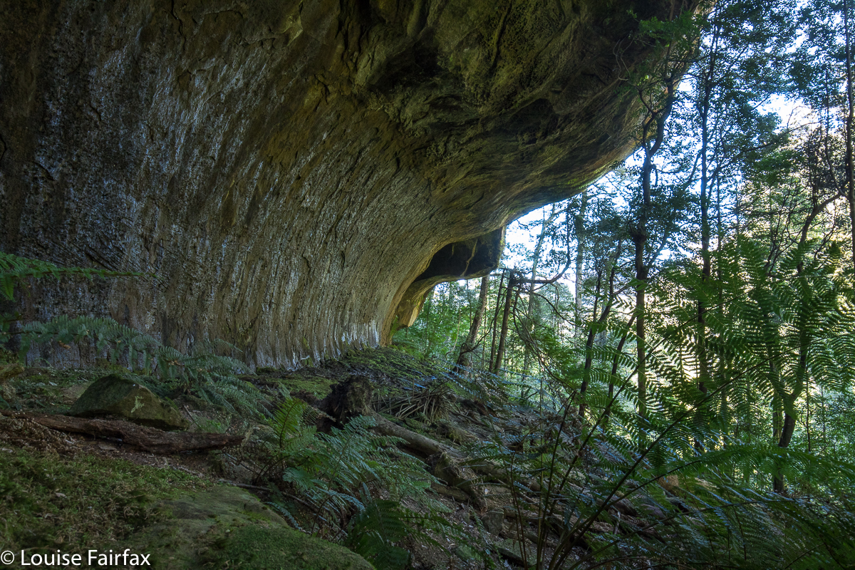
The overhanging rocks were truly awesome in their magnitude, and the whole area was lush and mossy – and steep and slippery as well. We agreed that it was not a place where you’d bring young children, especially if you were carrying one of them. Abby and Gussy will have to wait a bit for this, although they would really love this elfin forest. My gps said we walked 6 kms, and that we climbed 320 ms. Again, Waterfalls of Tasmania and Touring Tasmania both say you climb to 800 ms, kind of implying that that is how much you actually climb. You start at 625 ms, and climb to 945, so neither hint not fact is correct. Although it is “only” 320 ms, there are some quite tricky sections with permanent rope to help you, and it certainly feels like you’re working. Both of us took off a layer somewhere during the climb.
 We have both fallen in love with this area, and, whilst in the midst of enjoying round one, were busily plotting our return after more rain, like a kid who on Christmas day announces that they just can’t wait until next Christmas. Like that kid, we may well have to wait until next winter. At least we now have a more accurate time assessment of our task.
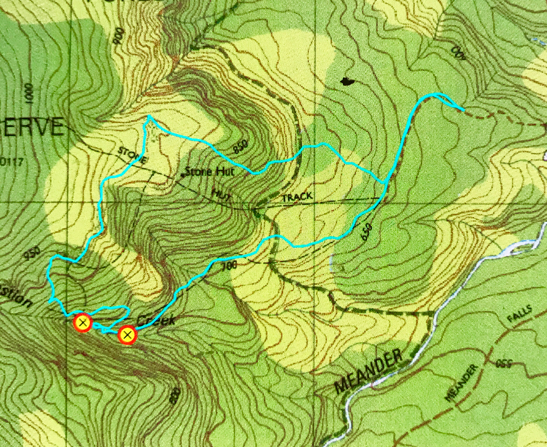 From Deloraine, follow signage to Meander Falls. However, immediately after crossing the Mother Cummings Rivulet (and the Smoko Road turnoff), there is a road on your right (Quarry Road), which looks a bit dicey, but is OK. Take it, and follow it as far as you dare. We did not go the whole way, as there were whopping mud bogs of indeterminate depth that had me too nervous to progress further. There are turning points at intervals on this road. My cyan route begins where we parked. There were two others in the forest that day, and they walked as fast as I drove for that section! After parking and following Quarry Road to its end, follow signs to the Stone Hut. Later, there will be another sign, and you can make up your own mind whether you want to visit the cascades clockwise or anti. Both directions contain fallen trees and parts that have ropes because the rock is so steep and slippery. This is not a tourist waterfall. If you go there, please remember that the beautiful moss is part of the attraction, and try to tread only on stone, leaving the beauty for others to enjoy as well.
Please note the gross inaccuracy of the original tasmap. The cyan line marks the actual track. Both the black dashed line, and the position of the Stone Hut are way off. The Hut is to the north of the top cyan line. (The contour they have it on is probably correct.) The black dashes bear no resemblance to reality. Whoever put them on the map got their spurs confused. The waypoints are where the upper and lower cascades are. Have fun. Take food with you. This is such a lovely place to stop and eat a while.
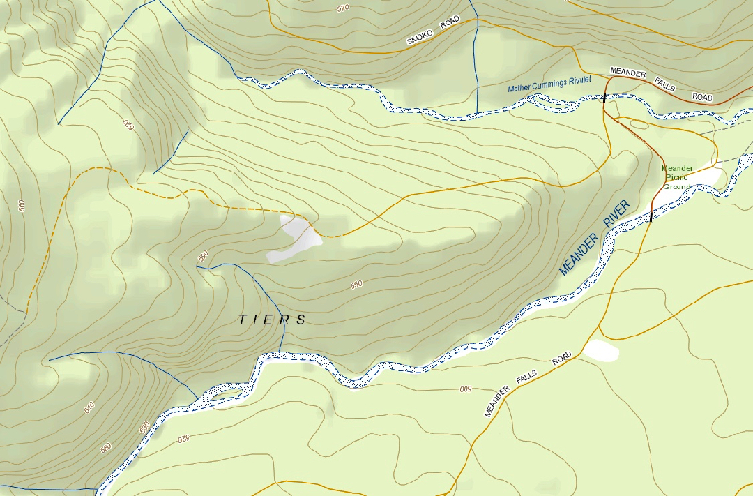
“Context statement”, showing the start of Quarry Road, after the Meander Falls road crosses Mother Cummings Rivulet. You will see that this road saves you quit a bit of contour climbing if you go as far as you can.
Bastion cascades would be my favourite walk i have done so far, when you go back with more flow there is a lovely fall that drops almost opposite the viewing area to Bastion, you will have to cross the creek to get a better view of it but it is nothing difficult. awesome fungi area in the right season too.
Thanks for the advice Greg. Yes, I bet the fungi in autumn would be amazing. I can see this place becoming a regular now that I’ve tried it. Amazing it all had to wait so long!! Do you mean crossing at the lower or the higher of the two main cascades?
when you walk to the main fall and the track sort of stops about 50 metres or so from the fall almost directly across from there, there is a high cliff and it gets a lovely gentle fall over it . we were able to hear it before we walked on over to investigate and you can see parts of it through the forest canopy.
Well, I’ll definitely have to go back after rain to see what you’re talking about. Thanks
Bastion Cascades/Stone Hut loop is one of my favourite walks!
Also I know the Falls Steve speaks of,across the creek at the bottom of the Cascades,there is a tiny little flat dirt/grass area I always sit for lunch,from there you will see a rough track going up the hill to the Falls!