
Every time we drove to Cradle Mountain and saw the old wooden sign attached to a tree saying Quaile Falls, I wanted to see what they looked like, and yet, every time, I was repelled by the other, much bigger and louder sign, there in its red and white starkness, announcing that this was Private, and that I should Keep Out. In addition, we were always either in a rush to get to the mountain, or equally anxious to get back home. Quaile Falls didn’t get a look in. Besides, how much time did one need to do this trip? Did one go right past the indignant owner’s house? What lay in store if one went down that road?
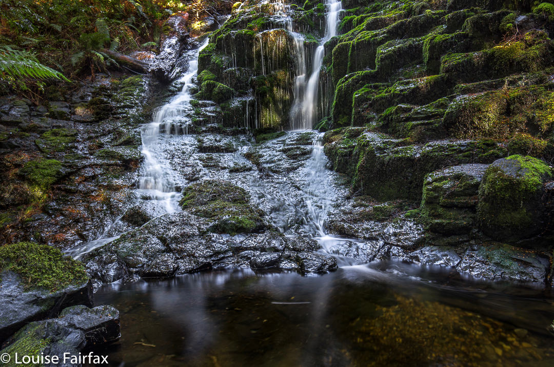
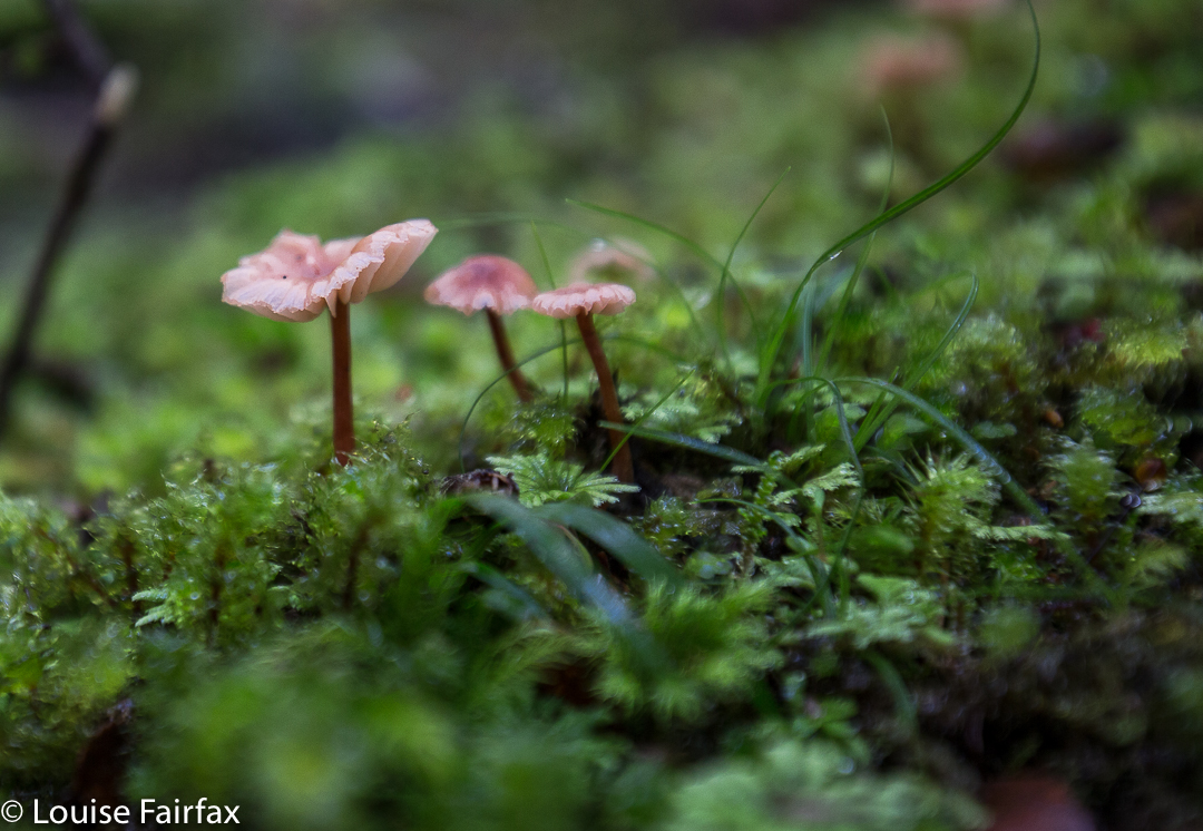
Upper Quaile Falls, encountered after fifteen minutes’ walking.
My curiosity was further ignited by the knowledge that a few friends had recently been there, and I felt it was time to find out how things lay. However, I had long since realised that a “we’re-passing-by-so-we’ll-just-call-in” kind of trip wasn’t going to happen. These falls required their own dedicated journey. And so, last week we set out to visit them in their own right, unaccompanied by any other purpose.
I retrieved how-to-get-there information from the Waterfalls of Tasmania website and off we set. The alluring sign that had attracted me for so many years was gone, but the dirt road remained, on the map northish from the falls themselves (and before the turnoff to Cradle), and leading down to near where the falls are. According to the web, there would be a small parking area (correct) with a sign pointing in the direction of the falls, and pink tapes to set us on our way (all correct).
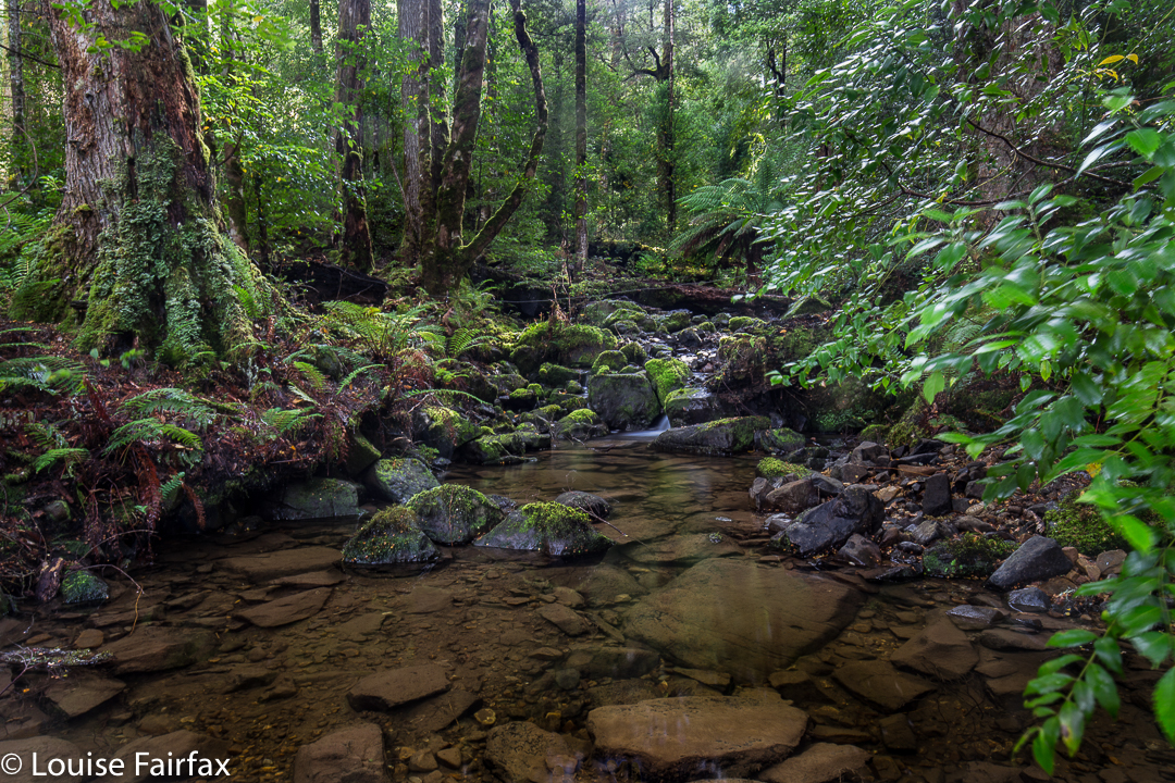
Olivia Creek
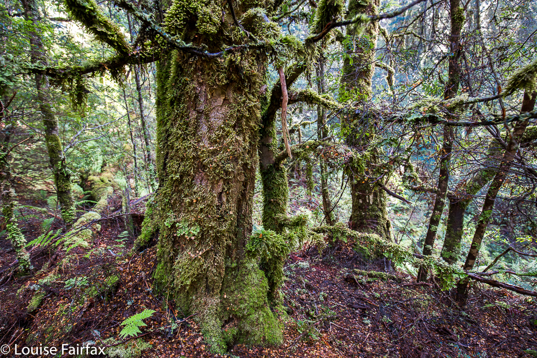
From the main Cradle Mountain Road (C13), looking south in the direction of the falls, you would never believe that such lovely myrtle forest was so close at hand. It looks quite barren and dry from the road. The track through the forest felt ancient. I guess it wasn’t private-keep-out in some bygone days of greater generosity; no doubt, before our legal system decided that if I fell on your land it was all your fault for owning it, and not mine for being careless. I can hardly blame the owners for trying to keep us out in the current state of affairs. I would too.
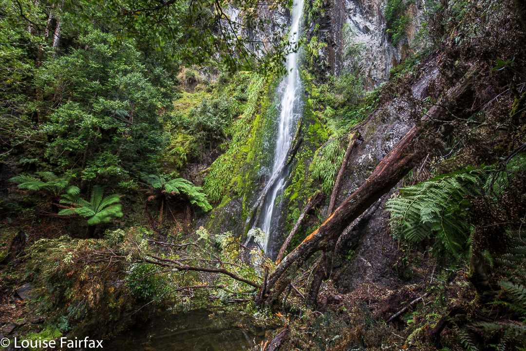
Actual Quaile Falls
As my source said, it was fifteen minutes to where I could first hear the Olivia Creek, and just beyond a creek junction to my right, lay the Upper Quaile Falls, which I actually found to be more attractive than the real ones, which, to be sure, have a huge drop, but the latter are a rather unadorned straight line, and at present, have quite a lot of debris at the bottom. The actual Quaile Falls were a further fifteen minutes from the Upper ones.
The top of the falls was a beautiful forest with gurgling, clear stream cascading over rocks and making lovely pools. I parked my husband there and said I’d be thirty minutes, planning to climb down the cliffs to the bottom. Thirty minutes was a gross underestimation. There was no pad that I could find leading to the base, so I made my way down the very steep slopes, over, around and under massive amounts of fallen timber, sliding down what I hoped I could later climb up, until I got to a spot that I decided was “good enough”. I’d used up too much time doing that much. My husband would be worried. Another tier lay below. That could wait until a day that I had someone with me. That would feel nicer. I took some shots from where I was and called it quits.
We had lunch back near the car at the edge of the forest, and were home in time for me to have a run in the gorge. The trip to Quaile Falls was a great outing, but I hadn’t exactly used up a lot of energy.
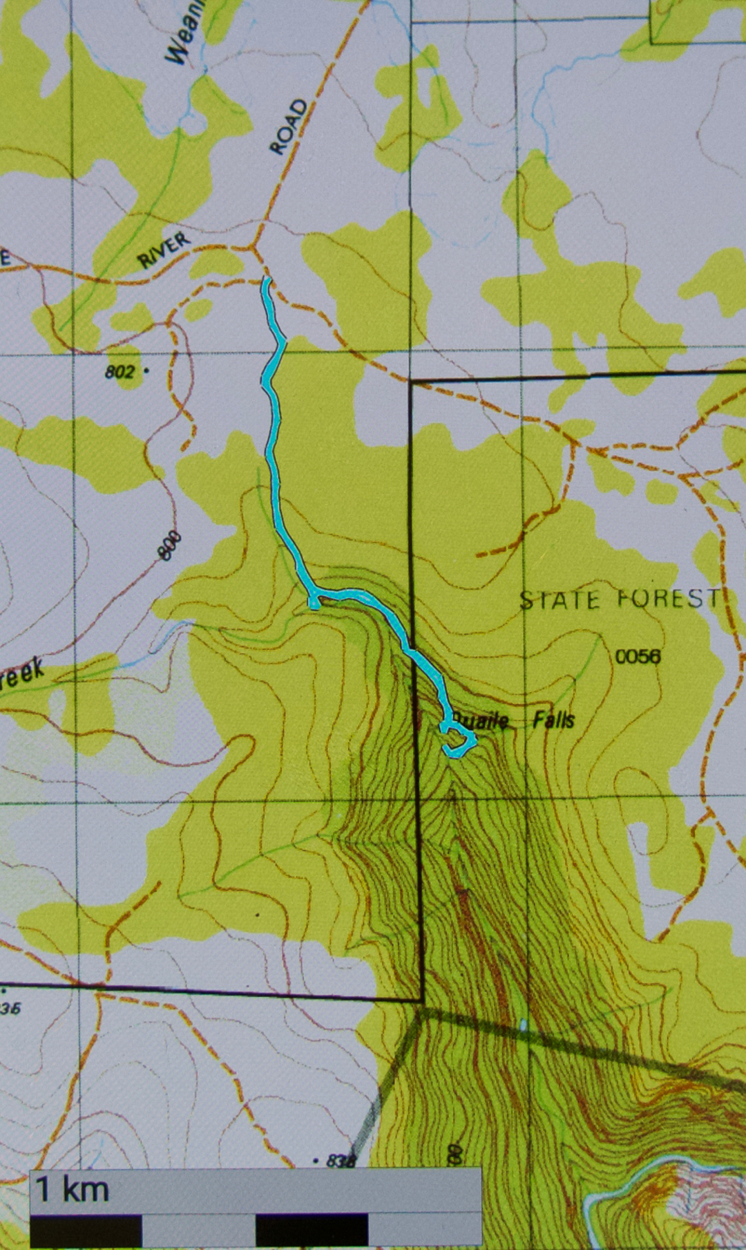
(The Road name you can’t quite read is “Dove River Road”)