
Bastion Environs 2018 Nov 24th
 This blog was going to be titled “Hidden Falls”, but, as said falls remained true to their condign name, and as we, the searchers, returned home empty handed of that particular waterfall, I have had to label it “Bastion Environs”, for in our search for this Holy Grail, we roamed far and wide in the upper environs of Bastion Creek and its minor tributaries. I can unequivocally report that these Hidden Falls are NOT on Bastion Creek, where one web report places them, and neither do they lie on any of its mapped tributaries.
 Diaphanous Falls
But hey, I am an orienteer, and am more than accustomed to the control description “shallow gully”, so we searched lots of those too. We have eliminated all shallow gullies adumbrated by the map except for two, adjacent to each other. We agreed that, given the lie of the land, the placement of cliffs and more, one of these two adjacent tiny gullies must contain our prize. I marked our guess with a waypoint. Since then, I have had our guess confirmed, and we have an exact location. I will return while the water is still flowing nicely.
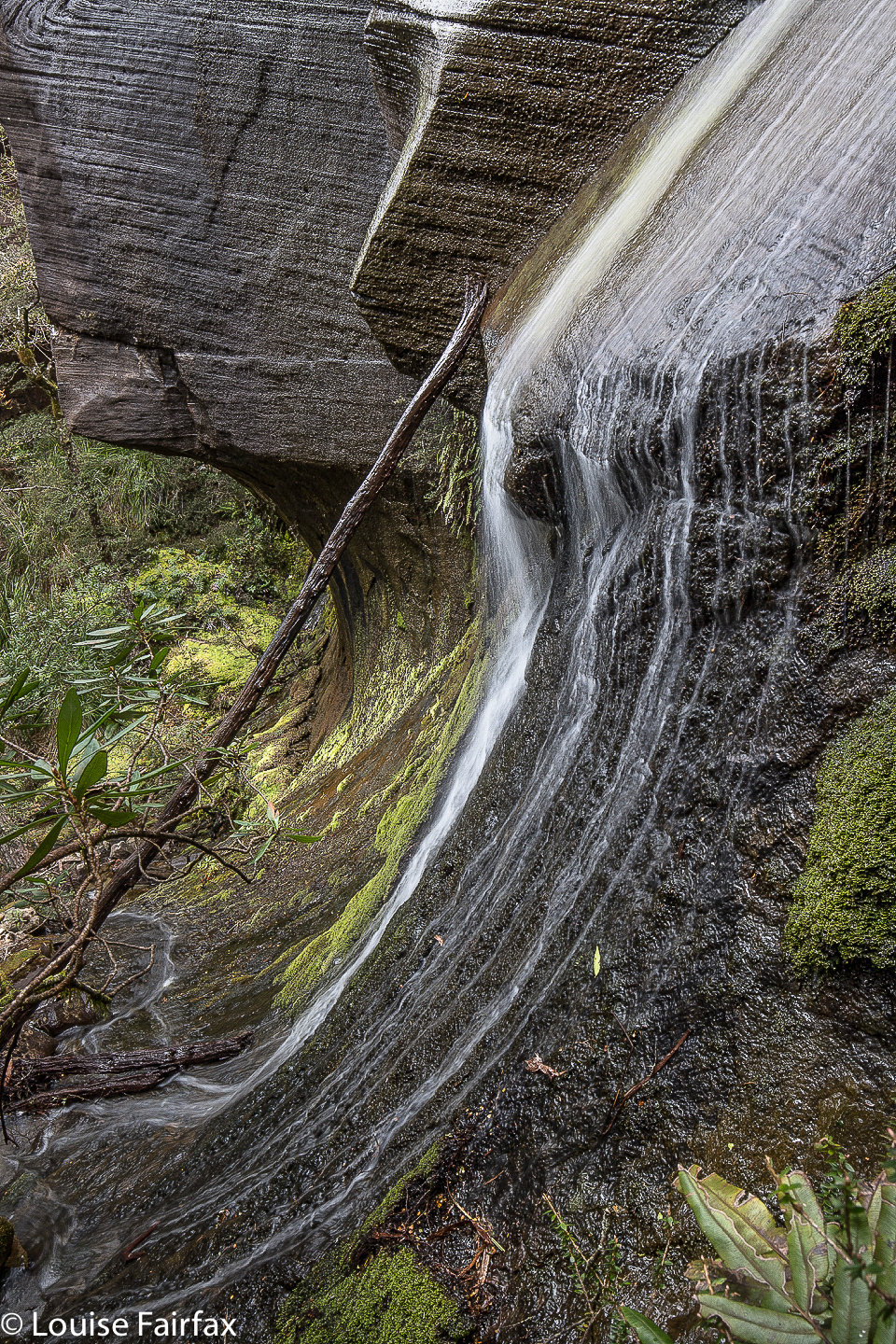
 Gossamer Falls Upper
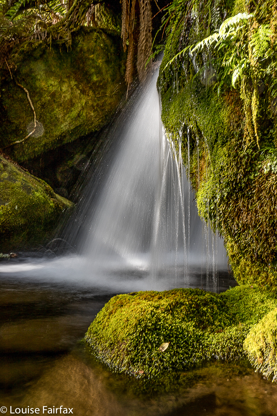
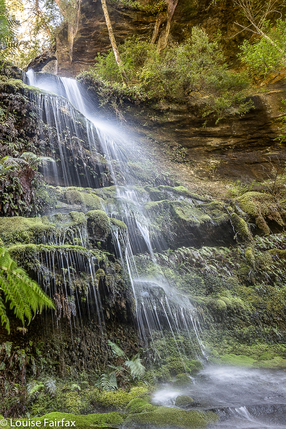
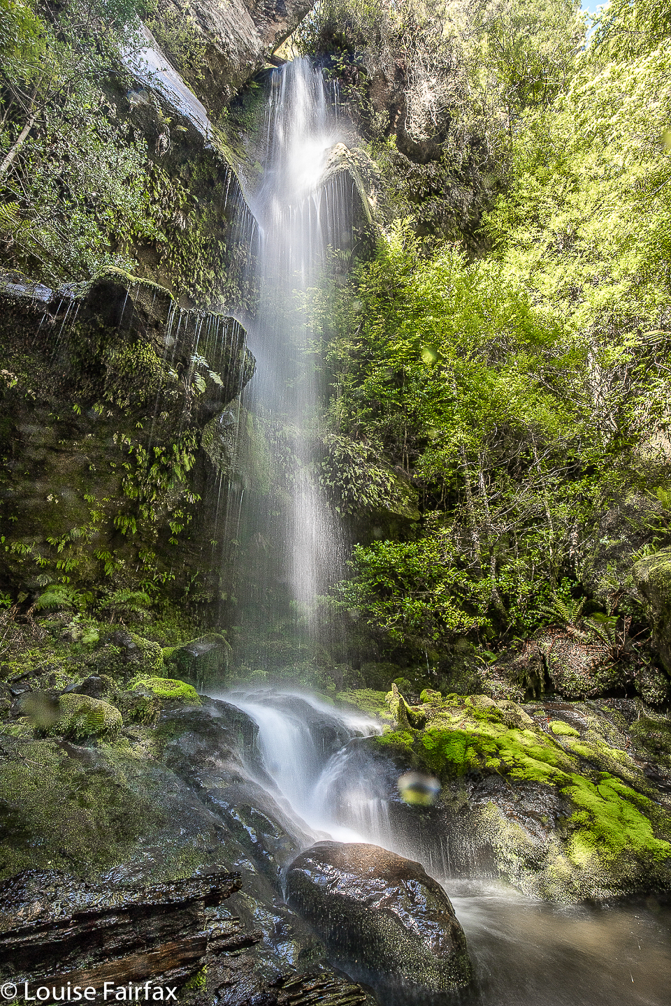
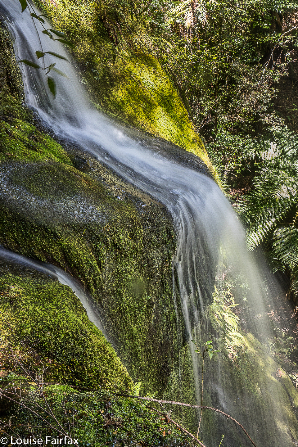
Do not feel one scrap sorry for us that we didn’t get our goal today. Working for a prize makes it all the more precious – and there were many fabulous consolation prizes along the way. The most hidden of these rewards I dubbed the very boring Hidden Falls B, until Steve suggested The Waterslide. This is a perfect name for these falls. You really did feel you were gazing at a brilliantly constructed waterslide. And why should they live in perpetual declaration of their failure to be the real thing, Falls A? So, The Waterslide it is. Other falls nearer to the Bastion Cascades that occupied our photographic attention and time were what we have called Diaphanous Falls (to the right staring at the main falls), and Gossamer Falls Upper and Lower (to the left). None of these falls is on the map. There are no official names we know of; the names are ours and we like them.
 Gossamer Falls Lower
And what else did we do with our eight and a half hours’ elapsed time? We photographed, I sang, Steve recovered, I ate, we stared spellbound at beautiful places and we chatted. Steve is a new friend, made through the Waterfalls of Tasmania Facebook page. The next day, I was going to meet up with Jai, another new friend from that group. Carrie, with whom I have had many fun adventures, and Craig, Bec and Caedence are also friends I have met and explored waterfalls with via this group, to name just a few. Our shared love has brought us together. Meanwhile, I feel I know the Bastion environs to the north and west quite intimately, and yet I have by no means explored all its photographic potential. That said, I returned home with 98 photos to edit. Sigh.
The Waterslide
Lovely pics Louise.
Thanks ever so much for commenting dear Vonda.
Location please?
HI. As said in the blog, head west along Bastion Creek, following it to near its end. We explored all that region, and then, for The Waterslide, went north of the only mapped junction on Bastion Ck. There is no track beyond Bastion Cascades, but the rainforest is not thick. The Waterslide is where the contours suggest something interesting may well lie.