
I was told that to get to the “real” Ford Falls, I “JUST” had to follow the Ford River down until I got to the falls. Now, if you know anything at all about this area, you will know that contours fill the map around these falls: it is very, very steep, and very rugged, with unmapped cliffs all over the place, and scoparia in between. I would personally find the word “just” to be inappropriate. But maybe this time I was mistaken. Perhaps it is not as formidable as it seems. Only one way of finding out. Hm. Maybe curiosity will one day kill this cat.
I was nervous going solo in such territory (which I treat with absolute respect), so made sure I not only had my PLB, but also lined up a friend who was primed to call SES should I not be out by 6.30. I didn’t trust my informant sufficiently to believe this would be a piece of cake, especially when his particular words mean that I doubt he has actually been there himself.
I set out from home at 2.30. I thought that meant about one hour driving in each direction, and one hour by foot to and back from the falls. Alas, the car trip took a tad longer than an hour, which then made me feel under time pressure for the foot part. Off I hurried. At first things went pretty well. The rocks were only mildly slippery, but I was not visible from the road, and the rocks are quite angled, with big drops between them, so I moved with enormous caution.
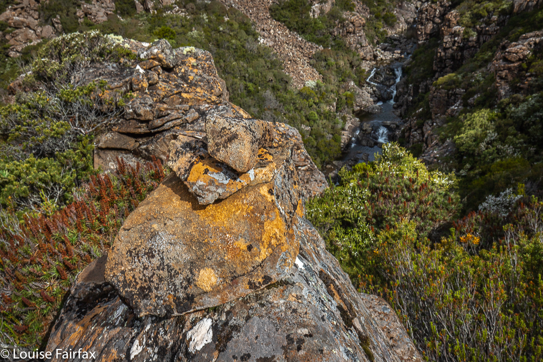
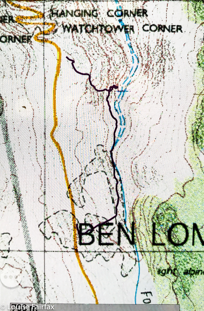
As I feared or suspected, after a few hundred metres, it became impossible to actually follow the river. Steep cliffs dropped into its waters from both sides, and I was forced back up the hill, and into swathes of thick scoparia as I wended my way forward. Higher and higher I went. Time went by. To my amazement, I then found a cairn. But where had it come from? Where was it going? I scouted around for the next cairn, but failed to find it. Its presence made me feel that I should try to go back down to the river at this stage. I tried a couple of options, but they were all too dangerous. My gps said I had arrived, so I hoped that the waterfall below me (pictured) that I was gazing at was Ford Falls REAL, photographed it, and cleared out. As you can see from my route, I just scaled the contours straight up, as I decided shorter was better at this stage of the afternoon. (It was much better, and faster!) I had been lower than this photo, as you can see from my route, but that spot gave the best view.
I drove home feeling utterly overdosed with adrenalin. I got in phone range on the way down Jacobs Ladder, so was able to let my backstop know I was out safely, even if I was drowning in an epinephrine bath.