
Cape Raoul Tasman Peninsula Feb 2019
 Walking to Cape Raoul was not on my radar, even at the start of this week (in which it took place), but the fires have thrown out almost every plan I originally made for this summer, and this week was no exception. To cut to the point, I found myself with the possibility of a night’s babysitting for my dog, but no longer any particular destination planned (I was supposed to be on a ten-day expedition, but that’s another story). Where should I go for a single night? I decided one of the Three Capes, and gave Raoul the guernsey. I will ultimately, of course, photograph all three. I have to start somewhere, and my daughter and her husband reckon Raoul is the best.
 The foot track to my goal was only 8.1 kms long (with 250 ms climb), so I knew I had plenty of time to slowly wend my way to the start, having dropped Tessa off in Hobart. It was horrifically hot, and I was not in a hurry to throw myself at those temperatures with the heavy pack I was about to carry. I popped in to the Lavender Farm near Port Arthur and ordered pumpkin soup for lunch, figuring that the extra fluid would be good for me. Unfortunately, the chef must have realised that his soup was insipid and tried to cure that by adding stacks of salt. I did not enjoy what I had.
 And why did I have such a heavy rucksack for a mere overnighter? First, because I knew I would need plenty of water in that heat, so was carrying 2.5 kgs of the stuff; second, and precisely because it was a mere overnighter, I was carrying my heavy tripod (rather than its lighter, travel counterpart) and all of my filters, cleaning gear and anything else I thought might be appropriate. I popped on the pack and almost fell backwards. Oops. Out of practice with a pack this bad. This will be good for me. Not only my shoulders, but also my legs noticed the extra weight. Nothing like training for a race by racing. Off I set. I really need to get back into a gym. I haven’t had one single session since Bruce died.
 What would this track be like? Slowly, getting used to a pack this burdensome again, I moiled my way up the hill. Ohh. There’s a comfy seat. A sign said there was a lookout in fifteen minutes. Signs like that for me, even with such a pack, constitute a worst case scenario, so I decided I could hang in there to the lookout, which I reached 37 minutes after leaving the car. I would normally never dump my pack so soon after starting, but this day was hot, and the pack was heavy. I dumped and had fun exploring the cliff line packless, letting the day advance and thus cool down a smidgeon before undertaking the next section, which I decided should be 45-minutes long. Again I dumped and had a bit of an explore. It was still much too glary to contemplate photography, although I could see endless lower-light possibilities, perhaps for the morning on the rebound.
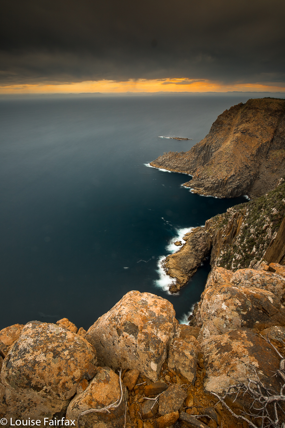
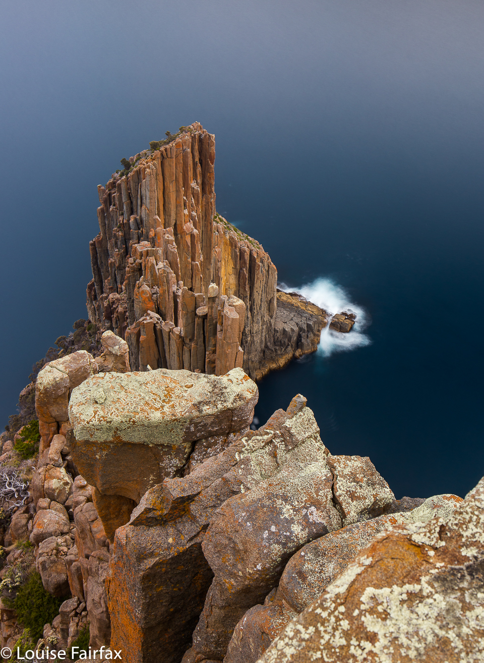
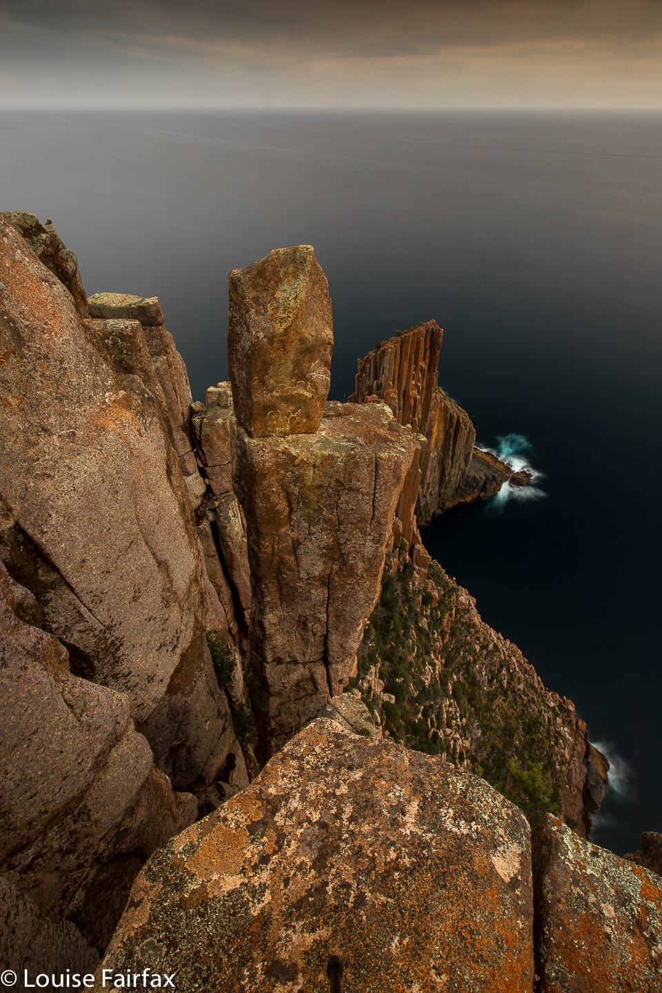
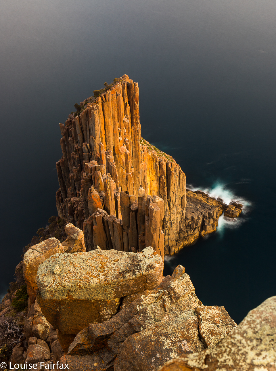
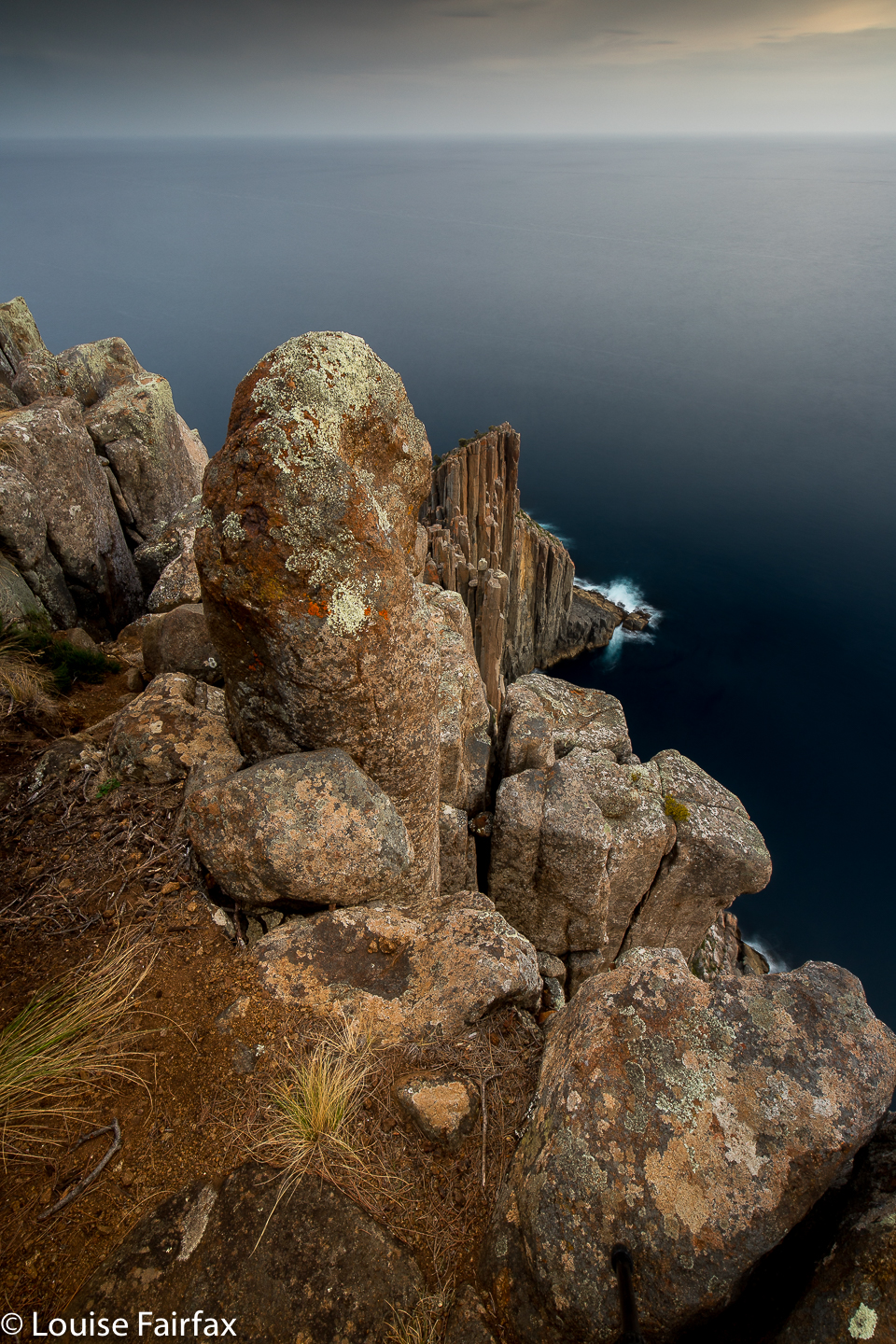 Fifteen minutes after that break, I arrived at a fabulous viewpoint directly and closely facing the jagged dolerite columns of the Cape. What a lineup of rocky, huddled soldiers with orange caps, all standing to rigid attention, possibly keeping each other upright, too tall for much standalone stability. I seriously contemplated stopping here. There was a good camping spot and fabulous view, but I couldn’t really make a decision like that without having seen the itty bitty end of the cape and having grounds for comparison. I could always return if I wished. Sixteen minutes more took me to the bitter end, which had no bitterness at all, of course, but only drama, and possibly terror for anyone afraid of heights. Respect for one’s height had to take place. Out on those columns, it was a huge 300 m drop to the sea below. A single lapse of concentration, a sudden gust of wind offsetting balance, and goodbye world. I did not look directly down, but concentrated on concentrating on being stable. I was delighted that some wretched governmental nanny hadn’t erected barriers to stop me enjoying myself.
 I was hopping columns (not with a 300m drop below – one of the ones with only maybe 3 ms to fall -) when I nearly did fall, as suddenly a huge smile with a helmet on top appeared in my peripheral vision of the gap below me. Barefooted Owen, who had just completed an almighty climb of two of the pillars further along, was now ascending a chute to easy walking: “One of the best climbs here … in Tassie … actually, some say on the planet, and I’m not going to dispute that”, he said with quiet satisfaction. We enjoyed meeting each other, and chatted whilst waiting for his companion to appear. He inspected, and approved of, my chosen real estate for the night. Entering into the spirit of choosing a beautiful location, he advised a spot even nearer to the edge than I was going, but I pointed out that my tent is a free-standing one, and that if a gust was strong enough to lift out my pegs (easy), then tent and I could go rolling over the cliff. Being rather heavier than I am, he had not considered such a possibility. I may appear to take chances, but, in reality, I am actually very cautious and safe.
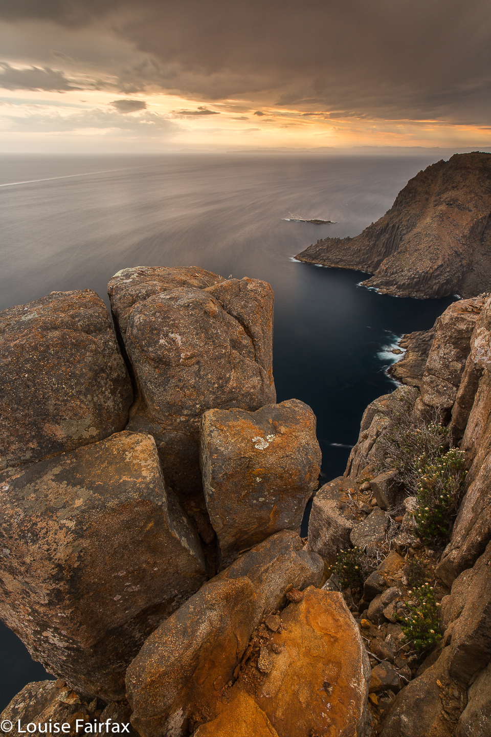
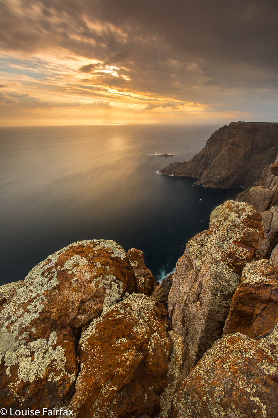
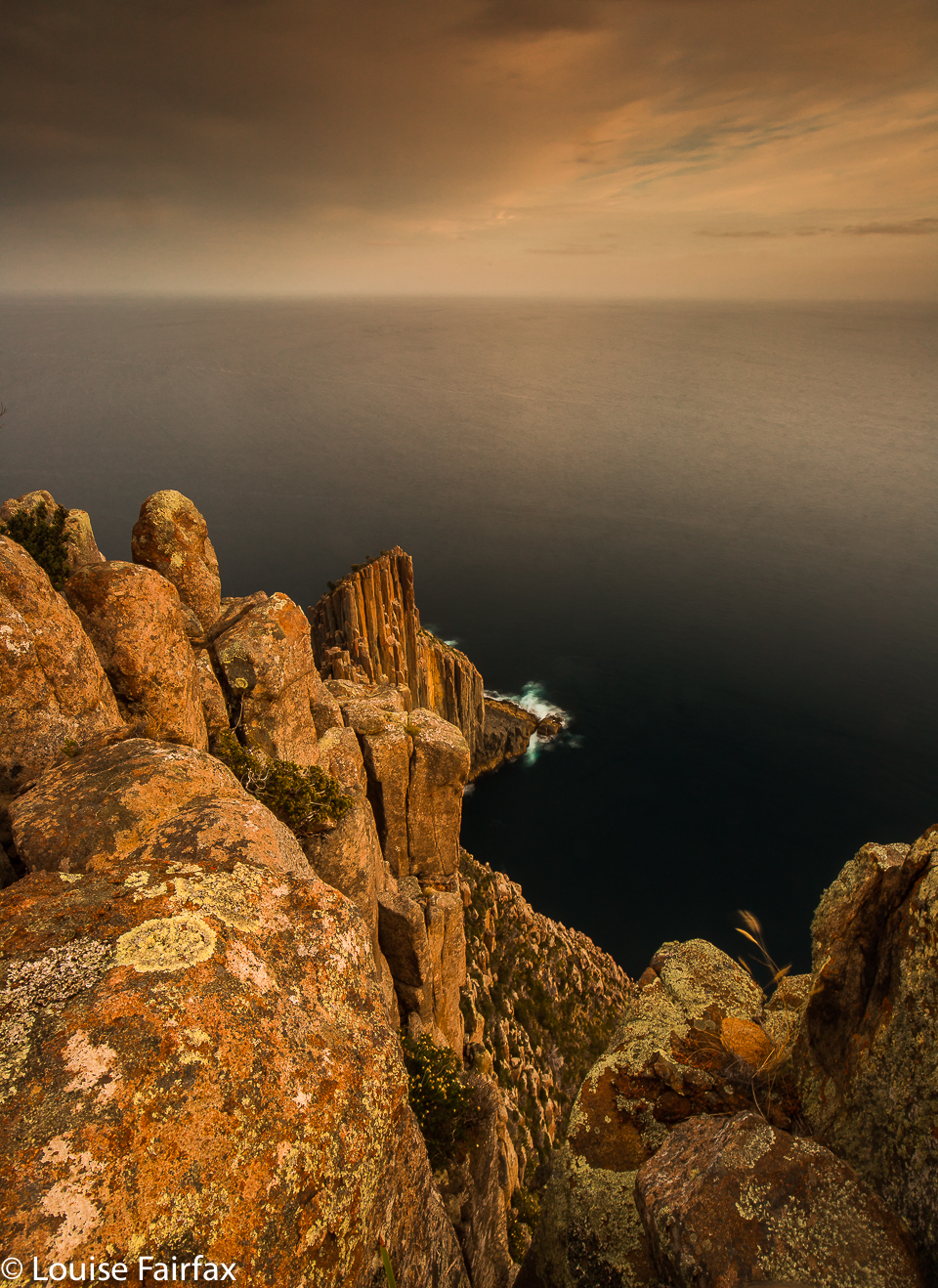 Alas, even by the time Owen left to return to his tent in a much less sublime part of the forest, clouds were amassing … just light, wisps of ones at first, and I paid little attention until I realised the sun’s rays were becoming a lot less distinct. The Bureau of Meteorology had promised no rain all week, so I refused to believe what my eyes were telling me, and had an early dinner to be ready to unhurriedly photograph the golden time of day. As I shot, it started drizzling. Grrr. At least I didn’t get any drops on my glass to ruin my photos. There is little sky colour in my shots, but the moody light did illuminate the orange in the rocks and intensify it as the sun dipped. I was not too dissatisfied.
 In the morning, I set my alarm for 5.50, but as the drizzle was continuing, I turned it off and rolled over, awakening later to have breakfast in my tent. Owen had said they were climbing out that way again this day, and he’d also said they were low on water and thirsty, so I carried half a litre for half an hour to their campspot, but otherwise had a much lighter pack for the return journey. What had taken 1 hr 53 mins with all that water, took 1 hr 42 on the way back with a lighter pack. I quite enjoyed walking in the cool, misty conditions, but have had my faith in BoM challenged, and my pleasure in maps of pure white for a week will have to be questioned.
Driving directions: After Port Arthur follow the main road as it swings west. You encounter a pear orchard with a creek and a road sign to Stormlea. A tiny blue sign with white writing alerts you to the Cape Raoul walking track. These blue and white signs will lead you all the way to the car park. (You also go through a place called Highcroft, which is fittingly named, as it is a high croft. There is a very clean toilet with paper at the start. The sign says 5 hours’ walking return with no breaks added in. You can do what you like with that information. (I took three and a half).
These pictures are breathtaking. Beyond epic.
Aw, thanks so much Husskie
Magnificient pictures!
Breathtaking, stupendous vues
Been there and done that, but a very long time ago 😉
Thanks ever so much for your kind comments Daniel. I am still to do the third of these three capes. Hopefully that will happen soon.
Fascinated with your blog and absolutely loved your gorgeous images!
Thanks a mil Anne. That is lovely to hear.