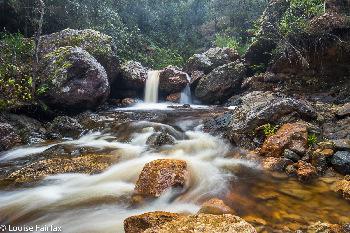
Machinery Creek Falls 1 (Petrifying Falls) and Machinery Cascades.
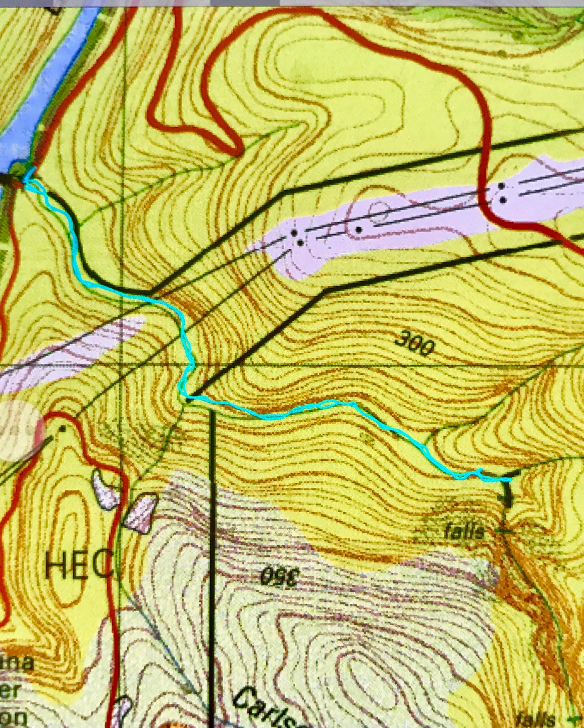
 This is your path. This pic is here just to give you an idea of the terrain.
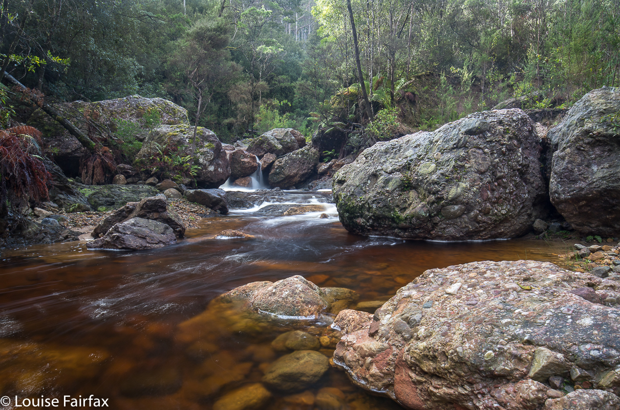
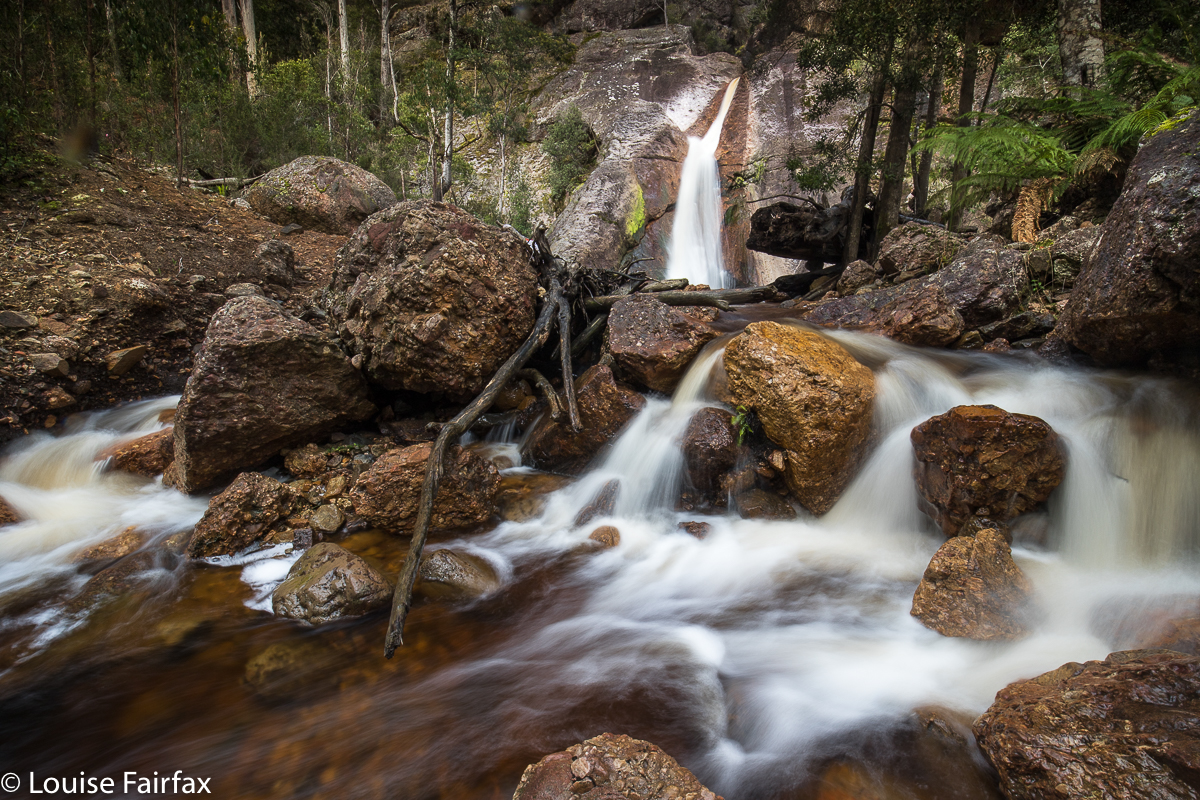
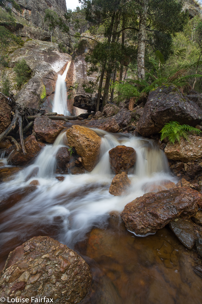
The first Machinery Creek Falls labelled specifically as “falls” on the map (see map at end) are actually above both the cascades pictured below this paragraph, and also above the falls pictured in the second section of this blog: they lie above the huge cliffs that lour over both these falls. I will post a screen shot of the List map below to try to clarify. Because the cascades below are not on the map, I have just called them “Machinery Cascades” so we can talk about them together. I hope you agree they are very beautiful.
 People on the Waterfalls of Tasmania Facebook page have called these Machinery Creek Falls 1, but this is wrong. They are “just” the Machinery Cascades. They are at least as big as Lower Chasm Falls.
I had been told to attack Falls 1 from below, from the intersection of Machinery Creek and the Forth River, where there is a bridge. I had sussed out that spot, and the water looked quite deep in places after all our rain of late, so came armed with my long gum boots for the journey. I hoped water wasn’t going to come cascading over the brim. I also made two poles (which I don’t normally use) for balance, hoping to thereby protect my several thousand dollars of camera gear from a dunking should I slip.
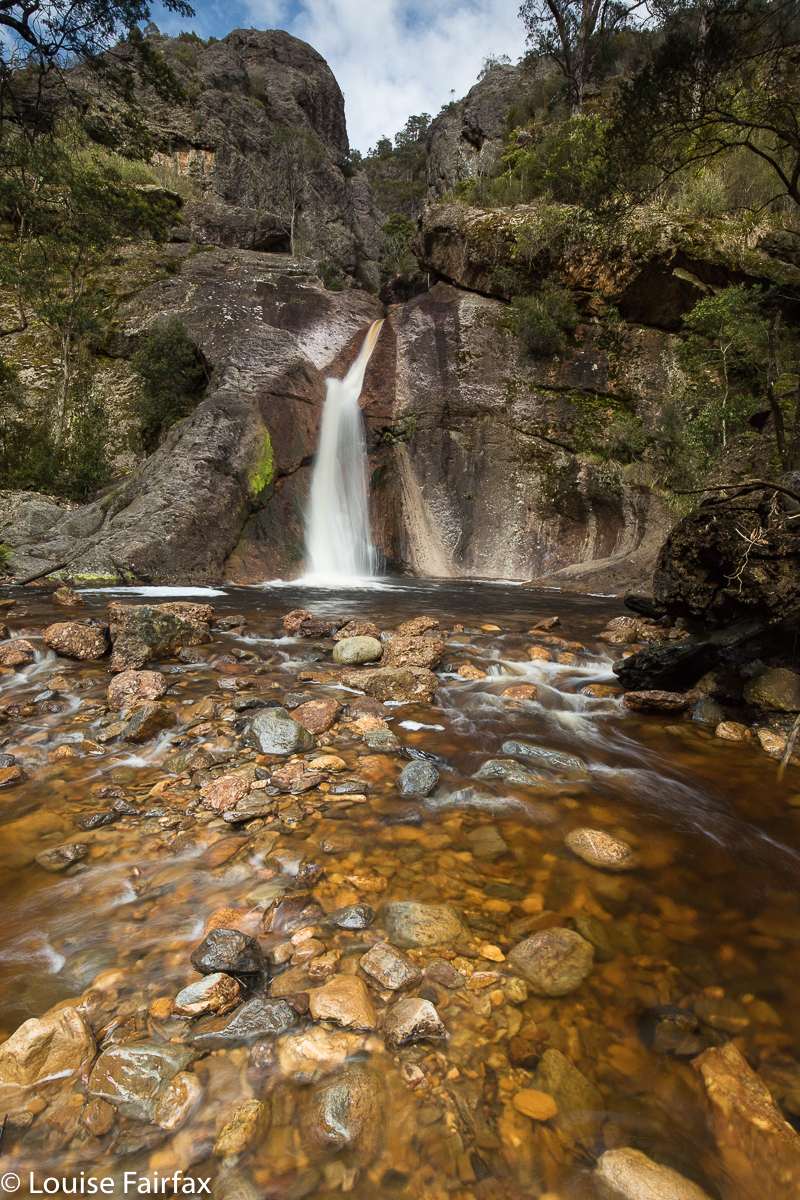
These are the first giant falls you come to. They are called by some Machinery Creek Falls 1, and by cognoscenti as Petrifying Falls. Some think this name came from Hellyer, which is an interesting titbit of history. The next falls, “Falls 2” are up behind that huge cliff, and excessively hard to get to.
On the way up, I was tentative, worried about falling and damaging my gear and becoming unreasonably cold. I was not sure when to be in the water, and when to climb onto the banks, and, if the latter, which side. Sometimes I lost a little time clumsily climbing obstacles that really I could have got around had I been braver. I was much more secure and confident on the way back. I took 52 minutes on the way out, but only 41 mins on the rebound.
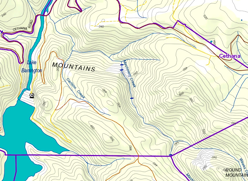
 After I’d photographed the falls and cascade, I explored the side stream as a possible route to Falls 2. Despite all our rain of late, this was a dry gully. It made climbing up nice and easy, but I obviously wasn’t going to reach a waterfall way up above the cliffs, so retreated. The gorge to my right as I climbed (which contained Machinery Creek) was absolutely monstrous, but I could see no sign of another fall above it – but that is hardly surprising: the scale of these cliffs is whopping. Just look at the massive brown smudge of contours on the map in the area, and the black lines where cliffs are indicated. This is a valley of the giants, and exciting stuff. I could have taken hundreds of photos here, but didn’t, as, uncertain about my own safety, I had told both my daughters what I was doing and what time I’d be out, so they could raise an alarm if I didn’t emerge. When I do that, then I feel a need to be punctual, or I will bother people unnecessarily, and they won’t take my requests seriously. I will be back, for sure!
 Just for your information, I read on the WoT Facebook page that these falls are “about a kilometre” from the intersection. Maybe I am pedantic, but I see a big difference between “about 1” and 1.6. Looking at the map, I had estimated 1.5, so was not surprised when my data read at 1.6. In country that slow, and extra 600 ms is significant, so don’t count on doing whatever time it is you take to dash off a kilometre on the track. (The big blue strip on the map top left is the Forth River. The black strip across it is the Cethana Bridge).
.