Mt Massif, Geryon North and the Du Cane Range High Point Jan 2016.
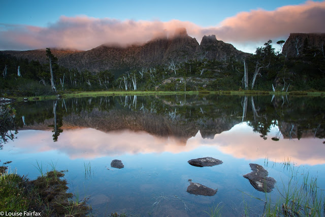
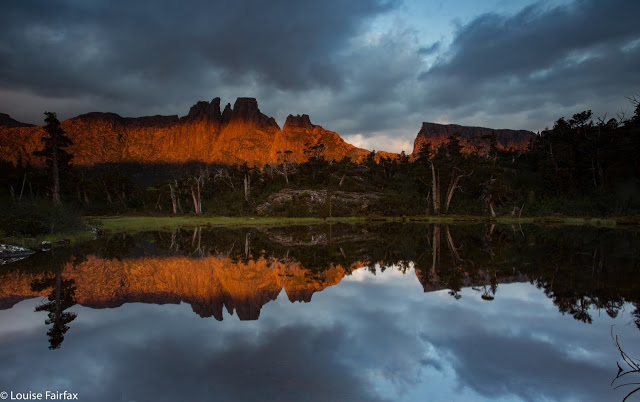
Mt Geryon at sunset. Day One: from the Pool of Memories
Surely it is impossible to look at Mt Geryon and not be impressed by its shape and slope, and the way it yells “impossible” at you when you think of climbing its vertical slopes. It’s a mountain that demands – and receives – respect. It is one of those mountains that I never dreamed I would be able to climb, but something has changed, and here I stood, ready to give it a go.
Meanwhile, my love affair with Mt Massif dates back to 2011, and has its provenance and inspiration in Dave Noble’s blogsite, where I stared at his pictures and wanted to go there and sleep on top. At last I stood on the startline to do just that.
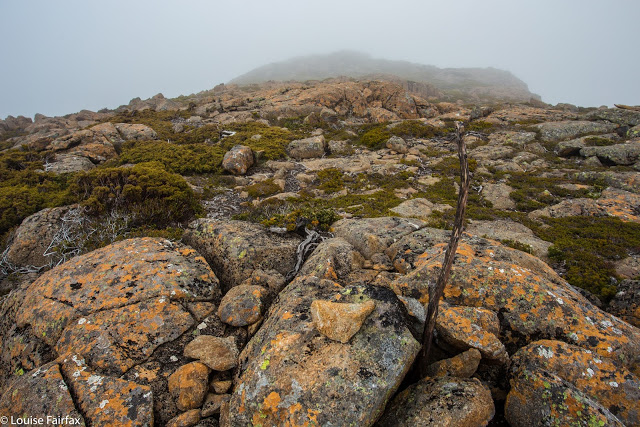
Du Cane Range High Point, with the stick jutting out of the cairn kind of thing
Day One was unexpectedly “interesting” in that we encountered a guy who wandered into our company after being missing for over thirteen hours. He had no raincoat, no food, no map, compass, torch or phone (it had run out of battery at about 10pm). Whatever else one might need, he didn’t have that either, but he did have an excellent camera and quality tripod, so (in that regard) was a man who had priorities akin to my own.
He didn’t really know where he had come from, couldn’t say if he had come downhill at all, chose a random (but impossible) lake on the map as a place he thought he had passed, yet we managed to somehow work out that he had reached us from Lake Elysia, most fortuitously wandering east and not west, where people do not get found. He had gone to the Pool of Memories to photograph stars, got whited out and disoriented, and so thought it was a good idea to wander aimlessly all night and into the next day. The fact that he found people might unhappily reinforce this dangerous modus operandi. Meanwhile, others at Elysia had reported him missing, so helicopters were circling overhead. Dave from our group luckily had a satellite phone, so called the police and S&R to report the lost as found. However, two hours later – due to lack of communication from one department to another, one can only assume – they were still flying around, trying to find the found.
We had set off with him to return him to his tent under escort, managing to use sign language near the Parthenon saddle to at last convince the police buzzing above that we had him. He certainly gave the bushwalkers up there plenty to talk about that weekend. He had the generosity and insight to thank our group for saving his life. He’s one lucky guy. I should have grabbed the opportunity and tried to swap my lunch for a sony A7, but he still seemed to know what was valuable.
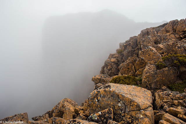
Day Two. After a day one where our goals were a long shot off the focus, we settled down to business this day …. except that the weather didn’t. As a result, we danced around in fog for 1.5 hours hoping it would change its mind and be merciful to my Mt Hyperion desires, but it would have none of it. Frustrated, I left the others who were munching lunch in the drizzle, and at least collected the Abel of the Du Cane Range High Point before I ate. Now I had bagged something I felt a bit more relaxed.
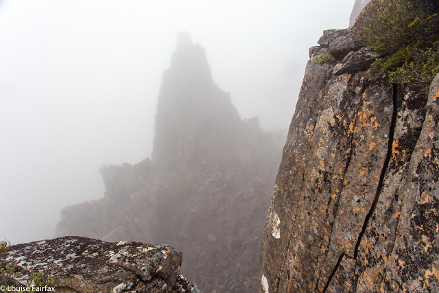
And so we wended our way towards the famous Big Gun Pass, with a compass bearing so we might find it. There were no vistas today, but the sight of the Big Gun as a clouded silhouette in the misty ambient gloom was even better. Views could come later.
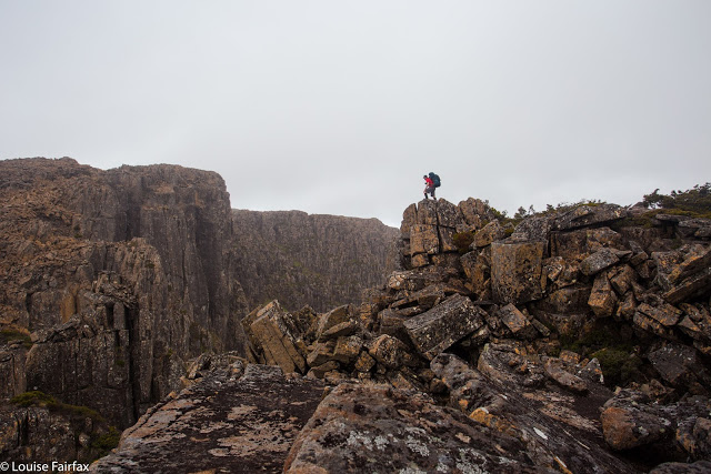
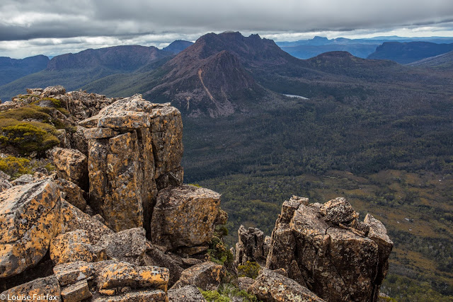
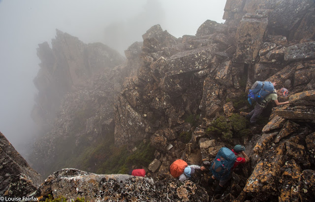
The way up the other side looked particularly steep to this group of heavily laden walkers, but everyone dug in and climbed well, and the high point was soon in sight. Eagerly we each pictured a kind of summit cairn with pastures of green grass to camp on stretching beyond: a veritable land flowing with milk and honey. And what were we given? Not just a wasteland of wild, slippery rocks, but ones whose trajectory was a very sharp slope downwards. We stared over the abyss with dismay. In silence the group sat for a fifteen minutes’ rest taking in the disappointment, conjuring up energy for the unexpected task ahead. If we could find a safe passage down that, we would then have to wind our way laboriously around the rocks to the grassy funnel we could see that must lead to the bowl beneath the summit further away. Straight ahead was a monstrous cliff wall that you couldn’t scale even with ropes.
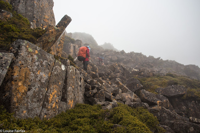
A route was found, and we lowered ourselves down the cracks and rocks to a place from which we could contour around, a group of sick crustaceans with all limbs attached to the black mossy rocks, trying to prevent slides into injury.
Once the tension of the traverse was over, the others quite sensibly wanted to relax and set up camp, but I am not able to relax if something is not finished, so grabbed my gps and set off for the summit, visiting all interesting high points up there for their different photographic angles, checking at the end that my blue line had landed on the actual summit at some point. There was no happy celebratory group with handshakes and high fives like there had been on the Eldons. It was a most anticlimactic summit for one that had been desired for so long.
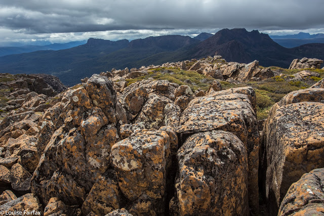
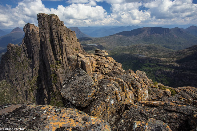
Day Two: Mt Massif summit. An unusual view of Ossa, Pelion West, Thetis and more. Cradle back right.
Day Two: a different view of Ossa et al
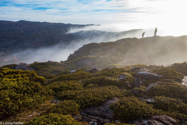
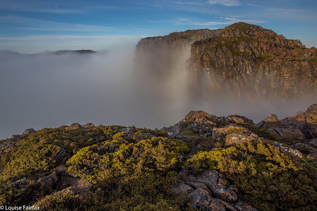
Day Three presented itself as a marvellous collection of diamonds and pearls strewn carelessly all over the grass in every direction. The mist was enchanting. We were not in a rush, so the pace was leisurely as we enjoyed all these sights and the feeling of total bliss that comes with being in a place like this.
The route over the rocks was much quicker in this direction, and there were no dismaying surprises, as long as you discount Rolfe’s cracking a rib. It seems quite the fashion these days. Mine is ten days out from being broken, so I had no trouble understanding the pain he was now in. As a result, a small subgroup went straight back to camp after lunch while the remaining ones headed for Geryon North.
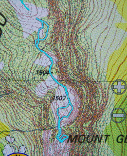
We arrived at the black dot on the map, and the group proclaimed it as Geryon North and cheered. However, I am an honest peak bagger, and knew that this flattish hill (with very impressive cliffs) did not fit the bill despite its cute black dot and height of 1507. The real Geryon North has a much higher height and it was staring at me across the abyss. Would anyone else come with me this time? Vaughan said yes. Hoorah. Then Rob and Cam joined in. More joy. Off we set while the others sat down for a rather dull spectator sport.
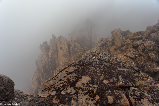
Action in the mist
Day Three. Climbing back up to be allowed to climb down to Big Gun Pass
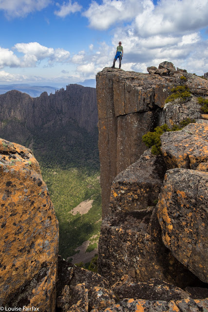
The watchers reported that it looked very dangerous. Vaughan recounted how his new role as father to a toddler and baby gave him a new purpose to be alive. Rob (father) admonished Cam (fouteen-year-old son) to be careful every two minutes. Louise was lead by the summit fever that always overtakes her, but is no risk taker. We were being careful, but Vaughan did say he found this climb harder than Federation in its technicality. We had to back out of a few manoeuvres; there was some light grunting, handholds where limbs couldn’t reach the only rock one on offer, helping pushes or pulls and eventually the team made it. This time there was joy at the top, and we all joined hands to touch. The views, of course, were breathtaking. Sure, you can hire a helicopter and get the same thing, but you will never get the joy that grated fingertips and slightly lacerated gear in your effort to get there will give you.
Cam on the lump called Mt Geryon that is not Geryon North yet
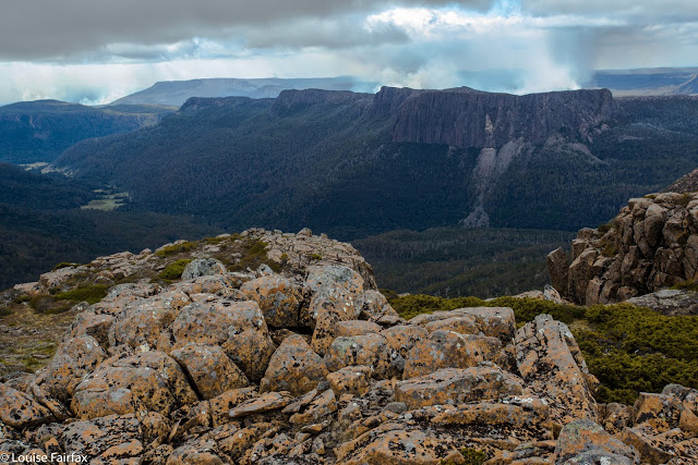
Here is our goal, up nice and close now. East face looks quite exciting
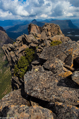
And here is one from the tippy top
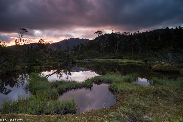
Before the others set out for the Pool of Memories, we had seen from high above that someone had dared to beat us to the pool; a little red tent was in “my” spot. This person obviously had good taste in views, but must be evacuated. We instructed our forerunners to be rude and raucous and thus drive them away. When we at last descended and I met the fellows, however, I decided to be raucous but skip the rude bit. These were people who were my friends in Instagram and here they were in the flesh: the fabulous Luke Tscharke, Tim Wrate, Francois Fourie, and Dylan Toh. I was delighted to hear they had consulted this blog when deciding where to go for their trip. As a result, the paparazzi lineup for sunset was quite amusing. Now I didn’t feel at all silly lugging 3 kgs photographic equipment all this way.
Mt Geryon says “good night”. Pool of Memories.
Day Four. We climbed down – reluctant to leave this place, yet refreshed from it – to resume our daily lives, descending through glorious rainforest to the Geryon Climbers’ Camp in the valley below, and thence to Pine Valley and eventually to the lake where we killed about three hours throwing stones waiting for the ferry.



Lovely account Louise. You brought back vivid memories of a Du Cane traverse a few of did maybe 10 years ago. We all ended up with bleeding fingers from the constant exposure to rough dolerite. I hope you had scrub gloves!
Hi Peter. Thanks for the comment. Glad to bring back happy memories. I know what you mean about the fingers, and several of the others suffered. Despite that, I didn't wear my gloves. The only time I was gripping rock was while climbing Geryon, and even then, I didn't grip much – and when I did, I wanted the best possible contact with the rock. If ever I get to climb Federation, it will be the same. I think I have the best grip that way, and thus more control. I can always repair the damage later with some nice hand cream :-).
Peter, you might like to know that I met with a few of the friends from this walk last night, and they all showed me their peeling fingers and complained of pain. It seems I have turned my own fingertips into little slabs of dolerite, so feel it no longer.