
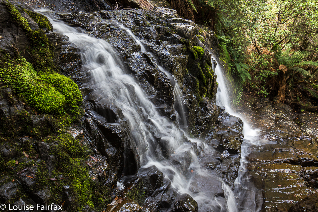
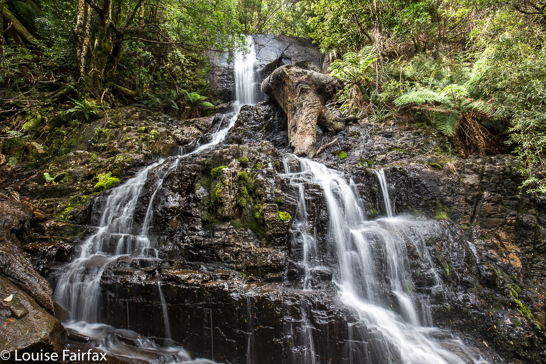
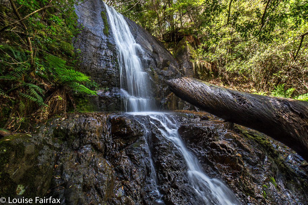
Barrow Falls, Feb 2017.
When researching available information to learn how to get to Barrow falls, and to see what I could expect, I noted that the material made them sound a little formidable. We thus wore our full bush battle gear for the journey, and were not actually confident of reaching our goal: “Don’t worry”, said my husband as we drove towards where I wanted to park and eyed up the rather thick bush to left and right, “we have six hours until dinner.”
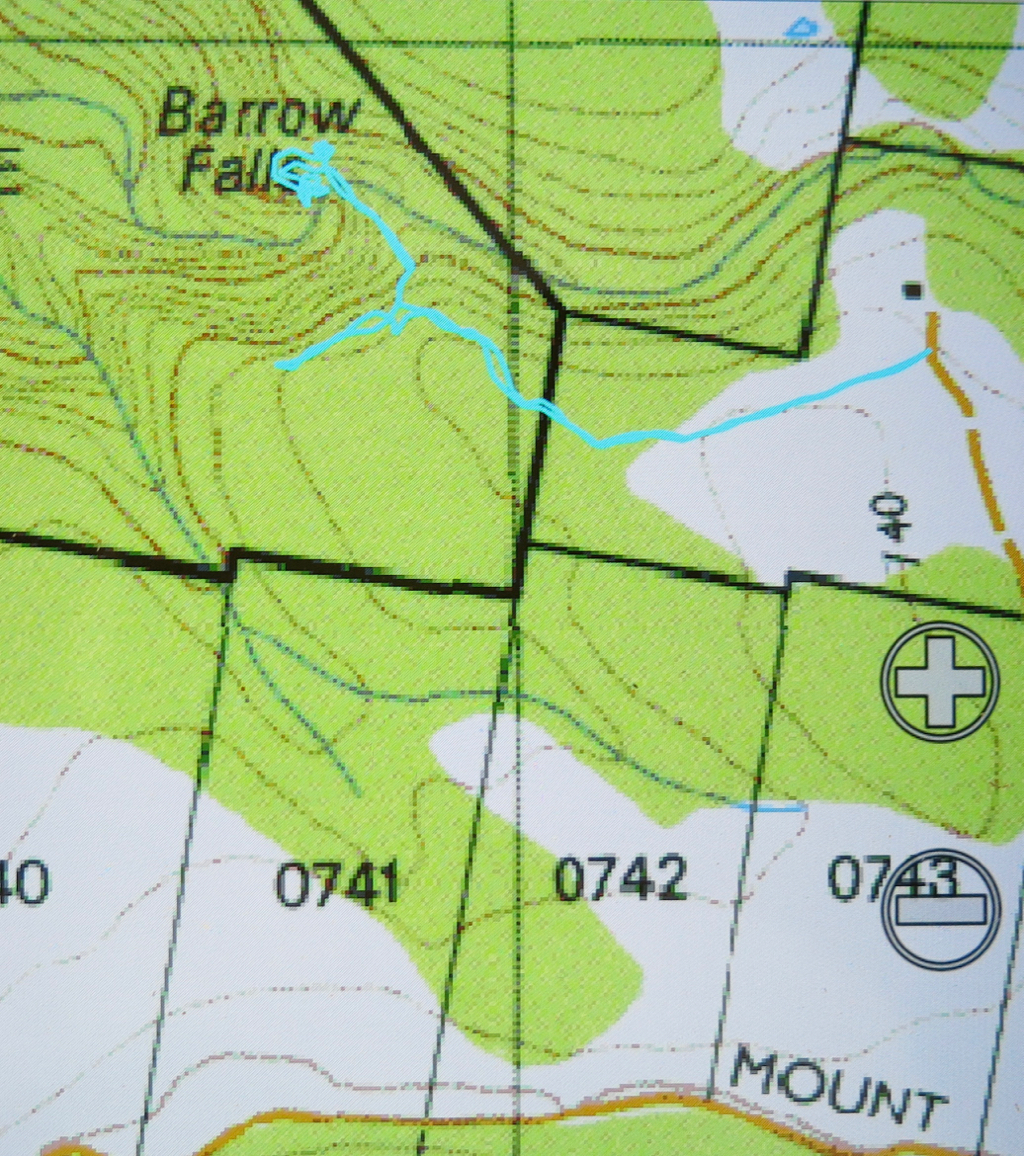
I drove down the orange track on the map that I wanted to use for my approach, not quite knowing what would be at the far end. Hm. A house to the left, with furiously barking dogs, and one at the end of the track, kind of opposite, that did not look exactly used. I knocked just in case, anyway. By the time I was back near the car, I could see a lady striding towards her gate from the house above. We smiled at each other as I explained that I had come to ask permission to try to get to the waterfall from here.
“Yes, this is my property. Go and enjoy yourselves. Head down here until you see pink tape and follow the tape to the falls.” What? THAT easy?
“Oh”, I laughed. “We have maps and compasses and a gps system. I thought it would be challenging.”
“Oh well, it’s always handy to have such things,” she chuckled.
Next question: “We have a dog in the car. If we keep her on a lead, can she come too?”
“Don’t bother about the lead”, was the reply.
As a result, all three of us (two humans and a dog) had a fabulous time. Tessa was soon joined by the owner’s retriever, so even made a new friend. The dogs had a lovely swim in the creek when we arrived. The retriever seemed to know his way around very well, and took over leadership of the group pretty soon into the expedition.
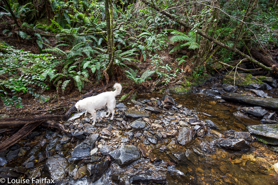
Hoorah. A dog friendly walk in Tasmania!!!
Our gps, map and compass did come into use on the way back! There was another lot of pink tape going to a different destination, and I followed it at first, without realising that it wasn’t the original tape of our entrance. Luckily I sensed that things were not as familiar as they should be, and checked our position with the gps – no, we were now well off the old track. I righted it with a compass, and soon enough we were back where we wanted to be. I am also very happy we both wore boots. It was VERY steep in the final descent to the river, and equally steep – and slippery as well – trying to get from the top of the falls to the base. Huge, loose rocks became easily dislodged, vegetation was slimy: boots felt nice and secure.
After all that exercise (16 minutes in each direction to the top of the falls – ha ha) we, of course, needed to refuel our tanks, so stocked up on delectable goodies on the way home to have a celebration afternoon tea. That was a great waterfall.
Hi
Just wondering how you get to the property to ask permission for the walk.
Cheers,
Rodney.
HI Rodney. It’s been a while since I was there. Basically, I looked at where the falls are on the map. I drove to the nearest point that one can get to , just using the standard TasMap. That’s where I parked, and went uphill to my left to ask the lady. I hope that helps.