Google tells me that Holwell Forest Reserve, in which both Holwell Falls and Holwell Gorge Falls lie, is thirty-two minutes from my house. It is therefore pretty reprehensible that I had never even heard of them before a local posted an image on Instagram that alerted me to their presence. It was too late, however, as the track had been closed in response to the flooding of two winters ago. Now it seems that part of the track is now opened – albeit with dire warnings that you need to be an experienced bushwalker to venture there. That’s fine. I’m very experienced. I wondered how bad it really was.
About two minutes into the thirty-two promised me, light rain began. Ten minutes later, it was so torrential that I couldn’t see at all to drive. The windscreen wipers flapped furiously, but to no avail. Nonetheless, I continued on my merry way, heading through Exeter and Winkleigh. There, I missed seeing the road to the left, and, hey, who can resist driving down a road called Flowery Gully Road? Not me. I followed it along, but it wasn’t doing what I thought it should, so decided to be logical and consult the maps app. Whoops. Now I was near Beaconsfield. Oh well. I found a road that linked this one to Holwell Road to the west, and attacked from the north. This ended up being a must fortuitous error. The northern end was way prettier than its southern beginnings. (But for efficiency, don’t head for Flower Gully. Turn left).
I turned in at the little blue sign, parked where I should, shouldered my pack with all my gear, and set out in what was now mere drizzle. I took an umbrella to shield the lens. You don’t often find me bushwalking with a big umbrella.
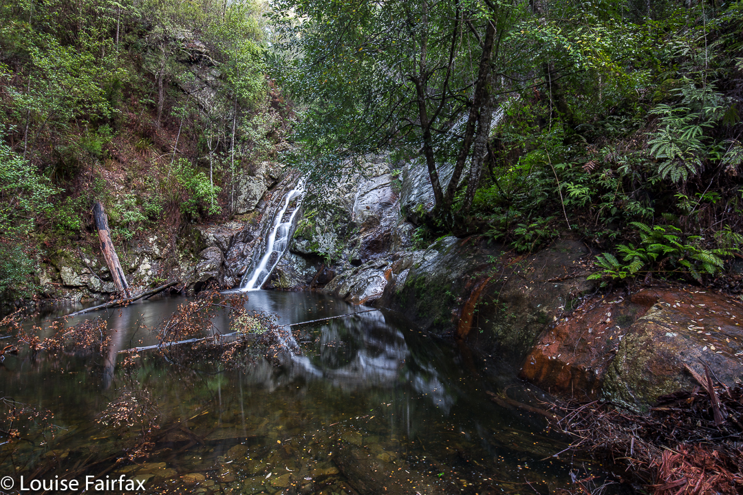
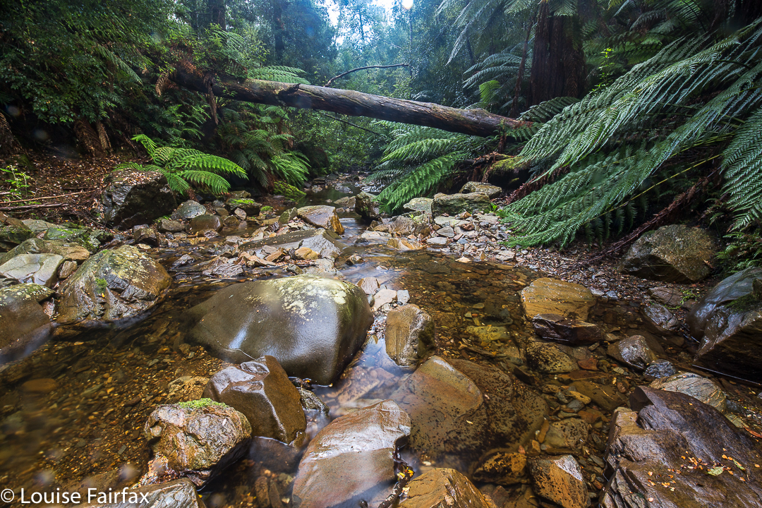
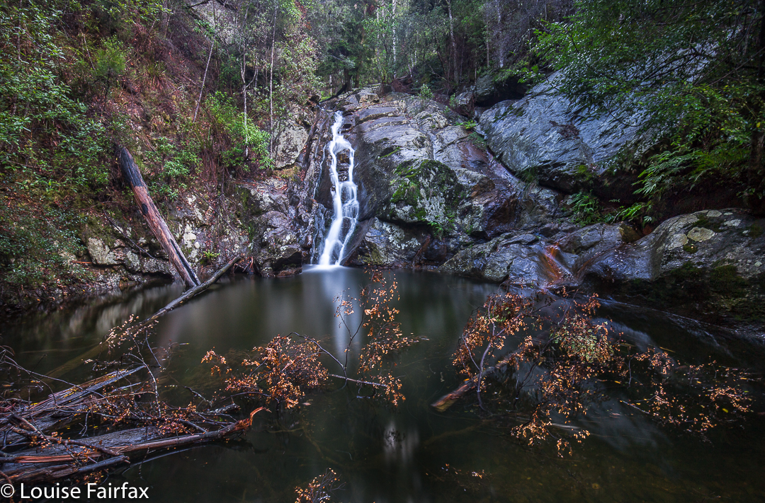
I couldn’t believe I have lived near this beautiful place for so long whilst remaining ignorant of it. The water was so very clear that even on this late autumn day, it begged me to paddle. Children must surely love playing here in summer. There were rock pools in abundance. The sign had said thirty minutes for the round trip, and I suppose that’s accurate if you don’t take too many photos. However, I was mesmerised by what I saw, and had all my gear for long-exposure shots, so way exceeded the suggested time. I think I was there about an hour and a half.
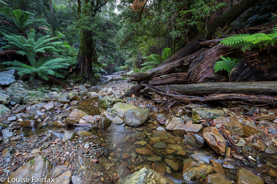
I had no idea what the state of play on the track was, of whether it had been fully or half repaired, or not touched at all. On the way to the first falls, it certainly felt repaired and in good condition. At the falls, as you can see from my photos, there were a few tree casualties lying in the water, and their leaves looked rather new. A bombed viewing platform had its skeleton remaining in place, but not much else. It didn’t look old. Maybe we have had even more damage. A huge eucalypt lay across the path; it was too big and slippery for me to get around it with a bear hug. You could, with a mild possibility of slipping backwards, get around if you went down and passed it at creek level. However, my watch now said I didn’t have enough light left for playing, so left that exploratory exercise for another day. Right now, I wanted a peep at the southern end. Round I drove.
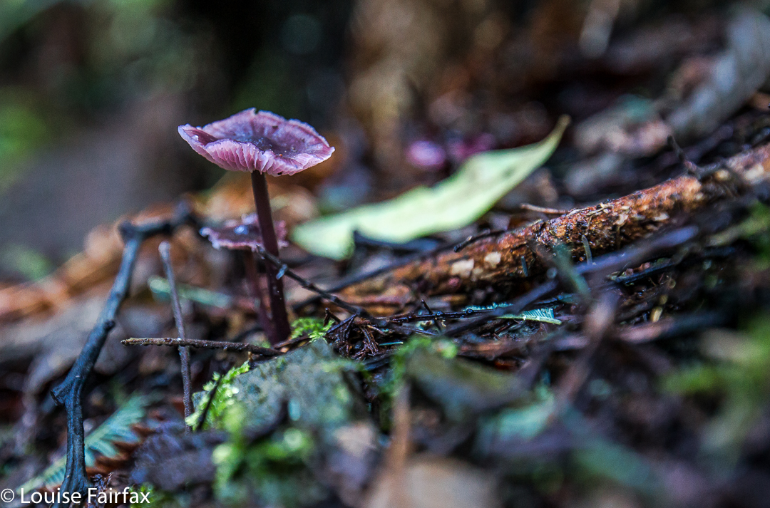
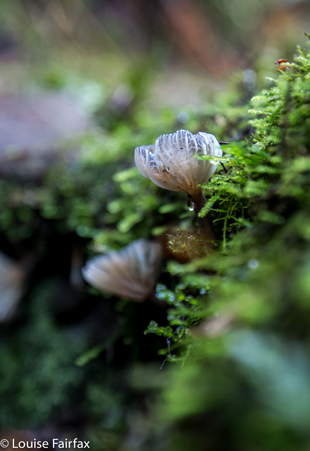
The southern end wasn’t nearly as welcoming as the northern. The track hadn’t been cleared at all and wasn’t manifestly visible. I think they’re hoping it will grow over and disappear. Again, signs warned that experience was needed to step into this zone. There were certainly huge drop-offs to my right as I climbed the track, but nothing to worry about if you’re not being silly. After about five minutes, the track forked. At first I took the left fork and climbed up high, away from the river. I decided this wasn’t going to lead to any waterfall photos in the next few minutes, so returned and took the other fork, to arrive at the top of a waterfall. By now it was really getting dark, so I had to be content with a peep of the top for this time. It wasn’t worth photographing. I’ll be back – to see fungi, even if not the falls!