
Agamemnon 2016 Sept.
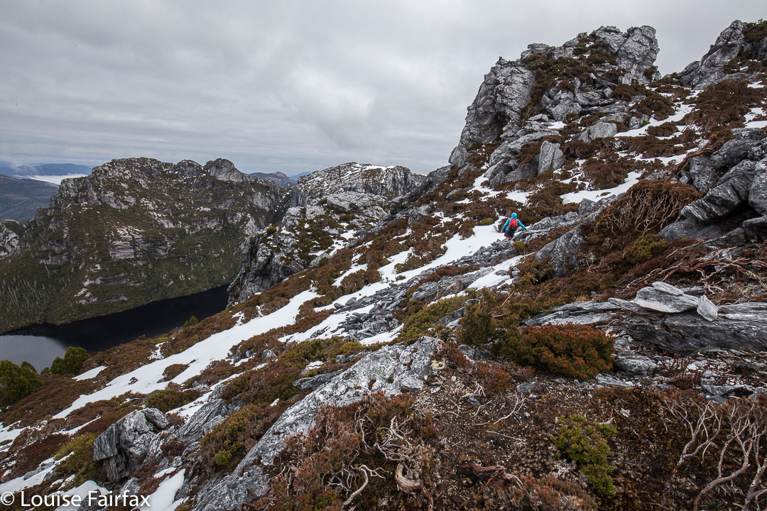
 Angela nears the summit of Agamemnon
Agamemnon had been calling me for a long time. At last there seemed to be a break in the weather that would allow us an attempt. Off Angela and I set, although neither of us was entirely on top of things, health wise. I had had a low-grade virus all week, but thought I’d be fine … until I shouldered my pack, which felt absurdly heavy. The hills felt shockingly steep. That’s OK. Despite a general “go slow”, we had reached the point in the track where a button grass clearing leads up towards Agamemnon in a bit under four hours’ walking.
Pessimistically, I looked up at a set of cliffs above and pronounced that it could take us an hour to get there. (I always like to overestimate so as not to be disappointed later.) Unfortunately, nearly an hour was exactly what it took. No one had mentioned that the button-grass lead cedes to thick, nasty steep scrub that two off-colour girls would find hard work.
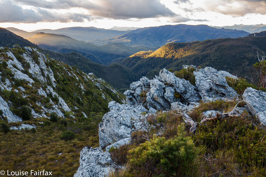
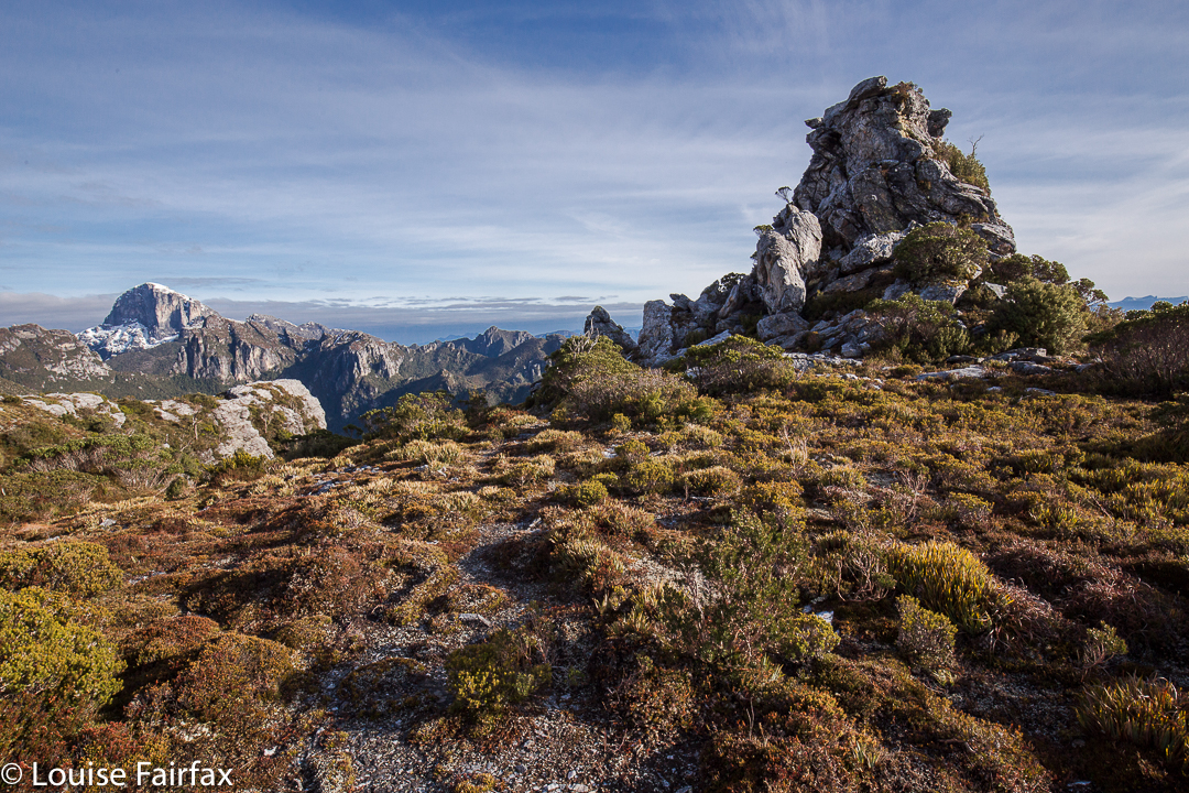
 From below, I’d seen a fissure in the rocks with green in its crack, and suggested that we head for it, hoping it would provide a lead to the top. It did. We sat on top of the rocky outcrop (above) at the end of ‘climbing stage one’, enjoying a snack and taking in the dramatic view. We’d gained a lot of height in that hour, although I had been drastically slow.
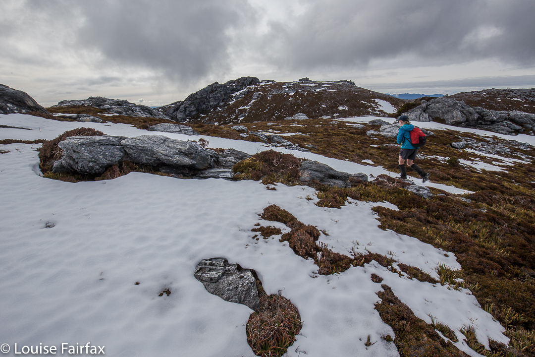
 The ‘Four Ugly Sisters’ (so named by us). A rocky outcrop on the ridge just below were on our bearing. Ultimately, we topped out next to the sisters (to their left).
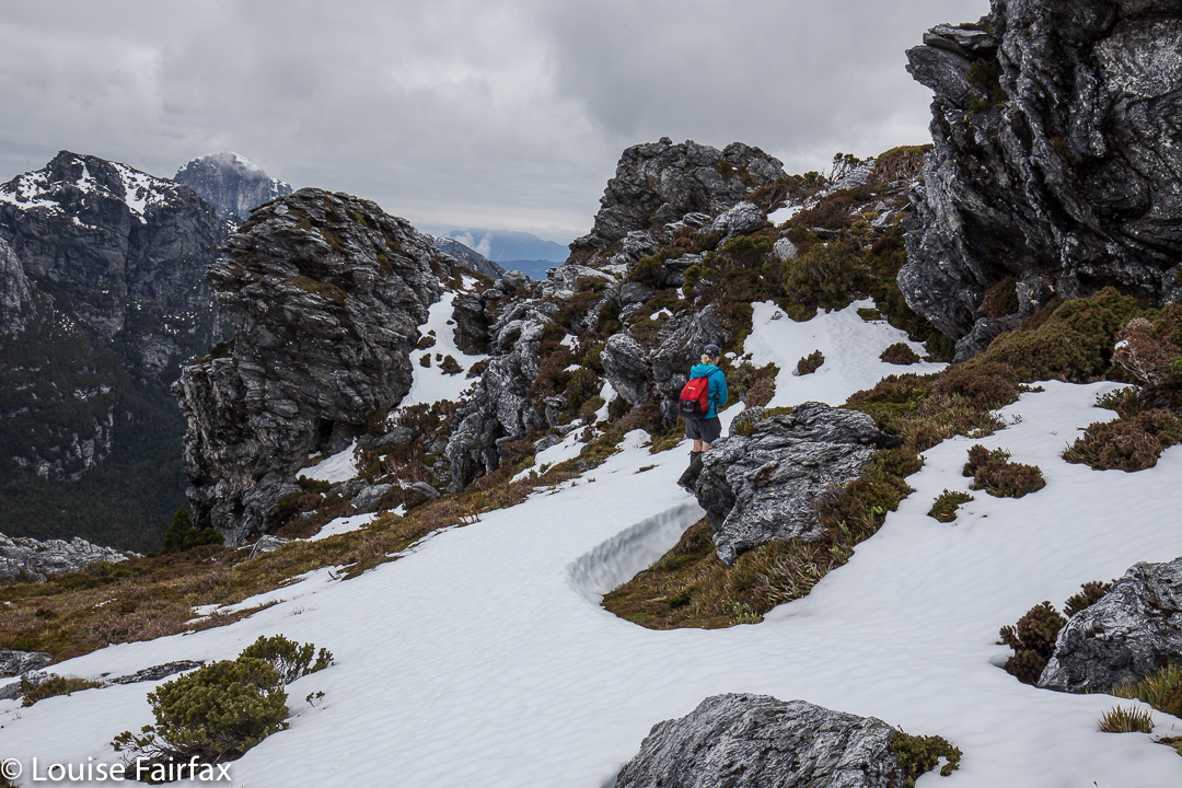
The next point we wanted to visit was a saddle not in sight. We set our compasses on 154 degrees and headed across and up. There were some rocks on a big ridge below the Four Ugly Sisters that were on our bearing, so it was easy to keep direction whilst weaving. The going was tougher than expected, however: the scrub had not yet finished, and there were many rocky bulges that posed a “left, right or over” decision. Sometimes Angela went over, I went right and we met at the far side, smiling.
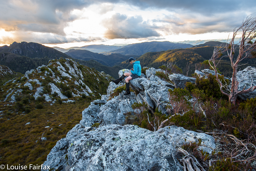 Angela examining her photos on “sunset rock”.
After about forty minutes, we came to a point where it looked quite OK up on the left on a little ridgelet. We were about to reach a mini-saddle (very mini) within the wider structure of the bigger ridge. Ahead, the bush looked very thick. Our destination looked to be dauntingly steep and far away. I pointed out that sunset views would be great from here. We agreed to call it a day. Higher would have been nicer, with better views, but we had had enough. The laden winter packs had been on our backs for five and a half hours. Time to enjoy what remained of the light.
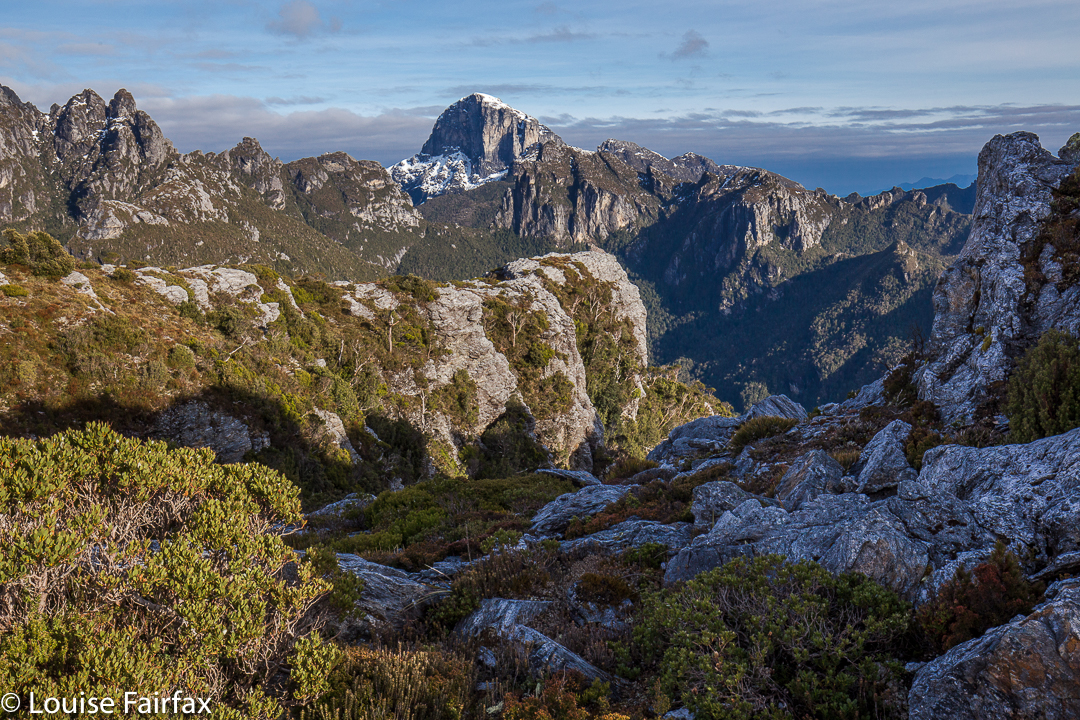
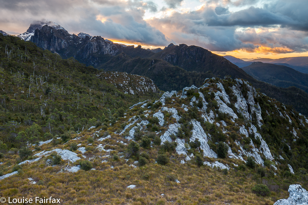 Frenchmans Cap in the clouds
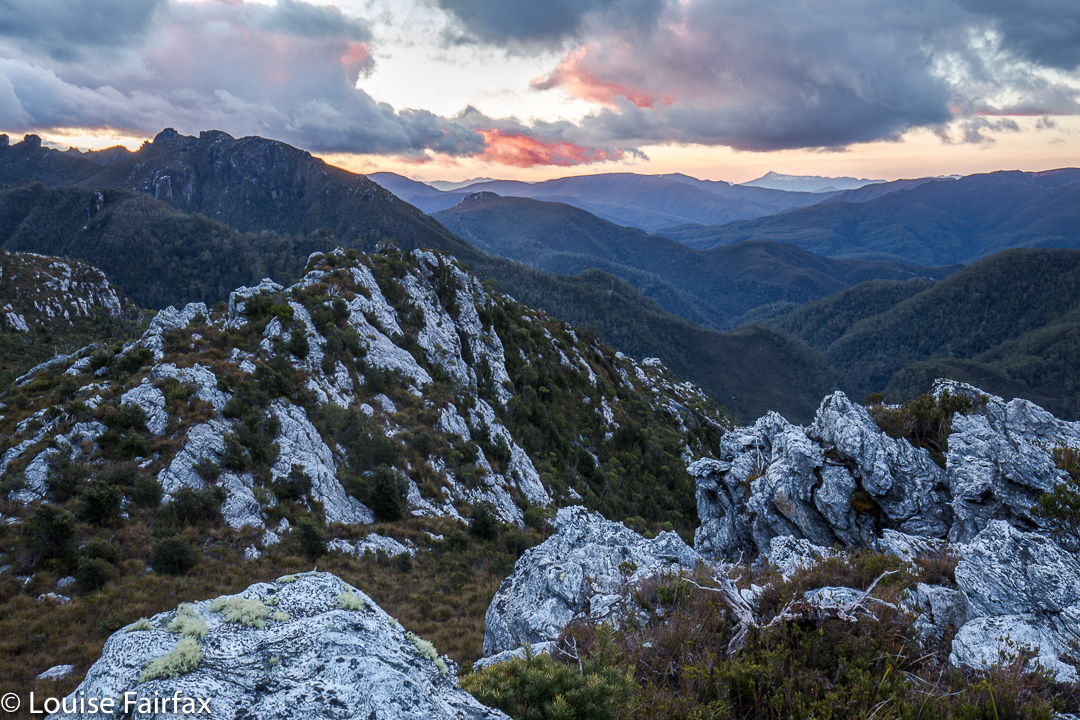 Given that the next day was supposed to be clear, sunset was a bit disappointing, but I am still pleased with what I captured. It was worth lugging my tripod and GND filters up there after all.
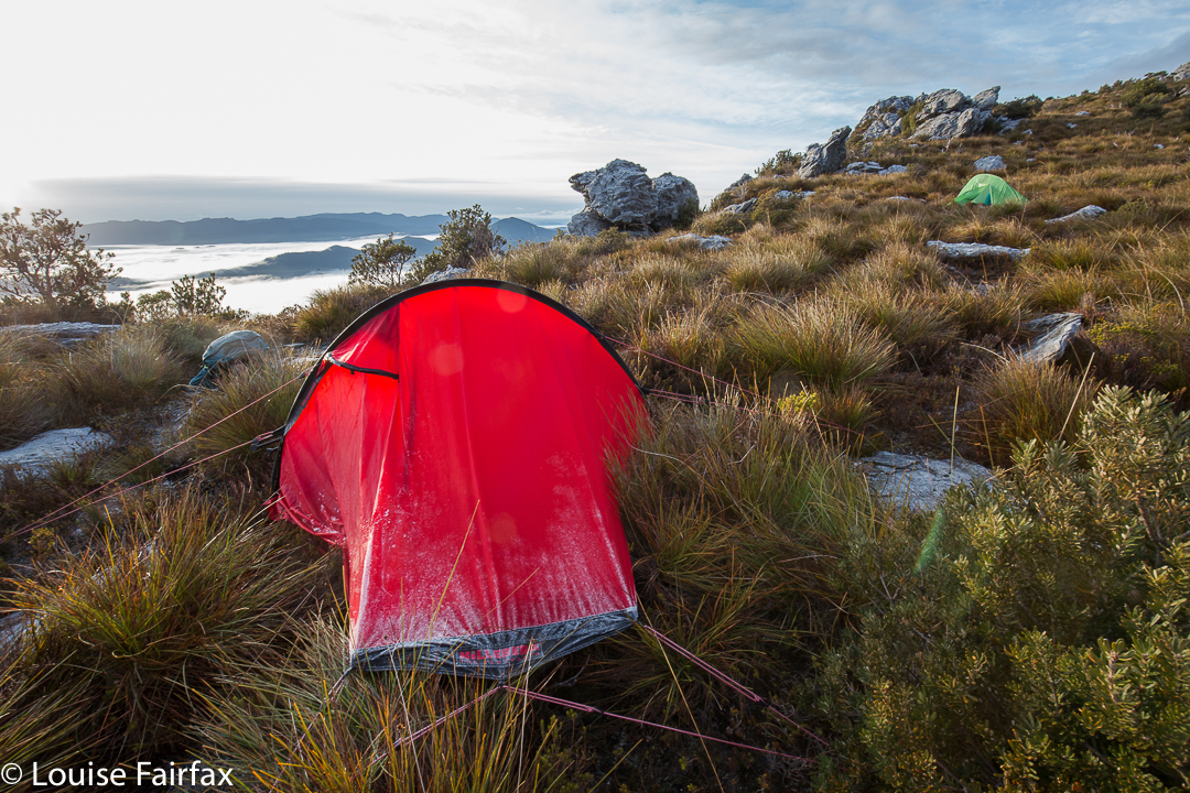 My trusty room with a view, frosted up a bit.
Angela did not want one of my super-early starts, so I suggested 7.30, hoping that was a good compromise. She agreed to it. I’m glad it wasn’t any earlier, as the tent was sopping in the morning, even though much of the condensation had frozen. I had time to enjoy early light without being hurried. There was no sunrise, as such. Hm. This was not the weather we’d been promised.
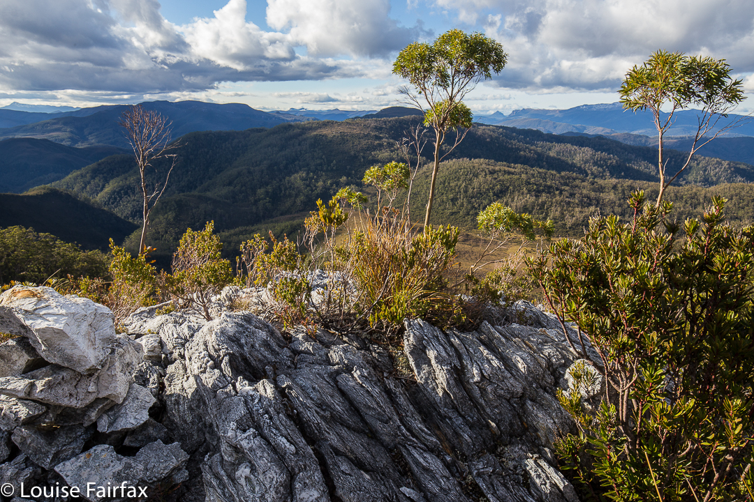
 Fenchmans looking cute below us, and the Fourth Ugly Sister looming large.
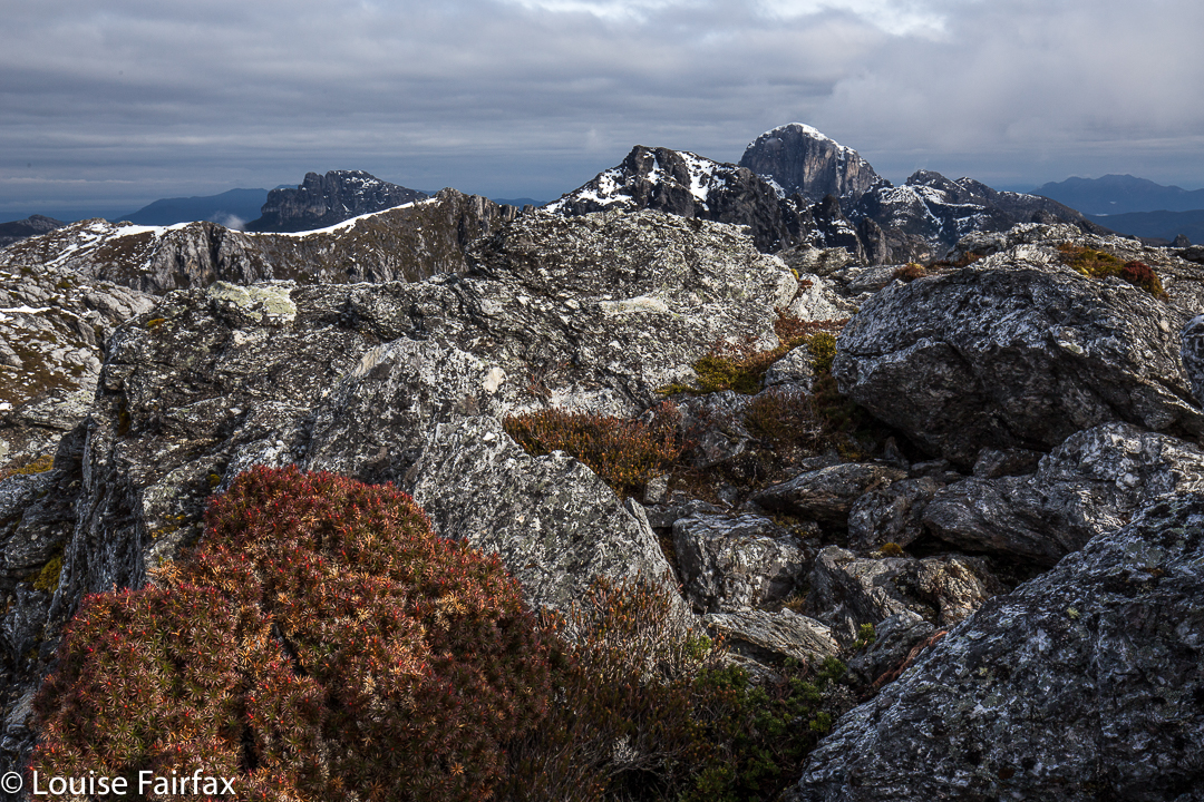
Again my pessimistic and conservative estimation came: “It could take us one and a half hours to reach the top from here.” Unfortunately, the one and a half hours it took was walking time only, and if you throw in time taken for photographs at those vantage points where not to stop would have been plain criminal (like when we reached those rocks on the ridge, or when when we topped out near the Four Ugly Sisters (the far left one of which is pictured above), then it was two hours. 9.30 a.m. I sat on the summit staring at my watch and looking out at Philps Peak, our next goal. My calculations of the feasibility of this programme had not involved summitting this late – not on a short, winter’s day with glowering clouds rolling in. I had had a snoop around while we were photographing and snacking, and was not entirely confident that we could even get off this cliffy mound on which we were perched without needing to take a big detour backwards.
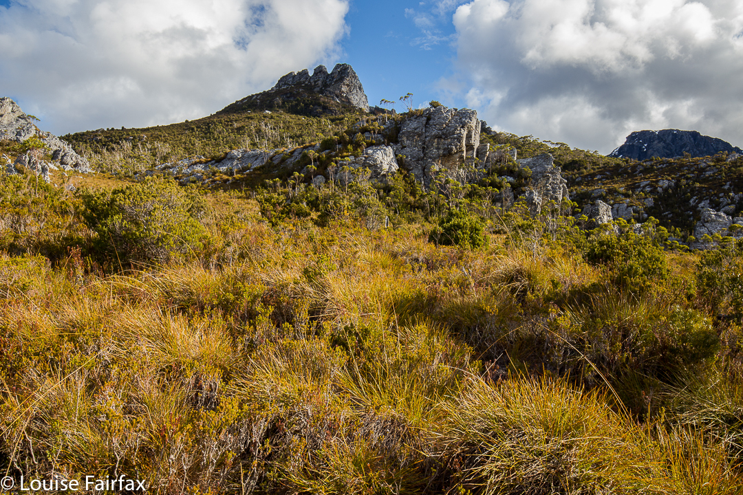
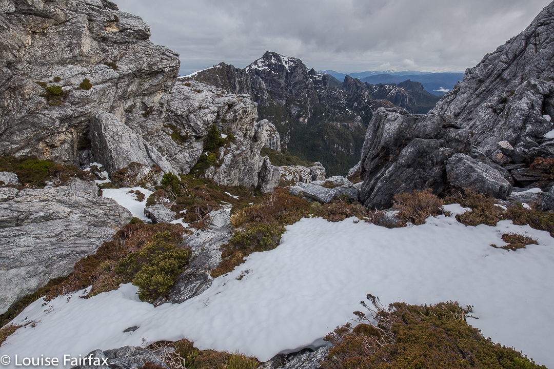
 The somewhat contorted landscape that a map has trouble adequately representing.
No detour was necessary, which was great. Meanwhile, Angela, undaunted by my pessimistic assessment of our chances, was keen to give Philps a go, so off we set, with me warning that we really couldn’t afford a single hiccup en route. We had one in less than thirty minutes, when we lost time skirting around Agamemnon South. The mess of thick bushes and snow that gave way, the general uncertainty of the best route ahead all took their toll and seemed to conspire against us.
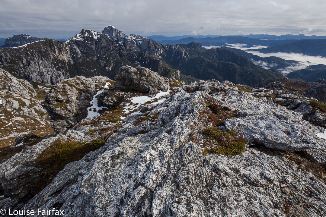 Summit view from Agamemnon
Meanwhile, clouds now completely obscured Philps Peak. This is not an area to be in with poor visibility: in fact, that’s downright dangerous. So many of our decisions were based on sight, as compass only gave a general direction, and map contours simplified the scenery to too great an extent. Eyes were needed to have guidance through this maze. Moreover, it was also raining over there. Angela reluctantly agreed to give up, jokingly commenting: “Who would believe that you’re the sensible one of the two of us?”
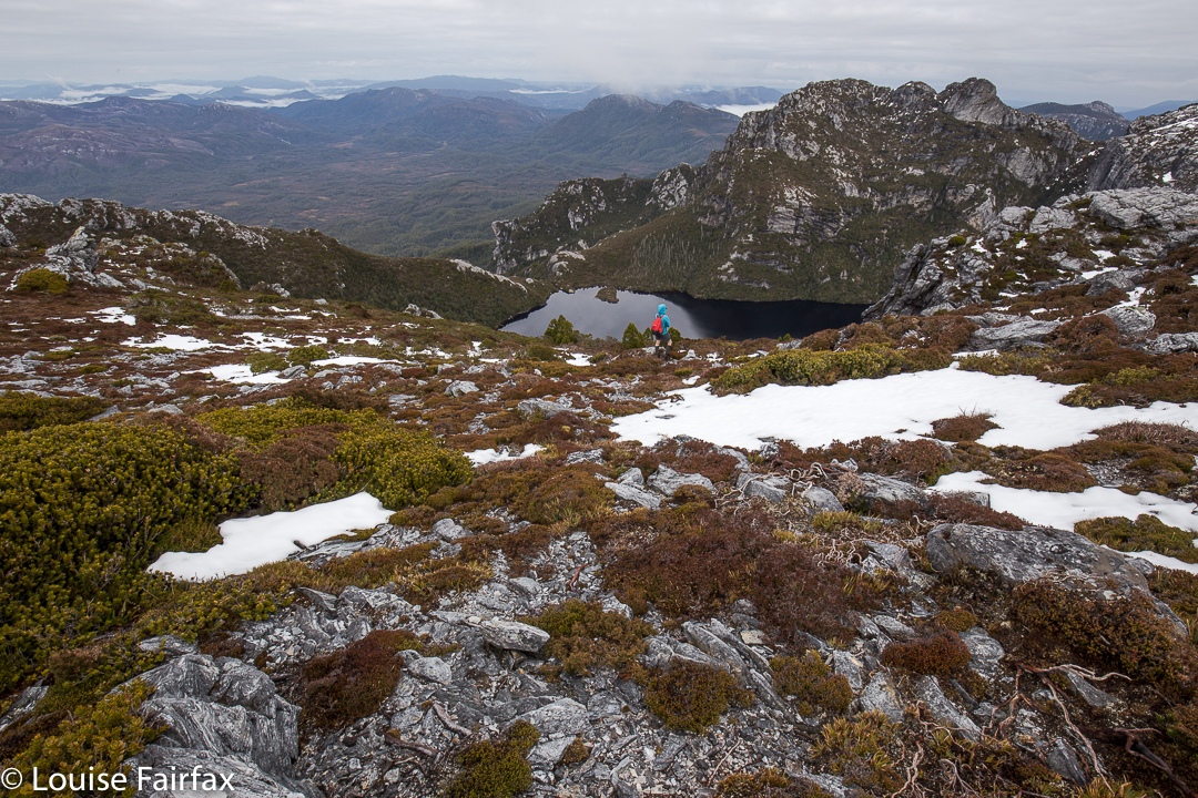 Lake Whitham far below
 Still on the correct route, but about to give up. We will be back next time.
We played on Agamemnon South for a bit and headed back, finding good routes harder to pick on the rebound. At 11.45 we reached the Four Ugly Sisters again. The view was anything but ugly. Columns of rain were advancing rapidly. I suggested we enjoy the possible remains of what had been forecasted as a nice day and eat an early lunch right there, enjoying what our hard work had won for us. This was the only really relaxing moment in a very long, very hard day … just sitting up there, chewing, staring. Wonderful.
 Once back at the tents, I raced to get mine down before the rain hit. Our packs had been on our backs for about thirty seconds when the first droplets let loose. Our chute down was hard to find in the thick mist. We very nearly missed it, and only just ascertained that we had found a way down when the blanket of grey completely closed in, and visibility was reduced to ten metres.
 Views from on Agamemnon South.
At 2.30 we hit the track far below. Quandary: Left to Lake Vera Hut, or right, out?? We both voted right. Realistically, we would finish after dark presuming we would need breaks and be slower than the time in. It had already been a seven-hour day. Undeterred, we marched on. By the Loddon River, I was exhausted and sore, but we were both keen to continue. As we donned our packs yet again, I muttered supposedly encouraging words: “Max two hours to go; even in the dark.” I then laughed, as I thought about the fact that a marathon takes not too much longer than two hours (depending on who you are), yet most people speak of this with trepidation, and here we were consoling ourselves that we only had a marathon left to go. Ha ha. The relativity of it all.
 The whole day ended up being ten minutes short of twelve hours, but we made it – AND we made it to the Derwent Bridge Hotel before they closed the kitchen, and were thus able to enjoy a delicious dinner near a great big open fire before setting out for the big drive home. I was still in my cow pants, gaiters and boots. Poor Angela. You will be pleased to learn that the cow pants got a tiny tear in them this trip. Their days may well be numbered.
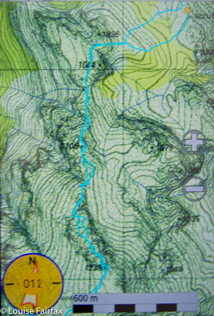
Agamemnon, from our tent (waypoint) to the summit.
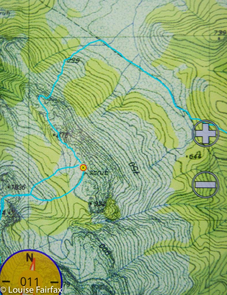
Route from the Frenchmans Track to our tent
Track data: (I was feeling a wuss before I noted these figures).
Day 1. 16 kms + 825 ms climb = 24.25 km equivalents.
Day 2. 22 kms + 800 ms climb = 30 km equivalents.
Total for two days: 54.25 km equivalents.
OK. I was allowed to be tired, especially considering the winter-weight pack and the 3kgs camera equipment on top of that. Even so, I do need to toughen up for long summer expeditions. Sigh.