
 “What’s your favourite trip?” I heard one of our party being asked. He gave a very similar answer to the one I would have given had I been asked: “Well, it depends on what aspect you’re thinking of. Scenery? Company? Weather? You can have great scenery, for example, but company that’s, well …. “, he gave a dismissive gesture with his hand. “Or, you can have great company, but miss out on the scenery.” I knew exactly what he was getting at. I have been in fabulous scenery, but have not been particularly happy due to the company I was keeping, or, as was the case on Ripple Mountain, I can climb a rotten beast of a hulk, but have great fun as I’ve done it with like-minded crazies who are also prepared to get out there and work hard, defy the elements, and somehow find enjoyment in the whole exercise. The very perversity of climbing something like Ripple Mountain has its own appeal, and when you do it with others, there is a complicit glee, like that had by kids at a midnight feast.
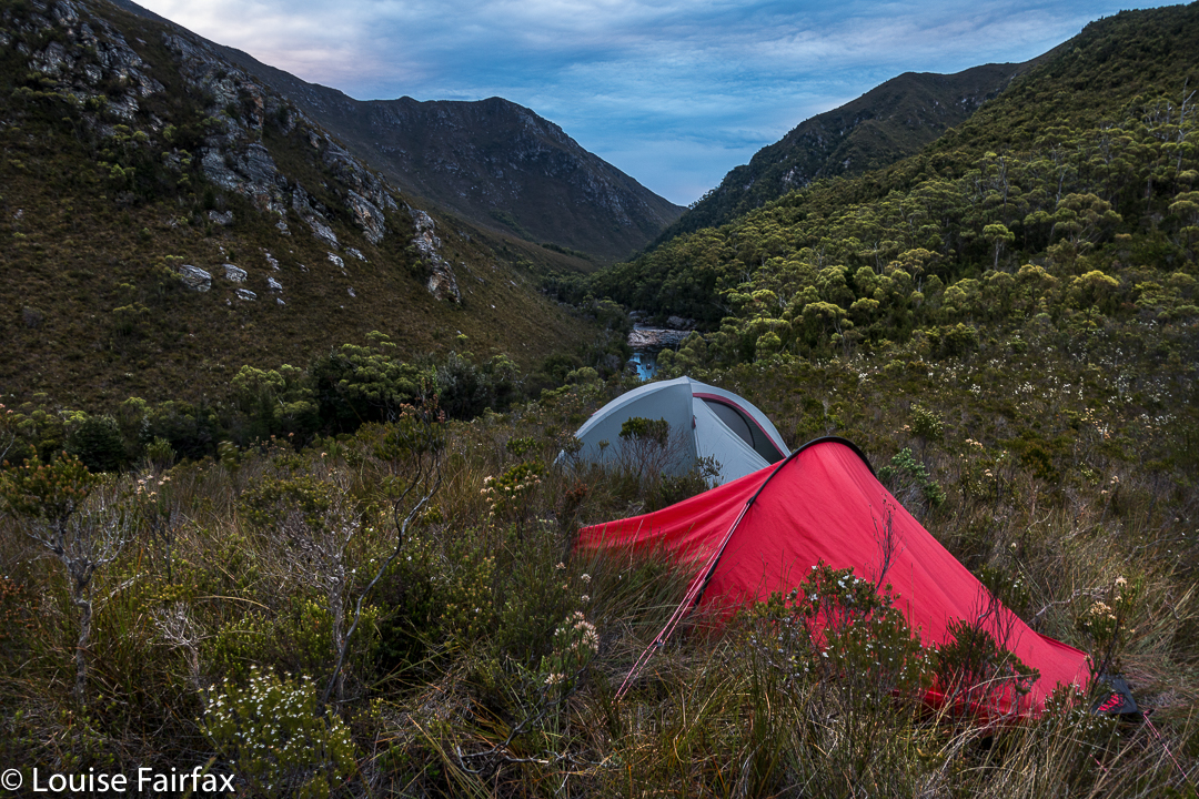
Just to get to the starting line of Ripple Mountain is no easy undertaking: first you have to fly to Melaleuca (South-west Tasmania) by light plane; next, there’s a boat ride through deep wilderness, up the Melaleuca Inlet and across Bathurst Harbour to a landing spot on its north eastern banks. By now, you are in a totally remote and wild area beyond the comprehension of most city dwellers. Finally, you have to walk over some mountains for two days and drop way back down to near sea level on the Old River. Now, you are ready to begin climbing. If it’s raining, what then? You climb anyway. And so, we set out in the mist and light rain, through ultra-thick scrub to climb Ripple Mountain because, well, what else do you do if it’s raining?
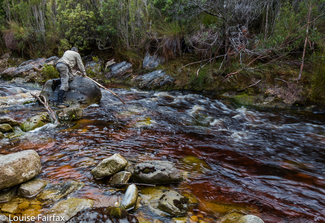
If I tell you we took six hours to cover 3.5 kms horizontal distance, with only 700ms vertical climb, that should give you a pretty good indication of the nature of Ripple Mountain, before I even begin to describe the day. Now, I have mentioned the light rain without indicating that the rivers and tributaries in the area were now somewhat flooded. Our first obstacle for the day was an integral part of these conditions: a fast-running creek of unknown depth and strength, which fed into the Old River, beside which we were camped. We found a narrow crossing point. The water looked strong, but not too deep. We took off our socks, put back on the boots and gaiters for protection, found ourselves each a nice long pole for balance, and tried our luck with the waters. They were strong; we inched slowly across (most of us) to make sure we didn’t slip or get bowled over, and were soon enough over the other side. Now began the real work.
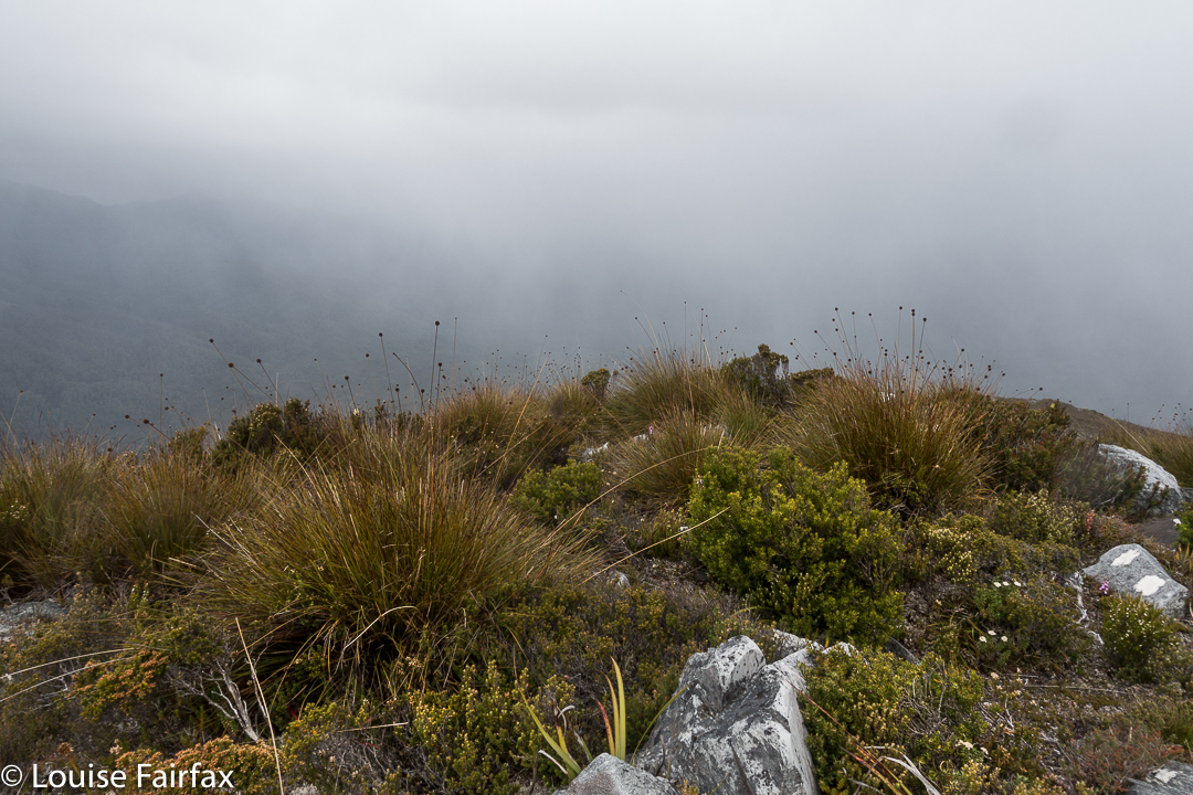
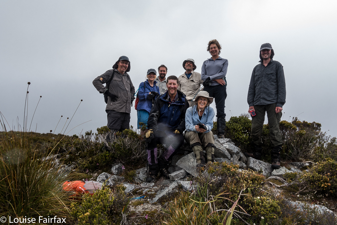
We worked hard for 6 hours (up) to get this view
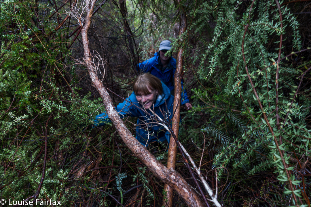
Ripple Mountain is a steep and scrubby affair: it’s a “dirt-in-your-face” kind of steep, where you use all four limbs to haul yourself up for hours … but that’s not all. It protects itself with an ingenious palisade of very thick scrub, the sort of scrub where, if a lightweight like me pushes at it, nothing happens. Even Dale, not a lightweight, could thrust his body energetically against it and have it move only a minute amount. Michael, our tallest member, was thus appointed to take on the worst of it. He did an amazing – an unbelievable – job of pushing away bauera and banksia to let the rest of us through in his wake. There is no way I would or could climb this mountain without the others – and no way I would want to. I was not here for points. On this occasion, given the weather, I was not even here for a summit view. I was here for “fun”, because I am so deficient in understanding that I think that getting myself covered in dirt and scratches, that hauling myself up for hours with friends who are doing the same, constitutes a good time.
We surmised that Ripple Mountain got its name from the seemingly endless waves of scrub that define the final ridge. As Matt pointed out: it did not get it from any ripple of applause.
We had lunch on a knob where the land flattened out a bit, thinking that, with only 1.2 kms to go, and negligible climb left, we’d be about another hour. Wrong. We were still a tad over two hours off our destination. I started to be very glad that we’d packed head torches, and was mentally prepared for a descent in the dark.
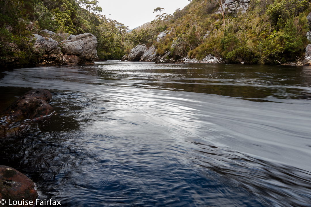
The Old River, beside which (nearly) we were camped, and across which we needed to go if we were to climb Harrys Bluff next day. The water, I should add, was very cold. Even on a hot day, no girl went swimming.
You will be thrilled to learn, if anticipating an ascent of this uncouth mongrel, that the final seven minutes are delightful walking, where you get to put one foot in front of the other in an upright stance, fighting nothing to gain the summit. I think from its position, geographically speaking, it must offer fantastic views. I saw a few blades of button grass from the top – and the friends with whom I climbed. The trip down was very speedy, done in only half the ascent time, not only due to the fact that we were no longer fighting gravity, but also to the excellent passage that Mike had made for us on his way up. We named our ridge “Mike’s Ridge”. All up, it was an 11.5 hour day, 8.75 hours of which were spent moiling forwards.
I didn’t track this one, but my friend did. When I get a picture of our route, I’ll post it here for those who love map-staring.