Mersey Crag via the Back Door. October 2016
When planning this trip, I castigated myself: Why hadn’t I climbed Mersey Crag when the road to it was somewhat open, and when I was so very near the summit? On two occasions I had been within cooee of the top, yet had not gone there because I thought access to it would always be easy, so why rush things? Why not savour the moment and do it all by itself sometime? Why not? Because floods would come, ruining approach roads and denying us all any kind of access to the area, possibly for years.
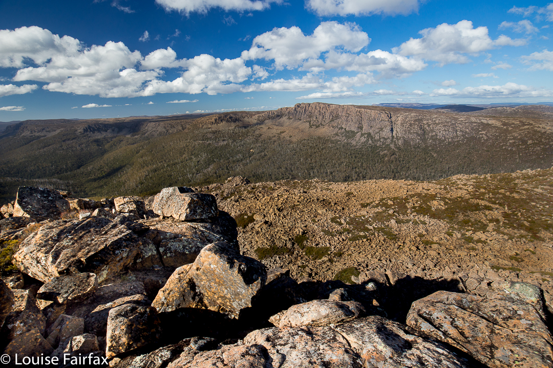
 Mersey Crag summit, looking down the Little Fisher Valley
So, now I thought I was doing it the hard way, because it was a very long way in, and I thought I was not doing it the beautiful way, because I do so love the Rinadena Falls. Little did I know. Alright, it was a long way in, but we summitted on the first afternoon, so not too long, and what surprised me most of all was the extreme beauty from the moment we rose above the bushfire marks on the Blue Peaks track.
 Mersey Crag summit looking across to Turrana Bluff
We reached the base of Blue Peaks in an hour and a half, but were focussed on our far-flung goal, so resisted the temptation to lose time by going up. We would stay focussed on our ultimate goal for now, and not climbing this first peak would justify another visit to this area that we were already falling in love with from the moment we entered the zone of lush cushion grasses with narrow, pure streams running through. On we continued, not even stopping for a break.
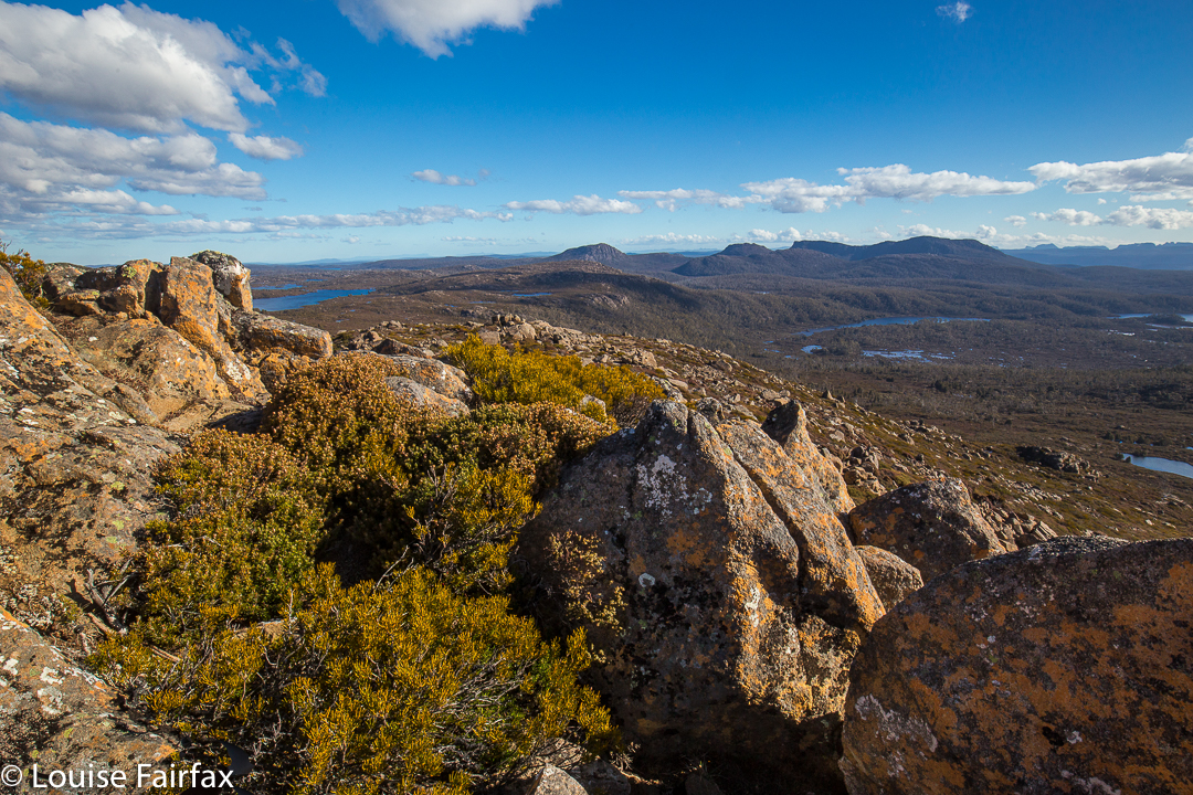 Summit area looking to the Walls. You can see Mt Jerusalem, The Temple, Solomons Throne, King Davids Peak and then, further back, mountains like the Acropolis and Geryon.
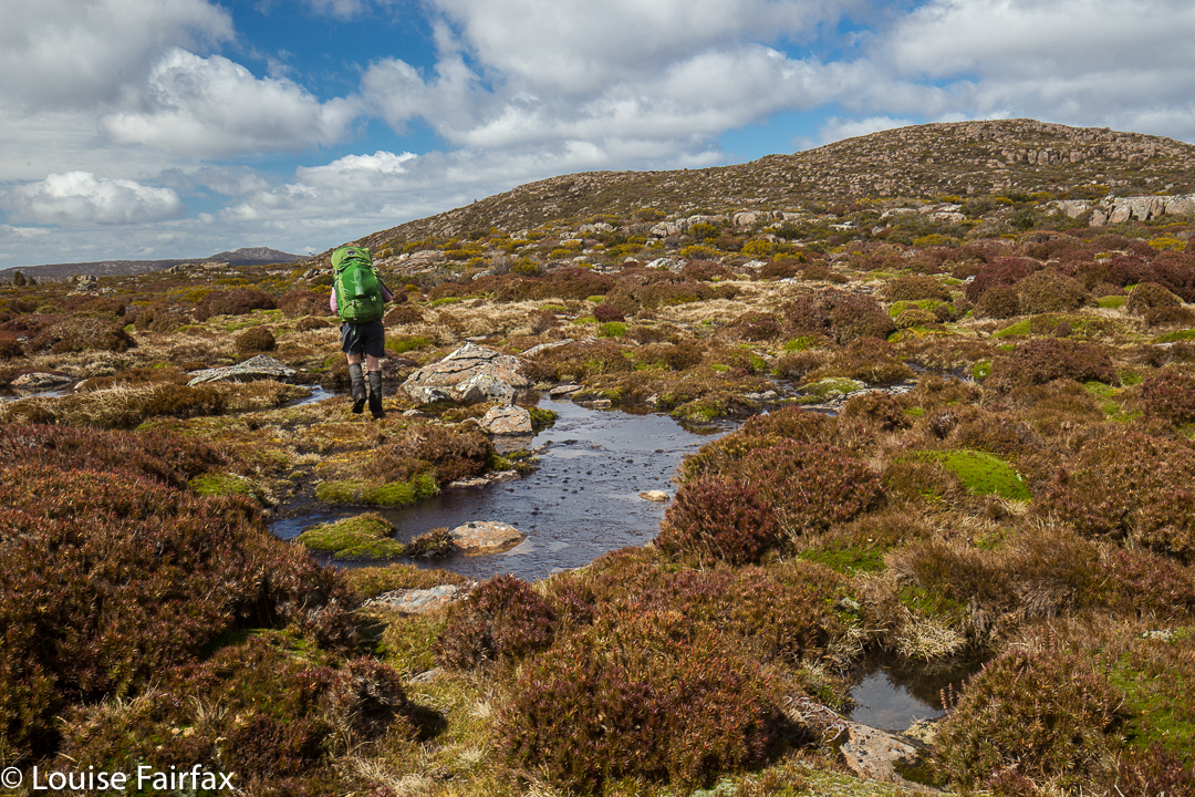
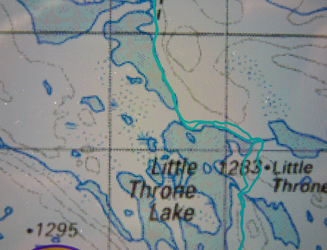
The official pad finishes here, but a rough hint of a route around the first two lakes – one followed, we suspected, by many fishermen – continued until we needed to cross the outlet stream separating Little Throne Lake from Grassy Lake. All this time we had no idea of how soggy things were going to be up here, or how many detours we were going to have to make around tarns, or, for that matter, how deep the many, many creek crossings marked on the map were going to be. Here was our first real creek. Hm. Up and down we go, looking for a place to cross. It is mostly wide and deep and flowing quite swiftly. We find a possibility, but it is risky. Will I fall in and get everything wet?
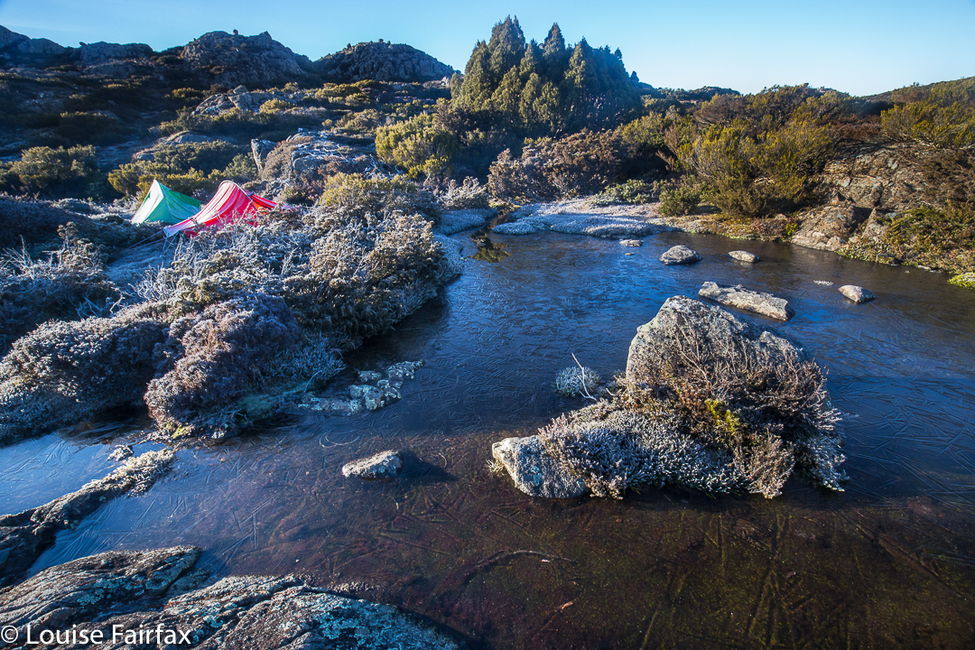
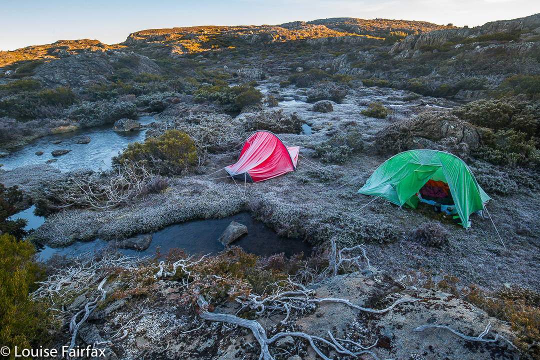 The frozen tarns of our tent site
Being a shocking pessimist in such matters, I opt for a double crossing, first with my pack, and then with my precious camera. Believe it or not, I even took off my jacket and jumper in case I fell in and wet them. Unscathed, we sat on the other side of the river and had lunch. Little Throne was just behind us now. From here on would be genuinely trackless wilderness, pure freedom to choose our direction and path.
 Morning glory
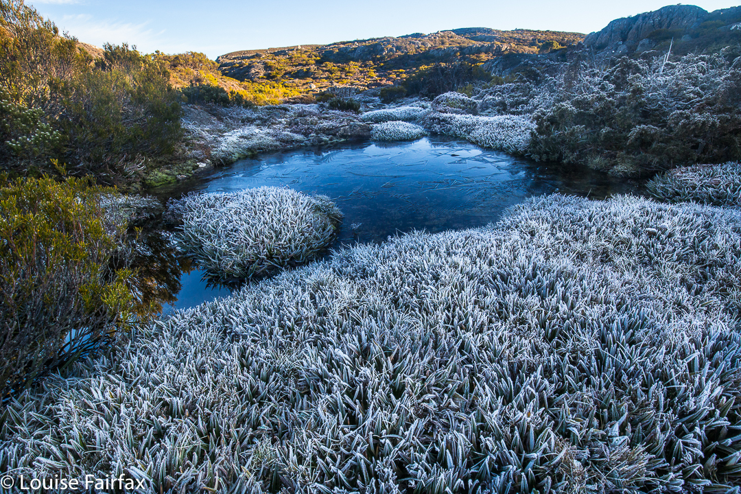
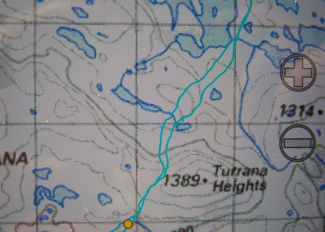
On Turrana Heights, we reassessed. I had originally suggested that we go for four hours with the full packs and then summit from there, but I was so happy with my pack on my back I kept pushing for further. Having the packs with us reduced all stress about whether or not we would make it back to where we had dumped them. We have both been quite sick in this last week. Angela was off work with a virus, and I had been to the doctor’s the day before with a combination of bronchitis and asthma. I found it hard to read my body under those conditions, and my pack meant security. If I hit a wall without notice, then everything I needed was right there with me. Angela was fine with this. On we continued until nearly four and a half hours, when we saw an irresistible spot just before the Turrana-Mersey saddle. It was now less than two kilometres to the summit, and only 3.15 in the afternoon. We could set up our tents here, saunter to the top and still be back in the light with no problems. Angela ate lunch part two.
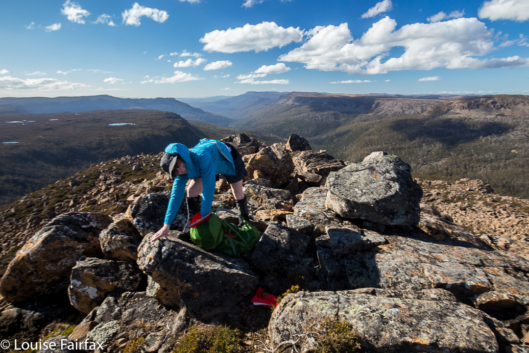
 Cresting the summit was very sweet. There are summits and summits, and this was a good one, as we had both held doubts about whether or not we could make it given the amount of water there might be to negotiate, given the distance, and the uncertainty of our health. When you doubt, the victory is felt more keenly. We had time in abundance now we were there and had our tents so close, so enjoyed the top, savouring the extensive view and delighting in all we could see. At a very leisurely pace, we ambled, almost reluctantly, back to our little tents.
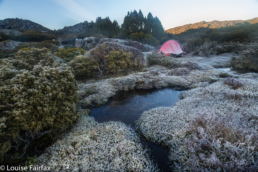
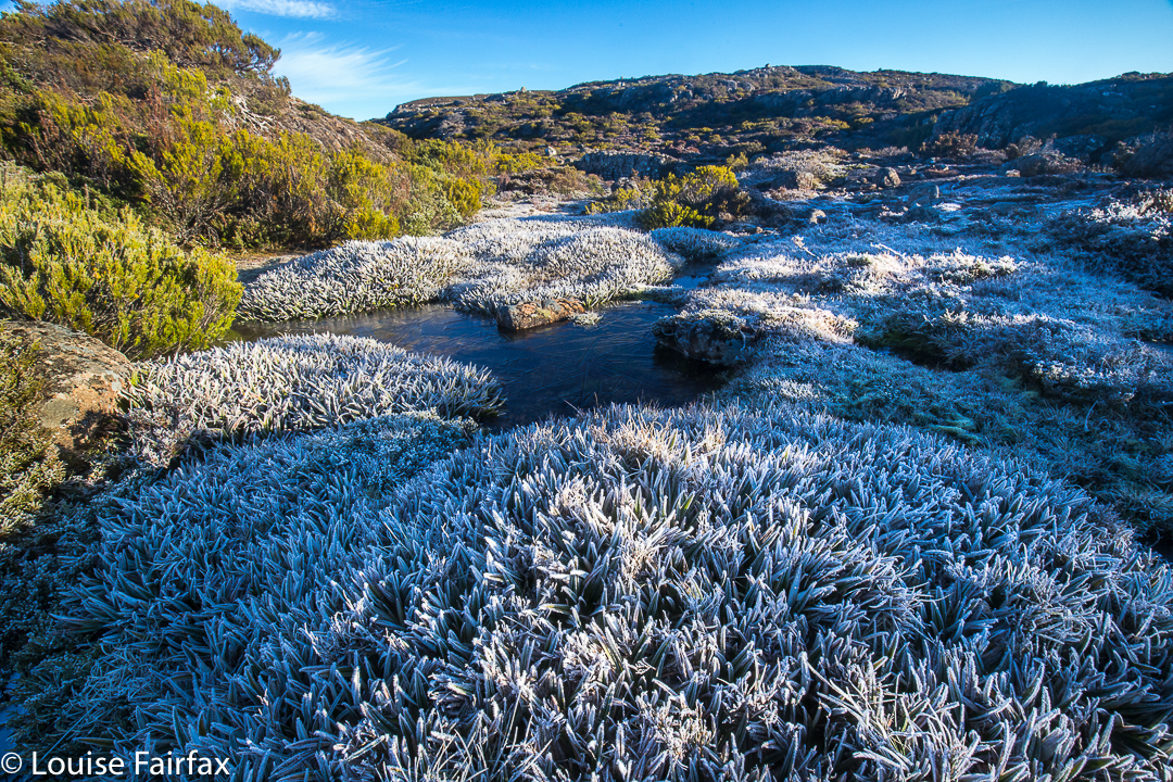
 We had both been snug and warm overnight, having both elected to use our extra bivvybags. I had actually been a little hot and had stripped down during the night. It is testimony to these bags that we discovered in the morning that our tents were rigid with ice and the world outside our aegises was a sparkling, glittering white one. Enthusiastically I snapped the frozen tarns and sword-like pineapple grass. I had lugged my tripod all this way, but, sadly, was too cold to use it. I told myself sick girls have an excuse.
 Back home we go
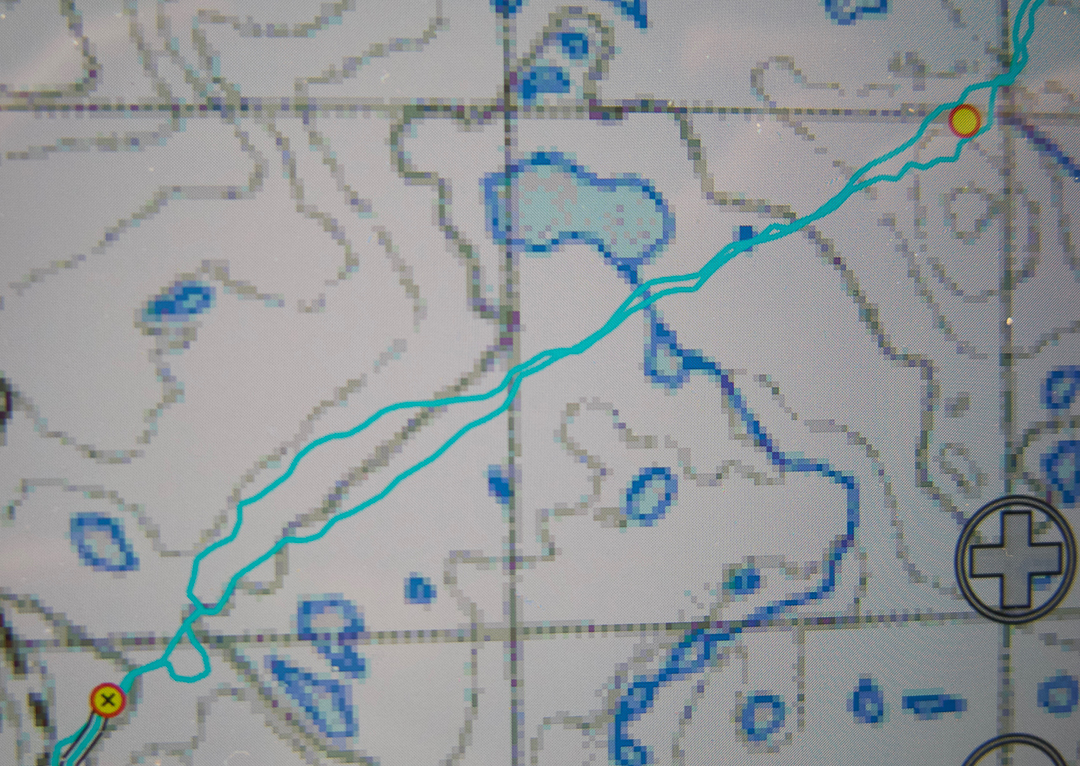
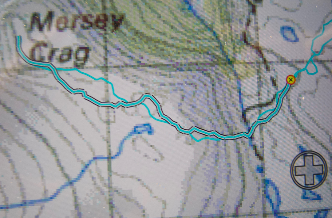
Total for two days, 46 km equivalents and 12 hours’ walking (this does not include breaks like lunch or morning tea). OK. We’re allowed to be tired. Here are the maps – rather a lot of them, as we covered rather a lot of territory and it is pretty complex (4 interconnecting screen shots).
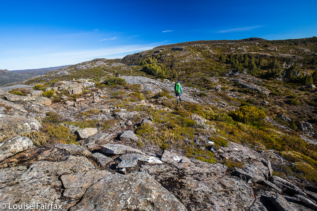
Continuing SSW over the side hump of Turrana Heights