
Mt Helder Aug 2017
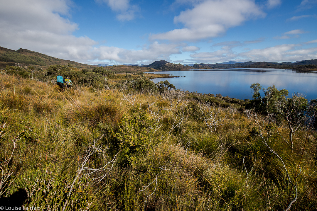
Underway to Mt Helder, walking around Hermit Basin at this stage, heading for the Herder Inlet. Stillwater Hill in the background, centre (I think).
Over the years, I have seen a few photos taken from the flanks of Mt Helder, and have wanted to see these sights for myself. For me, this mountain was all about the view rather than attaining the summit, although, of course, I wanted to do that too; however, being in the wilderness and seeing what could be seen from up there were my primary aims.
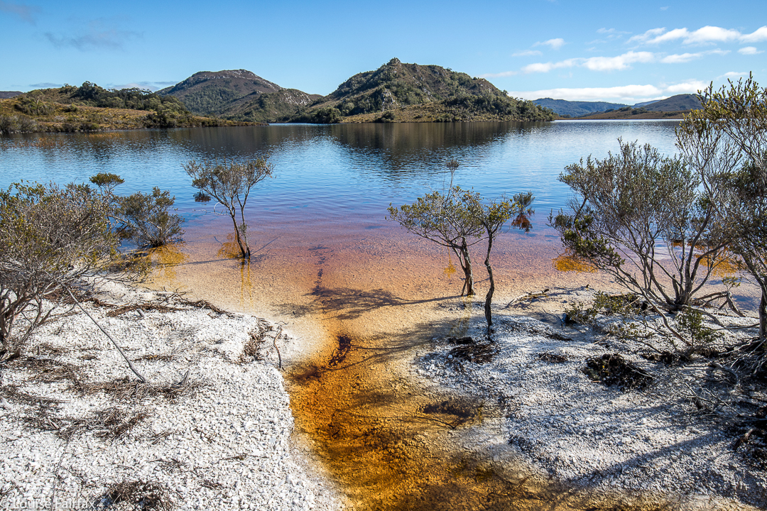
One of the very few moments when we could walk where we wanted to – on the white “beaches” of Lake Pedder.
We’ve had a lot of rain this winter, so I was not surprised to see that the normal white quartzite border around the lake (wonderful for quick progress) had been swallowed up by the bloated winter waterbody. This was inconvenient, but it sure was nice to see the lake looking so healthy. The repercussions for our little foursome were that instead of a nice lakeshore march to our real starting point, we would have to do battle with resisting scrub for several hours before we could begin the climb proper.
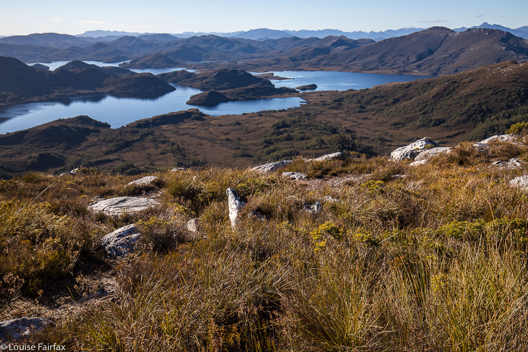
Looking down to two gorgeous unnamed lumps in the Stillwater Passage. Right to Mt Cullen. It took over an hour to get up here from the plains below.
The first hour and a half of our journey was thus embarrassingly slow. As far as the crow flies (pity these birds can’t carry packs for us), we had covered little territory, having wound back around the lake to where we could see our starting point, all too near. By lunchtime, we had made a more satisfying dent in the work to be done, but still had a way to go before the “starting line”. After three hours’ walking (plus lunch and morning tea breaks), we were sitting near the base of the climb, ready to begin the steep ascent. We sat there drinking and eating a bit more, girding our loins for the work ahead, and chatting while the day was warm and pleasant. I knew we would be too cold to sit around the non-existent campfire at night when the temperature dropped below freezing; it was fun to do it here, just soaking in the wilderness ambience.
As we chatted, I looked up at the first nobble we would head for, and guessed it would take us an hour to reach it, close as it was. I was hoping that was a pessimistic guess (I like to have pessimistic guesses so as not to be disappointed later), but, unfortunately, it was a little optimistic. Not only was the climb “in your face” steep, but the ground was slippery and slimy, making the work more difficult, as sometimes you’d slide backwards, losing precious height gain. Always, you were on your guard against a really big slide back to unknown depths below.
Dawn next day. I woke just in time to catch the roseate sky. I feared I’d missed it, but the eastern section still had a pink tinge.
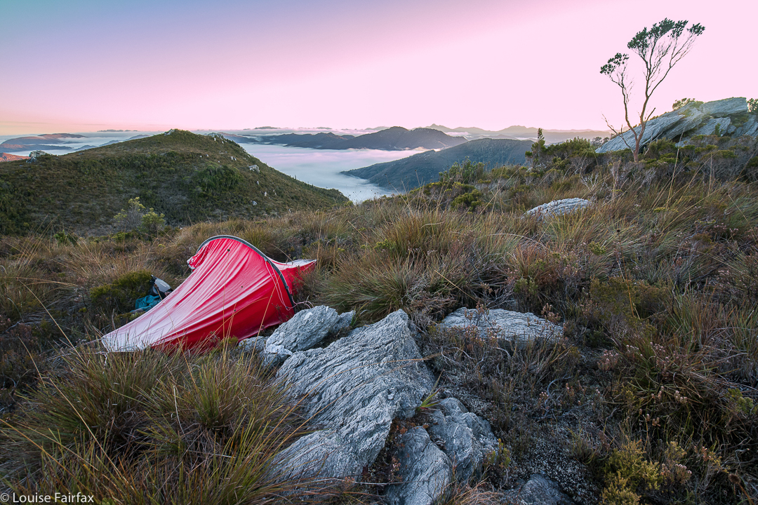
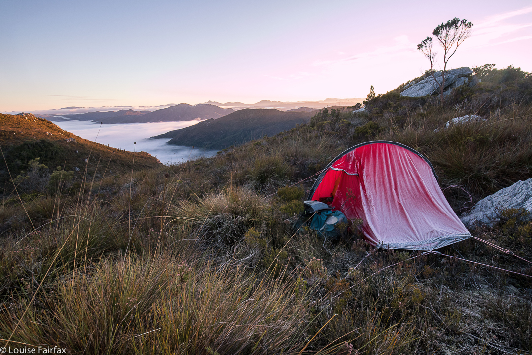
However, soon enough we’d reached it, and what a great reward for our efforts. I could have stayed there easily, but this spot wasn’t what we needed if we were to complete our stated intension of ascending Mt Helder. On we continued, to a high point looking across at Helder (on the map below, this is where you’ll see a lot of doubling back and forth). The aim here was to dump our packs, summit Helder, collect water on the rebound, and then proceed a tiny bit further in the direction of Mt Cawthorn. Off we set with water-collecting equipment for the way back, and plummeted down into thick, nasty scrub. We climbed back up and tried a different tack. Now, it was 4.30. We took stock of our current situation: (i) it would be dark by 6; (ii) this forest was very, very resistant to our best efforts, (iii) it would definitely be well below freezing overnight, making being caught-out perilous. It seemed we really ought to abandon a summit attempt for today, and do it straight after breakfast in the morning. This was a much safer option. We went down into the depths for a recce and to collect our water (mud, actually), gathered our gear and went to a nearer tent spot, the one in the picture above (and below). Can you see the ice on the tent in both shots? It was a bit chilly up there.
Day 2.
With plenty of time up our sleeves, we summitted without great difficulty (although with a worthy counter-battle by the bush) in a bit over an hour from our spot, and returned in a bit under, meaning that we had nearly an hour to scrape the remaining ice off our tents (alas) and pack up for a ten o’clock departure.
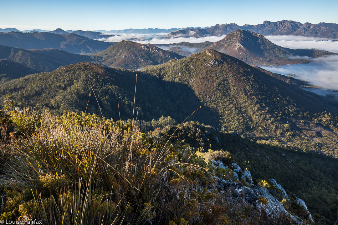
Summit view. We’d earned it – although I did like the tent view better.
We were more efficient on the way back, staying higher to avoid the thickest of the bauera’s web of unrelenting branchlets and the mass of melaleuca trunks that don’t like being budged sideways, and the cutting grass that likes to slit various parts of your anatomy. We only had to lift our legs high each step over the button grass and deal with bands of bush guarding the many creek crossings. Easy. Huh. We were back at the cars by 3.15. Obviously, we had decided to leave Mt Cawthorn for a time that favoured faster movement.
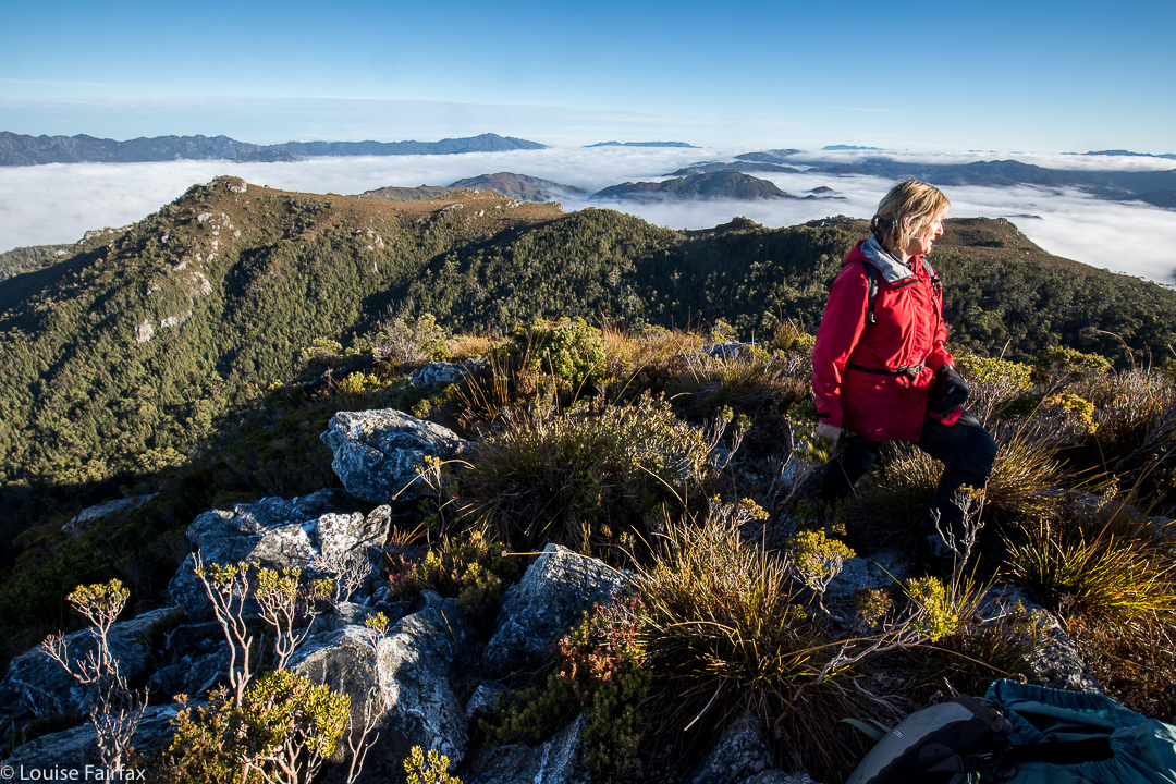
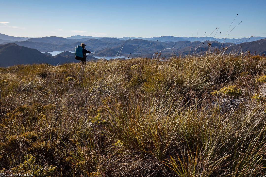
Sue Ellen looking east, while the camera gazes SW at Mt Cawthorn, and the Frankland Range beyond.
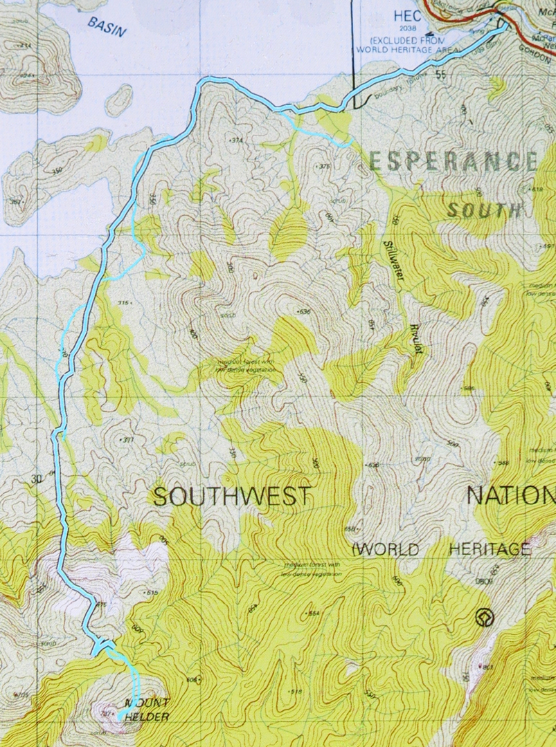
The lower route – to our destination – is the cyan route with black outline. The return route can just be made out – cyan with no black border. Unfortunately my battery ran out near the end, but you can see where we’re heading. The dos and from up high before the Helder saddle are (SW) where we pack dumped, and (NE) where we camped. The end of the black line is where we found water of sorts, so long as you like the taste of mud and grit in your drinks. It’s an acquired taste that I don’t mind.
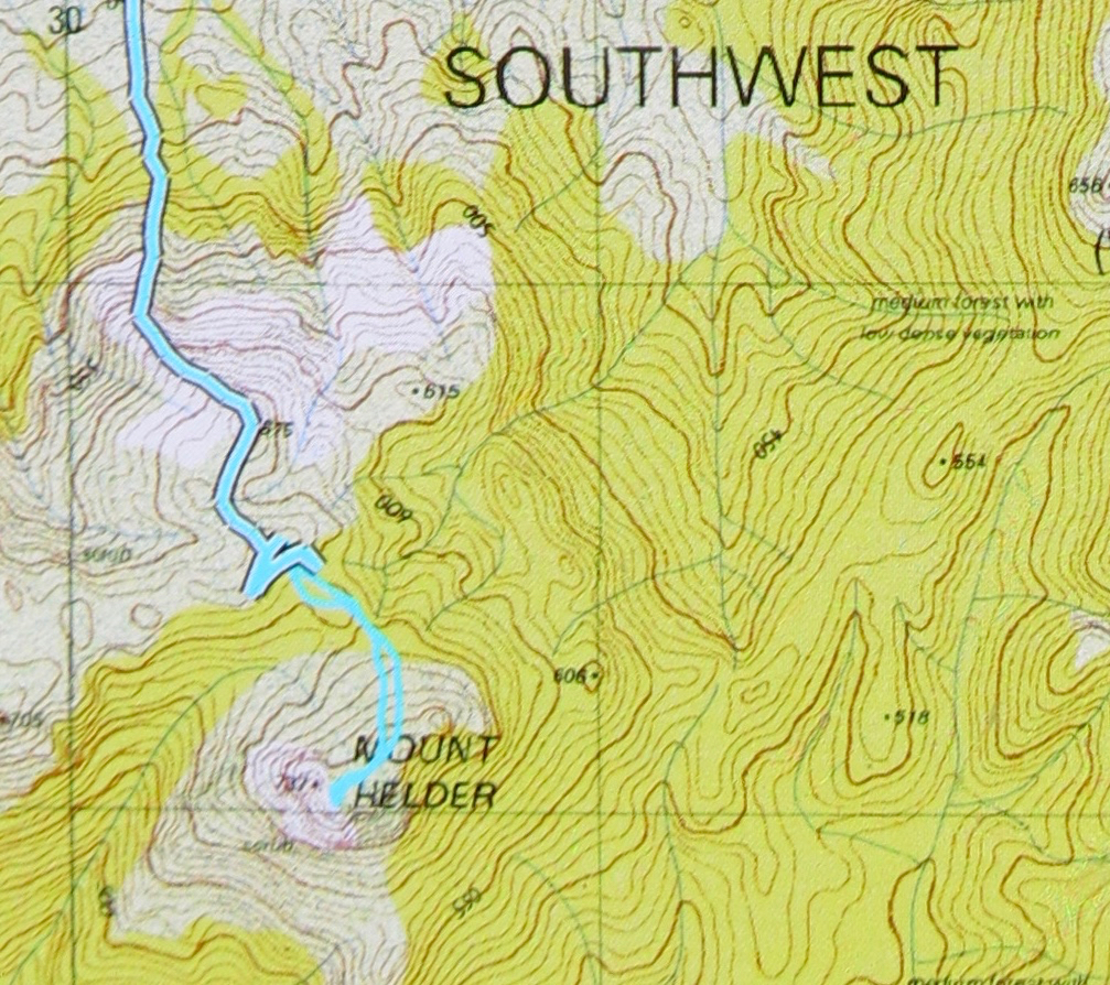
Close up of the final stages to give you a better idea.