
Mt Pillinger 5 Nov 2012
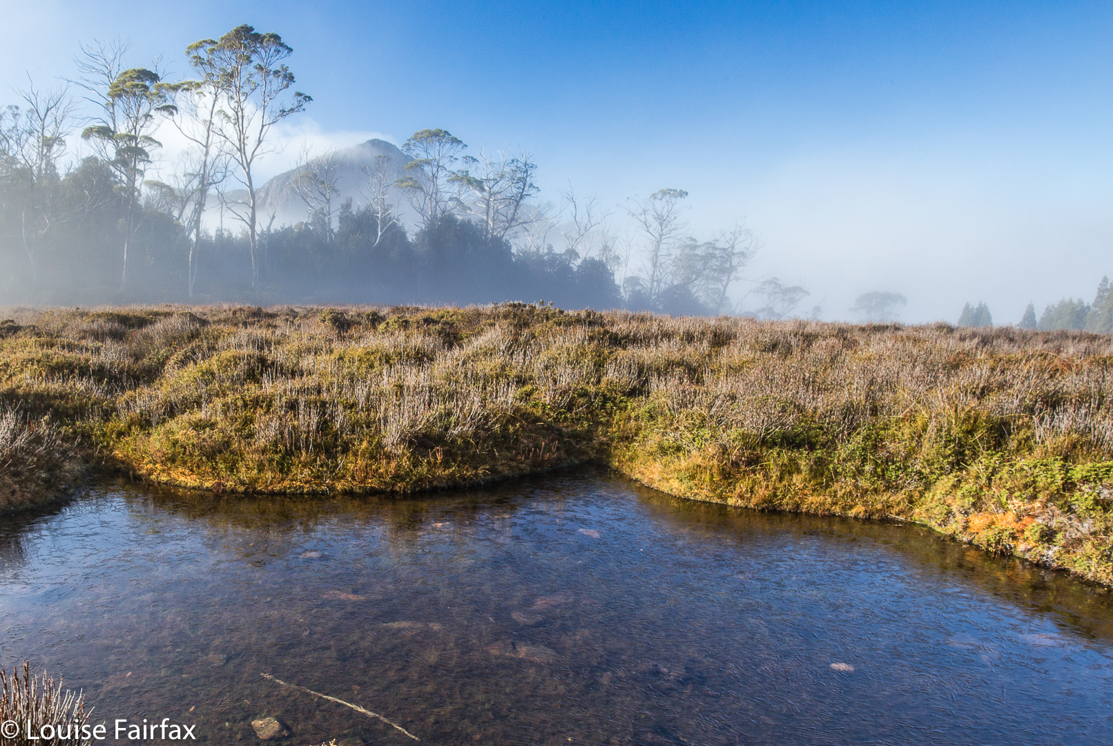
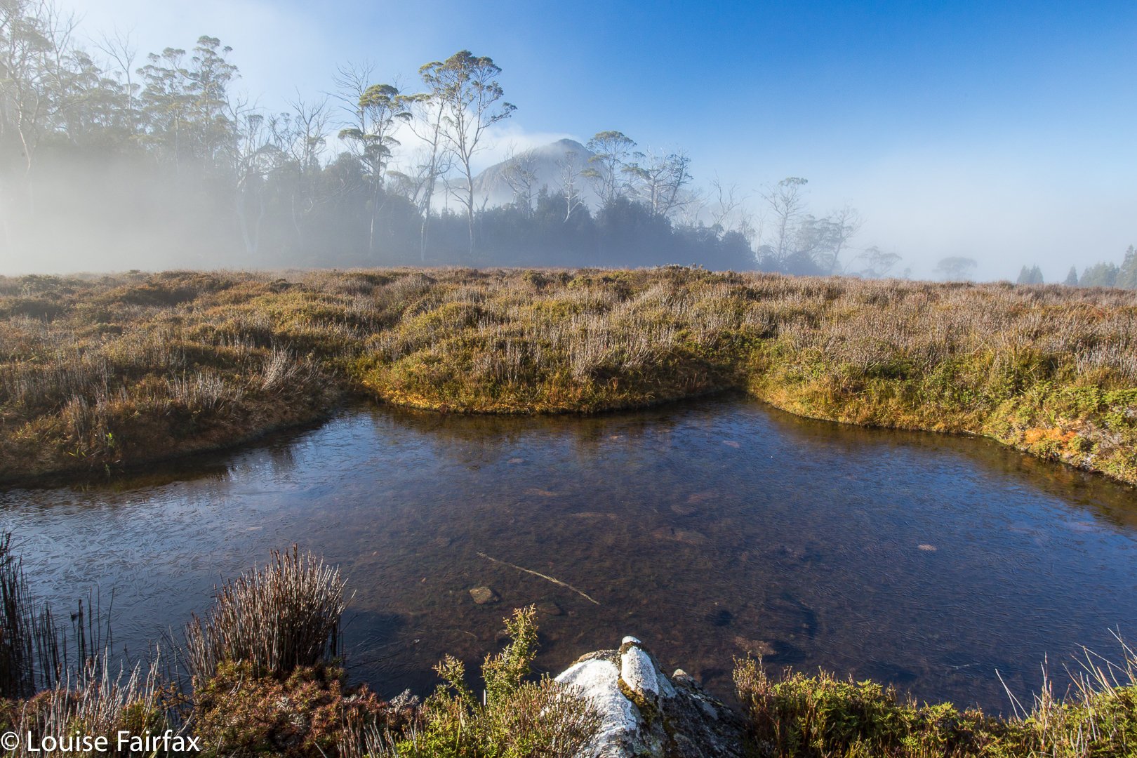 Mt Pillinger peeping shyly from mist. Photo from a later trip.
I am reworking my old posts, and see that this original one on Mt Pillinger told you nothing. So. I must go on memory, which has it that we went in on a nameless track that I duly dubbed the “Mt Pillinger Track”, which came off Maggs Spur 17.2, which is to the south of the Arm River Track (2 tracks earlier than its better known friend. See map below). It does not climb nearly as much as the Arm River one does, and deposits you closer to this goal. That said, I cannot vouch that, after the floods of two winters ago, it is still drivable. If not, use the Arm River Track, and just take a bit longer. If anyone has more recent information on the state of this approach road, I would love to hear.
We followed this track (which eventually joins the Arm River one – again, see map below) until we were at the base of Pillinger (to its north). When the big gully of that map was to our left (i.e., due south), we climbed up to that gully, although slightly on its eastern side (if my memory serves me correctly) to the flat area between two highpoints. From there, I definitely remember seeing cairns. They may have been present earlier – or perhaps we followed tapes. I need to reclimb this mountain. There is a track marked on the List map, which I have also included below. It seems to follow what my memory has just described.
 Mt Pillinger as seen from the saddle below the Twin Spires, further south again. Those are Lees Paddocks below left. The Mersey River and beautiful waterfalls are hidden in there.

View from Mt Pillinger, looking towards Pelion West and Mt Achilles. That would be Lake Ayr below.

Descending


Bassion thrush
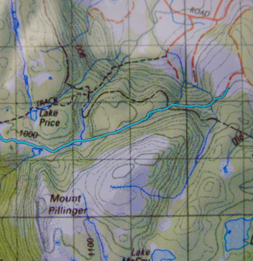
Here is a gpx of a route I did a year later, which shows the track we took in. The Arm River track is the dashed line to the north. You can see that it commences at a higher contour than the Arm River one. I found our track to be quite pleasant.
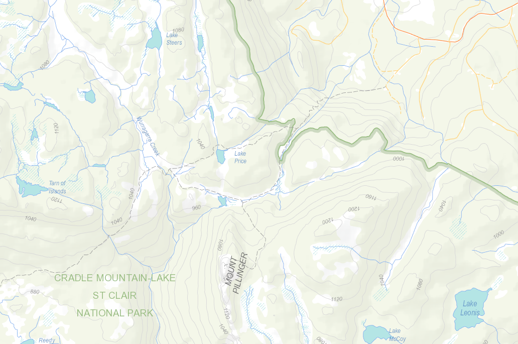
Below is the List Map version of the area.
Still as relevant today as 2014 and very helpful!! Thank you
Great. Thanks Jules.