
Mt Ironstone via Smoko Creek, Feb 2017.
There are myriad different reasons for needing to get into the wilderness, but a large number of us seem to feel this urge to some extent or other, whatever our driving force or motivation. I have a very strong and oft repeated need, and luckily, it is shared by my bushwalking buddy and good friend, Angela.
This summer has been filled with a large number of long expeditions, sometimes involving both of us together, and yet we hadn’t got out, just as a duo, to explore something new, climb something different – seulement nous deux – for several months. Angela knew that my days in the ICU watching over my husband had left me feeling cooped up and agitated, and suggested a daywalk this weekend. What a wonderful idea. I needed the wilderness; I didn’t just want it. Mt Ironstone was the solution.
I last climbed Mt Ironstone in 1988 (with skis on my back, that got tangled in almost every myrtle tree), reaching the summit on a glide. I wanted to return under conditions that offered something to see, and this seemed like the perfect opportunity. The last time we’d used Syds track; Angela too. I had decided that when I returned to take photos, it should be via Smoko Creek. Luckily, Angela had also not tried that route, so it was settled. Now we had something new to do.
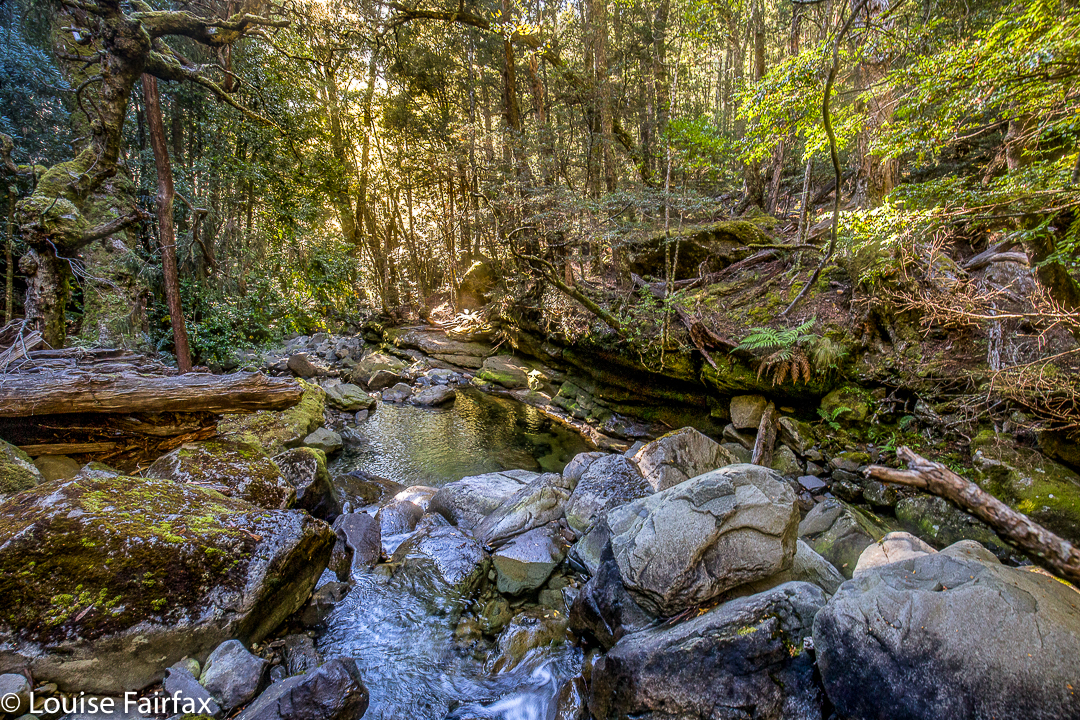
We parked near the collapsed bridge and proceeded along the ex road (now picturesque track) to the former parking area, reaching it in 20 minutes. This area offers a turn to the right to Mother Cummings Peak and Smoko Falls, and one to the left to Chasm Falls and Mt Ironstone. Funnily, we chose left. In a further 22 minutes, our narrow pad with metal markers and sometimes pink tape diverged, with one route (left) leading down to the creek, and another (right) up the spur. We took the spur route (neither direction was labelled) and continued climbing, soon crossing Smoko Creek by a log with wires to stop us plummeting to our combined deaths. I would not take children near this log unless they were exceptionally responsible.
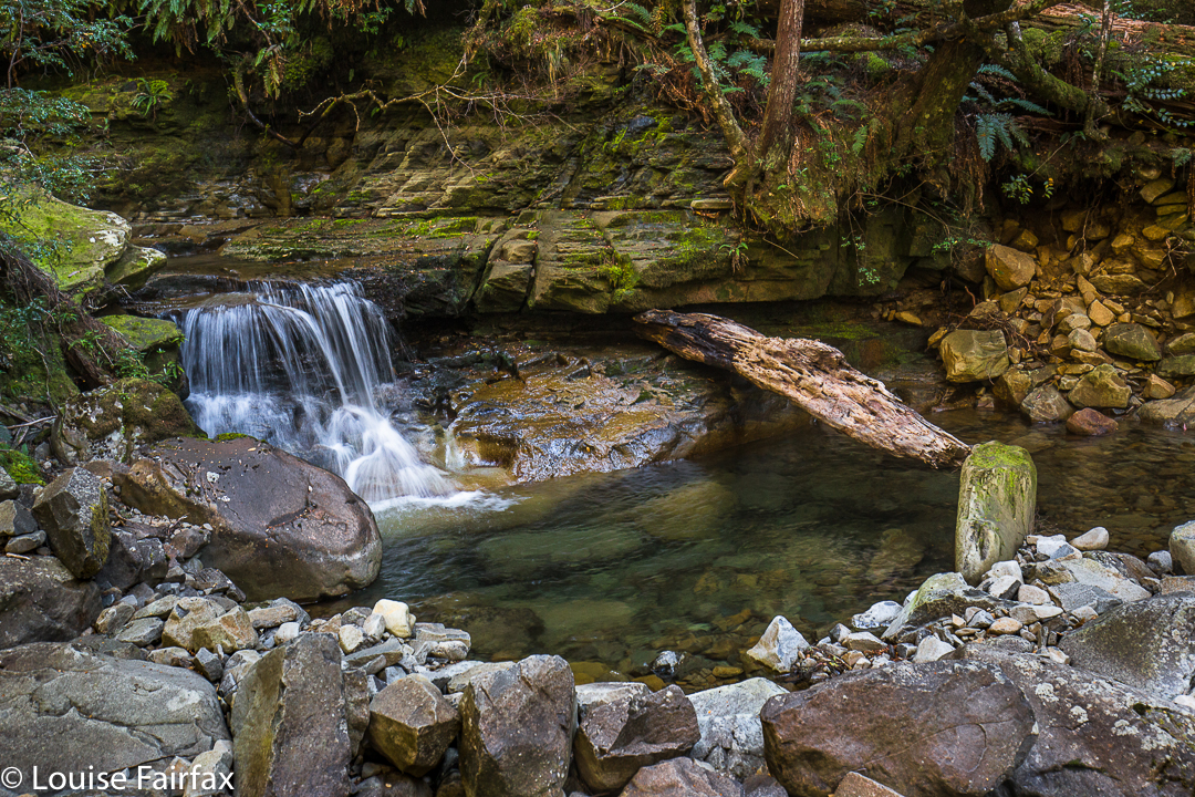
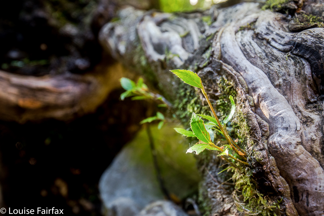
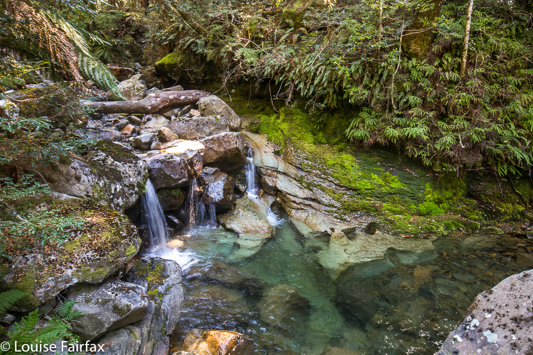
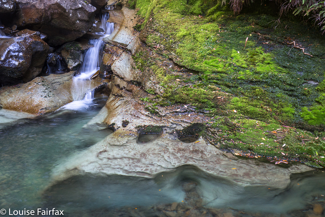
The forest had already been wonderful, but from here on its perfection seemed to reach new heights. If you want to believe in fairies and goblins and elves and ents, just come here and witness the weeping King Billy Pines and lush myrtles, the moss, clear pools and abundant small cascades. I was desperate to photograph some of these scenes, but we were intent on reaching the summit. Photos (mainly for me) and swimming in one of those holes (Angela) could come later. I eyed up scenes I wanted to shoot, and Angela tried to choose the perfect swimming hole as we climbed, past mossy caves and ledges, exclaiming about the beauty as we rose.
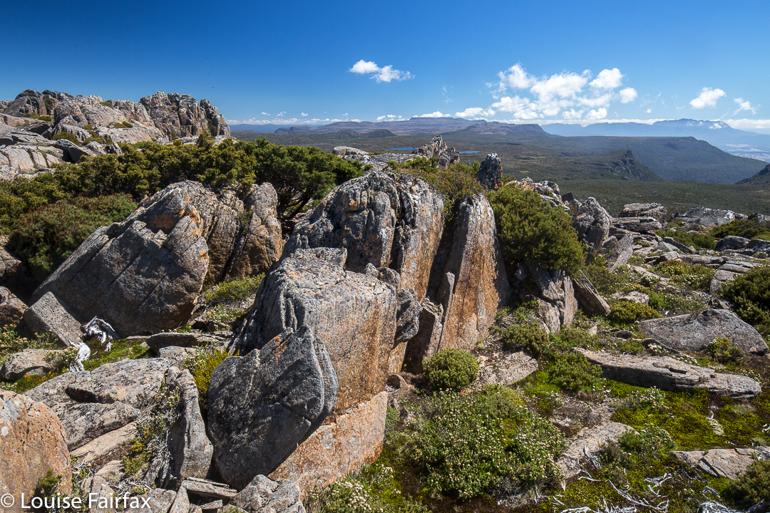
Eventually we emerged from this wonderland into drier bush, but it didn’t last too long. At first the track was still discernible, albeit with difficulty, but later – in the flatter area near a saddle-zone – it became downright vague, so we just followed our noses to the scree area, and climbed up it to the plateau on top. Once there, it took us about half an hour, at a guess, to reach the summit. Again, it was a “choose your own path” area. We were at the summit three and a quarter hours after crossing the river at the start. Oddly, perhaps, the downhill journey took us ten minutes longer than the climb – but maybe that’s just because we both love climbing, so proceed somewhat excitedly upwards, but are never in any particular hurry to leave our idyll. The extra time to come down does not include the time for photography, swimming, or for gazing while we had a snack beside a pool.
We pulled out of the carpark at 5pm, thus timetabled out of our usual cake and coffee at the Raspberry Farm, which is sad, but it will be there for next time, and the forest and mountain had had a stronger call on our attention.
Hi
Thanks so much for your report, looks wonderful!
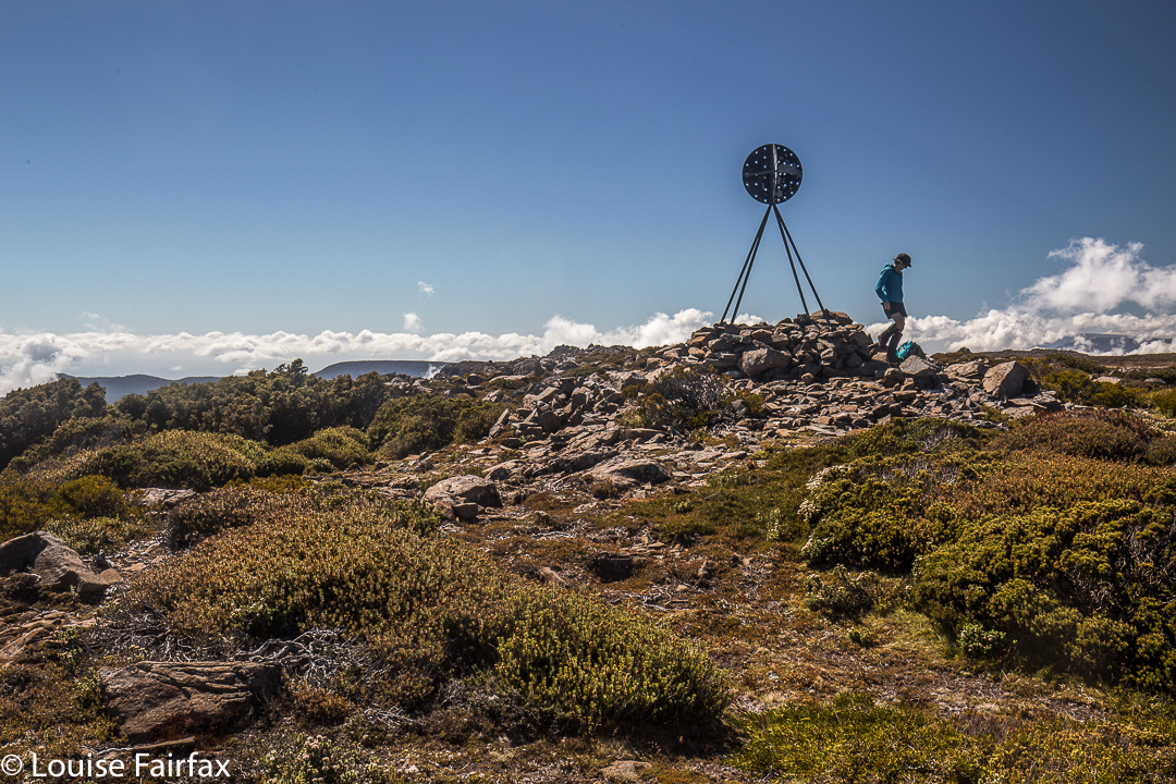
I’m planning on shooting up Ironstone soon (for the first time)… just checking that your summit photo is in fact of Ironstone?
ie There is a summit trig?
Hoping yes so that it is easily discernible as to where the summit is and once on the plateau where to be heading for!
Thanks
Phil
HI Phil. Yes, the summit photo is , indeed, of the summit. You can see the summit from a km away (in certain directions). You will find the route we did harder, as the bridge across Smoko Ck is now down. If you want to use this route, then stay on the original side of the creek for longer. Follow it up until you can cross it safely (not hard) and proceed along the track as marked. You may have to go 400 ms or so before you can get across – depending on water levels. Good luck. Louise
Hi Louise
When you say original side of the creek,do you mean the track on the left leading down to the creek?Im doing this walk next Saturday and hopefully can still get through!
Cheers
Scott
HI Scott. Hope you have a lovely time next Saturday. As you climb up the spur, heading for Ironstone, Smoko Creek is down to your left. Before the bridge washed away, you went down left and used the log to get over the VERY deep gorge of Chasm Falls. As that ‘bridge’ is no longer usable, I am saying to keep going uphill with the creek to your left for a couple of hundred metres further, and then cross when you see a spot you like. The track will be waiting for you on the other side, not far from the water. Crossing will be a total snack at this time of year, I would imagine, as water levels are frighteningly low. I hope you find enough to drink! There are some gorgeous swimming holes as you follow the creek up. You might like to have a swim on the way back down, when you know how much time you have left.
Thankyou Louise,
Much clearer now,I’ll be taking this route!
Yes the levels are low!I climbed Rogoona last weekend in the heat and drank my whole 3 litres I carry by the time I got to the summit,Lake Myrtle was waiting for me to replenish my stocks for the walk out to Mersey Forest Road!
Again thanks for the info.
Scott