

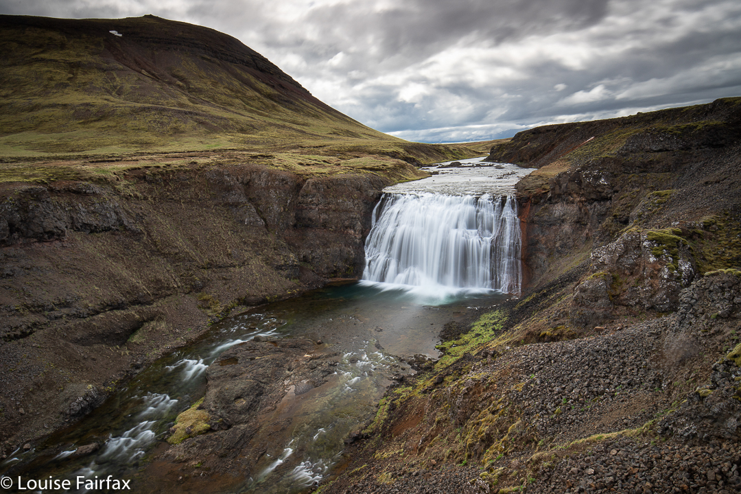
Day 5. It was sad to leave the farm at Fludir, but I was excited to see what lay ahead, so set out eagerly on the day’s rather long drive. My goal was a waterfall called Glymur, but I got a little distracted along the way, firstly by a nice early revisit of the Thingvellir National Park minus the tourists, and then by a little unmapped, unannounced waterfall called Þorufoss, beside road 48.
Glymur is at the far end of the Hvalfordur. Herein lay my third distraction. I was driving along, minding my own business, and I saw a sign of a little man walking, and the word Fossa (the name of the river there. No, I am not driving in circles. Every second river is called Fossa).
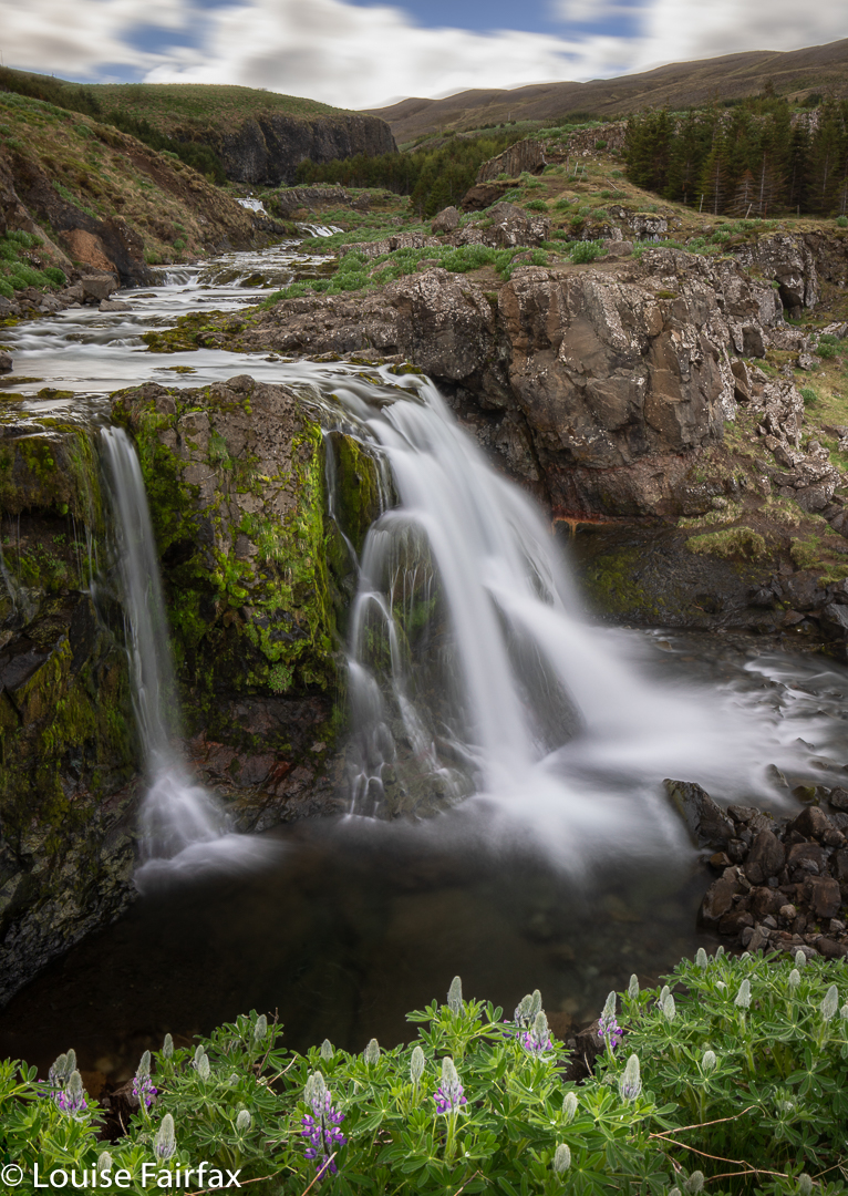
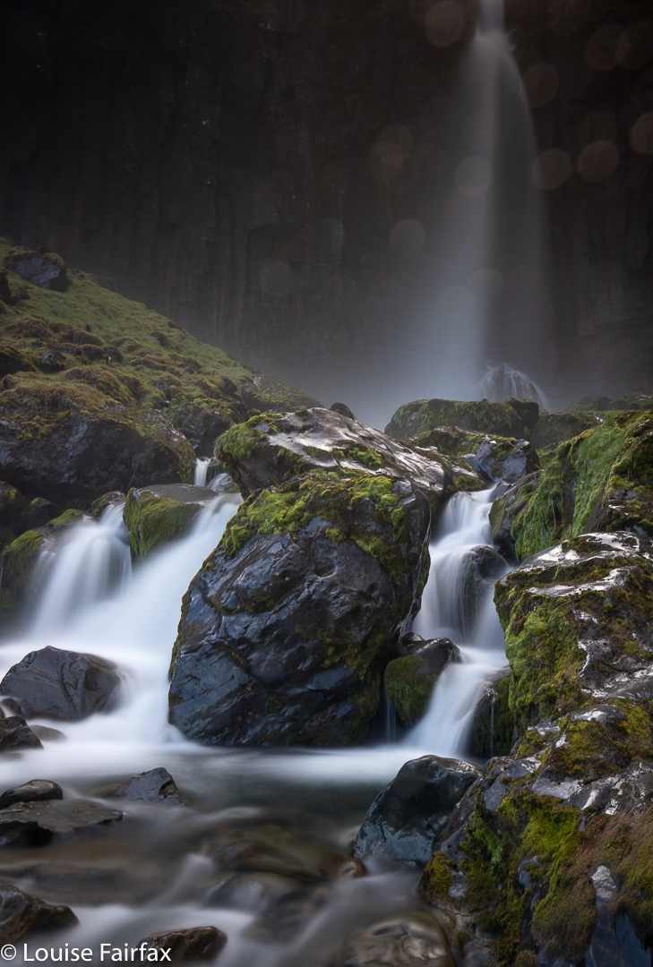
Then there was a sign to a Fossarrett, which is an old ruin of sheep holding pens, and was a name I knew from my research. That is because next to this lies the unheralded, yet very attractive, Sjararfoss, which, of course, I needed to visit and photograph. In climbing up for a different view of the falls, (and because hills are meant to be climbed, because you just never know what you might see from the top, and the act of climbing is extremely pleasurable), I noticed an upper falls behind, so shot them too. Upper Sjararfoss, I guess.
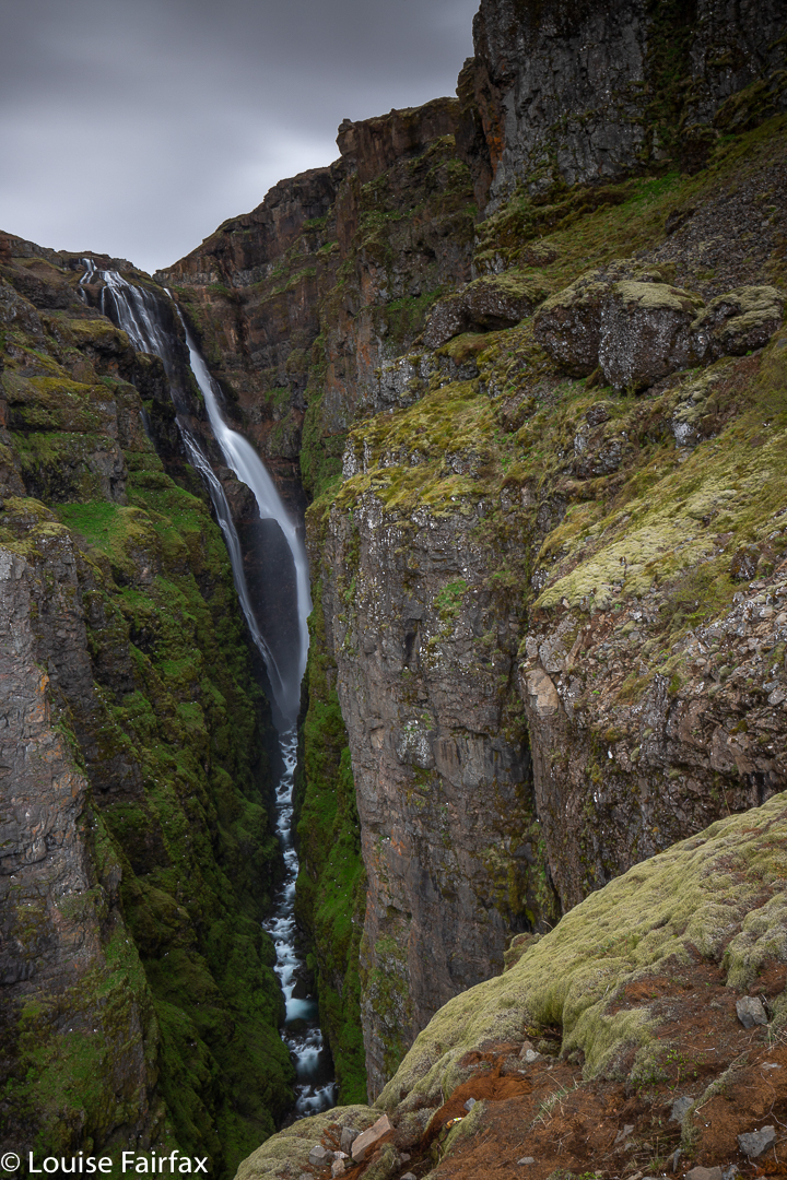
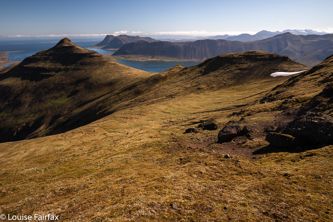
Now, at last, I was finished with distractions and diversions, and could proceed to Glymur. I parked and set out. However, I very soon encountered a sign that said “Leggjabrjotur”. I decided it meant “dangerous” or something of that ilk, so just kept going, as such signs are always overstated. However, it seems to be the name of a place, so my fourth diversion was to climb an extra, really lovely mountain, from which I could look down on Glymur, way across the valley. In climbing the wrong thing, I found another few wonderfully blue waterfalls with snow as their backdrop.
And finally, at long last, I had run out of other things to do, and set out on the real path to Glymur. Information says it is Iceland’s second highest waterfall, but I think they mean tallest, as we had not gained any particularly great height above sea level, which was not far away. It was a fun hike, as the path went through a cave, over the quickly flowing river on a log, and then quite a few roped sections. It was a most satisfying little exercise.
On the way out, I passed a German family who had obviously had a blow out on the rough road, and had then driven down a steep embankment. The situation looked quite dicey. I stopped to see if I could help. (Ha ha, I am useless, but maybe I could call, or drive to get, someone for them). Yes, yes, do I have a jack on board? Theirs had busted. I didn’t realise that I was now expected to use my jack, lift off their tyre, help put the other on, and more. Time went by and more time went by, as the process was very slow. I couldn’t believe that this person who cannot change her own tyres at home, had been made chief mechanic by these people, This does not mean my expertise had suddenly increased to be existent. It means they were even more useless than I am (and presumably won’t be reading this blog). In the end, someone else stopped, so, with great relief, I handed them over, and left, now running very late indeed for my destination of Borganes.
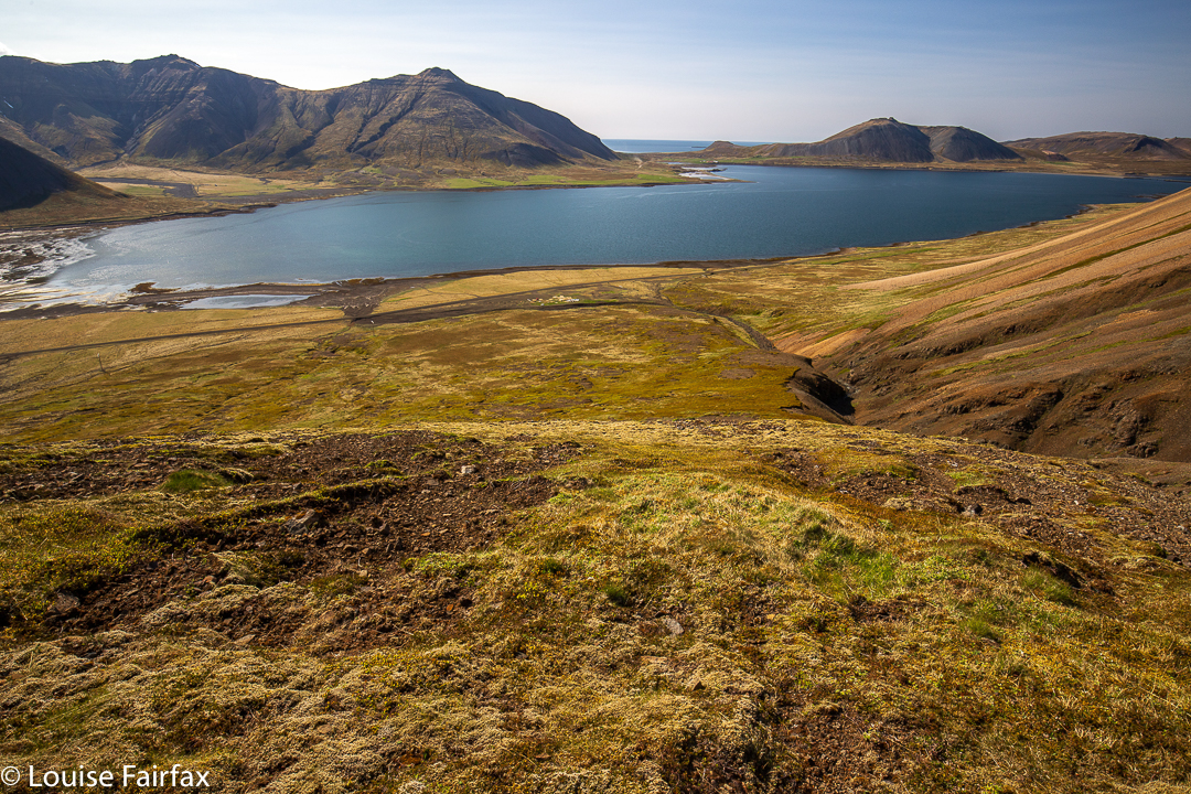
My chosen route (as dictated by Glymur) was along the Hvalfjörður, which is apparently now known as a “ghost” fjord, since most Icelanders bypass it through a tunnel under the sea (built a few years ago), saving 2 hours’ driving. Nowadays, the road of the old route is almost empty. I drove along, delghting in the calm water with reflected mountains to my left, dramatic mountains to my right, and the sheep and newborn lambs dotting the fields before the water. It was, nonetheless, a relief to have finished the day off – in time for a rather late dinner.
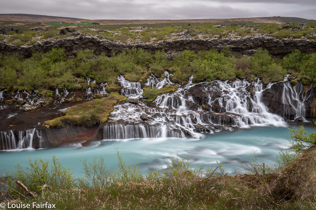
On day 6, I set out after a fulsome breakfast at my air bnb for the Hraunfossar and Barnafoss, which are basically adjacent (maybe 100ms from each other), and accessed from the same carpark. The walk is barely worth putting shoes on for. I was a bit disappointed at the lack of excercise, and the whole ‘episode’ was over in a very short time.
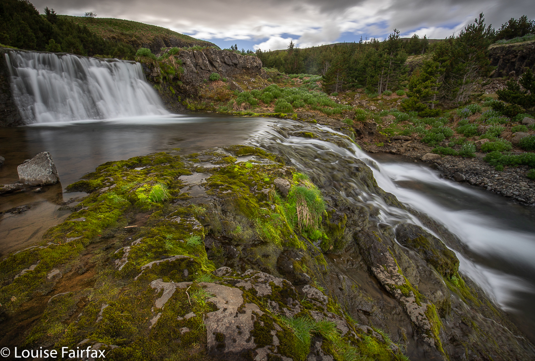
The “Hraunfossar” is a series of waterfalls formed by rivulets streaming over a distance of about 900 metres out of a lava field. The waterfalls pour into the Hvítá river from ledges of less porous rock in the lava. It is rather a fun sight, and the water is magic Iceland blue.
Hraunfossar, means Lava waterfalls, and Barnafoss, Children´s waterfall. There is rather a sad story yielding the second name.
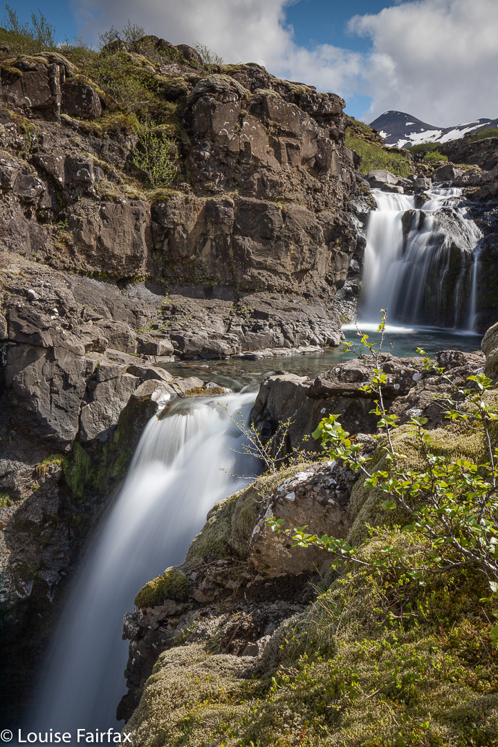
Now, I was feeling cross at being so very exercise deprived by this silly “walk”, so, in order to get to actually move, I drove a bit further to Husafell, where I had been told there are a few hiking trails.I chose the yellow trail which climbed up next to Selgil, and the Salar River, en route to Beajarfell. At the start, this looked boring and moonscape-ish, so I didn’t burden myself with my camera or tripod. This was just going to be exercise for the heck of it. Drat.
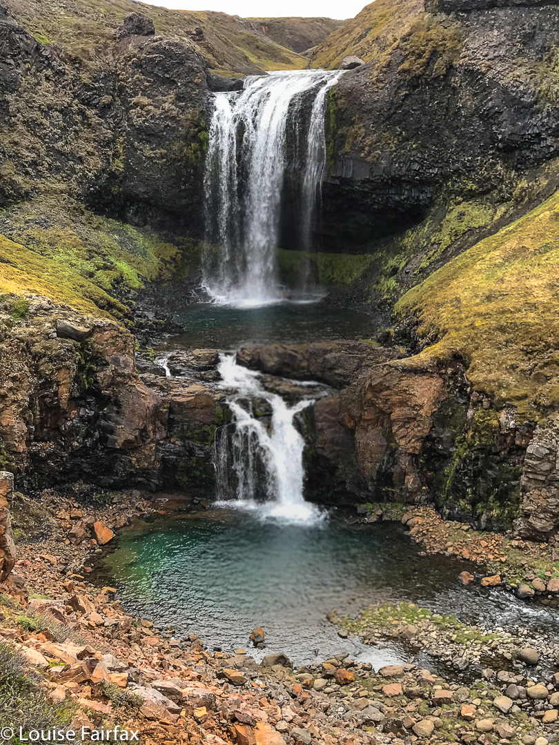
The actuality was really beautiful, and at the top I just adored the impressive gorge and the series of four waterfalls I discovered. (None of these was on my map). It was fabulous having everything to myself, and finding something so unexpected. I went up for just over an hour, and down, similar – a much more satisfying amount of exercise. The photo is only an iPhone one. At least I had that on board!
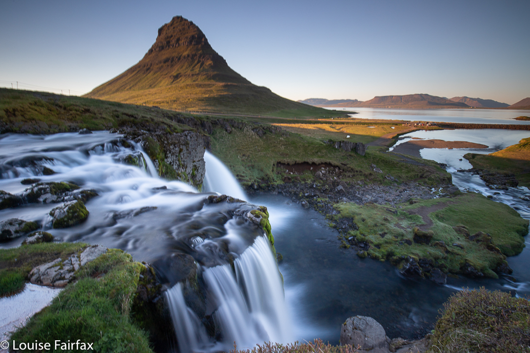
On day 7, I found that the experiences of the day before had left me quite drained, and I was quite listless all day. Trouble was, this was the day on which I was to drive to Grundarfjordur and its famous Kirkjufell, a most attractive and shapely mountain, rising with ridiculous steepness out of the ocean, and decorated with what is maybe my favourite waterfall in the whole world. Expecting to enjoy it, and wanting to give myself the best opportunity to photograph it, I was booked in for three nights. I discovered to my pleasure that the marvellous denizens of this little town have drawn up a map with hiking trails on it. I was about to have fun.
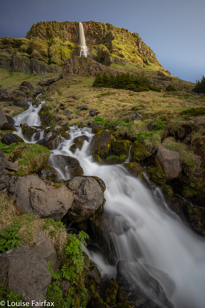
To reach there, I drove around the Snaefellness peninsula clockwise rather than using the shortest route. En route to Arnarstapi, I passed Bjarnarfoss, just before Budir. I liked the look of it, so stopped for photos.
I was also interested in a gorge up ahead: Raudfeldsgja. Because I was not feeling well, I almost wasn’t going to bother exploring it, but luckily I did, as I really loved it. Unfortunately, my lack of energy meant I did not feel like carrying my tripod, so the photos do not do it justice. I really was feeling very lethargic at this stage.
By lunchtime at Arnarstapi, I was really feeling sick, and explored nothing. I ate a bit and drove on.
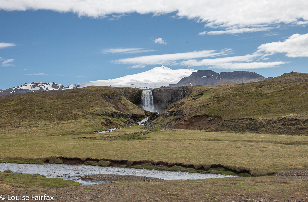
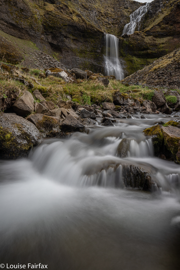
Listless as I was, I still stopped for Svodufoss, with the snow of Snaefellsjokul behind, and, right next door – maybe 300 ms away – Kerlingarfoss. Svodufoss woud be great from a helicopter or drone, but an earthbound human is too low to get in the snow plus the falls ?. Maybe if I were taller it would have helped. I climbed a structure, but it still didn’t work.
The drive to Kirkjufell was amazing, but I was too tired, sick and nervous about falling asleep at the wheel to enjoy it properly.
With so many trails on offer, (day 8) which one should I choose? One that someone who felt very ill the day before could tackle, so I chose Eyrarfjall. Good choice. I was at the summit in a pinch over an hour, and down in less. Perfect quantity. It was an enjoyable climb, but I hated not having a real map. The contour interval on the one provided is 100 ms!!! That barely qualifies as a map.
I was still not well, so after lunch had another sleep. I didn’t even feel like photographing!! There were no clouds. I skipped it.
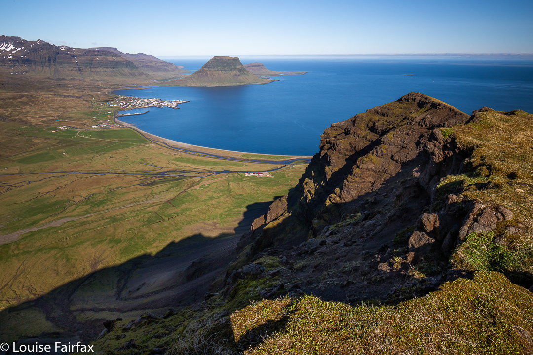
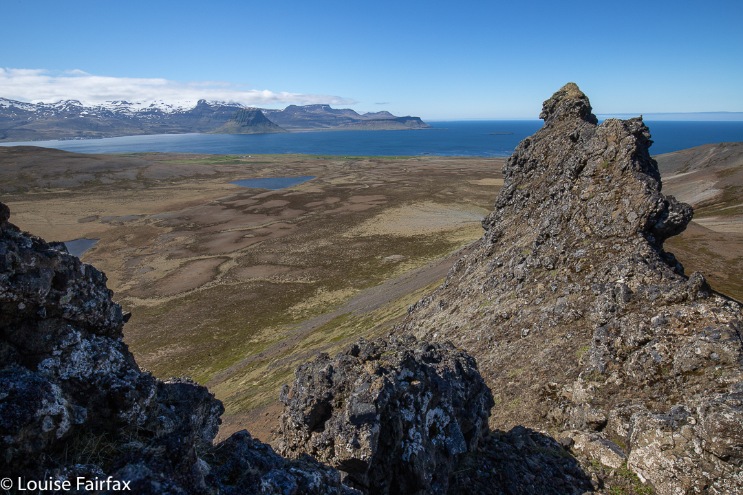
Luckily, I felt a lot better next morning (day 9), so could do a lot more, and was a lot happier. I began my adventures with a lovely early climb up the stunning Grundarmon. Such drama!!! There was a knife edge ridge the whole way along. I climbed to the snowline before retreating.
From up there I had a fabulous view looking down on tiny little Kirkjufell way below. The water of the ocean was a deep blue. I just sat on the cliff edge, dangling my tootsies over a several hundred metres of free space, and enjoyed the spectacle for a while before descending. Two hours’ exercise so far. Nice.
Next, I decided I’d better visit the other “legal” waterfall in the area (there are more but farmers don’t want us there). This was called Grundarfoss, and it took 23 minutes in each direction.
After lunch, I chose to climb Gjafi until the point where it got too dangerous (violently sloping scree). The colours of the rock were wonderful and on the way down, I had great fun in the well-cushioned alpine vegetation, springing as if I were on a trampoline.
Iceland is famous for its lamb, but up until this point in time, I had not tasted it. This night, I celebrated feeling well again with a lamb dinner at the local restaurant. It was wonderful! This was my final night night here, so my celebration did have a little grey cloud.
Yet again (a habit of every night but one), I set out near midnight to photograph Kirkjufellsfoss, returning in the early hours of the morning. It was also my habit to be awake at 3 a.m. and to roll over in bed and take a phone shot of the dawn pink over the snowy mountains out my window. I was simply too tired to do anything more than that.
I enjoyed meeting the other togs in the midnight fun. Amongst many, I made friends with Denise and Stefan from Switzerland, primarily bird photographers (and macro), but I persuaded them to come and see what was to be seen of this waterfall at that hour. They were just down the corridor from me at the Old Post Office. We still have contact through instagram.
Next day was a big drive. Yawn.