

Six and Twenty Falls at St Marys were, for me, yet another tantalising blue line on a map that I could find no information on, with no hint of a photo or a story to indicate that anyone else had been there. Ah well, here goes for another adventure.
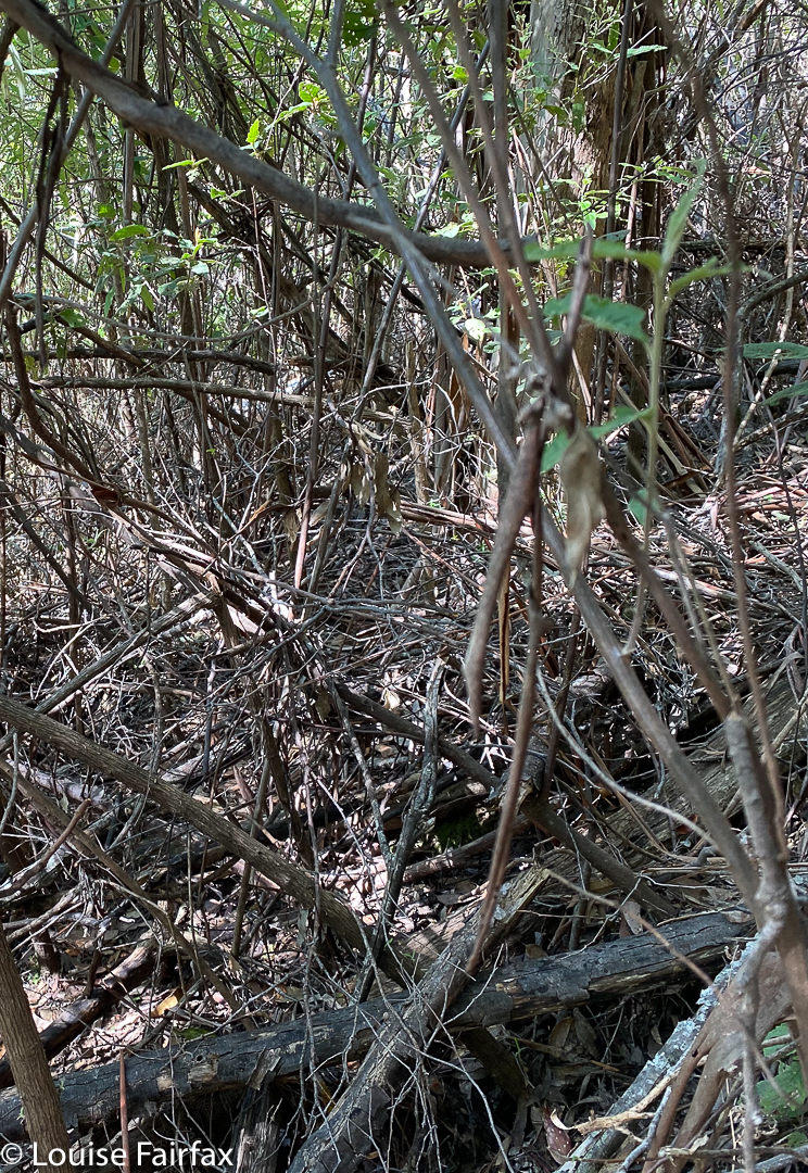
When map staring, I could see that they were just on the public land side of a public-private boundary, so I could navigate along the public land line and reach the falls without popping my tootsies onto someone else’s property. This was a nice idea. Little did I know that the bush would be so thick with a tangle of debris. I had to take on the role of living bulldozer to get through it. It was the sort of stuff you have to force your way through; it wasn’t a matter of climbing over or around: you just had to shove and keep shoving.
When I use the word “boundary”, that perhaps implies a clear mark on the ground, a fence or something. Na. It was just a line on the map, with no distinction between thick bush on each side. That said, I did feel a great longing to use farmed land in a longer route, but I had no idea who owned it, or whether they would mind someone using it to access the falls, so I persevered with the tough bush. What doesn’t kill you makes you stronger, they say. I think I was more psychologically than physically verging on being defeated.
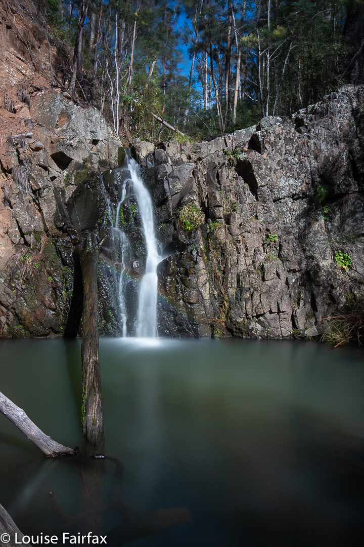
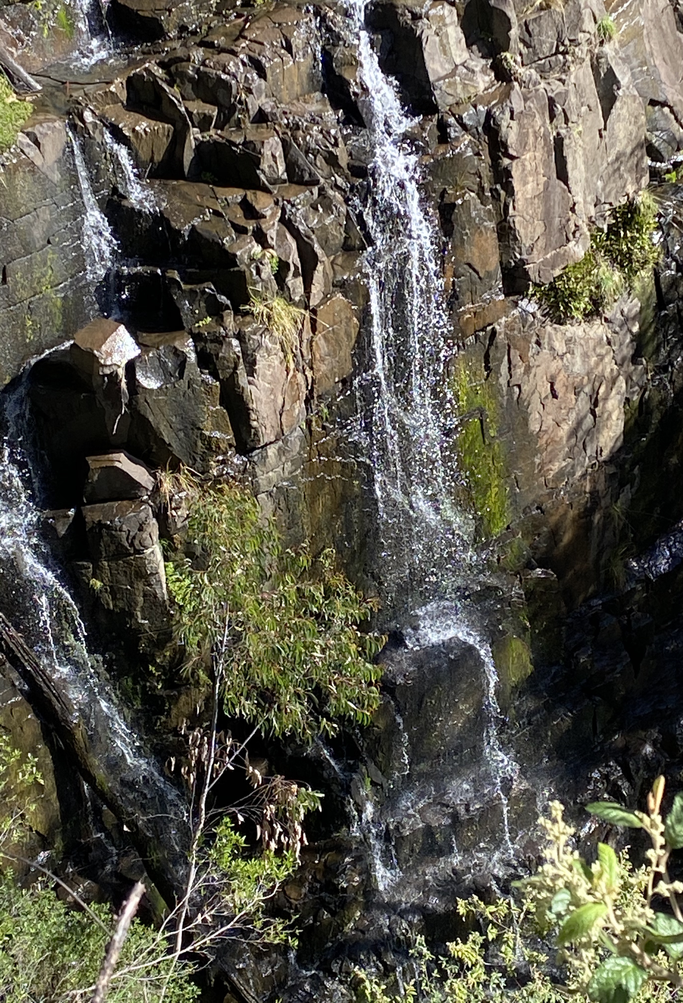
But from some hidden corner of my being I found the will to keep going, and at last after about 50 minutes of concerted shoving, I found what I assumed was the falls. Well, I found a pretty waterfall, and it was where the falls should be. I was relieved, and sat to eat and enjoy first; photograph second.
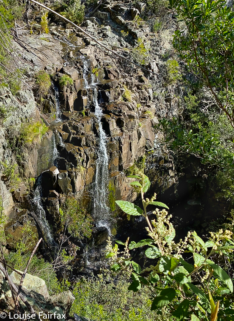
Just as I was packing up, I noticed a sense of space further below me. With Knäckebröd in one hand and my drinking cup in the other, I continued down stream to check out my sense of vacuum. Climb; haul, snoop; OH!! Here was a bigger fall. But there was still a sense of space so on I went (my pack with camera is now well and truly behind me. I have a cup, plb and phone. C’est tout). This next time I discovered a humungous drop. I had eaten entree thinking it was dinner. Actually, it was only a pre-entree appetiser. And there I was with only my iPhone. My camera was back at the appetiser. I took a few snaps and went to retrieve my gear – much harder than might be imagined.
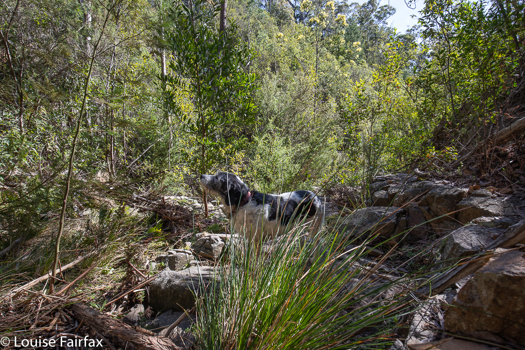
I got it at last, but was nagged by the desire to get to the base of this massive drop. That I did, but by this stage was so mentally exhausted I didn’t feel like unpacking all my gear to set up for a photo, or with dealing with the fact that where I descended to water level, I was too short to see over the rocks to get a good view of the base. I really felt that I had no adrenalin left to do any more fancy climbing, so patted myself on the back for getting there, and turned for home. The way back was faster, as I didn’t have to check direction as often, was feeling more confident, and had already pushed down some of the resisting bush.
Would I go back? If I had a bash partner, definitely. There was great drama there, but I’d had enough for one day. This was only really a recce, done in sunshine. Clouds would yield much better images. Besides, it was time for a late lunch number two, and I have become addicted to the pleasure of lentil vegetable soup at the Purple Possum in St Marys, and the cake I follow up with is always amazing. Time to refuel!