
Gads Falls 19 August 2017
Gads Falls truly intrigue me. I first read about them in a website that made them sound simple, although it said they’d been destroyed by fire, so wait a while. However, following the recent reopening of the Mersey Forest Road, I saw web shots depicting images of what could now be seen.
Meanwhile, I heard an old-timer from LWC talking about them as we passed nearby last weekend, and he commented: “It depends what you mean by Gads Falls. There are many falls. The first few are easy. They get harder as you go along, and the final one (here he sighed), that one is very, very hard and only for the brave.” He shook his head. Hm. Now I was curious, to say the least, although, as I don’t see myself as being very brave, this wasn’t like a dare or goad. He implied it was very steep and that the scree was loose. A different old-timer pointed out the real ones to me, much higher up than any short walk would be; you could just see them peeping out very high above.
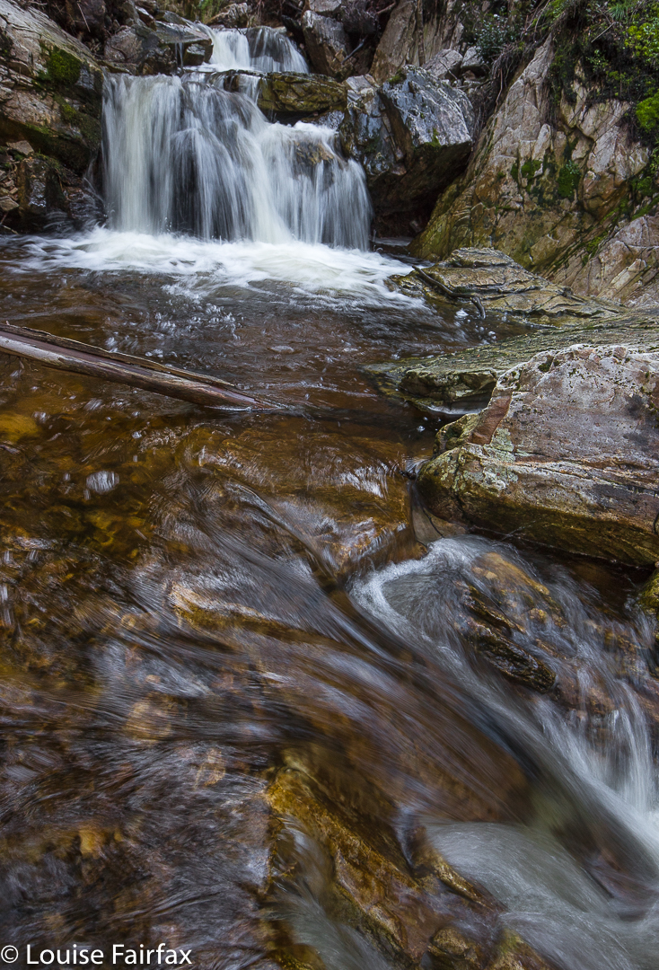
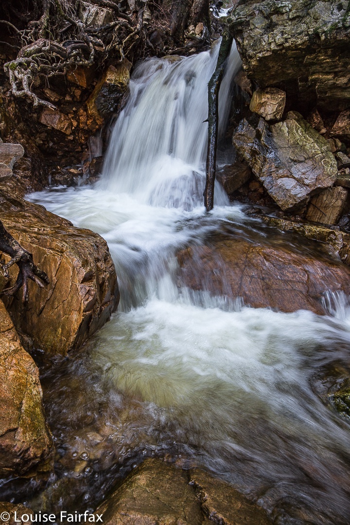
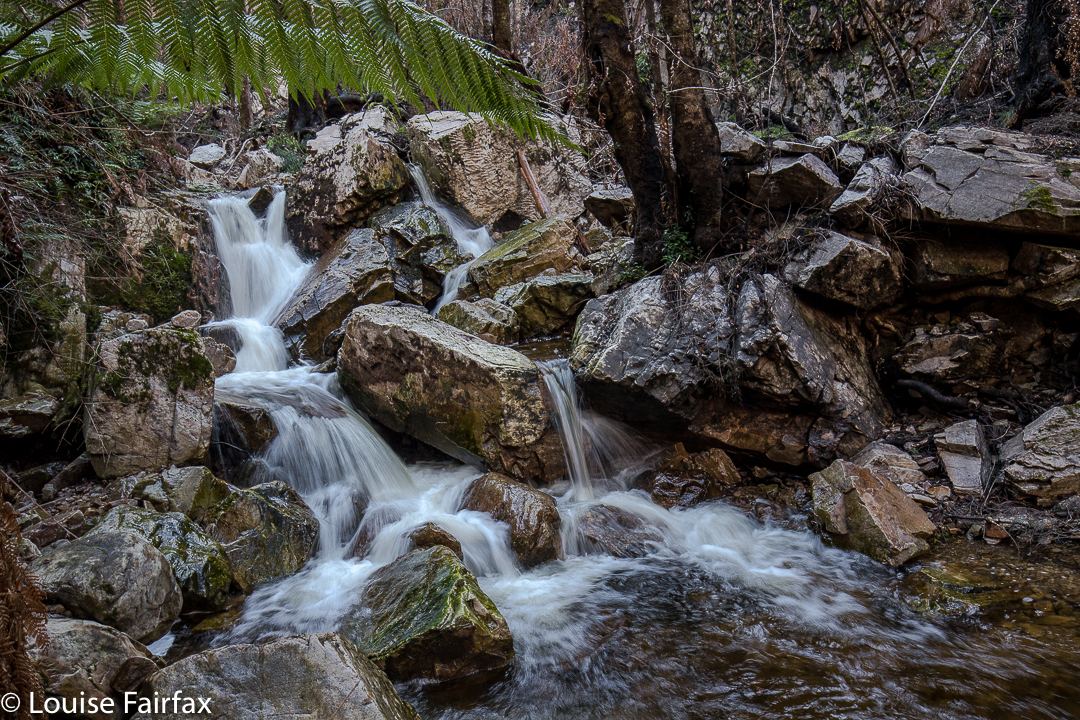
On Sunday, my husband and I happened to be passing by the base with time on our hands, so I decided to pop in and do a recce. As I had no idea what to expect – wasn’t sure how to interpret what I’d heard – and as this was therefore only a recce, I didn’t bother with a tripod. Thas quite good, for what I encountered just getting to some of the lower cascades, was very, very steep and loose, with slopes plummeting down into the various little falls (if you wanted to reach their base, and I did). River crossings needed two hands for balance. No single tumble would kill you, but it could easily break a bone or two, and I wasn’t in the mood for that on Sunday. Also, I didn’t know exactly what would happen if a landslide began, and my curiosity didn’t extend as far as wanting to test that one out. I was very cautious indeed, which meant that the short time indicated for each direction was way under what I took, especially as I did indulge in a few photos of each cascade. Meanwhile, I plotted my attack for what is called Gads Falls on the map, the ones indicated by my second old timer, and which are much higher than any web photos I have seen. A third knowledgable person told me the only photo he’s ever seen was taken with a drone. I’ll let you know if I get to the top ones. Don’t hold your breath waiting.
Re the spelling: Gads Falls seems to be favoured by Tourism Tasmania, whilst Forestry confused people by writing Gadds Falls on a signpost (not for the first time have sign posts in Tasmania confused people by having a cavalier attitude to spelling. Poor google has enough trouble trying to find our little island without that!). As ever, I let the map have the final say, and my map, having not consulted Forestry, spells it Gads Falls, so, Gads it is.
To go to the easier, lower cascades, park in the quarry to the north of Gads Creek. You can do as I did and bushbash to the creek and cross over, which is tricky in these winter high flows, or do yourself a favour, as I did on the way back, and cross the creek on the road, and proceed upstream from there. You will come across the odd marker that has survived the fire, and see bits of remnant track, but the distance is only a few hundred metres, so just work your way upwards. You can usually see where other humans have trodden. The moss has been mostly burned, but the cascades and stream are still very attractive.