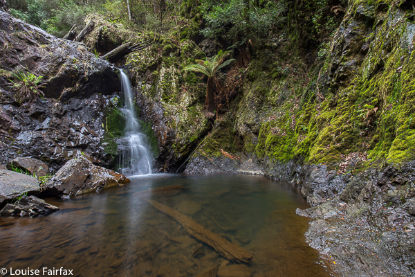
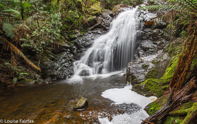
Silver Falls, Castra Circuit 2016 Jun

Silver Falls , Castra Circuit. Jun 2016

Originally, I listed the three falls of this circuit: namely, Step Falls, Castra Falls and Silver Falls, in the one post. However, I have realised that some people search for a single waterfall, and therefore miss the ones not in  prominence in the header, so I am giving each waterfall that has happened to its own blog, but with a reference back to the main blog that actually describes how to get there and what it was like. Photos are here just to make it pretty :-). For the main blog for these falls turn to:
http://www.natureloverswalks.com/step-falls-castr…lls-silver-falls/ ‎

Freycinet NP 2016

Freycinet National Park – a winter visit. June 2016

What a terrible dilemma we had. It was created by the fact that Tassie (Tasmania) is a mountainous island, with more beauty to offer than most places can dream about (which is why we choose to live here). It was a long weekend, and I had to choose between going to the mountains, where some early snow was scheduled to fall, making the already mesmeric landscape a stunning white, or going to the sea, where the weather would be milder, and the rolling tides and swells would make interesting patterns as the water surged. I consulted my dog, who said to stay at home, but that was not a popular vote.

I love mountains more than sea, but perhaps the snow would be set within dark grey conditions, with no views to the distance. My husband said he’d come too (a great sacrifice on his part, as he’d earmarked this time for getting his reports written), and the idea of camping near to the sound of the ocean won the day.
To please the ‘no-voting’ dog, we stayed at home until lunchtime, taking her for a good long run before setting out, aiming to eat at Campbelltown to break the journey – well, that was the excuse. The food there greatly pleases us, which was the real reason. Here we ran into the first of many friends: Jess (from Pandani Bushwalking Club) was going to paddle to Shouten island with another mutual friend. Nice idea until you took note of the fact that it began to snow shortly after we finished lunch – just wet, sleety sort of snow, but you could see it falling and see the icy blotches it made on the windscreen. Our hands had been frozen just crossing the street.
Now, some people call me an adventurer, so this blog is no doubt going to greatly destroy my image. What great adventurous thing did I do this afternoon? I photographed sunset from a nice perch on a headland, and selected our camping spot for the night. I also nearly lost a few fingers taking long exposure shots in sub-zero air. Then we went to the pub, intending to set up camp in the dark, later.

We sat at our little table for two, innocently eating our meals, and in came two friends from Hobart Walking Club, who chatted to us while we ate. Then two from the Northwest Walking Club came in; more chatting. Then my friend and fellow expeditioner, Pete, from Hobart Club spotted us, so came to say “Hi’, followed by two more friends that I knew from the Eldons expedition. Next there was Sally, an old workmate of Bruce’s, and a lady from my Pilates class. The list goes on, and includes my climbing partner and “sister-in-crime”, Angela. We had a merry night, and didn’t leave until quite late. That’s fine. That’s what head torches were made for, isn’t it?

We had a glorious night, cosy within tent fabric with puffy down to keep us snug, sleeping away to the sound of waves crashing on the rocks slightly below. I sat on my perch watching stars for a while before turning in. Photographing sunrise next morning was a thrill that was so riveting it took my attention right away from the cold that theoretically must have been there. It certainly was when the excitement died down.
Hauling himself up
I was delighted when my husband announced that he’d like to climb my mountain with me rather than sitting in a warm spot getting some work done. (You see, you can cheat in Tasmania, and vote for the sea, but take in a mountain anyway). When someone who has Parkinson’s disease announces that he/she wants to give something a go, you encourage, not deter (well, when that person is your husband, anyway). I knew it would probably mean that we wouldn’t make the summit, but the summit will be there for me some other day. This was a day for climbing with Bruce. We rolled around the rocks for a while, with me getting quite anxious about the difficulty of what he was undertaking, especially when I led him across a ledge with an overhang and nothing to hold on to. Shortly after that he said he’d had as much as he could take of this level of difficulty (and there was no easier way coming from this starting spot), so we turned around.
Bruce, trying the recommended rocky approach, having a breather from mental as well as physical exhaustion.
I sussed out a different attack further down, one that I’d been eyeing up for a while, and it was an excellent lead (we followed it up until just short of the Mayson-Mayson saddle), but Bruce was exhausted by this stage, so we turned around once more, and continued down to the beach at Wineglass and turned the day into a pleasant normal-person walk. On the way back, we bumped into two instructors from the gym where we work out, so I had a chat, sending Bruce on ahead. Whilst giving chase, just before the track down forks in two, I saw a girl I thought I recognised, but, hey, she lives in Sweden, and visited us just two years ago, so it couldn’t be her. She stared at me with the same look – I mean, what are the odds of bumping into a foreign friend there in the middle of a national park? We rushed to hug each other when we realised that, despite the laws of probability, the other really was the person we thought it was. Ironically, the last time I had tried to climb Mayson had been with her, and meanwhile, she was on her way to repeat the experience we had introduced her to, namely, sleeping on Mt Graham. They always say that Tassie is small, but it felt very small, and very, very homely this weekend.


Step Falls, Castra Falls, Silver Falls 2016 Jun

Castro Circuit: Step Falls, Castra Falls, Silver Falls and more. Jun 2016

First Falls on the list: Step Falls. Very steep and slippery. 
The forecast was for developing rain. My friends had all reneged on climbing a mountain: time for a waterfall walk with the last brave man left standing, my husband. There are so many amazing and wonderful waterfalls in the north of Tasmania, it’s rather hard to choose, but I selected the Castra Falls circuit, as what I had read suggested it would take about three hours, and that seemed a good walk to drive ratio. As it was, we only did one and a half hours’ walking – but used up that amount again taking photos :-). I could have taken a whole lot more (requiring even more time), but felt guilty at forcing my husband to watch the less than interesting activity of his wife motionless behind her tripod going click, or lying in the mud adoring tiny fungi – possibly more amusing than the tripod option, but still lacking in spectator excitement.

From our very first steps, we loved this walk. Fungi were everywhere, but this was a waterfall walk, so I tried to ignore these delicate beauties, and left my macro lens in the bottom of the pack so as to not be even more boring by changing lenses the whole time. Oh the shame of it all, but I did admire them anyway as I walked past.

There were masses of fungi – best catch this year.

Well, I did say I admired them en passant. I decided I could photograph them with my wide-angle lens and that would not take up so much time.

My husband using the safety rope on the way down to Castra Falls, the second Falls on the circuit
We both got a bit of a shock going to, and being at, Step Falls. The notes we read said it was very steep. I usually assume such advice will be overstated, but in this case, it was right, and I was glad there were saplings to brake downward progress a little. At the bottom, the rocks were the slimiest, slipperiest rocks imaginable, and I felt clumsy on them with precious camera around my neck, bag of filters on my shoulder, tripod in hand … whoops, slide. Balancing on them was hopeless. I don’t know if they’re always like that, but in today’s conditions, I didn’t attempt any fancy angles; survival was the key.

The second falls on the list, the Castra Falls, had a rope to hold, which Bruce greatly appreciated. (All these Falls are done as side routes from the main circuit, as I hope my map at the end makes clear.)

Castra Falls, the second falls on the circuit.

Climbing back up from the Castra Falls


More beautiful fungi

The Castra Cascades were pleasant enough, but not as beautiful as the many river scenes along the way, … and very shortly after that, we were at the junction of the Castra Rivulet we had been following, and Nietta Creek, which we were about to pursue. We’d been exercising for a total of 45 minutes at this stage (which included side trips, but not photos). This was a really pretty spot with a kind of beach – perfect for lunch. I ate hurriedly, as I wanted to explore a track that went off to the right here, to what was called a “Secret place”. I was unsure about where it went and what it was, as, unlike the other side routes, it gave no time estimation. I left Bruce quietly eating and set off along the steep banks on my mystery journey. After 16 minutes, the tapes seemed to have run out, and even if they hadn’t, I felt my time had. The scene below was what I found. I photographed just with hand-held camera on 1/10th second, as I feared Bruce might be getting cold and wondering what on earth his wife was up to. No longer wondering the whole time if this was the secret place, or this, I moved more quickly, and was back at the junction in 11 minutes.
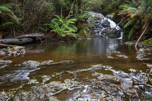
I have thus called these the “Secret Place Cascades”. If someone wants to tell me their real name, I’d be most grateful. 

From the junction, the beautiful Nietta Creek is followed upstream until Silver Falls are reached. This part of the route is wonderful, as you are right beside the stream the whole way.

Nietta Creek

The side track to Silver Falls is the tiniest deviation from the circuit, and this was my favourite of the Falls. Another short but steep push and the top was reached.

Silver Falls, falls number three


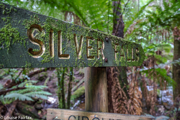
signage

 We had parked the car at the second entrance to the forest, maybe two hundred metres from the first, but the other side of the rivulet, in case the stream was flooded. As you can see from the photo below, it wasn’t, so we completed the circuit in the forest and were soon back at the car. (If the water is high, you can do this tiny stretch on the road.)
Apparently this beautiful circuit was destroyed in a huge storm a few years back, but has now been repaired by local volunteers, to whom go my heartfelt thanks. The tapes and path are clear, signage is fantastic, but, better than that, it remains a real bushwalk and not one of these wretched manicured tourist highways. You do have to concentrate a little; you can fall over or trip, you need to look for the next tape and use your brain a tiny bit. The freedom to fall or to make a slight error is a marvellous manumission in this over-cosseted, litigation-terrified age.
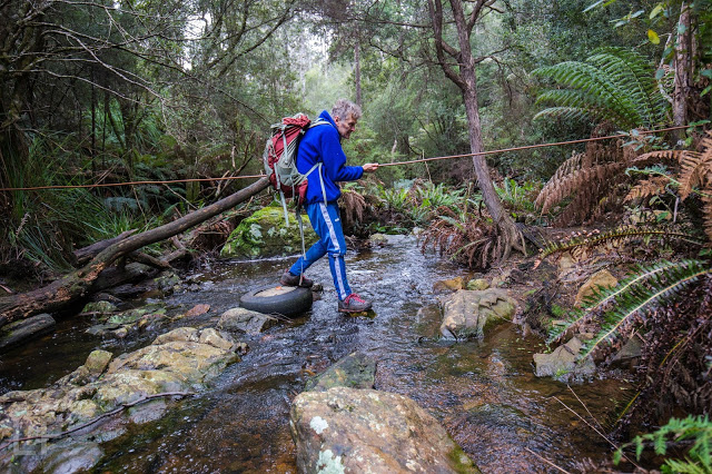
We had parked our car at the second forest entrance, and so finished with this creek crossing (over the Castra Rivulet) to end a perfect walk. (If you park at the first one, then this is about two minutes from the start).

Our route. Hopefully you can see that there is a main circuit, with Falls off to the side, usually involving a climb down. Tasmaps, being their usual inefficient selves, have not only omitted the path, but have misnamed and misplaced the position of the falls in their habitual cavalier attitude to the needs of walkers and tourists who might want to use the maps for something purposeful. I have blocked out the incorrect names. We walked anti-clockwise. The narrative (combined with map reading) should make it clear which falls are which. Step Falls are correctly named and placed.


Just for fun, here is a graph of our altitude. Did I happen to mention there was a bit of up and down? Nice workout for the legs.

Proteus 2016 Jun

Mt Proteus

Dawn, summit day
Angela had three days clear (as did I); we decided Mt Proteus was a suitable mountain for this time of year and that time span. We knew Maureen needed Proteus on her way to completing all the Abels, so invited her too, and an expedition (albeit a little one) was born. Off we set excitedly on the Arm River track, heading west, and then the Overland Track heading north until our camping spot, just north of Pelion West (Pine Forest Moor). What lay in store for us? For the moment, light drizzle and not much of a view. Happy to have the day completed so we could get cozy in our tents, we filled up with water from the idyllic creek below, so lush you almost needed sunglasses to cut the vibrance, and retreated to our colourful homes among the pencil pines (Athrotaxis cypressoides – which grows between 700 and 1300 ms asl and has nothing to do with the pine family at all [or with pencils]. Homesick early settlers called anything evergreen “pine”). It was protected enough there under cover for us to have a relatively leisurely setting up process, and to spend a little time carefully choosing our piece of real estate for the night.

Frosted button grass, with Pelion East, Mt Ossa and Paddys Nut behind.

You should have heard me gasp with delight when I emerged into the open on the morning of the second (summit) day and saw the expanse of white depicted in the two photos above. I was thrilled with the freshness and delicacy of it all. This is the terrain we had to cross for many kilometres to meet our mountain. We found it tiring, as we had to lift our legs very high to get over that grass, sometimes unexpectedly falling in holes – often filled with water – hardly a welcome outcome on a morning such as this. We had had to don wet socks and boots at the start of the day, so accidental soakings were not quite as disastrous as might be imagined, but our toes were numb and frozen nonetheless. There were also two bands of pretty dense bauera bush, but they didn’t last very long, being narrow, and just as I was starting to wonder if it was going to be a fight the whole way, the vegetation became calf high, and we had easy access to the summit, now not far away.

Angela (L) and Maureen (R) at the summit cairn. Maureen looks very happy to only have ten Abels left to go.

It had taken 2 hours 38 to reach the summit. The book had said two; I had feared three, so this was a pretty good compromise. I had allowed for a possible ten-hour day when I asked the others if they minded starting at 7.30, so maybe we had won a little time. Off we set on our return journey. Once we knew which type of undergrowth in this area fared better (scoparia scattered amongst fern grass was faster than button grass, which we managed to mostly avoid on the rebound), we were able to cut a bit off our time, and after a tidy 2 hrs 7 mins we were back at our wonderful fairyland campsite, ready to relax with a cuppa before packing up our tents and moving on.

Angela photographing Ents at our campsite.

We squandered a little of our won time by being a tiny bit slow at packing up (I’d allowed an hour), and we were not ready to set out before 3.15. Maths said it would probably be dark by the time we reached Pelion Hut. Maths was unfortunately right, but we knew this was likely. I wanted a tiny break for a drink at Pelion Creek, and another for photography at Frog Flats. I also couldn’t resist a set of photos as we rounded a corner and saw Pelion West in the clear afternoon light. Cathedral mountain also looked a treat. These things take time …. Angela had predicted that we’d be able to do without head torches until 5.45 and she was right to the exact minute. By this stage it was becoming downright dangerous, as the boardwalk has steps that you couldn’t see in the dark, and falling would have been treacherous. Also, many of the boards lacked chicken-wire, and the ice of the morning had lingered on boards and leaves the whole day, turning the Overland Track into an elongated skating rink. The final twenty minutes were done by torchlight.

Paddys Nut and Mt Thetis as evening approaches from Frog Flats

I was hoping for another lovely frosted morning next day, but thick mist regaled us in our waking moments. At least it meant I didn’t hold the others up with too much photography. Off we set into the mist, hands burning with the cold, hoping that the climb to the high point on this track would warm us up.

The high point on the Arm River track, and the sun breaks through
We had only been going one and a half hours, but I was starving. Besides, some photos were in order!!! Don’t be put off by Angela’s shorts. It’s FREEZING.
Mt Pillinger bursting into the blue realm above.
A different tarn on the way home. I didn’t say I took NO photos – just not as many as I might have done.
It was all downhill from there, and thus ends another perfect little expedition. Mt Proteus is a wonderful mountain to have in my collection, and already the happy memories of our time there circle and recircle in my contended mind as I relive moments of beauty and wonder.