Dasher Falls 2016 Apr

Dasher Falls Apr 2016
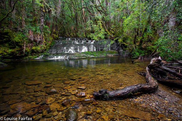
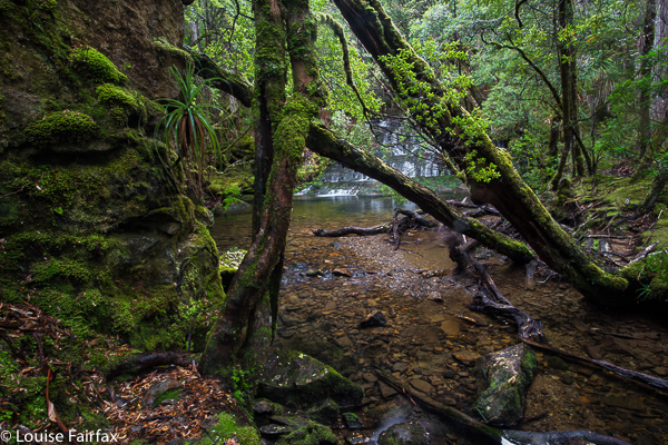
We did Dasher Falls in combination with Redwater Creek Falls Upper and Lower – a pleasant short trip from Launceston.
(See www.natureloverswalks.com/redwater-creek-falls/ )


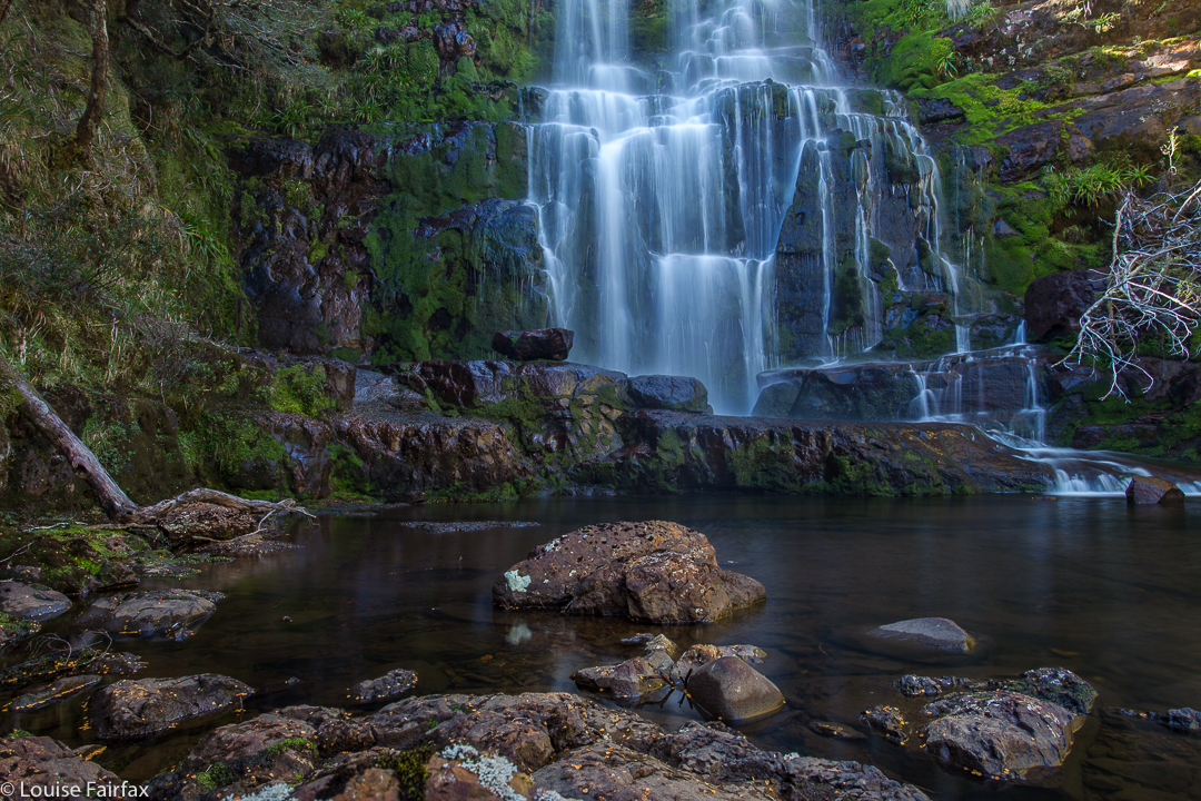
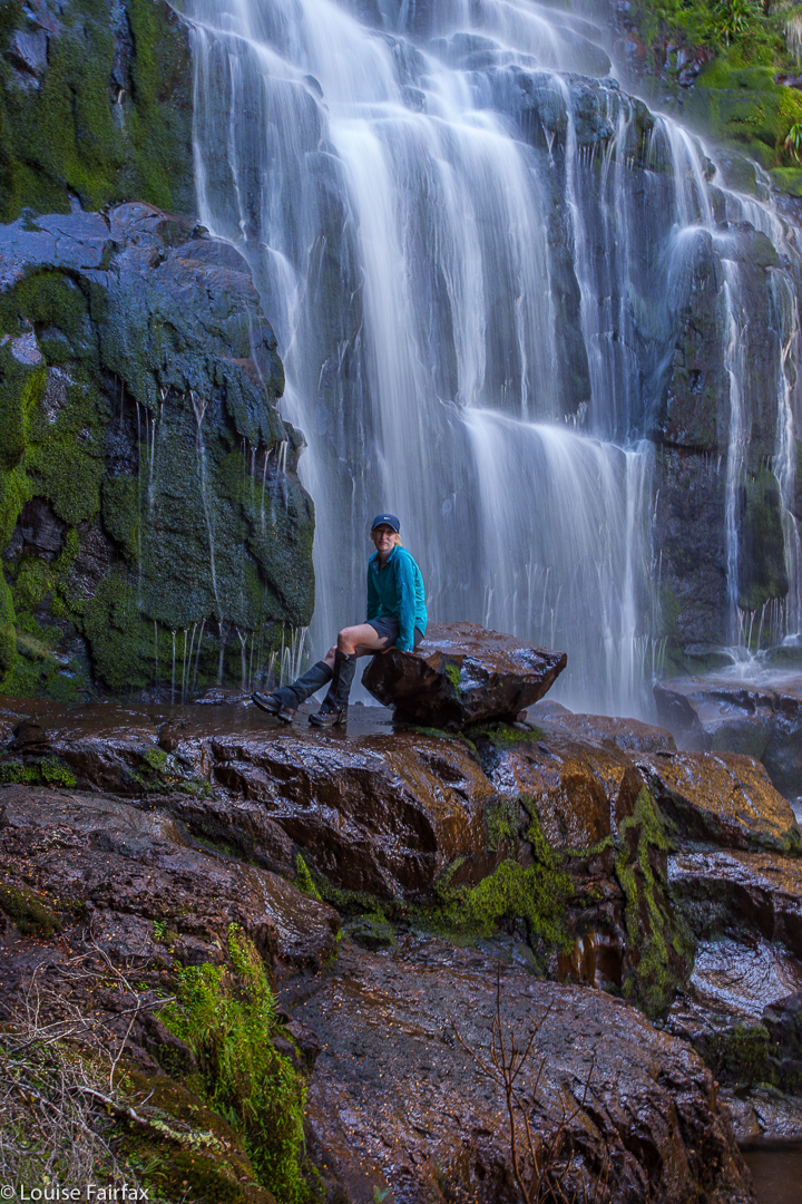
Dasher Falls
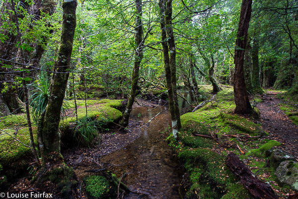
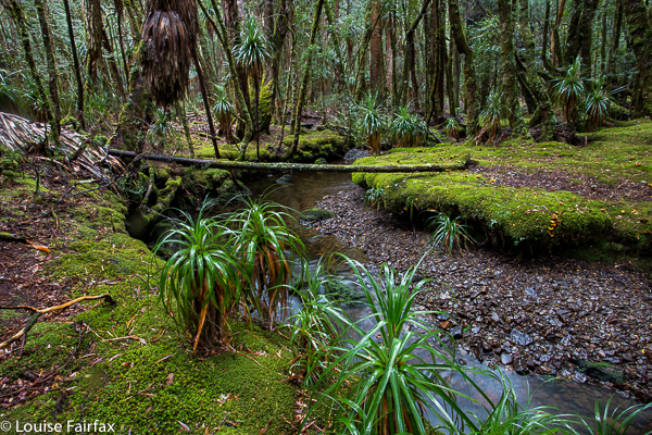
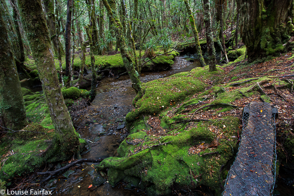
How to get there:  Driving from Sheffield, we turned towards Beulah at the intersection, along a road that the map (but not the signage) calls Bridal Track Road. We followed this along until there is a road off to the right at the bottom of the hill with a sign that says Lower Beulah 3 kms. This road crosses the Dasher River within 20 metres of the intersection. The falls are now about 400 ms upstream. You can either park there and walk up the road, or be lazy and do what we did and drive back up the hill for about 200+ ms until you see a pine tree with a pink tag on it. Parking there is fine pulling over to the left from this direction (but parking coming from the other direction and trying to spot tape etc didn’t appeal to us). From this tree, follow tapes towards the river, and then upstream to your right. Soon enough (a mere 100ms or less) you’ll see the falls. Today, after the heavy rain we’ve had, the mud and rocks were slippery, and my husband and dog both backed out of actually gong to the falls, settling for a walk back along the river on safer ground. I would not under any circumstances bring a child here unless it was on a lead! Maybe the picture is enough to tell you why. I was too scared to look over some edges.
After you’ve visited the falls, you can turn around by putting your nose into a dirt track that is on the right shortly after the pink-taped tree.

Gear List

Gear List for bushwalking.
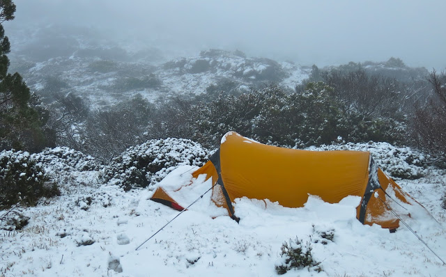
Are you ready for this? It can happen in January

Some of my followers on IG and blog have asked if I could give advice on packing – of clothes and food. I am happy to oblige, and will begin with gear. Before I do so, however, I need to stress a couple of matters that seem important to me, and that should be borne in mind when reading this.

A different snow squall, different place – any time of year

(1) Individuals differ from each other in the extent to which they feel the cold. What is good and necessary for me might be insufficient for you. In the case of ‘the cold’ that is actually unlikely, as I am a renowned wuss, but thought I’d better mention it.
The most important thing is to know your own body, and know it well before you step into the wilderness. Being in the wilderness is as much an experience of self learning as it is one of seeing beautiful wild places.

If you count on getting saturated, then you won’t be disappointed.

(2) Begin simple, so you can learn from your mistakes without killing yourself. I have heard of first-timers who want to start their ‘bushwalking career’ with the Mt Anne circuit or the Western Arthurs. This is like a beginner in high jumps setting the opening bar at 2 metres.
When we wanted to take our 6- and 8-year-old daughters on the Overland Trail, we first took them on the 33 km Freycinet Peninsula walk as a warm-up – both for them and for me, the provider. I weighed and measured everything in those three days to learn for double that number.
If you have never experienced even a daywalk on a Tasmanian exposed mountain in a black mood, how can you plan for five? I once took a Swiss friend to Cradle, insisting he pack certain precautionary clothes. He was indignant, and scoffed: “I live higher than the summit of this mountain, and you’re telling me what to bring?” He didn’t get past Hansons Peak, and had the grace to apologise. The incident points to the fact that height is not felt in the same way in all circumstances, and height on top is very different from the same height in a valley.
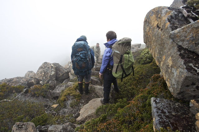
More soaked walkers – it’s a recurring theme

(3) You need to be prepared to be tough and uncomfortable if you don’t want to burden yourself with a pack full of wet gear. Most (all?) of us put on wet clothes each day (in continually raining conditions) rather than wet a different outfit each day, only to have the new outfit wet after five minutes. This means, of course, that your daytime get-them-wet clothes need to be made of a fabric that is comfortable and warm when wet, and that will dry quickly if given quarter of a chance. I use icebreaker gear next to my skin, supplement it with a thermal or icebreaker long sleeve top, then have a third layer of a padded jacket that is warm when wet (mine is a macpac Pulsar hoody, not down for day), and over that, my Anorak (rain jacket). Even so, I need to keep moving to keep warm. PS Now I use an Arc’terx hoody instead of a macpac Pulsar, as it’s warmer.
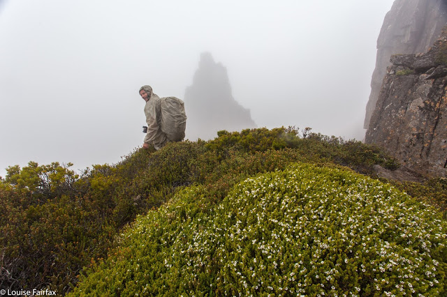
Perhaps another theme – comical – is to be careful of your company. Do we assume cause and effect (or post hoc ergo propter hoc fallacy) if I tell you every photo above was taken on an LWC walk? It does make the incidental point that clubs get out there and do it, even when the weather is not kind. I have stood on many a misty, freezing summit huddled with LWC or HWC members, penguin style, warming each other up (hopefully). 

(4) You must have a complete dry set of everything for nighttime, when it is imperative that you warm up and sleep dry. This includes nighttime woollen socks, gloves, beanie and undies; i.e., double up on everything. (In summer, you can sometimes get away with one thermal top and long johns – but even then, you can get caught out, as I have been; better to be safe).

(5) Have a bag of warm, dry clothes in the car. Assume you’ll arrive back cold and wet. Anything else is a bonus.

You can pack a baby if you wish

My Gear List.
Tent                                         Sleeping bag
compass                               map

stove                               gas
matches                                 inner sheet?
Sleeping mat                        blue carpet underlay for extra insulation
2-3 prs wollen socks        crocs for camp
headtorch                              phone for gps / navigation
Camera gear                        spare batteries? (camera, torch, phone)
water sac / bladder           EPIRB
water bottle                          cup / mug
penknife with scissors     2 spoons (1 to use, 1 to lose)
tiny towel                                 wetex to wipe wet tent
walking shirt, quick dry     walking pants or shorts
Thermal top x 2                    Thermal long johns x 2
waterproof pants x 2         3 prs gloves (fleece, wool + possum)
scrub gloves                           anorak (ie, rain jacket)
boots                                         gaiters 
icebreaker singlet               day pack for day climbs from base                   
beanies – 1 for day, 1 night     silk balaclava   
lip cream                                   sun hat
paper for writing                   pen                 
3 prs undies (1 of wool)      crop top
Arcteryx jacket (for night)   extra jacket (Pulsar) warm when wet for day wear
face cream                               sun cream
sunglasses                                pack cover
Toothbrush                              Toothpaste
Blister gear (Compeed)      Panadol
Anti-inflammatory tabs      tinea cream          
food (to be discussed later)      whistle (if Osprey pack, it’s part of your pack)           
book?                                       If you are on any medication, then those tablets.
Some need electrolyte tablets to replace salt lost in sweat.
light spade for toilet use        toilet paper (please have mercy on the bush and     use only when necessary. Leaves can be an excellent substitute for quality).
I also take 2 pegs and a bit of chord. You never know what can come in handy.

Plaster can mend trousers as well as legs.
You have no idea how handy doubling up can be. On a ten-day expedition I went on:
I forgot toilet paper, but W had 2 rolls and gave me one;
M forgot his hat, but J had two;
B lost his sunglasses, but J had two pairs;
S broke his stove, but A had two;
C broke her spoon, but I had two;
Someone tore their pants, but C had a sewing kit;
W broke his pole, but S had a pole repair kit;
My tablets for pain were dated 2007, which A informed me would not work in 2016, but she had spare.
The list goes on, for sure. This is all I can remember.
Helping out and being helped in mutual working towards the goals is the theme.

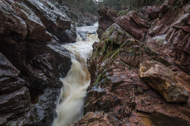
Orites Falls 2016

Orites Falls 2016.
The real story of Orites Falls is actually the story of the Cheyne Range, which can be found scrolling down to C on the right here, by an internal search or clicking:
http://www.natureloverswalks.com/cheyne-range/


I have done a separate heading for those who are solely interested in waterfalls, and in seeing a very unusual one. However, if you are not interested in “real” bushwalking with a pack on your back and an overnight stay in your tent, then this one is only for window shopping. You also need to be able to navigate to get to these falls, as tracks will only help you for about the first hour. The going is rough and tough, but the rewards are great. I was upset that I couldn’t bring my tripod on this trip, but I found an obliging rock that allowed me to use it for exposures of a couple of seconds.


Our route is in the Cheyne Range entry. I haven’t repeated it here in order to emphasise that this waterfall is only for very experienced members of  bushwalking circles.

Cephissus Falls 2016 Mar

Cephissus Falls and Creek 2016


Normally I am rushing past the Cephissus Falls on my way to higher ground, but in March 2016, when we were on our way to climb Hyperion, the weather was so horrid we stopped short of our goal, and used the comfort of the hut for the night, This meant that I could spend some time at this beautiful waterfall, get out my tripod and see what I could capture. Unfortunately, the flow was less than exciting, but the lushness of the greens in this area always thrill me.


However, I mourn for this area already. Strident voices with a certain twang are complaining that the “facilities” of the hut are not up to scratch. They want more beds and more of … well, who knows what. I love it simple, just how it is, with what it used to have – genuine bushwalkers with stories to tell having fun in a remote place. I don’t want brash tourists who are clocking up comodified experiences and totalling this and that conquered place from some insta check list, rather than just listening to nature and enjoying it. Guide books are sending tourists there, and my beautiful little haven is no doubt going to be ruined by the building of some monstrosity like the replacement of Windy Ridge Hut – Bert Nichols I think it is now called. I hate it so much I won’t even eat lunch there. It has no soul, like the people who need such places in what used to be wilderness. We have sold our soul to tourists. Who cares for earthly riches when you have nowhere left for your soul to soar?

Hyperion 2016 Mar

Mt Hyperion March Long Weekend 2016

What is it about a mountain like Hyperion that demands our respect and makes it impossible for us to take it for granted? Sometimes it’s the shape, sharp and steep, where no easy way seems possible from afar. Other times, it may be the stories we are told of it, or warnings we are given. I had received plenty of these with regard to Hyperion: “Don’t do that one solo, Louise”; “Don’t climb it in mist. You want to be able to clearly see the dangerous drop-offs”; “It’s very airy up there”; “Hm. You and Angela are very short, I’m not sure you can do it. Maybe if you help each other you can”. Some people give a slight (very reassuring for me, the listener) shudder when they recall the exposure. I was certainly not going to take this one lightly.

It is now cool enough for fungi. Yippee. 

If you want to see quaint, tasteful bridges like this in the Lake St Clair area, you’d better hurry. Pukes and Wildspite are ripping them out and replacing them with monsters made of synthetic material, a metre or more wide and giant handrails, of course, because if we fell into the water we might get our tootsies wet and sue them. I weep for the loss of the rustic, picturesque and natural. They are even thinking of replacing darling Pine Valley Hut with something bigger – perhaps something as utterly unsuitable, chilling and unwelcoming as the Bert Nichols Hut. Who knows? If they think it will get more tourist dollars, that’s what they’ll do.

I set out a little in awe of what might be my fate on this mountain of the stories and warnings, and rather anxious. Rock chutes, and reaches that are challenging do not scare me, but the possibility of toppling to my death from a ledge in a moment of carelessness does, and not just because of the recent accident of Feder. Ledges bother me. Could I summit this mountain? I don’t usually doubt my ability to get to the top, but with Hyperion, I was unsure, AND I certainly did not welcome the last-minute change in the weather forecast that now promised us rain and mist every day of our possible attempt.

En route. I have dubbed these “Geryon Base Camp Falls”

The first day was so wet and gloomy that we, a group from NWWC plus the Fairfaxes, stopped short at Pine Valley Hut, thus allowing us to keep our tents dry (and lighter) for a bit longer before the climb. Any excuse to spend time in this valley is a good one, and Bruce (my husband, still with us at this stage) and I enjoyed wandering and photographing in the light drizzle of the afternoon.

Russula sp coloured the forest

Next day, we climbed in mist and rain, up through glorious forest and onto the Du Cane Range, ultimately descending to Lake Helios for our campsite, pitching our tents shortly after 3pm. We all expressed astonishment and pleasure while we set up camp at the brief appearance of the sun. Our leader, Greg, announced that if we were to make a summit attempt, as soon as our tents were up was probably the best moment, as we did not know what the morrow would bring. This was a great call. The next day, we now know in hindsight, would not have been suitable.

Climbing to our base camp at Lake Helios.

The group gains height on the Du Cane Range

The beautiful Lake Helios, perched under Hyperion, our goal.

I didn’t find any particular moment of the climb itself (the manoeuvres involved) to be scary. What concerned me was the weather, which closed in and fogged us up so that good routes up the next stage were harder to sight. I feared the unknown that lay ahead, and I was anxious about the time, as it was getting later than I liked should we have trouble getting back down. I think we all probably harboured our own little anxieties as we forged on upwards, hoping it would work.

The final stage lies ahead. We can get there.
Six happy summiters. The group minus me. I was too cold, and in too much of a hurry, to use auto timer and find a rock to balance my camera on.

When anticipating summitting Hyperion, I always thought I would be joyous and whoop with delight when I reached the top. In fact, all I did was heave a sigh of relief, grab a few photos in the icy wind, and clear out of there, back down to safety. Tempered joy would come later. Relief is still the dominant emotion.

Clouds await us below.
An aspect of the ascent that interested me was that I was hit by (another) falling rock, this time on the thumb. I have always thought that if this happened, I would lift my hand in pain, lose my grip and possibly fall from my position. I am delighted to report that the worst that happened was pain and that I did not let go. This is quite a comforting thing to know. I had to keep moving so the pain didn’t overwhelm me, and the others understood. Movement took my thoughts away from my thumb onto things I could control, like making the next climbing step. I was fine for now.
Sunrise next day. I hope you like this shot. I had nearly as much hand pain taking this as I had from the falling rock. Temperatures were sub-zero while I took this tripod long exposure with no gloves on.
The next morning, it was so cold we had to wipe sheets of ice from the tents. Rocks were slippery. Climbing Hyperion would have been treacherous.

We exited through the Labyrinth, making an attractive circuit, and descended to my husband, who had climbed the Acropolis while we were away.

Mt Ossa and Pelion East from the northern end of the lake shortly after dawn.