Adamsons Peak 2015 Dec

Adamsons Peak, Dec 2015
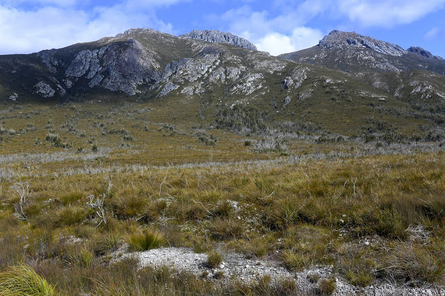
On the moor land before the final climb

The hardest part of climbing Adamsons Peak was getting to the start line, and I had always suspected this would be the case – ever since I heard that the old road was closed (and, apparently, has been closed since 2008, which seems to me rather a long time to fail to repair a road that could be well used to give tourists something to do in the Dover area. Perhaps the local council hasn’t yet figured out that modern tourists want to do something and only tourists who are nonagenarians want to sit in a car and drive all day).

Here we have a grand mountain with a track all the way to the top, a relatively simple climb – as long as you have a little fitness – and grandstand views of the coast, Federation Peak, La Perouse, Pindars Peak, Precipitous Bluff, Hartz and Snowy mountains and the list goes on. Today was quite a murky day, being a lull in between two storms, but the view was still highly enjoyable. Judging by the number of tourists who climb Queensland’s Mt Sorrow, a much steeper and harder mountain, I think it is a waste of an opportunity to keep visitors in the area for an extra day. Perhaps even a couple of ten dollar signposts directing people along the huge and odd detour one now has to make could go at least some of the way to helping provide amusement for people who would like to be energetic in the area.

So, how do you get there? Continue driving south past Dover for about four kilometres until you reach the bridge over the beautiful Esperence River. Turn right just before this bridge onto Esperence River Road, and follow this for about ten kilometres, until you see a fork that you can take to the left on Esperence Road that takes you down over the river. After you have crossed, you turn left again, onto Peak Rivulet Road, ignoring all the spur roads that lead uphill to your right, and, staying on that road, you eventually arrive at the signed start to the walk (and a point where parking is easy).

Very near the top now

Once you have managed to find the start, the rest is easy. The steeper sections were in beautiful lush green forest, and the flatter sections contained the usual bauera, cutting grass and mud. There was an “introduction” section, then a relatively steep climb, a flatter section (= bauera etc), then another climb, where the forest type reverted to lush moss and myrtles, and then you were out on the top plateau. This took members of our group between one hour forty and two hours. The moor section has a few deeper mud baths to test you out, but these are soon dispensed with, and in not too much time, you are embarking on the final climb to the first lump you can see when you emerge on the moor, and, finally, the rocky summit itself. And then comes the reward: lunch with your well-earned view.

One of the summit views (to SW)

Please note that words like “simple” and “easy” are relative and not absolute, and are used within the context of this writer’s other experiences. If you begin a walk dubbed by somebody as “simple” and you find that you disagree with their terminology (perhaps you even doubt their sanity), it would be very wise to turn around before you land in difficulty.

Looking towards the coast. We could see Southport Lagoon and beach, as well as Bruny Island, the d’Entrecasteaux channel and Dover far below.

Bobs 2015 ii Nov

The view from my tent window of the sinkhole

Mt Bobs beaten.
“Thirteen, fourteen, fifteen …”
“Louise, you’re just showing off.”
“Sixteen, seventeen, eighteen … .” I would not be put off my leech count, flicking them as they ascended to my hands, pulling them out of my hair and off my rainjacket, overpants, gaiters and boots. The light rain that had persisted for much of the first day had certainly brought them out, but at last we were at the sinkhole, ridding ourselves of them before disappearing into our tents to try to slough off the array of wet layers and warm up before exploring our fascinating environs. The rain had ceased, and the sinkhole is a truly fabulous area.

Sinkhole view, different direction

Although we had never tried Mt Bobs and failed, both Mark and I had the feeling that this was an elusive mount: a hard capture. I had cancelled a couple of trips due to bad weather before I ever set out from home, and on one occasion we had gone to Lake Sydney, only to turn back before ever beginning the climb proper. People seem to speak of this mountain with certain tones of respect; some, even with something akin to fear in their voices (these being the ones, I guess, who had particularly long or difficult battles with thick forest on the way up). Certainly, the way is steep and the rainforest thick, and no possible path declares itself as you stare amongst the tangle and cliffs. You are too close, at that stage, to sort things out. With Bobs, I think, you need to have worked out your method of attack before you begin. Horror stories of being held captive in her thick bosky arms are not too difficult to find.

Sorry, but it’s rare to have such a fabulous scene from the shelter of my tent

We did not treat this summit lightly, and read as much as we could before departing. In particular, we found the help of Rohan and notes he leant us from Marco to be invaluable. Thanks guys. Thanks also to Ian Ross – for our email discussions and his inspiring pictures in bushwalk.com that first sparked my interest in this mountain.
Day Two
At last ascent day dawned and we stood at the start line, ready to try our luck, determined to succeed. The sinkhole was pretty full, but we could at least get around some foreshore (left) before being forced up into the rainforest by rocky cliffs. We climbed a contour or two and then progressed parallel to the lake which already seemed quite a way below us when we got glimpses of it.

Looking back at my tent once we went exploring

Marco’s notes mentioned climbing an obvious spur. Lots of spurs can seem obvious on the map, but not so obvious when the shape is obscured in situ by thick covering, and, conversely, small spurs in the terrain can strike you visually yet be not be represented on the map, often due to the scale or the contour interval, or because they are not detected by the photogrammetry. I was standing on a spur that seemed obvious to me, but was it obvious on a 1:25,000 map with 20m contour interval? Time to check the gps. Yes. Good. Up we went. Confidence was high, and yet the notes also said that a pad of sorts could be encountered if one is in the right spot. We were seeing signs that humans might have held this or that branch, but after a while I felt like another dose of confirmation. I turned around to Mark:
“Right now, I would give a lot for the sight of a little pink tag.”
“Yes, that would be nice.”
I turned back to continue and could not believe it. There, right in front, waving at me, was exactly what I desired. It felt like we’d spotted the summit cairn. I gave a victory dance and hugged Mark with joy. This would take us on a pad that worked as far as the scrub just short of the saddle. We didn’t need to waste time with trial and error seeing if this or that cliff was going to allow us to progress on our way in this low-visiblity forest. We wouldn’t land in a cul de sac of tangle now – well, not as long as we managed to continue finding the tags. We still, of course, had to keep navigating, but every five minutes or so, you gained a pink benison: you were doing the right thing. It was a great feeling; like spiking the control at orienteering. Despite still concentrating, we could relax our guard a little now and enjoy the forest even more than we had been doing. When you are in a fairytale wonderland, that is a good thing.

Typical of the forest we climbed through

We swung a bit far in the scrub before the saddle, but didn’t lose too much time, and were soon enough standing on the turn of the land, gazing up at a cornucopia of cliffs, wondering exactly which were the “obvious” ones of the written instructions. Not quite knowing, we agreed together to head for a bushy gully between two likely contenders and play it by ear from there.

Mt Bobs summit area views

Emotionally and physically, I was pulled towards the more cliffy of the two main possibilities, so when I saw the hint of a lead through the scrub that would get us to the top of it, I took it. From there, we gazed together at our alternatives. The notes had talked of cairns. There were none for us, but in this section there is visibility, so we surveyed the scene and opted to go straight up the rocky spur in front of us, reckoning there were enough low-bush connectors to get us to a gully up high that we could see, which would give us a lead through the dominating cliffs to whatever was up there beyond. We were not on THE route but this route felt good. It was, indeed, as good in fact as it was in theory and we fair bounced up to the top in a very slick time, cresting the plateaued area by 10 a.m. This was it; we’d done it. The remainder of the stroll across the tops to the actual summit – photographing, admiring the view, delighting in the tiny watercourses, patches of snow and vibrant green cushion grass patches – was almost like a victory lap after a race.

Mt Bobs to Federation Peak in all her glory

It was sunny up there as we ate a bit and gazed at Federation Peak, but we were also very aware of the gloomy weather forecast for later in the day. We had climbed in a very small window of opportunity. We thus elected not to climb the Boomerang, but rather to descend, spend a little time relaxing at the tents – even cook some warm soup to have with lunch – and head out.

Cascades on top of the waterfall along the way both up and down

When we reached the bare knoll on the way out that offers the final view of Feder, we could see it was already raining there. The clouds were quite dramatic; the front was approaching speedily and earlier than we had envisaged. The race was on. We belted down that mountain, putting in as much distance as we could before we had water dumped on us from above.

Lazing in the sun by the tents while the billy boiled for lunch

The trip ended as it began: soggy logs, covered in moisture-laden moss that drenched you if you got too close; deep mud to suck you under and wet your boots and socks; soaking bauera that made each brush with it feel like a cold, unwelcome shower; and two sodden bushwalkers. Luckily, the really punishing rains began during the drive home. We were quite wet enough with the low-intensity version of a dunking that marked the beginning of the change. Our decision to hasten out was a good one.

Mt Bobs: Our route from the campsite to the top. No, we didn’t go swimming. I guess that blip is the gps objecting to the thick forest cover, trying to find a satellite. 


Gell, Hippogriff, Chimera 2015 Nov

Mt Gell as seen from a previous trip (with better weather) : from the Loddon Ranges. Ah yes, see those rocky knolls on the ridge line?

Veni, vidi, vici? No way. We came, indeed. We saw? Never, neither from afar nor from up close. I have had to use pictures from other trips. We conquered? The gps and bit of a cairn both agreed we were at the summit, but it sure didn’t feel like “conquer”. To me it felt as if Gell just couldn’t be bothered fighting us silly ants any longer, so lay down so we could pretend to be victorious. Perhaps in deference to my feeling that I had in no way “won” this mountain, but rather floundered to the top, I never actually stood on her (or, not that I recall. Don’t worry pedants; I did touch the cairn). My lack of standing was, in reality, due to the howling wind, my frozen hands and fear of incipient hypothermia. I crouched on top, a most unvictorious pose. There were no photos: not from me; not from anyone. We all had survival on our minds. Perhaps we all own enough photos of summits in thick mist and drizzle.  We all know we did it. A few gps devices no doubt recorded our presence.

Gell from the Loddon Ranges, putting her best foot forward on that occasion.

From there, we made a hasty retreat to escape the wind. There was no evading the rain. I eventually ate out of duty rather than desire: I was not hungry, but I also know that eating peps up the metabolic rate, thus helping in the fight against hypothermia, so I did my duty. The thought of removing my protective shield, namely, my pack that was keeping my back a little warmer and dryer than otherwise, had no appeal. Shedding my gloves to hold my food was almost intolerable. Give me nice, dry ice and snow any day.

One of the few nice sections along the Franklin. I was bitterly disappointed, imaging in advance that the whole way would be like this.

I had totally underestimated Mt Gell, and had only done it the courtesy of reading the report in the Abels II book, which made it sound quite a friendly jaunt. The article made no mention of the marshy web of stubborn melaleucas that guard the flanks of Lake Dixon, nor of the endless kilometres of unpleasant scrub lining both sides of the Franklin River. Not a word was said about the many cliffs that need to be avoided or climbed, which lie between the Franklin and the summit of the Hippogriff (front quarters of an eagle; hindquarters of a horse. Hm). These cliffs were actually fun on both our ascent and, quite different, descent routes, but I do think they deserve a mention.

Another glorious moment beside this famous river.

It took our group 1.5 hours just to get from the car to the crossing of the Franklin (“walk … along a track … until more open terrain is reached”. This is definitely not our experience). It took an additional 5 hrs 13 from the river crossing to the summit of the Hippogriff. It is to be admitted that our coordinator had a very interesting navigational technique, but still, this 6 hrs 45 total is very different from the 3 hrs stated by the book as the time needed from the carpark to this point. The tarn where we camped, a nameless wonder below the summit – and easily visible from there – was a half hour’s gentle stroll downhill, making it a 7 hours 18 mins day. We pitched in the rain. I did unceasing tent exercises (crunches, sit ups, glute and quad contractions) in order to try and warm up from about 7 pm until 10.30, by which time I felt I’d got my core temperature high enough to relax and allow sleep.

Our wonderful tarn, as seen on the last morning when the weather improved.

The book seemed to me even more deceptive when it came to the next day, when it says: “(A)n open vale leads down towards Australia Tarn”: whoops. It forgot the thick scrub (drenched for us). “The lake edge offers camping areas”: luckily, we were not in need of one of these as we sure never saw anything that might tempt us to pitch a tent. Our glorious unnamed tarn was far superior.  “An obvious ridge is followed … through scrub which decreases in density”. Now, it is true that the sodden, dense scrub eventually ceded to glorious alpine meadows with a series of transparent ponds and streams that I would adore to visit on a nice day (preferably arriving by helicopter), but there is not the vaguest hint of, or allusion to, the series of rocky knolls that are encountered along the way, one of which took us 30 minutes to get around – admittedly in mist, rain and driving, chilling wind. The book says to allow two hours from Australia Tarn to the summit. Due to our “knoll” problems (and more), we took nearly four. Luckily, our way down was much faster: less than two to Australia Tarn, and one more from there to our own tarn. My gloomy midday fears of our being benighted were thus averted.

At last we find a crossing point.

So far, our mountain had claimed nearly sixteen hours’ hard labour, all of which was done in wet clothing with a wind chill factor that was not inconsiderable. Whether it was raining or not was almost immaterial, as the dense scrub was so full of drenching droplets that further precipitation from above could hardly make us any wetter.

Climbing the Hippogriff

The final day brought a hole in the thick grey above that ceded to sunshine by lunchtime. We made good time up and down the Chimera (Χίμαιρα: a mythical beast made of various animal parts), and cut the 5 hrs 15 mins taken from Franklin to Hippogriff down to 3 hours (not including the Chimera climb) in the reverse direction. When one incorporates that climb, this was a 7 hr 20 day, food stops not included.

Gell from the Hippogriff.

All up, it took us 23 hours 17 to climb these three mountains. This was a club trip, so was naturally much slower than when one goes with handpicked friends, but I did think the times were worth mentioning to give an alternative agenda to those offered by the book, in case people are like me, and fail to realise that climbing Gell is a more serious undertaking than might otherwise appear.

Another view from the Hippogriff summit.

I can’t resist including this photo, which is part of the trip, although not part of the climb. I deliberately ran early so as to dash down to Lake St Clair before I was scheduled to meet the others. Here is a shot of the approaching storm that greeted us an hour later as we began our journey.

Coronets 2015 Nov

View from part way up the Sentinels

Coronets Nov 2015. Day One. 
I could hear Vicki up ahead:
“Break you. Break. Ach. It’s alive.”
What on earth was she torturing up there? Ah. A branch. Well, it deserved it. It seemed we’d been ineffectually pushing and shoving it and its kind for an eternity. In fact, probably only three or four hours. We’d climbed the Sentinels that morning – gaining a wonderful misty view of lumps and bumps and dragon spines with white clouds swirling around us and Lake Pedder below. This was what I was here for: photography and views of this glorious landscape. Pity about the light but incessant drizzle that kept my camera securely hidden in my jacket.

Sentinel view on the way to the summit

That ascent had been followed by a glorious traversing descent over the other side through lush, marvellous rainforest with moss that your hands sank deeply into: cool verdant glades of fairy land … but eventually all good things come to an end, and our next move was to drop further into the land of Bauera rubiodes, a shrub that, according to google, “forms dense thickets”. That is a euphemism for “forms vast, utterly impassable tangles of head high mess that leave the bushwalker exhausted”. We needed to penetrate its stronghold to emerge out the other side, but it was beginning to seem like mission impossible. However, thanks to the strength and persistence of Dale, the leader of this fabulous HWC walk, we managed, eventually, to somehow find ourselves past the unwieldy, unyielding disarray and into knee-high buttongrass and dwarf melaleucas.

Wonderful Sentinel views

The Coronets now rose visibly above us, no longer obscured by the woven basket of branches. However, it was half-past four and climbing them now seemed out of the question. Here was water, and, if you used a great deal of imagination and did some “gardening” a kind of place where pitching our tents might be possible. Well, certainly more possible than anything else we’d seen that day. We happily grabbed the opportunity and pitched away whilst the drizzle that had pursued us most of the day abated enough to let us do so in peace. Later we would hear the light patter of further rain, along with myriad birdcalls announcing the close of a wonderful day.

Day Two.

Sue crests a section that gives us a reprieve from thick scrub

Our clothes had been pretty sodden by the end of yesterday, and we had done all we could to dry them out after finishing, but it was now time to don wet items and begin our bauera fight anew. We shook our wet tents, spraying ourselves in the process, packed them up and set out up the mountain that lay ahead.  The clear going we’d hoped for (and that Dale had planned for, having stared at google earth) seemed to have gone somewhere else. Progress was, once more, tough; every step a fight not only against gravity, but also against the vegetation, with a few rocky cliffs providing variety in obstacles. Packs had gained a kilo thanks to wet gear inside. It took us much longer than expected, but eventually we stood on the summit, satisfied, with awe-inspiing views to reward our efforts. In fact, the views from the various knoblets along the way had also been pretty sensational.

Nearing a false summit

When we were a portion of the way back down, the sun came out for the first time that trip, so we stopped to bask in its warmth, drying out our clothes while we did so, and enjoying our lunch staring out at the Sentinels from the day before. It was good to have a break like that, as another major battle lay ahead, and we would spend the next few hours fighting repeated skirmishes in an attempt to break through the palisade guarding Swamp Creek to win the victory of the other side, where the only viable camping spots lay. More grunts and shoves and sighs lay in store. It was almost overwhelming: at times I felt quite defeated by the impossibility of passing through.

Fabulous views during the climb

It was only quarter past three when we had won through to the other side and found ourselves in a patch of ground that could be classed as almost suitable for a campsite. We knew the likelihood of finding any other in the land ahead was nil, so eagerly grabbed our chance and searched around for places to pitch. Breaking through barricades in order to get water for dinner took a failed fifteen minutes in one direction, and a successful half hour in another. It was good to have the leisure for such a hunt, and to pitch in clement weather. Soup, cups of tea, general relaxation ensued.

But there was more thick stuff to negotiate before we could claim the summit

“Have we got as far as your day one plans yet, Dale?” He grinned sheepishly and shook his head, waving at the mountains we’d been intending to climb and pointing further away to our hoped-for spot for night number one. That had been based on discussions with others and google earth. Reality is a different matter. We all laughed at the very idea of doing that in two days, let alone one. It was a great joke. We had taken seven and a half hours that day to cover about six kilometres. This was not racing country. The pace gave us time to soak in the beauty and wildness of the region, to look around and marvel, not just at nature, but also to think with respect about the early pioneers who toughed it through land like this. Nature is not all cushy, cute and tame, moulded to suit human needs. This was wild nature, and it was fabulous.

Dale on top


Descent route – much easier going

Day Three.
Last night we all agreed to abandon our earlier glorious hopes of a multitude of mountains and bail out. There was an option that would let us climb to a saddle where we hoped to connect with the old Port Davey track that traverses this region: a marvellous historic track of great cultural significance that Parks is actively trying to stop people using so it can disappear forever! Satirists could have a field day if they had a look at where the bureaucracy of a body set up to preserve places of great beauty for the general populace has landed. We knew from other reports that this track was very overgrown, but nothing could be worse than what we’d been doing, so the track got our vote. Off we set with tents once more wet due to the overnight rain.

The way ahead – and this was a relatively clear bit, so we had stopped for a break.

Our second break was after two hours forty five (well, three for pedants) minutes’ walking. Dale had out the map and gps. Like a kid on a car trip I enquired: “Are we nearly there yet?” My admittedly cursory glance at the map had given me the impression it was about two kilometres from our campsite to the saddle. Surely after this amount of walking we’d be nearly there now.
“We’re about half way,” came the sombre reply. Oh no. We were in a dense patch of greenery, and any time we’d been given a glimpse of what lay ahead, we could see more hard work in store. We dropped all earlier plans of Possum Shed cake and coffee, and started to wonder if we’d actually get out this day.

View back down the valley in one of the interludes

We had lunch staring at the yet unconquered saddle, so near and yet so far. Dale estimated another hour to reach it. After forty minutes’ labour I looked back to where we’d dined. We’d conquered about two hundred metres at most. The saddle still appeared to lie the same distance ahead as it had been at lunch time. High to our left as we walked lay another peak, dense with dark green armour, and full of cliffs and crevices. Dale said that we had also been going to climb it in the original plan. I gave a huge belly laugh. The idea was, quite frankly, hilarious, knowing what we now knew.

Dale contemplates the exit route from a creek crossing down lower

Eventually, we did reach the saddle and found the old track. To bodies worn ragged by all that pushing and shoving, this “track” was bliss. Yes, it was terribly overgrown, and we still had to push and shove and tunnel and wonder where on earth it was, but believe me, it saved us from another night out there camped in dense forest with no spot to pitch. Our pace on the track was, by comparison with the rest of the adventure, lightning fast. There were times where you could actually put one foot in front of the other in a kind of walking motion – a most curious but pleasant feeling. Other times, of course, we had to revert to old tactics. Not being strong like Dale, I favoured a burrowing motion on the few occasions when I was in the lead. Fine for little people, but even so, the scrub was so dense that this tactic did not yield success. “Lower still”, cried Sue, watching me from behind while I crawled under the scratching web. I wriggled like a snake, but still got caught like Peter Rabbit in the thicket. Dale tore two raincoats. My overpants now come in several parts. When I got home, I could not get the tangle of forest out of my hair. Even with help, I could not undo my plait. It is now shorter, courtesy of this trip. Cutting myself free was the only solution. Thanks to the old track, we were out by four p.m. Our adventure had been fantastic, but it was also good to have it behind us.
The view from the finishing line, looking back at the alluring Sentinels. Butter wouldn’t melt in their mouths. It even looks as if we had great weather the whole time. What a cushy trip.

It is humbling to think that, had I been alone, I would right now be somewhere in that Bauera tangle, unable to extricate myself. No helicopter would land there; a rescue party would need chainsaws to reach me (machetes don’t work on Bauera). I’d possibly die of hypothermia or starvation before help arrived, if I managed to set off my PLB properly. I had been contemplating doing the Coronets solo before I saw it on the HWC programme and decided that company would be nice. Doing it with friends and benefiting from Dale’s amazing strength and tenacity made what could have been an awful ordeal into a grand and memorable life experience that I will always treasure.

Stepped Hills 2015 ii Nov

Stepped Hills 2015 Nov.

The first hurdle between us and our quest: Mt Wright from down below
I looked ahead at the mossy rock on another rock, and could, for the moment, see no other higher ground. Could this be? Dare I hope? I called to Mark directly behind me (It was my turn to lead):
“Mark, I don’t want to make assumptions, but …”
“I’m making the same assumptions, Louise, but I don’t want to name them, just in case.”
“We’re running out of higher ground possibilities.”

The mossy rock posing as a cairn seemed almost an anticlimax. But there was nothing else on the mountain higher than we were at that moment. This was it. We’d reached another summit.

A tranquil patch of the Gordon River

Excitedly, we gave each other a congratulations hug and together ceremoniously touched the rock. It had felt like hard work, involving a double climb as the most popular route to reach Stepped Hills is by summiting Mt Wright along the way and then losing most of your precious height before embarking on the mount of your quest, and also because we’d only just done a massive effort to summit West Portal a few days before. I had only two days at home in between the two – just enough time to get the mud out of my gear for the next venture. A general lack of water possibly also contributed to the perceived effort: there was no running water in between the Gordon River and the stream that flowed at the base of Stepped – these two separated by four hours fifteen minutes walking with packs, and about eight hundred metres’ climbing and dropping; the day was hot and we were sweating quite a bit.

That mossy rectangular rock there is the best this mountain can do for a summit cairn.

Crossing the Gordon River at the start of the day had been quite tricky: the fallen tree that provides a bridge thanks to one of nature’s more generous accidental acts was wet and covered in moss from the winter moisture (it had rained during the night). It was extremely slippery, and we could see marks where someone had tumbled into the fairly deep river below. Scared by this, I rode it like a horse rather than doing my usual careful walk across. It was a long, fat horse, but I managed. Mark crawled.

The view from the summit in the other direction, looking over Stepped part Two and beyond to Reeds Peak, Bonds Crag and more. The Spires lie over there: a goal for the near future.
The steep climb with mountain in your face over Wright had gone well, apart from surprise and disappointment that the creek normally flowing at this time of year was dry already. We had full waterbottles, but had hoped to have a good drink there so as not to dip into supplies. The “creek” was just an erosion scar now.

The trip down the other side was, as I remembered it from before, perilous due to the array of moving boulders. These rounded rocks do not stack neatly, and were a mobile kitchen-set under our feet: microwave-, refrigerator- and dishwasher-sized rocks (with a few toasters thrown in) all moved underfoot as we placed weight on them.

Mark with his foot on the summit

Down and along we went, stopping about half way between the two mountains near a tarn to pitch our tents and have some lunch before we continued. One can drink from the tarn, but Mark had his heart set on running water that lay about a half an hour away, and as I was not good friends with the resident tiger snake that prowls the long grass surrounding the tarn, that suited me well. We had enough water for lunch.

My wonderful room with a view: in this case, of Reeds Peak and Bonds Crag.
Stepped Hills seemed scrubbier than my memory had it, fondly harbouring as I did the idea of a short-grassed uphill stroll. In reality the “grass” was dense, thigh-high tufts of button grass, accompanied by visiting patches of squat melaleucas. Rocky runs gave faster movement. It was steep and kept on going, but was not as steep as Wright. I was just tired from all I have been doing lately. It was not really Stepped Hills’ fault.

We reached the top by early afternoon and, having nothing better to do with our day than sit outside our tents, we elected to sit on the summit instead, so had a very enjoyable hour up there surveying our momentary and hard-one kingdom, eating snacks and drinking the heavenly water that comes from the stream down the bottom. It was lovely to relax up there.

Mark on the summit of Wright, with ten fingers raised to symbolise the ten Abels left to climb for a full collection of 158.

Day Two’s special moment was scheduled to be (and, indeed, was) lunch at the Possum Shed to celebrate, but before we could do that, we needed to climb back up over Mt Wright, touch its summit cairn, go back through its fascinating arch and negotiate the Gordon River (walking this time; the log had dried). I was near Oatlands on the return drive when the predicted afternoon showers materialised. As usual when this happens, I felt smug for missing a dunking.

Wright’s summit rock and its view to the north.
Track data: We walked 23.33 kms and climbed 1700 ms (this is “only” the absolute climb from peak to peak and does not include all the incidental ups and downs along the way. My gps doesn’t measure them, unfortunately). This yields 40 kilometre equivalents – and it felt like it.