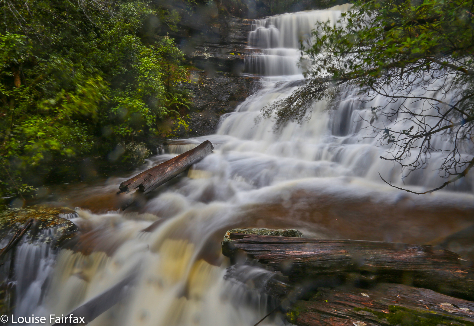
Lady Barron Falls 2015 Aug

Lady Barron Falls 2015 August.


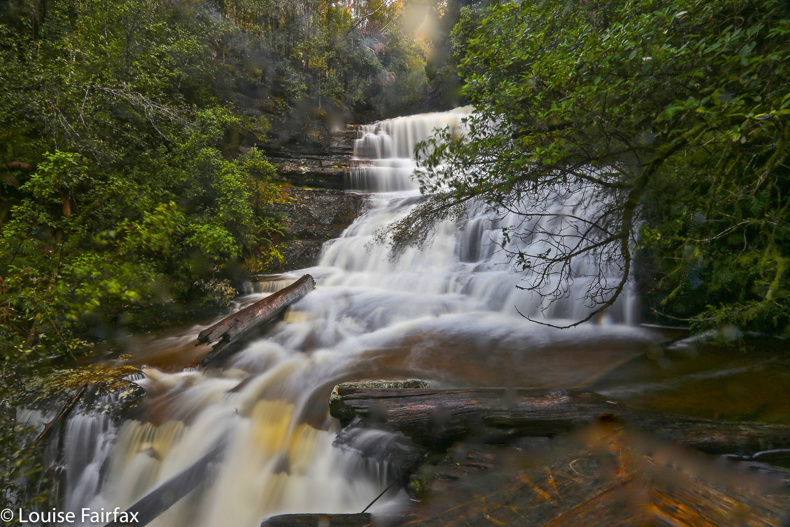
The day we visited Lady Barron Falls, the river was in flood, so the flow was monstrous – almost too big, as its enormity obliterated many of the interesting rock details one normally sees (and its volume created a spray that hard to keep away from the camera lens.


If you want to read the rest of what we did that weekend, turn to http://www.natureloverswalks.com/collins-cap/

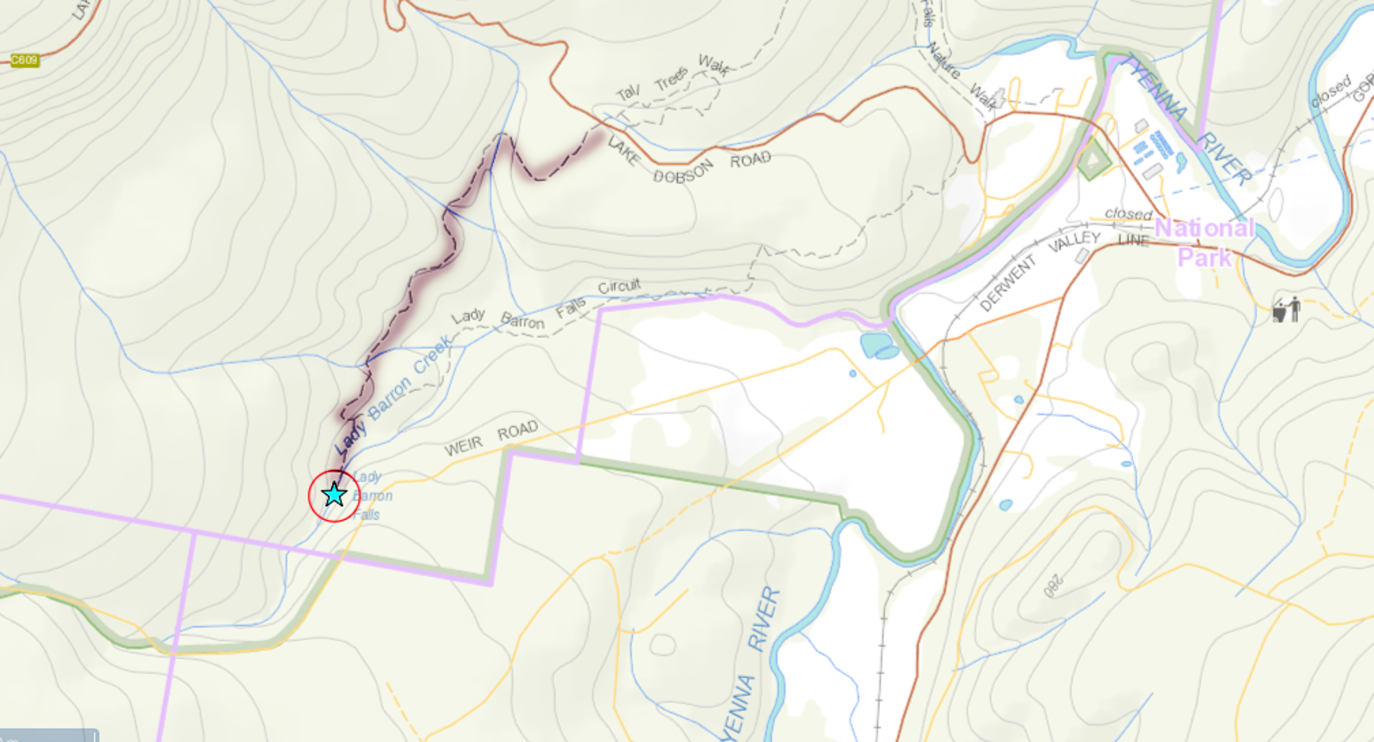
My diary records that my husband and I took twenty minutes in each direction. We parked the car at the topmost intersection between the track and the road (centre top below), and just walked in, almost on contour, from there, as we were in a bit of a hurry, having “wasted” a lot of time playing in the snow, and darkness was approaching. (Since when is playing in the snow a waste of time? You know what I mean.)

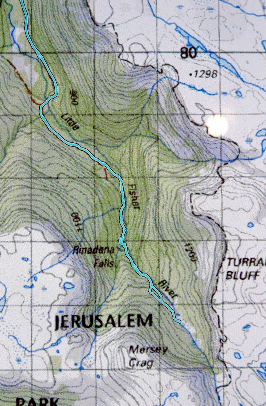
Rinadena Falls and Little Fisher Valley 2015 Jun

Rinadena Falls and the valley between Mersey Crag and Turrana Bluff – or maybe you’d like to call it the Little Fisher Valley. June 2015.
Progress is not quick when the driver keeps stopping for photos … but who could resist these cows in the dawn light?

If your child says to you: “Hey mum, dad, please take me to fairyland,” please don’t say: “It doesn’t exist.” Instead, pack your lunches and take them to one of Tasmania’s many jewel-secrets, Rinadena Falls. You can all look for goblins, fairies, ents and gnomes while you walk. William Morris or JRR Tolkein would have loved to have set a book there, I am sure, if only they’d been lucky enough to see this place. Magic glades and open forest are what you’ll find there. Gurgling waters can be heard for nearly the whole route. It is pure delight.


Some walks are about reaching the summit; others about the views from on high. Yesterday’s walk was more about just being out there on a beautiful, sunny (but freezing) day, and about getting in a nice long walk to help “fitten” my husband up for Europe. I wanted him to be walking for five hours (not counting breaks). This route took 4 hours 50.

Having not yet climbed Mersey Crag, my thoughts wandered in that direction, even after I’d learned that an extra two hours now had to be added to the time taken as a bridge was down. Last visit to the area, we had taken 4 hrs 45 walking time to climb Turrana Bluff, so this meant we would be looking at about 6 hrs 45 walking plus photo and food stops. Hm. Well, why not just go to that beautiful valley at the top with its marvellous pools that appear from nowhere and equally quickly disappear, that are waist deep yet one step wide? I love those pools. Even yesterday, in sub-zero temperatures, they begged me to have a dip.

Had we started at first light, we could have done the whole trip to the summit, but that would have involved being at the start line shortly after sunrise, and I was in need of a “sleep in”. We didn’t leave home until 7 a.m., and didn’t park at the closed bridge until 10. No time to summit, but plenty of time for what I now had in mind – the valley described above. I was also looking forward to seeing the wonderful Rinadena Falls again.

We allowed an hour for the first part of this journey, which we had driven last time. One blog, by a strong walker, had said 50 minutes, so an hour seemed realistic. I was delighted with my husband’s progress when he hit the old car park at 42 mins despite his Parkinson’s disease. He, too, felt chuffed, as last week he had been rebuffed from a club walk because he was “too slow”. He had been judged by the name of his disease and not his actuality. Having a good split here today helped him to reclaim something for himself.

I expected that road to be boring – some kind of medicine to be taken to enable other activity. This was far from the case. We loved it. Moss grew down the centre, complemented by the lightly tanned dirt to each side. Tiny myrtle leaves overhead framed a tunnel through which we progressed. Gurgling streamlets bubbled their way past us, chuckling as they continued to travel downhill and join the Little Fisher River below. Fallen trees indicated that even if you got your car magically past the bridge declared uncrossable, you would not get more than a short distance along this road that was fast giving itself back to the forest from whence it had come. Frozen fungi laced the scenery.

We crossed the bridge at the end of the former carpark, proceeded 8 more minutes to a cairn, and then swung left to follow a pad with pink ribbons through the lush forest. The tape was helpful, as fallen timber sometimes obscured where the path should lie – but don’t worry. This is still a very family-friendly route. I plan on taking infant Guss there at Christmas to enjoy this enchanted forest and to paddle in the Little Fisher River.

Rinadena Falls were as perfect as ever, so we took a longish photography break here. Half the falls were frozen, augmenting the beauty already there.

The broad valley at the top, framed by Turrana Bluff, lightly clad in white powder to our left and Mersey Crag to the right, was all that I had hoped for when planning this day. Frozen tarns giving white foreground interest, rich colours, crisp outlines provided by the sharp air. All was wonderful. We meandered our way along between the pools of water and ice until my watch indicated it was time to turn around. Mersey Crag was so tantalisingly close, I felt very tempted to ask Bruce to wait while I dashed up, but it was too cold for waiting, and such an impetuous dash would have meant we did the last road bit in the dark. The wicked tempting feelings said: “Who needs light for a road anyway?” Well, we didn’t need light, but it was sure nice not to have to hurry to try to “beat” it, and when we did get to the road, it was very handy to be able to see which patches of ice were more dangerous than the other bits. Our hands, even in the hour before sunset, were frozen to the point of pain. The mountain iced back over as we walked.

 It was also very helpful to get some driving in before it got dark. I reached the bitumen before visibility vanished, which, in those conditions, pleased me greatly. We had had a perfect day, so decided to round it off by treating ourselves to a light but delicious (and inexpensive) meal at the Pepperberry Cafe in Mole Creek. I loved the fact that the other family dining in this attractively set-out restaurant were also clad in the Tassie bushwalkers’ uniform: shorts over thermal longs, thick socks and boots. I was dying to ask them what adventure they had had that day. It was sure to have been a good one.
To reach Rinadena Falls, go past Mole Creek, heading for Lake Rowallan .. After you’ve driven over the little bridge below the dam wall, drive along with the dam on your right for about 3kms, until you see the Dublin Rd turnoff to the left. Take it. Your next turn will be to the right, along Little Fisher Rd. it is the third turn to the right (the first is Clumner Rd, and the second is to a spur). Drive along this road until you reach the pile up of dirt that announces that you are not to drive over the bridge ahead. Park, and walk over the bridge, continuing as with the Little Fisher River to your right, as described above. You will, of course, need a map: Mersey 1:100,000 or Pillans 1:25,000.

Projection Bluff 2015 Jun

From the base of Projection Bluff as we passed it the first time

Luckily Projection Bluff is not far away from our intended mountain for the day, which had been Rats Castle, for we piked out of the latter. The story goes like this:
We stood at the base of Rats Castle, feet crunching the icy snow, wind howling ominously around our ears, numb, aching hands held close to our bodies in a vain attempt to warm them – and we hadn’t yet begun clutching icy vegetation. Our overpants seemed ineffective at offering any kind of help in protecting us against this blast. I gazed up to where our goal lay, up there beyond the couple-of-kilometre-long band of frosted scrub, and up above the blocks of now white dolerite. Dark clouds were swirling on the tops. It would be slow work along the ridgeline, making sure we didn’t slip on the thin ice carapace that covered each rock. Snow started falling again as we considered. This worsened matters.

The walk begins …

“If this snow continues, it may make the road undriveable on the way out,” I mused aloud. I was beginning to feel decidedly wussy about this whole venture. Luckily for me, Angela agreed to a change in plans. Let’s do nearby Projection Bluff instead – short, sweet, a pad with markers hopefully so that we didn’t have to bush bash and could move quickly enough to maybe even warm up. The path would debouch us onto the rocky area much more quickly than the alternative in front of us, and if the rocks  were treacherous, well, we’d turn around. The trouble with our planned Rats Castle was that we could work for a few hours and only then discover the rocks wouldn’t admit passage under these conditions. By choosing the shorter Projection Bluff, we’d at least get a mountain in for our drive.

So, here we were at the startling line a second time, ready to push through snowy bushes, wondering where the “pad” was, buried somewhere there under arching bushes and covered in white. We had trouble locating it at first, and decided it wasn’t there, but then some markers appeared, then disappeared in a frozen lake, but eventually reemerged in icy rainforest once we happened on the right spot out the other side. After that, it was plain sailing – just the normal game of “spot the marker” as we climbed, being careful not to be caught out on slippery ice.

 The exercise even warmed us up enough for me to shed my ridiculous oversized goretex mittens that made me shockingly clumsy and that fell off every few metres. I had enough feeling in my fingers to plait my hair at last so I could begin to see. I even had enough movement in my fingers now to tie my shoelaces properly for the first time that day.

The views from the moment we popped out above the tree line were worth any discomfort we may have felt earlier on. I was in love. Click, click. Two or three metres’ progress. Click, click. Poor Angela. She waited with great patience as my photography slowed us down far more than the icy rocks. What a privilege it was to climb something, even as small as Projection Bluff, in conditions such as these, and to witness such enormous stretches of beauty laid out before us.


Hobhouse 2015 Jun

Mt Hobhouse success.
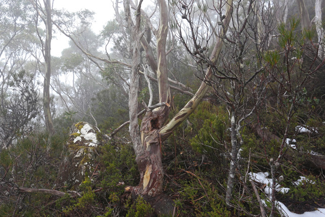
The forest just below the rocks of the ridge. Our first stop where we took off the packs (for a quick drink) – which meant I could have an equally quick snap with the camera that was tucked out of the weather in cosier environs.
“Mt Hobhouse. That’ll be a tough one to get on a short winter’s day,” an acquaintance said, and of course, he was right, but we just wanted to do it, so that was that. Did one always need to be sensible?
I was farewelled on my way by the Launceston debating community, as we had had Parliamentary Shield on the Saturday. To many of those people, who inhabit a very different world to mine, the notion of abandoning creature comforts to drive over an icy and dangerous Central Plateau to then attempt to climb a remote mountain in semi-snow was something almost outrageous. They wished me well with all their wonderful hearts. My students had won both trophies on offer. The memory of their warm hugs and delighted faces, and the joy shown by their families, lining up to photograph them with their booty, buoyed me as I drove. I don’t often travel to the mountains in a skirt and stockings. I hoped Angela would recognise me in this uncharacteristic and utterly unsuitable attire. She laughed when she saw me and suggested I carry the stuff up to wear on the summit for our victory photo. I declined. We were going to stay at Bronte Park Village which has an open fire. I’d dress more appropriately later. Let’s brave the ice on the road now, without delay, before it got any worse.
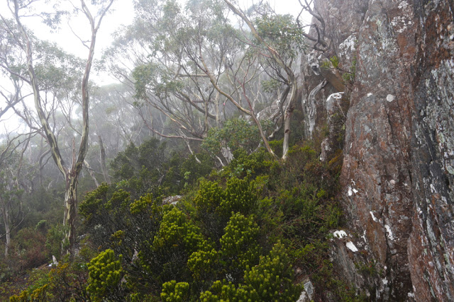
Moody forest and cliffs near the top.


And here we were, sniffing the top. It had to be that next lumpy shadow appearing out of the mist. I’d checked off all the features as they went by; this was finally it.
“I can hear in your voice you’re getting excited now,” Angela commented, with enough momentum to carry her to the top even if her legs dropped off her torso right at this moment.
“Yep,” I agreed, unwilling to call it success until this moment, but now, now, it would take an atomic bomb or a fatal heart attack to keep us from that prized summit stick. We crunched on the last of the snow and covered the final twenty metres of our day’s directed endeavours.
The mountain had seemed so formidable on our first attempt – because we had come up onto the ridgeline a tad too early and had met a solid wall of cliff, well fortified by a palisade of dauntingly thick scrub. Now it seemed nothing but a song and dance across the ridgeline to the top. Amazing what 100 ms difference can make.

Weeee. We’ve done it. Angela on top.

This trip was not about views. It was about undoing a bad job last time and not admitting defeat. Last time we had done all the hard work of getting up onto the same ridgeline we were now on, but we had been timed out of finding a way around the cliffs so we could reach a point from which ascent was possible. We had started too late, underestimated our mountain, and were not prepared enough in our homework (we had actually not intended to climb the mountain on that day. It was a last minute switch).

Fabulous summit views.

So dedicated were we to our task this time that the only breaks were a toilet stop, a quick drink before the ridgeline, and a bit of time wasted looking for a cairn that we have decided has been knocked down by fallen timber (of which there is a lot. Recent storms have caused quite a number of new obstacles, even since last time we were there). We were at the top by midday, having survived the overgrown and very unclear bombardier track, the magnificent and quite open rainforest of the early part of our ridge, the slow and snowy bauera and eucalyptus band between it and the ridgeline, and the final, enjoyable semi-romp of the last section where the bushes were lower and a pad could even be seen.

Picturesque lunch spot on the descent that offered rocky substratum for our packs and shelter of sorts in the rain.

The weather was such that we didn’t linger long on the summit, and chose to eat our rather hasty lunch in the rain at the bottom of the cliffs prior to plummeting down into the bauera once more. I timed it to this spot. Twenty-three minutes. It was where we had passed through on our retreat last time. How sad that we had been so close the summit, yet had not had the time to go there. Of course, at the time we didn’t realise the journey would be so quick, and our decision to turn around had been a wise one given the time. We did not have forty six minutes (plus photos) to spare on that day, and we thought it would all take a lot longer than that, containing the possibility, we thought, for many errors and false chutes. This time we knew better, thanks to the kind advice offered to us by both Phil Dawson and Becca Lunnon, who each described their (basically identical) route across the ridge. That knowledge gave us more confidence this time.
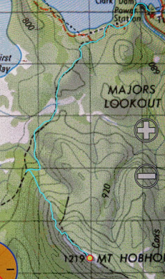
This time I am posting both a 1:100,000 map (here) as well as the more normal 1:25,000, as this one has darker contour lines that make the shape of the land and our route more obvious. The other scale on this particular map has oddly light contour lines, and as, for me, a map is all about contours, I find that excessively unhelpful. I’ve done all I can to darken them.

The trip back, retracing our steps was uneventful if you don’t count the fact that our clothes were so sodden they were hard to keep on, and that we increasingly resembled odd wooden puppets trying to move in a way that kept pants up and frozen feet operating. We were both a little worried about how very numb our fingers were, knowing that we would need them for our lives right at the very end, but, here I am, alive to tell the tale. The return trip was slower than the ascent – partly due to the fact that the bushes now bent low over the bombardier “track”, making it impossible to differentiate from its ambient non-track scrub. We lost it several times, but were still out with a nice amount of light to spare so we could see the ice and snow on the road and attempt to dodge the animals that decided suicide at Angela’s hands was the way to go.
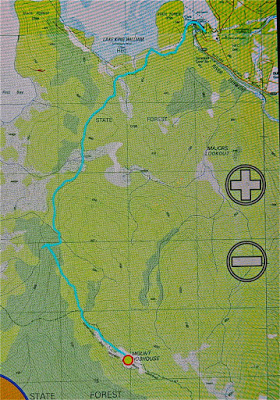
Here is the 1:25,000 version which usually gives you more information, but with the contour lines so very washed out, is not as useful as it should be. A combination of the two should give you all the information you need to determine our route, I hope. The line crossing the ridge is a boundary line. Don’t be tricked into thinking it’s a helpful track, although at the very top, just for the end game, there is a bit of a pad in the shorter vegetation.

Dundas 2015 Jun

Mt Dundas June 2015

For some reason – well, actually, for a very good reason – I was a bit scared of Mt Dundas. As you may have gathered from photos, ice and snow dominate our scenery at present. Fine. Beautiful. The trouble is, this mountain begins with a river crossing, and we were under the impression the water would be knee deep at best (thigh at worst) and rushing. I would be climbing in snow with sodden feet, a sure recipe for personal misery and possible hypothermia. I was so anxious I even had nightmares as darkness morphed to dawn. Gulp. Here comes day: my moment of testing.

Monika negotiates the rocks near the summit

Down we went to inspect the infamous creek, scene of my sure doom. Hey. There was a branch I could clutch and swing from – Tarzan’s wife – over the slippery, slightly submerged rocks. I didn’t need to get my feet wet.

I don’t know why I had imagined that Dundas wouldn’t have rainforest at its base like almost every other mountain in Tasmania. Perhaps because nearby Tyndall is not impressive in this aspect. All I did know was that there was an old road one followed for a while after crossing the creek, and that it was “very overgrown”.  Well, yes, it was … a bit … but not so much that it was a problem. Up we climbed through glorious, lush, mossy forest to the point where “road” became pad, replete with tape in several hues. My favourite section was the stand of King Billy pines that rendered the path a carpet of textured needles in various shades of brown. My second favourite was when this was replaced by a different study in brown and ochres made by fallen fagus leaves.

Kent and Monica on the summit

Once we mounted the top of this ridge, the land flattened out for a section of tiny wombat pads through low lying scrub, one pad of which was used by humans. The final climb was now visible, but the summit still seemed a long way off – both in terms of vertical and horizontal distance. It seemed to me that it was too far away to be achievable on this short winter’s day. I pessimistically predicted failure to my two companions who betted on the contrary that we’d be there by half past one. I owe Kent a cake at Zeps, I am very pleased to say. I like placing bets that I hope to lose.

Here comes Jack

Not at all deterred by the possibility of having to buy cake, on we continued, taking especial care in the snow. I happened to be the one making the footprints in the end game, and needed to be particularly careful: it’s easy to assume there’s a rock under the snow and to fall and hurt yourself if there isn’t. Aware as I was of the dangers in this section, I was simultaneously aware of how grateful I was to Rupert for putting on the walk, and to HWC for enabling me to connect with others who are crazy enough to find climbing a mountain in mist and snow to be a fun idea. I know we are not the norm.

I was thrilled by the thwarting of my own pessimism when at last out of the gloom a mound appeared that was definitely the summit. Several false promising ones had made their appearance as we climbed, but this one had no shapes beyond. At last there really was nothing higher to climb, and Kent and Monica had even been a half hour too pessimistic in their own estimation of when we’d get there. Every member of the party had reached the top before one, and in fact, we had descended a bit and finished (a very quick) lunch by one thirty. The reason for the speed was not gluttony, but rather freezing fingers and toes that made picnicking in the snow a little less than pure delight. Moving was the best solution to the freezing problem.

Cold it may well have been, but I feel very privileged to have seen and climbed Dundas in the snow. I loved this mountain, and will return one day to admire her summer outfit and linger longer on the top.

A real, paper map will give you the context of where that lower waypoint is – scene of road end and where we parked the car. We then followed the obvious road until a cairn (NOT very far) indicated the path down to the river. After crossing, the old path that will lead you upwards is to be found on your right, and is indicated on the map above by the more easterly path which followed the road the whole way. The upper waypoint (2 of 3) is where the old road ends and the pad begins; basically, if you are heading up to the sharpest part of the spur you can’t miss it.