ENGLAND Lake District 2015

Helm Crag. A pre-breakfast climb to begin our trip

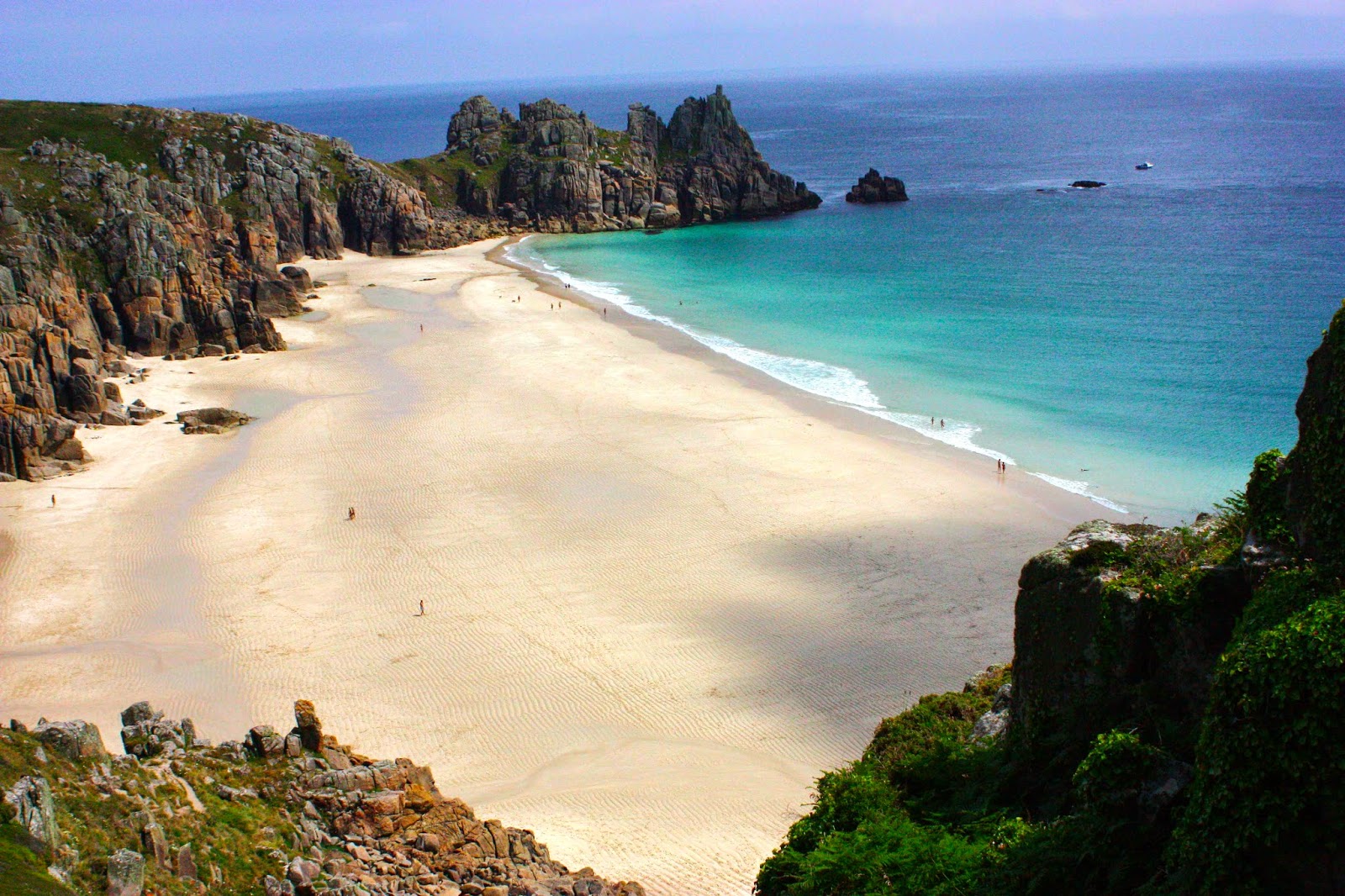
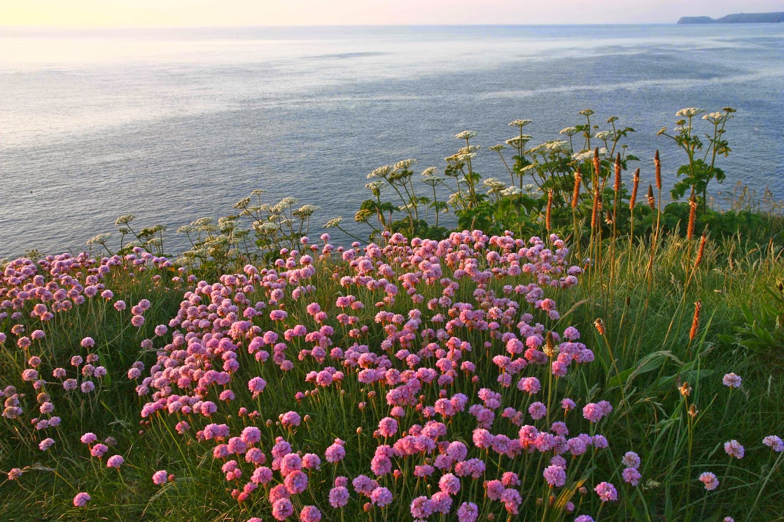
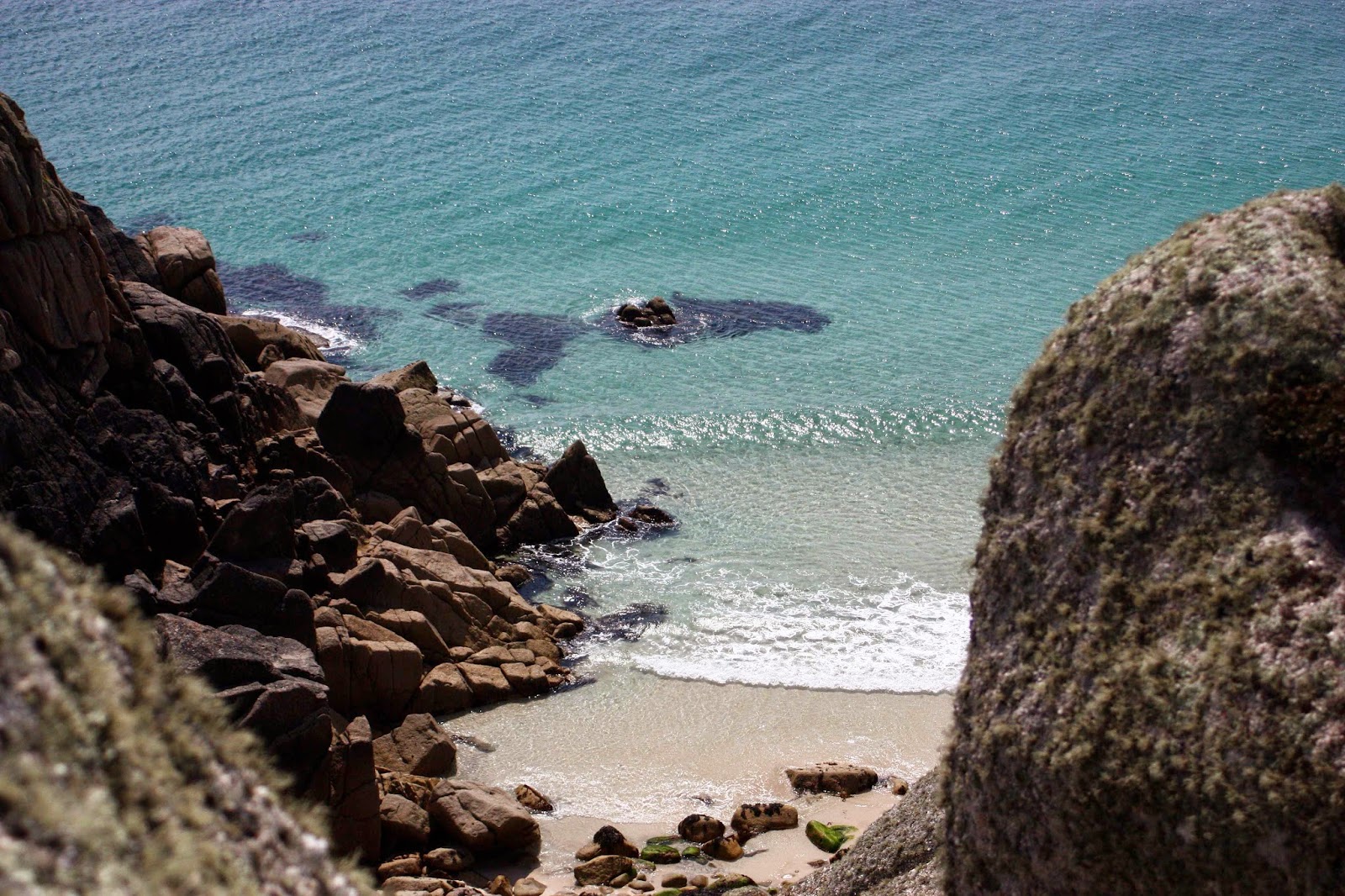
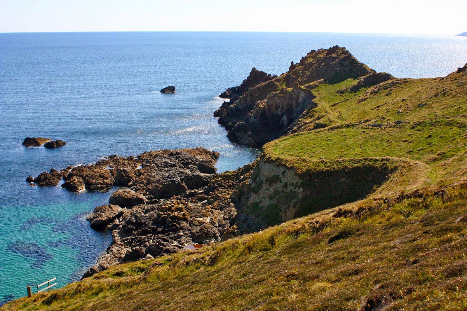
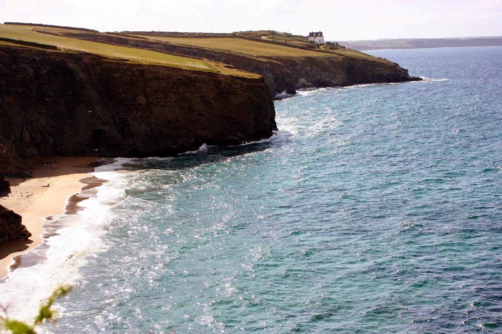
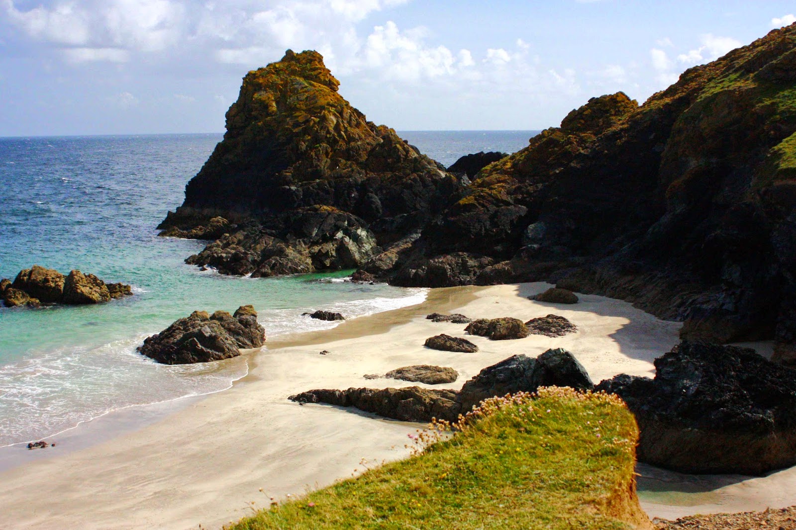
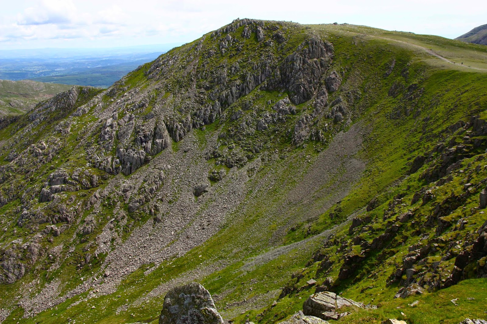
I am trying to climb all the Wainwrights (Lakeland Fells). “Isn’t it perverse,” I hear you say, “going to the Lake District to climb peaks when Tassie has so many mountains of its own?” It can seem so, certainly, especially to those who judge a mountain’s worth by its height. If this is your criterion then, yes, forget it. And if lakes are to be judged by volume and impressive dimensions, then forget them too. This is not the country for that kind of importunate drama. However, if you find beauty in subtle shifts of colour and form, in lines and patterns in the landscape, in amusing lumps and bumps as the land progresses upwards; if you love the mixture of verdant green with blue or steely grey, then you might begin to understand the allure.

Seat Sandal

And if you have a head full of English Literature (especially that of ancient times) as my husband and I do, then you might understand even more.

Descending Seat Sandal

“OK,” you say, “a holiday, sure. But why bag peaks (Wainwrights) there when there are great Abels and other mountains to collect in Tasmania?”
“Why not do both?”, I retort.
And why did I get started on this idea of wanting to climb all the Wainwrights in addition to as many of the Abels as I can? We were drawn to the Lakes initially because of what the area meant to the poets who claimed part of our imagination, and have continued to return for what it means to us in its own right: for the nuanced beauty it contains. We lived in England for a while before we had children, and have returned since for a term to do some research at Oxford; as an athlete I trained in the Lakes for a month in preparation for the World Championships in 1993, and competed on the fells I now walk over.
Somewhere along the line I began ticking the ones I’d climbed in the index to my Wainwright books, and from there developed the idea of ticking the lot.

Fleetwith Pike

We adore our lifestyle in Tassie, and the bushwalking we do here, but we also treasure the Lakes and the regime we adopt while there. I am a completer of things I begin, and now that I have commenced this mission to climb every Wainwright, I won’t stop until I’m finished. And then I’ll turn around and begin all over again, just like I do with a good book. These mountains are now my friends and, having got to know them, I want to keep seeing them. Once will not be enough, but I want to taste everything on the smorgasbord before I go back for seconds in any systematic way.

Rannerdale Knotts

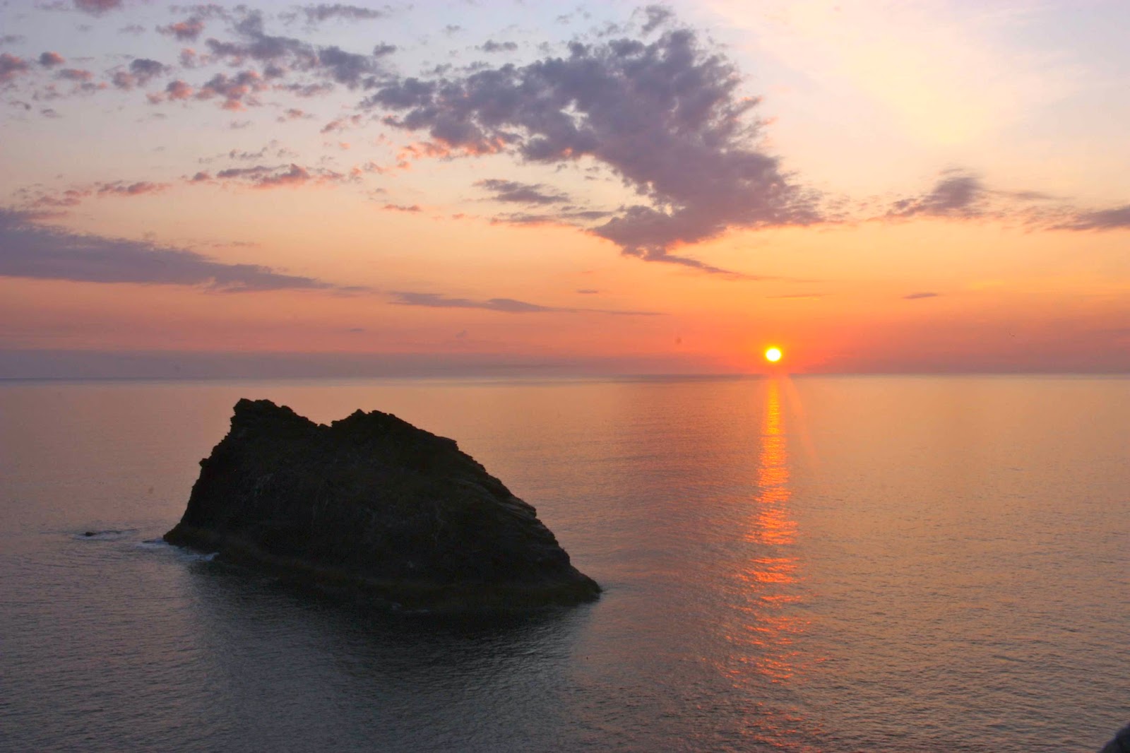
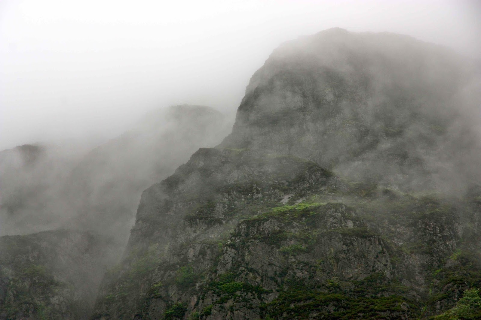
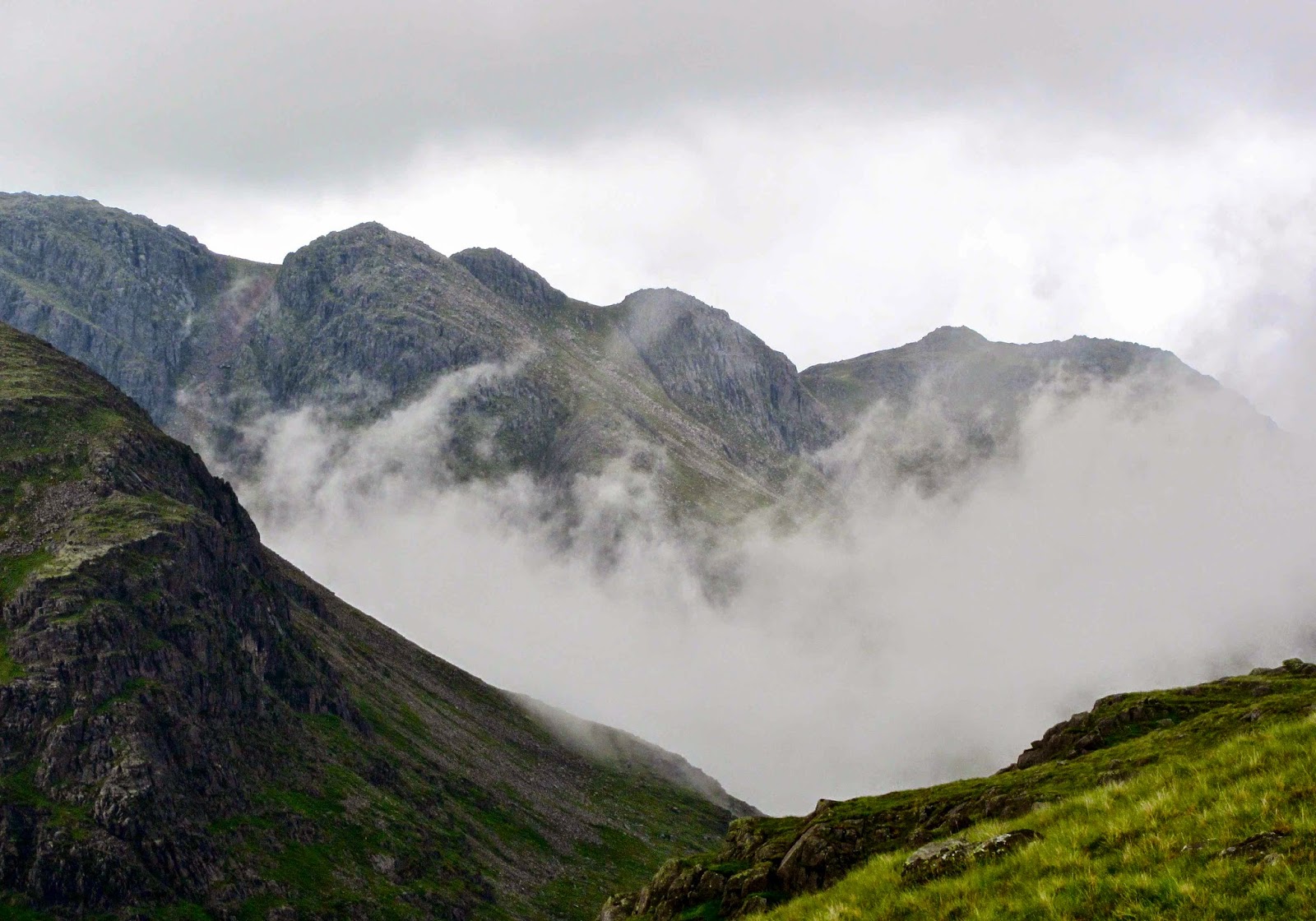
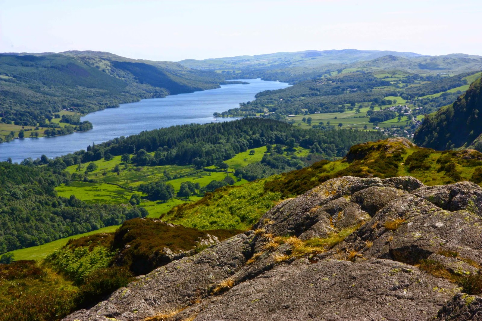
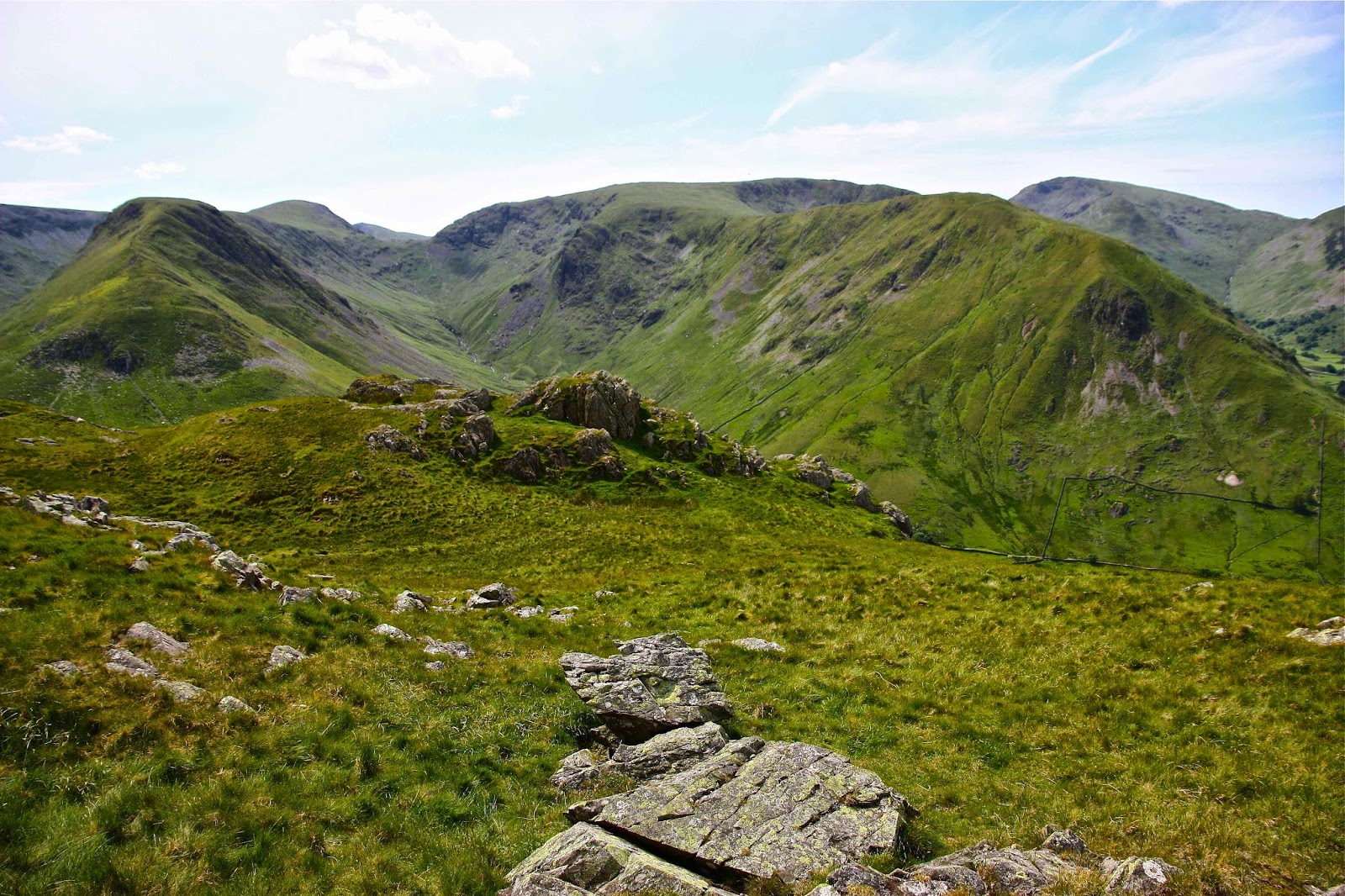
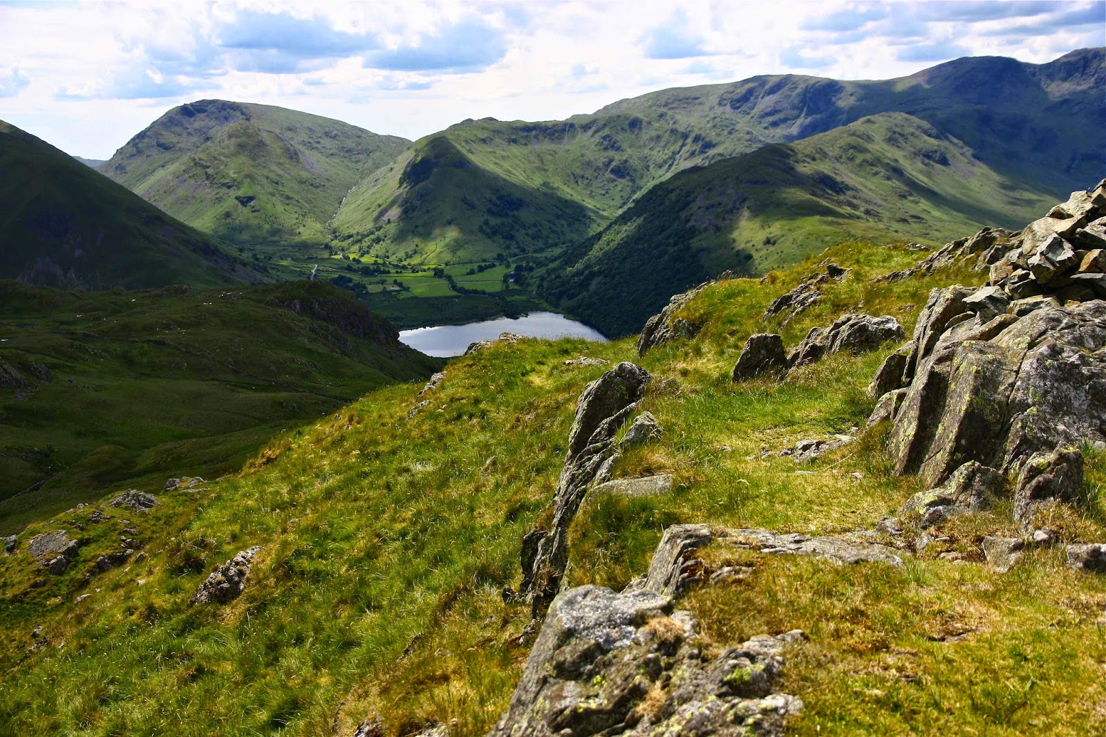
Although the view from a peak in Tassie stretches further in many cases, and although the scenes tend to be more wild and rugged, the view from a Lakeland peak still has the capacity to thrill and to connect the soul to the infinite.

Rannerdale Knotts to Loweswater

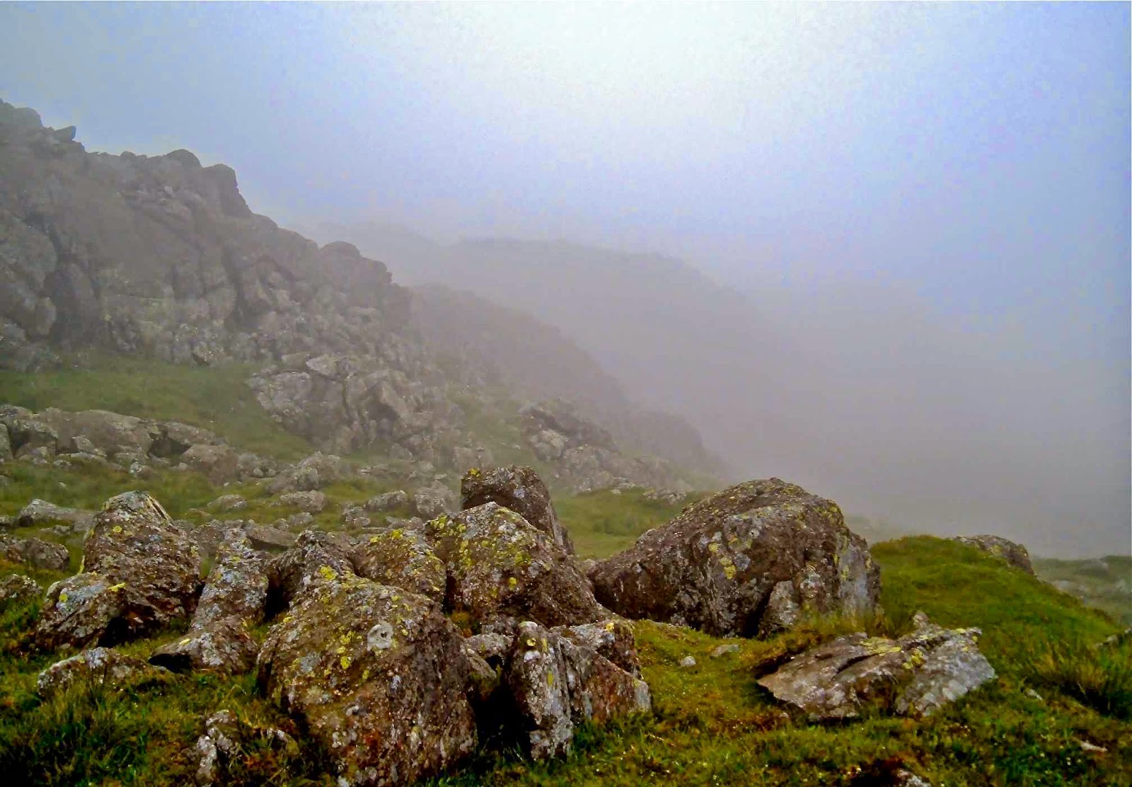
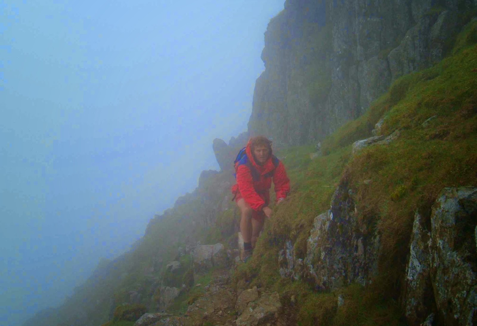
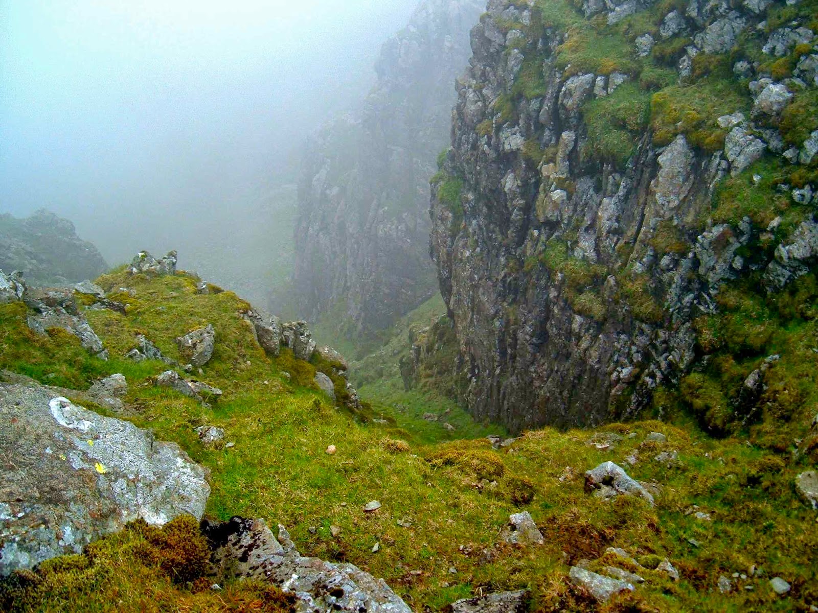
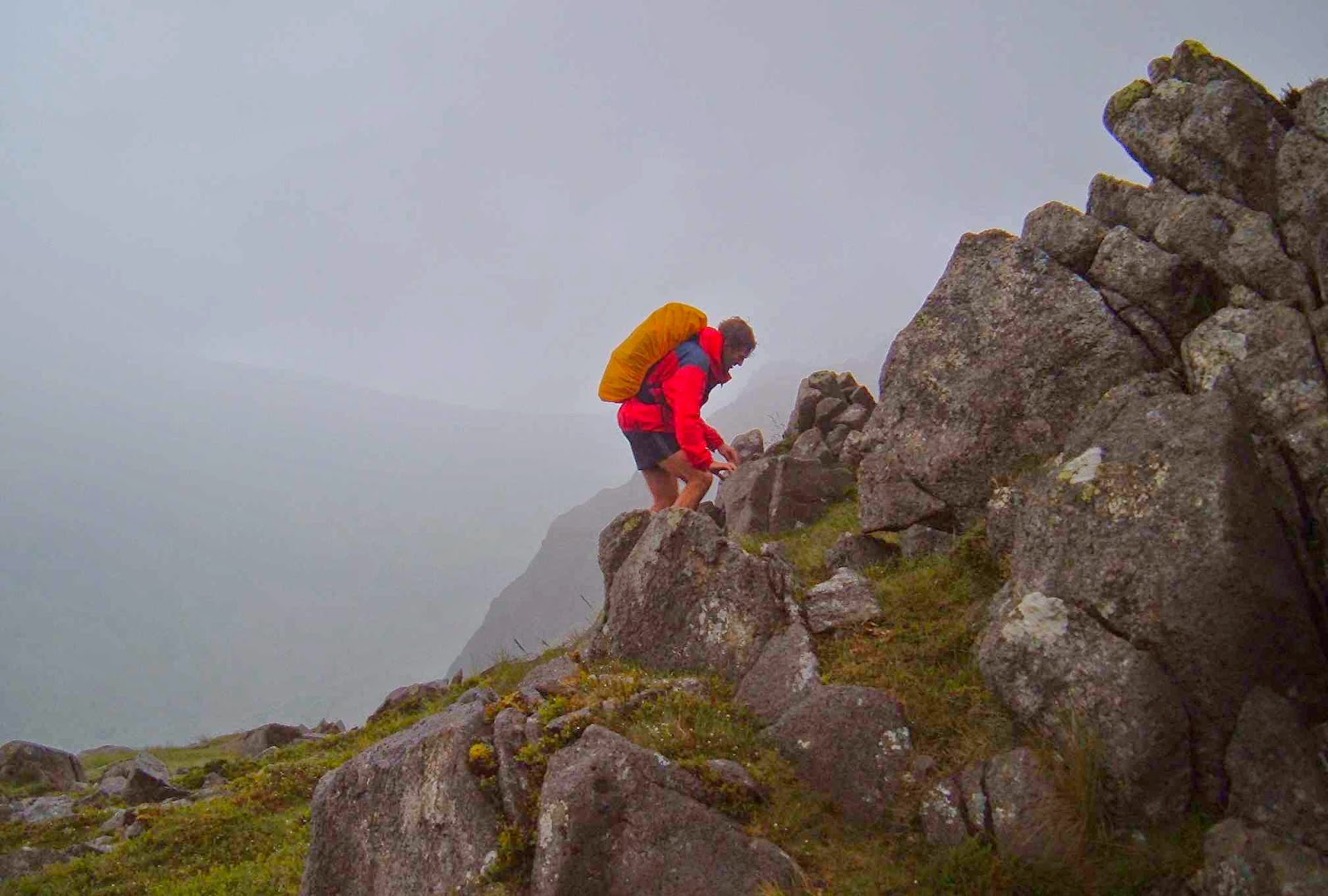
And if you think the fells are too tame and unchallenging (which is what some say to me), then perhaps you haven’t done them justice, or are judging them without having been there. You can die just as easily in the fells as you can in Tassie (if that’s the level of excitement you’re seeking); in fact, due to population differences, there are more Fell deaths than Tassie wilderness ones. If you find them unchallenging, I suggest you walk faster, or choose routes that are more direct – straight up the face if you will. One creates one’s own challenges in the fells, just as here. I know I have led us into some pretty precarious situations in thick mist over the years, especially on the day a few years ago on Swirl How when my compass said that every direction was north and the ground said nothing helpful at all. That day, a young guy (25) died within a kilometre of where we were, falling off a precipice.

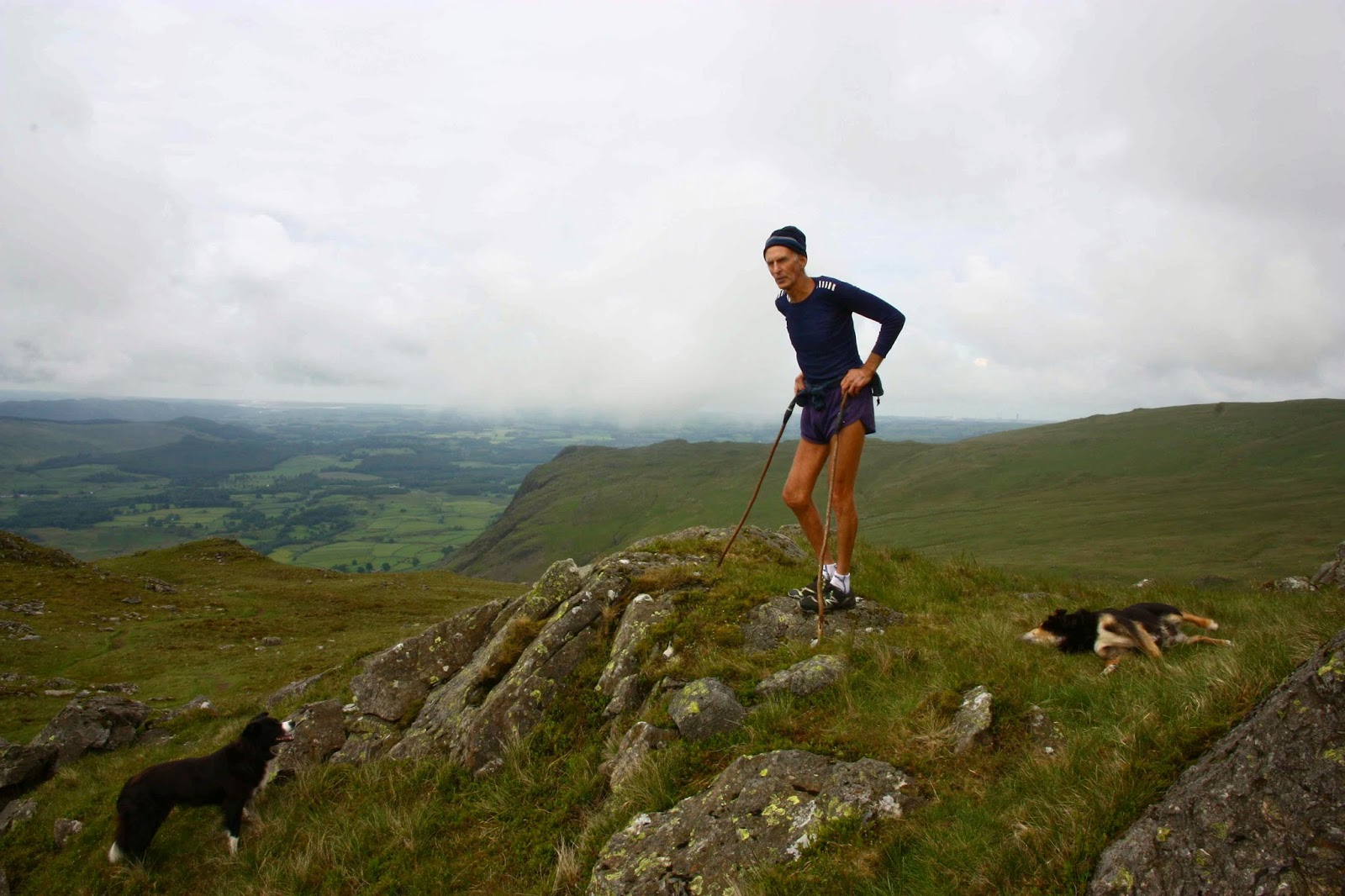
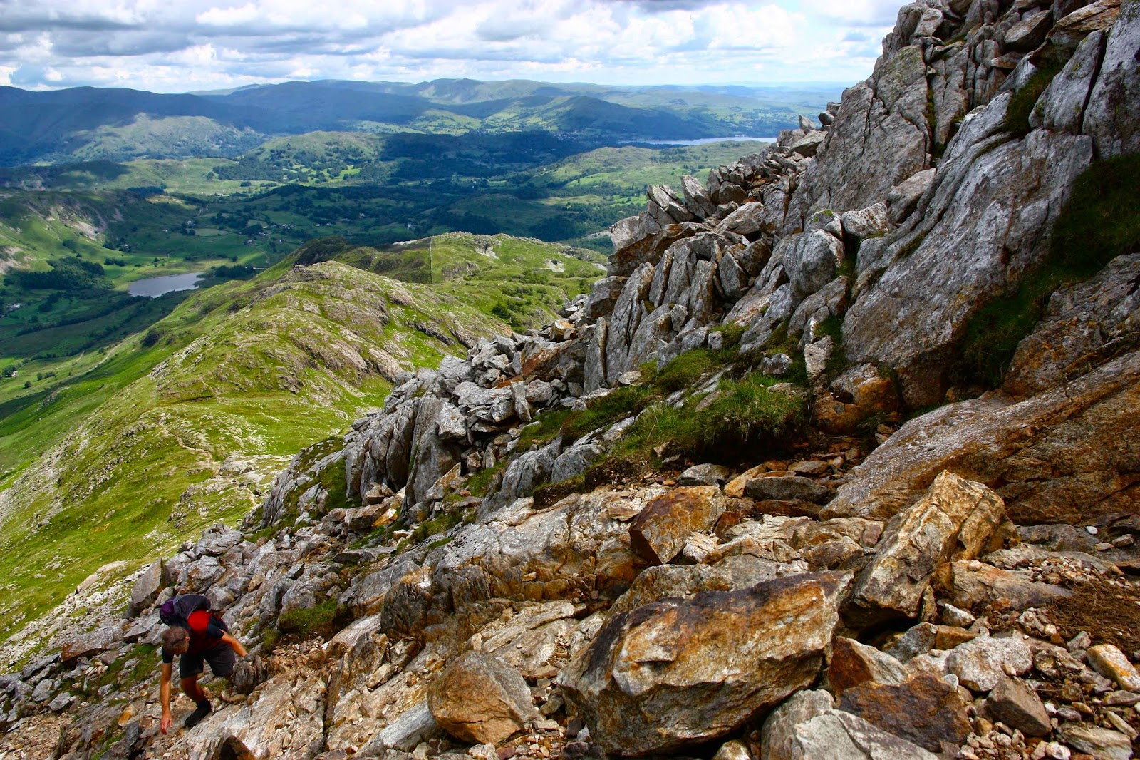
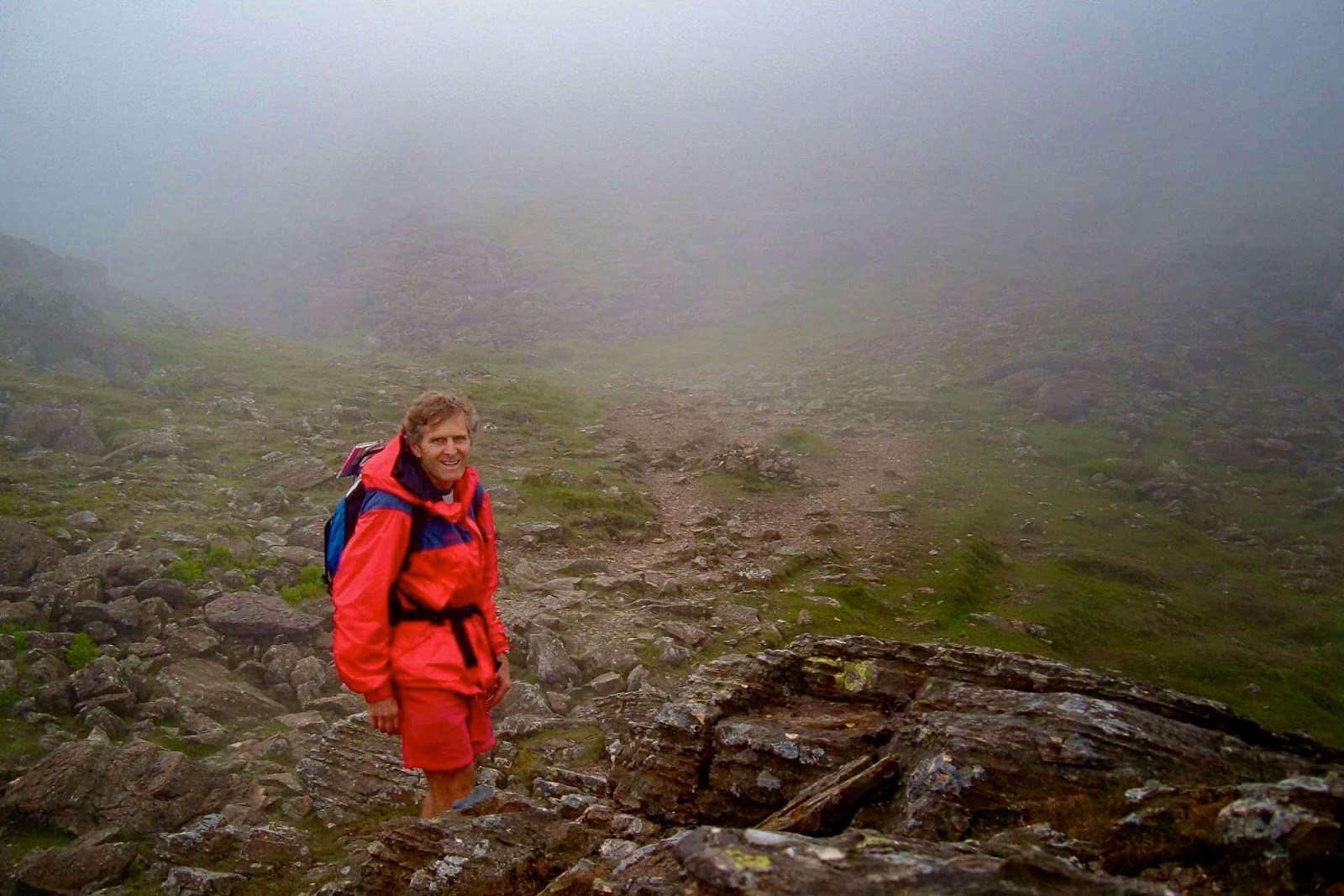
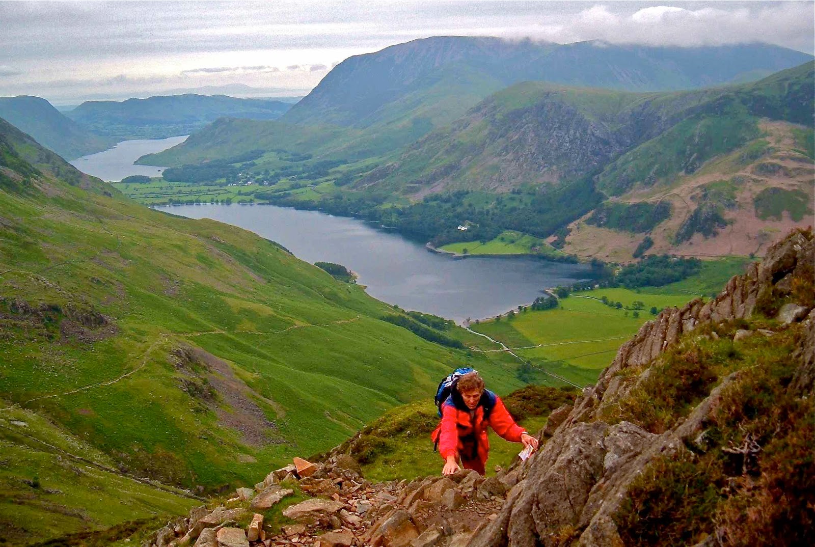
My husband trying hard not to kill himself on the way to Causey Pike. As you can see, there are opportunities for this activity off to the right, especially if you have Parkinson’s Disease. My husband finds ridges like this to be very challenging. Logic says if he fell to the right exactly now, he would not fall down the mountain, but that is not how his emotions feel it.


Loweswater. Plenty of scope for a gentle walk after dinner.

The Fells and Tasmanian mountains each demand a different type of fitness. In Tassie, as you are fighting bush down lower to get to your peak, the going is often very slow. You need strength and endurance. In England, you can run up the fells with your heart pounding (as long as you are not lugging a full-frame camera). You can do ten or more Wainrights before lunch if you choose the right ones (even with said camera) and are very fit – unthinkable in Tassie. Ten Abels might take you a year if you’re nearing the end of the count and have left all the far-flung ones to last. I have a strong, fit friend whose experienced party took ten days to get a single mountain, and it was only 800 ms high (thus not an Abel. Only mountains over 1100 ms are Abels). This variance does not make one type of mountain superior to the other; it just means that the style of walking (and the gear) required is different.

Climbing Long Side
In Tassie, if you are collecting Abels, as said, you must be very strong, as you can’t do it without carrying a heavy pack for the multi-day excursions required to reach some of the peaks. In England, a day pack is all you need. Both types of mountain require map and compass skills.
I love my heavy pack as a symbol of freedom and adventure, but I also love this cushy daypack business for a pleasant break, and I adore being able to move much faster. I feel great pleasure moving quickly, especially in nature.
Crummock Waters – a little walk with friends before dinner at the end of the day in the mountains 

My husband loves being filled to bursting point every breakfast (which never happens at home), and I don’t mind climbing a mountain or two waiting for the very late – agonising – hour of 8 a.m. when this breakfast is finally served.

Crummock Waters

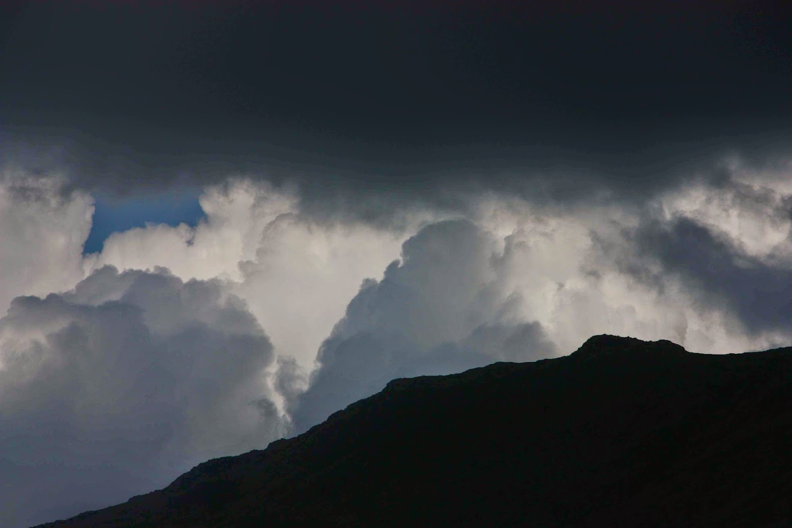
And it’s pleasantly sociable climbing in the fells without it being crowded (but then, I have long since climbed the icons like Helvellyn). That said, we had Scafell Pike to ourselves last year on a return visit. We climbed it yet again, just because the sun was shining when I suggested we go up, and although I’d climbed it four times, I’d never seen the view. Alas, I still haven’t. As in Tassie, the weather changes very quickly. I have an excellent collection of photos of my husband surrounded by grey, all claiming to be taken at different times on the top of Scafell Pike.

The famous waters of Buttermere (whilst waiting for one of the notoriously late breakfasts).

I enjoy the fact that on the most horrid of days, in a spot that you think is totally outré, you can still come across a fellow traveller. Of course you have a chat. I love to meet people who are as crazy as I am. They’re my type. You have a short exchange and then diverge, for there are endless possible routes in the fells. Sometimes you just give and receive a smile of complicity, a recognition that here is another person smitten with the same disease and the same penchant of going out into wild nature even when it’s furious – sometimes precisely because it’s so raging, as there’s something fun about being out there when nature is trying its best to destroy you. That is wildness as opposed to wilderness. I love both. So did my “friend” Goethe. King Lear’s rages in the storm suggest to me that even Shakespeare knew what it was like to be out there in the inclement elements. It is exhilarating (not that Lear found it so). Elizabeth Bennett loved it too, and I love her (and Jane Austen, her creator who loved to walk).

Buttermere again

And where else in the world does a sheep beat you to the summit?
Where else does a sheep show you that here is a possible route down when you’re in a fix?
I love a summit cairn that materialises out of the gloom with the shape of a welcoming member of ovis aries beside it. Unfortunately, they seem very camera shy, and the minute I pull my lens cap off, they’re away.

Walla Crag
From Raven Crag, looking towards Thirlmere

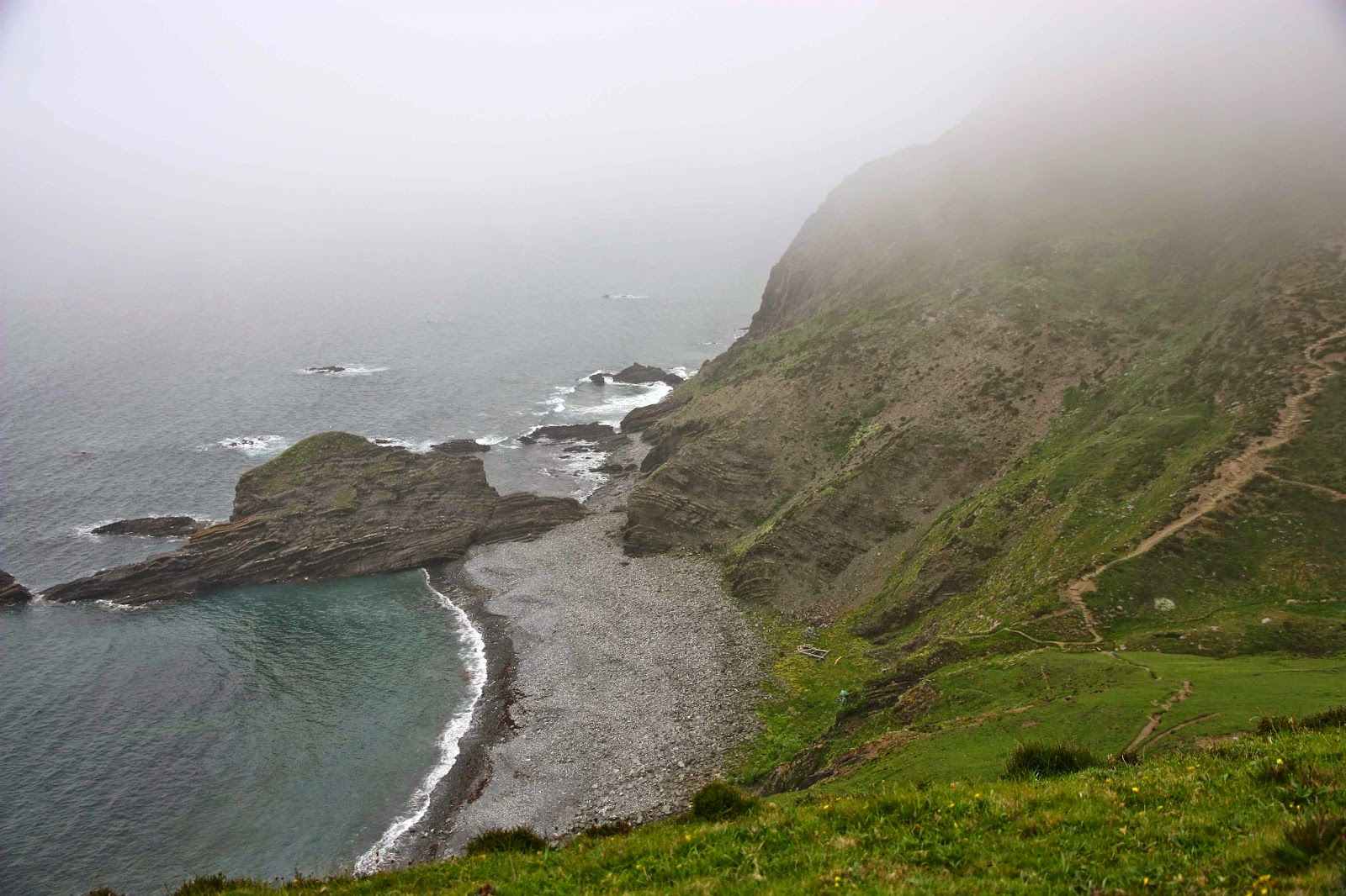
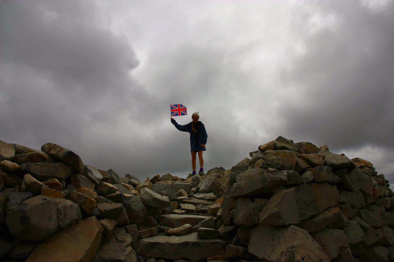
Tassie’s weather is wild, especially along the tops of the southern ranges, and yet it is only in England that I have been reduced to worming my way along the ground in order to touch the summit cairn. Only in England have I been a mere two meters (horizontal) from my destination yet been in serious doubt about making it. Each centimetre was a fight against a blast that threatened to lift me right off the mountain and deposit me somewhere a long way below. If you think there’s no adventure to be had in England, then you just haven’t tried.

High Rigg. This was the windiest summit my husband climbed. The one where I crawled, I had to do solo while he sat in the car and counted the pairs who began and gave up after five minutes.
Friendly sheep near the summit en route to Sail
 

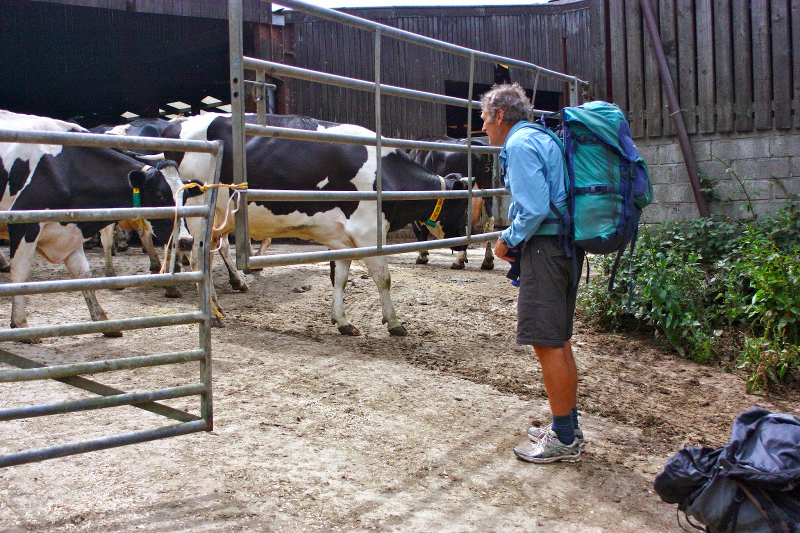
A note on planning: Another factor required by both areas if you are actually trying to collect all the peaks, is careful planning. I spend multiple hours at home before we leave with maps spread all over the bedroom floor, plotting the circular routes we’ll do each day. Sometimes I think I spend more time planning than climbing. It’s like a mini rogaining competition. Once you’re into the end game, you can’t just haphazardly do a mountain here and then decide which one to do in the afternoon. Clusters have to be worked out to minimise or avoid unnecessary travel. When you’re just beginning, this is not so essential, although it makes sense to have a base and climb as much as possible from that point. Now I am discovering isolated mountains carelessly left behind when I was in an area. In two more trips of one week each I’ll have finished my Wainwrights, and one of these trips will be a kind of mop up operation, like a wife tidying up, picking up the strewn bits left here and there by a neglectful husband or kids. At least these strewn bits are beautiful mountains, but on this trip I will have more than the usual amount of driving. I already have it planned. It is feasible.

In Tassie, the planning has more to do with weather and finding the best route up the mountain, which usually equates to extracting from somewhere information about patches of thick scrub and how to get around cliff lines on the ground but not on the map. In Tassie, other walkers and bushwalk.com are both indispensable. In England, when researching routes, the site I use, which has fantastic information not only about routes, but also has wonderful pictures and information about the best place to leave your car, is the blog put together by David Hall: http://www.walkthefells.net/ . Unfortunately there is no listed way to contact David. I would so dearly love to write and thank him for the fabulous help he has been in my little quest, but there is no email. He has been swamped.

ENGLAND Lake District 2014

Heron Pike (view)

As in many previous years, I used England as a warm-up for my husband – a kind of transition between his semi-sedentary job and the demands of walking all day, every day over mountain passes on the continent.

Grasmoor view

This year, I chose to go “peak bagging” in the Lake District. I use that verb as a shorthand to describe our activity, but as I look at my four maps of the area, with the routes we’ve done highlighted in yellow or orange in a spiderweb configuration, I realise that it’s far more about ridges and routes than the summits themselves, even though we visited each summit in question. The best views and the most exhilarating experiences of nature’s wonderland are often to be had on the way rather than near the summit cairn.

Mellbreak as seen from our window

Before we left, I pored over my existing highlighted routes, plotting the best bases for filling in the gaps that remained. The Buttermere area was a definite, but as that village is either booked out at the cheap end, or too expensive at the other, I selected nearby Loweswater as our first base. Kirkstile Inn, with its wonderful view out our window of Mellbreak, a fabulous fell, was my choice, and we loved our time there.

Climbing Mellbreak

I didn’t want our whole twelve days in the one spot, so also opted for bases in Patterdale and Skelwith Bridge for variety of peaks and experiences (the latter being chosen more on grounds of nostalgia than access to unclimbed peaks).

Loweswater, dawn

We arrived excited to be there at last after 40 hours’ travel. We weren’t really hungry, but had some soup just to call it dinner; we were far more eager to stretch our legs after such a long time sitting, before official bedtime claimed us. Heron Pike didn’t seem all that far away and the evenings are long … off we set, straight up a direct line from Grasmere, where we were spending the first  night.

Climbing Low Fell (the face of Whiteside dominates the left half of the scene)

The next morning we were up at 4.30 with the approaching dawn, so set out walking with no particular plan. We just wanted to enjoy being there and to see whatever we would see. I can’t resist going up when it’s an option, so put up with ‘flat’ for about ten minutes before the allure of an adjacent sharp climb dragged me with irresistible pull and we began a steep ascent of Heron Pike from a different approach, through the bracken and up rocky crags. I wondered if I was leading us straight into an impassable cliff face, but soon enough a sheep appeared and we were on the ridge line shortly afterwards to enjoy a much more scenic approach to the summit that we’d had the night before. We climbed two more peaks before dropping down, starving, for a hearty English breakfast. I’m surprised we weren’t rebuked for gluttony as we had multiple servings of everything available, and cleaned them out of prunes, grapefruit and muesli before beginning on the hot food. The English don’t serve breakfast until the late hour of 8 a.m., so this (early walk + edacity) became a fairly regular pattern. Our behaviour was either tolerated or not noticed, and no one saw fit to expel us.

Climbing Whiteless Pike

As we climbed over forty new peaks (in addition to many repeat climbs) in our eleven days there, I won’t give an account of each one, but will sect a few favourites from the mix.

Descending Whiteless later

In previous trips to this area, we have climbed the peaks (Haystacks, High Crag, High Stile, Red Pike) in the vicinity of Scarth Gap, on the southern side of Buttermere more times than I can remember, as we love that area, but we have never climbed any of the ones on the other (more northerly) side. I’ve always eyed them up and thought them a little imposing; they look very steep and quite sheer from the front. Thanks to the notion of peak bagging, however, we were challenged to try new mountains, rather than keep summiting familiar friends, and I’m so glad to have been prodded to do this.


Climbing Whiteside. Grasmoor provides the immediate backdrop.

Whiteless Pike is due north of the hamlet of Buttermere and looks over the lakes Buttermere and Crummock Water, presenting a rather inhospitable face to both. A direct approach is marked on the map, but not exactly visible on the ground. My husband did not dare a direct approach, and I selected a route that went up the Rannerdal Valley beside the crags of that name and that then climbed steeply from that direction. It was a beautiful way, with a fabulous, narrow ridge before the summit that offered extensive views of shining waters below and layers of mountains above. The grass was lurid green. My husband was rather unnerved by the ridge, but tolerated it, whilst opting not to return home in that direction. Once was enough. Still, there were other peaks to climb before that became an issue, and we enjoyed the views from four more before I showed him how he could get down on a less confronting route. I wanted to see the ridge from the uphill direction and see the lakes with a now lower sun, so I arranged his pickup point and set out to climb some more before dropping and joining him. It worked well. The possibilities for that kind of separation make England very suitable for us.

Grasmoor as seen from Whiteside

The third peak in this foreshore lineup, Whiteside, lies to the NE of nearby Crummock Water and flanks the other side of Grasmoor, yet another hulk with fabulous water and mountain views. This one we did take head on, with Bruce tolerating the mild level of exposure very well. It was the peak beyond, Hopegill Head that had him challenged as we approached. “Where are we going?”, he kept asking, as I headed him for it. I knew it would be much less threatening at close quarters when he could see the route up, so just kept responding vaguely, “Oh, ahead”, (waving my arm broadly), “in this direction.”

And this is taken whilst descending Grasmoor, looking towards Whiteside
As predicted, the actual route was less confronting than his fears. The next question was: “Are we going back down the same way?”
“No. You’ve done all the tricky stuff now. We’re just going to climb that nice one ahead and then drop back down the valley using Liza Beck.”
He knew Liza Beck from the day before, so gained in confidence. From the top of Grisedale Pike, we could see not only Keswick way below, but peaks that I used to run up from Keswick when I was training there (Cat Bells, Maiden Moor, High Spy and Dale Head). It was pleasing to greet old friends unexpectedly, out of context as it were. I hadn’t bothered to look at the map to see what lay beyond my present focus of interest.
Sheffield Pike

My third favourite peak was also done from our Loweswater base, and was the peak we looked at out our bedroom window at Kirkstile Inn. We woke up seeing it and went to bed staring at it, and said “Hi” to it any time we happened to visit our room. The side that faced it was another “in your face” slope, and I knew there was a route that went straight up that slope, so that was what I’d chosen for our first afternoon there. B attempted to come, but gave up when the route became somewhere near ninety degrees and he wasn’t comfortable with the distance he’d fall if he started sliding. He doesn’t have full control of arms or hands, so it was a good decision. He opted to wait for me on a spot we named below and just enjoy the scenery while I played above.

Elter Water
Before I close my account of the Lakes, I must put in a good word for Ian at the Old Water View, Patterdale. When we arrived there, he told us our daughter wanted us to call her. Ominous. This is not her habit. I jumped to conclusions that were correct. Bruce’s dad, aged 92, had died that day. Whilst the death of a person that old may well be expected, it brings closure on a whole relationship that has been treasured for a lifetime: in the words of a beautiful song by Celtic Thunder, “I never will forget him, for he made me what I am.” Dad was an amazing father – a wonderful person – and his model of how it can be done inspired my own husband, in his turn, to be a superlative father. Naturally, our children wanted to cry over the phone and to talk to us, just to hear our voices at length, as they adored their poppa. Ian made his whole bar area our private quarters so we could send and receive Skype messages and conversations, not only with our daughters, but also with Bruce’s brothers who wanted to talk arrangements. Even after we had checked out, Ian declared his place open to us – just pop by any time we wanted to use wifi and use his facilities. He was very supportive, and refused to appear put out by the fact that most of these conversations were taking place at midnight English time, and that he was being inconvenienced by it. The staff at Skelwith Bridge Hotel, two days later, were similarly very understanding and tolerant of phone calls coming into their hotel (and being conducted in the lobby) at odd hours. (Wifi in England usually only works near the main computer).
Pensive son. Glenridding Dodd
I should also mention that, if you’re in the Lakes and wondering about where to park to climb a mountain, or about the various possibilities for climbing, a website that I found indispensable, and which offered wonderful photos without overkill, was David Hall’s site, to be found at http://www.davidhalllakedistrictwalks.co.uk

ENGLAND South West Coast Path 2011 and 12

Logan Rock 

When we began the South West Coast Path (Cornwall) we did have a small idea of what we might expect, having done a chunk of the Pembrokeshire Coastal Path with the Oxford University Walking Club when based there. But that was Wales, and this was England, and I always have trouble ridding myself of the notion that England is unpleasantly crowded. I’m sure the big cities are. The country regions remain magnificent.

Near Port Isaac

Our starting point in both 2011 and ’12 was Padstow, plucked originally out of a hat, but having the advantage that public transport went there, and it had good press. We flew to Heathrow, caught the bus that went straight from the airport to way out west and sat for another five or so hours, had one more change of bus and we were there, over forty hours of travel accomplished (both times). As you might imagine, we arrived feeling that rest at last would be very nice. It was just after 5pm, so all offices were closed. The town was completely booked out. (Next year, 2012 we took the precaution of making a booking).

Padstow, first morning

Oh well, the next village along the route was only 8 kms away. Might as well begin the trail right now. We shouldered our packs and set out, heading south west along the headlands. I have nothing against sleeping under trees, but unfortunately somewhere in that 8 kms it started to drizzle. We needed a roof over our heads, and a feed wouldn’t go astray either. In the meantime, however, the walking was a marvellous tonic: how wonderful it was to have the sea air massaging our faces, the light wind tussling our hair, to smell and see the English coastal countryside, the stone walls and English trees, the sheep that are different to our own, and the English wayside flowers. It was also grand to be moving after such a long period of sitting. This was the perfect beginning. In no time, the village appeared.

Near Tintagel 

There was trouble getting a room even here, but with the help of a friendly shopkeeper and an obliging family who were about to open a B&B but were not quite ready yet, we found a bed and roof, and the best breakfast imaginable next morning. That night we went to the pub for a meal, and I did the old slapstick comedy routine of falling asleep with my face in my lasagne. It lacked originality.

Near Boscaslte

Filled to the plimsol line with porridge, croissants, berries, cooked tomato, mushroom and eggs, great coffee, home-made jam and more, we bloatedly set out to begin the real journey. The air was still misty, visibility reduced, and yet everything thrilled us. The path, for major stretches, is high along the cliff tops, with a fabulous sense of space. The grass was verdant green – the British speciality – and the sea an arresting cerulean blue from the distance, totally transparent and dancing with glittering light up close. I loved looking down on the tiny coves, perhaps with an imagination informed by Enid Blyton as a child. A cove for me is a place of romantic adventure, excitement, mystery and wonder as well as beauty.

Near Crackington Haven. One of only two overcast days.

What we were offered was a series of endless variations on a theme – each one having its own unique stamp to keep us absorbed – just like each of the over eight hundred eucalypts is very like its other genera members, yet different enough to provide entertaining variety. Here, we had hundreds of  kilometres of coves, beaches, headlands and villages, and yet every single one, whilst being recognisably like its ambient friends, was also unique. If you’re a bored type, you can dismiss huge groups of things under a single generic heading, “Oh, they’re all just fungi, or trees, or mountains”, but if you look for the differences and immerse yourself in those – better still, learn the name of the distinguishing features – then those differences will entertain you.

SW of Padstow

So, for us, it was not a matter of another cove or headland, but we delighted in the variety of size, shape, colour, aspect, lumps and bumps, the particular rocks or islands visible, or the caves or arches that were there.

My husband’s Parkinson’s disease was not going through a good patch in either of our times there, but the infrastructure of the area gave us enormous flexibility. Unfortunately, the first and final days were the only ones where he could last a whole day with me. On the others, he would either not walk at all, or do half a day, and cover the remaining distance by bus.


That way, I could throw down the pub breakfast of prefab croissant and unexciting coffee – with porridge if I was lucky – and leave Bruce to luxuriate in the full English breakfast, which he adores, grinning like a naught schoolboy, possibly because it is very different from the fare he gets at home. He likes to be able to chew slowly and take his time, which does not suit my restless spirit much, especially at the start of the day when I am just itching to be outside in the golden light and the dew. I wave farewell, pack on my back, and I’m off. He knows which village I’ll have my lunchtime soup in, and which one I’ve chosen for that night, and he knows to meet me at the pub closest to the water. It always worked. I was free to dance, run, dawdle and photograph … whatever. I felt very free. It’s nice to choose my own pace in a world of compulsion.

In 2012, as said, we started once more in Padstow, but went in the opposite direction. As we’d made a booking this time round, we got to explore the town the evening of our arrival, which was good, as it’s very quaint. Its popularity is there for a reason. The next morning we were both up at about 4.30, excited to be there, and wondered the coast for hours before the British breakfast time. It reminded me of my childhood, when I seemed to have lived a whole life before my parents awoke to break their overnight fast. They never had a clue what their innocent-looking daughter had been up to.


We used the same modus operandi this year as well, so I mostly walked alone and met Bruce at the far end of the day, when he would often walk backwards along the track to intersect my route, having settled in our pub for a bit first. I carried my pack, not because I needed to, but because carrying a big pack is, for me, part of the necessary apparatus of a proper walk. Without it, the walk becomes something else – a daywalk and not a pilgrimage. My pack connotes freedom, adventure and excitement. I want it there with me.

This method meant that Bruce could do exactly as much as he felt he could manage without being ruled by the distance between villages, and gave him a gradual easing in, a transition between his hectic but sedentary schedule at home, and the long-distance paths we were about to undertake. The website for this walk says that its height gain is the equivalent of climbing Everest four times!!! It’s no wonder Bruce found it challenging to do straight off the plane. You are constantly going up or down, and very steeply. Gradual slaloming of the path to tone down the steepness is for the Swiss, not the Brits. They attack each rise head on. Short but sharp, but they add up and take a toll if you’re not conditioned for it.

 I would like to return to this area one day. My memories of it are happy. It warrants another visit – with better photographic equipment and methods next time.

ENGLAND Lake District 2012

England, Lake District 2012.

Whinn Rigg
In 2012, by the end of a two weeks’ stay in the Lake District, we had bagged 87 Wainwrights (Fells). This section of our holiday was preparation for a larger segment that would take place on the continent, where I intended to walk from Lake Geneva down to Chamonix Mont Blanc and then across on the haute route to Zermatt. This was my husband’s crash course in getting fitter and stronger after working too hard and letting his health drop. In total, he took off six weeks. We also did the South West Coast Path and the Cotswold loop. (See URLs for these at end)

My husband has Parkinson’s disease. When the hospital gurus did a check on him at the end of all this holiday, they told him he was much healthier than he would have been after any course of medicines that they could prescribe, and that his general coordination and symptoms had taken a definite turn for the better.
Notice that I am now counting Wainwrights. I have now been bitten by the bug. I want to climb them all. 87 down, 127 to go. It’s fun.

Wastwater, near the Wasdale YHA where we were based for part of this venture.
One of the mot amazing fell runners of all time, Joss Naylor.

I was delighted to meet Joss Naylor, above, on the summit of Middle Fell – we had each run up from different directions. (He is aged 76 here, but ran like a young filly). We chatted and then we began our descent. I thought it quietly amusing that, although I have many top places in my past life in World meets, he didn’t expect me to keep up with him, but did me the courtesy, once he’d  noted that I was keeping pace, of chatting to me while we went.

Shot whilst climbing Yewbarrow, one of my favourites of all.
On top of Scafell Pike, that is, on top of England. This is my third time up this one. Yet to see the view.
Summitting Hartner Fell

Climbing Crinkle Crags – just LOVE that name
Cold Pike in cold weather
Bruce climbing Weatherlam


Swirl How
From the summit of Holm Fell
Brock Crags, looking towards High Street
Angle Tarn Pikes


ENGLAND Lake District 2006

England: Lake District 2006.

In 2006 we were doing research at Oxford Uni. Naturally, amongst the many walking trips we undertook whilst there, we went to the Lake District.  Here are some snippets from that time …

(The photos are a collection from all the peaks we climbed, not just the ones from this story. Sorry I didn’t own a better camera back then).

Story 1: Sca Fell
“You’ve chosen a nice sunny spot,” said a lady as she glided past while we ate our lunch standing in a broad saddle on the intersection of four paths, using a rocky slab as a table and a cairn as a shield.
“Yes,” I called in reply, “but I’m worried about getting sunburnt.”
“Just slop on some more cream,” she yelled as she marched on her way.

The mist swirled around as the wind howled and rain fretted. We ate standing, as it was too wet and cold to sit. I devoured more lettuce wrapped around blobs of apricot and cranberry chutney, with two-day-old bread for ballast.

Nearing the summit of Sca Fell
“Delicious,” I enthused, not to be ironic, nor to be some Polyanna figure: it just seemed the perfect lunch for such a place – sweet for energy, crunch and juice from the lettuce, no fat to make us feel heavy and lethargic – and it tasted excellent, thanks to the high quality chutney. I consumed the last of my jelly babies (Jonathon Swift would have been proud of my measures to reduce English overpopulation and mendicancy) in the rather hasty “meal” and we were off. It was not a day to hang around.
Wasdale.
Climbing the Pillar

We set out into the mist. We could see the path in front for about a metre – enough to stay on the track, mostly; certainly not enough to be sure of anything much. Luckily this was our second summitting of Sca Fell, so I knew roughly which shapes might emerge out of the mist and which way the land might be expected to slope. But we were climbing England’s second highest mountain, so the general idea was “up”, except that often to go up, one needs to go around or down, and climbing steep slippery rocks that go up but into a cliff face is not a great help.

Pillar summit
Scoat Fell

 I seemed to manage to keep us on course, and in moments of doubt, ghostly figures of other climbers on the same route would appear out of the fog on their descent, or we would overtake their shadowy forms as they stumbled over the slippery rocks or laboured up the slope, and we would know we were on track. There was a wonderful camaraderie amongst those on the mountain. I’m sure that only in England can you climb a remote mountain in the foulest possible weather and find a queue on the steepest slopes.

Story 2. Next day ….. Pillar and more

“I think we’d better sit here and take stock,” I said, as we found the first ledge of rock big enough to accommodate us in over half an hour of scaling slippery waterfalls in the mist. We were supposed to have undertaken a difficult but achievable scramble up the Pillar, keeping to the left of Pillar Rock, which dominates the landscape, or so the guide on climbing in this area says. There was no Pillar Rock in the mist – indeed, no Pillar. “The only problems will be encountered if one tries to climb to the right of the rock,” I had read the night before. Fine instructions if you can find this imposing massif.  We didn’t, and so climbed to the right of the rock. As we sat there, I announced it might be a very long sit, as I was way too scared to attempt a descent without a rope, and I couldn’t find a way up. We had about three squares of chocolate left, and our uneaten lunch. Not much to last about 20 hours until a search party tried to rescue us.

Scarth Gap
“Just make yourself comfy.”
“Why can’t we go down?” Bruce asked, surprised by my announcement.

“No way,” was all I bothered saying. Both directly up and down were impossible, and to the left was a steep, impassable rock face. The route to the right was similarly blocked. Our only hope was diagonally right, but I needed chocolate before I tried our only chance of escape. Nice, Lindt, orange-almond chocolate. Then one can climb further.

Chocolate to cheer, we set out again; with enough handholds to make some slight progress. Suddenly through the mist I saw a shape that had softer edges than the rest of the rocks – the shape of a sheep up to my right, not far away. I knew that if I could reach her, then we would have reached safety. Anywhere a sheep can go, I can go. She must have come around an easy back route that adjoins where she now was. Hooray.
We reached her and celebrated beside what we thought was the summit cairn, consuming our lunch now that we didn’t need it for dinner and breakfast and snacks during the night waiting for the rescue team. The mist was so thick we couldn’t see any other cairns, so after the refill, I set out in search of a way down – also precarious, as visibility was only about two metres. My search revealed that we had eaten about three metres away from the real summit cairn – invisible from our picnic spot. By making sure I stayed within earshot of Bruce, I circled until I found the next cairn in a progression, so we eventually found a route – we didn’t care which one. Any safe route down was welcome. The one I happened on also turned out to be the one I wanted, one that enabled us to also climb Great Scoat, Little Scoat, the Steeple and Haycock before descending, yielding yet more photos of blobs in the mist to add to my already considerable collection. The others at our YHA accommodation in the valley that night giggled with delight at the photos, so it seems they were a success.