Saddleback 2013 Sep

Mt Saddleback   12 Sept 2013

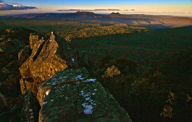
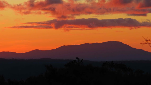
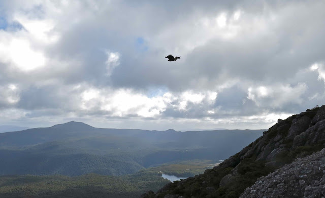
Victoria and Albert in the distance
“How long does the book say it should take us to climb it?”, I ask as we near the parking spot for Mt Albert.
“Two hours.”
“Oh. Swear.”
We have one hour’s light left. We can’t undertake a venture of possibly four hours if the book’s right with those statistics at hand. I slam on the brakes and do a U-turn. “Can you check Saddleback? Should be page 32.”

“One hour.”

“OK. Let’s hope we cut the book time as normal.” There’re still a few more kms to drive, and the sun will set in an hour. This is ridiculous, but I’ve just driven for two hours, so I am intent on summitting something.

As we approach Saddleback, there’s a tree over the road so we have to walk from there, adding time to the ascent. Great. At least we’re underway, and I note with a little dismay that the cairns are as subtle as cairns can be, and the “track” is even subtler. We will be descending in the dark for sure unless we work miracles on a speedy ascent, and I don’t like my chances of finding these cairns in the dark. My husband has coordination problems. Is he going to be able to clamber  over these big rocks in the dark?? These are questions to be dealt with later. Right now I have summit-angst and press towards the goal with my hapless husband in pursuit.

The gradient is wonderfully steep. What a fun mountain. We go straight up on all fours – but not for long. After 22 minutes I am cresting the flatter section at the top. Good. We may make it in the light yet. Unfortunately, however, B has dropped behind on the steep part and then got lost in the confusing section on the plateau, so I have to go back and dig him out of the thorn and scrub maze in which he had got himself entangled. More precious time lost.

Arthur
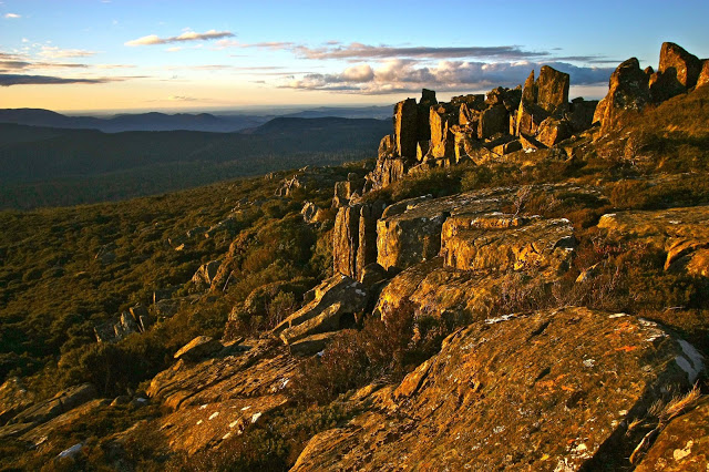
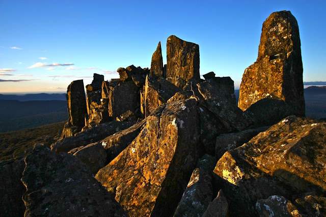
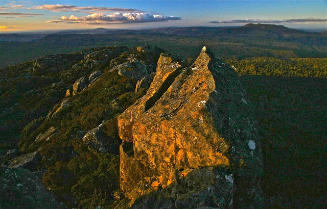
Once it was flatter, however, he kept up and I slowed down, and we managed to mount some wonderful, dramatic rocks that would serve as a summit for him while I went on to the real one that still lay about 200ms further on (in length, not height).
Now it was my turn to waste precious time. I went to take a photo of where I was leaving him, which had wonderful views to the east and north, and realised that I had on my telephoto rather than my wide-angle lens. Stop, change (I had brought up three lenses). I kept taking photos … more time lost. Then, while forging on to the monstrous real summit structure, my camera jolted, just a tap, but the lens cap and polarising filter flew off and down a crevice. More time lost while I searched. I ended up spending far longer on the summit than intended, although even so, not nearly long enough for such a worthy mountain, but by now the sun was setting in earnest, and I still had to get my husband out of this rock and scrub maze.

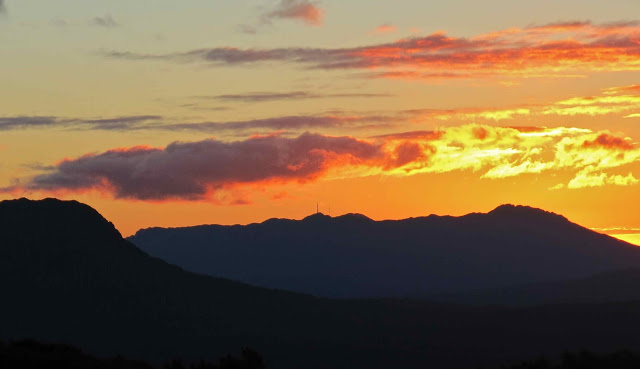
Barrow and a small bit of Lomond
 The forecast for Cradle was minus four over night; even Launie was expecting minus one. This was not a night to be trapped on a mountain. Haste, haste. But the sunset was sooo beautiful. I collected B and we began our way down, but I just had to stop while we were still high for one last series of photos after the sun had slid behind Lomond and Barrow, leaving behind a sky of gold, and Arthur became a purple silhouette with pink background. Even if we did have to stay the night up there, I decided, it was worth it to witness that particular sunset.
Bruce looked a bit impatient as I clicked away. Had I forgotten my great urgency? Well, it was a case of “might as well be hanged for a sheep as a lamb”.  There was no way we were going to get down before dark – it was basically dark already – so why not at least take a few photos? He wasn’t exactly in a position to criticise me for holding him up, and soon enough we were on the treasure hunt that the trip down became – each cairn evoking a cry of victory as it was found. The dark grew darker, but I kept managing to find the next cairn. I was immersed in a world of extreme concentration as I read the bush for signs of usage. There was, however, only one spot where I was in doubt, thinking the land looked better to the left than either down or right. At that point I consulted my gps device for the first time, and a retracing of our tracks dictated that we should go slightly right instead, continuing to drop contours steadily. We obeyed my screen.
We did have head torches, but chose not to use them, as we didn’t want them destroying our night vision. They were there for a worst case scenario. On we went, until my victory cry. There was the road. High fives; smiles. Oh what a great adventure that one had been !!!! Bring on the next one.
Another two hour drive home made for a late dinner. I like at least a 1:1 ratio of driving to exercise. This trip was even worse than 2:1, but no matter. We love a grand adventure, and Saddleback provided that for us, for sure.
Bruce commented later: “I wonder what the doctor who told me to stick to flat surfaces with a handrail would say to that one.” (He has Parkinson’s disease).
“He’d never catch up with you to do the saying”, was my response.

Tyndall 2013 Sept

Mt Tyndall   7-8 Sept, 2013

A cold start to a wet mountain

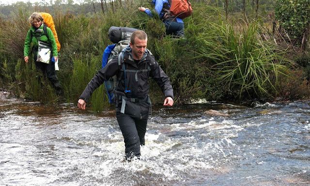
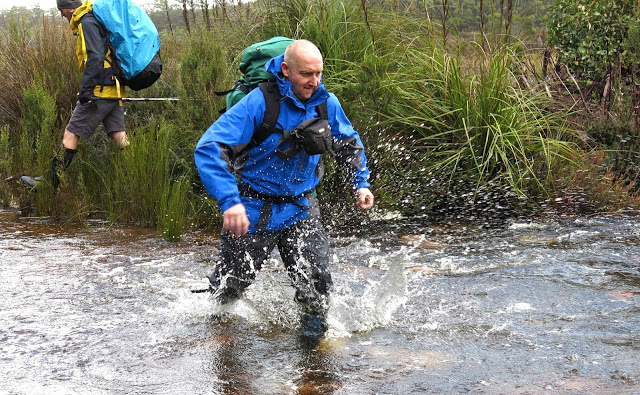
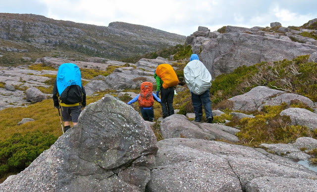
The day for this summit attempt began with a chilling wade through a swollen creek, after which I really needed to be allowed to move at a pace that kept me warm, whereas the others wanted to take the incline at a pace that would have had me shivering to death. The leader agreed to let me do my own thing so I could keep warm. As a result, the first day of this trip, which included, at last, a summitting of Mt Tyndal, was done solo. Luckily I had my gps for the summit, as there was a total white-out, with snow blowing all around me, and only it could confirm that I was standing in the right spot (and only it could guide me to the spot, as I could see nothing but snowflakes).

I returned to our designated camping spot and ran on the spot and danced to keep warm until the others returned.

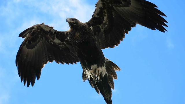
An eagle was my lunchtime companion – but it looked to me as if I were to be the lunch.

I have NOT used zoom on this guy. He thought I was a lamb, I’m sure. I have another photo of him just above me, staring straight at me, looking poised to attack.

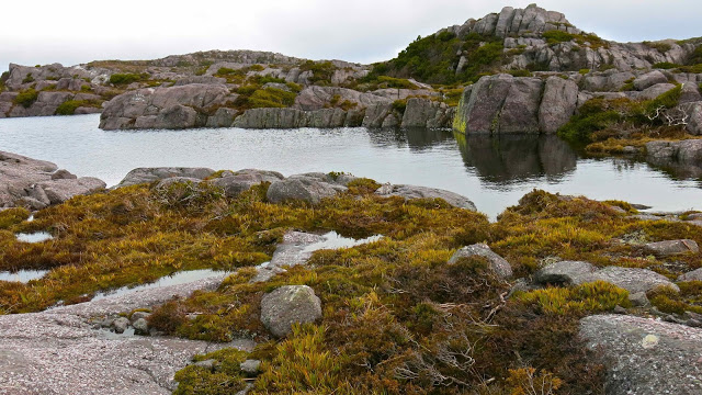
We camped near here.

Colourful beetles


View from near the summit
The others returned soon enough, and we began to prepare our meals together (those of us who could stand being outside),  huddling around the gas flame of the cooker, pretending it was providing a greater warmth than the flimsy requirement of boiling three cups of water. I did a bit of dancing to keep from freezing into a solid block, and was hugely appreciative that our coordinator boiled extra water for me, so that I didn’t have to fight my stove with hands that weren’t really working any more. Had she not done that, I would have just contented myself with snacks for dinner – not nearly as nice.

 Next morning
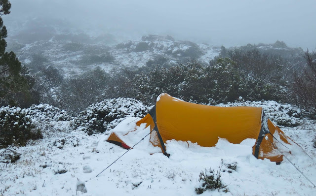
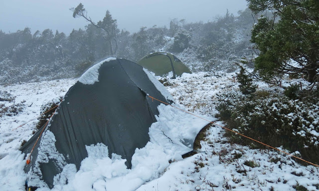
We retired to bed early, as after the eating, there was no more point in standing around getting colder while the snowflakes fell around us. My feet had been sopping and frozen all day from the first river crossing – about five minutes into the walk – so I was quite busy in my tent, massaging them to try to restore some life, and then doing a series of exercises to warm up my torso: glute raises, bicycles, crunches and more. After three and a half hours of concerted effort I was warm enough to try sleep. Success. I slept for four hours, but then woke up cold again, so repeated the procedure for a couple of hours, dropping off again at about 4.30. Considering how cold it was, and that it snowed all night, I thought it was pretty good to get even that much sleep. I wasn’t expecting any.

The snow next morning was beautiful, and duly photographed, before the dreaded job of depitching had to begin. Why dreaded? Because I would need to don saturated, snowy socks and sodden, icy boots and drenched, unpleasant gaiters in order to do the job. It was not a joyous occasion.

The next hour and a half were not the favourite moments of my life, and we’ll leave them without much comment here. We got there in the end, and could from the perspective of safety look back and declare it a marvellous adventure. That was my second attempt at Tyndall – both times in disastrous weather – so I’m very glad to have made the summit despite the blizzard. I want to return to see the view some day.

Pearse and Cleveland 2013 Sept

Mt Pearse and Mt Cleveland   Sept 2013

 Peak one of Mt Pearse
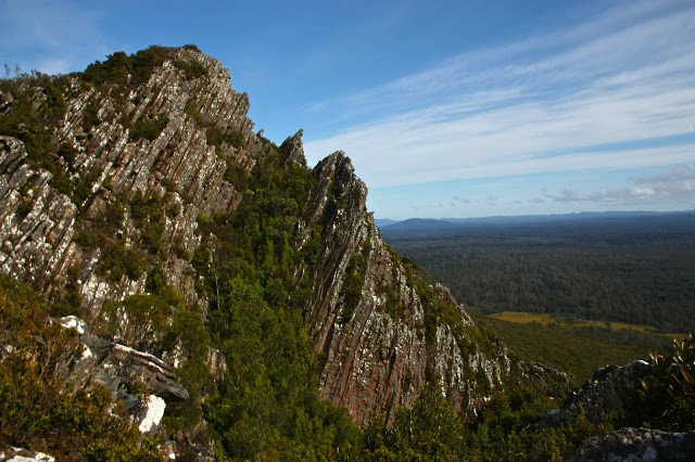
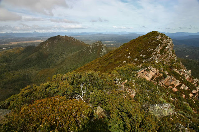
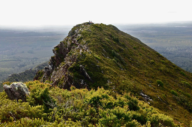
Mt Pearse was a wonderful mountain with a super ridge line. We began in lush rainforest, progressed to a short section of (doable) bauera scrub, and then began climbing through dry sclerophyll forest with stunted gums and low shrubs, up onto the ridge.  It was really dramatic once we emerged on top, with fine views all around. Enjoying the drop off to either side and the sense of space up on the edges, we went along to the fourth peak, which is said to be the summit (and which has an ugly, knocked-over trig lying like a dead animal that no one has cared enough about to give a decent burial to in the shrubbery), but climbed the fifth for the heck of it, and then got a higher GPS reading. Thus the old summit and trig do not appear to actually be the summit of Pearse, and the fifth bump with cairn has, it seems, outgrown big brother.
 
 Looking back along the ridge from peak four of Mt Pearse
 
 Looking to peak five and Rocky Sugarloaf
 
 Looking back to the others on peak four
By comparison, Mt Cleveland on the Sunday was a pretty boring mountain, with a road all the way and not much of interest to see at the top (particularly as it was a bit hazy). However, it was a great workout, as there was nothing stopping uphill movement apart from one’s own fitness, so I had a great time striding out, and enjoyed the fact that it wasn’t all over too soon, as is often the case. The road was very slippery from the recent rains, so we parked 1.2 kms lower than expected, which increased the workout value of the exercise. I was alone at the T-intersection at the top, decided the main summit would be to the left, went to the highest point visible on that ridge, came back down, went to the top of the peak to the right, saw that the peak to the left had an extension that went even higher, so went back and summitted that. A few of us did this cute bit of exercise, and enjoyed the extra exercise. It says something about the mountain, however, when I say that I took no photos on the summit, one at the T-interesection just to have gone click (now discarded), and two back near the car at a stream crossing. From this photophile, that is an all-time record low. But we are one point richer, and surely a bit fitter for having gone there.


Waratah Falls 2013 Aug

Waratah Falls 2013

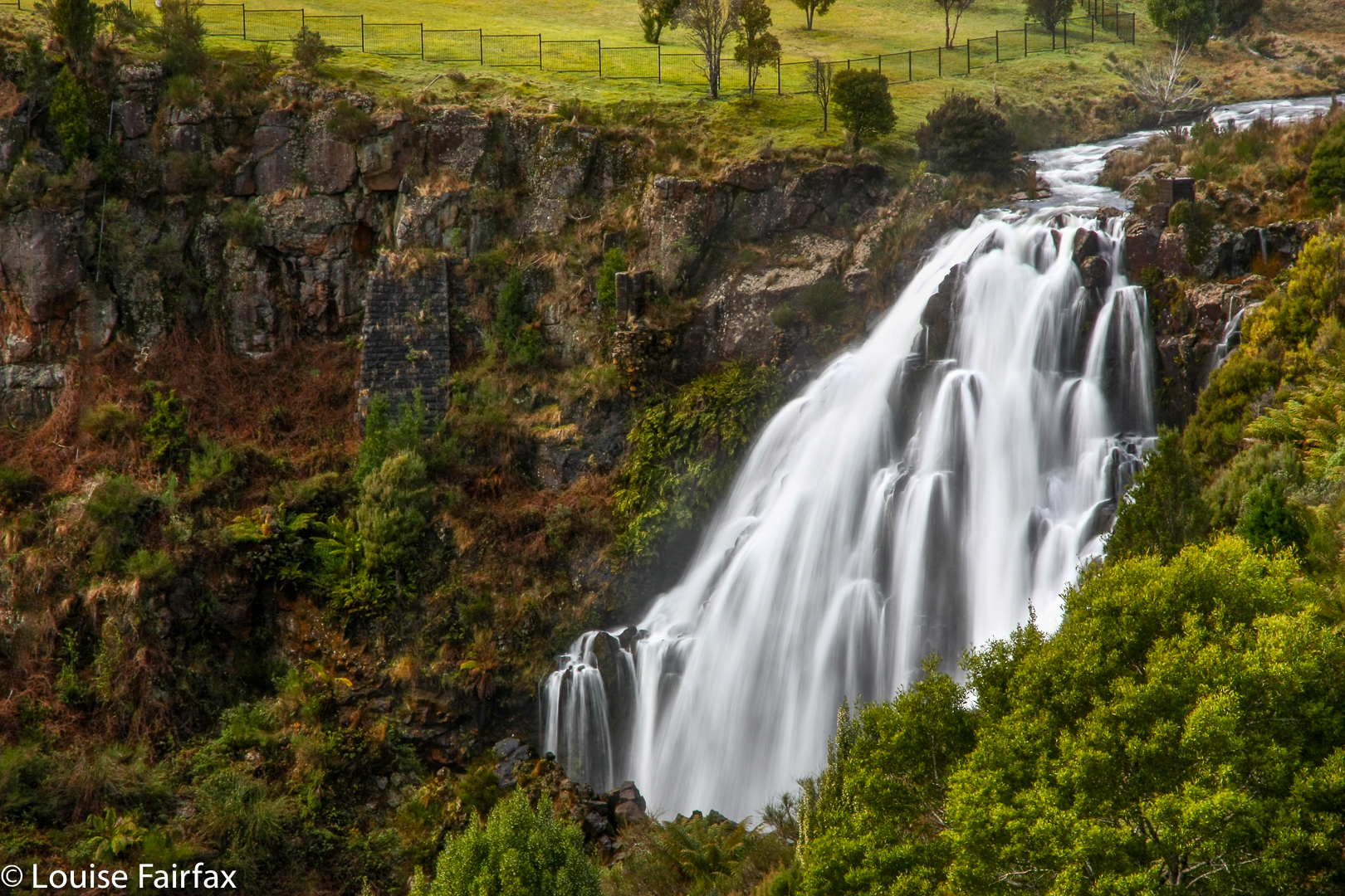
When I passed through the township of Waratah for the first time in my life in 2013 (on my way to Mt Pearce), I was not a waterfall bagger; I had not even heard of such a thing, but I did love waterfalls, so took a picture. I was also not yet a photographer. I did own a DSLR cropped-sensor camera, which I used for taking jpeg photos. Neither the cropped sensor bit, nor the Jpeg is conducive to giving an image rich in detail. We all have to learn sometime. Here is the photo I took.
I marvelled that a little picturesque place such as this could be doubly blessed by having a waterfall right in the middle of ‘town’ – and one that had not been crowded out and ruined by ugly viewing platforms and other concessions to the tourist trade.
I returned recently to photograph the base, but nothing was happening down there. I’ll have to wait until next winter, I guess.

Schnells Ridge 2013 Aug

Schnells Ridge  24 Aug 2013

Ever since the moment I first saw images of Schnells Ridge, over a year ago, going there and camping on top have been high on my wish list. The forecast for last weekend was perfect. It had been snowing all week, but the weekend’s prediction was for intermittent sunshine mingled with more snow. Perfect. I imagined my little tent up high, surrounded by white ridges, shining tarns below, and in the distance, the blue waters of Lake Pedder. The only thing wrong was that I would probably have to take up my compact rather than my SLR camera, as the weight of spare winter clothing, tent, 2 mats, sleeping bag, food, fuel, stove and more might break this camel’s back. If the weather was absolutely perfect when we arrived, then I’d carry the good camera around my neck, but there was just no room inside my pack for it if there was even a hint of rain or snow.
Unfortunately, the noble forecasters had changed their tune without consulting me. As we set out, I heard the forecast was now for rain. Both days. Oh well. We’d see when we got there. Out we set from Launceston for the big drive south.
The forecast was unfortunately accurate. The big camera stayed in the car. Off we set into the clouds, drizzle threatening to break into fully-fledged rain at any second. We were about to climb, so I resisted wearing my anorak.
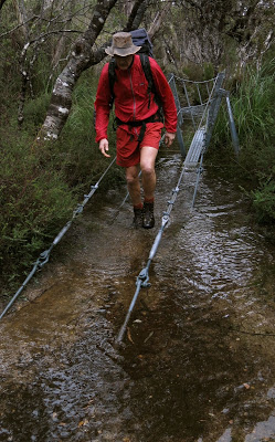
The track was a pathway of water, across the windswept moor, and a group of us went walking, sliding, paddling, and a group of us went walking, up to the Schnells Ridge door. Before we reached that “portal” (a high point on the track where a sub-ridge emanating from Schnell’s main ridge connects with the Judd Lake track), we had to cross the Anne River. Luckily there is now a suspension bridge there. The water gurgled along about five centimetres below the steel hatching. With more rain and snowmelt, I wondered what the level would be like tomorrow, and how strong the water that should be covering the bridge by then would be. I practised for the worst-case scenario at the end of the bridge by climbing the railing so that my feet were on the first handrail, my hands on the second. It worked well. My technique was needed anyway, as the river had burst its banks, and we had quite deep water to wade through on the other side. By climbing up onto the handrails I was able to ward off the evil moment of submersion for a few seconds longer.
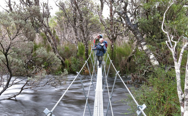
We were obviously quite precious about our feet on the way out, as the split for the car to end-of-path was nearly twenty minutes longer than the split for the same section on the way back, when we were arguably tired. Before we left the path, we grabbed a quick bite, as the ground on the path was relatively dry, and it was not raining just then. It was far too early for lunch, but we had driven from Launceston, so were on a special kind of adapted time-zone arrangement. I had eaten breakfast at 5 a.m., so that justified an early meal.
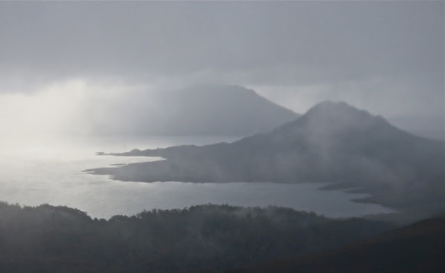
Reports I had read about the ridge leading onto the main ridge always made it sound thick and difficult. I found it very easy going, with hardly any resistance from vegetation (a bit of mud slipping every now and then). As it was now raining properly, I had my anorak on, so tried not to move at a pace that would have me sweating. No problems. I was lucky: while waiting a bit for the others so we could regroup before disappearing altogether into the thick grey gloom, a brief moment of vision flashed into the sky. I quickly grabbed the opportunity to shoot the monochrome scene on my compact. Mt Solitary disappeared as quickly as it had come into view. The others had missed it, as their eyes were turned forwards and upwards. On into the now darker mist and up into the area above the snowline. Loose snow. We sank into it, thigh deep, goose stepping our way forward to the top.
There were now two of us at the front, and we waited for the others behind another rock, sheltering from the now very strong wind. We had reached the top of the ridge. Off we set to touch the high point, and then continue our way along the ridge to eventually circle around and drop down again in about two kilometres’ time.
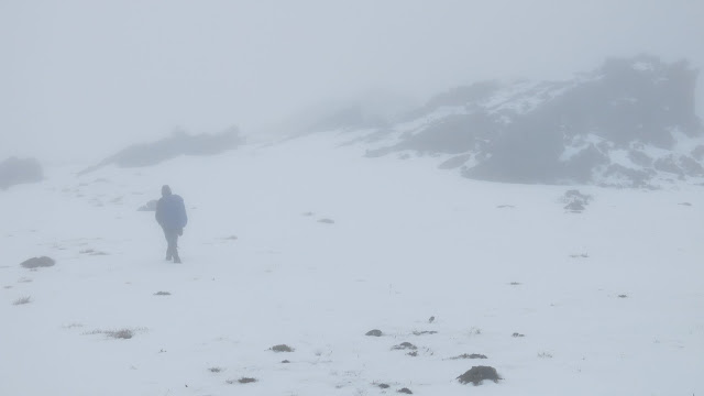
We could barely see each other through the thick mist; we were also very wet by this stage, and the wind was whacking into us, driving the snow into our faces. One of our party had already been dropping back; now he started stumbling a bit. We hid behind the next rock to discuss what we should do. It was way too early to set up camp (it was only about 2 p.m. at this stage). We didn’t think this struggling member could hack another two kms of goose stepping through soft snow with wind mercilessly attacking him. Setting up camp at the other end had decidedly lost all appeal (whilst waiting, I had run the video through my head of struggling with the tent pole while the wind tried to blow my tent straight down to Judd below; stripping off my wet clothes in that restricted space; dealing with the high levels of moisture at ground level, and more. Not one scenario sniffed of pleasure). Camping at Judd Lake was not an option – pitching in the middle of a mud swamp. We all agreed to retrace our steps and descend.
It was a great training exercise, carrying all the gear for a full winter sleepout up that incline. The whole exercise took five and a half hours’ walking, with nearly seven hours of having our heavy packs on our backs (it was just too wet to put them down apart from the brief lunch break and an even briefer afternoon tea. The other non-walking time was spent in photography and waiting for the others. There was no scenery to admire, and it was too cold to be stationary, resting.)
We drove back to Launie, with enough time left for hot showers before bed.
So, now I have seen Schnells ridge, but have yet to see the view. Next time, hopefully.