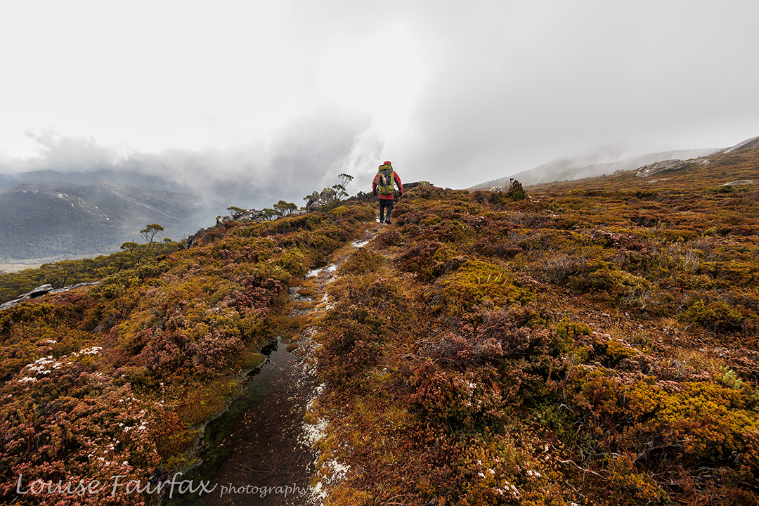
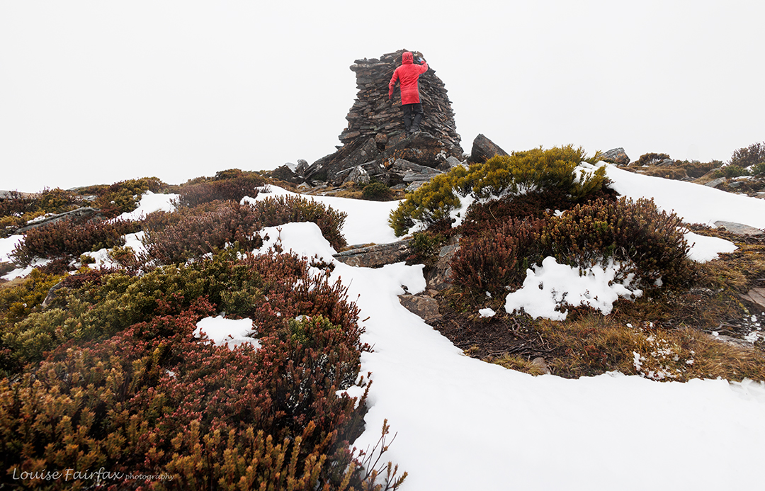
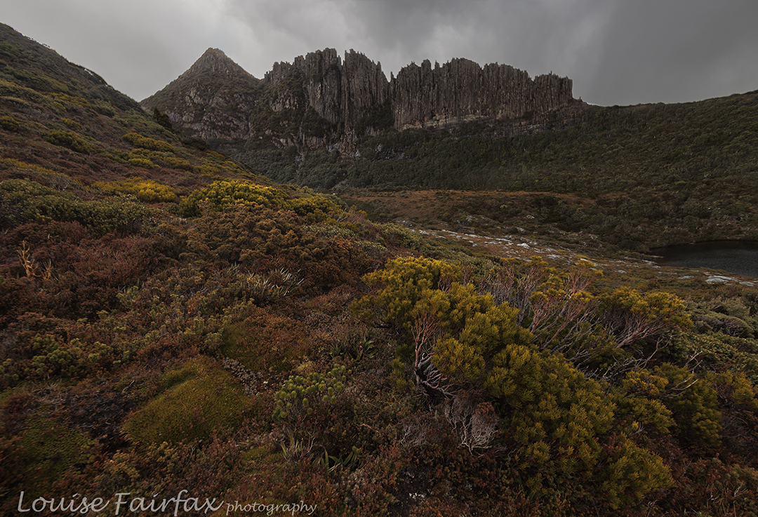
My bush buddy Andrew wanted to summit Mt Rufus to add to his Abel collection, and I wanted to sleep up there to test out a new snow tent I’d bought that is free standing. It was a deal.
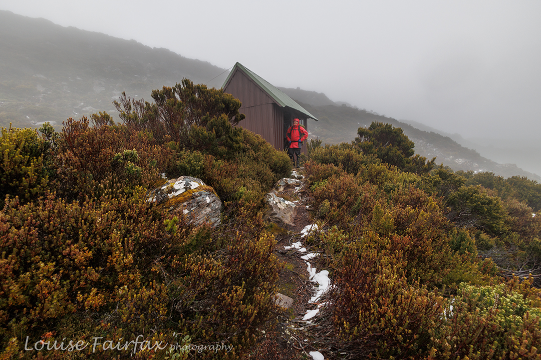
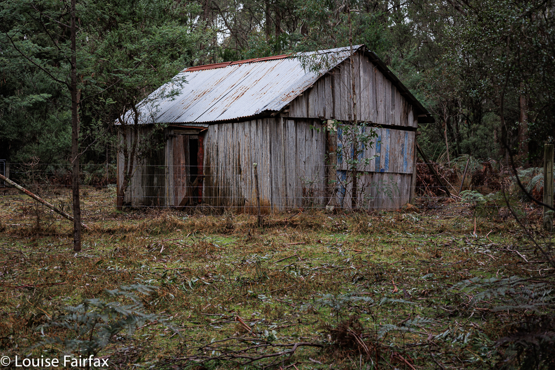
Popping in to inspect the Gingerbread Hut
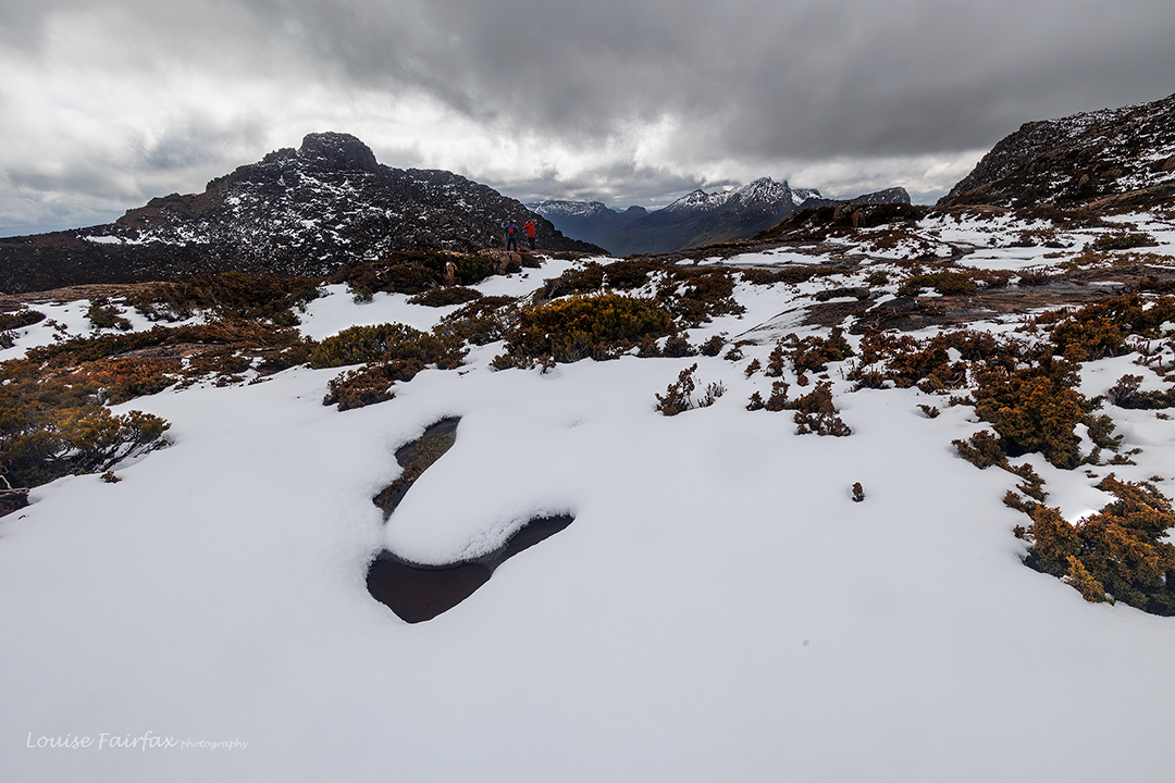
Andrew would also give his own snow tent a bit of a workout. It’s good to make sure you’ve got the routine in order at least once a year. The fact that it was actually snowing a bit on that day made it all a bit more realistic as we climbed. There was a slight problem in that the whole mountain was several inches under water. Who feels like camping in the middle of a lake? Hm.
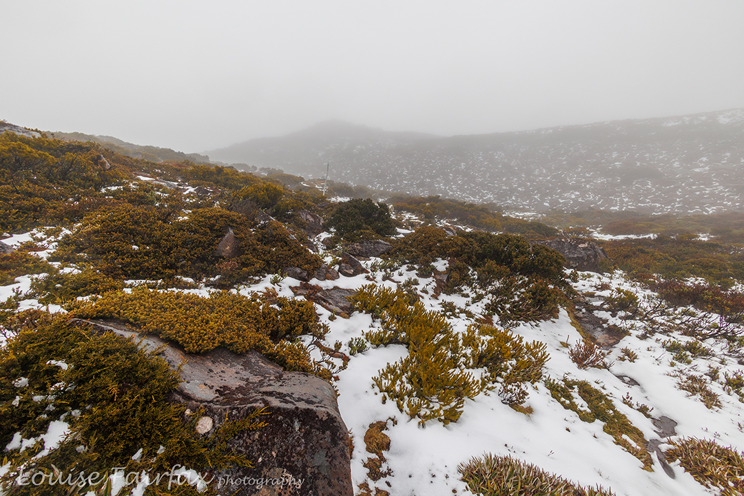
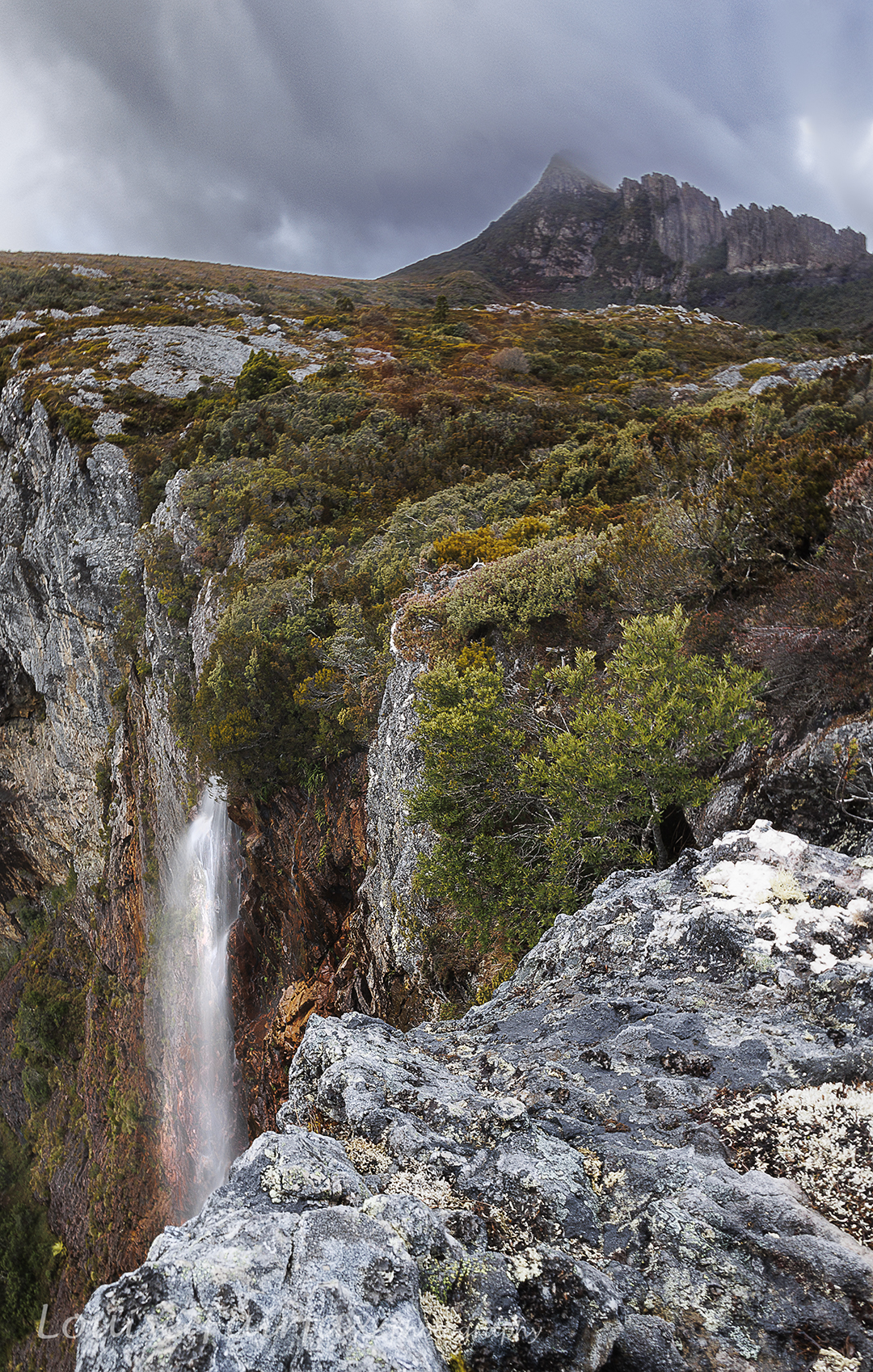
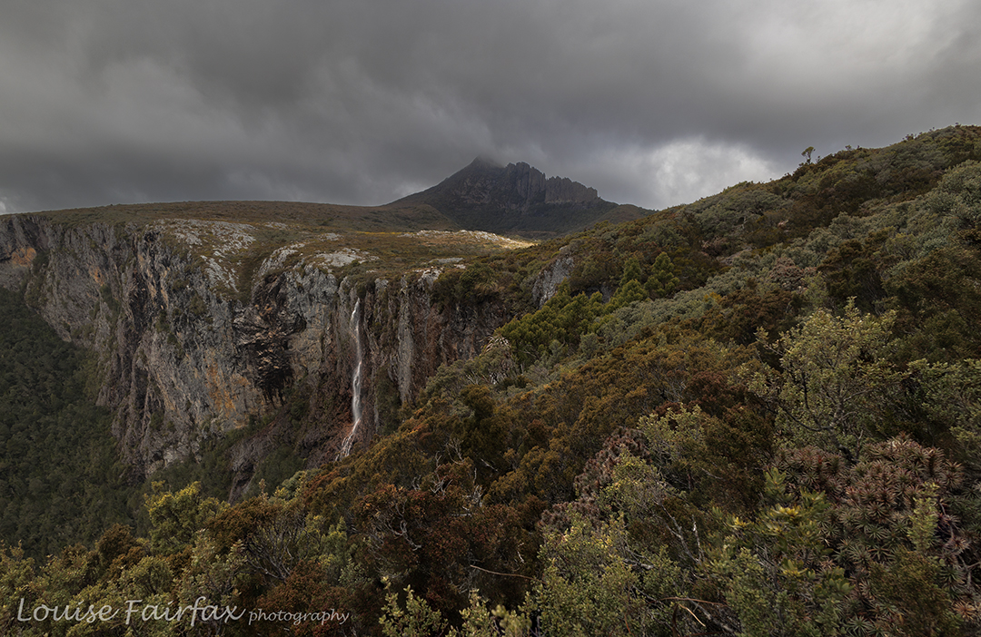
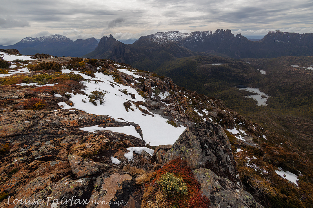
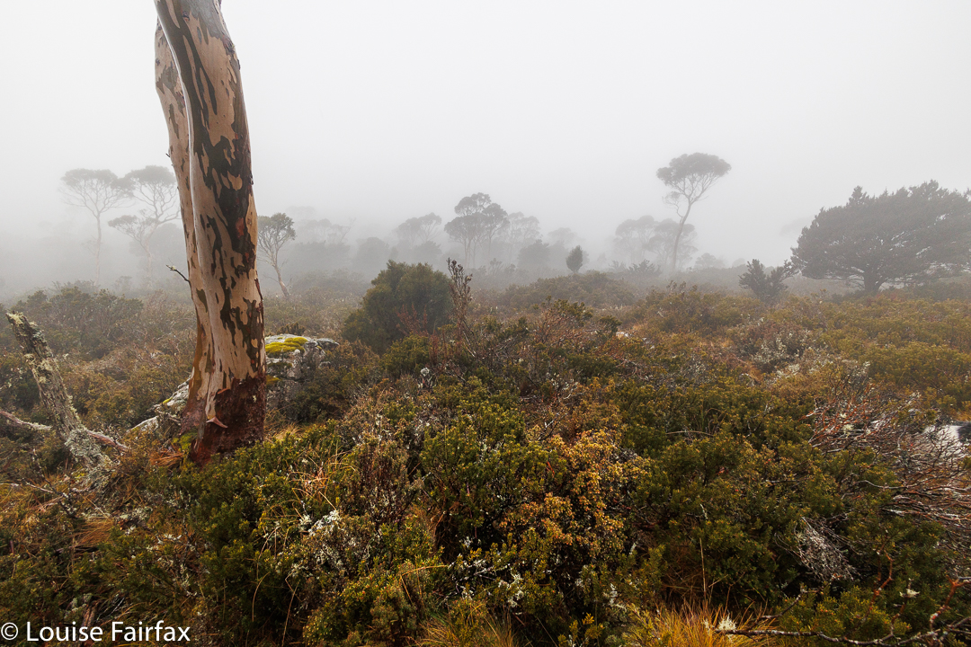
Exciting, expansive vistas … but it was very atmospheric (albeit cold).
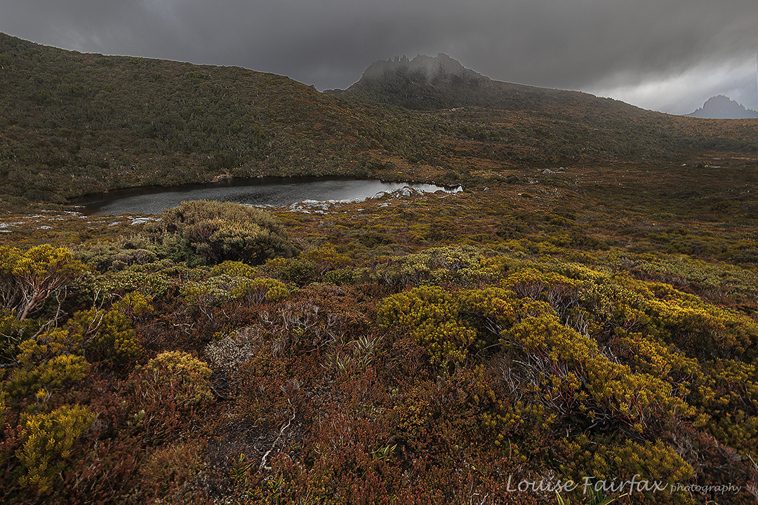
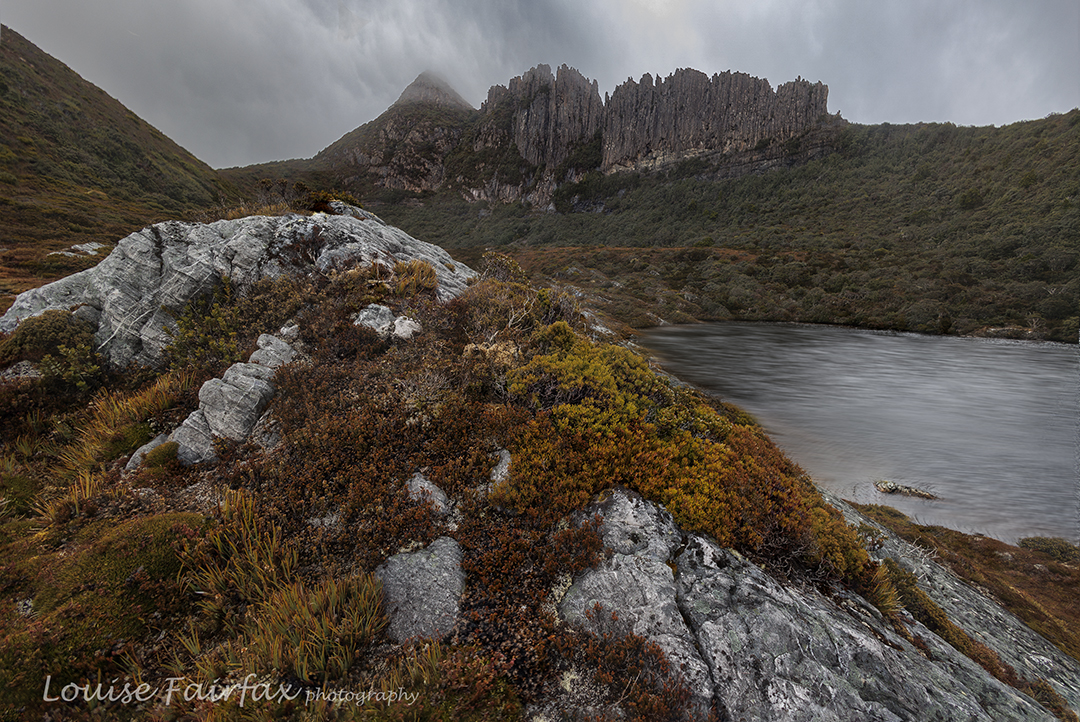
I had camped up on Rufus in 2014 (http://www.natureloverswalks.com/mt-rufus/ ) for possibly the equal coldest night of my life, but wanted to do it again to update my photos … hopefully improve on them. Unfortunately, the weather was gloomy, grey, and full of moisture, and the wind howled menacingly.
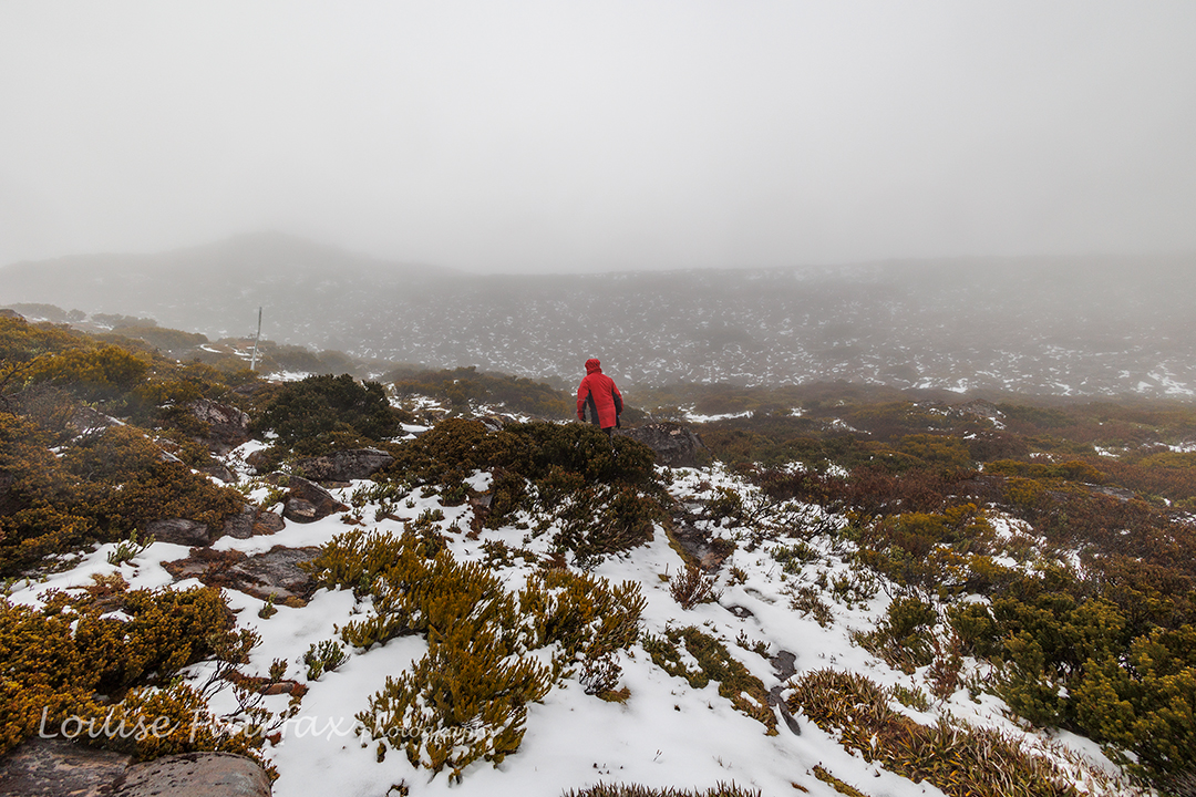
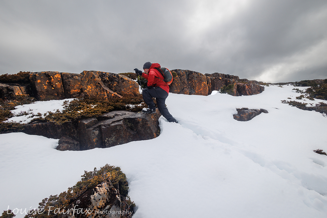
Andrew nears the summit
It was neither an evening nor a morning to tempt me to any photography, so I need to try again. I am beginning to think that if I lug my tripod up a mountain to photograph the dawn, then that almost guarantees mist and a grey start and end to the time up there.
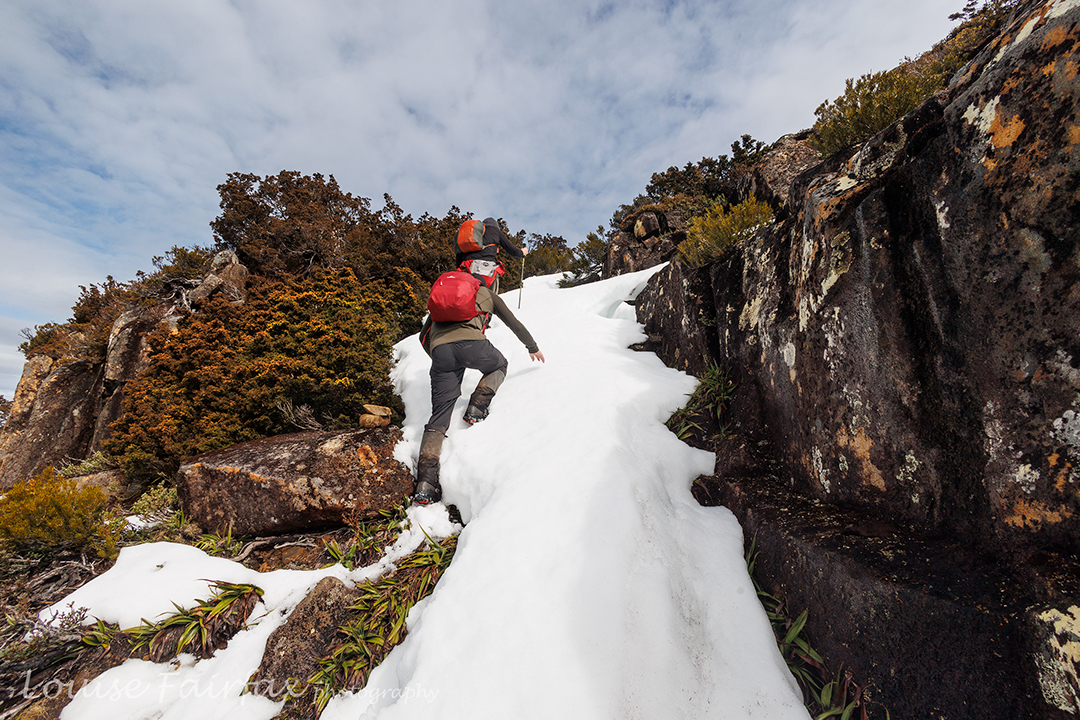
Summit touch.
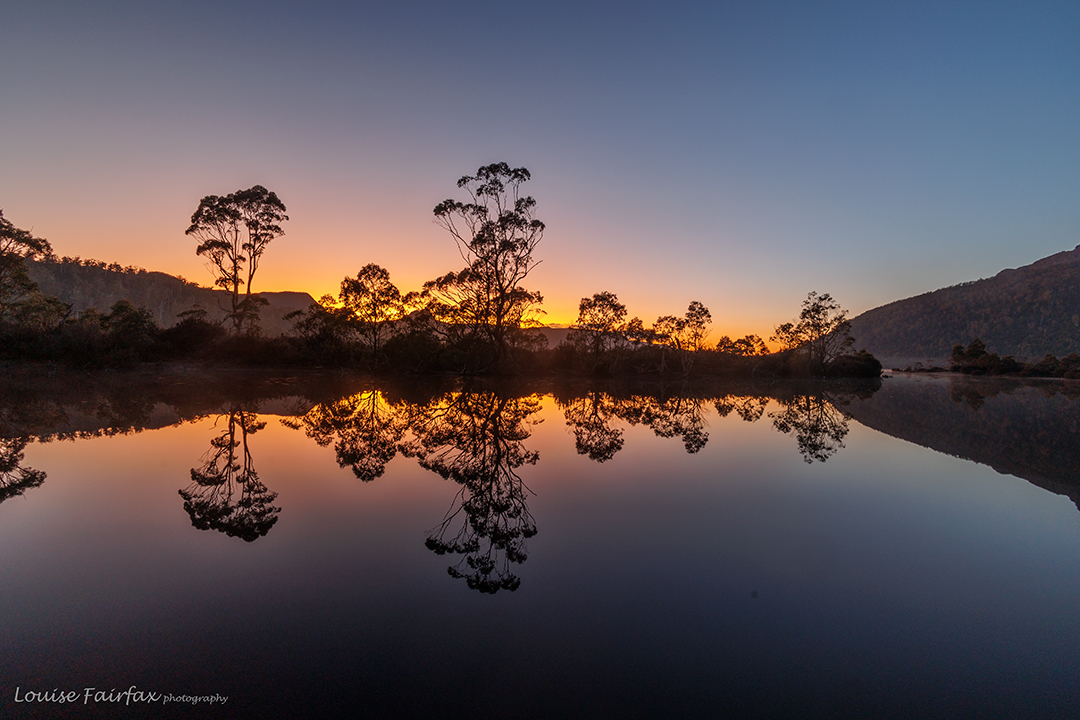
So, I can’t offer you glorious or even half-interesting evening or dawn scenes. However, the journey was still fun, and above are a few hints at the whole.
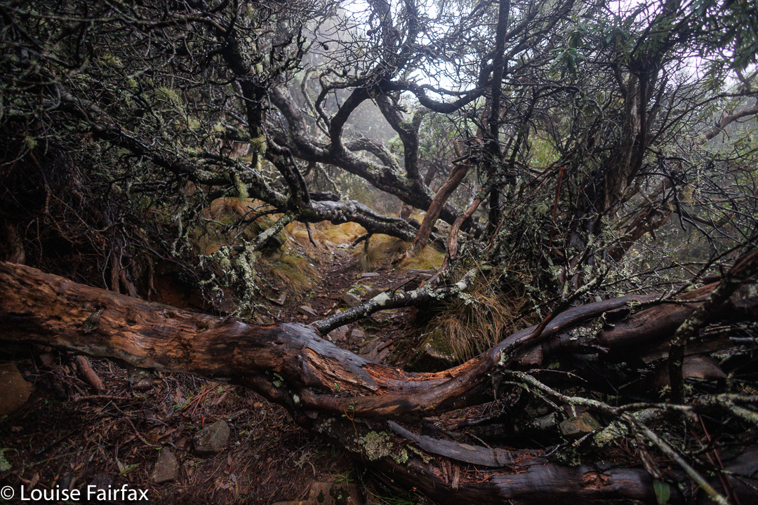
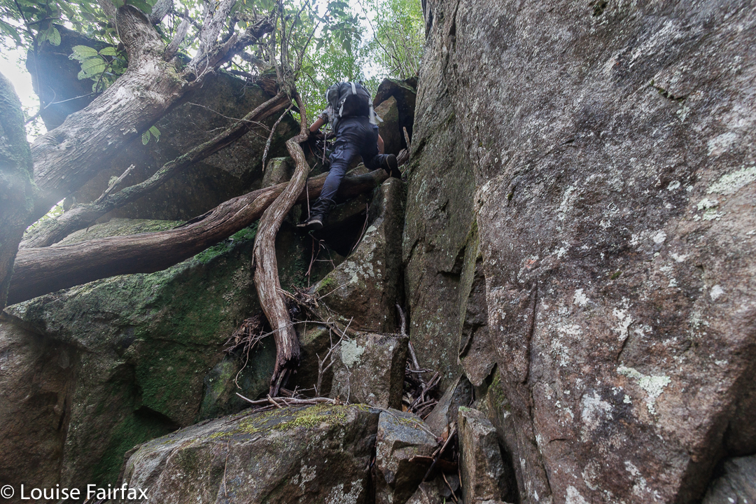
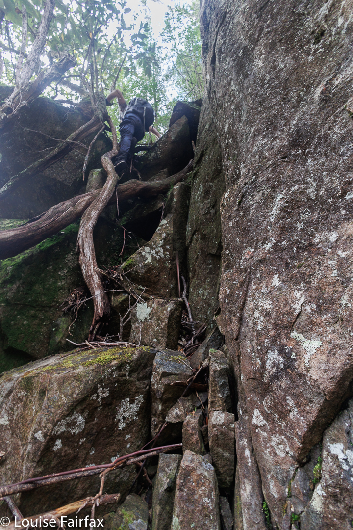
The first time I climbed I used the longer track which goes past Shadow Lake. The last two times, I have used the Gingerbread route.
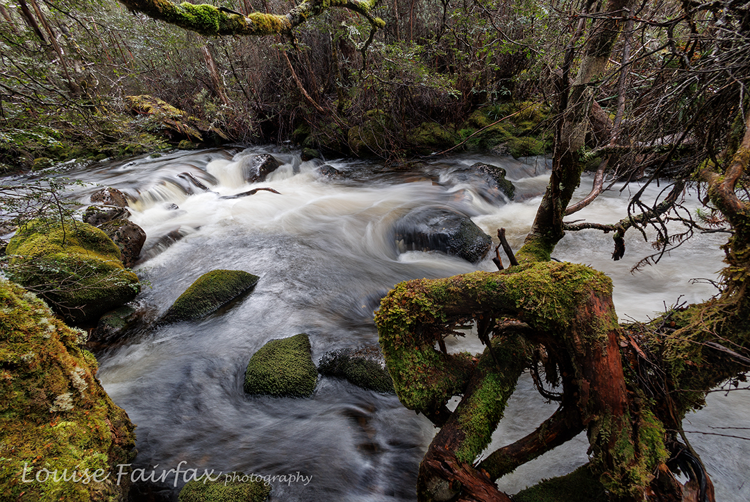
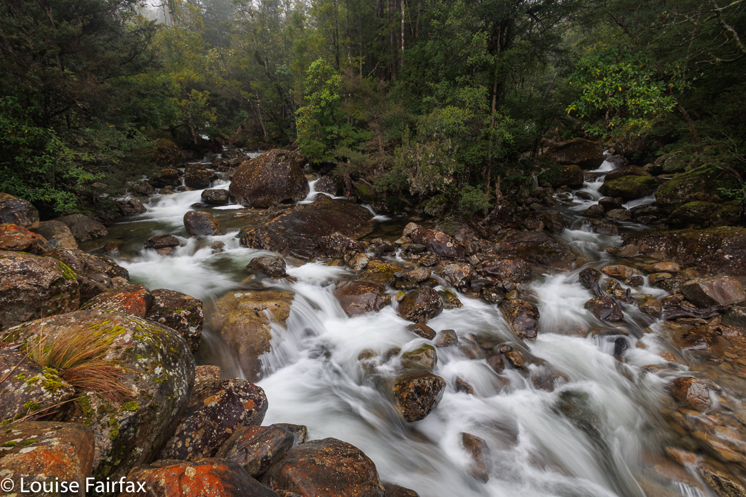
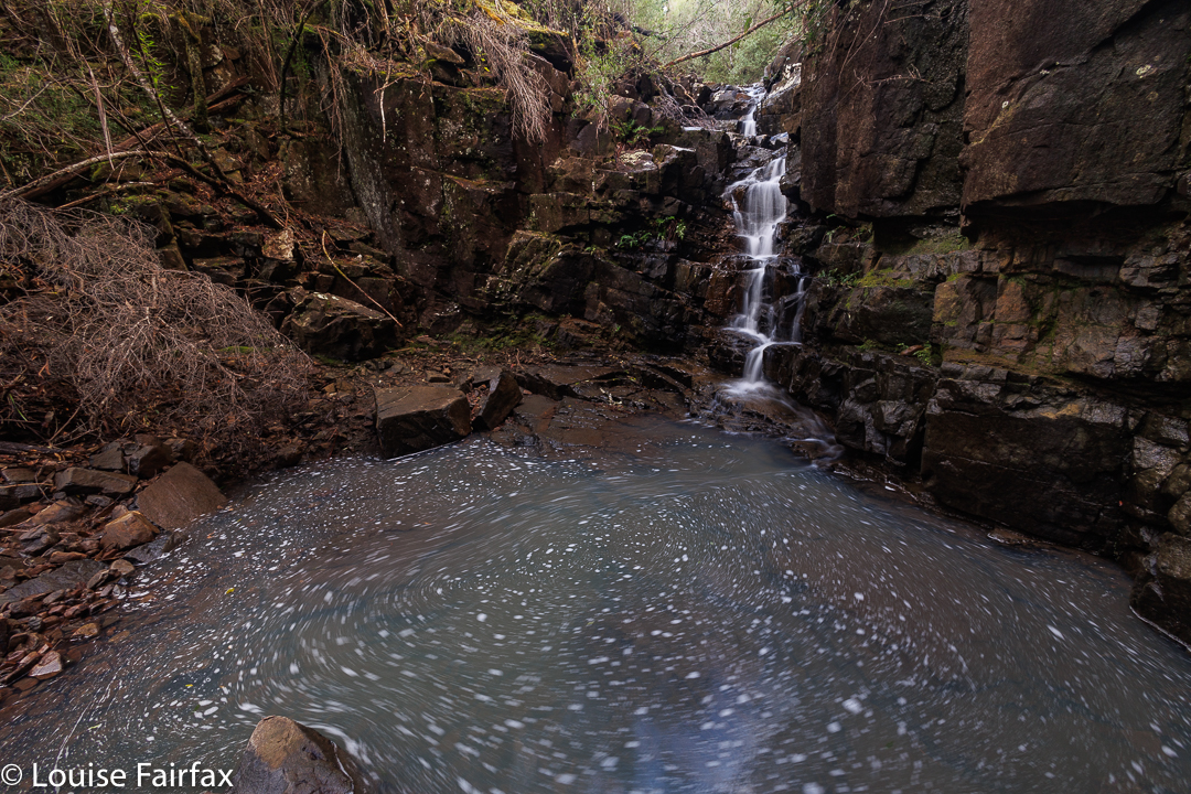
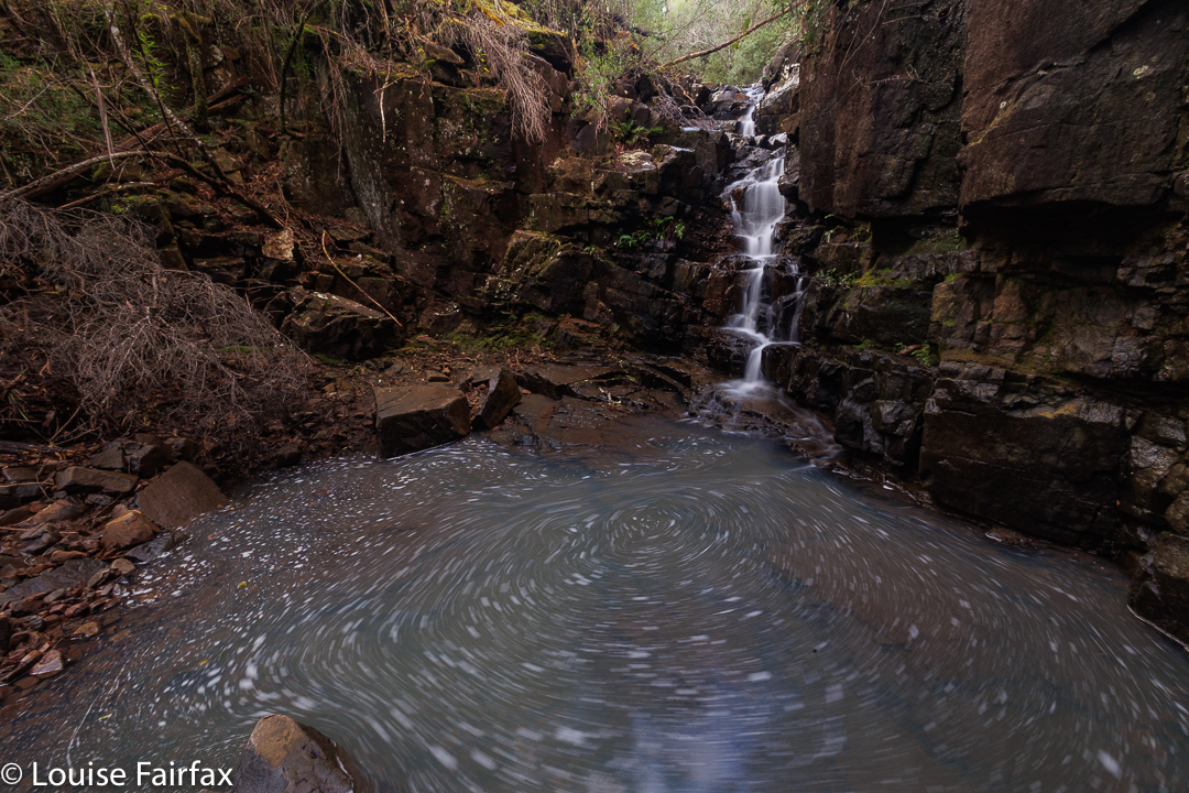
Navarre River
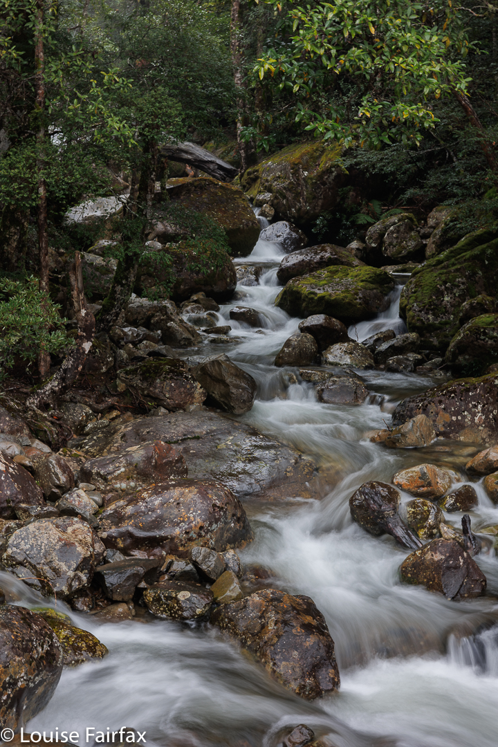
Back down the bottom the next day, the Navarre River was pumping. Last time I was up there, I visited several waterfalls high up (http://www.natureloverswalks.com/rufus-and-navarre-falls/),
and we had toyed with seeing them on the way down, but the weather convinced us that we’d rather just make straight for the exit. We were looking forward to coffee and pies from the Hungry Wombat.
Angel Falls, near Mt Sarah Jane, are best seen after good rain. I decided last Wednesday was my day. The weather map predicted that Tuesday would be cloudy with maybe a little rain, Wednesday perfect, and Thursday and Friday back to rain.
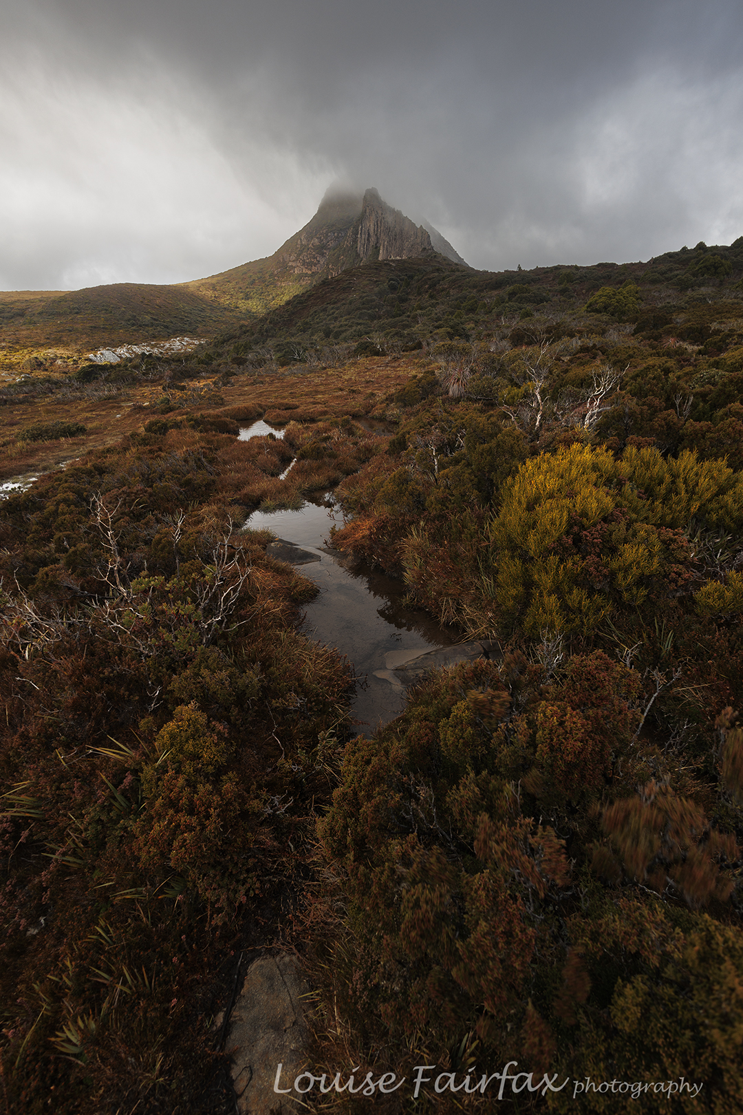
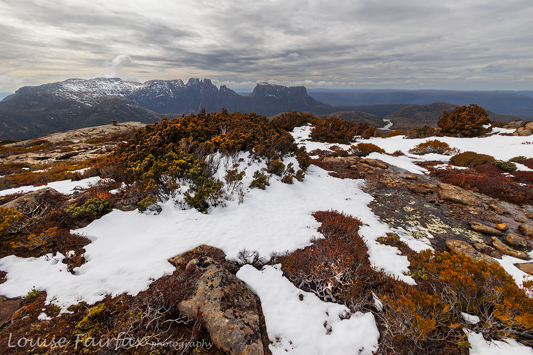
Getting near the top the clouds started getting quite dark
Living in the north, there is no way I can drive down on the day I want to see the waterfall. And, if I am driving down the day before, then, it makes sense to lug my tent up the mountain and sleep there, all ready in position for the morning’s splendour, and enjoy sunset and sunrise from on high. Maybe I can even get in some astro photography too. That would be great.
Tuesday was, as predicted, cloudy, but it wasn’t raining. I drove my dog to Hobart, gave her a walk, had lunch and then continued on to the South West. I was carrying a tripod and three days’ worth of food and gear, just in case it was so lovely that I wanted two sunsets up there. This made my pack rather heavy, so I was thrilled to only take 3 hrs 15 to be breasting the top of the climb.
Dark clouds brought out the colours
Bam. The wind punched me in the face. Hey; this wasn’t predicted! The clouds got darker. The wind was gale force up there so I dumped my pack and spent an hour searching for the perfect spot, which had shelter from the blast and a view. It didn’t exist. In fact, I couldn’t find anything particularly tolerable, so chose a spot that had access to water and a tiny bit of shelter by being in a bit of a hollow. Anyway, as there was no view to be had, that didn’t matter any more. So much for the sunset and astro photography.
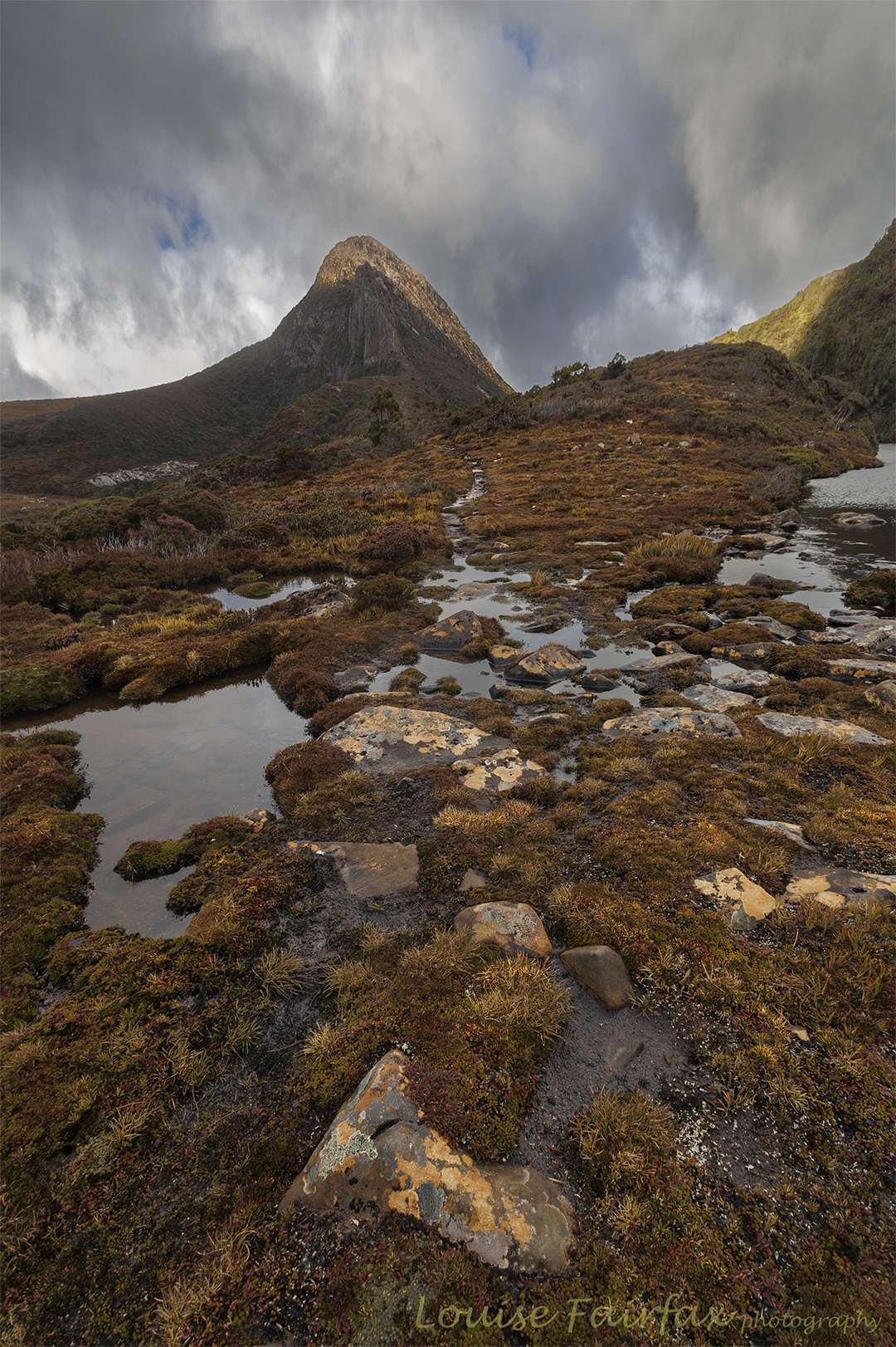
Mt Sarah Jane from “behind”
I tried to pitch the tent, but the wind kept ripping out the parts I had attempted to secure. I finally got it up, tightened the guys and crawled in to get out of the battering. It was such a relief. I wondered if I was going to get a match lit to cook with, but in between gusts I grabbed my chance. Whew. I was hungry.
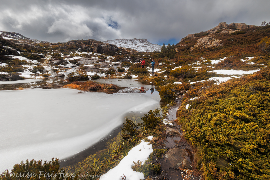
A pretty tarn along the way
That night I did not get much sleep. The gusts were loud and destructive. They ripped a peg out so my tent started flapping badly. I went out to re-place it, and added my snow pegs that I’d also brought up for extra stability and anchorage. I started making plans for what I would do should the tent blow down. I know I am not capable of repairing a tent in a gale without help. Plan B was to abandon the collapsed, bucking tent and begin back down the mountain by torchlight, leaving everything else behind. I also know from experience that you can’t find anything if the wind collapses your tent, as each gust just throws everything around. So, I donned what I would need to wear if escaping down the mountain. I even wore my torch to bed so I could find it with no searching.
I love her pointy backside
The gusts became less damaging at about 2 a.m., and I was able to get in a few hours sleep before waking at first light, which had very little light to offer. I could not even see my mountain, the mist was so thick and the clouds so grey. Where was this perfect sunshine I had been offered? The wind was still uninvitingly strong. Time to doze some more. At 7 a.m., I decided I might as well eat breakfast, but I was not going out in that. It started raining. I ate. By 8 a.m, I decided I might as well get out and do what I had come to do. The day was not in any hurry to be nice to me.
More love
So, off I set into the wind and clouds. Some photo this would be. It was hard to even hold the camera steady. Lucky I had my tripod. The light did make the colours very beautiful, and I got used to the wind. Although this is my third time up there, this is the first time I have had the liberty to properly gaze at Sarah Jane. She is actually very beautiful. When I climbed her in 2015, I neither saw her nor the view. When I passed by in 2016, my focus was on our goal of Lots Wife. This time I gave her the attention she deserves.
Angel Falls where I popped out, nice and close, but I was too scared to look over the edge in case the wind gusted. I sat down to take this photo, keeping myself very low.
I had all day and was in no hurry. I just ambled along, enjoying myself now I was getting used to the wind and the gusts were not so bad. Navigation to my goal was not challenging. I popped out of the scrub just above the spout. The spot does not give a brilliant view of the whole waterfall, however, and I could see where I needed to be to get the angle I wanted. It was maybe 80 metres away.
I took over half an hour to reach this spot, as the slope is severe and the penalty for slipping over the edge, infinite. The bush was excessively thick. I couldn’t even see where the edge was and was not in a mood for experimenting. I have seen people fall many metres by taking an extra step that they thought was onto ground but it was just greenery that looked like ground and gave way beneath them. I would fall a great deal more than “many metres”.
The whole falls seen by climbing a tree.
So, what did I do? How did I get a view, especially considering my big height disadvantage? I climbed a tree, of course. The photos you see are taken by me up a tree, hanging on by one hand and attempting to hold the camera still in the continuing gale with the other. I was many metres above the ground, so my tripod was to no avail.
Back at the tent, I had an early lunch, still waiting for the day to improve. I packed up, still waiting. There was no point in staying an extra night, and, besides, the wind meant the next night might be just as sleepless as the previous, so down I went, back to the car, real food, my dog and my Hobart family. Gussy and I had a lovely night reading together and doing wordle and square word. It was so soothing to have warmth, shelter and loving company. I seemed to eat rather a lot of ice cream.
Please note: The bucking tent I have experienced is not my Hilleberg. It was an Exped Extrem. I ordered my Hilleberg the next day, but the memory of that bucking tent will never leave me.
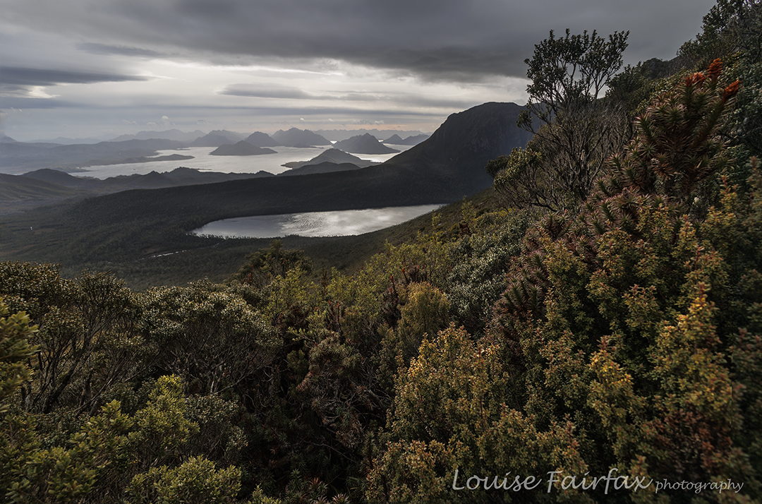
I love the Du Cane Range, and seek any excuse at all to go there. I have been planning a night’s sleep at its high point for a very long time, so when I saw its name on an HWC list, I was excited. It wasn’t the trip I have been mentally planning for myself, but it can wait until summer, and meanwhile, it would be fun to just be there again and climb a few mountains. As it turned out, I ended up going there with only two others, and the snow was so deep we didn’t complete our original plan of three mountains, but we sure did get to see some beauty.
Valley scenes by a sodden track
I broke two ribs a couple of weeks ago, and this was my first pack carry since then, so I decided to catch the ferry to Narcissus, and meet the others, who were walking in, at Pine Valley Hut. That would give me plenty of time to see how the ribs were coping with the heavy pack, and the afternoon to do some packless exploring after I’d arrived. The ribs were fine, and in the afternoon I took some shots of the flooded valley and then went up onto the Acropolis plateau where the wind howled and light rain fell. Valley and heights were ankle to calf deep with water from the recent rain. It was going to be an “interesting” trip.
Du Cane Range near Lake Elysia, climbingDu Cane Range Lower Falls
Three of us set out next morning for the heights, and I was excited to see the first snow before we’d topped out at the Parthenon saddle. Flippers would have been better than boots for getting around Lakes Cyane and Ophion, and, despite the forecast for just cloud today, light rain continued to fall, as it had done the day before. Lake Elysia looked magical in the watery mist, alternatively (and tantalisingly) hiding and revealing Geryon and The Acropolis. We stopped there for a snack and some photos before moving on.
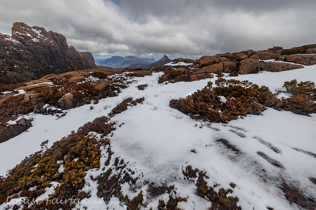
Du Cane Range .. getting higherDu Cane Range snowy scenes. Gould peeps out behind.
At some point in there, the force of the wind coming in from the west hit us, and I started to wonder about the sense of camping up high in the snow in this wind (our plan). Luckily Paul was thinking the same thing, and Phil agreed. Our new plan would be to camp at the Pool of Memories down lower and in a sheltered spot, and then try for our goal of Hyperion with only daypacks, returning to the gentle harbour before nightfall. We were already thinking that Eros would probably be omitted.
Geryon looking ravishing today. Paul and PhilHyperion from the shelf. Ossa behind.
Thus, when we reached the Pool, we dumped the heavy packs, pitched our tents in readiness for our later return, had an early lunch and then began climbing through the snow. This part of the day was absolutely magic. I took heaps of photos: the tale is one of beauty and vistas.
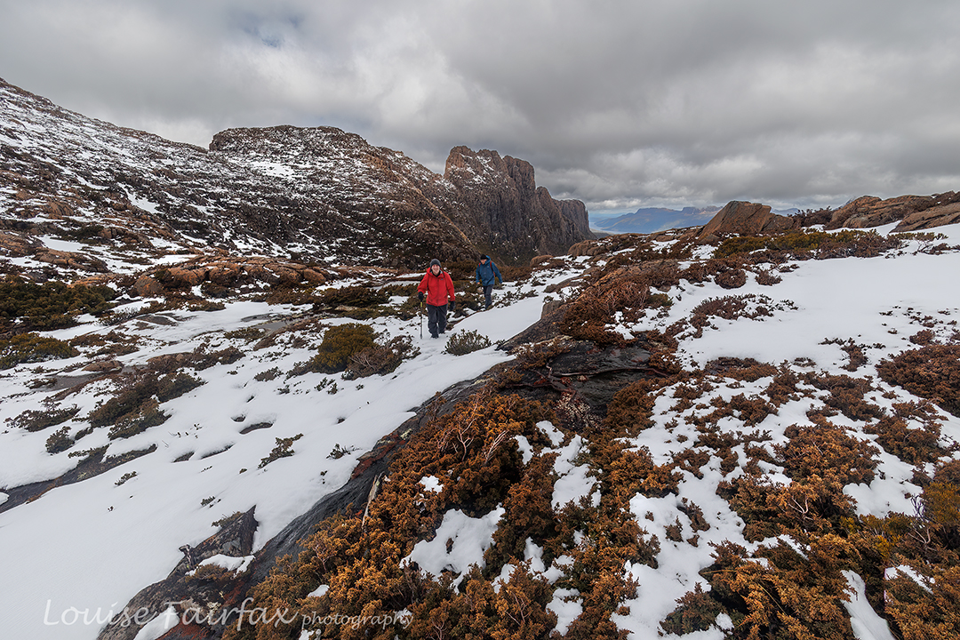
Paul climbing towards Hyoerion, Du Cane RaClimbing Walled Mountain
For me as photographer, plenty of action was required, as I had to run to catch up after each shot – kind of interval training – which is fun, but I did note the truth of the words that a photographer of this type needs to be a fit person. I enjoy the challenge: I mostly shot from behind and caught up; every now and then I went up ahead to get a front-on shot.
Walled Mountain near the summit
The third day was Walled Mountain day. This would be my ninth summitting of Walled, done this time in boring daylight hours, so I was tempted to skip it and just move on. However, I decided the exercise would be good for my fitness, so stayed with the other two. I am so glad I did!! It was absolutely wonderful up there, and nothing like the boring dull-light summiting I was anticipating. Descending, glissading through the snow, was a blast.
Walled summit to Du Cane HP, Geryon, AcropolisWalled to Ossa, Hyperion et al
On we went and then down to Pine Valley for a late lunch, and finally on to Narcissus for dinner and to sleep the night. I pitched my tent by the river, and listened to its soft flow as I fell asleep. Already by this stage, my feet, having been pretty soaked for all of every day, were starting to blister up. Day four would be agony.
Leeawuleena dawn; last morning
It was. I slowly trudged the distance, taking nearly as long as the advertised time I was so slow, but that pace gave me plenty of time to appreciate the extreme beauty of the forest, clothed in thick layers of moss, with a sparkling blue leeawuleena (Lake St Clair) beside me. I am writing this two days later, and my feet are still red, raw and swollen, although the blisters are starting to form a crust. I hope I can try running today. Putting shoes on my newly huge feet is a bit of a struggle.
I’m getting quite good at climbing mountains when the forecast is for rain, but what else are you supposed to do? Sure, if it were pelting I’d have cancelled out, but it looked like the sort of rain that would yield lovely misty photos and would not overly drench me, or, more importantly, my camera. And I’m a big girl. If I’m too wet, I can turn around any time I want.
Western Creek, a bit before where the track starts.
Have you ever noticed that very few praised photos are taken on days with blue skies and dark shadows from a cosy sun? Bad days are great for good photos, so off I set. Good photographers are tough when it comes to weather, so it was time to toughen up. Who wants to sit on a mountain with heat haze spoiling the view? I had no view to be spoilt in that manner – much better to have moody mist.
Western Creek again. It is so pretty.
The trip there was slow, as I kept finding beautiful old sheds or barns to photograph, and … perhaps I was procrastinating? Maybe I wasn’t as keen as I was pretending to be to climb a mountain in thick mist?
Mother Cummings Peak from near the last pinch. It is there. You just can’t find it.
I was actually doing a recce for a different reason, and just in case it did start pelting, I chose the short, sharp route from Westrope Road. It rose over 350 ms in 1.4 kms. That’s steep!! I was (of course) wearing my Scarpa boots, but still kept sliding backwards with every second step. There was a lot of very wet leaf litter on the ground, and the slope is toe against shin steep. When I say straight up, I mean it. Coming down was going to be interesting.
Mother Cummings Peak track (on my way back down).
I was happy to start topping out after 35 minutes. The forest cleared and I was now in a flat marshy area. There were some cairns, but visibility was so low that they were lost in the mist. I decided it was easier to just bushbash my way up. The bush became bushier, which would have been fine, but I started to get very wet. The wind picked up. I headed to my left, to where the rocks would be rockier, but there would be less thick bush. It seemed to take forever to get across to said rocks over and under all the obstacles, and once I reached my goal, and cleared myself of all trees, I was able to perceive how cold it was being wet in this wind, and how potentially dangerous it was on very slippery rock where the edge was not visible. I said “Good bye” to this old friend with no ceremony at all and retreated down to safety.
Old barn on the way out
The trip down wasn’t nearly as bad as I feared. I think I had maybe only two skates, neither of which harmed me. Unfortunately, I had gone up in order to find a flat spot near the top for a later visit, but as I could see nothing at all, I did not find a suitable spot. But really, the recce was only an excuse to climb this lovely mountain again. Good mountains are like good books: once is never enough, and each visit reveals new insights and delights.
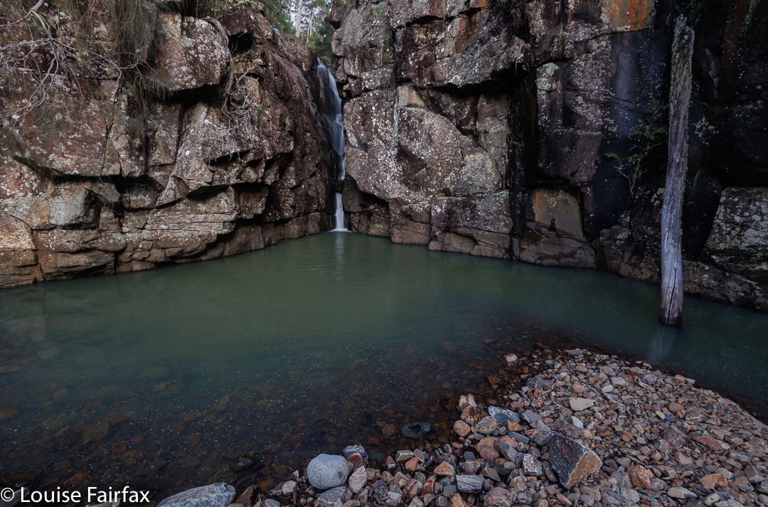
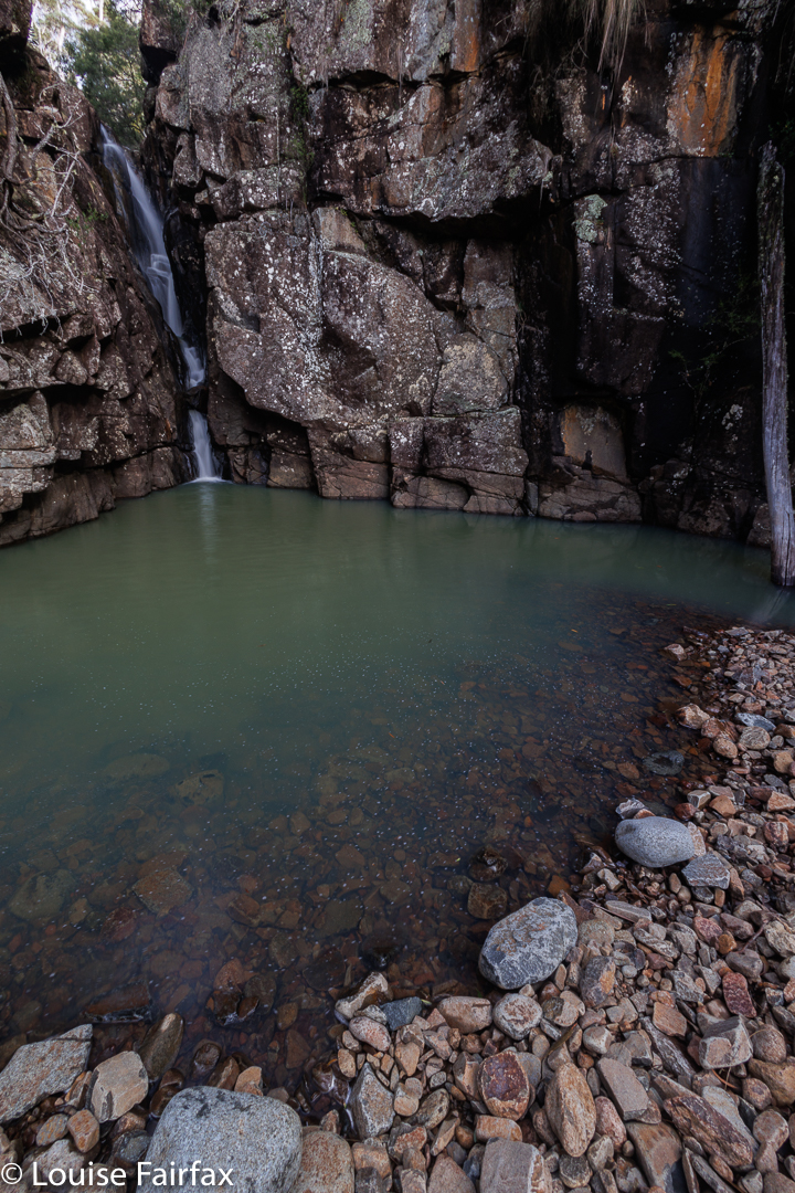
Tasmania boasts three Hidden Falls, but the Hidden Falls at Orford are the first and the real Hidden Falls, being on the map, for a start. Today I was lucky enough to visit the Hidden Falls Orford for the first time, being invited to join my Waterfall Friends. It is such fun to visit waterfalls with people who not only love being there, but who understand when you want to get out your tripod and camera because this scene looks worth that kind of effort.
Hidden Falls Orford
Of course we got out the gear for the main ones, Hidden Falls, but we also paid Drizzle Falls , seen on the way home, the courtesy of a proper shot. A different small waterfall on a tributary of Griffiths Rivulet east of the main Griffiths Rivulet that harbours the Falls of our mission, was only permitted a few handheld shots, so I guess it can consider itself the ugly duckling of the day. I was going to let you judge for yourselves, but really, this blog is about beauty, and I decided that Ugly Duckling Falls, as I am going to call them here, are just not worthy of an appearance. This is probably my fault for not getting out the tripod, but that’s just how it goes. It’s a harsh world.
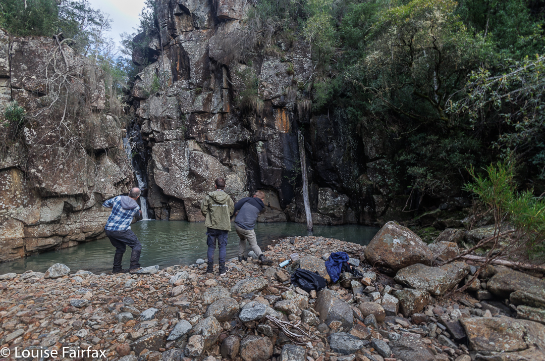
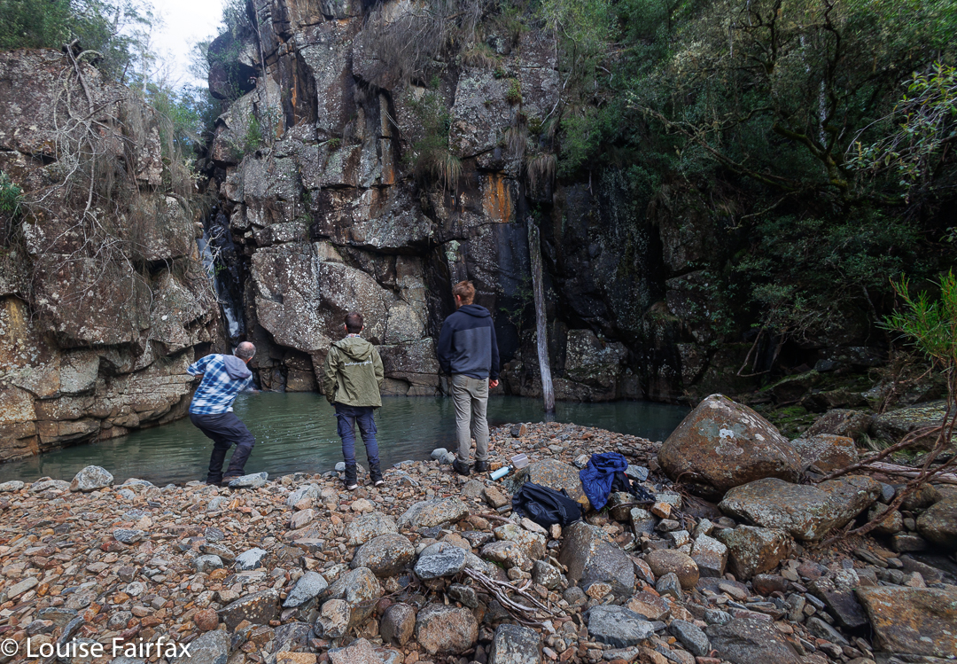
Adrian and Caedence show their style skipping stones. Rob watches on. Caedence is an ace cricketer, so he is no doubt using some of that technique here.
For our directions and basic information, we consulted the blog of Denis at https://hikinginsetasmania.blogspot.com/2014/06/hidden-falls.html
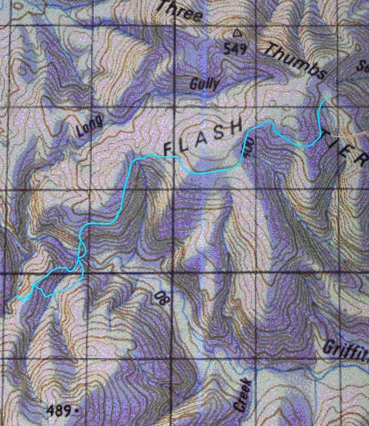
and liked his advice, so used his route for our way out, parking just short of Three Thumbs Lookout, and then following an old road, made all the nicer for the fact that no vehicle could get to use it. It was, however, a road, and roads will be roads, even if no cars can come along. It was wide and stony, so I was very glad when the time came to leave it and start bushbashing. On the trip to Orford, there had been lots of beautiful frost everywhere, but it seems that this translated to a large amount of dew in this bush, as I got pretty saturated leading us down, and was very grateful when Adrian took over to lead us up the other side. I was a tiny bit miffed that his section was open and dry, but, well, such is life, and I was not so miffed that I couldn’t enjoy walking through such open forest.
Boys being boys
The saddle and ridge on top reminded me of fun orienteering days, and we followed the open ridge along to the left a bit before dropping steeply to our goal. The best views of the falls involved our crossing the creek, but I found a spot that didn’t involve my getting wet, so all was good. I don’t like wet shoes when I still have over 6.5 kms left to go.
It was quite steep in places. Rob climbing
After the obligatory photos from a few different perspectives were taken, and lunch enjoyed, the guys got into stone skimming. Some great shots skipped right up the first level of the waterfall. I smiled to myself about bushwalking with boys: Gussy threw snow on Tuesday; these guys were throwing stones today. I joined in, but not with the same success. At least my stones bounced, but not as well or convincingly as theirs.
Rob climbing
Adrian mooted the idea of a different route back, and we all approved. A circle is much more fun than out and back, so we followed the ridge once we’d climbed it, and rejoined the Griffiths Rivulet via a tributary to the east, which kindly offered us two more waterfalls, albeit small ones. After that came a long slog up the steep hill. Either the bush had dried out a bit as the day progressed, or Adrian soaked up all the moisture ahead of me, but I didn’t seem to get wet at all on the rebound.
Drizzle Falls. They may be smaller, but I found them to be the most picturesque falls of the day. They are not on the map.
After we levelled out at the top, we expected a long flat road walk to the car. That is what we appeared to have had on the way out. To our surprise, someone had lifted the ground while we were at the falls, and we just kept having to go up … and up … and up, seemingly forever, until about 50 metres before the car, when we were given a crumb of easy downhill.
Drizzle Falls with a 5 second exposure to play around with the fun currents of water. I wonder which you prefer.
Stats: Vertical 645 ms climb; horizontal 13.18 kms, which yields 19.63 km equivalents. This involved 1 hr 43 moving for the 6.68 kms out, and 1 hr 49 moving for the steeper but shorter 6.5 kms return. When you include stops for photos, clothing changes, etc, we spent 2 hrs 10 on the outward journey, and 2 hrs 35 on the homeward one.