It was not actually our original intention to climb Mt Wedge this weekend. We were here for the long-awaited ascent of Mt Field West, a climb that is now assuming saga proportions. I announced last December that I wanted to climb Field West with young Gus. It would be a long day for him, so I thought we’d need to camp down by the river at the base to avoid driving from Hobart to add to the day’s length. But that long summer holiday period got filled with a large number of tennis camps and suddenly it was time to resume the new school year. Sometime or other it would happen, and now my daughter wanted to come too.
Entoloma sp Mt Wedge
Then she said we could all (five of us) stay at a cottage near the park as part of my birthday celebrations, and do Field West on one of the days. I phoned to make the booking. Full on my birthday. Full the weekend after. Full, actually, until after Anzac day. But then there was the problem of the school cross country race: he would be tired after doing Field West, so again the date got pushed back.
Cortinarius sp Mt Wedge
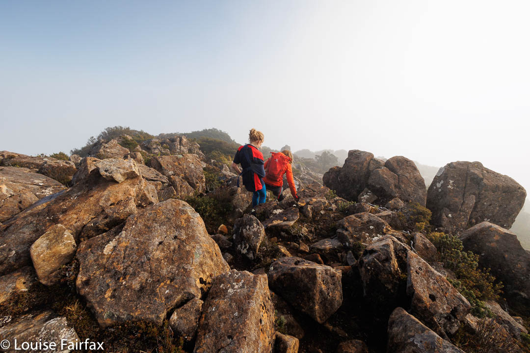
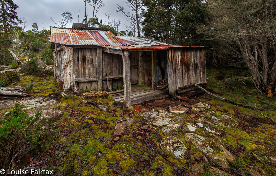
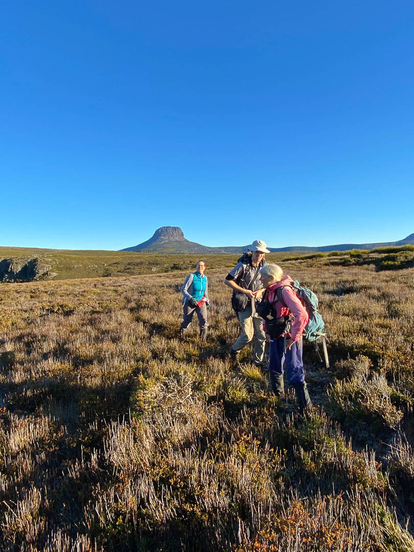
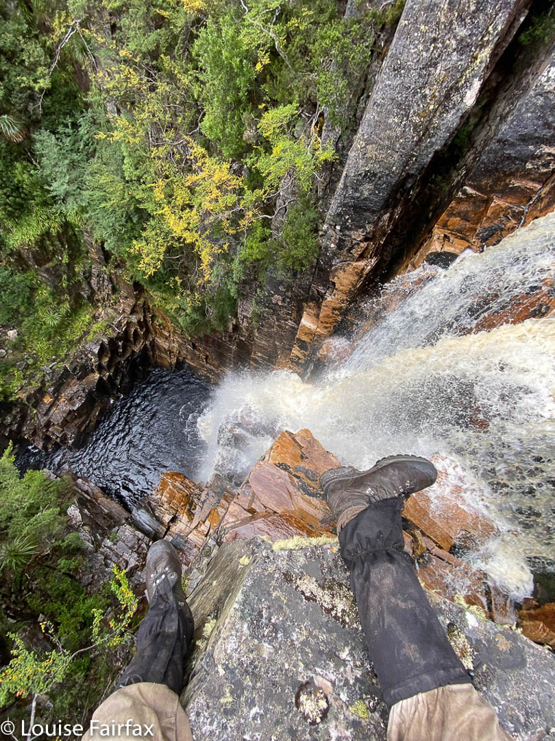
Tra la. It was to be last weekend, the one after the school XC. Trouble is, on the day the race should have taken place, at recess, Gus broke his arm, and was then in plaster from shoulder to finger tips. There was to be no race, and also, no Field West. He could not cross the icy, jagged rocks of the Rodway Range with a newly broken arm. We would need to settle for something less taxing. Mt Wedge was not too far away, and was definitely an easier climb, which wouldn’t involve him using his plastered arm. Wedge it was.
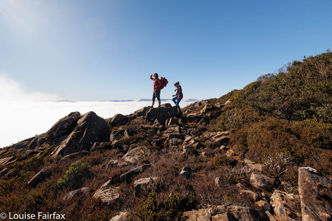
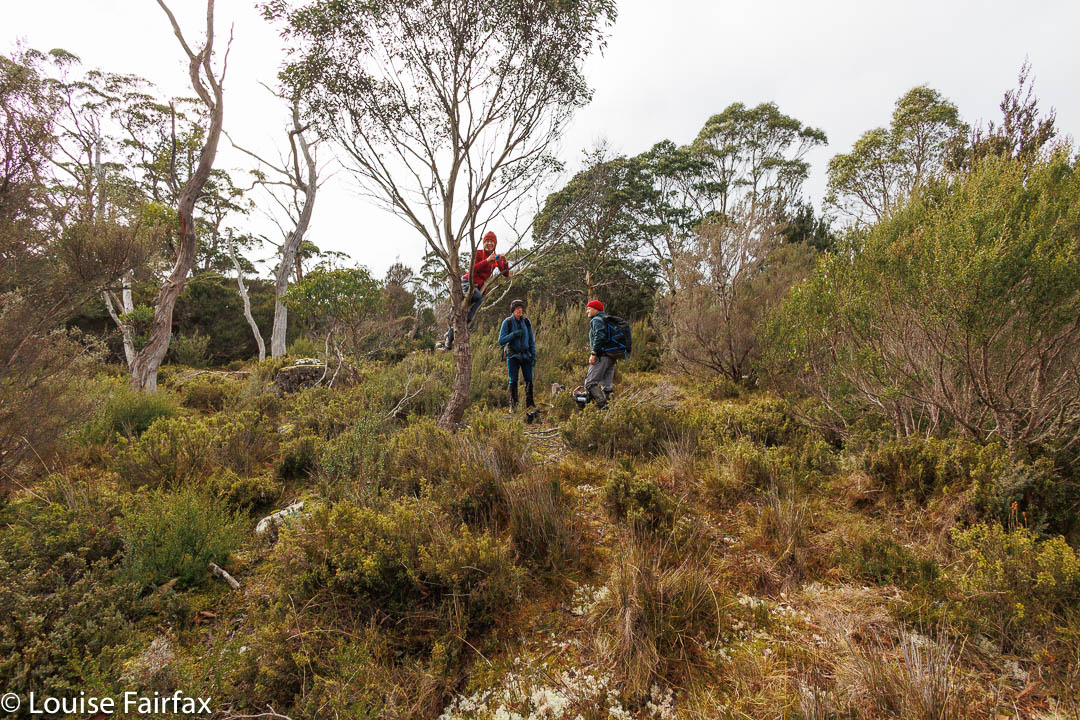
Cheerful one-armed climber
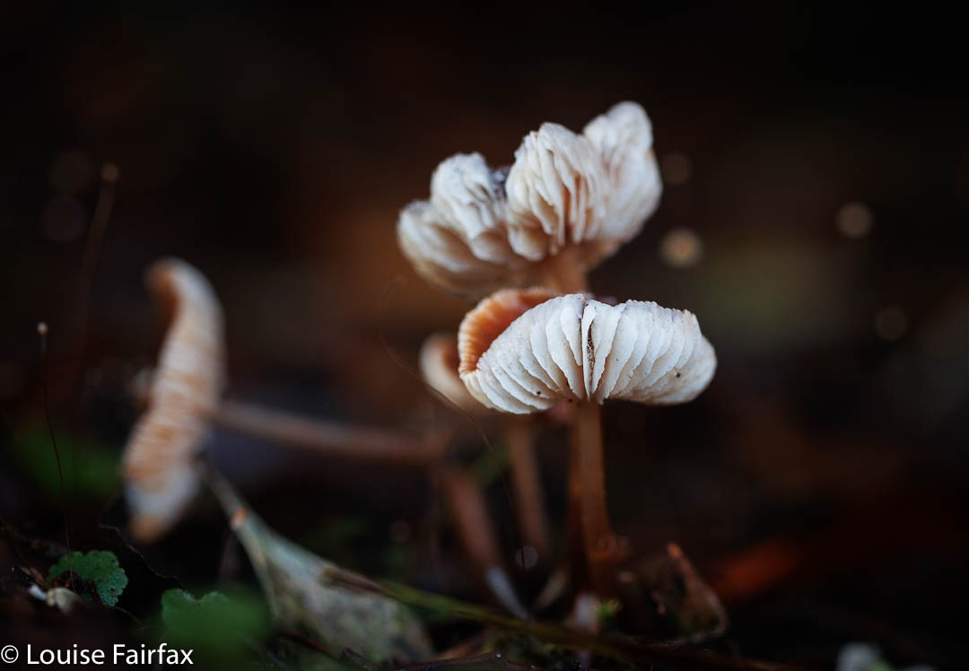
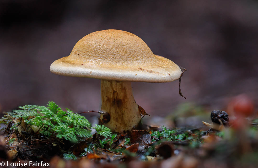
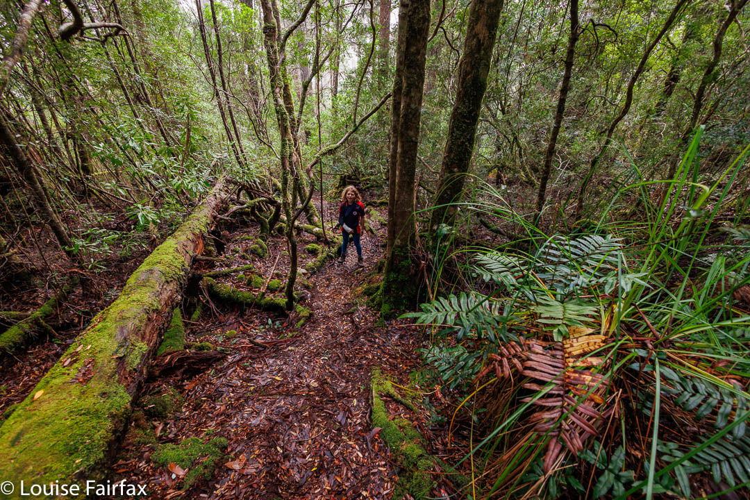
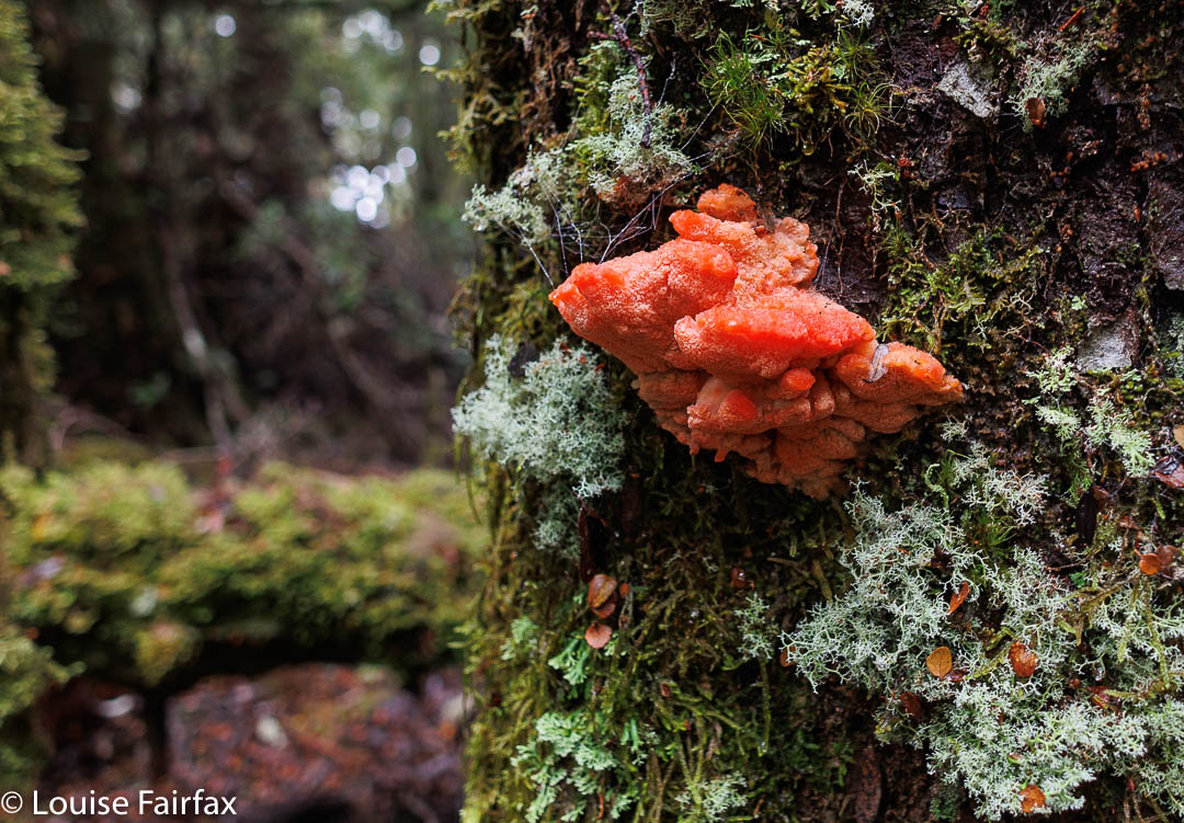
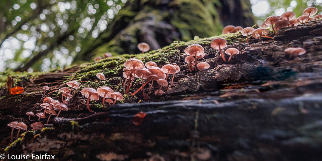
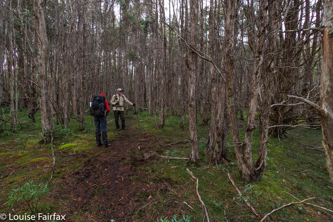
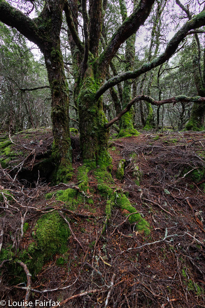
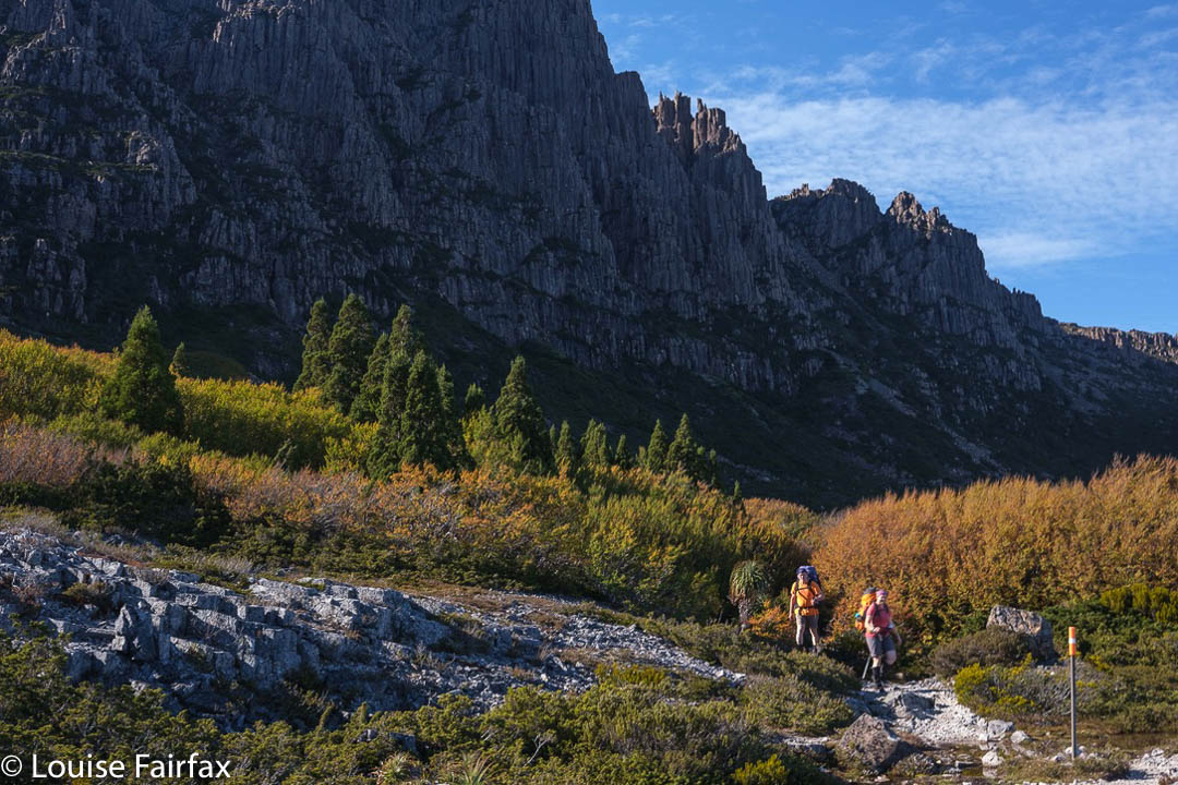
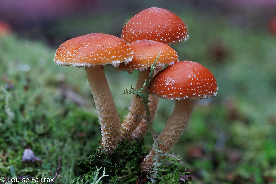
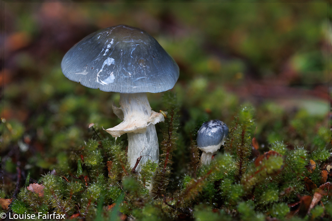
The last time I climbed Wedge was 2014. In the eight years since then, I have forgotten how absolutely beautiful the forest was. It was especially wonderful last weekend as there were more fungi than twigs decorating the forest floor. Everywhere you looked there were more, mostly in clusters. I wanted to have lunch on the summit, and we had not set out particularly early, so I disciplined myself to only take maybe five fungi photos on the way up.
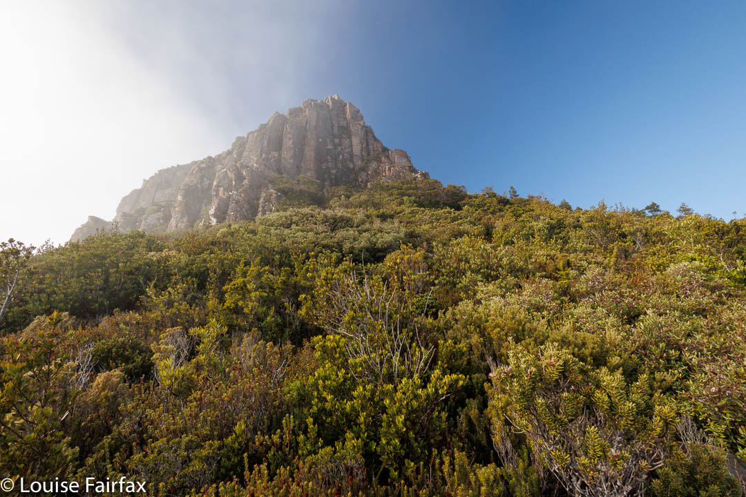
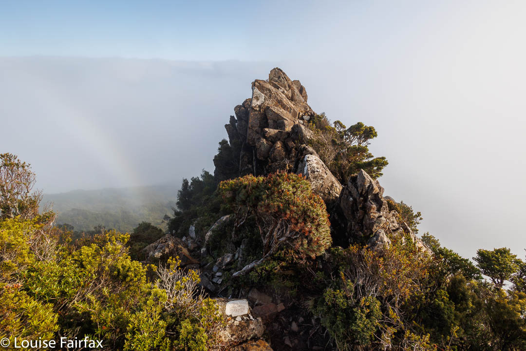
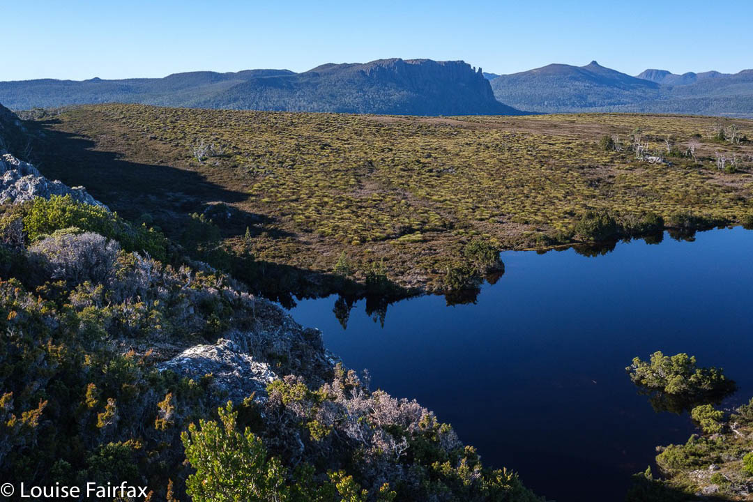
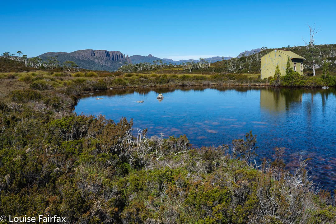
Mt Wedge: now we’re above the cloudsLooking at the sea of white puff
A special treat was in store for us when we burst out of the forest: we were already above the clouds. Gussy has never been up above the clouds like that before, and was suitably excited. Below, the valley was shrouded in mist, but up here, the sky was blue and the sun was shining. We could see the high peaks like Field West or Mt Anne poking as indigo and white silhouettes above, and the rest was a sea of pure white cotton wool below us, with occasional fog bows.
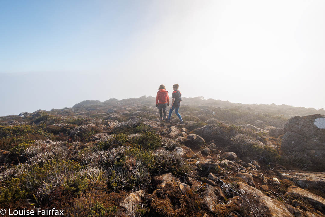
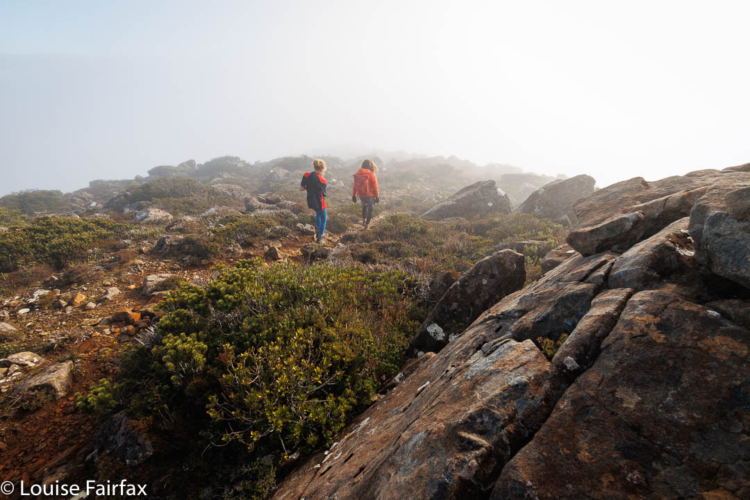
Descending into the mistDescending into the mist
It was even mild … or maybe we were just warm from the climb; there was no wind at all. The ground was a little damp, but we sat on rocks and used the heli pad as a table on which to spread out our goodies. We were even joined by a couple who had moved to Tassie from Melbourne in the last year, up there with their baby who toddled about the pad. It was a fun picnic.
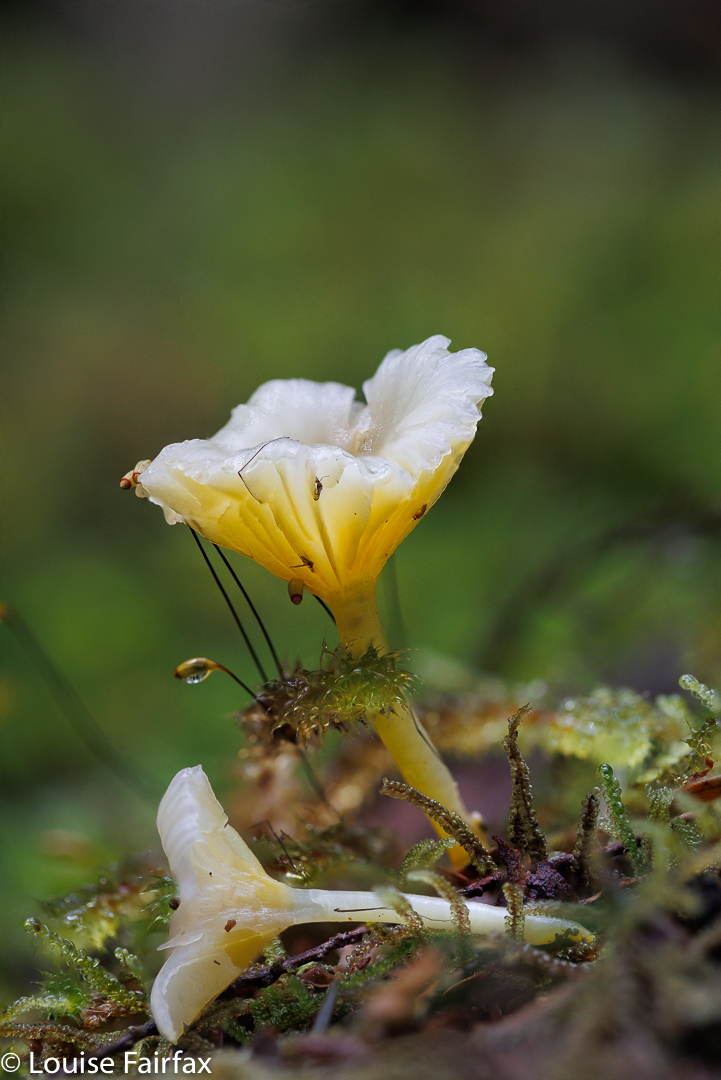
There was no rush on the way down – quite the opposite, as Gus needed to take especial care of his arm going downhill. That gave me time to photograph a few more fungi. I think that makes it eleven Abels for him, aged ten.
And maybe one day we’ll get to do Mt Field West.
This was only my second visit to the beautiful February Plains. I tend to always want to go up things, or else down cliffs in search of waterfalls. The February Plains involve almost no climbing at all (who counts two hundred metres?) , and no cliffs. You just amble your way through often very open forest – at best, myrtle forest – or along wide, flattish glacial valleys with ankle-high vegetation.
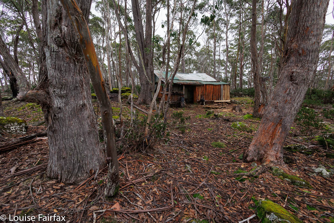
Basil Steers Hut 1
It is nice to have a goal for one’s ambles, and February Plains provide several excellent ones, part of which is a visit to the old huts of possum-trapper and snarer, Basil Steers.
My friends tell me that this is the biggest cushion plant in the world. Who am I to dispute such a claim?
On Wednesday, a small clutch of us visited the two huts left standing, as well as two ruins, where we searched for scraps of tin to indicate that a hut had once been there. We also navigated ourselves to the old Innes Track, where bits remain, which we also examined. We could manage to follow it for a little, before signs of its former existence petered out. This was intended to be a long track, from Liena on the Mersey to Rosebery and the mines on the west coast. The idea was no doubt good, but the reality of the terrain and the distance, inter alia, held the trump card. It was a failure, but by no means because of the excellent surveying done by Innes. The Innes Falls are also named after him: what a beautiful place to be remembered by.
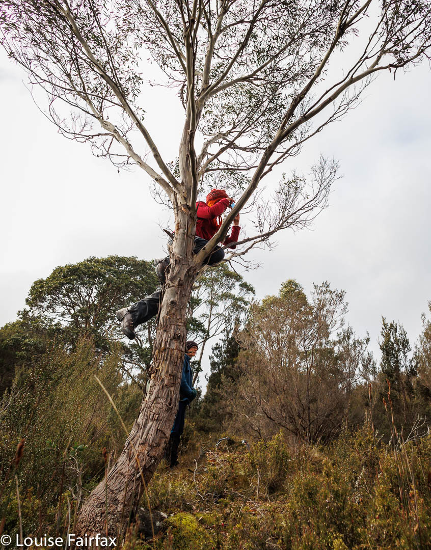
Sue climbs a tree to get a better shot of the cushion plant. Hope it worked, Sue.Such devotion to a good shot.
As we headed down to Sardine Creek, right near the end, someone said: “Look. Little Horn.” You wouldn’t believe how close it appeared to be. On this day, it was still covered in white from last Friday’s snow.
Basil Steers Hut 2
Somehow or other, we managed to clock up nearly 16 horizontal kilometres plus 277 ms of climb. That was very inventive of us. And right near the end, we got another aspect of interesting and important history. Brian O’Burne, one of the small group I was in, had been part of a blockade trying to save the February Plains from the destruction of Gunns. He showed us various aspects related to the struggle and amused us with tales of being put in gaol and taken to court for daring to protect an area of stunning beauty. I’m so very glad they won. Once you kill an ancient forest, it is gone forever.
Some of the forest we walked through.
It is hard to believe, looking at barren Afghanistan, that it once had beautiful forest. The Russians cut down trees at the rate of 200 trucks of timber per day, following their invasion of the country in December 1979. Their destruction of this neighbouring country seems very similar to what they are currently doing to a different bordering neighbour, this time, Ukraine. The world around us seems threatening and in turmoil. How wonderful to retreat into the wilderness. Even a single day refreshes us and reminds us of the healing powers provided by a retreat into a realm of calming green, open spaces and rugged wildness.
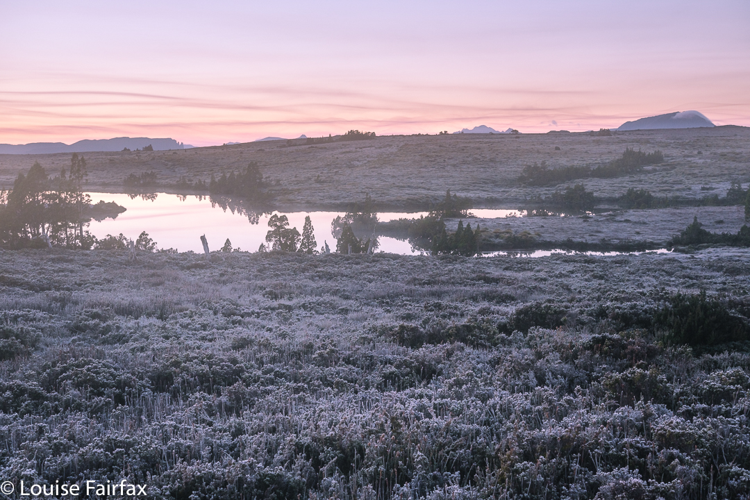
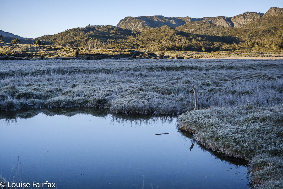
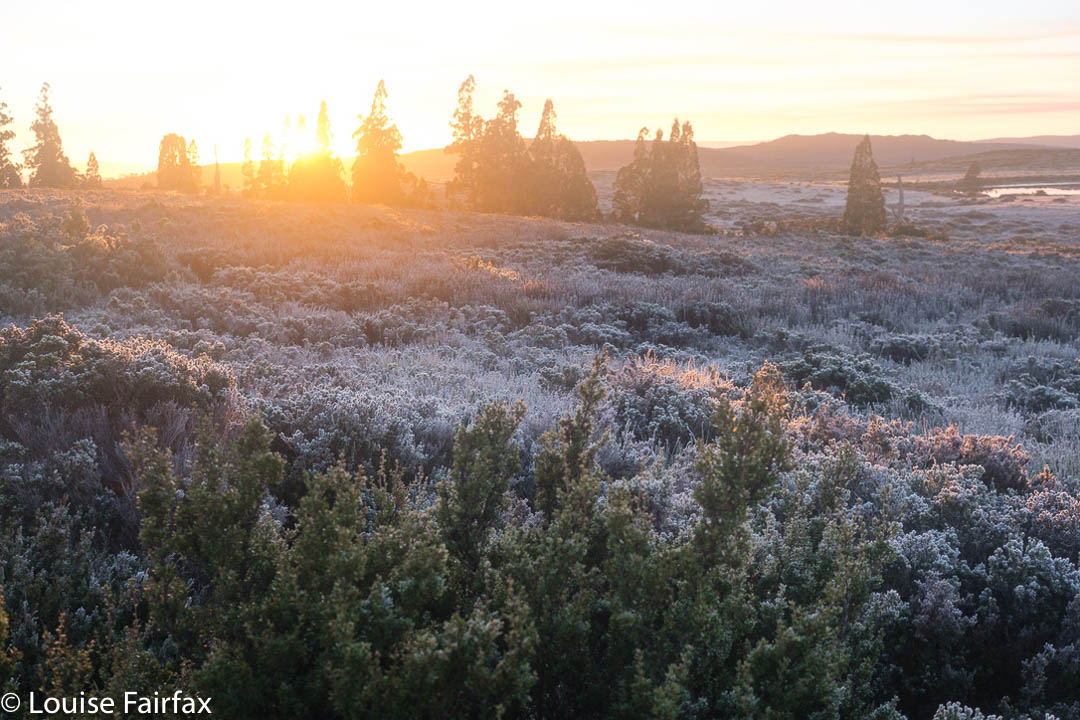
Day 3 dawned, as cloudless as the preceding two clear days, which meant another dusting of white ice on all the bushes, and pink hues on the horizon at dawn. As on the other two days, we would set out just before sunrise, which meant I ate my porridge at 6 a.m. to a view of dark silhouetted pencil pines against a backdrop of red glow. Sunrise itself – later (7 a.m.) – was a far more pastel affair.
Straight into the sun they go
This day we would explore an area to the east, heading into the rising sun with its golden hues. The backside of Cradle was on our left. To our right as we made our way across the button grass plains, were glimpses of Mts Oakleigh, Pelion East, Ossa, Paddys Nut, Thetis and Pelion West, with others playing more insignificant roles. Barn and Inglis were behind us if we looked back. Emmett was a lump between us and Cradle. These are all my old friends, and just as seeing the spine of a favourite book helps you to recapture the feeling of reading it, so seeing these old friends sparks many happy memories of other trips.
Around the top of Lake Agnew we go
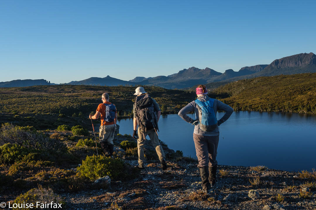
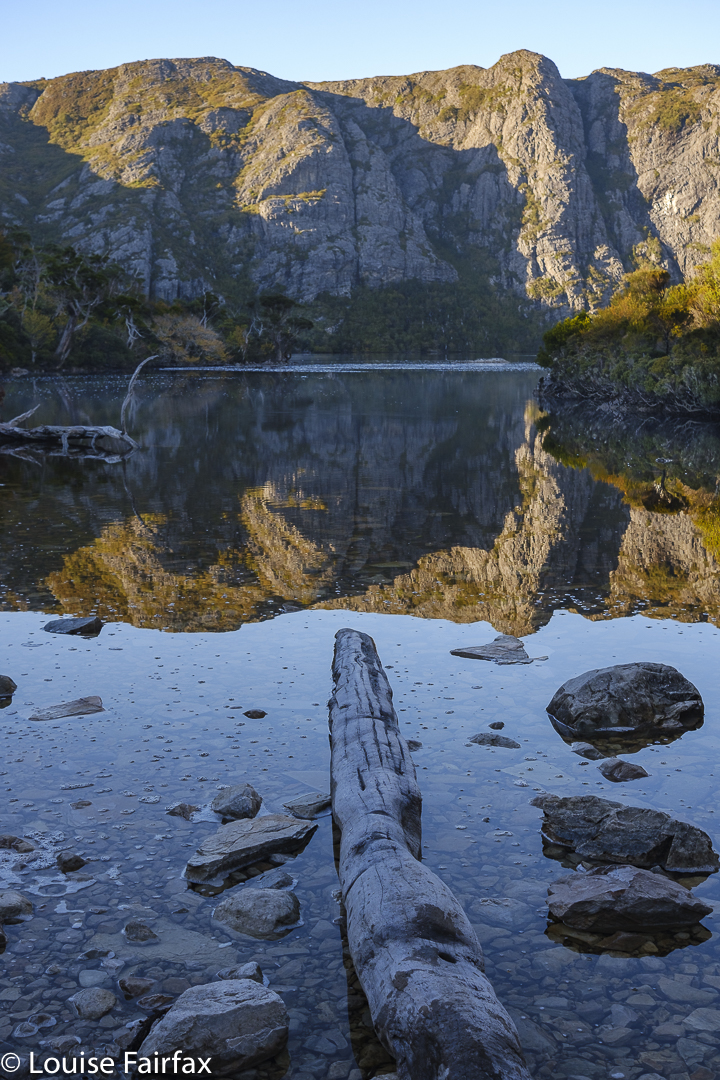
Our first goal that had any significance other than “broad expanse of alpine scrub dotted with pencil pines and tarns” was Lake Agnew. So large was the seemingly featureless route in between us and this lake that, when I thought I was going to be doing this solo, I had marked a waypoint on my map, just to have something to head for. We said “Hello” to my waypoint en passant. I hadn’t any information on Agnew other than that people who crossed it on its outlet stream side had trouble finding a good spot to do so. Adrian and Caedence were all for passing it on the uphill side, which gave us two streams to cross, but as they were more uphill, they were merely passages of water to jump over. Meanwhile, we had the added bonus of walking along dramatic cliff tops overlooking the lake, with views later to Lake McRae further north. I loved those cliffs.
Leandra having fun on Spine Ridge
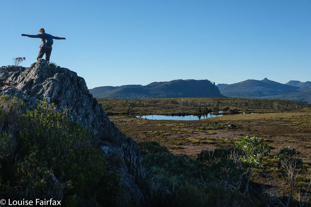
We had to drop down from the cliffs in order to cross the first stream, but that was also problem free. Up we headed to a feature I have called Spine Ridge for obvious reasons. Here the view was so fantastic we stopped to have a snack and just enjoy the vista for a short while.
Now, Caedence gets a little antsy when he sniffs that he is near a waterfall, and so urged us to take a straight line for the first falls of the day, labelled Razorback on the map. He felt that would be the fastest way there. I did mention a good route from the hut to the falls below (not these, but nearby), but my arguments fell on deaf ears. I also pointed out that the shortest route is not always the fastest. What do I say? I merely advise you to listen to what I said, and don’t take the “short cut” unless you feel like a really engaging bush bash where the forest will throw everything it can at you to retard your progress. Of course, we didn’t know that at the time, and Caedence was so eager to at last see water falling we all took the hypotenuse … and lost a bit of time. The day was still long. It was only 10.10.
Mt Oakleigh, Pelion East and more (+ nameless tarn) from Spine Ridge
These falls are actually interesting, as, although they are labelled Razorback on the map, they do not match Stephen Spurling’s photo of falls he calls Razor Back.
Scene along the way. Thanks Adrian. I really do think this was that pink jacket’s very last long trip. It now has so many holes it no longer keeps me warm.
In case you don’t know your early Tasmanian explorer and photographic history, Stephen Spurling III, 1876-1962, stands out as a glorious photographer of his era. His photos form the earliest extensive record of the Cradle Mountain and Western Tiers area. (He was quite an explorer, and now that we have seen some of the falls he shot, I can add he was an excellent bushman. The falls are not in easy terrain.) He took the first known shots of the Gordon and Franklin Rivers, as well as the earliest known aerial photos in Tasmania from 1919. Although many of his photos remain, some are unlabelled, or unclearly labelled, so we are left to guess some things, and join some of the dots. It seems to us, however, that the waterfall labelled Razorback on the map (the first ones we visited) were not the ones labelled Razor Back in his photo.
Myra labelled Razorback Falls on the map
The others believe the first waterfall we visited (above here), labelled as indicated in that last sentence, was therefore Myra Falls, not Razorback, and that the second falls we visited, near the old mine downstream, match the photo labelled “Razor Back”, and hence my caption of the first waterfall as “Myra labelled Razorback on the map”. The second waterfall, which we feel strongly is his one labelled Razor Back, is merely a blue, unlabelled line on the map. I have labelled it “Real Razorback Falls”. I guess there was a transcription error by a clerk in an office somewhere when maps were being made. It is not the first and will not be the last such error.
Real Razorback Falls, as judged by Spurling’s photos rather than map labels
Having had a big bushfight to get to these falls, we were not entirely lusting after more of the same to reach the next. Luckily, it wasn’t as bad, and we knew the next falls would lie in rainforest. We longed for mossy green after that dry, thick scrub, and we got it. My first shot was taken at 11.09; my last around 11,30, so it wasn’t quite lunchtime, but breakfast had been early, and this place was very beautiful (also having many fungi), so we sat by the cool stream and had lunch before climbing up to the high land above and Hydrographers Hut that we wanted to see.
Hydrographers Hut. Sorry for the lack of apostrophe. That is official nomenclature.
Although still a student, poor Caedence also has this awful thing called a job, and, worse still, the pay for Anzac day was going to be just what he needed to amass some savings, so he left us at Hydrographers Hut to make a dash for the tent and an early depitch and exit. But, it was a truly magnificent day, and we remaining three had no pressing commitments for Anzac Day (the morrow), so we chose to enjoy the lake around the hut and the scenery on the way back at a more leisurely pace. We had thought of moving the tents nearer to the cars, but decided we would stay put another night in the end. Adrian had another swim. Louise stayed dirty.
Afternoon light. Looking towards Lake McRae (and Cradle and Emmett).
For the third night in a row, there were no clouds, and ice decked the ground and our tents in the morning. We enjoy our early departures, but on this day it was a mild problem in that the tents were absolutely sopping with the condensation from our moist breath during the night. Drying them out would take hours and a massive effort, so we popped the weighty wet lumps in our packs and just put up with the extra kilo or so of water.
Fagus display as we head back north
As ever, it felt weird to land back in the area of masses of people on the trails once we got near to Cradle. We stopped at Marions to marvel at the Overlanders, sweating and grumpy of face, dressed in black to make them hotter than necessary. It was only maybe the fifth group that actually said “Hello” to us and looked a bit cheerful. I hope their enjoyment of the wilderness increased as they went along.
For Days 1 and 2, see http://www.natureloverswalks.com/cradle-area-waterfalls-days-1-2/
I had trouble deciding what to call this blog, for, although it had its provenance in the idea of seeing as many waterfalls as we could in the area south of Cradle – and although we did, indeed, do that – in my mind, both in anticipation and whilst I did it, it was all about far more – or was it far less? – than that, for I kept “just” seeing it as a time in the wilderness with friends, where we would just happen to spend that time seeing water flowing in its various positions and manifestations about the place.
We had to have a brief stop for this (Crater Lake).
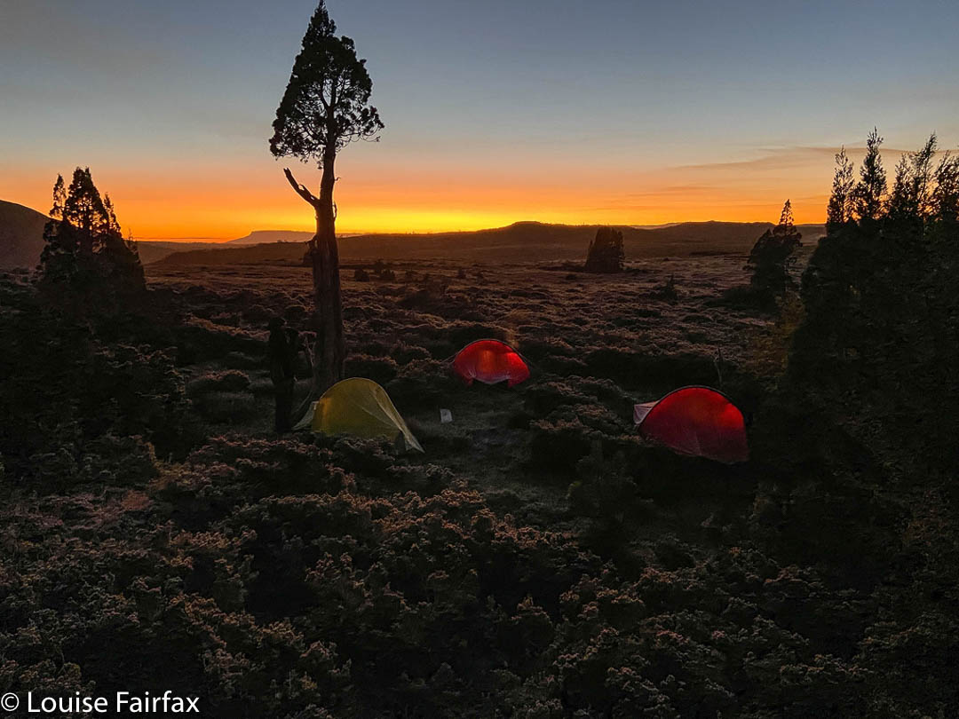
But I cannot pretend to deny being a list ticker, a person driven by curiosity to know what that little unnamed blue stroke on a river or creek actually looks like in “the flesh”. I like to see as many of the things I love as possible, be they mountains, fungi or waterfalls. So, there we were, four of us, gathered on the start line with white crunchily iced bushes around us, ready to set off on the next adventure together. With Caedence’s cricket schedule, it took two years to organise, and I had decided I needed to do it solo, but here we were: we had actually managed to settle on a date and pull the arrangements off. Hoorah.
Hypholoma australe. There were fungi everywhere.
I was a bit worried about my four-day pack. It had now been over two months since I had carried a full pack, and this one had my tripod on board, which, of course, adds to the weight. However, we all love beauty, and everyone wanted to have a brief beauty stop at Crater Lake, and another at Marions Lookout, so my shoulders coped fine. Once we got past Waterfall Valley Hut, we began the earnest business of visiting waterfalls, for which I only carried my camera and tripod, so all was well by the time I had to shoulder the combined weight again.
A washed out Gliophorus chromolimoneus
On day 1, we visited falls that I had for the most part already seen: Branigan Falls in its Upper, Middle and Lowest manifestations (all quite separate from each other – several hundred metres apart), and then a waterfall that was lower still, which I have called here Hartnet Rivulet Falls, and which we actually had to observe from across the valley. I found these ones very disappointing, for, although they are very tall, they were more cascadey in structure than I was anticipating. Be that as it may, they were definitely a waterfall.
Branigan Falls. Confessions of a sinner: this was a shot I took last year. I prefer it to this year’s effort.
More disappointing in terms of capturing flow, but for some reason I found them to be fabulous, were “No Fall Falls” Upper and Lower. These were overlooking the Hartnet Rivulet Falls, and were supposed to have their own water falling, but, although a very deep gorge was present, obvious sign that water did once rush through, there was no water at all on this day. If you look at the map, you will see that the catchment for these falls is tiny. They issue from a small, unnamed tarn that debouches into an unnamed stream with two blue dashes (indicating waterfalls) across it. We had had a week of rain, but I guess that tarn up above us was empty. The orange cliffs, however, were massive, and the fagus was several shades of yellow and orange, with a few mightily tall pandani here and there. It was a beautiful place to be, and felt deliciously remote. I was sadder about having no opportunity to quench my now severe thirst than I was about not being able to photograph another waterfall.
Middle Branigan FallsLowest Branigan Falls from aboveHartnet Rivulet Falls, taken from near No Falls Falls (Lower and Upper).
Eventually we had visited all we wanted to see in the time we had, and off we set further south to our planned camping spot, in the shelter of pencil pines away from the track. The skies were pretty clear, which made for a freezing night. Luckily I had come armed with all my winter camping equipment, including warm booties for bed and an extra SoL bivvy bag to add 5 degrees to my down bag. The tent flap was stiff and white next morning, and the ground, a fairyland of white sparkling crystals.
Predawn glow. Photo credit: Adrian Bol, who was much braver about getting out of his warm sleeping bag than I was.Sunrise Day 2. I am up and about now. We are underway. This one is mine.
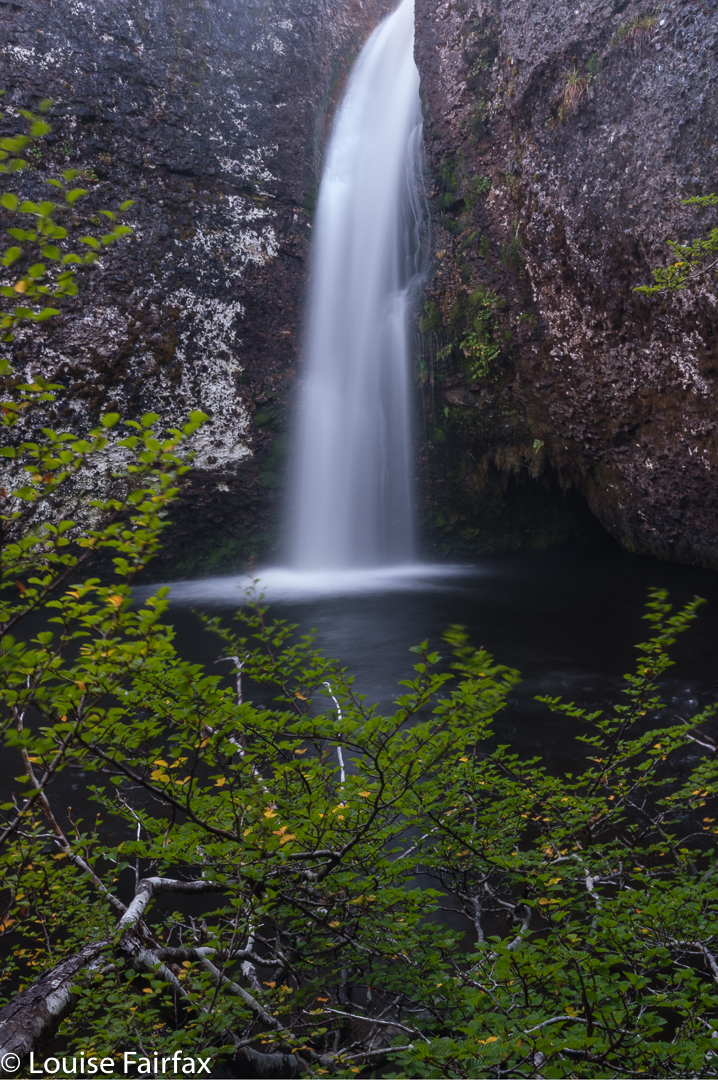
On Day 2, our faces turned to the west rather than the east of the track, and in the glorious dawn we set out west for our first rendez-vous: Innes Falls. We had been told the track around Lake Will was very muddy, but, well, it was still frozen, so I guess that helped. It was no big deal on this day. My big disappointment was that the fagus was still green in that protected amphitheatre. At this time of year, we thought we’d be guaranteed of yellow. Now I want to return this week, but it is raining all week, and I am not sure what that will do to the leaves.
Innes Falls
Innes was one of many. We stayed there only twenty minutes, and then moved on in our big circle. The distances between waterfalls got smaller, but the times got longer as the vegetational resistance grew. It was not horrific or anything, but you sure don’t cover ground as quickly as you do if you are on a track. And lifting your legs high over bushes naturally slows you down.
Upper Tumbledown Falls
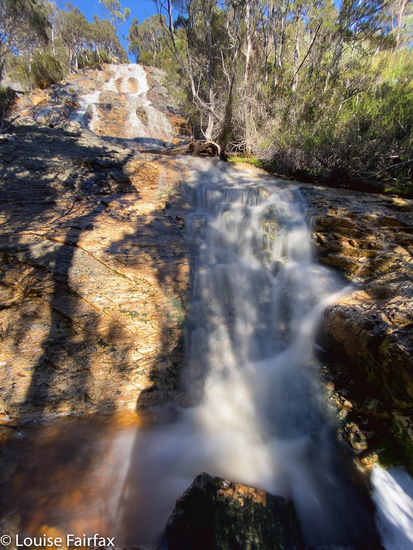
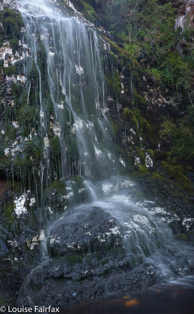
Our next port of call was Upper Tumbledown Falls, which were nice enough, albeit nothing extraordinary. There were odd exudations of white all down the rock (calcareous deposits??), which reflected glare making a good angle hard to achieve. I settled for a 4-shot panorama to get near to what I wanted.
Cave Falls
Climbing out of these, I got poked in the eye with a sharp stick, but luckily the effect and blur wore off as the day continued, and we wended our way on towards the next nameless waterfall in our circle. On getting to the bottom of this one, we dubbed it Cave Falls so we could all refer to the same thing. This name came from a kind of cave structure in the rocks in the upper part of the falls. These, too, had white deposits in/on the rock.
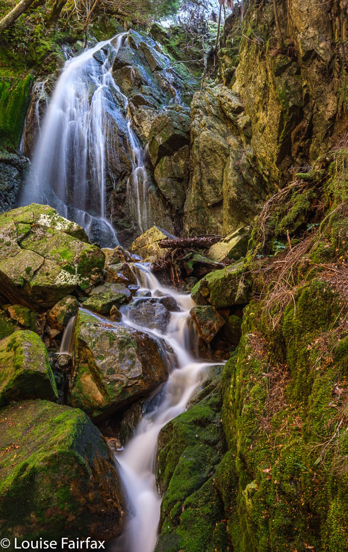
Veil Falls. I am not one scrap happy with this photo, but have included it for the sake of being comprehensive.
The next were also nameless, and the sobriquet Veil Falls was an obvious contender to an unofficial title, as they flowed in a beautiful Veil down a long expanse of partly mossy rock. There were countless aged Cortinarius metallicus here – so many it was hard to find a place to put your feet. Adrian grew worried. There was still a great distance left to cover, and he feared I was about to be irretrievably diverted by my other hobby: fungi hunting.
Cortinarius metallicus. Sorry, but the idea of inclusion has its limits. Maybe next visit I can take a photo of Tumbledown Falls that I am not ashamed to post. There were hundreds of these fungi to be seen this trip. Most were old and brown, but there were enough that still had colour for me to want to photograph them.
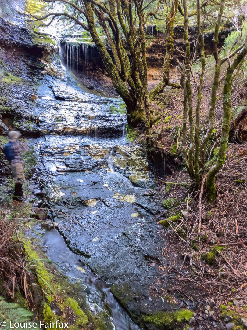
On we pressed. I assured him my focus this trip would remain on waterfalls. At 11.15 we arrived down lower, at Tumbledown Falls, having had no particular trouble finding a feasible route. These, although named on the map unlike Veil, were not actually as aesthetically pleasing as the former, but, of course, we photographed them to record their presence anyway. (That said, my photo does not pass my own standards, so is not included. Sorry.)
Tomahawk Falls Middle Tier. Adrian supplied this photo of this very dramatic drop (and his magnificent legs). I like it as it captures the sense of extreme height. The water in this part of Bluff River had the most wonderful rich tannin colour that you can also detect.
Now began a slightly longer march across button grass plains in the direction of Tomahawk Falls, which, we could tell from the map, would be protected by a bushy palisade, and would involve skirting steep cliffs, if possible. Because the northern side of Bluff River is ultimately steeper and bushier than the southern, we went on the latter side, but thereby added two creek crossings which proved a challenge to this person who did not want to get her feet blistered later by covering big distances in sopping shoes. I got around, but only after searching. On the rebound, Leandra and I took the northern side, and returned home with dry footwear. It was much faster.
Tomahawk Cascades, above the three tiers. Thanks again A
The position of these falls is slightly different in Listmaps from on my highly-contoured navigational map, which has an extra gully marked in (that is on the ground but not in Listmaps). The bush was stunningly thick and steep, so we weren’t sure of the best approach or how to actually gain access to these falls. We slid several metres down massive drops, to the point where I began to have serious misgivings about whether I would be able to get up again. Leandra was comfy stopping where she was, from which position we could see the flowing water, but had no access to a clear shot.
Bluff River in low light
The boys wanted to climb further. I was nervous about my ability to stay with them in terrain like that, and didn’t like leaving one person alone, so I opted to stay with Leandra while the boys searched. We heard loud screaming. Were they screaming at each other or us? Was one of them in trouble? Had something happened? Our optimal turnaround time had by now well and truly gone by. In the end, we decided if someone had been in trouble there would have been more yelling, so we set out for home, knowing the boys would catch us later. Maybe the yells were to tell us to move on. I stayed very near the cliff face to get photos from afar, even if not the lovely ones the guys got, which they have been kind enough to give me for this blog.
Icy environs. I love icy landscapes even better than waterfalls. Sorry.
Leandra and I adored the cascades of the Bluff River as we followed its journey from its source above. They were such a honeyed tannin colour we delighted in them, and agreed we wanted to camp there one day. The light was now a little too strong for good photography, and the day not long enough to linger, so we stored the treasure for another time, and headed back towards Tumbledown Falls, from near which we climbed up to the top of the falls. From up there, we could see the guys below us, so we all knew the others were safe, allowing each gender to pursue its own route choice. Ours was longer but involved less button grass and, one thing and another considered, was the faster route. We followed cliff lines with magnificent views back to Innes Falls, and then the normal Lake Will path from there.
The sky was clear. It was already getting cold and we were hungry by the time we reached our tents. Adrian, brave soul, went swimming. Brrrr. I stayed dirty and cooked an early dinner while I still had light to see. I like eating my dinner and looking at the scenery. I was also very keen to close the tent up to keep in my body warmth once the dubious feast was over.
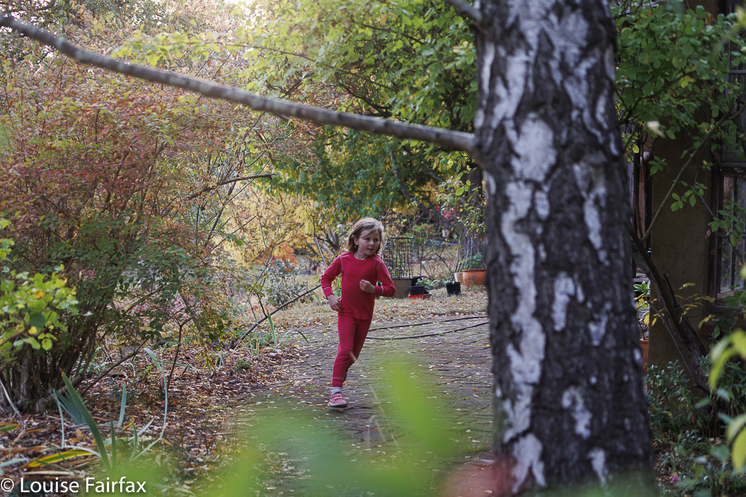
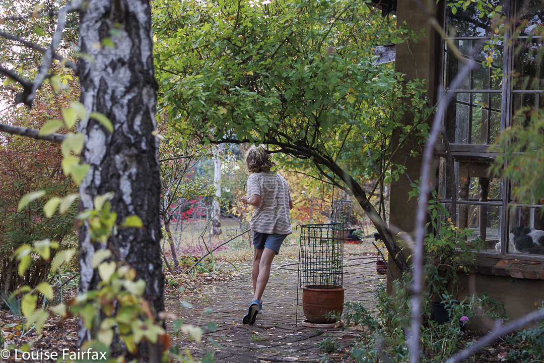
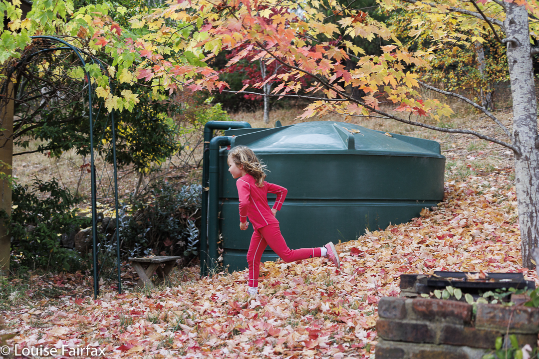
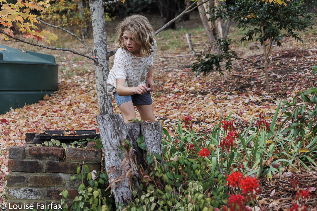
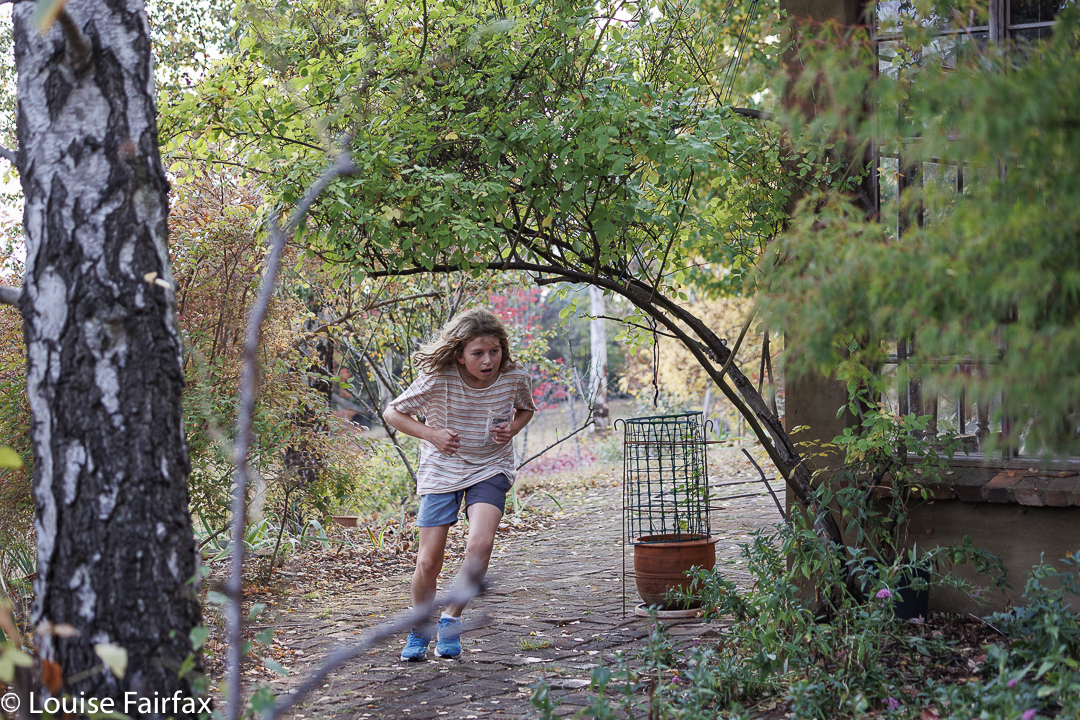
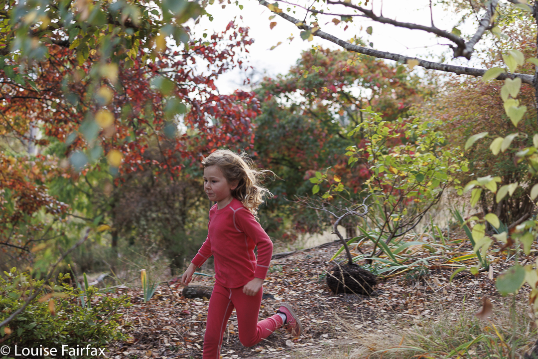
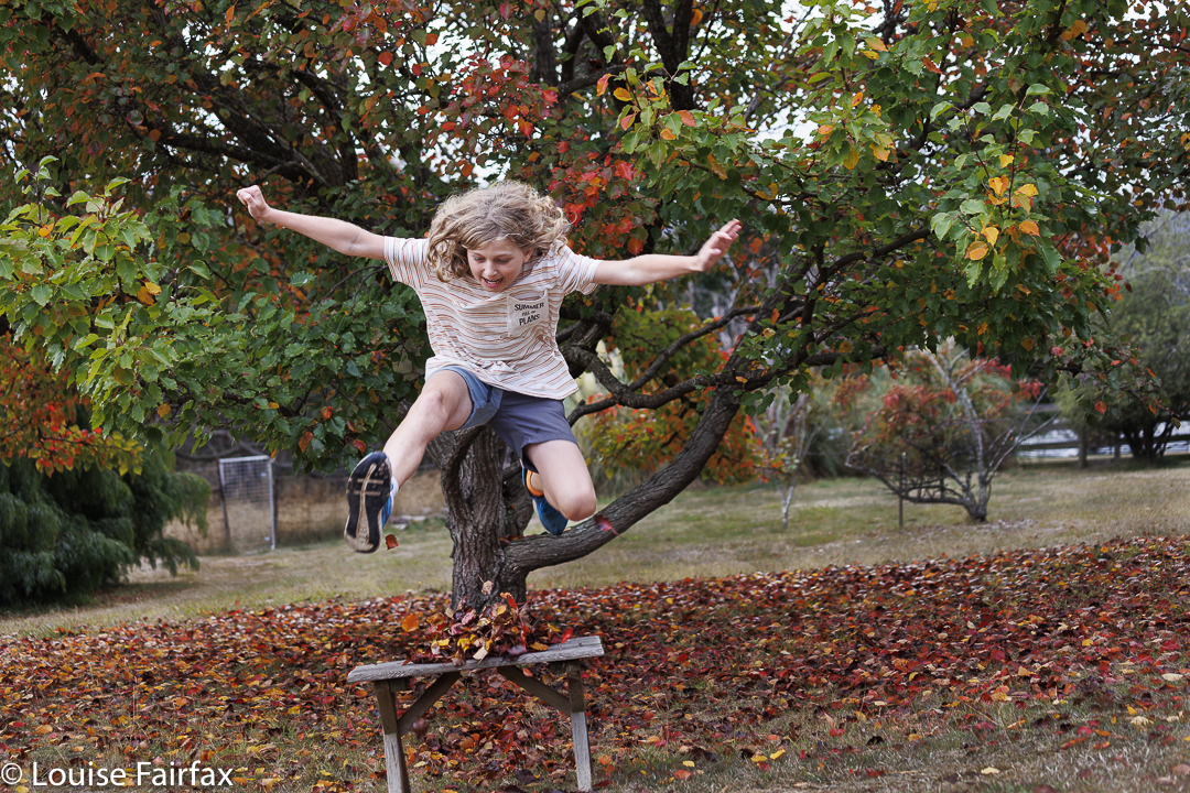
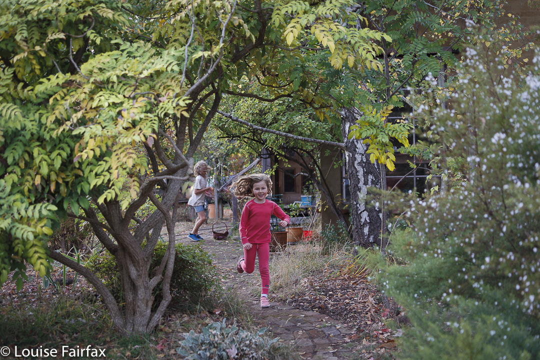
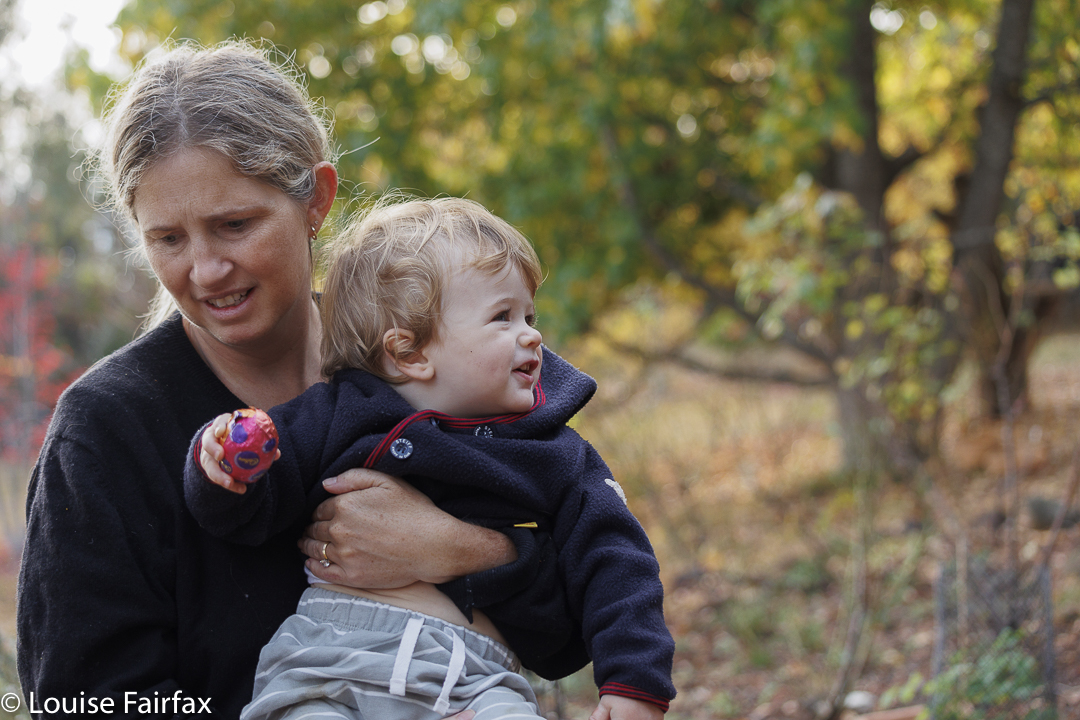
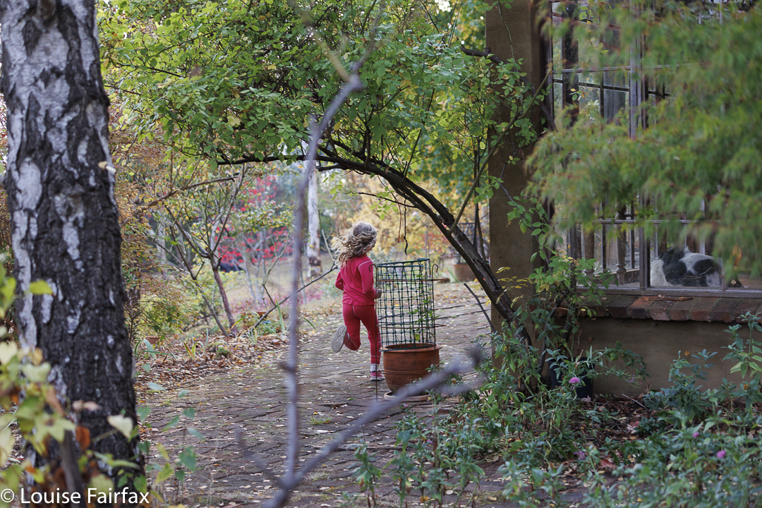
As I explain every time I post on cultivated nature, such as my garden, rather than wild nature (wilderness), my love of nature is not restricted to bushland and forest, but also encompasses beautiful gardens. This year, as I photographed the family Easter egg hunt, I was in my element, enjoying the colours of autumn, the profusion of glorious trees that I have planted, (which my neighbours hate!) and the thrill of the chase.
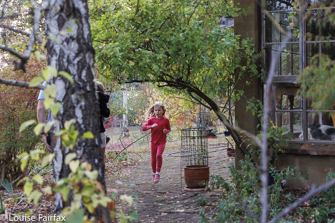
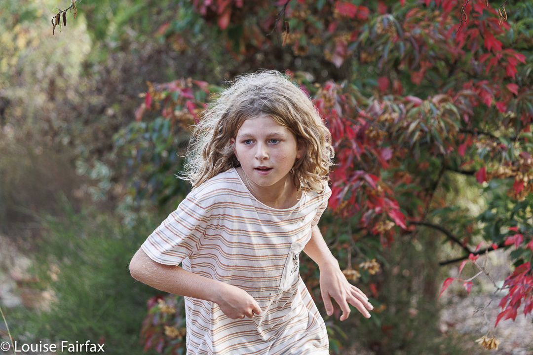
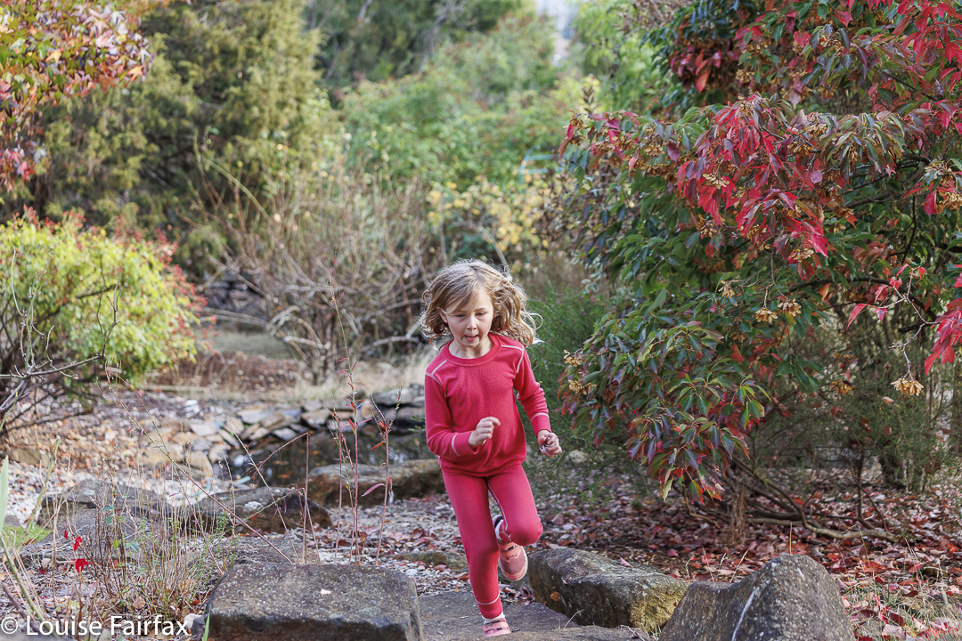
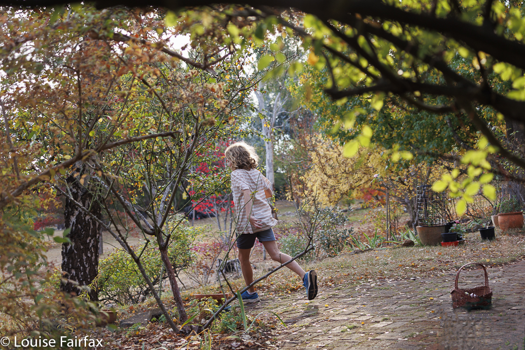
Gussy in the chaseAbby in actionAh ha. There’s one by the BBQFletcher finds one high in a treeRush rush
I was also fascinated, not so much by the joy of the children – Easter is a fun family time – and a life force here symbolised far more by activity than the chocolate eggs they were hunting, but by their exuberance in the hunt. The images show rushing, urgency and the thrill of the chase.
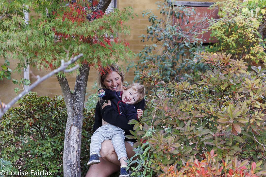
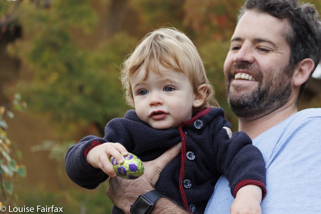
Another one for Fletchy. His first Easter.Indefatigable GusGo AbbyJust for the heck of itNot slowing down
But what if I explain to you that they are just running for the sheer pleasure of it? The rules in our family are that you rush to get eggs, sure, but not for yourself. No. You get the eggs for everyone and you put them in a communal basket. There are no prizes or rewards for being fast, or faster than someone else, for finding more or bigger. Later, after all the eggs are gathered, we take it in turns to take an egg from the basket until we feel complete, and then opt out of any more taking. If only society at large could operate like that!
He didn’t get to taste chocolate, but he liked finding eggs anyway. Letting go into the basket was a challenge, but he got there.ConcentrationDon’t you just love her style? Textbook. She’s six.Round the corner for the next oneUrgent
So, all that running that you see here is just movement as an expression of joy; movement as an end in itself rather than a means to it.; movement as an expression of the wonder of partaking in life.
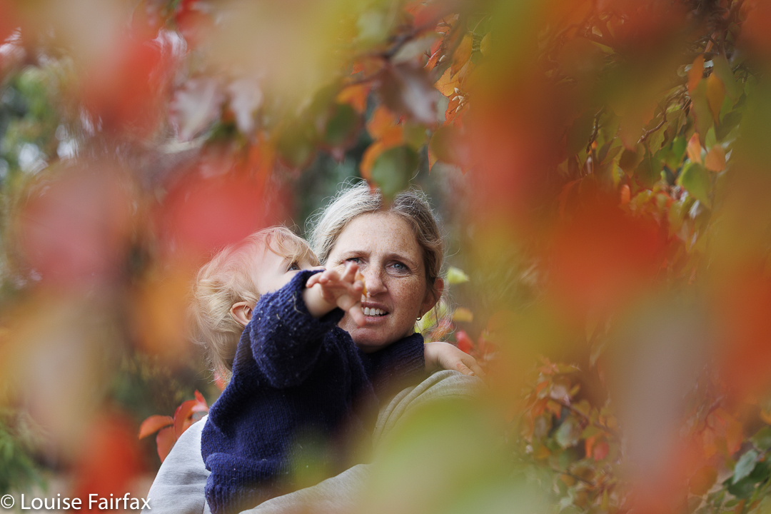
Time for babies to enjoy leaves
Meanwhile, the children ran like that for nearly forty minutes: 8.37 until 9.15 is the range of times in the photos’ metadata. No wonder they do well in beep tests, cross country and orienteering. No wonder it’s not a big issue to climb a mountain with me.
Probably 17 photos is a large number for a blog post, but I had real trouble culling it down to that!! I hope you forgive me the indulgence.