Horizontal Hill 2016 Feb

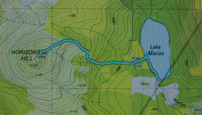
Horizontal Hill 8 Feb 2016

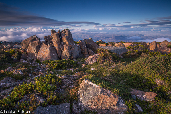
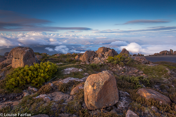
Angela on top of Horizontal Hill, the Guardians behind
Our friend, Mark, first mooted the idea of climbing Horizontal Hill in the dead of last winter, when the nights were frozen and the days icy. I wanted to climb this too, but had decided reservations, for the route involves a 350ms wade through Lake Marion before you begin ascending. I thought about wearing my wetsuit, and meanwhile bought a pair of light, padded Wellingtons. I was not looking forward to the ordeal, but, as Malcolm Fraser said, “Life wasn’t meant to be easy”, and well, you take what comes in this business of trying to climb all the Abels.

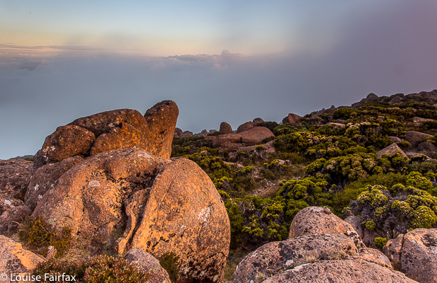
Moody sunrise at Lake Marion
Luckily, on the appointed day, it was snowing, as well as icy and freezing, and we climbed Mt Hobhouse instead. We waited for the next opportunity, but other mountains pushed the queue for one reason or another, until last weekend, when I noticed that, with a little rearrangement of several programmes, our old intrepid trio could climb this together before returning to our separate agendas. Now hyperthermia and dehydration could replace hypothermia – a much more comfortable way to damage your body.
Now, the dreaded icy lake was a delightful warm bath. Padded Wellingtons were replaced by open crocs and the wetsuit allowed to continue gathering dust in the laundry. The wade was fun, even if I did keep sinking, and then we left the water behind to head upwards on bearing through rather lovely pandani forest, travelling towards the head of a pointy spur. Punishment for the unexpected ease here was the inevitable band of scoparia, but I have seen a lot worse and we swallowed our medicine, and in under two hours were doing the last climb up a sandstone cliff to the summit area, to at last sit up there and eat and drink in both view and water.

Our route up Horizontal Hill
Next morning, after a relaxed beach breakfast, Angela and I set off for our next goals, vi.z, Falling Mountain and Castle Crag.
http://www.natureloverswalks.com/castle-crag-falling-mountain/
It was actually too hot to climb them that afternoon, so we got ourselves into position for an early assault in the coolness of the next morning. It was good we didn’t go up that afternoon, as Angela was not feeling at all well, and the next day she found a tick on her body that we assume was the cause of the malaise.

Massif, Geryon North, Du Cane Range 2016 Jan

Mt Massif, Geryon North and the Du Cane Range High Point  Jan 2016.
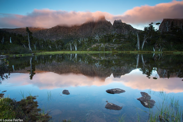
Mt Geryon at sunset. Day One: from the Pool of Memories
Surely it is impossible to look at Mt Geryon and not be impressed by its shape and slope, and the way it yells “impossible” at you when you think of climbing its vertical slopes. It’s a mountain that demands – and receives – respect. It is one of those mountains that I never dreamed I would be able to climb, but something has changed, and here I stood, ready to give it a go.

Meanwhile, my love affair with Mt Massif dates back to 2011, and has  its provenance and inspiration in Dave Noble’s blogsite, where I stared at his pictures and wanted to go there and sleep on top. At last I stood on the startline to do just that.

Du Cane Range High Point, with the stick jutting out of the cairn kind of thing

Day One was unexpectedly “interesting” in that we encountered a guy who wandered into our company after being missing for over thirteen hours. He had no raincoat, no food, no map, compass, torch or phone (it had run out of battery at about 10pm). Whatever else one might need, he didn’t have that either, but he did have an excellent camera and quality tripod, so (in that regard) was a man who had priorities akin to my own.

Day Two: traversing the rocky scree around Mt Massif

He didn’t really know where he had come from, couldn’t say if he had come downhill at all, chose a random (but impossible) lake on the map as a place he thought he had passed, yet we managed to somehow work out that he had reached us from Lake Elysia, most fortuitously wandering east and not west, where people do not get found. He had gone to the Pool of Memories to photograph stars, got whited out and disoriented, and so thought it was a good idea to wander aimlessly all night and into the next day. The fact that he found people might unhappily reinforce this dangerous modus operandi. Meanwhile, others at Elysia had reported him missing, so helicopters were circling overhead. Dave from our group luckily had a satellite phone, so called the police and S&R to report the lost as found. However, two hours later – due to lack of communication from one department to another, one can only assume – they were still flying around, trying to find the found.

Day Two, Big Gun Pass: The Gun

We had set off with him to return him to his tent under escort, managing to use sign language near the Parthenon saddle to at last convince the police buzzing above that we had him. He certainly gave the bushwalkers up there plenty to talk about that weekend. He had the generosity and insight to thank our group for saving his life. He’s one lucky guy. I should have grabbed the opportunity and tried to swap my lunch for a sony A7, but he still seemed to know what was valuable.

Day Two. Vaughan surveys the abyss

Day Two. After a day one where our goals were a long shot off the focus, we settled down to business this day …. except that the weather didn’t. As a result, we danced around in fog for 1.5 hours hoping it would change its mind and be merciful to my Mt Hyperion desires, but it would have none of it. Frustrated, I left the others who were munching lunch in the drizzle, and at least collected the Abel of the Du Cane Range High Point before I ate. Now I had bagged something I felt a bit more relaxed.
And so we wended our way towards the famous Big Gun Pass, with a compass bearing so we might find it. There were no vistas today, but the sight of the Big Gun as a clouded silhouette in the misty ambient gloom was even better. Views could come later.

Day Two. Vaughan surveys a different abyss. He’s getting pretty good at this.

The way up the other side looked particularly steep to this group of heavily laden walkers, but everyone dug in and climbed well, and the high point was soon in sight. Eagerly we each pictured a kind of summit cairn with pastures of green grass to camp on stretching beyond: a veritable land flowing with milk and honey. And what were we given? Not just a wasteland of wild, slippery rocks, but ones whose trajectory was a very sharp slope downwards. We stared over the abyss with dismay. In silence the group sat for a fifteen minutes’ rest taking in the disappointment, conjuring up energy for the unexpected task ahead. If we could find a safe passage down that, we would then have to wind our way laboriously around the rocks to the grassy funnel we could see that must lead to the bowl beneath the summit further away. Straight ahead was a monstrous cliff wall that you couldn’t scale even with ropes.

Day Two. On top of Mt Massif at last. One of many views from one of many possible summits.

A route was found, and we lowered ourselves down the cracks and rocks to a place from which we could contour around, a group of sick crustaceans with all limbs attached to the black mossy rocks, trying to prevent slides into injury.

Day Two: a sorry sight. Fires raging behind Cathedral. You can also see another fire front back left. You cannot see any helicopters dropping water to save these gentle tree giants.

Once the tension of the traverse was over, the others quite sensibly wanted to relax and set up camp, but I am not able to relax if something is not finished, so grabbed my gps and set off for the summit, visiting all interesting high points up there for their different photographic angles, checking at the end that my blue line had landed on the actual summit at some point. There was no happy celebratory group with handshakes and high fives like there had been on the Eldons. It was a most anticlimactic summit for one that had been desired for so long.

Day Two: Mt Massif summit. An unusual view of Ossa, Pelion West, Thetis and more. Cradle back right.

Day Two: a different view of Ossa et al

Day Three presented itself as a marvellous collection of diamonds and pearls strewn carelessly all over the grass in every direction. The mist was enchanting. We were not in a rush, so the pace was leisurely as we enjoyed all these sights and the feeling of total bliss that comes with being in a place like this.

Day Three: fabulous sunrise views from Massif

The route over the rocks was much quicker in this direction, and there were no dismaying surprises, as long as you discount Rolfe’s cracking a rib. It seems quite the fashion these days. Mine is ten days out from being broken, so I had no trouble understanding the pain he was now in. As a result, a small subgroup went straight back to camp after lunch while the remaining ones headed for Geryon North.

Day Three. Rob and Cam arrive to check out the early light. You can see our tents below.

We arrived at the black dot on the map, and the group proclaimed it as Geryon North and cheered. However, I am an honest peak bagger, and knew that this flattish hill (with very impressive cliffs) did not fit the bill despite its cute black dot and height of 1507. The real Geryon North has a much higher height and it was staring at me across the abyss. Would anyone else come with me this time? Vaughan said yes. Hoorah. Then Rob and Cam joined in. More joy. Off we set while the others sat down for a rather dull spectator sport.

Action in the mist


Day Three. Climbing back up to be allowed to climb down to Big Gun Pass

The watchers reported that it looked very dangerous. Vaughan recounted how his new role as father to a toddler and baby gave him a new purpose to be alive. Rob (father) admonished Cam (fouteen-year-old son) to be careful every two minutes. Louise was lead by the summit fever that always overtakes her, but is no risk taker. We were being careful, but Vaughan did say he found this climb harder than Federation in its technicality. We had to back out of a few manoeuvres; there was some light grunting, handholds where limbs couldn’t reach the only rock one on offer, helping pushes or pulls and eventually the team made it. This time there was joy at the top, and we all joined hands to touch. The views, of course, were breathtaking. Sure, you can hire a helicopter and get the same thing, but you will never get the joy that grated fingertips and slightly lacerated gear in your effort to get there will give you.

Cam on the lump called Mt Geryon that is not Geryon North yet

Here is our goal, up nice and close now. East face looks quite exciting

And here is one from the tippy top

Before the others set out for the Pool of Memories, we had seen from high above that someone had dared to beat us to the pool; a little red tent was in “my” spot. This person obviously had good taste in views, but must be evacuated. We instructed our forerunners to be rude and raucous and thus drive them away. When we at last descended and I met the fellows, however, I decided to be raucous but skip the rude bit. These were people who were my friends in Instagram and here they were in the flesh: the fabulous Luke Tscharke, Tim Wrate, Francois Fourie, and Dylan Toh. I was delighted to hear they had consulted this blog when deciding where to go for their trip. As a result, the paparazzi lineup for sunset was quite amusing. Now I didn’t feel at all silly lugging 3 kgs photographic equipment all this way.

Mt Geryon says “good night”. Pool of Memories.

And here is sunset looking in the opposite direction.

Day Four. We climbed down – reluctant to leave this place, yet refreshed from it – to resume our daily lives, descending through glorious rainforest to the Geryon Climbers’ Camp in the valley below, and thence to Pine Valley and eventually to the lake where we killed about three hours throwing stones waiting for the ferry.

Love rainforest. Hate, hate to think of it burning further east.
Route up Mt Geryon North from near Du Cane HP – please note. This is only for the experienced and confident.
 The map to Mt Massif is also available on request. 

Wellington 2016 Jan

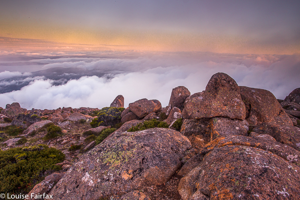
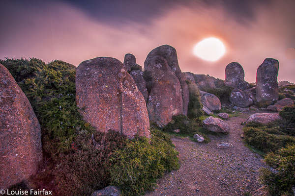
Mt Wellington 2016 Jan


I had been feeling guilty for a while that I had never turned my photographic attention to Mt Wellington. It is an Abel, after all. All I’d ever done was run up her, endlessly, in wondrous dreamlike runs where the world and all that is in it was temporarily forgotten while I floated to her summit. I loved my training runs on Wellington (or anywhere. I was always in a trance while I ran, and was in some very far off place. I still am, for that matter. Running is my “time out” from the world, where I can refresh my should for the next round).


However, now it was time to come to the top by car, and to bring my tripod, filters and lenses to see what this evening could give  me and my camera. This is what I got.


At first, it was pretty nice, but then it seemed that it was just going to be a grey fizzer. I actually packed up and was in the car when all this pink came out. I had to do the most hasty set-up imaginable and chase the syun and the pink across the mountain. It was rather fun.

Nescient Peak 2015 Dec

Mt Rogoona from the valley which we climbed up to. The shoulder of Nescient, which we used to ascend her, is on the right there.

Nescient Peak. There was something incredibly tranquil about this day – perhaps partly caused by the fact that this was the first day since winter that there was a feel of summer in the air. The Examiner reported today “Summer is here”, and indeed it had arrived. Perhaps the feeling also sprang from the fact that this was a Monday, and one doesn’t normally climb a mountain on a Monday, but my friend Angela had the day off and I was free, so here we were in good spirits, ready to try the taste of another mountain on Tassie’s wondrous smorgasbord of high points.

There is another shoulder of Nescient. I am toying with you … hiding her to arouse curiosity. Angela taking a welcome drink from the tarn. The day was hot.

I have decided I love climbing mountains that have received bad reports elsewhere. It’s not that I’m perverse, seeking to find pleasure where others have found pain: I think it’s just that if my expectations are set low, then reality has a good chance of bettering my anticipations, and I am left pleasantly surprised.

OK. Here she is. Ta da. Nescient peak in all her glory, given a photo at last.

The writer of the Abels essay on Nescient Peak was quite clearly disenchanted: in the opening sentence of instructions on how to get there, the reader is admonished to wear scrub gloves and gaiters, as if this were the most important thing one would need to know about this mountain. I suggest the author visit the Coronets to gain a different perspective. It made us feel as if this mountain were a kind of medicine that good people had to take in order to keep healthy. As a result of the warnings, we kept commenting to each other on how easy this bush was to get through; how light and malleable the small branches.

A summit cairn that leaves you in no doubt that you’ve arrived

We did have to agree that the first glimpse of our mountain was “unremarkable”, but I still found it attractive enough to want a shot from a few angles. The book insulted it by only publishing an image of the very prickly Coprosma nitida (mountain currant), as if any image of the peak would detract from the beauty of the book – like dismissing an atonal person from the choir.

We enjoyed our lunch spot beside the cairn with moss and flat rock to sit on, and a spot of welcome shade.

Next criticisms were directed at the apparently awkward navigation (in nuce, head west, over two contour bumps and the third and highest of the contour collections is your goal), and the fact that apparently the ground was very rough underfoot. We were in the bush. The ground was neither better nor worse than any other bush. If you want a smooth highway, visit QLD. They vacuum the forest floor there at 7 a.m. in case tourists should sue them for having uneven ground (I kid you not. Pity about the hideous noise and smell of petrol in a National Park). Again, expecting the worst, we felt nothing but pleasure in not finding it. You could run through that bush (if you were an orienteer), and the rocky knolls were fascinating and shapely. I loved them, and climbed over them on purpose. “This is fun”, we agreed to each other as we climbed.

Summit cairn and teasing trees

The “difficult to discern” summit stood out loud and clear to us, and even the complaint about the presence of trees fell on deaf ears. We enjoyed having a patch of shade in which to enjoy the view and have our compulsory summit-lunch, and I liked having a frame for the scene provided by leaves and trunks. I don’t want that on every mountain, but was happy to have it on this one. It seemed appropriate here. Of course we could see Mt Rogoona, but what that interested us the most was the unmentioned (by the book) King Davids Peak and Solomons Throne: it was fun to see these old friends from a different angle. Lakes Bill and Rowallan were very appealing from up there. And on the way down, once you’d started the very steep descent from the high moorland, we enjoyed views of Lake Rowallan that did not disappear, and that got bigger with each step. We’d taken, in walking time, 2 hrs 15 up; 2 hrs down, which made it a great daywalk, and meant it was short enough to have what was, for us, an uncharacteristically late start. Perhaps that also helped create the feeling of tranquility that I referred to in my opening sentence.

And a parting shot of Rogoona

Confessions of a sinner, in case it helps: that ‘up time’ includes mislaying the track somehow: one minute we were on it, chatting away as we climbed, the next we weren’t. I am always a person on a mission on the way up anything, and Angela is a very agreeable soul, so I suggested we just bushbash our way south until we happen to intersect with the pad, and she agreed that would be fine. I’d much prefer that to wasting time finding a pad that you don’t really need anyway. As predicted, we did get back on to it a bit later.

Our route from the pad on the marshy land below to the summit

Bobs 2015 ii Nov

The view from my tent window of the sinkhole

Mt Bobs beaten.
“Thirteen, fourteen, fifteen …”
“Louise, you’re just showing off.”
“Sixteen, seventeen, eighteen … .” I would not be put off my leech count, flicking them as they ascended to my hands, pulling them out of my hair and off my rainjacket, overpants, gaiters and boots. The light rain that had persisted for much of the first day had certainly brought them out, but at last we were at the sinkhole, ridding ourselves of them before disappearing into our tents to try to slough off the array of wet layers and warm up before exploring our fascinating environs. The rain had ceased, and the sinkhole is a truly fabulous area.

Sinkhole view, different direction

Although we had never tried Mt Bobs and failed, both Mark and I had the feeling that this was an elusive mount: a hard capture. I had cancelled a couple of trips due to bad weather before I ever set out from home, and on one occasion we had gone to Lake Sydney, only to turn back before ever beginning the climb proper. People seem to speak of this mountain with certain tones of respect; some, even with something akin to fear in their voices (these being the ones, I guess, who had particularly long or difficult battles with thick forest on the way up). Certainly, the way is steep and the rainforest thick, and no possible path declares itself as you stare amongst the tangle and cliffs. You are too close, at that stage, to sort things out. With Bobs, I think, you need to have worked out your method of attack before you begin. Horror stories of being held captive in her thick bosky arms are not too difficult to find.

Sorry, but it’s rare to have such a fabulous scene from the shelter of my tent

We did not treat this summit lightly, and read as much as we could before departing. In particular, we found the help of Rohan and notes he leant us from Marco to be invaluable. Thanks guys. Thanks also to Ian Ross – for our email discussions and his inspiring pictures in bushwalk.com that first sparked my interest in this mountain.
Day Two
At last ascent day dawned and we stood at the start line, ready to try our luck, determined to succeed. The sinkhole was pretty full, but we could at least get around some foreshore (left) before being forced up into the rainforest by rocky cliffs. We climbed a contour or two and then progressed parallel to the lake which already seemed quite a way below us when we got glimpses of it.

Looking back at my tent once we went exploring

Marco’s notes mentioned climbing an obvious spur. Lots of spurs can seem obvious on the map, but not so obvious when the shape is obscured in situ by thick covering, and, conversely, small spurs in the terrain can strike you visually yet be not be represented on the map, often due to the scale or the contour interval, or because they are not detected by the photogrammetry. I was standing on a spur that seemed obvious to me, but was it obvious on a 1:25,000 map with 20m contour interval? Time to check the gps. Yes. Good. Up we went. Confidence was high, and yet the notes also said that a pad of sorts could be encountered if one is in the right spot. We were seeing signs that humans might have held this or that branch, but after a while I felt like another dose of confirmation. I turned around to Mark:
“Right now, I would give a lot for the sight of a little pink tag.”
“Yes, that would be nice.”
I turned back to continue and could not believe it. There, right in front, waving at me, was exactly what I desired. It felt like we’d spotted the summit cairn. I gave a victory dance and hugged Mark with joy. This would take us on a pad that worked as far as the scrub just short of the saddle. We didn’t need to waste time with trial and error seeing if this or that cliff was going to allow us to progress on our way in this low-visiblity forest. We wouldn’t land in a cul de sac of tangle now – well, not as long as we managed to continue finding the tags. We still, of course, had to keep navigating, but every five minutes or so, you gained a pink benison: you were doing the right thing. It was a great feeling; like spiking the control at orienteering. Despite still concentrating, we could relax our guard a little now and enjoy the forest even more than we had been doing. When you are in a fairytale wonderland, that is a good thing.

Typical of the forest we climbed through

We swung a bit far in the scrub before the saddle, but didn’t lose too much time, and were soon enough standing on the turn of the land, gazing up at a cornucopia of cliffs, wondering exactly which were the “obvious” ones of the written instructions. Not quite knowing, we agreed together to head for a bushy gully between two likely contenders and play it by ear from there.

Mt Bobs summit area views

Emotionally and physically, I was pulled towards the more cliffy of the two main possibilities, so when I saw the hint of a lead through the scrub that would get us to the top of it, I took it. From there, we gazed together at our alternatives. The notes had talked of cairns. There were none for us, but in this section there is visibility, so we surveyed the scene and opted to go straight up the rocky spur in front of us, reckoning there were enough low-bush connectors to get us to a gully up high that we could see, which would give us a lead through the dominating cliffs to whatever was up there beyond. We were not on THE route but this route felt good. It was, indeed, as good in fact as it was in theory and we fair bounced up to the top in a very slick time, cresting the plateaued area by 10 a.m. This was it; we’d done it. The remainder of the stroll across the tops to the actual summit – photographing, admiring the view, delighting in the tiny watercourses, patches of snow and vibrant green cushion grass patches – was almost like a victory lap after a race.

Mt Bobs to Federation Peak in all her glory

It was sunny up there as we ate a bit and gazed at Federation Peak, but we were also very aware of the gloomy weather forecast for later in the day. We had climbed in a very small window of opportunity. We thus elected not to climb the Boomerang, but rather to descend, spend a little time relaxing at the tents – even cook some warm soup to have with lunch – and head out.

Cascades on top of the waterfall along the way both up and down

When we reached the bare knoll on the way out that offers the final view of Feder, we could see it was already raining there. The clouds were quite dramatic; the front was approaching speedily and earlier than we had envisaged. The race was on. We belted down that mountain, putting in as much distance as we could before we had water dumped on us from above.

Lazing in the sun by the tents while the billy boiled for lunch

The trip ended as it began: soggy logs, covered in moisture-laden moss that drenched you if you got too close; deep mud to suck you under and wet your boots and socks; soaking bauera that made each brush with it feel like a cold, unwelcome shower; and two sodden bushwalkers. Luckily, the really punishing rains began during the drive home. We were quite wet enough with the low-intensity version of a dunking that marked the beginning of the change. Our decision to hasten out was a good one.

Mt Bobs: Our route from the campsite to the top. No, we didn’t go swimming. I guess that blip is the gps objecting to the thick forest cover, trying to find a satellite.