Jubilee Range 2024 Feb

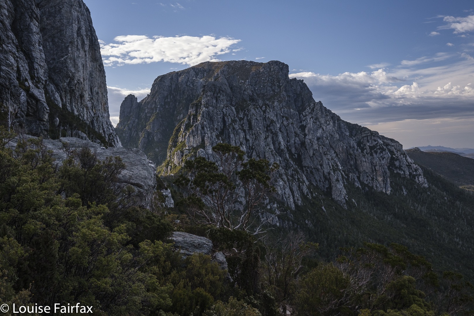
Over ten years ago, I said in my blog that I would like to return to the Jubilee Range, not only to reach the actual high point, but also, and far more importantly, to sleep up there. For me, sleeping on high and witnessing dawn and dusk are the essential elements of a satisfying wilderness experience. A single day pop-in doesn’t have nearly the same effect on me.

The road walk in : 3.5 kms. Photo cred: Adrian Bol. (White pants did not stay white).

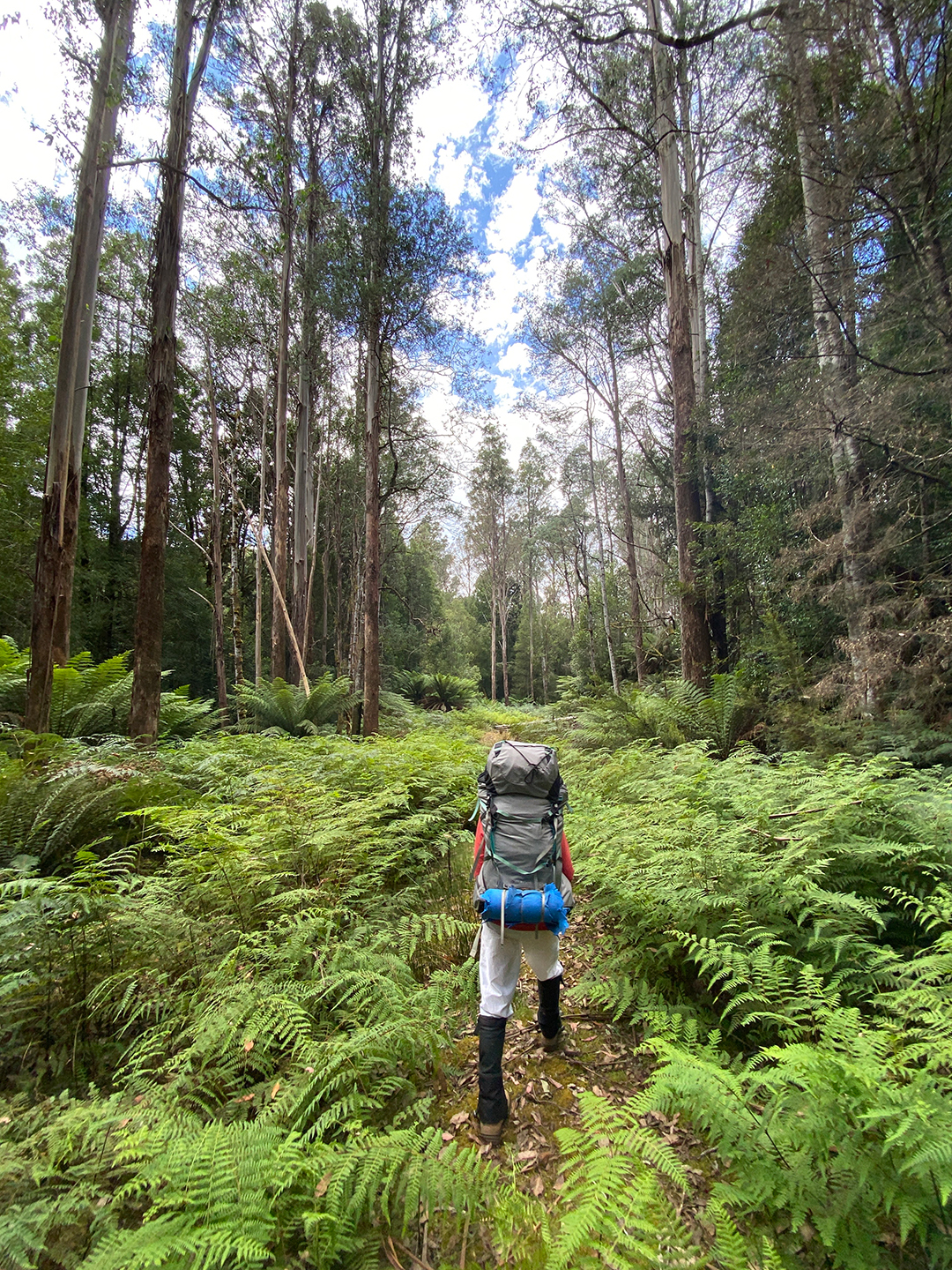
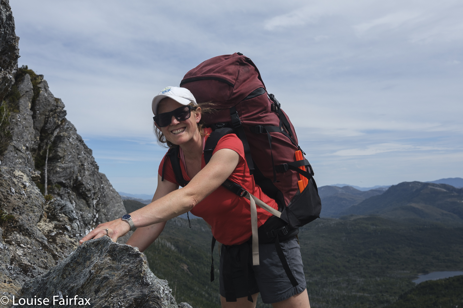
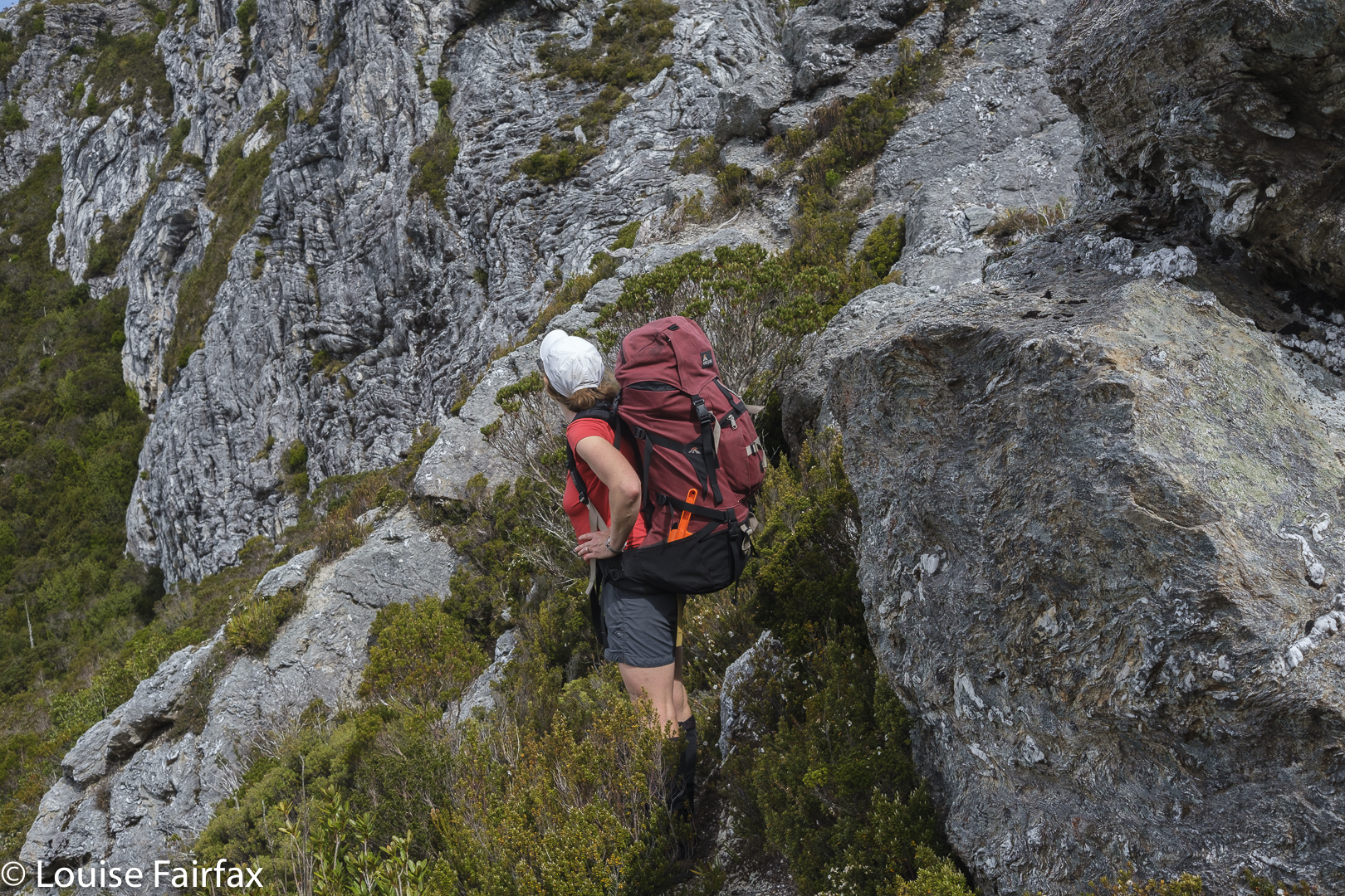
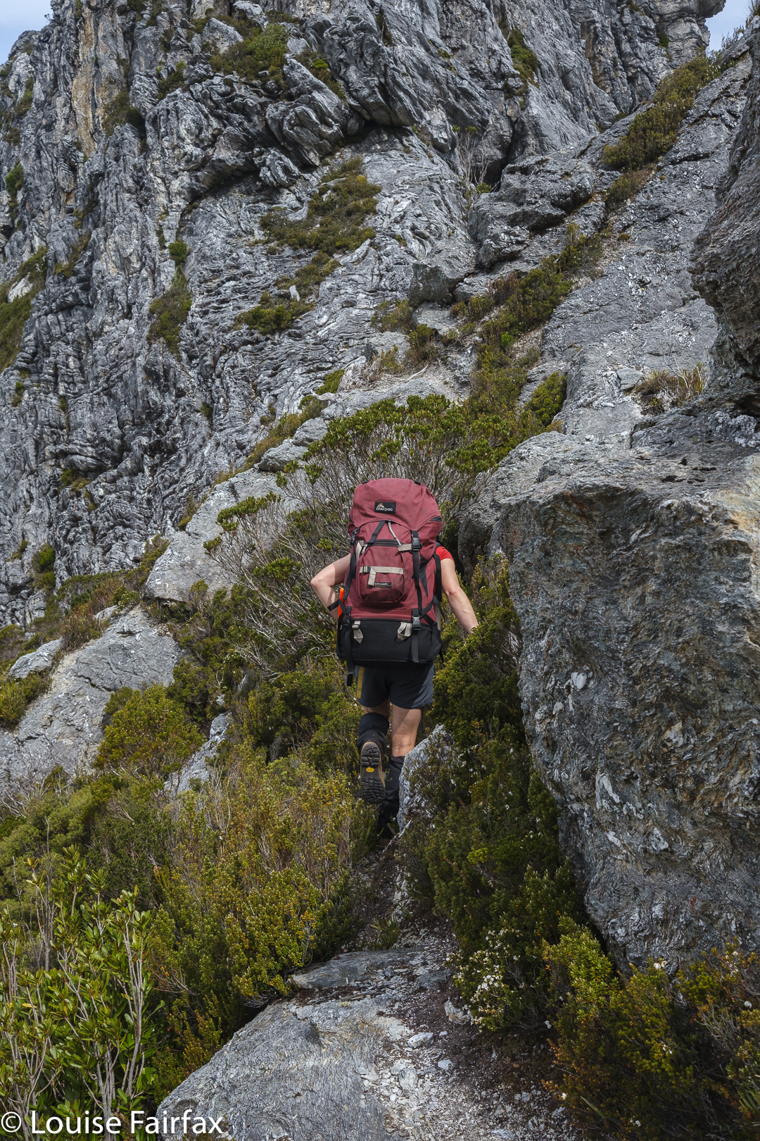
Luckily for me, one of my waterfall hunting friends, Adrian,  had decided he wanted to check out some falls way at the far end of the range, between it and Nevada Peak. He planned a trip with four of us eager beavers in mind, but two dropped out. I feared our speed difference would make the trip boring for him, but he disagreed and encouraged me to continue, so off we set. Thanks mate. He knew I needed the restorative powers of the wilderness to soothe my soul a bit. Nothing like pushing your way through dense melaleuca and bauera, piercing your skin with cutting grass, and goose-stepping over high button grass to soothe the soul. The steep climb in debilitating heat no doubt also contributed to distracting me from the state of my soul. I drank 5 litres of water on day one!!! Pity all the creeks were dry!

Jubilee Range campsite.

Our cause was not helped by the fact that the road is now impossible and impassable beyond the Styx crossing. We had to walk 3.5 kms to get to the actual start, which added over an hour in each direction.

Jubilee Range Adrian’s tent

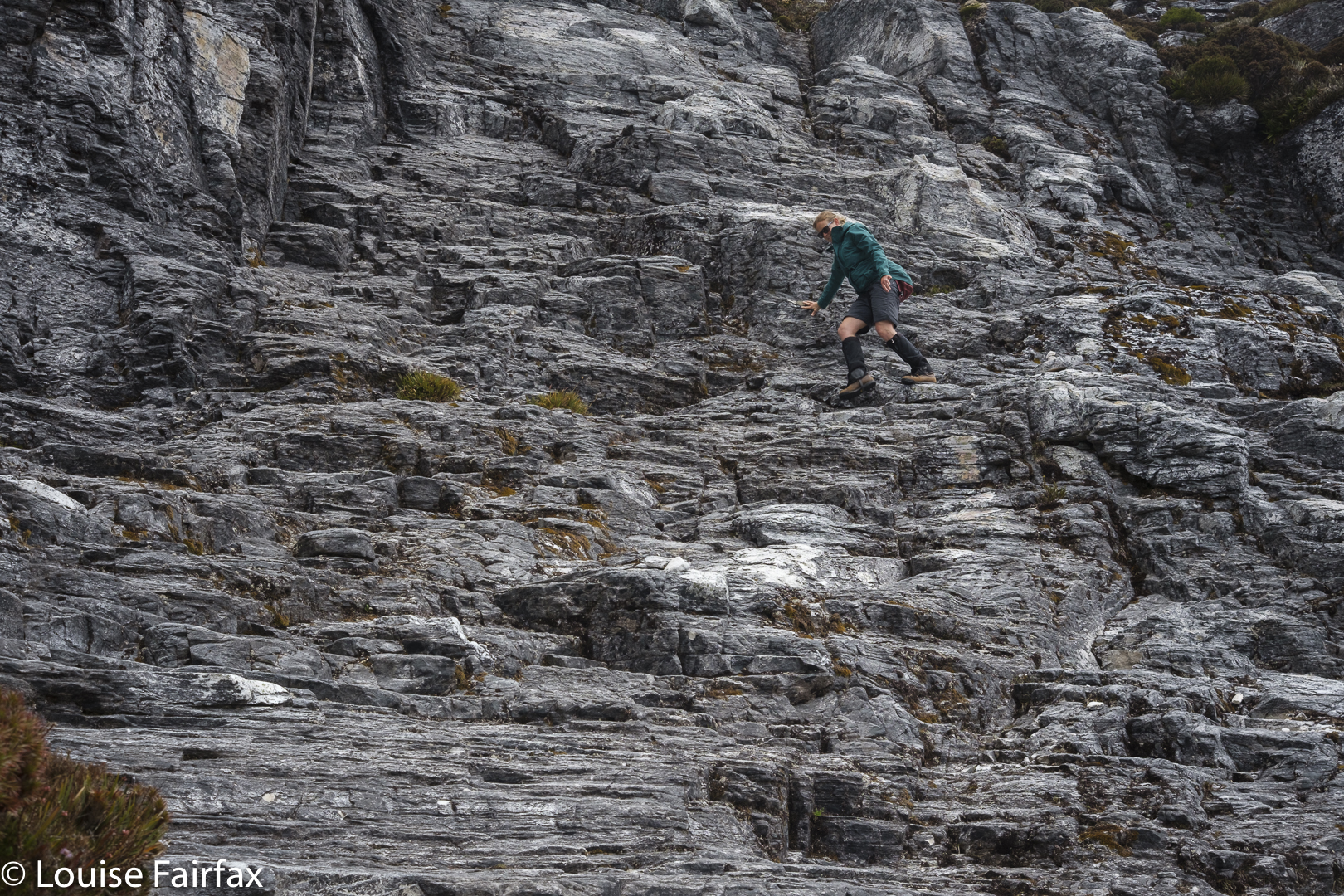
Luckily, we kind of had enough water to make it to Mt Jubilee. Progress was very slow, and every time we stopped, I needed another 500 mls – far more than on the Larapinta trail, where I drank 250 mls/hr. After one hour, first break, we had covered a mere single kilometre. This dd not bode well for our overall plans. We could only do whatever it was we could do. On we pressed. Up through the thick, resisting muck. More water disappeared from our bottles.

Jubilee Range day 2 begins.

I started to worry about the future of this trip. We had already consumed so much water that we didn’t even have enough for dinner. If we didn’t find water by the summit of Mt Jubilee, I decided, we would need to turn back. Our whole trip depended on finding a source of water somewhere up high, but as all creeks had been dry, the prospects did not look good.

Jubilee Range: tarn below “Lunch Bluff” on “Endless Tarn Ridge”.

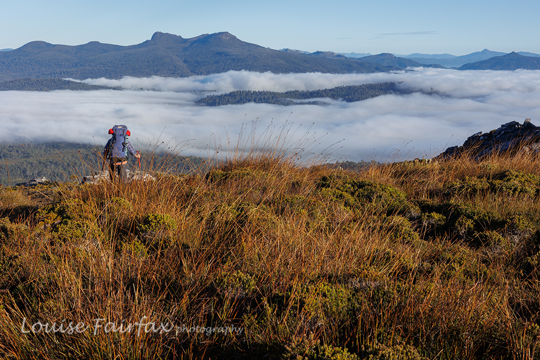
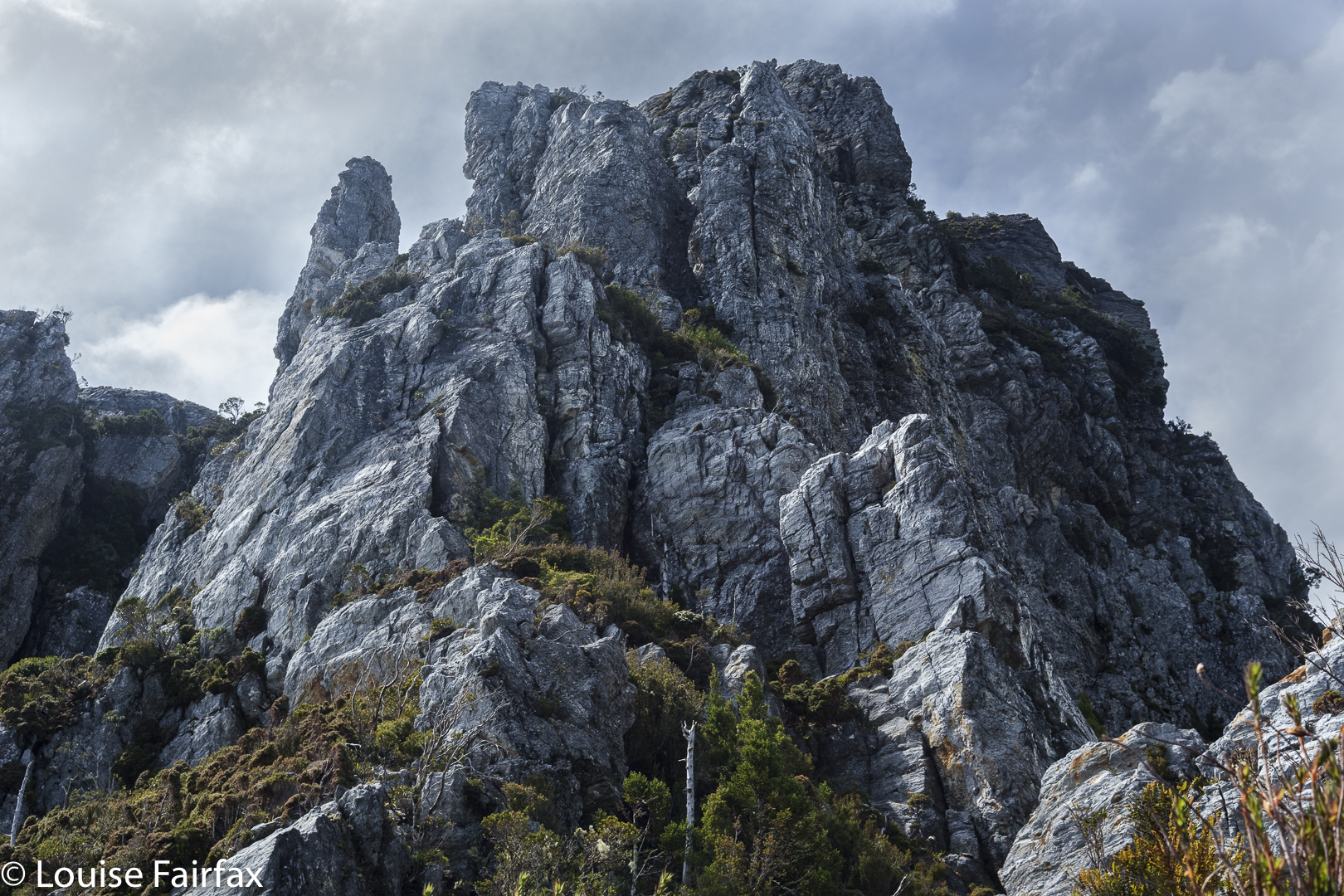
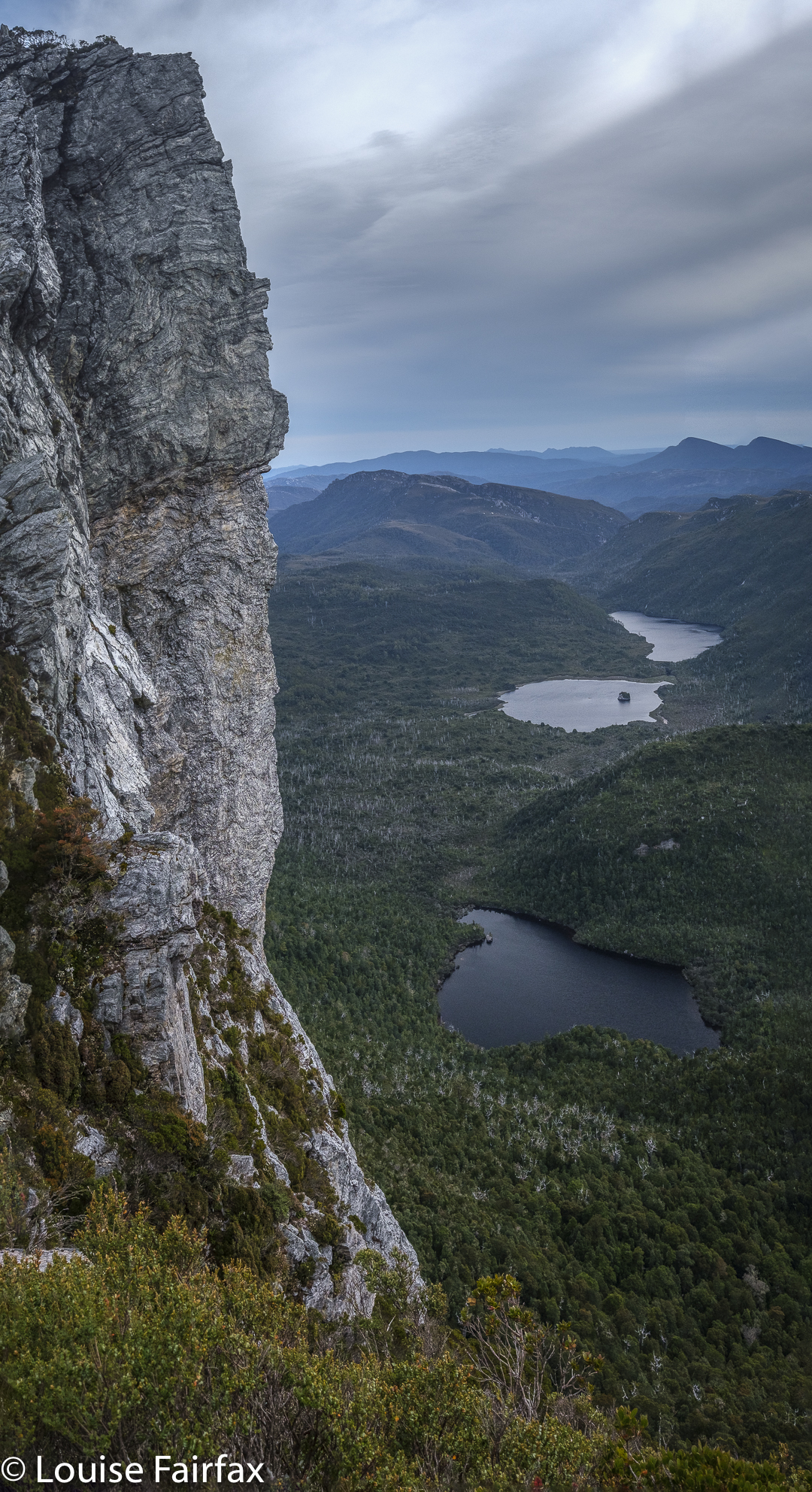
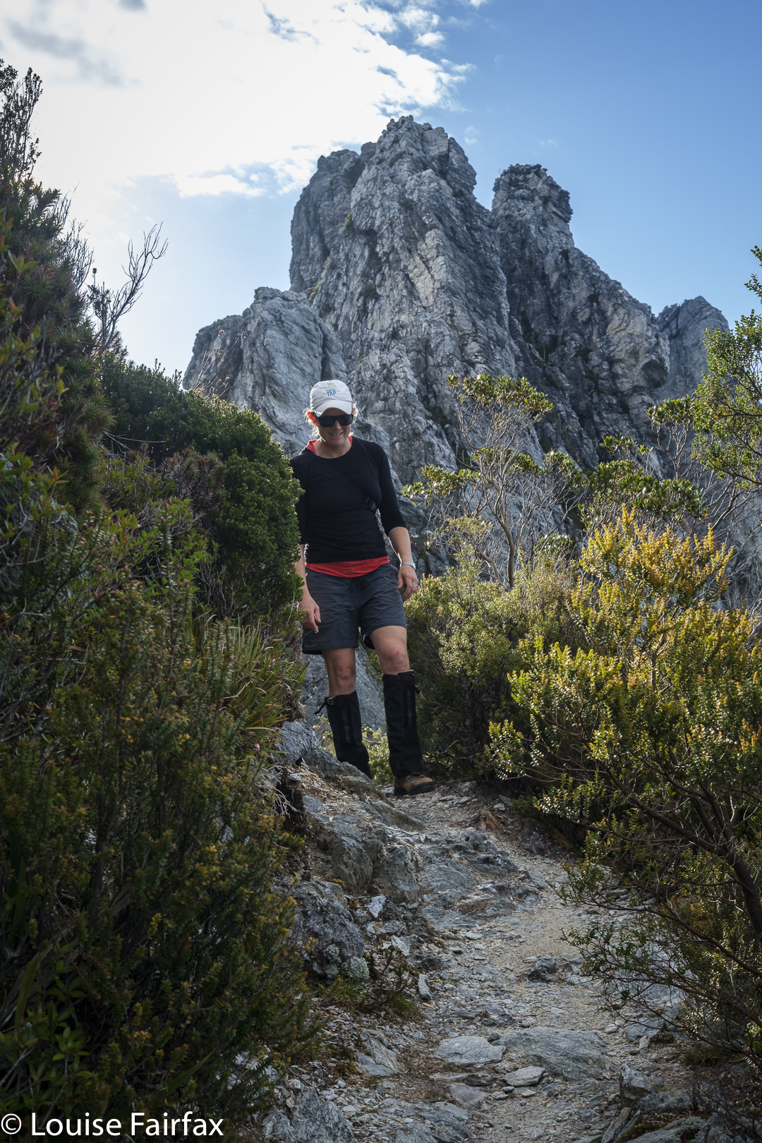
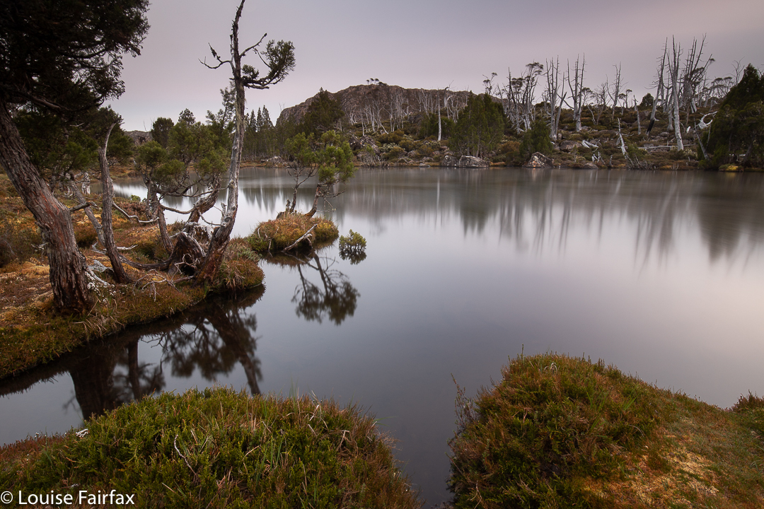
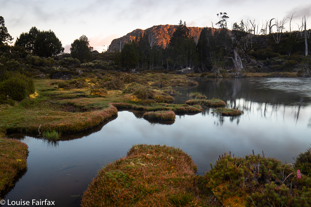
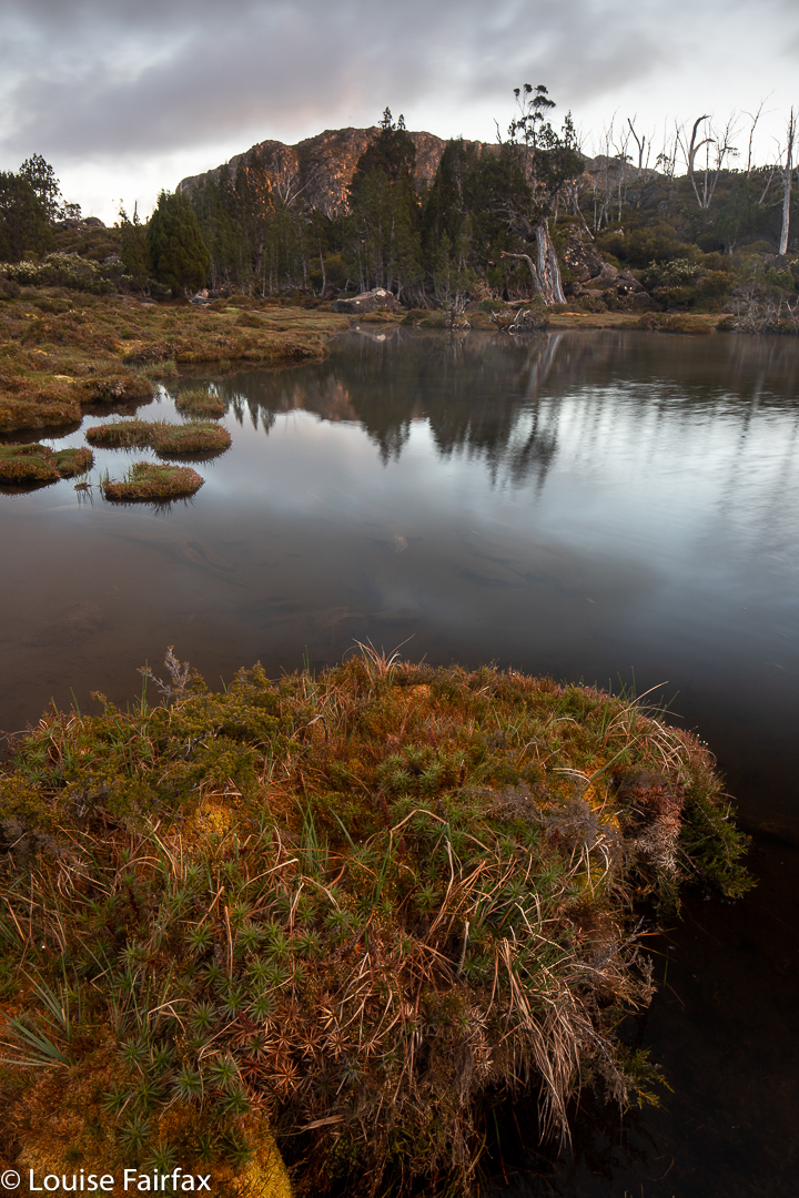
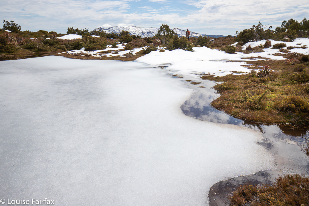
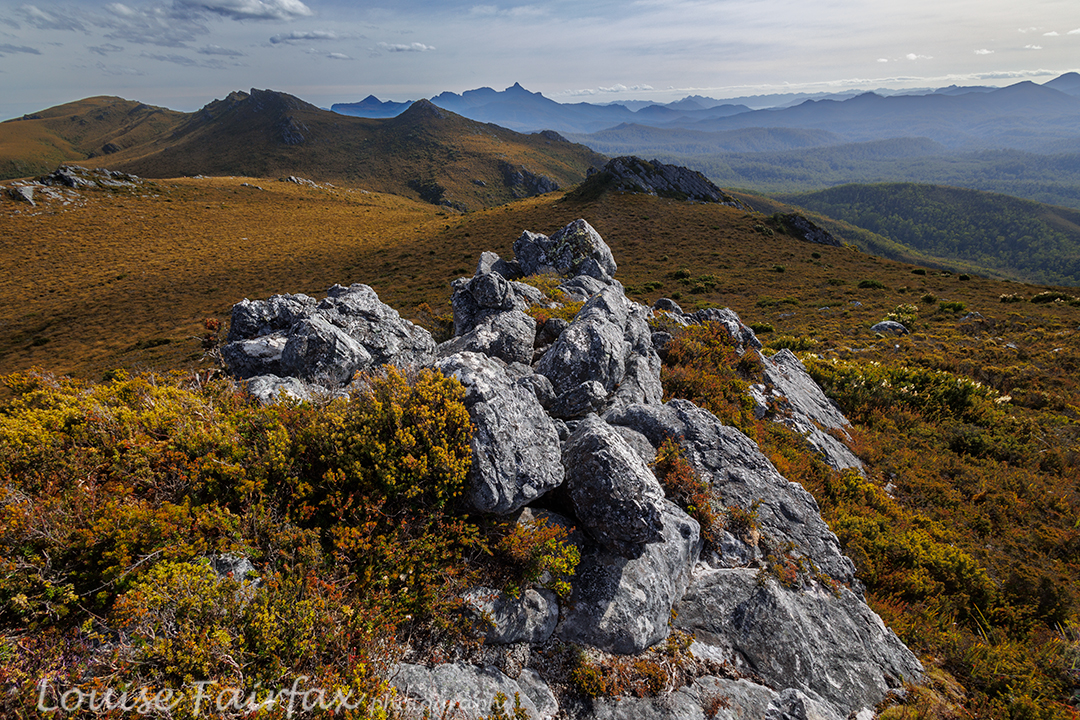
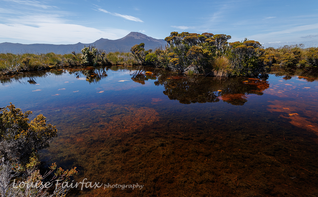
The slope looked like it was at  last levelling out. Our climbing trials were nearly over. We were going to crest the slope near a rocky, bluffy sort of arrangement, with Mt Jubilee itself just slightly to our left, only a couple of minutes away. I dumped my pack unceremoniously on the ground and looked to my left as I turfed it. Unbelievably, hidden behind the deep green of knee-high bushes was a tiny, tannin coloured, yet pure and clean, tarn. Our trip was saved. Yahooooo. Adrian dumped his pack, and we drank, and drank and drank. I needed more, so added two more protein drinks to the couple of litres I’d just gulped. Off we set on the 5-min ‘trip’ to Mt Jubilee. On top it was nice, but I was still thirsty, so had to return to the tarn for more water and two “post workout smoothies”.

Jubilee Range day 2. The Pool sort of near Lunch Bluff. Nevada Peak behind.

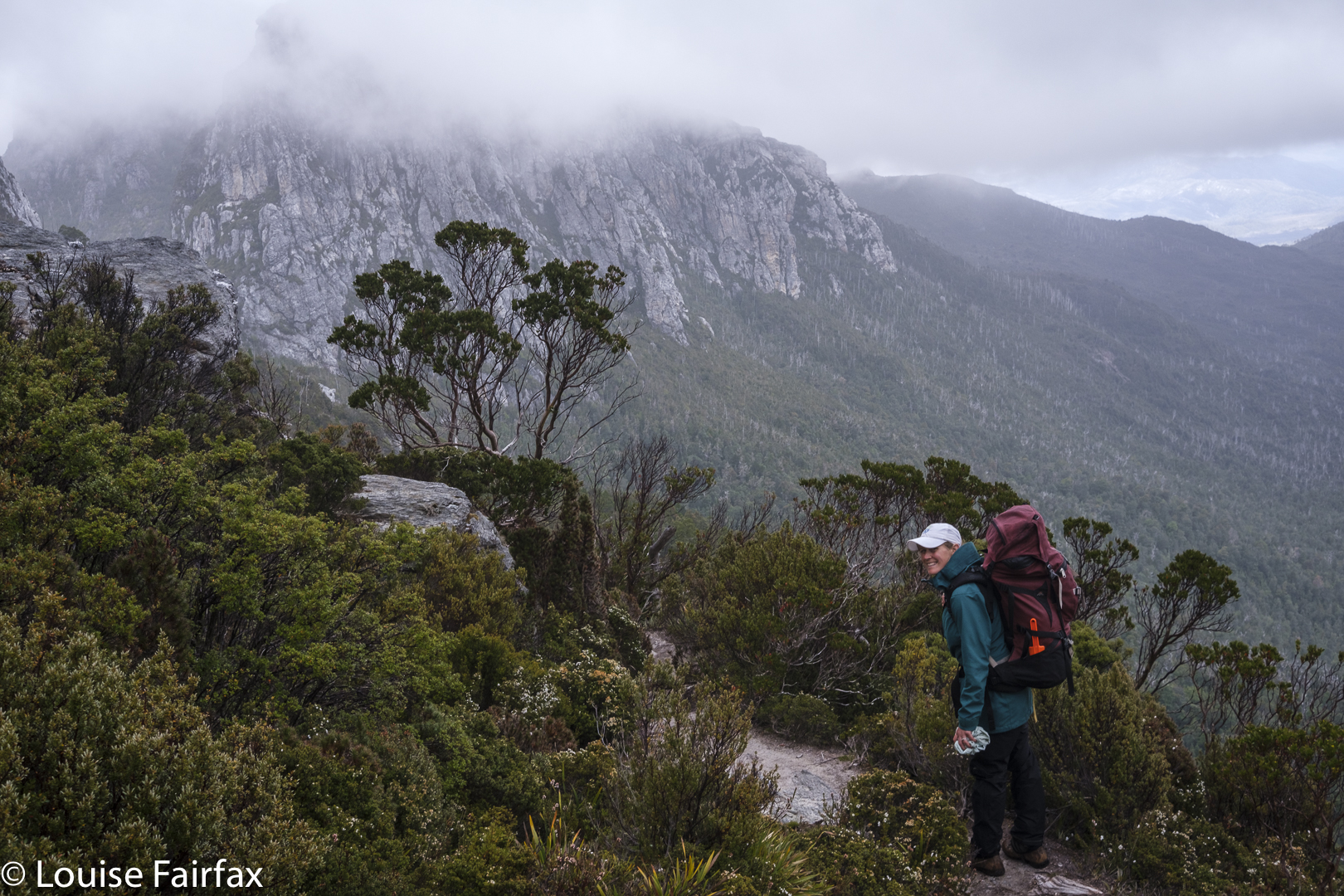
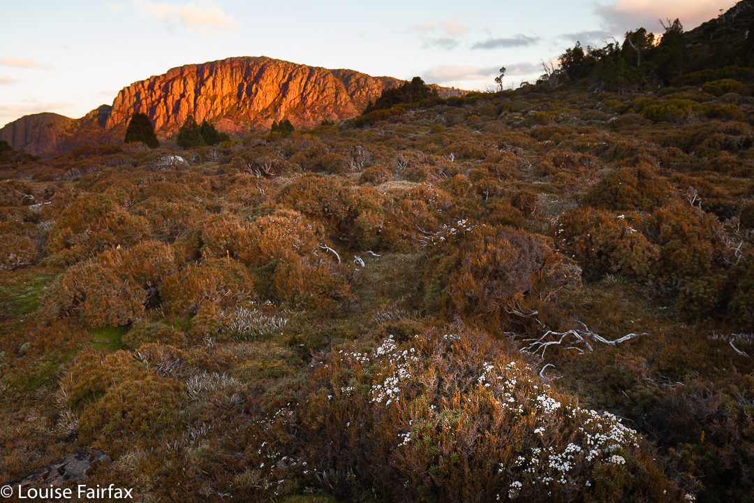
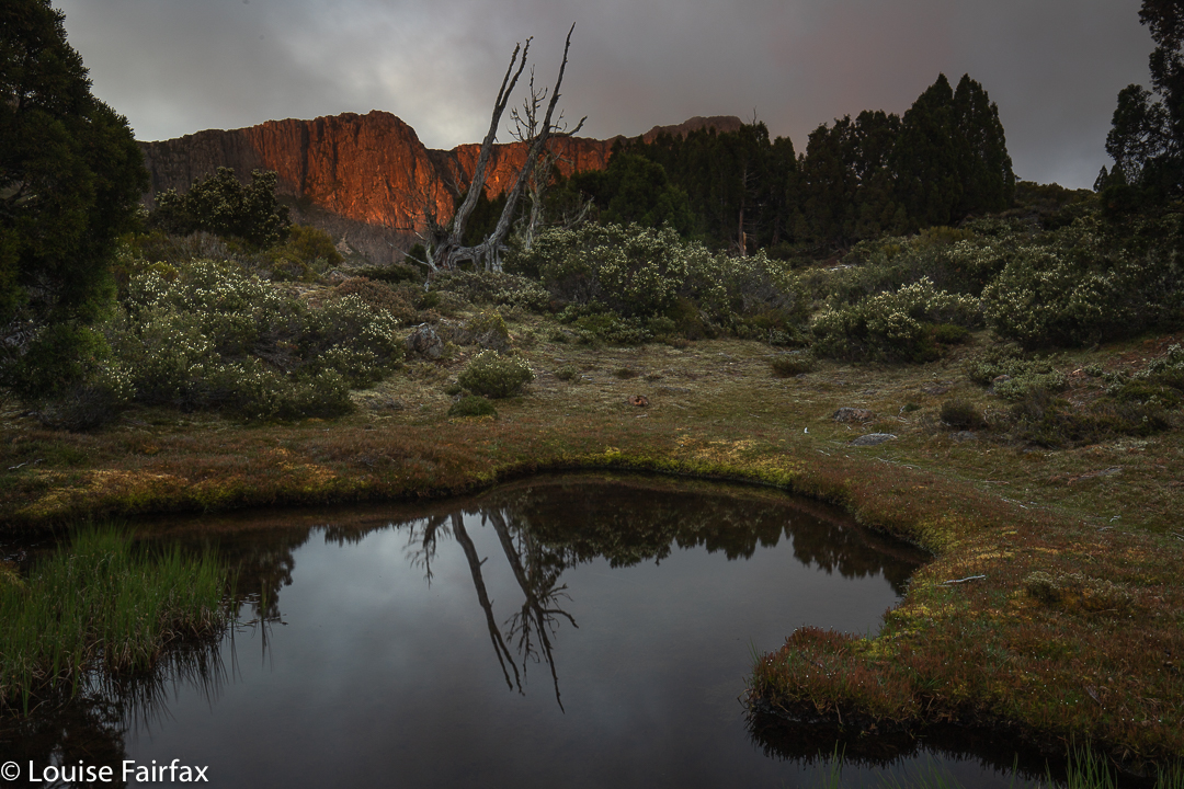
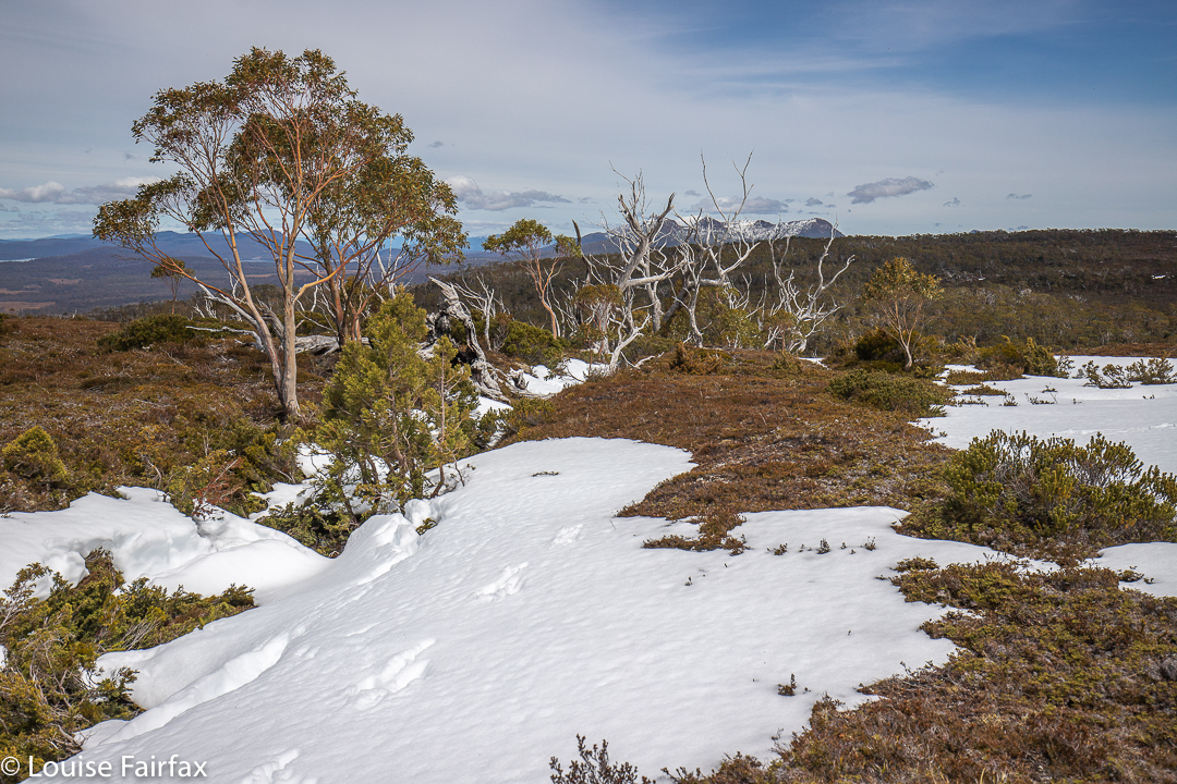
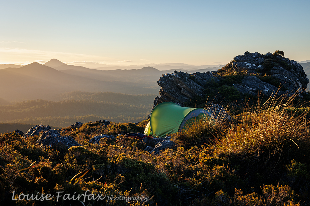
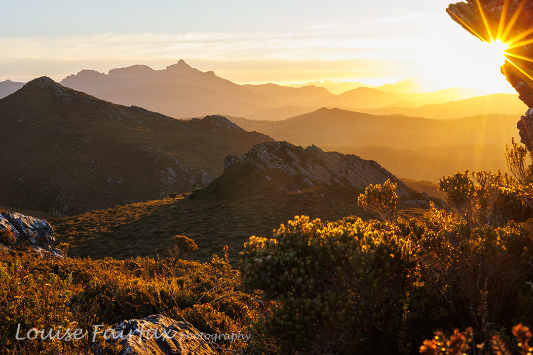
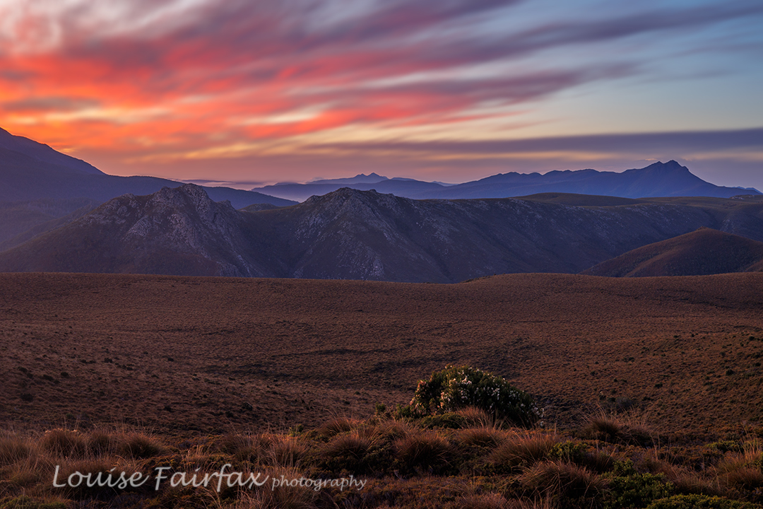
It was only mid-afternoon by the time we had explored our first summit and drunk to our hearts’ content, but I was finished for the day. It had taken five walking hours from the car to where we were, and I have not done any pack carrying or bush bashing for many months. The plan had been to sleep near the actual high point of the range, but Adrian kindly agreed to sleep where we were. By this stage, I needed a cup of soup. I really was a hard case this day. Adrian had a cup of tea, and we spent the rest of the time between then and sunset climbing knobs and bobs nearby, of which there were plenty, eating more, and setting up our tents. I was so exhausted, and so out of practice, it seemed to take forever just to get my tent up. Sunset was pretty OK, but not exactly what we’d ordered. That’s part of the beauty of nature: it is unpredictable, so you just never know what it will deliver.

Jubilee Range sunset night 2. Mt Anne and friends behind.

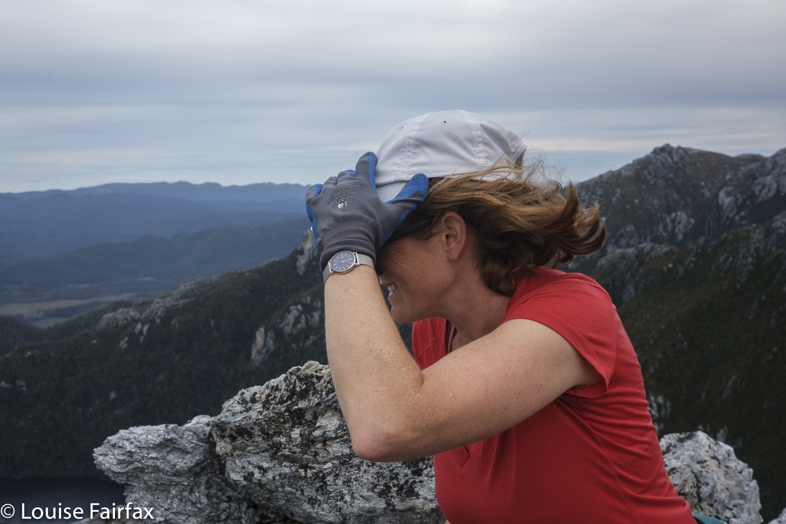
The next morning, an inversion layer had been predicted in some weather app. The predictors were wrong. We awoke to heavy, blanketing mist. I had set my alarm for 5.45. I peeped out my window, groaned and rolled over in my bag. Every time I checked, there was no improvement. Near 7, I checked on Adrian’s tent. We decided we would keep our tents where they were and just do a day walk. There was no point in lugging them higher in mist like this.

Jubilee Range dawn Day 3.

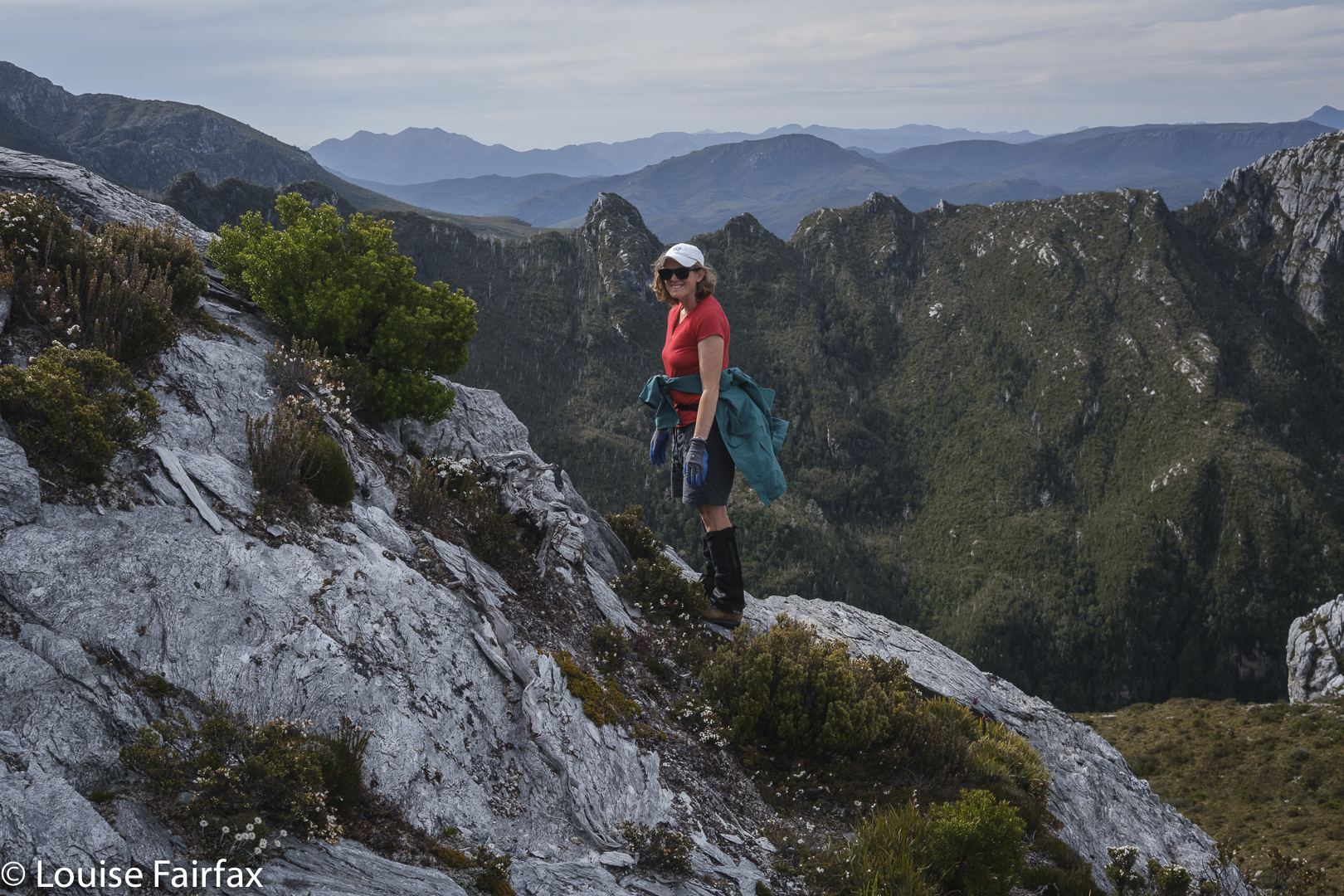
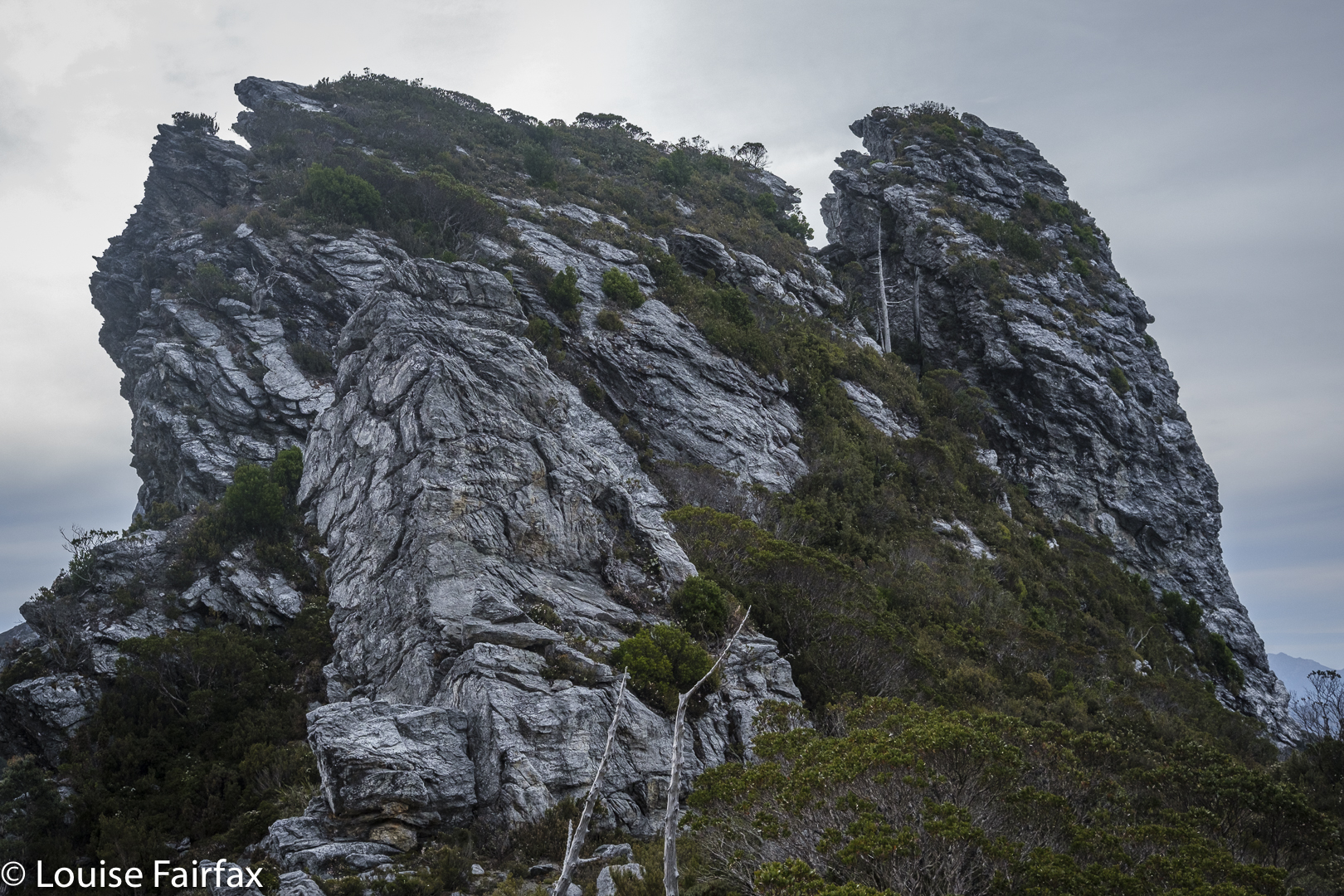
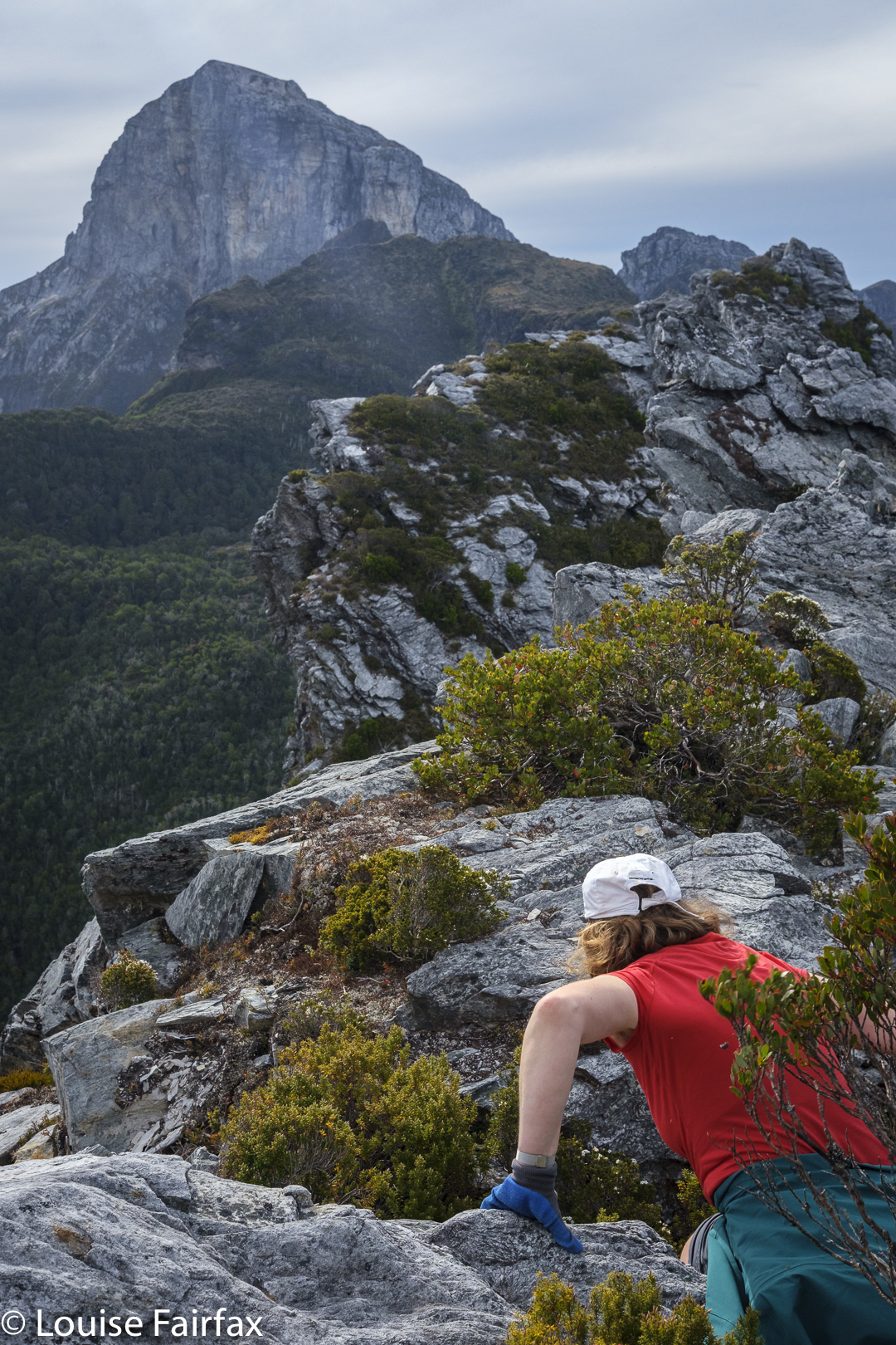
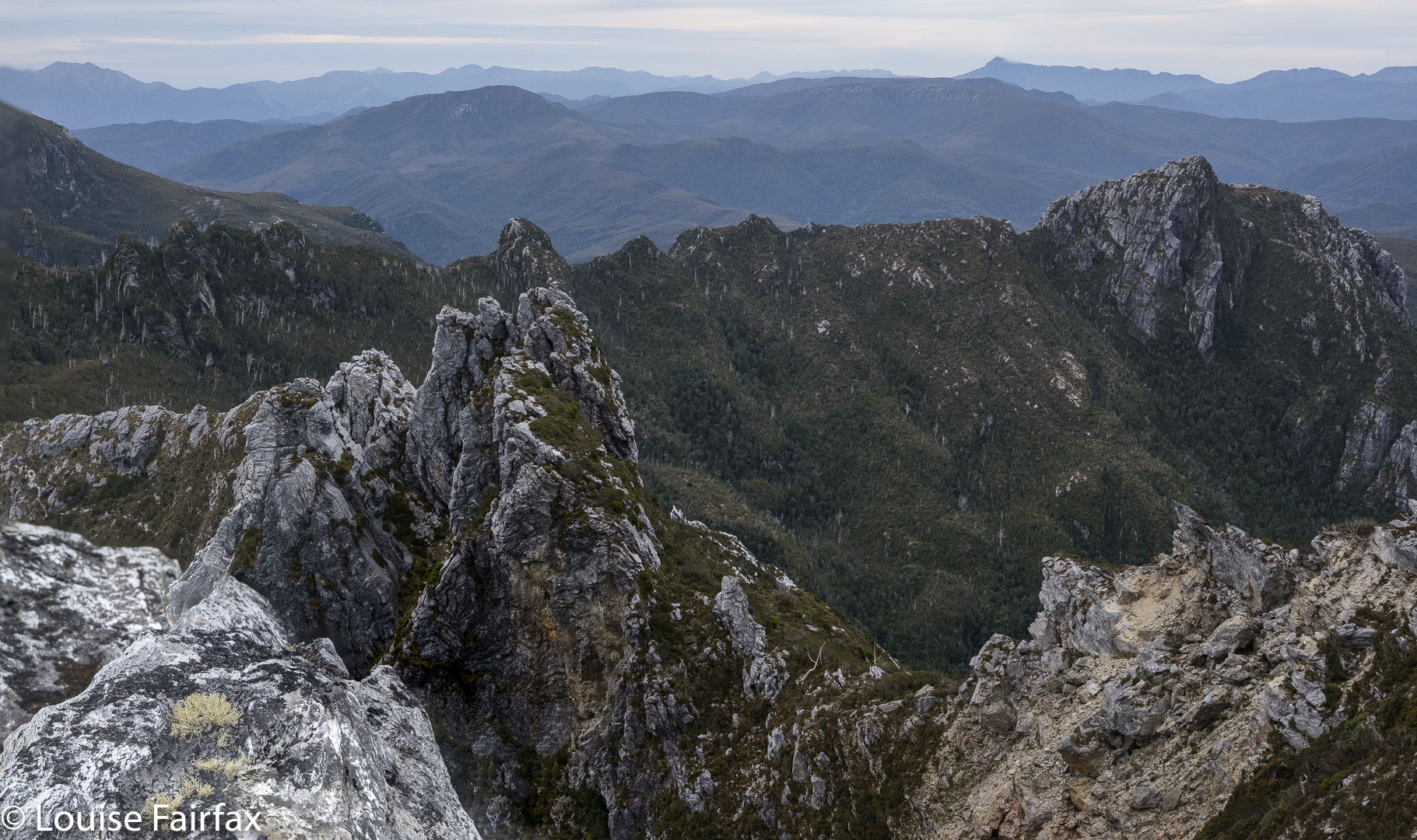
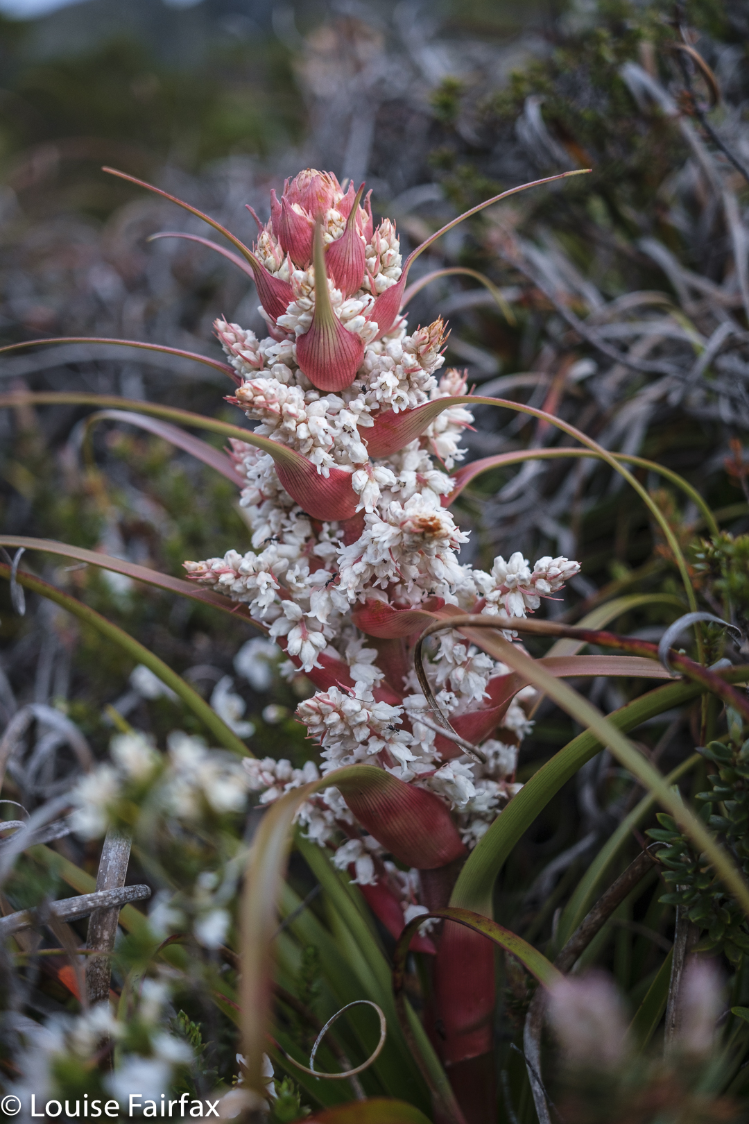
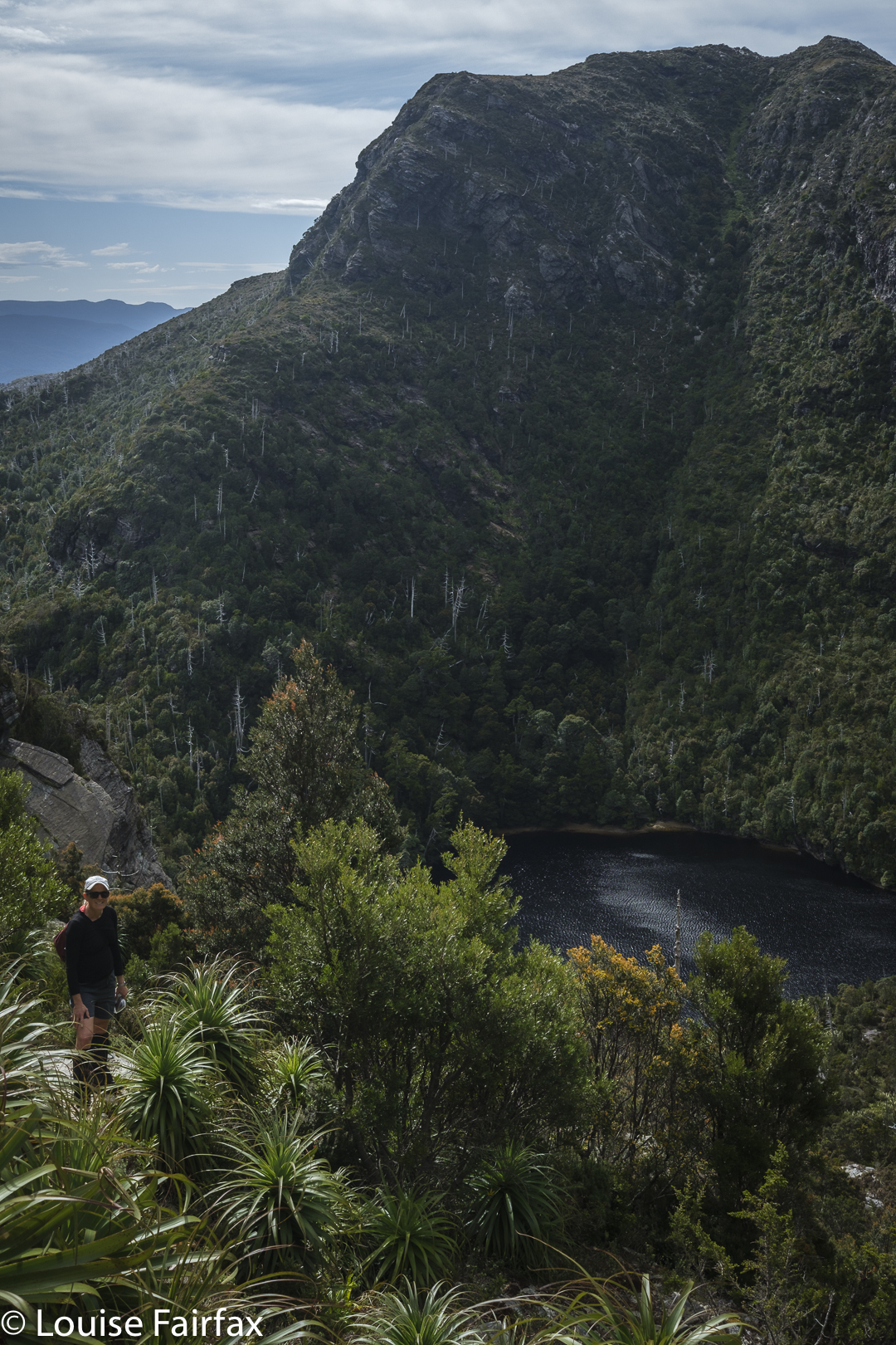
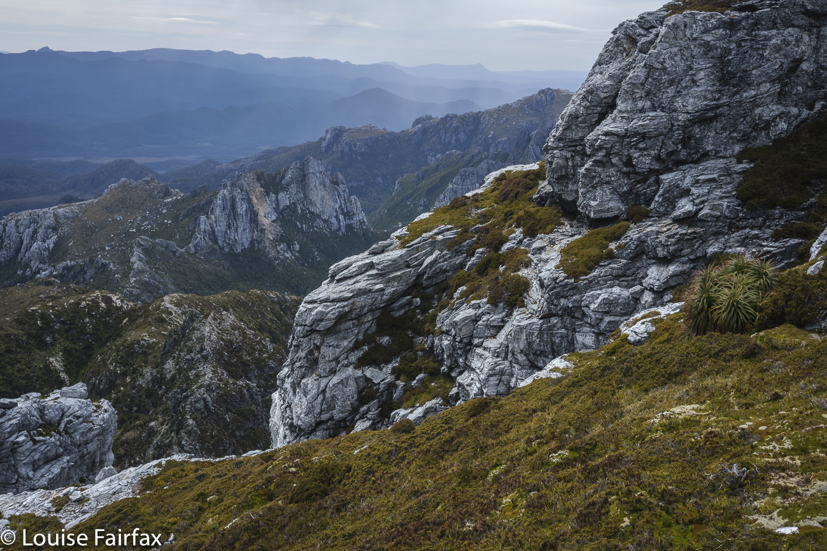
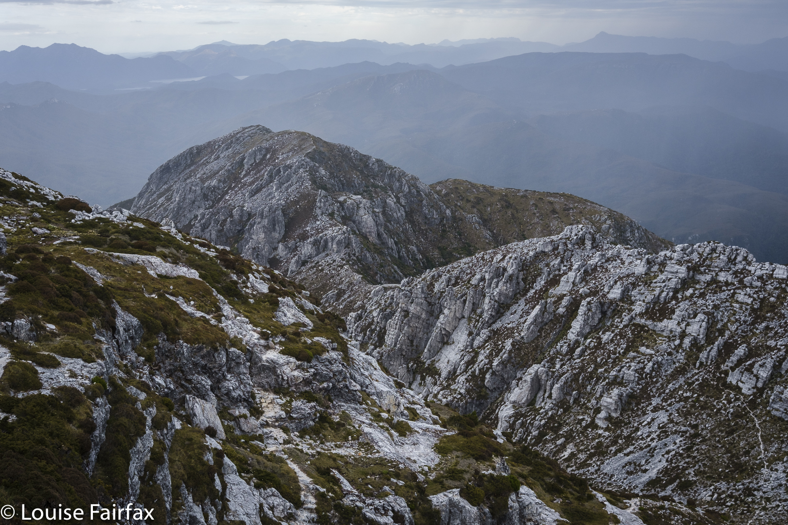
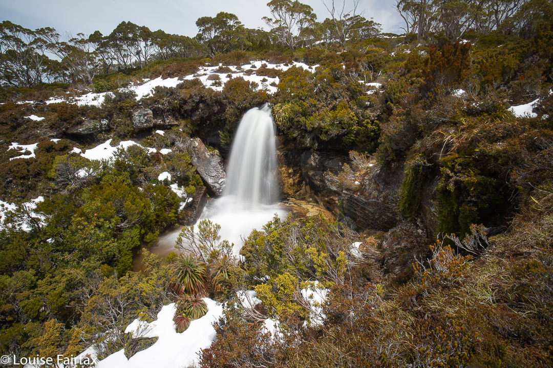
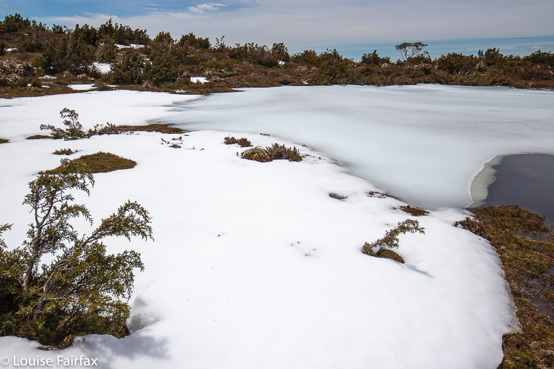
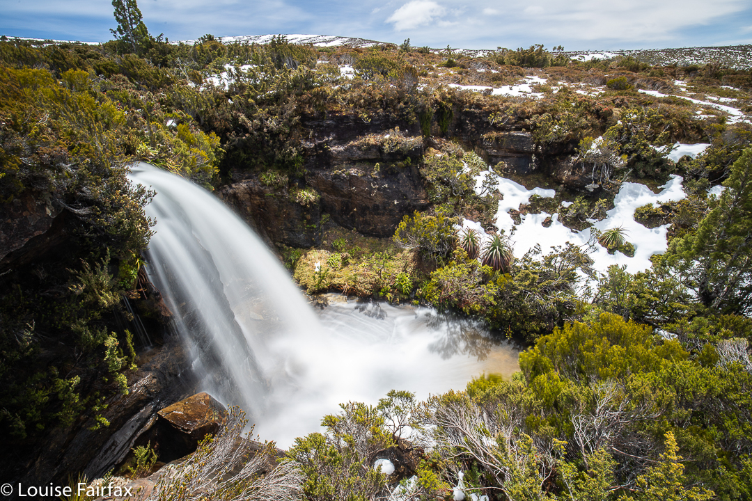
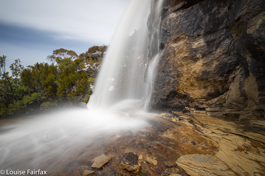
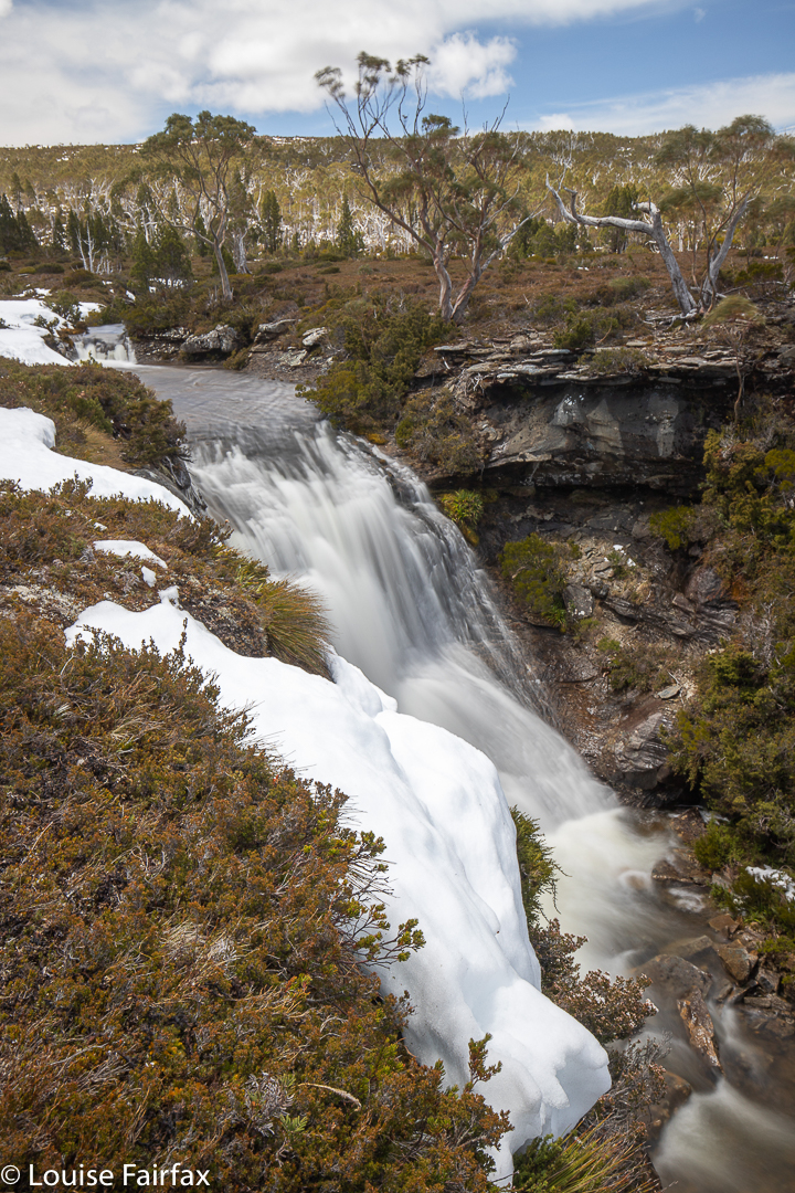
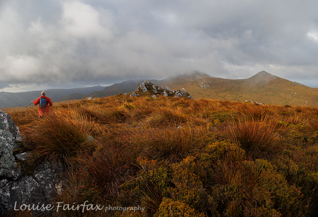
We walked for seven hours this day (plus stops), covering territory that we have never seen photographed or blogged (beyond the Jubilee Ra High Point). We explored “Endless Tarn Ridge”, “Neighbour Ridge” and Lunch Bluff, and photographed Special Tarn, Sibling Tarns, The Pool and more. There were far too many tarns to name; even far too many tarns to photograph them all, although we made a pretty fair attempt at that. By the end of seven hours’ exercise, I was glad to be returning to our tents. If nothing else, I was hungry for an early dinner.

Jubilee Range dawn day 3.

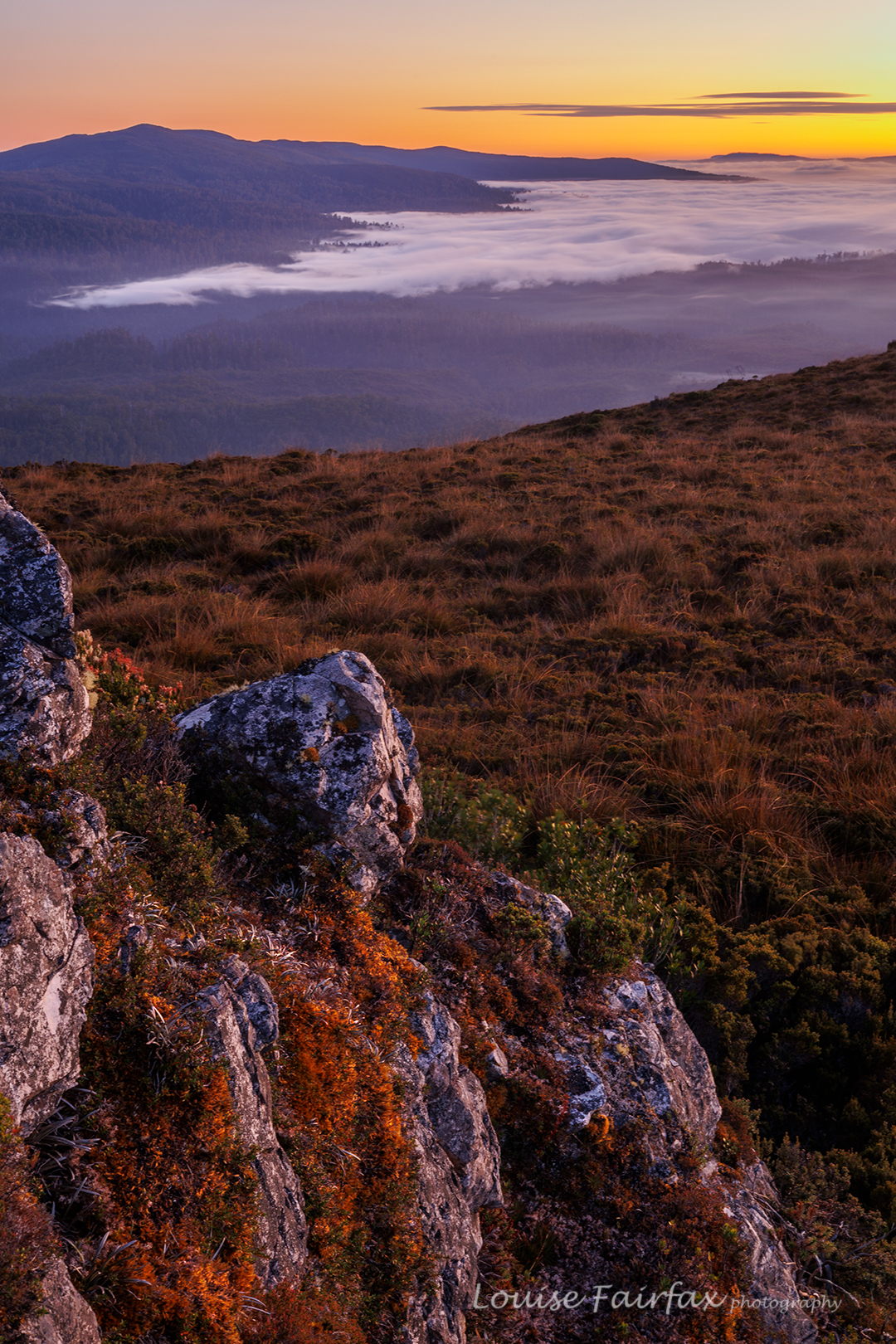
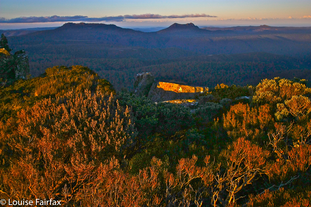
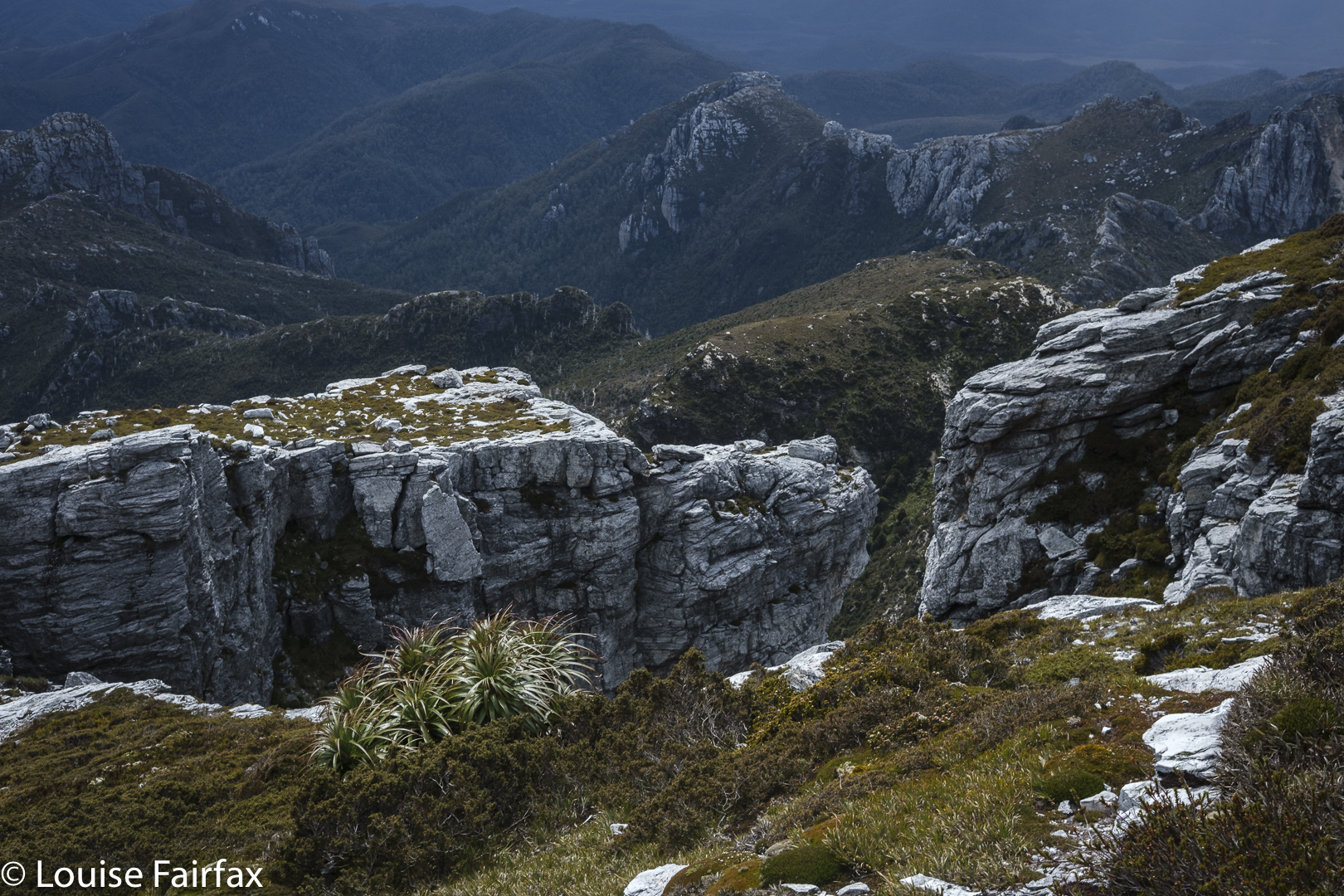
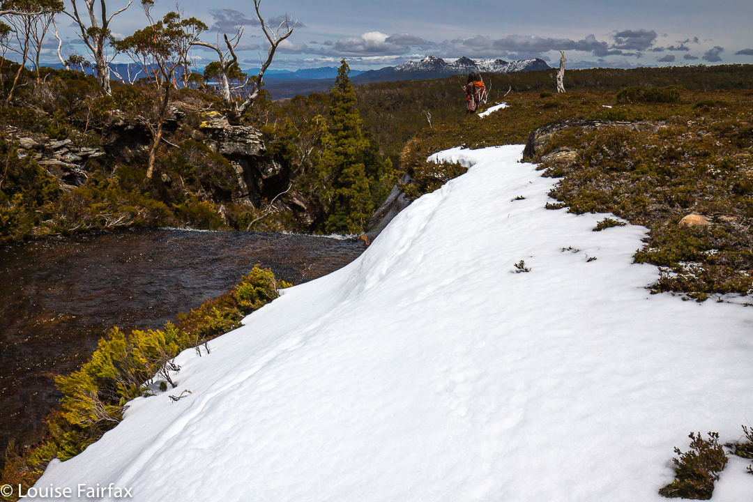
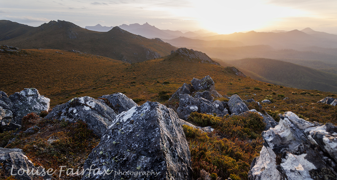
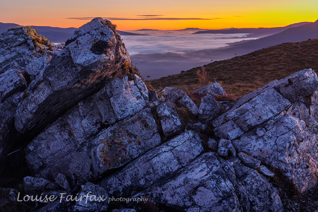
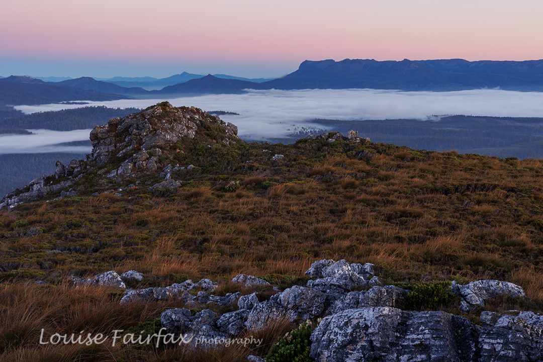
This night, sunset delivered, and the next morning, we got the inversion layer we’d wanted the day before, along with glorious colour. It was very well worth the early rise. Again, we climbed assorted knobs and bluffs for different vantage points, and shot happily until our fingers dropped off and the sun rose, and it was time for porridge.

Jubilee Range dawn day 3
Jubilee Range dawn day 3.

It was glorious walking with the mist lingering below us. The scrub was still very thick, but descending makes it a bit easier. There was one section where it took us 15 minutes to cover 80 metres (the final creek crossing – quite a bitch).
I normally hate roads, but the concrete pipe that marked the end of bashing and the start of the road was perceived by us at that moment as a thing of great beauty. We cheered and gave each other a high five, had a break (drink) and then took the road (mossy covered, fern filled and shady) as quickly as we could. We both had an urgent appointment with the Possum Shed for lunch.

Jubilee Range. The descent.

Albert: an unplanned adventure

By the time I pulled into the ‘space’ for cars below Mt Albert I was already seriously questioning the sanity of climbing the mountain this late. It had been a ridiculously slow trip, not helped in the slightest by my decision to indulge in cake and coffee in Lilydale, … but the German apple cake from The Bean Barrow is so good, and they are only open a few days a week. How can you go past without having some? No idea. I always stop.
It was 4.10 and I wasn’t yet in my bushwalking clothes (that would push it to nearer 4.25 before I was ready to get going). Ah well. Let’s get out of the car and go to the toilet and then think about whether there was any point in climbing this late.

OH NO!!!!! My back left tyre was flatter than flat. I must have had a blow out. Whoah. How can that happen on a road that is not in bad condition? OK. Now I was in almost panic mode. All of a sudden I had no choice in whether or not I would climb this mountain. I had to climb it in order to get phone reception to call the RACT to help me change the tyre. Sorry folks, but tyres feel like they weigh almost as much as I do so that I can’t even pull them out of the boot, let alone place them in position on the axel. Also, even when jumping on the lever to undo the screws, I do not exert enough force to budge the fulcrum to move the screws to undo them. I needed help and urgently. It would go well below freezing overnight, and my dog was locked outside back at home.
First job: put on walking clothes. I was still in my running gear from earlier in the day, and already the temperature was nearing zero. The air had a stinging nip to it.
Stuff grabbed, off I set. Now 4.22, on one of the shortest days of the year, and at this time of year, Tassie’s beautiful long twilights do not take place. Darkness very quickly follows sunset. I had to hurry. I remembered Albert as being a quick climb. I hoped my memory was good. First memory fault: almost as soon as I began the walk, I entered a huge patch of ferns where the fronds met each other across the pad that presumably lay beneath. That was going to be impossible to detect in the dark that would accompany my return. Problem for later. On I pressed. I needed help and that meant I needed to be on top of this mountain.
There were pink tapes to guide a bit but they would also be invisible once darkness set in. No one had done work on maintenance in this area for a long time. Of course there were fallen trees to climb over. Would I find them in the dark? Who knew? Not I. On I went. Up up, climbing as quickly as I could.
Then there were confusing bits where even in this light I had to scout around for the best route. What on earth would I do on the way back? Maybe it would be easier when I couldn’t see. Ha.

Albert summit taken back in 2013. I was hoping to arrive early enough to take 2022 photos, but that didn’t happen.

Then I came to a bit that really scared me. There had been small sections where the rocks were steep and slippery, but this was different. The rock was very wet, had little grip, no footholds and only the most meagre of twiglets for my hands to grab on the right hand side; nothing further over on the left. I took this bit really slowly. Below me was a three or four metre drop onto jagged rocks: not enough to kill me unless I fell very badly, but enough to break a bone if I found myself travelling downwards out of control, and if I slipped or the twiglets broke, that would be my fate. I would not do this bit on the way back. Somehow I’d have to find a way around it.
Up up. At last I had topped out enough to try for phone reception. Hallelujah. There was a bar. Would it be enough? I googled RACT roadside assistance, and yes, google worked. Well, that is, google fed me with stuff, but the stuff was just an endless series of adds for how I could buy assistance … or insurance if I would prefer. I scrolled and scrolled, but never got a phone number. I tried out my memory. I was obviously close, as I got NRMA, the NSW equivalent. They put me through the endless series of loops and hoops that I just didn’t have time for in this emergency. The sky was a pretty red; the sun was now below the horizon. I had very little light left already to fund my return journey, and I couldn’t afford the luxury of dealing with stupid computer systems. I needed a human. I phoned my daughter, usually busy and more than often nowhere near her phone. Luck was there. She answered. Hoorah. I told her my situation as briefly as possible and asked her to find the number of RACT and get them to me as quickly as possible. I needed to start down the mountain while the going was good.
She must have been very successful, as the RACT called me whilst I was still in range. The very nice girl, however, didn’t seem to understand the word “emergency” and wanted to know the car number (totally irrelevant; I was the only fool in my location), whether the car was automatic or manual and other  questions that came across to me as a terrible waste of time in what was becoming a crisis. The climbing was too tricky to do with one hand instead of two, so I was losing precious light, a commodity I could not regain. At last I got my urgency through to her, and she let me keep climbing down.
I had to get past the really dangerous bit. I stared at it. Nope, I just couldn’t do, not even with hardly any light so that many of the dangers were no longer visible (and thus less confronting). I decided to bushbash off to the side rather than risk a fall.
Down lower and back on track, every time I lost it and later refound it by accident, I marvelled that I had done so, and gave thanks. Being on the pad was going to be more efficient than bashing, and I would be less likely to hit something and hurt myself if I were on the pad.
And thus it was that with my admix of bashing and somehow remaining on the pad, losing and then finding a more traversed section of land than otherwise, the ribbon of light that was the final section of my journey – made so by the fact that it was under 10 cms or so of water – came into view.
I was back at the car, and now just had to wait another hour and a half to be rescued. At this stage, I became very glad I had indulged at Lilydale. I pulled the final third of my German apple cake from the serviette in which I’d wrapped it, and ate it slowly, savouring the juicy taste while I watched the Milky Way above take a more defined shape as light vanished from the night sky. The temperature dropped some more.
When my children were aged 1 and 3, we used to bushwalk with dear friends from Armidale every weekend, and on these walks we never ever made it back to the car in the light. It always added to the sense of adventure. I wonder if the children have any memories of those grand days of feeling our way through the bush in the dark, laughing our way through the wilderness.
Sorry for the lack of usual photos dear Reader (and for the very old photo used as the “featured image”. I’ll renew it as soon as I can, which will no doubt be a few weeks). As you can tell from the story, I was kind of too busy to think about such things. I will have to visit Albert yet again to take some more photos. However, I have no wish to ever climb down it in the dark again – or, not solo and in mid winter. I do love an adventure, but there are limits.
The RACT guy said: “You went up THERE at sunset?”
“I had to, to get reception. ”
“I took my teenage son up there and he came home with his knee dashed to pieces. I took another group up there and they never made it. There is a reason the track notes say it’s very dangerous.”
Yeah. I get it.

Sharlands Peak, Frenchmans Cap 2021

Here we were at another saddle on our supposed climb of Sharlands Peak. It was another dead end with a drop to certain death if we took another step, or peeped over the abyss too enthusiastically. I took another photo to match the mounting collection of “failure saddles”, sighed a meaningful sigh, and withdrew. Again. How many saddles were left for us to try?

Nicoles Needles, a lower part of the Sharlands Peak tower group, nearest Barrons Pass
Climbing

The book had merely said to head east to a saddle that had mild exposure. There had been something about a ridge offering dramatic views, as well. Did the writer not remember there are myriad tiny saddles up there? Or that east covers a multitude of general possibilities ranging over a possible eighty-nine degrees? We kept gazing over edges that dropped to eternity below and asked each other: “Does this constitute ‘mildly exposed'”? “Would you call this view ‘dramatic’?”

Hm. We go up THERE?
Traversing

All the views were dramatic. Every saddle had a certain degree of exposure. How nauseous did you need to feel before you could pronounce: “This must be the one; I can identify it by my stomach.”

Isophysis tasmanica

We would be on a saddle, looking up a knife-edged ridge that brooked no error: one rock falling out of the collection, one slip and the climber was gone. You couldn’t see what lay beyond the next dodgy climb. Was this where we were supposed to go? There was no point in risking it if it was yet another dead end, but we couldn’t see if there was any use trying from where we were. One of us would climb the next bit and report back on the likelihood of this being the way … or maybe offering A way, even if not THE one.

Getting higher

Now that it is all over, this nervy trial and error seems rather fun, but at the time, my nausea level was mounting, especially when it was my daughter’s turn to try out first and I could see my beloved offspring straining her way up rock that looked too loose for my comfort. She is very experienced and capable, so it seemed terribly condescending to call out: “Be careful. Test each rock hugely before you commit to it.” But love made me want to yell precisely that.

Another saddle, another needle but not the summit. Sigh.

We found ourselves by and by at the top of the landslide. The book had said not to go via the landslide, but it meant not to climb that way from below, and  implied the real danger was lower than we were. Should we keep trying here?
I was beginning to give up, I have to confess. I announced that I had just lost interest in this Abel, and thus in the idea of getting all Abels. I was ignored. Mercifully. We tried yet another tack. My turn to go first. From this knob, I could see a saddle that surely led to the top, and I thought I could make out a possible route that would find us at that saddle. Kirsten came up to get the view and agreed. Here  we go again. This was not the first time this had been said in our tour of these maze-needles. We tried on rough contour. Failed again. Dropped again but not too far and bingo. We could see a possibility of gaining the top.

Another push up to a higher level, but we are not where we need to be. Great views, though.

Yet, even as we climbed this, we had to tack and back a bit in order to get a route that would take us up and not on the flight of our lives. Now that we have successfully done it, it all seems terribly easy. Uncertainty about whether what we were doing was yet another false manoeuvre was part of what was mentally trying. But, I have to say, the whole uncertainty ultimately engendered far more excitement at success than if we had known all along that we would get there.  It was fun having to work it out and do it for ourselves. Too much of our wilderness is being dumbed down. “Wild” and “dumbed down” are actually mutually exclusive, in that the word “wild” has as its antonym “tame”.  Could someone please explain that to our government?

Pano. At last we have found the summit needle.

There was the summit stone. I couldn’t care at all about who touches first, but Kirsten wanted us to touch together. It’s a cute ceremony. We did it. I snooped around the back, and called out that I’d found a way of actually getting on top of it. (It was too high at the first point for either of us to scale it.)

One final grunt and we’re both on top.

With a grunt and an accelerated effort, I gained enough height to then haul myself to be on top. Whoah, it was windy up here, only 2.3 or so metres higher. Kirsten of course, quickly followed. There was not room for a third person up there, but we were only a duo, so that hardly mattered. We briefly enjoyed the view, and descended extremely quickly now that we knew the best route. Our little welcoming tent far below signalled our new goal.

Weeeee. Made it. Summit of Sharlands

How lovely to reach our tent at last. It had been a long day. We had driven in, walked past the Lake Vera hut (where Kirsten had a swim en passant), climbed Barron Pass in what felt like oppressive heat, enjoyed the view up there, and then gone along to curve around to the valley behind our desired peak. We were filled with joy as we descended. There we were in a a quiet valley, surrounded by astonishing majesty and soothing silence. THIS was wilderness. This was what we’d come for.

Views. The landslide from above.

Earlier, despite the already very long day, we had made the call to climb this peak today in case the bad weather came in early.  Now we were back at our tiny red haven, we couldn’t have been happier. The evening was mild enough to cook and eat outside and stare at the changing light as we ate our delicious (only in the wilderness) cauliflower and pea dahl – the normal rehydrated, formerly dehydrated fare.

Dracophyllum milliganii near the tent

Sharlands was a kind of bonus, brought about by the expected bad weather which had been forecast for the next two days. We had changed plans and now got in a peak while the weather held. Now, if it turned totally sour, at least we had something to show for our efforts. Kirsten had kindly taken a day off work to be with me and climb a mountain together. It was great that her generosity was not in vain.

Day 2. Looking back to Barron Pass

The next morning, it was not yet raining, and there had only been a couple of light showers during the night, so we decided to head off in the direction of Frenchmans Cap, and maybe climb it, maybe not. The world was our oyster. We’d respond to how we felt.

On the track to Frenchmans
Lake Tahune below as we climb higher

Of course, we ultimately felt like climbing, even though the weather started to close in (and we had to allow a great deal of time for photography of flowers and views, and for Kirsten to enjoy a swim in Lake Tahune). We were under no pressure, time or otherwise.

Mountain drama
More mountain drama

We had climbed it together (with Bruce) when Kirsten was a student, so this was a revisit, and in fact, I have now climbed it five times. Familiarity has not bred contempt. This is one heck of a beautiful mountain, and the climb is pure fun – especially on this day, with wildflowers everywhere, with high drama and an approaching storm and with a monster feeling of satisfaction that we had Sharlands Peak on our list of climbed mountains. Three Abels to go. Weeee.

More mountain drama
Descending

We celebrated at the end of our walk out next day with a ‘works hamburger’ at the Hungry Wombat. After three days of bush fare, I felt unaccustomed to so much real food all in one go, and was uncomfortably full as we continued on our way. It’s Christmas. We boomed out the Messiah as we drove back to Hobart, singing along together with gusto as we headed east.

Back on the track with the trusty pack
Blandfordia punicea for some Christmas cheer on the way out.

Walls of Jerusalem 2020 Jan

New Year’s Eve was upon me, but what should I do? Mope at home, mourning the gaping hole left in my life by Bruce’s death, or go into the wilderness, where although I may well be alone, I am never lonely? The latter, of course. The wilderness revives and refreshes me, filling me with joy and taking me right out of myself with its infinite beauty. I can be miserably lonely in my home city with its people who aren’t there for me, but I am never lonely in the putatively empty wilderness, with beauty, freedom and space as my companions.

Sunset, Mt Jerusalem

I decided the Walls of Jerusalem would be the right place to be, so phoned the kennel to see if they had any room. Luckily, a cancellation meant the answer was “Yes”, so, despite the fact that Tessie thought this was a shocking idea, and that the two of us should have a mother and doggy night at home, I deposited her mid-afternoon and drove on to the Walls, arriving later than I wanted, but, hey, this is summer and nights are pretty endless, so what did it matter?

King Davids Peak and the Western Wall

The weather forecast, checked to be certain just before I left home, was for mild weather and no rain, so I chose my light three-season tent, and left my bivvy bag, heavy night coat and more at home. Seeing’s I carry my tripod, filters and heavy camera on such a trip, I appreciate the offer of a lightened pack in other respects. Ha ha. The weather had the last laugh.

First rays on Mt Zion

As I rounded the corner into Herods Gate, I was knocked over by a blast of icy wind that roared all around and turned my hands to frozen blocks. I couldn’t wait to set up camp and shelter from its pummelling. Pity about the three-season tent that lets in way too much air for those conditions. Pity also about the fact that it was raining and that I didn’t have my bivvy bag or warmest coat to pamper myself with.

Walls: sublimity

At sunset, I was too cold to concentrate on good photography. I took all my gear to my chosen position, but just wasn’t in the mood to use it, so just took a few hand-held shots. Luckily, after yet another sleepless night in the wilderness doing bed exercises all night to stay warm, I was up at 4.50 and in the mood for photographing pre-dawn and sunrise, dancing on the spot to raise my metabolism. Later, cappuccino at Deloraine was sure appreciated. … And, because the scoparia was not quite in flower yet, the good or bad news is that I will need to return for another night in the not too distant future.

Rufus and Navarre Falls

Rufus and Navarre Falls, Dec 2019

Off I set: my goal being mysterious blue lines on the map, lying on the flanks of Mt Rufus, on tributaries that would eventually flow into mighty rivers. Now, when you set out bushbashing in quest of a blue line on a map, you have no idea (i) whether there will actually be a waterfall at the end of your rainbow, and (ii), whether it will have been worth the effort in time, energy, petrol and scratches. Thus I have (in the past) been the questionably proud discoverer of Dry Falls and Trickle Falls, to name but two of my findings. Funnily, no one has been very excited about these, even though my documentation has, at the very least, told them what’s there and informed them that it’s probably not worth their while adding that to their list of immediately pressing activities.

Rufus Falls: off we set

HOWEVER, Sunday’s journey through knee-deep mud and then thigh-deep snow with shoulder-high scoparia thrown in – and a few magic, primaeval pencil-pine grovelets with brief sections of alpine grass – (plus one tiger snake), a journey that took seven and a quarter hours in total, was absolutely Worth The Effort. I could have called the falls Wonder Falls, Speechless Falls, Gaze or Delight Falls; however, even these names diminish them somehow, reducing the spiritual experience of being there to one aspect of the experience.

Rufus Falls. First goal achieved.

They need a name that will impart a sense of their particular place set in wilderness, a name that reaches out not in, and I think an aboriginal name is what they deserve, as it will add its own mystique, just as does the name Leeawuleena, lying not far away, “sleeping waters” … how beautiful. I have wasted hours trawling the web for a Tasmanian aboriginal dictionary, or for place names that could be vaguely related to the area, but my net remains empty. For now, English monikers will have to do: Rufus Falls, and Navarre Falls Upper and Lower. Although Rufus was a Roman poet of antiquity, whose poems none of us have heard of, and whose only claim to fame was that he was a friend of Virgil (is that not clutching at straws???), at least the name “Rufus” suggests to us Taswegians an area of wilderness with a certain feel to it. And Navarre is a former kingdom of SW Europe, established in the 9th century by the Basques. What has that got to do with us??????

Rufus falls from below

Up there near the waterfalls, the views are expansive, looking out at Mt Gell, King William I, Pitt and Mulligan, and then Slatters Peak, and the King William Range, with Frenchmans Cap thrown in, and that’s before I begin to name the ones further to the south. On this day, all were decked in snow. For me, all these are old friends and I love seeing them. Gleaming and sparkling in the distance far below us was Lake King William.

Navarre Falls, Upper – from above

It was not a fluke that this journey was undertaken with white peaks all around, and snow covering the route. I had been watching the weather maps very carefully, and chose accordingly. This was exactly what I had ordered, and I revelled in it.

Upper Navarre Falls

I had brought along a friend who, I knew, would appreciate being there. She had never been in real wilderness before, and was floating with delight. We giggled our way through the snow drifts, which are actually quite hard work, forcing you to lift your legs very high each step, after which you’d sink to an unknown depth, depending on what lay underneath. And then, I kind of squealed with delight, for there was a real waterfall, and it was beautiful: an attractive drop of maybe ten metres of delicate white, attended by deep clumps of pristine snow, pandanis (richea pandanifolia), with a few pencil pines, and Pherosphaera hookeriana for colour, texture and form variety. It was set in a small sandstone, cliffy amphitheatre, with striations of warm hues. We photographed from the west and the east, from above, the side and below. It was fun.

Lower Navarre Falls

Even so, I thought that my friend, unaccustomed to all I was doing, might have had enough, or been very tired by the physical effort of getting there, so I offered her the choice of turning around at this stage. To my excitement, she said she’d like to see the other two falls I had in mind. I pointed to where I expected them to lie, gave her a pessimistic time estimation and reminded her that there might nothing there (I hate overly positive promises; I would never make a politician), but still she agreed. Yippee. Off we set.

Making our own way home

On this section, the snow was more of a challenge, with some very steep drops, and drifts of unknown depth to contend with. However, the final spur was sheer pleasure. Again I sort of squealed with shock and delight when I looked over the edge and saw what we had found. And just below, the water dropped yet again to another hidden treasure. Meanwhile, the cliffs on the way, and in the region of these falls, were marvellous in their own right. We were in heaven. We angled around to the side to inspect and photograph both, and then climbed back up for a snack beside the river and a relax, imbibing mountains, lakes and beauty, before beginning our reluctant journey homewards. Just to show off, I sent friends pictures of the frozen tarn where we also spent some time. Most of Australia is on fire at present. How amazing and fortunate to be in the snow!

Beautiful frozen tarns begged us to linger.

My friend’s shoes were sopping, and her feet numb, parts of her were no doubt scratched, but still she was in love with being in the wilderness. Both of us felt our souls had been expanded and nurtured by being in this place.
If you think you know how to get these falls, will you kindly respect people who love their wilderness wild, and leave no plastic tape and no cairns. Let others feel the total freedom we felt in this place.