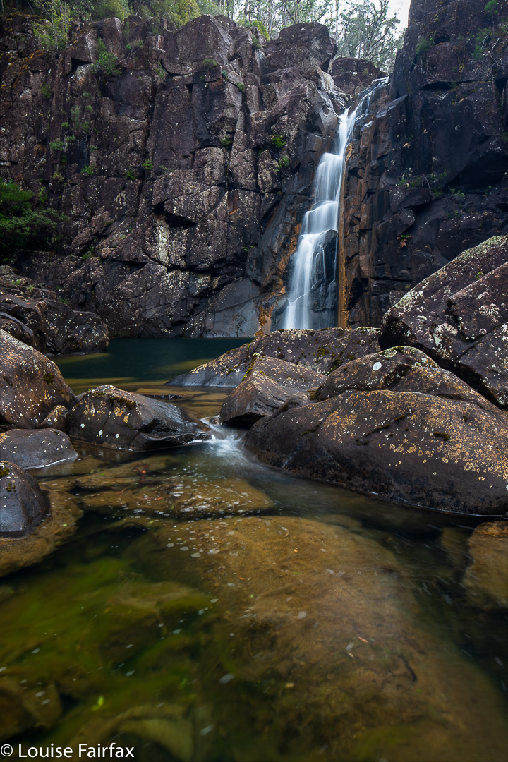
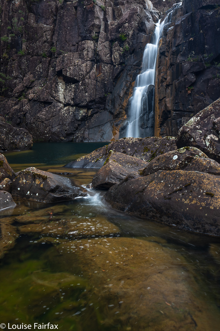
The last time I climbed Ben Nevis, it was in June (2013), and my report was pretty negative, as the memory of all the prickles we had to fight to get there dominated my thinking.
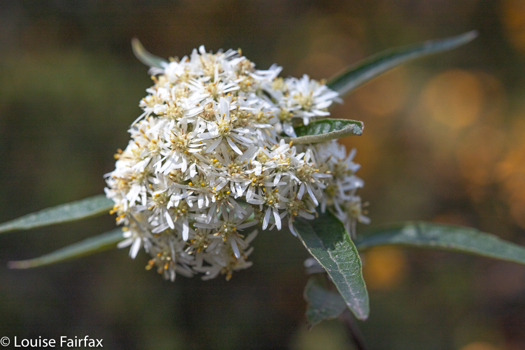
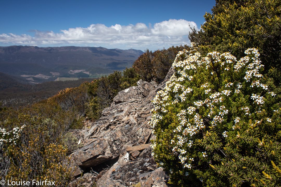
Olearia lirata Ben Nevis. This was one of three varieties of Olearia we saw this day. Down near where we parked, the tall, tree form, Olearia argophylla, filled the moist valleys. Up in the alpine zone, we encountered Olearia ledifolia. All have white daisies.
This year, my feelings are entirely different. It was December, and an abundance of colourful wildflowers decked our way: reds and yellows and creams and whites. The bush was a mass of waving colour. The temperature was quite possibly the same as in that June, as there had been snow down to 800 ms overnight, and the wind was strong and felt like it was straight off the snow. I had already seen a lovely photo of white Mt Wellington that morning.
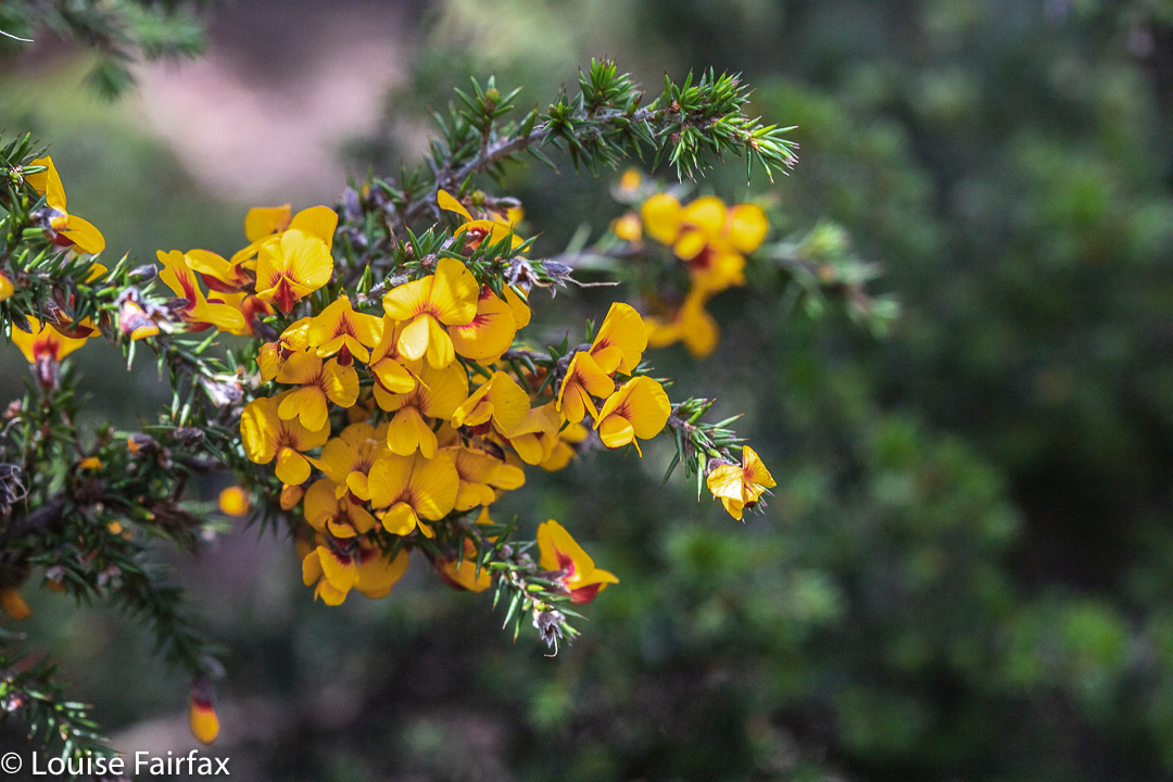
Pultenaea juniperina. The lower, drier section of the walk was a mass of yellow and white, the yellow being provided by this plant here.
However, although the wind was strong, we managed to find sheltered spots for a snack and then lunch, and enjoyed the views.
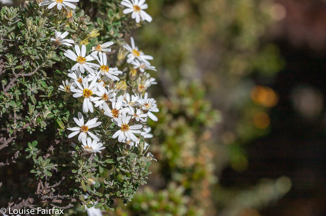
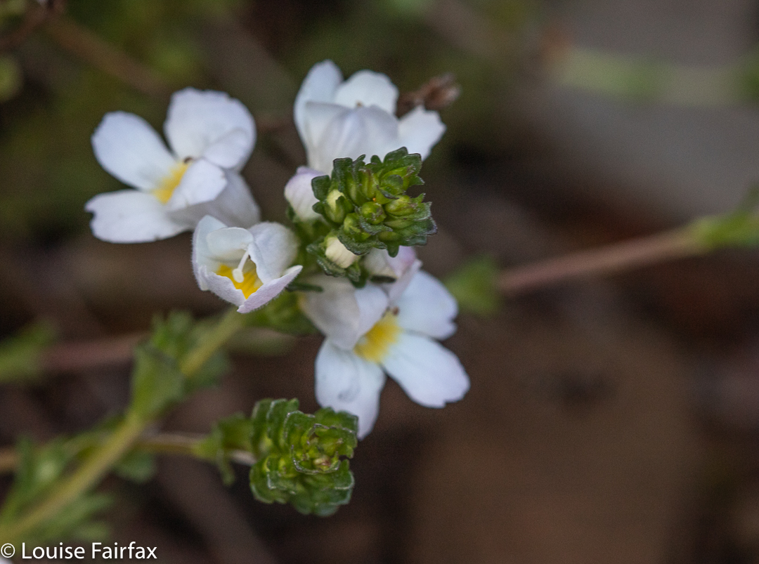
Olearia ledifolia Ben Nevis. This is the species of Olearia we encountered once we entered the alpine zone. It’s not even half the height of of the lirata.Euphrasia gibbsiae Ben Lomond. One web source I consulted said this is threatened. I am pleased to report we saw six or so bushes, just beside the track.Westringia rubiifolia Ben Lomond. This was also in the alpine zone.
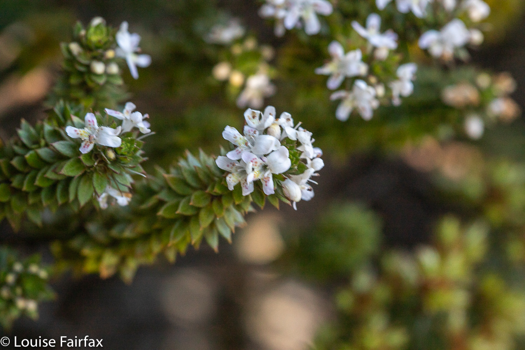
The plants are just as prickly as they were seven years ago, but they are a tad taller and this makes them more comfortable to negotiate. In addition, kind people have thinned them somewhat. Even so, I would not take a small child up this pleasant mountain, as I fear the prickles would be at a child’s face level. For us, they were often chest high. In 2013, they hassled our thighs. The prickly offenders were mostly Pultenaea juniperina and Leptocophylla juniperina, with a few specimens of Hakea lissosperma and even fewer Richea scoparia along the track. One forgives them for being prickly when they are colourful.
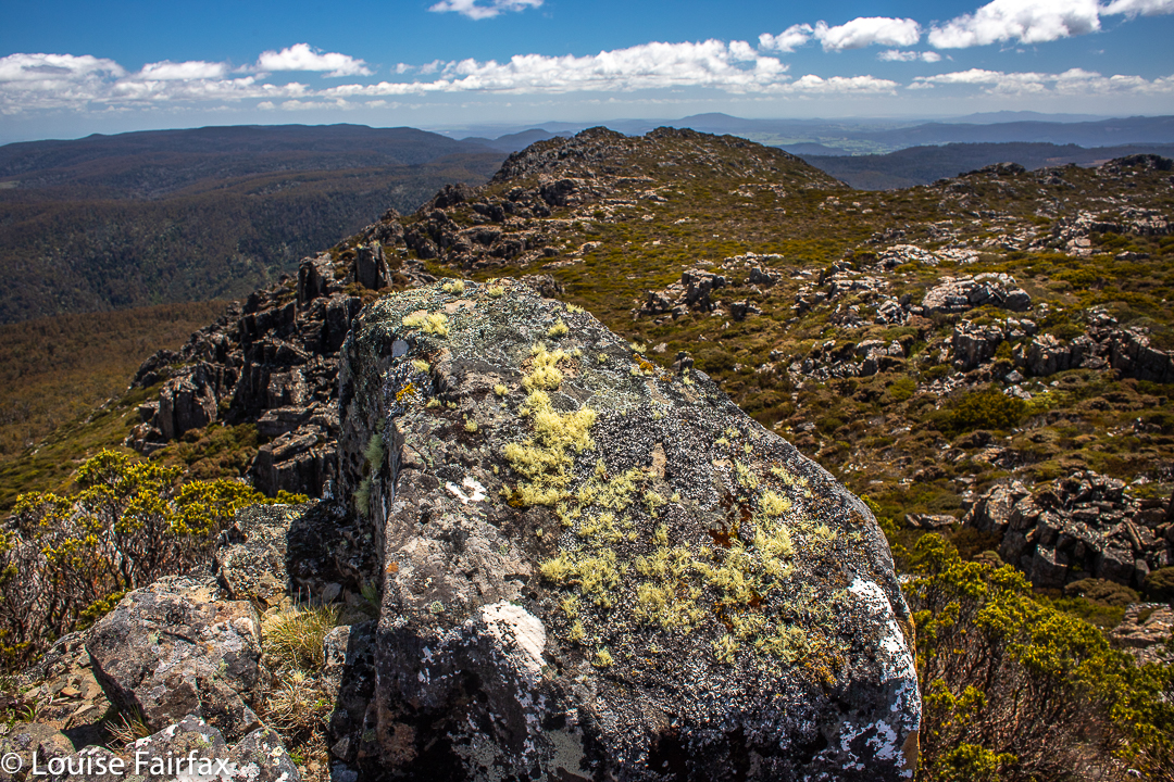
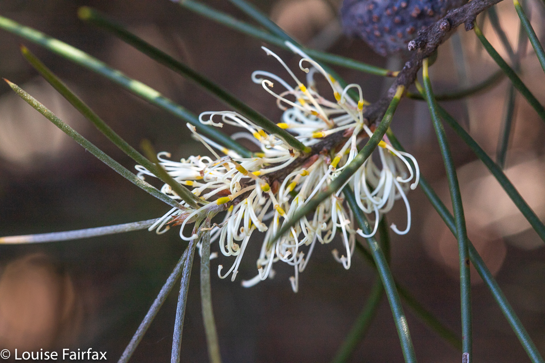
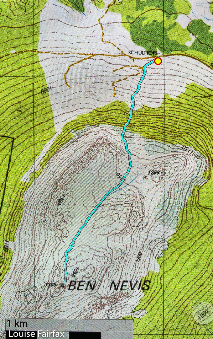
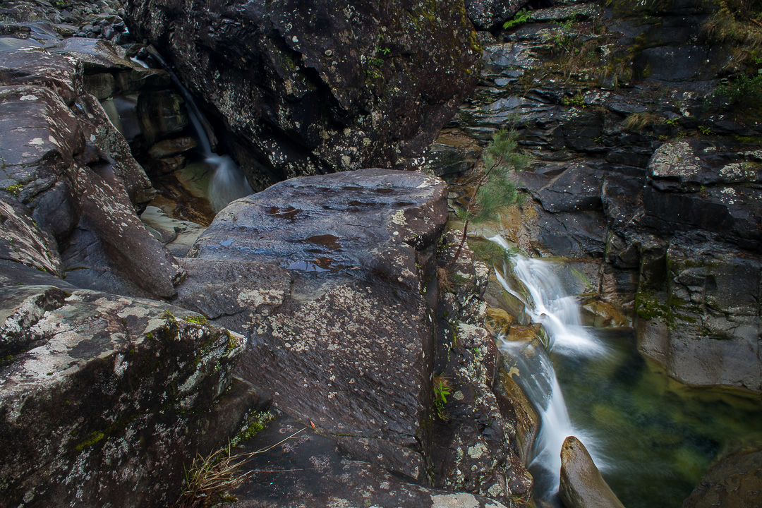
Olearia ledifolia enjoys the summit viewsLichen Ben NevisHakea lissosperma Ben Nevis. Luckily, the prickly mountain Hakea did not protrude over the track, so its needles stayed where they belonged and didn’t attack us.Ben Nevis gpx route
The walking (as opposed to talking ) time of our ascent was a bit over an hour. This included a few photos where I forgot to stop my watch. My gps says we spent a lot less than that moving, but the gps is always quite insulting, accusing you of not moving when you are. Possibly more to the point is that the exercise, which included stopping for drinks, lunch on the summit and the odd bit of track clearing, took us 3 hrs 46 minutes. The day was thus still young, so I went off and bagged a waterfall on the way home, the Cornwall Falls. (Hm. Rather a circuitous way home, but the countryside was very beautiful.)
It seems to be a recently established tradition that we climb Hartz Peak the day after we return to Creekton Falls to have a family ‘Bruce memorial’. That is, we did it last year, and again this year. Hartz Peak is near our base of Driftwood Cottages at Dover (nearer still to Geeveston), and is doable for the children. Traditions are good things to have, as long as you don’t become their slave.
Some wet, muddy bits, that convinced Abby she needs bush boots.
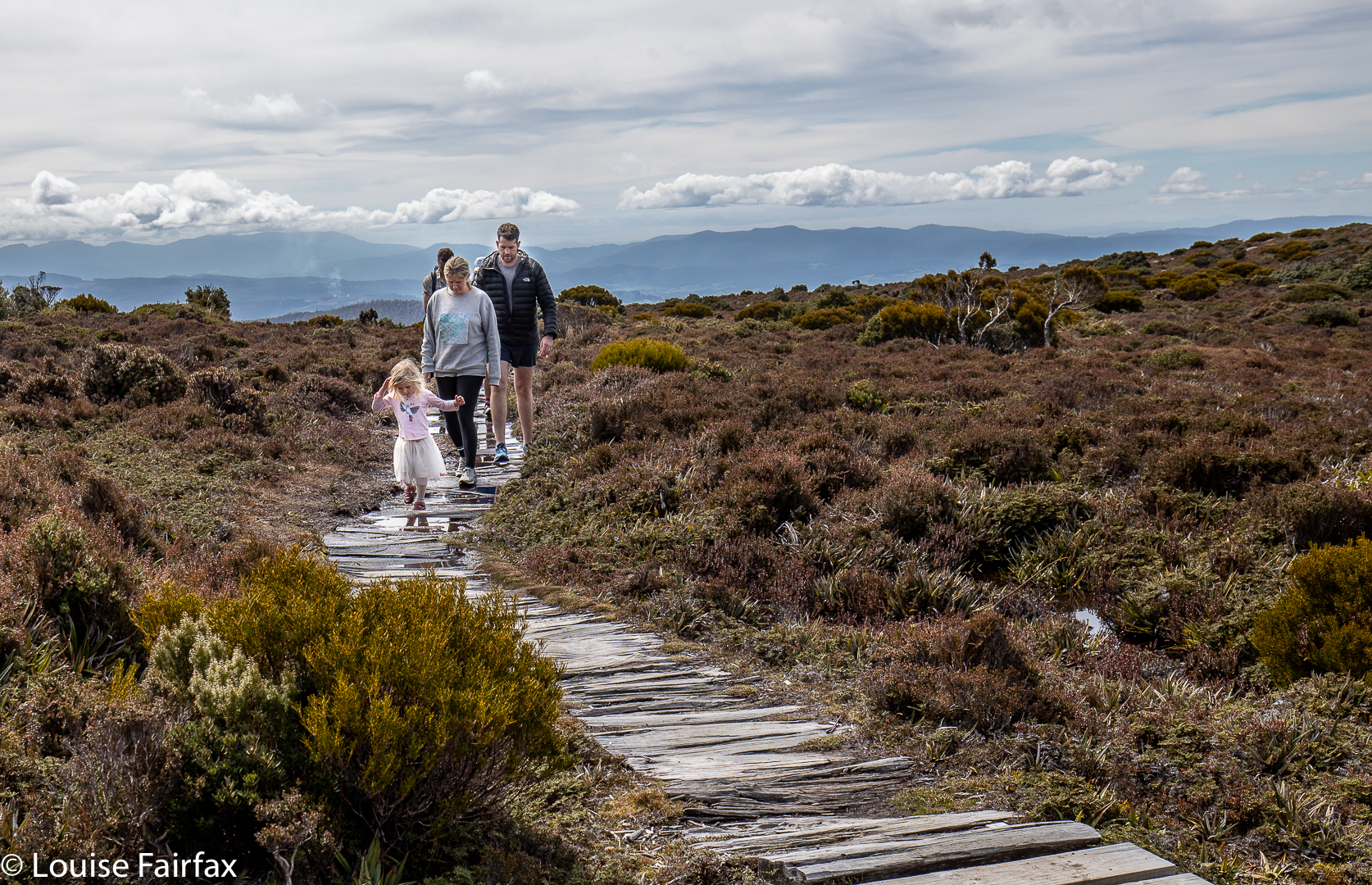
I recently read a book by Katherine Abetz (An Obstinate Love) set in the Federation era, in which they took three days to climb Hartz Peak (and wore long frocks and high heels shoes). Abby wore a tutu, as you do if you’re three, and strapped leather shoes, and we were back by early afternoon of the day we set out. Gussy had his proper bush shoes on, and Abby agrees that she needs a pair. She got her feet very muddy, and a little bit wet. Unlike the characters in Katherine’s book, the children elected to run most of the way, despite Abby’s tender age. We adults, more burdened down with gear, went at a more measured pace. Gussy pressed on the accelerator between Ladies Lake and the top, so I left the group to keep him company, tucking in behind him to let him keep his nose in front. I rather think that next year, when he will be in third class, I will have no choice in the being behind bit. This year I was comfortable, but aware that the pace was verging on the “not so”. Soon I would be puffing. He is getting very fit, and already has a fantastic beep test score.
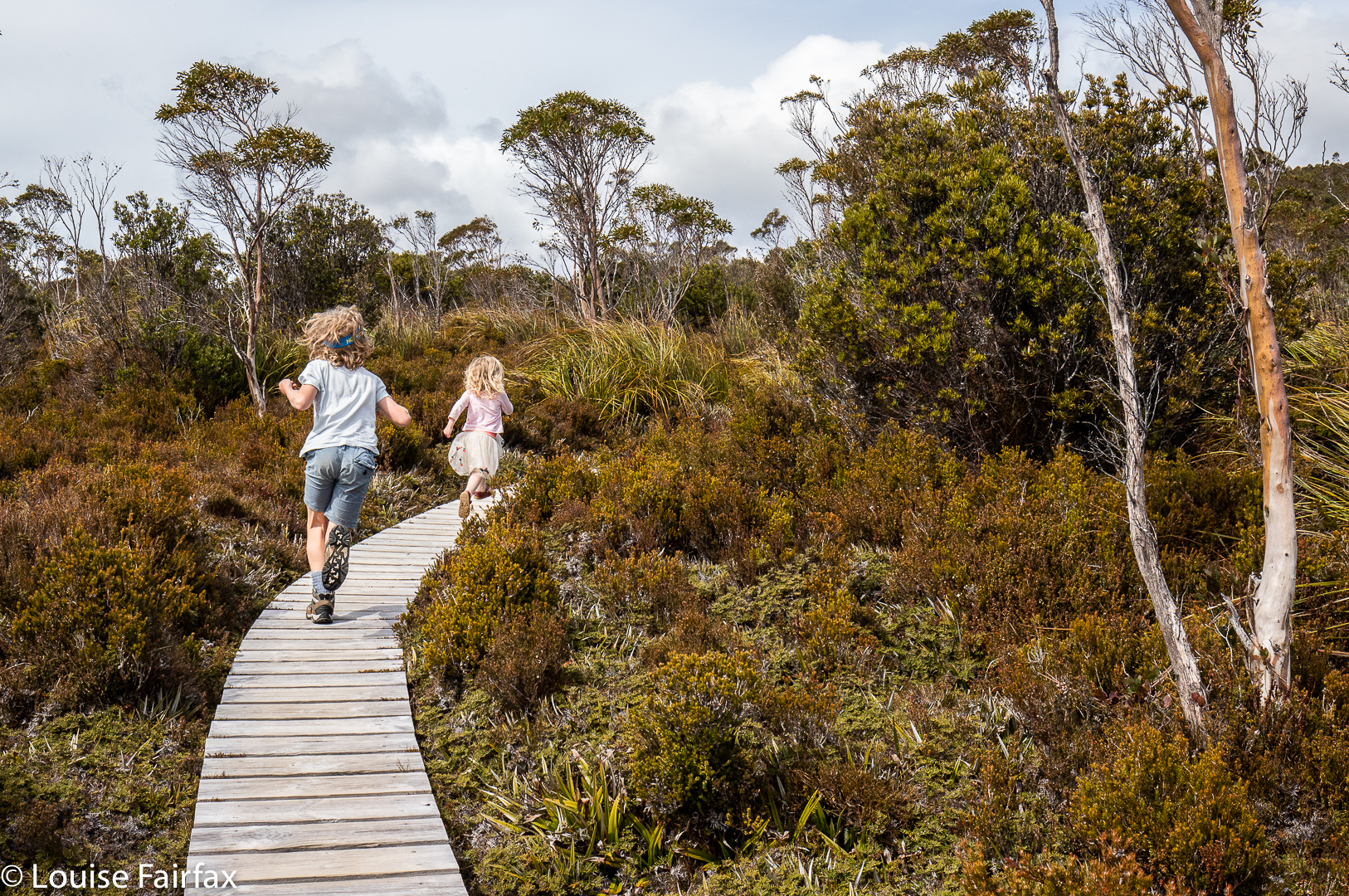
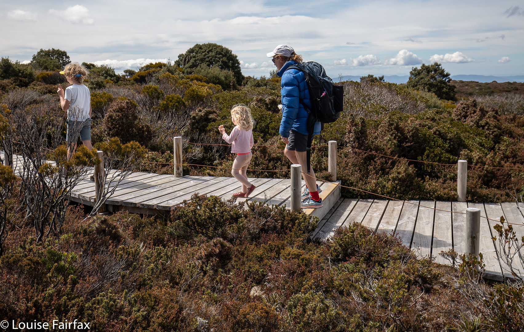
And she’s off again on the boardwalk.
Keithy braved a swim in Ladies Lake, to “have one for Bruce”, who, for most of his life until Parkinson’s got a good grip, swam any season, any weather, any altitude. I have pictures of him and our daughter swimming with icebergs in the Alps. Keith was a delicate shade of blue at the end. The rest of us watched.
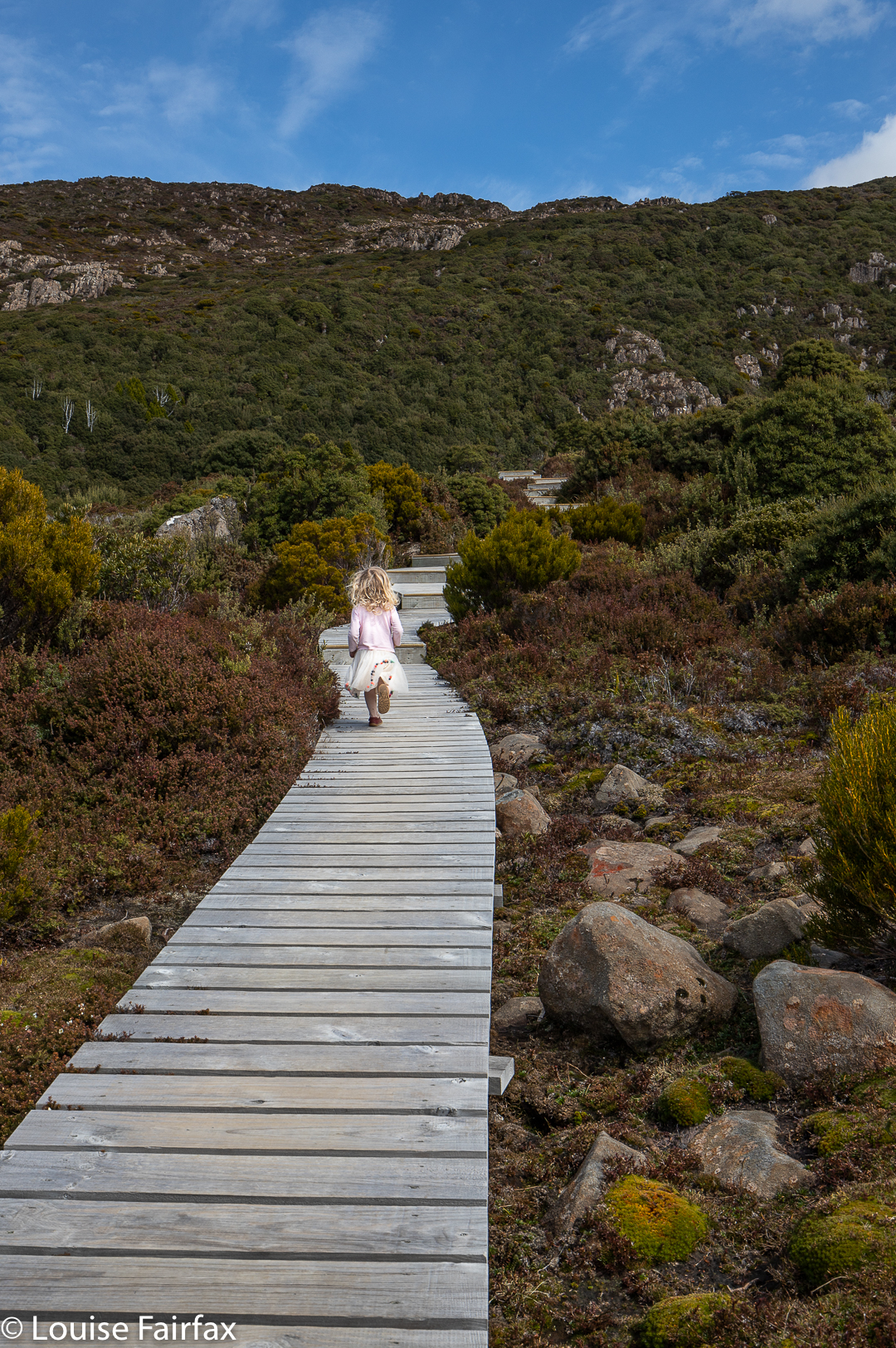
On the way back, the tutu hit the rucksack.
Predictably, Abby was very prepared to examine insects and other interesting features on the way down. She is a diminutive three, and her running on the outbound journey must have been pretty exhausting.
I was ridiculously anxious before I began Leeaberra Track mach 2. My bout of flu A has left an unwelcome aftermath of generalised fatigue, and when I try to run, I have heart palpitations. Was I going to make it up the taxing hills with a heavy backpack? Was I going to be a nuisance by my slowness? Were the others going to get impatient with me? Would I conk out? One thing I did know: I didn’t want to cancel out. I wanted to give it my best shot and see if I could do it.
Leeaberra Track. Can you find it?
Meanwhile, the car problems facing us looked as if maybe I’d need to drop out and become a chauffeur: we couldn’t find a way of retrieving my car should I take everyone up to the start. Nobody else had a car capable of taking me back to my own at the end. It would be sad to only be chauffeur, as this walk had been my suggestion. I phoned National Parks for a solution, but drew a blank. Adrian tried the far better option of the Bicheno Tourist Bureau, and was given the number of Tiger Tours, who own a 4×4 vehicle capable of taking us all right to the very start. Wow. 0416 983 926. Brilliant innovation.
So, after breakfast in Bicheno on Saturday morning, Lynden picked us up. We dropped my car at our finishing point, and all continued together to the official start of the walk. Others have taken 3.5 hours to do what Lynden did for us in his van in less than half an hour. Who wants to walk uphill for that amount of time on an ugly old road that can’t be used any more? Not us.
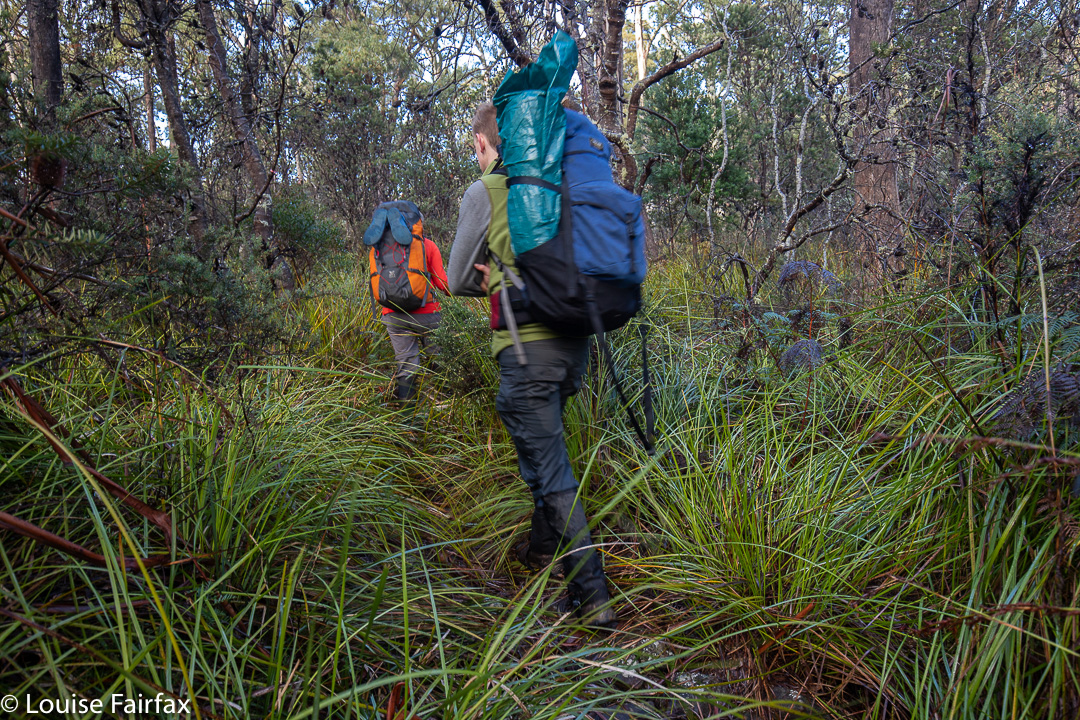
Leeaberra Track: Underway
The start was a bit of a disappointment, as the NP ranger said they’d done work on the track. We searched and searched for signs that someone had improved something, but not a hint of work could be found. We were drenched within about a hundred metres of starting because of all the overhanging branches. Cutting grass invaded and obscured the track. This was what I would have expected had I not been told of improvements, but having been thus told, I became disappointed in its lack of fruition. Although it wasn’t raining, I really should have had on my jacket and pack cover, as everything was sopping by the time we reached our pack dump point a bit over an hour and a half later.
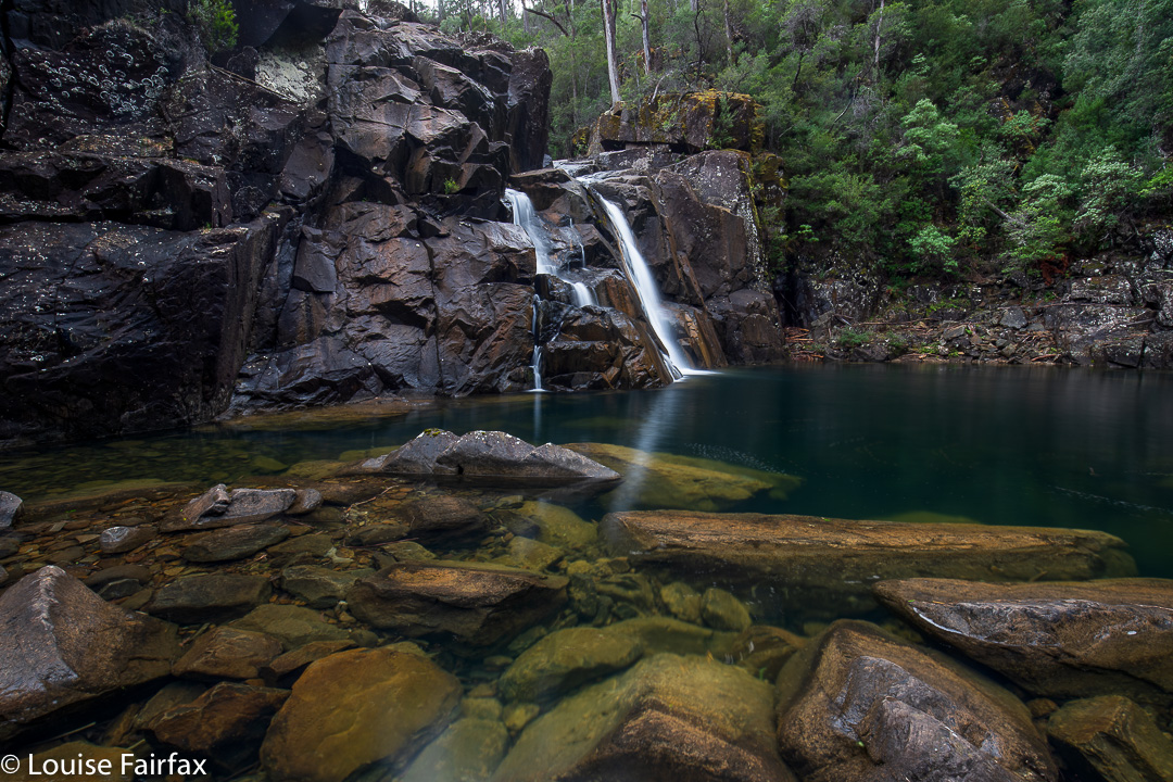
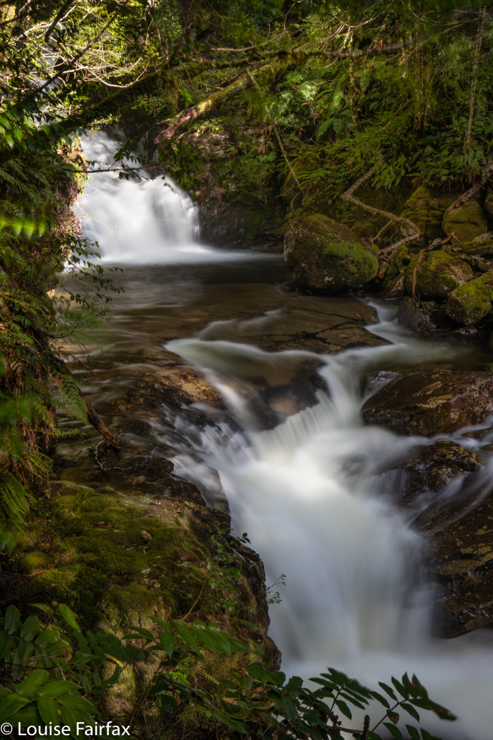
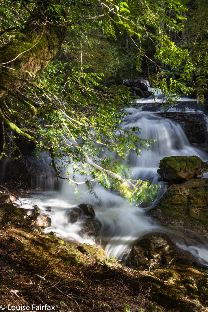
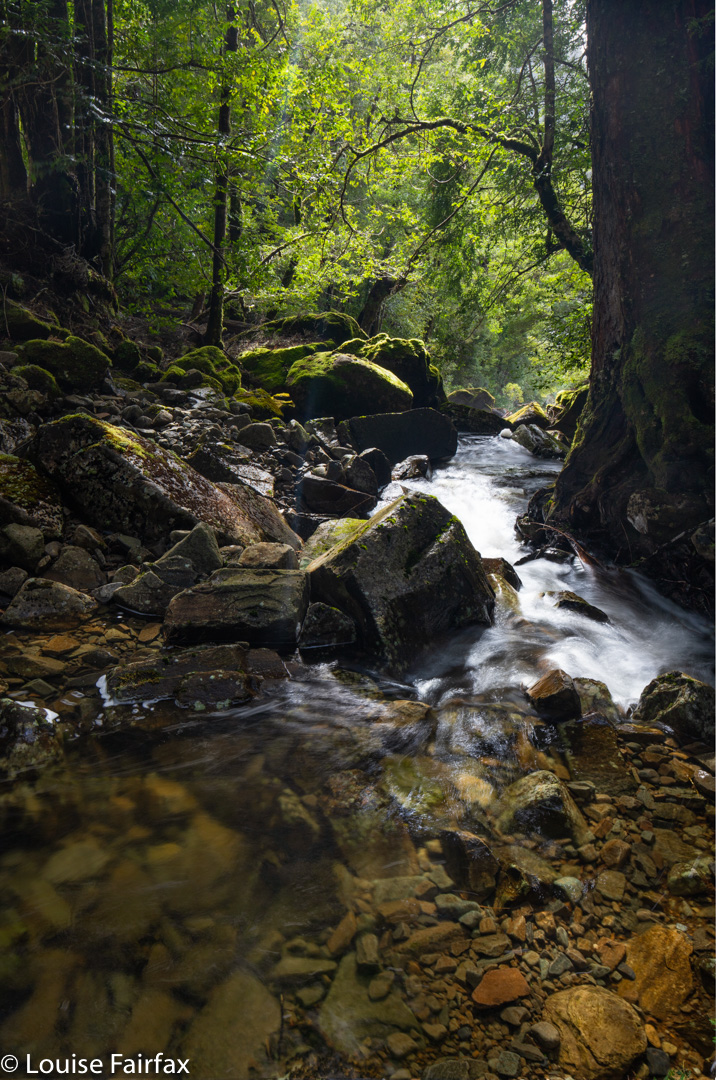
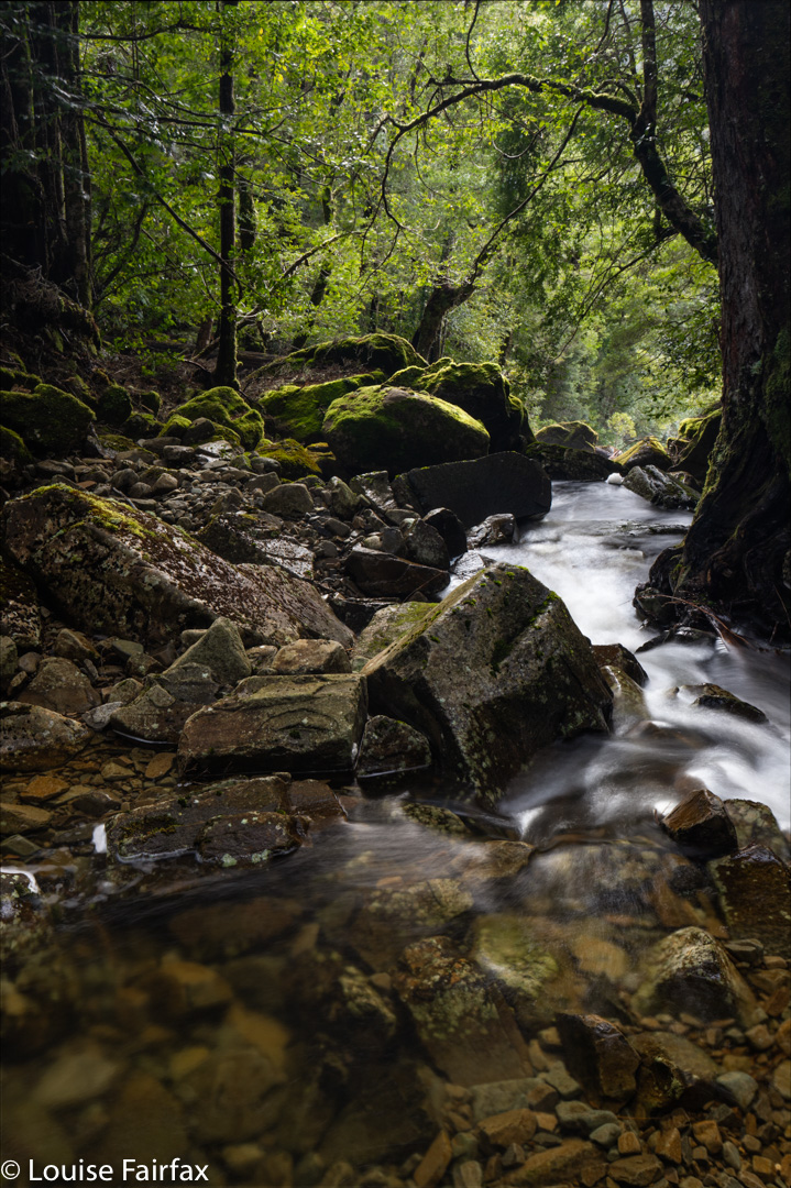
It was great to drop the packs after this time and head to the falls. I estimated two hours. Wrong. It took us three: two in getting there and back and an extra hour for photographing all that beauty. Having not met track improvements in the first bit, I was hopeful that maybe what the ranger had spent time on was this waterfall section. Wrong again. It was still chocked with fallen limbs and branches. I felt very clumsy with my tripod dangling around my neck, but that left two hands for grabbing and climbing. The rocks themselves were very slippery indeed, so Leandra and I stayed on what used to be a track and fought all the fallen scrub. The boys felt OK about skating on a bumpy surface, so went along the rocks. But it was far from relaxing, and they chose the scrub on the rebound. Using the rocks, they had to climb back up high anyway, as there is no way over the bluff that guards the entrance to the actual waterfall. If you want to see the base, you have to climb up and over. … and then DOWN a very steep section where some people sent rocks flying, as it is also loose.
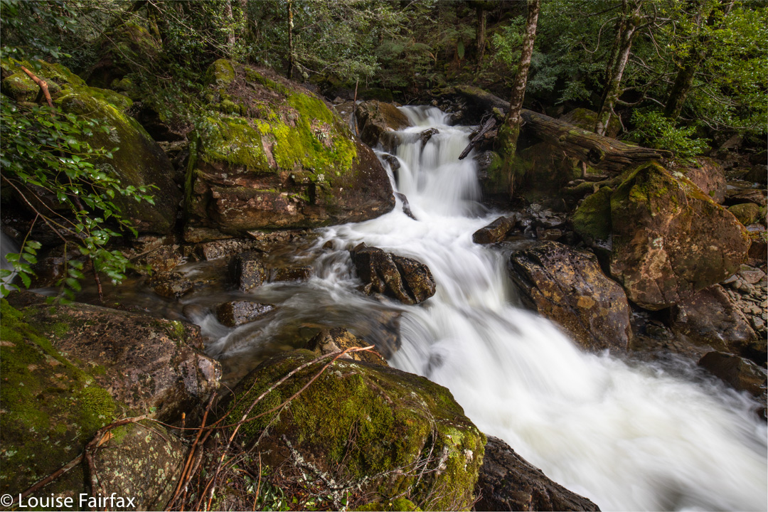
Down there in the semi-amphitheatre made by the curve in the river below us, it felt like hallowed ground. The falls dropped into a pool that was a fabulous blue, but also wonderfully transparent at the same time. Everything was super except that I was too scared to move. All rocks were angular, and they dropped into water I didn’t feel like bathing in, especially not whilst having priceless electrical equipment strapped to my body. There was nothing much to hold, and the rocks were some of the slipperiest I have ever encountered in my life. My photographic compositions were dictated entirely by safety rather than by whatever the more artistic part of me may have wanted. I chose a spot where I was kind of wedged in, so that when I slid, I would fall into a rock and not the pool. My tripod slipped downwards as well. I chose to do a series of shorter images and stack them later. That way, if and when the tripod slipped on the rocks, I wouldn’t ruin a whole long exposure. The photos you see are stacks of 3-5 images.
Despite these difficulties, I chose three angles. Caedence, more courageous, chose more. Adrian hopped from here to there, sliding with gay abandon (was this his Dutch ice-skating heritage coming out?), and Leandra mostly sat on a stable rock and enjoyed the scene from her vantage point, soaking in its beauty. It was so nice for me to be with friends who wanted to spend time at the falls. When I was here in February, the people I was with didn’t even want to go to the base with me, let alone spend time there gazing in wonder.
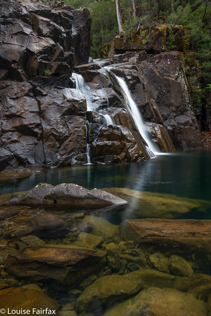
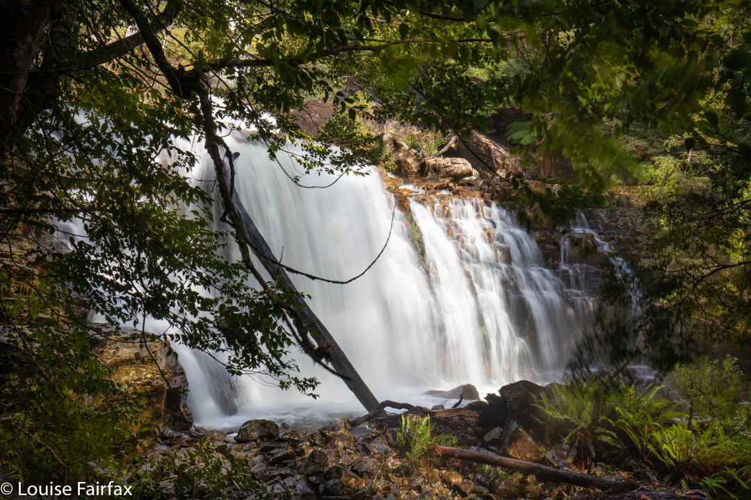
Everyone content and happy, on we moved to the base of Leeaberra Falls, which we could only see from the top at this stage (having gone downstream a bit). I hadn’t been to the base of this one last time, due to time pressure of the others with me who didn’t like waterfalls, so I was excited to be seeing something new. We found a safe crossing point. With the rocks as treacherous as they were after yesterday’s rain, we were lucky the water wasn’t any higher; it was possible to get across safely – even for cautious people like me – and then we climbed up over the kind of bluff the other side before dropping pretty steeply to the base of Leeaberra. As said, this exercise took, in total, an hour’s walking, photography time not included. Down here was more beauty, and a kind of repetition of the previous fall, with two setting up tripods, the third hopping about exploring many angles, and the fourth meditatively gazing in wonder. I felt very content by the time we were ready to head back. Waterfalls should be savoured like this.
Leeaberra Falls base
Back at the camp that wasn’t our camp, we had lunch before dispensing with the business end of the afternoon, namely, getting up the big Lookout Hill (highest point on the track) and descending the long, long drop to the Douglas River, our actual campspot for the night. I think everyone was glad to finish off the day. The river was lower and less scenic than last time, and the lighting less interesting, but it is still a beautiful spot to spend a night. The others ate “in” the river on rocks. I socialised a bit, but then retreated to my warmer tent. I had never dried out from the morning’s drenching, and the chill was gnawing at my innards.
Leeaberra Falls base
The next day was earmarked for Tevelein Falls, but overnight rain had made the rocks a nightmare again. It had taken me an hour in nice weather in February to reach them. I didn’t fancy my chances today in these conditions where, really, it might as well have rained olive oil over night. Leandra and I contented ourselves with lesser goals. The boys, not burdened with a female’s life preservation instinct, dashed along and got to a spot that satisfied them. I already had photos from last time, and was pleased not to have the pressure of trying to squeeze this one in under these challenging conditions today.
Tevelein Falls, Caedence’s perspective. HIs image; my editing. Thanks Caedence.
And then, it was back to camp, packing up, and setting out up the big hill to the fire trail. We were all up within forty four minutes’ walking. I had been pessimistic and thought we needed at least four and a half hours to get from camp to the end, using the fire trail exit. Adrian thought three, and it was wonderful that his predictions were correct and not mine. We did this second section in stints of, roughy 50, 50 and 30 minutes: the first break for lunch, the second initiated by the fact that Caedence came into range and thus wanted to catch up on the cricket scores, so I dumped my pack and declared it a rest. The final one finished it off. There was my car waiting for us. Now it was time for cappuccino and home. We were all so refreshed from having had time in the wilderness.
Horeb Falls day (today) seemed to start quite well. The road beside Lake Rowallan must have been recently worked on, as it had fewer nasty attacking rocks and deceiving puddles than on my last visit. And, it wasn’t raining, despite BoM predictions – which admittedly still had plenty of time to come to fruition; there were some very healthy clouds floating around the place.
Off I set, along the Jacksons Creek track, which I intended to stay on for 15-20 minutes until it crossed the creek on a swing bridge, after which I would hive off to the west. Hm. The track was actually frozen and I was sliding everywhere. I had to slow right down. Even when I trod on old bracken (of which there was plenty), I was skating, as the fronds were coated in a thin rime. The myriad fallen branches were also treacherously slippery, and, hm, where was the track, actually? I kept having to search, as the large quantities of bush debris (artistically dotted with snow patches) obscured any trace of a path. Sometimes I just gave up and hoped to pick it up later.
Cascades on Moses Creek
At one stage, I got out my gps to check. Horrors. I was nowhere near the mapped track. Just in case, I called up my Cathedral Mountain route. Ah. Yes. Hardly for the first time in my experience in Tasmania, the track on the map and that on the ground bore not the slightest resemblance to each other. The dashes on the map were a mere “artist’s” fumblings, which is quite dangerous when you actually need accuracy. Luckily I had my own old route with me, so used it to guide myself back to where the ground track was.
Jacksons Creek was roaring, and several pop-up creeks had appeared along the route. I decided to change my plan to ensure that I could get across the next creek with maximum safety, and continued on the “formed” track for a while later. Surely it would cross at a good place. It did. With the aid of a broken branch, I even kept my precious tootsies dry. Wow, the stones were slimy!! Being solo in territory like this requires extra care.
Lower Horeb Falls
I climbed a short steep incline, swerving now away from the track, and began the bushbashing section of the day. Unfortunately, I had earlier ascertained that my compass was not playing game and was randomly selecting directions. (Had I accidentally brought a northern hemisphere one along? Possible.) My map said to keep the more sharply contoured section to my left, the flatter land to my right, and use that to get around the spur, climbing a little.
I have already mentioned the debris. There must have been an almighty storm in the somewhat recent past. On the nose of the spur, fallen trees were piled on top of each other as far as my eyes could see, in an untidy fiddlesticks jumble. The wood was icy, sodden and treacherous, but I could not get under or around it, so would have to do what I hate doing, and tread on wet wood. ‘Over’ was the only way if I was to move forwards. I made gastropods look hasty.
Testing everything before i committed, and using, as ever, all five limbs. I snailed my way over the obstacles, eventually reaching the next band, one of thick bracken and tree ferns that concealed submerged tree mines.
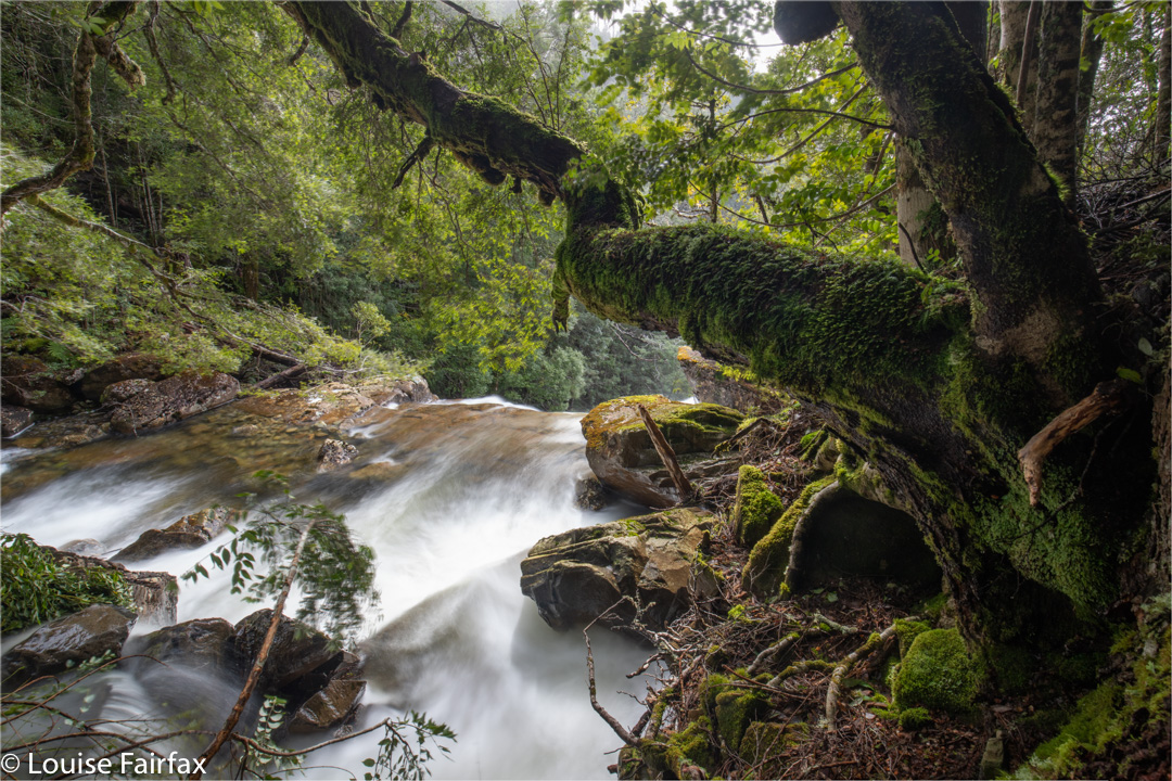
It was with enormous relief that I finally made it back to the rainforest. Ahhhh. The green lushness of that calming moss and the delicate myrtle leaves instantly erased all the anxiety and negative feelings caused by the spur. According to the map, the falls were still about a hundred metres upstream, but I could see foam and beauty below me, and I don’t trust Tasmaps’ placement of waterfalls, so I descended to the creek to investigate. Definitely worth photographing! I dumped my pack (with, possibly hilariously, two sets of ice spikes.) But, oh no, it contained no filters for my camera. Ach. They must have been left in the boot of the car. I’d have to take lots of shorter shots and stack them together later for a single long exposure. Sigh.
From this point on, the creek was magic, and I took lots of photos and enjoyed the green beaches, and the feel of the forest. I was also starving, so got out some food, but discovered that the water was so cold it hurt to drink, and lowered my core temperature drastically and almost instantaneously. I couldn’t afford that, so opted to go thirsty.
Now, quite apart from skating on ice, losing the track early on, being held up by tree bandits, forgetting my filters and not being able to drink the plentiful water that surrounded me, I began to have problems with the sun. Right up until when I got out my camera, it had been snowing lightly. The minute I pointed it at water and took the lens cap off, the wretched sun came out and would not go away! Grr. Meanwhile, thirst was getting to me. I decided ginger chocolates would help. I opened the packet (which resisted my attempts at first) and whoosh, little brown bombs flew everywhere. They were subtly disguised on the brown humus, but I did retrieve some. Na ja. The beauty overcame all. I obviously need to return on a day that is more consistently overcast, and with my filters.
I had squandered too much time playing with all the different drops and falls to then do the full circuit, so did my own much smaller one on the rebound.
If Horeb Falls were not already named, I would call them Glory Glory Glory. I spent about an hour and a half playing around their presence. You are no longer in “time” in a place like that. You lose yourself. The world stops … or maybe you just step off it.
Another waterfall you may want to visit in conjunction with this one is Meribah Falls, about 1.5 kms upstream. See my separate blog on this waterfall http://www.natureloverswalks.com/meribah-falls/
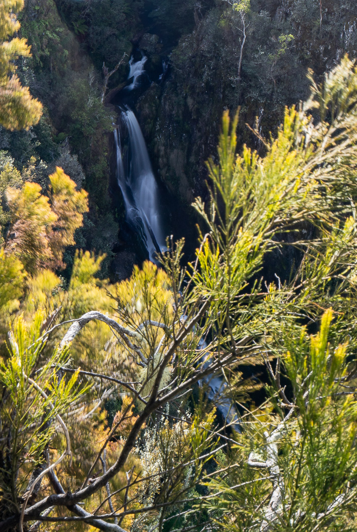
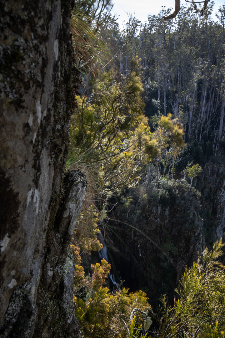
Having seen my own, and a few other people’s, photos of Joy Falls, I have to wonder if it is actually possible to begin to do this waterfall photographic justice. A huge part of the problem, of course, is that wherever you stand, trees seem to obscure the view. Another part of the problem is that the drop-offs are so massive, and the potential for your gear (or your person) to tumble over, so apparently likely, that you are both on the edge and on edge as you soak in what you are seeing. Adrenalin levels are high. This set of falls pleases yet teases – reveals yet conceals – simultaneously. Your eyes can join the dots and yield a really pleasing whole – a long, medium width strip of fine, misty white veil with several tiers – but the camera just cannot – or not one attached to a human attached to terra firma.
I shot with my tripodded camera also around my neck for safety, and with my arm looped right around a young, healthy tree, leaning into it, so I couldn’t get bumped or just somehow accidentally start sliding. If I had brought the rope that was in the boot of my car, I would have anchored myself with it. Steve dropped something he was carrying and it did exactly as I was expecting: it just rolled a metre down the incline before dropping irrevocably over the edge into space, never to be seen again. Each of us announced any movements we intended making in advance so we didn’t accidentally even hint at bumping the other one. Any loss of balance or position could have been disastrous.
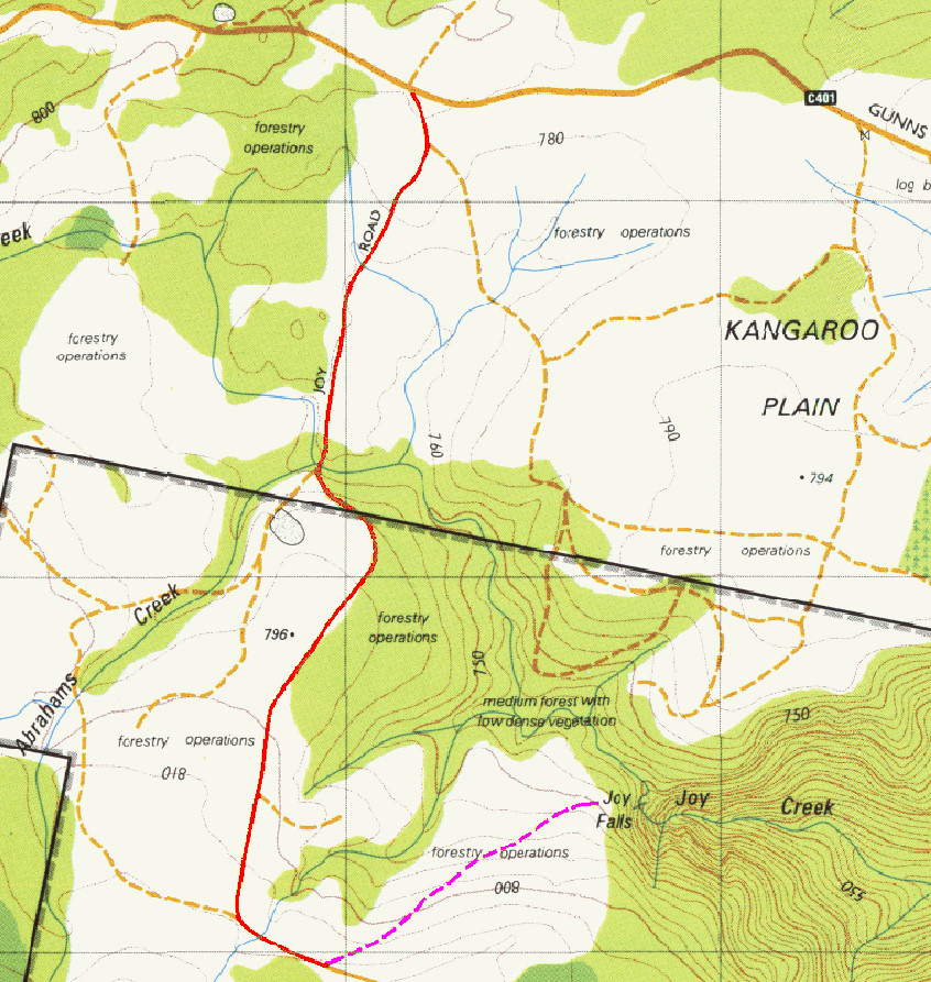
Apart from this danger of trying to get a view and shoot from it, the trip itself was not at all dangerous. We parked where “Joy 3” (pink) track met Joy Road (red). Sure, you couldn’t drive along Joy 3 (an old logging road), but it was easy and delightful walking. At the end of Joy 3, there were tapes to guide you in through pleasant forest. We took our shots at about where the “l”s are in the word Falls. But don’t think that tapes mean it’s easy. Tapes help if you know what you’re doing and are already doing it. This is yet another waterfall that is for experienced bushwalkers. If you want to learn to navigate so you can enjoy areas like this, I suggest you join an orienteering club. That will also increase your confidence in the bush.


