Wright 2014 Dec

Mt Wright 2014 Dec

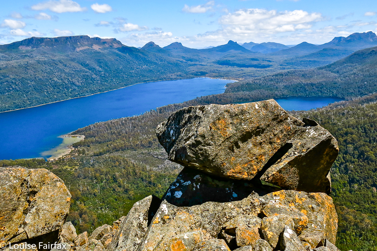
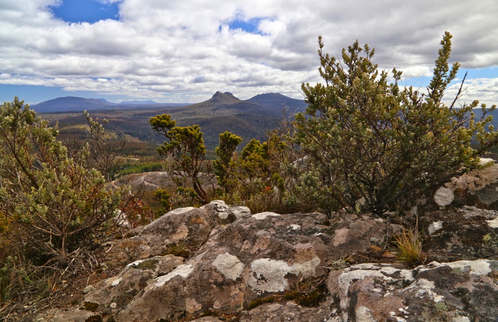
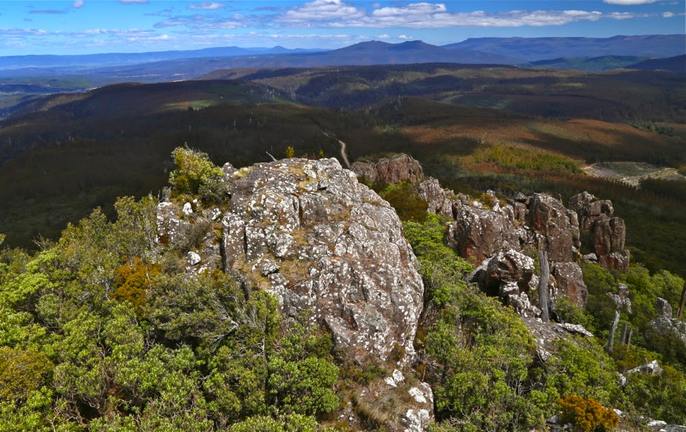
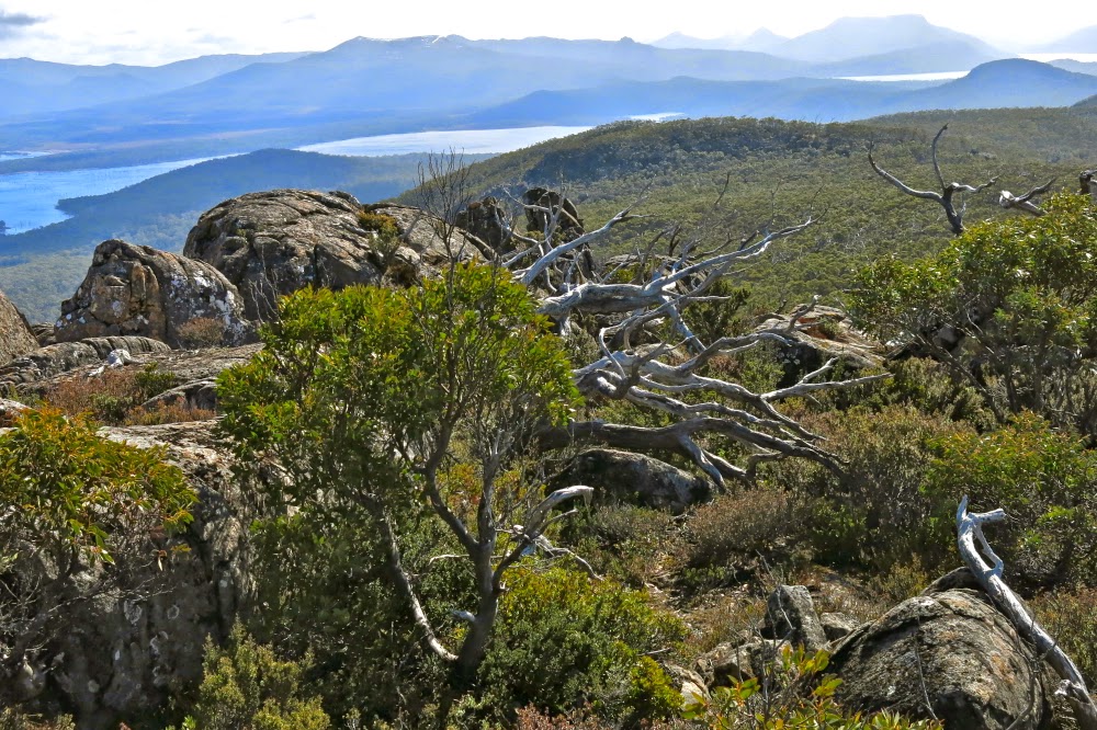
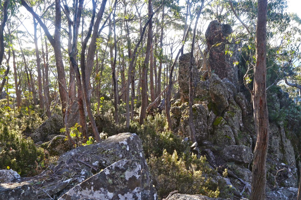
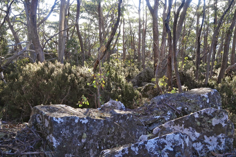
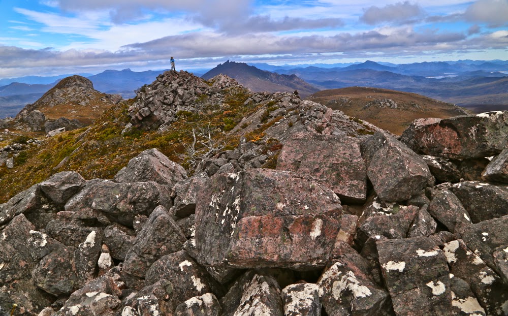
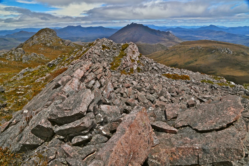
From the top ridge, looking back towards both the southern summit and The Thumbs.
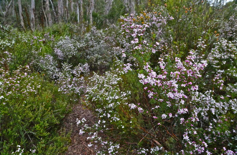
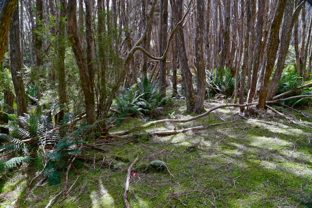
I travelled four hours in each direction to climb this mountain, but left my walking boots in the trunk of my car, parked in Hobart (old gardening sneakers with holes to allow mud in had to suffice); I climbed a mountain that has been on my bucket list for ages; I saw a splendid array of peaks from the top, met new, lovely people and reunited with old friends whose company I enjoy … and yet the single most thrilling impression of this day is not the wondrous vista from the top, the joy of the climb or the seeing of the famous natural arch. Rather, it is a far more tellurian one: our 25cm wide track obscured with a veil of arching swathes of shoulder-high boronia. Each time you brushed a plant, you released the most delicate, welcome perfume into the air. The fragile blossoms of every shade of pink and white waved gently as you passed. I was like Goethe’s “may beetle” (Maienkäfer) floating on a cloud of fragrance.

Weathered striations of rock indicate the steepness of the slope

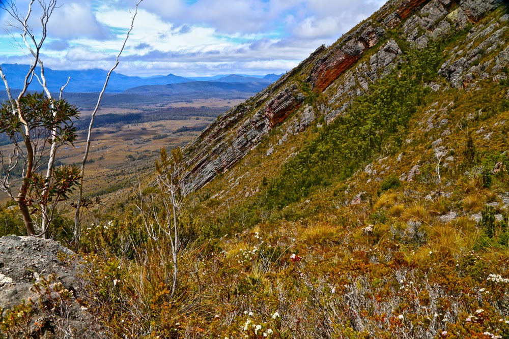
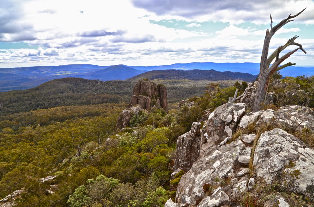
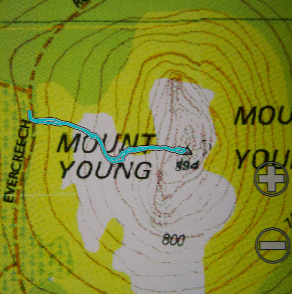
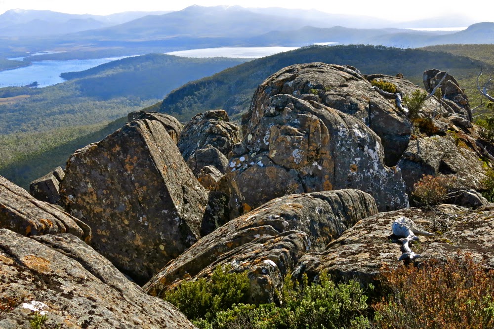
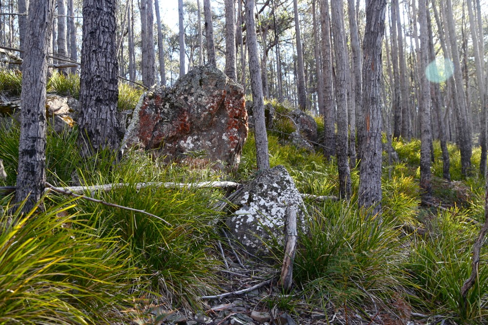
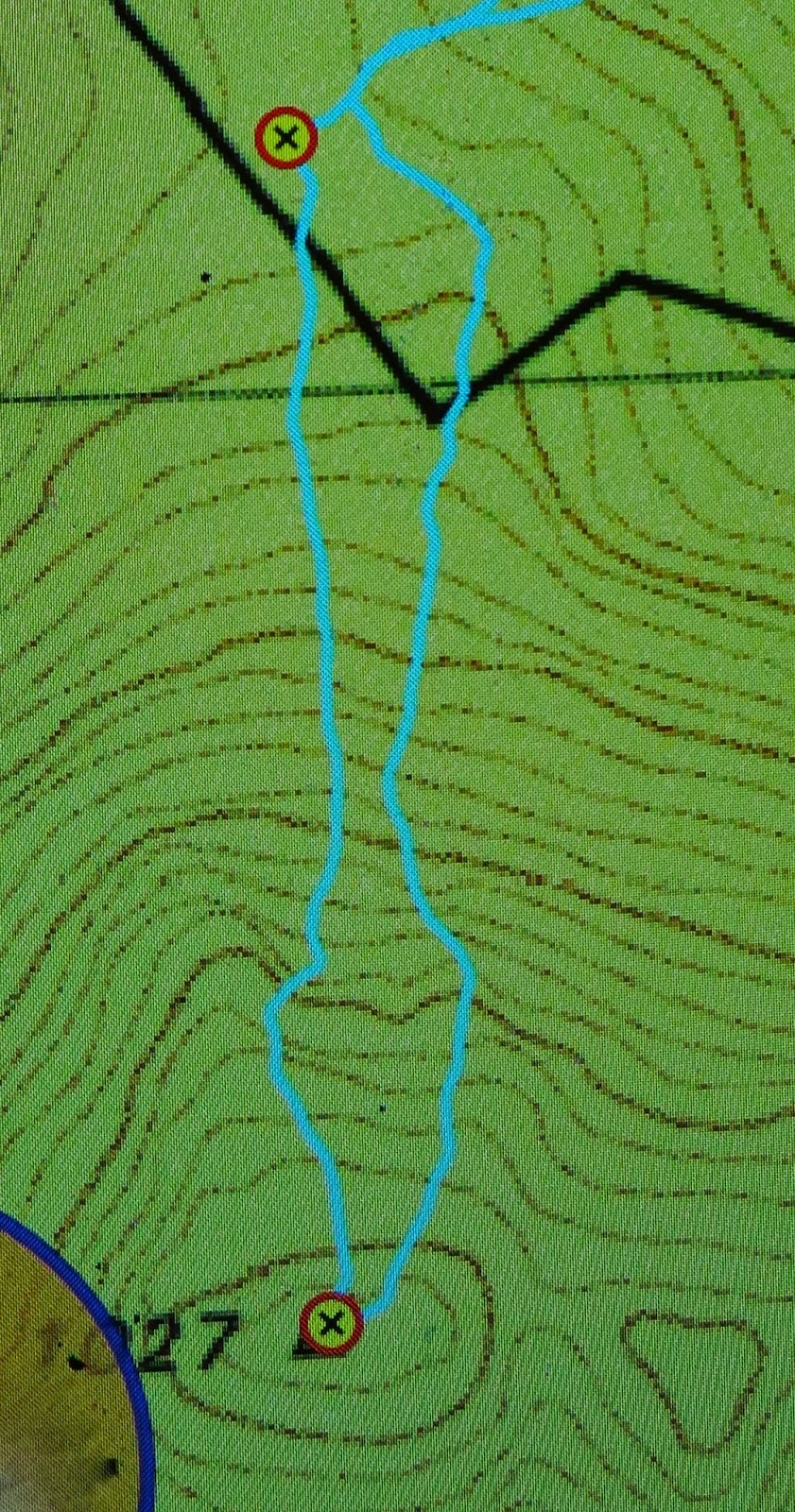
I had been told by others that Wright was steep, but I tend to just nod when receiving information like that, preferring to form my own judgements in situ. The statistics of the matter are that we gained 745 ms in our main ascent to the tops (at 1112 ms) in a bit over 2kms. The photo of the rock striations probably says it all. Using tractionless gym shoes was not totally smart: I stuck to as much rock as I could find on the way up and had a gloriously fast bum-slide on the way down, clutching wildly at shrubs to prevent gaining too much momentum. My shoe situation reminded of the time I flew to America to race the Boulder Boulder Colorado – 33,000 entrants – as an invited athlete, to discover on race morning that I had brought my spikes instead of my racing flats. That was a somewhat worse error, but solved by the organisers who nonetheless delighted in telling the assembled multitudes as I mounted the dais that I had flown in from Tasmania without shoes for the race. I gave a cheeky grin in response.

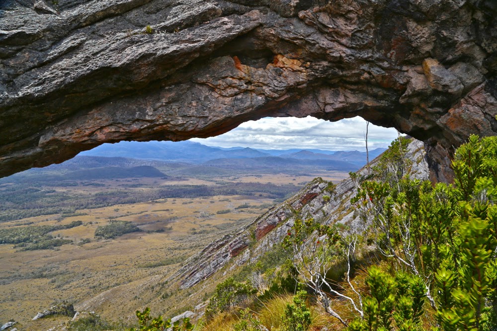
The famous natural rocky arch
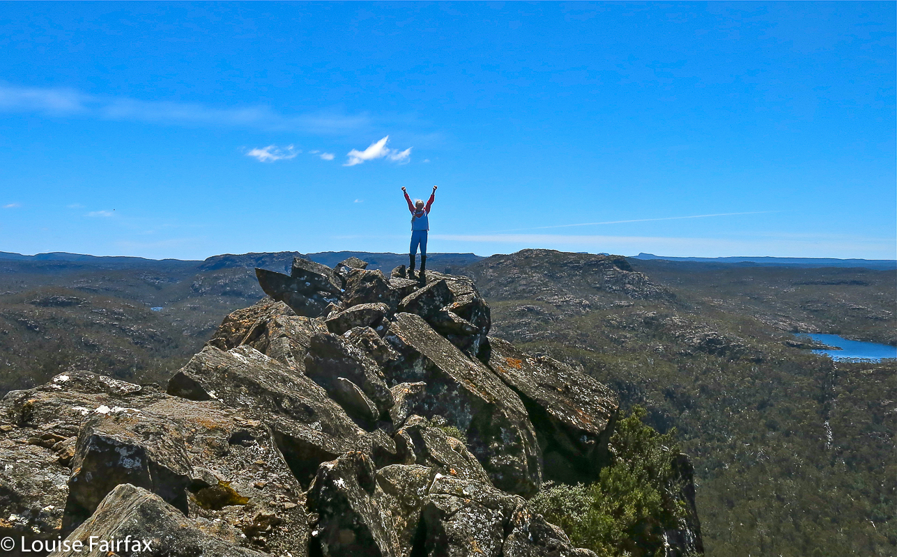
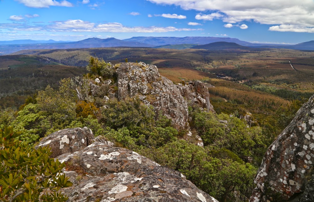
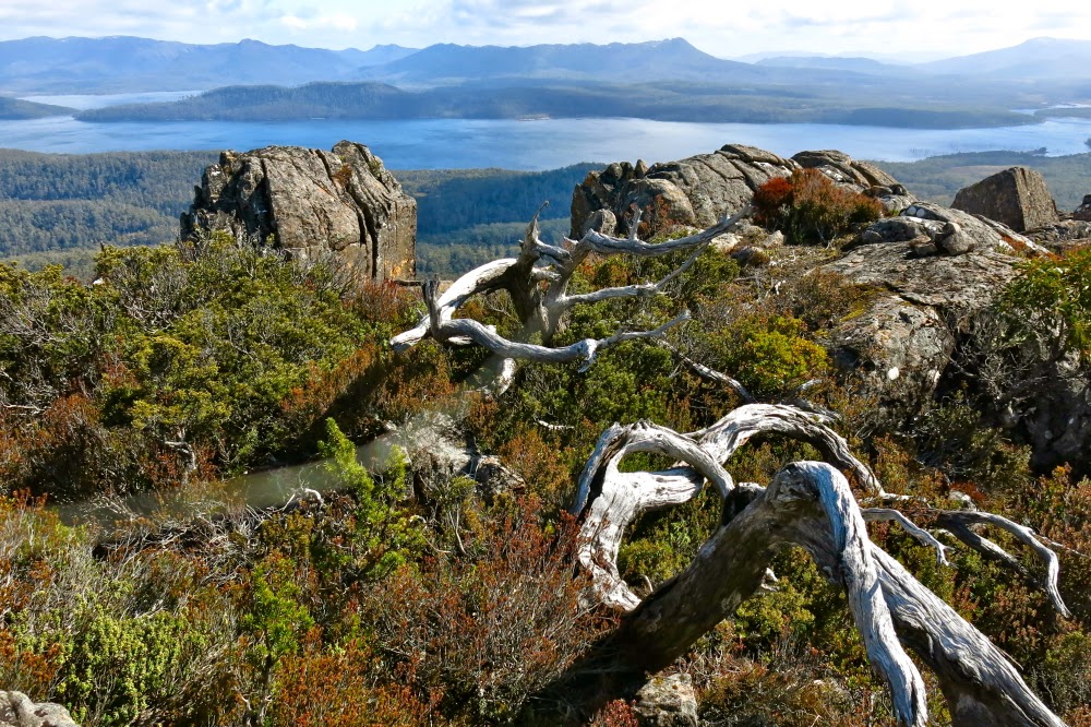
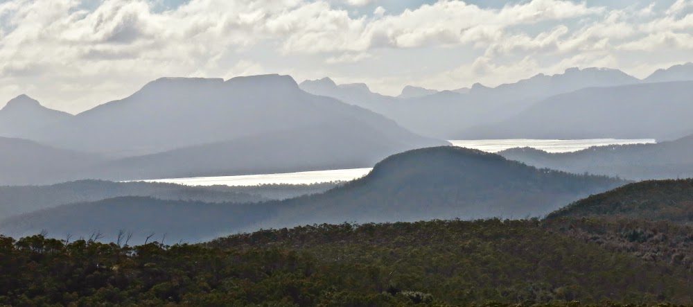
How peaceful it was sitting on the rather small summit of Mt Wright quietly munching our food and surveying the surrounding peaks. The air lacked perfect clarity, indeed, but given that it was raining either lightly or heavily in the rest of Tasmania,  we felt we had been dealt a very good hand. I enjoyed being so close to The Thumbs – my mountain of only a couple of weeks ago – and Stepped Hills, a peak on my fairly urgent “to do” list. Reeds Peak from across the way was also calling with fair insistence. Tasmania has a plethora of wonderful mountains, each with its own cozening siren to lure me and bind me with its spell. Sitting on summits is pretty ‘dangerous’ work, as I just get tempted by a new list of must-do mountains.

The southern summit to the left. David is on what my map says is the real summit, taken from what some gps devices say is the real summit, looking towards The Thumbs and the other mountains of the South West.

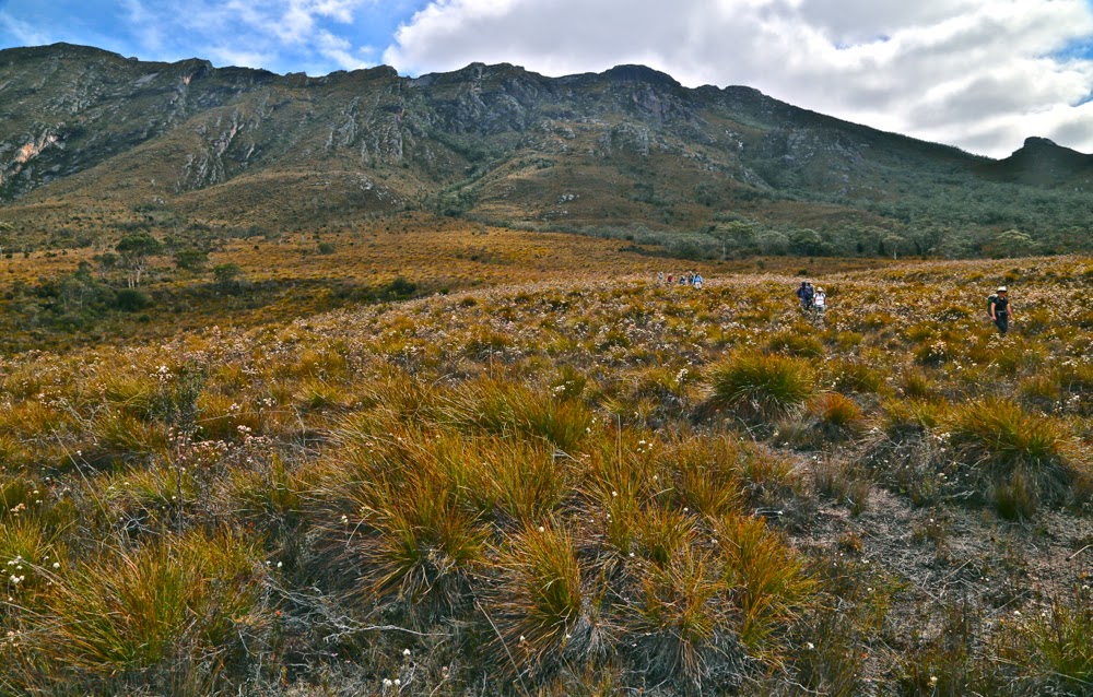
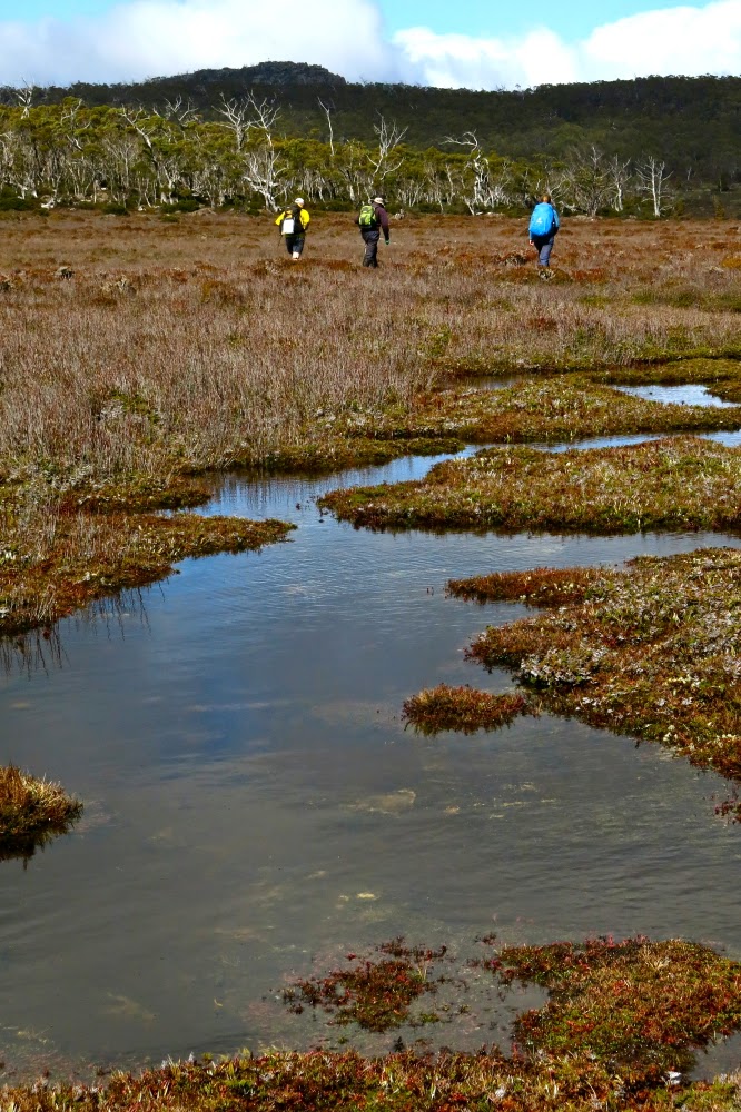
Because of the slippery dip that constitutes this mountain for those who dare and who don’t mind returning home with filthy pants, the descent was significantly faster than the more exerting and laborious (but exhilarating) climb. Feeling full of joy down the bottom, I had a brief frolic, running through the marshy heathland at the base. When I turned around to see the others, what I saw was a delightful file of backlit walkers marching through a field of now-golden button grass, with heath flowers shining like little lanterns. This was my last glimpse of the group as such, as once we arrived back at the boronias, I dropped to last in the line, and the others disappeared out of earshot as I floated on my perfumed cloud and photographed, only catching them again at the cars.

Descending in afternoon light. The mountain looks quite tame from here, doesn’t it. don’t be fooled: it is deceptively steep.

Swathes of boronia cover the path below

Our route. The waypoint is where we left the Rasselas track. The car is parked about one millimetre to the right of this picture.

Ida 2014 Nov

Mt Ida 2014 Nov


Mt Ida is possibly the scariest of the Abels I have climbed. I took photos at the top so that my family could see what I saw just before I died. As it turned out, coming down was very easy compared to going up, but I wasn’t to know that in advance. Because I thought I had other – better – things to do in my final moments on this earth than watch midday glare from a lesser-known peak, I didn’t fully appreciate the view. Luckily I took quite a few photos.
For the full context of this mountain, please see the link:
http://www.natureloverswalks.com/travellers-range…ter-spurling-ida/

Young 2014 Oct

Mt Young 20 Oct 2014.

I was excited as I put on my suncream; I love that smell, redolant of summer holidays, the beach, excitement and adventure. It seemed as if I hadn’t been on a proper Tassie walk forever. I couldn’t even find a compass, and that’s about as likely hat our place as not being able to find a spoon to eat with.

As I left the house, I joked with my husband: “We need to leave for the airport at 7, so dinner will be at 6. See you at one minute to …. haha.”
It was a beautiful day, as promised. The grass was that magic spring green; little lambs gambolled about, leaping randomly, jumping invisible obstacles and filling me with delight. Ben Lomond was sharply delineated as I continued on past it. I was finding the driving enjoyable and relaxing.

However, I seemed to have used up far too much of my beautiful day, I decided, as I at last reached Mathinna. It was already 11.30. I turned to the north. Checking the map at every turn was a bit bothersome, so I drove on, and checked far too late to see that I was now heading to the Falls instead of travelling on Diggers Road, parallel (sort of), to the one I wanted. Back I went, found my road, did a bit more stopping and checking at intersections this time, and there was the road I wanted, the one that would connect Diggers with Evercreech Rd that led all the way to Mt Young: Symonds Rd. It was surprisingly narrow. I rechecked the map – yes, solid orange, same as the roads I had been on, which meant I could drive on it. Yet it was only just wide enough to take the car, and branches were trying to get in the windows. I’d already seen two black snakes on the road. Now, travelling very slowly, I saw a third. I came to a halt to glare banefully at him. He stared menacingly back, eye to eye and no mistaking it. I was starting to think that the solo bit wasn’t so nice today.

I drove over a fallen tree, small, but with side branches – trunk maybe 12 cms thick. Then came two more logs. I’m now going downhill, presumably to a creek. The road is getting even narrower, scratching the car as I went, and also becoming quite sandy and loose. Luckily my husband is not a man who cares about a bit of metal … which is kind of why I married him. His head and heart are in other places. BUT, then I came face to face with a very thick tree that had fallen, and although it had been cleared enough to let a motorbike through, I was not a motorbike and for me there was no way forward. Another big BUT. Could I back up the slope and over those obstacles on a path this narrow and sandy with all sorts of hidden traps at wheel level? Could RACT ever rescue me if the answer to that question was was ‘No’? I remembered my joking words of this morning and feared I would not even be home by one minute to six at this rate.

Whenever I’m in a sticky situation like this, I’ve found from experience that the very best thing to do is to sit and eat – preferably some chocolate, but almost anything will do. I grabbed at my lunchpacket and gobbled some of its wares. That felt better. It wouldn’t do to go backing a car on an empty stomach in that kind of terrain.

 Miraculously, I made it, and after far too much time, found myself driving back towards Mathinna to try a new attack. South to the town, and then east, and once more, north. This trip was getting very long, and the purpose (climbing a mountain, in case you’ve forgotten), seemed still a long way off. The airport was starting to call.

At long last, my mountain, and the goal of this trip, came into view. I wanted to drive until I was due west of it. I now had out the gps as I drove to line up waiting for that point. Going nice and slowly now. Just as I was deciding I was due west, I saw a most heartening and glorious (given my frame of mind at that time) sign – a pink ribbon tied to a tree. That strip of pink ribbon could have been a golden necklace and I wouldn’t have been as happy. I looked at my watch. Time for one hour up, one down.  That should do it. I packed my bag and set out.

Oh the joy of at last being in the bush after such a stressful and protracted journey.  Oh the pleasure of walking through open forest with a green carpet under my feet. I had imagined as I pictured the day in advance, that I would have to bushbash the whole way, and find my own route up through the rocks, but the pink ribbons went on and led me right to the top. Thanks ever so much person /people who put them there. Everything was glorious, I utterly enjoyed the feel of the bush, its smells and its sights … except that in 15 minutes I was standing by the summit trig. That represented a truly shocking drive to walk ratio!!! (17:1).

The view was wonderful, and I stayed a while to take it all in. I could see the sea – very clearly –  and lots of mountains that I’d climbed already. In fact, I think the only mountain in my purview that I hadn’t climbed was Mt Blackboy, which was also on this day’s agenda, but I had now timed myself out of it. The airport called louder and, had that call not had dire consequences if I ignored it, I might have attempted to squeeze in another mountain, but I couldn’t risk anything more going wrong, so quit while I was ahead, and assured myself it had been a lovely morsel of a mountain and that I could bathe in its happy memories for a while without pushing them to the side by adding an extra climb that would be tense as time ticked by.
I came home via the north, heading first from Mathinna to Ringarooma and then west on Ben Ridge Road towards Targa and thence Launceston. It was very interesting seeing new angles on otherwise familiar mountains, such as Ben Nevis.

I arrived home in time to have some berry and almond cake with a cup of tea before throwing some gear in a pack, having a hasty dinner, and driving to the airport, where we ordered citrus tart and cappuccino to try to begin relaxing. I had done almost nothing in terms of physical exercise, but the strain of almost being stuck overnight a very long way from phone range had made me absolutely ravenous.

Wentworth Hills 2014 D’Arcys Bluff Sept

 Wellington Hills and D’Arcys Bluff 2014 Sept

 The reward: a view like this

“I hope I’m pleasantly surprised by this mountain today. I’m not feeling overly hopeful.”
“Why not?” asked my husband,  probably wondering why his wife had brought him on a walk that she wasn’t expecting to enjoy.
“Hmm. The picture in the book was rather dull – it looks rather a non-event – and the book says it’ll take 4 hours from car to summit, which is rather a long time. The distance doesn’t seem overly long, so that bodes ill re the terrain.”
“Why are we going then?”
“Mhm? To taste new things. Besides, when expectations are low, you often end up loving whatever it is. If we don’t like it, we won’t go back.”
Well, it was too late for him to object. He was already in the car and we continued our way through the gloomy dawn mist; at the very least, we’d get a good workout, which for us is always a positive.

Easier scrub near the top of D’Arcy’s Bluff

And what is my verdict, now that I’ve completed the walk? Unfortunately the old “low expectations trick” didn’t quite work. I will certainly never climb D’Arcy’s Bluff again, having gained my single point for the efforts, but I would return to Wentworth Hills via the route of our return. Although the lower slopes of D’Arcys had rather lovely myrtle forest, and were sufficiently open to allow pleasant walking, that forest type didn’t last long enough, and ceded too soon to drier, bushier, thicker stuff, cluttered with fallen timber and rocky jumble as we sidled our way around under the palisade of cliffs, looking for a break that would allow us up to the top level.

Nicer going right on top
Up there the rocks became mossy again, and a view opened up over Laughing Jack Lagoon way below. It was not the most dramatic view in the world, but at least there was more reward than just the acquisition of a single peak-bagger’s point.

The more open section between D’Arcys and Wentworth Hills
On we pressed to mountain number two, the dubiously named Wentworth Hills (the minute you call a mountain a hill you’re asking for trouble in my books. Who wants to climb a mountain called a hill? Only a fairly desperate peak bagger). The bush wasn’t too scrubby, although not lightning fast, and then there was a fairly long stretch of spongy open wetland with only calf-high vegetation that sank somewhat even under my unimpressive weight. A bit more scrub, sightly thicker, another rocky barricade and the summit at last. Not a moment too soon. I was absolutely ravenous.

View from Wentworth Hills, to Lake King William (L) and Lake St Clair (distance, R) 
There had been a mild dispute over direction down lower, and I, knowing that others had gone off in the direction they felt to be the summit, took that as licence to do the same, and as it so happened, got to the top with a gap of fifteen or so minutes in which I could soothe my soul by staring out to an infinitude of natural delights: to vast blue and grey skies stretching to worlds beyond, down to Lakes King William and St Clair, and across to a cornucopia of mountains, many of which are familiar friends, but seen here from a new angle. It was delicious to have the summit to myself, to photograph and spend silent time with the beauty. Having taken the photos I wanted, I chose a rock and quietly munched my roll, gazing, gazing, not even worried by the rather strong breeze.

Lake King Will and the King William Range (et al)
 I reckon there was enough ground water near the summit to stay overnight up high. As to whether the mountain would pay off the trek up through the resisting forest with a sunset that made it worthwhile, that is a question that I may … or may not … one day solve. Our return route was via a saddle to the south-east of D’Arcy’s Bluff, and then following the slight spur to the left of the creek that issues from it until it intersected with the road. That’s the way I would go if I didn’t need the point for D’Arcy. If I did need the point, I’d still go up beside the creek to the saddle, and climb D’Arcy via the “back door”, after I’d got my Abel (Wentworth Hills), on the way out. The bush is friendlier by far from that angle.

Zoom in on the watery mountains surrounding Lake St Clair – an interesting aspect.

Route. (Turned gps off early)

St Pauls Dome 2014 Aug

St Pauls Dome, Fungal Valley, Tasmania. 2014. Aug

The bush in the first eight minutes
The minute you turn east off the highway to Hobart and begin heading to the coast along the Fingal Valley, there is St Pauls Dome, dominating the skyline slightly to the right of straight ahead. If you climb a mountain like Mt Henry, nearby, there it is again, looming larger than the mountain you’re on and telling you you should be on it instead. The trouble was, I wasn’t sure how to gain access, as private land separates the highway from the mountain.

A few postings to and fro on bushwalk.com and I had a telephone number, and soon after that, permission from the friendly owner, Jamie, to cross his land. My husband finished work at 1.30 today. It was on. We met in town and set out.

The bush with 100 ms of height gain left.
We found the sign that said this was property 3710, so turned in the gate with its sign about alpacas, crossed the railway line, and headed through the fields for the mountain. I had feared that we’d have to park at the start of the bush, but Jamie assured me I could get further than that despite my only having a 2WD, so up I continued. I was pleased to be doing this at last, not just because I’ve ignored the gauntlet tossed in my direction each time I pass, but also because there’s a big orienteering event near here in January, and I wanted to know whether this mountain was worth recommending to some of the interstate visitors who’ll be staying with us.
My judgement now I’ve climbed it and seen the “view” is that I’ll send them up St Patricks Head instead.
Not too far from the summit now
 
Directions: Looking at the map above (scale 1:50,000), you can see where I parked just below a corner that swings left (as you drive south towards the mount), not far from crossing a creek (most northerly waymarker). The section from the creek to that corner was a little hairy in our 2WD and if you love your car or are nervous, it’s probably better to stop just before the creek, where there are numerous places to turn the car and pleasant, green, flat sections just to sit and enjoy the bush while you don boots and gaiters. Continuing to drive to where we did saved us a bit of time which, given how low the sun was now in the sky, was necessary for us on this occasion. Turning the car around where I did was about a 7-point turn (but out car is very long). There is NO way I would have driven any further.
We then followed the road that would have even tested a 4WD up, as per the map, cutting off a corner in the road by taking the hypotenuse through the bush to meet it again higher up. The second waymarker is where a Pandani group (who did have a 4WD) parked when they did it last year. It took us 30 mins to walk from the first to the second waymarker.
As you can see, I left the road where the spur comes down to meet it, and just headed straight up. The bush at first looked like the bush in the first photo above, and was very easy to negotiate. After 7 minutes, the bush type changed completely, and short prickly shrubs predominated. However, these were very easily avoided, as the ground became very rocky, and I just steered us along rocky leads that took us to a mere 100 vertical metres of the top (another 7 minutes since leaving that second waymarker).
On the map below (1:25,000), you can see a kink in our direction partly onto a spur. That’s because there were some very interesting rocks there that I wanted to climb …. trouble is, you can just see in the contours the hint of a shallow gully, and the moisture it contained meant that the scrub was now over my head and very thick and our progress was pretty slow from that kink to the top (scrub gloves came in handy) – a further 14 mins. Therefore, on the way back, you can see I chose a more easterly route, and we both felt it was way faster, except that the ascent time was faster than the way down – but that’s pretty standard for me. I’m a girl on a mission on the way up if left to my own devices. In total, the time from that second waymarker where a 4WD can park to the top took us 28 mins. Even with the extra 50 mins’ walking that parking where we did added to the return journey, it was still less than a two hours’ walk (plus sitting at the top), and a very pleasant way to spend one of the last afternoons of official winter.
That said, don’t do it for the view. People talk enthusiastically about it, so I was expecting something glorious, and most definitely expecting to see the sea (Wildtiger says you can see the Tasman sea, but we couldn’t). We perched on the trig rock to eat before descending, and looked at leaves and trunks and, yes, some hazy distant mountains if we craned our necks, but I didn’t even take one photo!! Afterwards, I explored a different mound that looked promising, but it wasn’t brilliant (but was better than “trig rock”). I climbed the trig itself, thinking that perhaps the problem was my diminutive height – and that gave me perhaps the best view – but I wouldn’t rave. The scene we both enjoyed the most was after we’d joined the road and were walking along it to get to the car. The light was now beginning to change colour and the water-laden air was taking on golden hues tinged with grey that made that section very peasant. We could actually see further there than we could from the summit.
I have now checked with Jamie, and he’s cool about having his number here. If you want to call him about climbing the Dome, his number is 0419 394 572