
Goulds Sugarloaf, Little Sugarloaf, Coal Hill, Cuvier and Byron 2015 Oct

Gould Sugarloaf expedition. 2015 Oct

My little orange tent, with Mt Manfred, the Guardians and Mt Gould (inter alia) in the background
I don’t think Goulds Sugarloaf is supposed to be an epic. I had thought of it as a rather easy catch … but that’s before I encountered the bands of scoparia that fortify the boundaries of Mt Cuvier – or of Coal Hill and the lower reaches of Little Sugarloaf, for that matter.
The forest around Byron’s belly

These prickly soldiers are well armed, and not to be underestimated. My poor shorts-wearing friends are now battle scarred. I’m merely exhausted from all that pushing and shoving, bullying and poking that Richea scoparia is prone to necessitate.

Mark and Angela climb the final rise on to Cuvier shelf.

That said, the magnificence of the Mt Cuvier shelf, the fun of snow climbing and the views from all five summits compensated in full.

Mt Byron at dawn on day 2.

Day 1 was a rush. I’d walked this same stretch in December with LWC when we climbed Tramontane (see that blog entry for details), taking the 9 a.m. ferry and pitching tents as the sun sank at the terminus of a near summer-solstice day. This time there was no 9 a.m. ferry, so we had to settle for a midday departure, and the sun sets at around 6 p.m. at this time of year. We needed to match the LWC walking splits and take far fewer breaks than they took to get in before dark. We managed the five hours of heavy bush bashing spread over six and a quarter (hours), which included our lunch break, but that meant we only just made it before nightfall, cresting the final pinch that took us to the shelf as the sky turned pink and the mountains indigo. The white snow blotches shone like beacons; Byron glowed red, reflecting the dying embers of a glorious day as the sun sank below the jagged horizon.

Looking towards Mt Cuvier from my tent spot early next morning

We had mirrored the route of the Tramontane track, except that wicked Sirens tempted us to climb northwards rather than remaining due west for an appropriate length of time, landing us in a sea of thick junk. Now at the top at last, we pitched our tents on the edge of the shelf with a million-dollar view, and gazed at eternity while boiling our billies for dinner. The wind whipped up, and we were pretty tired, so we all retired early.

Cuvier a little later (but not much).

Day 2. After enjoying a magnificent sunrise and a relaxed breakfast – prelude to a day of very hard work – we packed our daypacks and were off, choosing to circumvent Cuvier on the way out and trust our luck at getting through the rather nasty scrub. It was alright, probably thanks to the fact that, being a wuss, I headed us for every single line of snow between camp and our destination: the ridge that comes down off Cuvier heading towards Coal Hill. “You love the snow,” commented Mark, as I headed us straight for another band. Now come on; the alternative was our friend Richy (richea scoparia for non Taswegians – a very prickly bush that hurts and destroys expensive clothing in a single kiss, as well. This poses a great dilemma when it’s raining and your goretex jacket cost you $450).

Mark on a band of snow. You can see the ridge we’re aiming for ahead: where the two rocky knolls are.

It took us just short of an hour to be at the base extension of this ridge we’d been heading for, and we gazed with a little dismay over a flat section that looked far from inviting. We all imagined some pretty serious bush ahead. Angela voted to go under cover of the trees a little to the left; I voted to swing back further right for the forest there; Mark voted to go straight ahead through the open flats and get it over and done with. We generously handed him the lead, promising that he would never hear the end of our mocking mirth if he got it wrong. Luckily for his prevailing sanity, he got it perfectly right, and led us through the muck speedily and efficiently, and soon enough we were drinking from a little tarn at the far end. Absurdly, I was already desperate for lunch, but it wasn’t yet even morning tea time. I stole a quick bite of lunch anyway.

Skirting a rocky knoll, still on Cuvier.

Off we set up the last slope between us and the first of our mountains for the day: Coal Hill. The forest had no wicked reputation that we knew of, and we sanguinely assessed its difficulty as minimal, believing we’d be celebrating the first summit in a very short space of time. Ha. Fooled. Almost imprisoned in a life sentence of immobilising junk, we made scant progress to penetrate our way out to the other side. It was a tough battle, but we fought well and eventually won. At last we could claim our first peak, and could see our goal for the day drawing nearer. The land that lay between looked completely benign. You can see it in the photo below – walk in the park stuff. Tricked again.

Angela eagerly arriving at the first summit: Coal Hill. Goulds Sugarloaf and Little Sugarloaf are on the horizon back right.

Someone forgot to mention the band of scoparia that separates Coal Hill from Little Sugarloaf. However, with our carrot literally dancing before our eyes, we determinedly pushed through obstacles, winning all small skirmishes, and were soon enjoying a marvellous snow climb, harbinger to the summit of mountain number two: Little Sugarloaf. And in less than half an hour from that, we were victoriously standing on top of our goal for the day: Goulds Sugarloaf. It wasn’t yet lunchtime, but I was positively ravenous, and it was only the thought of lunch on top that had given me momentum for the final climb. I began stuffing my face long before I bothered touching the summit cairn. It was amazingly peaceful sitting up there gazing out at the cornucopia of mountains all around, each one blotched with remnants of snow to enhance its beauty. The only marring factor was that we had taken 3.5 hours to get there, and could count on at least that many hours of hard bush fighting for our return. I scanned the horizon for a friendly helicopter but, with none materialising, off we set stoically to undo the distance we had done.

Icy tarns and pleasant walking in this (small) section of the route.

We managed to find more horrid prickles and walls of fierce scrub on the way home somehow. Timewise, this was compensated for by some very fast snow slides, especially off Little Sugarloaf. I had fun kind of ski-skating down in giant strides. Angela adopted the enjoyable method of a bum slide, leaving smooth marks in the snow as if a wombat had tumbled down the slope. Mark opted for a more conservative method of descent. All methods worked well. Our faces glowed with pleasure as we looked at the three sets of tracks in the snow that we had left behind.

A moat protecting Little Sugarloaf
Once we got back as far as the base of Cuvier, even though we suspected it would take longer, we decided in favour of climbing over the mountain on rocks rather than going around though the bush. Besides, Angela hadn’t yet summitted Cuvier. Unfortunately, however, it was on the approach to this mountain that she decided to do a spot of research for a book she has in the pipelines: Mountains to Spew on. Bound to be a best seller. She has quite an interesting collection of mountains in her portfolio thus far, her migraines helping to provide occasion for her data.

Stunningly, despite her research schedule, she pushed on valiantly to the top, never slowing her pace. I can’t begin to imagine walking with a migraine. She is an incredibly brave person. While I was noting my extreme hunger, she had lost all her calories from lunch, yet was still walking well. This is beyond my capabilities, such as they are. I swallowed some more honey and nut bar to help her along vicariously.

Snow on Little Sugarloaf

Mark rearranges the summit cairn on Goulds Sugarloaf before taking a break to snack.

Mark nearing the top of Cuvier.

Cuvier summit. Mountain number four for the day. It’s all downhill from here.

The slopes of Cuvier. This is what I call fun.

This time we arrived back at the tents in plenty of time to relax before dark. Unfortunately, the strong and biting wind that had arrived as the day wore on drove us into our own little tentspace. I reclined in my wonderful shelter, propped up from behind by my rucksack, my vestibule “awning” up, and stared out through my feet at the sublimity stretched before me, slaking my appetite with soup, and then hanging in there until legitimate dinner time (6pm).

Dawn next day
Day 3. If scoparia bands don’t count as events, then day 3 was uneventful. We managed to find faster routes through the scrub than on day one, so arrived in good time at the base of Byron. This time, as with Cuvier, we voted for “up and over”. It was very, very steep going up – at times it felt like vertical – but I personally find this far more relaxing and enjoyable than fighting bush.

All you had to do was grab roots or trunks and haul yourself up, rising with each pull  through glorious rainforest. Climbing is fun. Soon we were at the rocks which marked the base of the final palisade of Byron. We dumped our packs once we’d intersected with the cairned route that approaches Byron from the Gap and we were at the top in a mere eight minutes.

Byron at dawn


Manfred, dawn on day 3.

Angela and Mark set out, day 3.


Hoorah. Angela leaps to summit number five of our route: Mt Byron. GSL, LSL, Coal Hill and Cuvier are in the distance behind her.
We munched on muesli bars to savour our view for longer, and then went on our way, eager to be back at Narcissus to ensure our place on the boat. We arrived with an hour to spare, having dined on Byron Gap once we’d rejoined a real track. How very relaxing. And now, at Narcissus, our work was done. We slumped on the verandah of the hut, staring at the creek through the gum trees for a while, and then sauntered down to the jetty to stare at the lake and chat to a happy group of OT walkers whilst listening for the sound of an approaching motor. Peace. Contentment. Pleasant exhaustion.

Pavement Bluff 2015 Sept

Pavement Bluff, Sept 2015.

The view north towards Pavement Bluff from Broken Bluff. Heading DUE north at this stage is not such a good idea.
I had endured a torrid week; my friend Angela had missed last week’s walk and was feeling mountain and exercise deprived; Bruce (my husband) had had an alarmingly busy week at work. It was time for the three of us to experience the recuperative and restorative powers of the mountains to heal body and soul: time to withdraw and take stock of things in life far more important than keeping the economic system rolling. This was a perfect day, then, to head for the nearby Ben Lomond Plateau and climb a new mountain.

Once more, a view to the north towards Pavement Bluff from the Broken Bluff playground.
It looked as if it’d be cloudy, but for me climbing a mountain is far more about getting to know that mountain, about feeling the wide open spaces around me, uncluttered by signs of “civilisation” than it is about seeing some panorama or other. For me, each mountain has its own distinctive feel (which is why I also like to give each mountain its own little story; its tale is, for me, part of the character of that mountain). The vista is part of what it has to offer, but I love the minutiae as well.


Now, only the creek, with its gully, separates us from the Bluff of today’s goal.

We’ll have to return to Pavement Bluff to see the view that I can only suppose it has. However, we are now well-acquainted with the tapestry of reds and browns, ochres and rusts it offered us, enhanced by the encircling mist, sometimes tantalising us with a quick exposure of dramatic cliff lines before it once more drew the curtains.

Angela and Bruce stride out while I play paparazzi for a while longer.

It was a lovely little jaunt: 1 hr 20 to the tops. We played around up there, mounting assorted high points on Broken Bluff and then proceeding on, northwards, to Pavement Bluff where more exploration and photography took place. There’s a creek on the south side of the bluff, so on our way back we stopped there for lunch before once more passing Broken Bluff and descending on the track in the gully to its south, back to the car parked at the track’s end.

There were two summit cairns on Pavement Bluff. Here is Bruce about to reach what we dubbed “Summit A”. It had the more impressive cairn. You can see the smaller cairn of “Summit B” in the background. The map had no black dot.
The track is a little overgrown, which poses no problems for anyone with experience. If you are new to bushwalking, just remember that you may need to scout around in one or two spots to pick up the trail again. Don’t go up without a map and compass – and preferably also, a gps. There are two dirt roads that the track crosses that are not on the map and that may confuse if you’re used to perfect maps. The track itself is on maps.

Angela, about to do one of those “just in case” touches of Summit B.

Bobs 2015 i Sept

Mt Bobs and the Boomerang. Neither, and in two days.

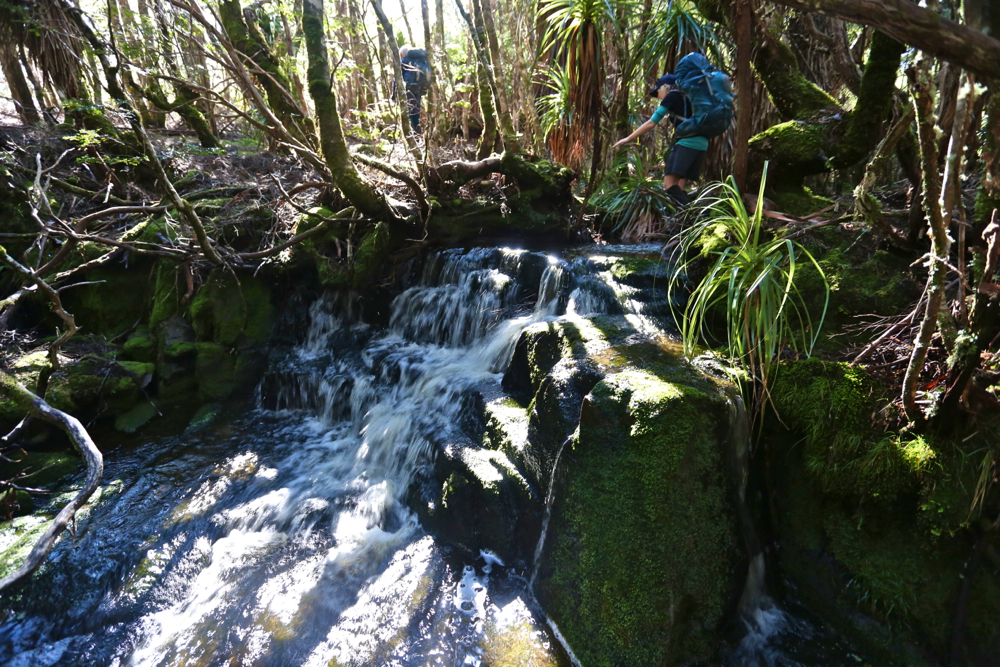
Farmhouse Creek, the famous.
“BOBS?? THIS weekend?” queried our amazed and knowledgeable friends when my husband explained my absence from the gym. They knew the full implications of an immediately post-winter attempt on Bobs, especially having just returned from sludging their way around their own, lower and less southerly mountain, where they had found the going slow and hard. They were right. Bobs was pretty bad – and they had retreated from their mountain before the rains began.Day one was not a booming success. Unfortunately Friday morning was the earliest I could get away, which was one day too late for the window of opportunity that gave three dry days for Bobs. And it certainly didn’t help that, with one thing and another, we didn’t leave the carpark at Farmhouse Creek until 10.45. If these suggest to you a lack of respect for the worthy Bobs, you are probably right. We have learned due respect now. Perhaps we also needed more deference for the amount of water that must have accumulated after the kind of snow dumps we’ve had these last few months. However, my climbing partner has personal reasons for trying to collect as many Abels as he can before Christmas, and we both enjoy giving things a go, so there we were. Our third accomplice in mischief would have also given it a try had she not been required to be at work on Saturday. She was at home consoling herself with wine. Perhaps this was not a bad idea.

It was very exciting for me to see the famous Farmhouse Creek up close. A frisson of delight coursed through me just thinking of the many connotations this stream holds in its compass. The pad to the right, immediately after crossing the bridge, was clear enough most of the time. We were delighted to be underway and chatted furiously, making up for several months of not seeing each other, exchanging news and stories, enjoying the pellucid, whisky-coloured gurgling mass beside us and the almost lurid green forest as we made our way to the crossing of this now mighty river – swollen as it was – before we began our actual climb. Apparently one rises about 250 ms in this section, but it is not noticeable.

It’s quite a long way; I had had breakfast at 4.50 a.m.. On the dot of 12 I begged for lunch, and Mark was cool with that. There was a nice stream flowing, but I was told it was not Farmhouse creek, even though it seemed pretty big. There were quite a few mud puddles, which increased in number and size as we went along, but – and now I can speak in hindsight – the going was pretty good in this section: just a few fallen logs and trees to climb or attempt to skirt; what you’d expect on a longstanding, unmaintained track.

The creek at the crossing point

The real fun began at the mud plain called by some “track junction”. Now, to have a track junction, you actually need at least two tracks, so I question this terminology. We did see a stick with two tapes on it, but we assumed it was just to announce “You are still on the track”. We did make explorations off to the left to make sure, but the slight suggestion of a pad was really too minor to be promoted to this status; the stick with tape was a stick and not a tree as the Abels book said, and we hadn’t been going long enough. This was a wily false pad. We were not fooled. On we went, chatting merrily. However, after some time (and the gps says about 700ms) we were climbing more contours than seemed reasonable amongst friends, so we did the gps the courtesy of a check (I had been trying to save battery by not overusing the screen). Alas it confirmed that the stick must have been the junction. My watch said this was not good news with respect to our broader hopes for the day. Back we went. When I visited the stick the second time and looked up high in the air, I saw that giants had indeed put more tapes there than either of us had noticed, focussed as we were on how deep our feet were sinking and other suchlike matters. The tapes were well above my eye level. We put a bright pink one just above where my eyes look for good measure, one that people like us could see.
There’s a creek crossing a bit on from there, so we stopped for a quick drink and to refill our bottles, and on we went, worried now about the time. The book Mark had said 3 – 3.5 hours to the campsite from here. It was exactly 3.5 hours until dark. Pitch dark, that is. Unfortunately, due to problems locating the vague thing glorified by the term “pad” in forest thick with newly fallen trees, branches and leaves following a winter that has been rather active in weather events, we spent more time in a game of ‘Pooh finds hephalumps’ than in making forward progress. There were also many mud ponds of unknown depth that we tried to evade down lower that prevented us breaking the world record on this occasion. Unless people document startling PWs.

Down low, beside Farmhouse Ck, where the way was clear. The track is the shiny bit, and there is visible tape. Higher up I think someone ran out. Tiny, tight bits of blue are what you mostly find, if you’re lucky. They’re sure better than nothing!!

Darkness – of the proper, pitch variety – set in as we were descending to what Chapman describes as a button grass valley. We found no button grass by dark or by day. Just more thick forest and deep, deep mud. When it’s very dark, sinking in deep mud is not a nice thought. Our pace slowed even further. The compass was now needed as the land gave us no clues. We were supposed to be in a valley heading SW. We could find SW on the compass, but no particular valley on the ground. Nothing that yelled: “I am a valley. Just stick to the lowest point and follow me up.” The pad, being now full of mud, was shinier than the non-pad, so we made a little cautious progress, but once we reentered the forest, the shine lost its sparkle and we were back playing Pooh and hephalumps again, circling tapes to try to find where the pad went from that point and making footprints to later get excited about. Simply heading SW was an even slower option in forest that tangled, so we only resorted to it when desperate (which we became at about 8.30).

We never did get to see the sinkhole, but we did see where one would lie were it not drowned. We retreated and found two tolerable spots for tents. It was now 8.45. As I was boiling water for dinner, Mark yelled out: “Hey Louise, I just found a tape in the tree above my tent. We’re on the track.” The rain began soon after that. I enjoyed listening to it beating on the tent as I very easily drifted into sleep.

There is a knoll where you get a view of the famous Federation Peak. What a thrill to be so near the Great One.

“Wake up, Louise.” The rude sound penetrated my dreams. But we had agreed on a 6 a.m. start. Outside, Mark was standing in the rain, offering me three alternatives: climb, wait a bit, or bail out.
“Bail out?” I almost yelled (well, actually, I think the volume was “yell”) in shock.
“Yes, the book says it’s four hours to the summit from here. That’s eight hours in the rain and mist with no view and hypothermic conditions.”
“And no line of sight on the helpful cliffs,” I chipped in. With each passing moment, this “bail out” notion was seeming like a fantastic idea. What an ingenious guy Mark is. Within two seconds I’d agreed to it.
“Can we sleep in ’til 7?” I asked hopefully. Affirmative. Life is good.
I rolled over to listen to the rain and just enjoy the state of being in a forest this wondrous with its trunks heavily laden in deep spongy layers of the best green. The scene out my vestibule was a wonderfully Tolkienish vista. (Alas, it was too dark and wet to photograph).

We had thought the trip back would be way faster than the trip in, with the wonders of vision added to the mix, and it was certainly quicker than our way there, but lighting-fast does not describe our speed. The amount of water that had fallen in a single night was truly astonishing. The mud puddles were now mud tarns. Divergences were extravagant to avoid a soaking. Why not just go through and get wet and be done with it? Because the depth of these puddles is unknown, and falling in up to your throat or high chest is actually a frightening experience. It requires great strength to get out again, and is rather cold and dirty to boot. Besides, I had my camera to protect, and my brand new (expensive) Anorak. I pussyfooted around cutting grass and scoparia in an attempt to have it last more than a single expedition.

Our lunch was had in the campsite just before the intersection – a nice clear place to put down the packs. It was a nice clear place for snakes, too. I have never before seen two snakes curled up together. I wanted to poke one with a stick, just to see what would happen, but decided against it. We both did go quite close, however, curious about this daring pair who appeared long before snake season was due to start. (The rain had now stopped). They seemed a little curious about us, too. We parted on good terms.


All up, we carried our packs for 16 hours, which includes all the errors – circling, prancing around puddles, swinging from trees, having several attempts at sliding up logs that were as high as my eyes but offered no way around or under, and other suchlike games. The time does not include eating or photos – the only time we gave our shoulders a break. We had three rests going up, two coming back – just long enough to throw a quick bit of food down and some water, and we were away again. We got to the car, dreaming of hamburgers or better, only to look at the watch and know that even Banjos would be closed by the time we got there. It was quarter to five. No hope.
32.5 kms. 800 ms climb (which does not include any of the climbing on the way back, or the climbing we did in error. Real climbing is more likely to be 1100ms).I was very tired driving home. Ironically, I kept awake by blasting out (and singing along with) Bellini’s opera, La Sonnambula (The Sleepwalker).
A 1:100,000 image of our route.

A 1:25,000 version. Note the huge discrepancy between the blue line of the pad, and the black of the map track. It is absolutely impossible to use the mapped black line of the track to determine the whereabouts of the track. If you can’t find the pad, there is no point in getting a gps reading of where you are and saying: “The track is to our right”, as the “track” (word used very loosely) could be absolutely anywhere. The bush is thick. It’s worthwhile trying to find the pad, if possible! We added a few more tapes when, and only when, we were certain we were on the official pad. 


Clumner Bluff 2015 Sept

Not my photo. Neither is it my view (seeing’s I didn’t get one). This is a photo kindly sent to me by my friend David, taken from a snowy “summit B” under somewhat more ideal conditions than my own.

Clumnar Bluff. Hoorah. Sixth time lucky – if “luck” is what you call it. I have at last climbed you. Both summits. And what happened on the failed attempts? Is it a hard mountain? No, it is not hard at all, although I was starting to feel that it must be. So, what’s the story?
Time 1) It was frosty with icicles on the rock, so it was called off before we began, and we climbed a slippery, icy Mt Victoria instead. (It’s not as high).
Time 2) We got started, but didn’t even get half way. It was raining and cold, and our organiser was still recovering from an operation. We were obviously not going to make it, so we all opted for the comfort of the car and to the business of pulling leeches off ourselves while we drove back. The count was 42 leeches thrown out the window on the return trip.
Time 3) This trip was called off because of rain before we left our homes.
Time 4) I put my name on the list, but then discovered I had a clash and a trip organised up a more important mountain. That group made the top, but without me.
Trip 5) I was told we were skiing to Clumner Bluff. HOW exciting is that? I was thrilled. However, in the car on the way, I was told we were not going to Clumner at all.

This is also not my photo, but one offered to me by another friend, Catherine, showing me walking around a different lake on Wednesday. This is very similar to what we could have been seeing had we been able to see, or had the luxury of time to stop and take it.
Enough was enough. Obviously it seems, if you want a mountain dearly enough, you need to take matters into your own hands. I studied the weather and decided Friday was good enough for a try, despite the fact that either snow or rain was predicted for the afternoon (depending on the temperature). An early frost would at least mean that the snow would be firm for the way out. It would be several kilometres across the top once I’d climbed up to the snow, so I wanted to make sure of being out by midday, just in case it got slushy and slow, and in case sinking with every step became a possibility. It thus needed to be a trip with a nice early start, and one done on the march with very, very few stops, if any. Who would be up for such a trip? My friend Angela, of course. I was so annoyed with five failed attempts that I was prepared to go solo if she couldn’t come, but luckily for me, she could, so when the sky closed in and even the ground became difficult to see, I had the warmth of company.

Angela checking the summit. Sorry, it’s just a phone image. Beggars can’t be choosers. Having forgotten my camera, I had to learn to use my Galaxy, which won’t let me download onto my computer, so this got texted to my daughter and then emailed to me. Quality has been lost somewhere in all of that. Don’t be fooled by the shorts. It was COLD. Angela is tough!

Angela and I, as a duo, now have, by default, a very good – yea, pure – record of summitting success in the snow, and this mountain was no exception. I say “by default” as we don’t always set out intending to snow climb. It just happens to be the case. This time, however, the snow was sought out and courted. I thought it would be great fun to have my first summitting of this elusive mountain in winter white. The fact that it was also in a grey-out, done half-blind, just added spice.
At first the day seemed benign. I thought it would be another glorious one, like Wednesday. However, once we gained a contour or two and were exposed to winds coming from the west, we were hit with an icy blast, and quickly donned another layer to cope with the freeze. We were not deterred. It was chilling, but we also both had many more layers in our daypacks in case. To the west, the sky began to look dark and ominous. I checked my compass to note our bearing, as the land was almost featureless. The clouds were rolling in, and yet it was still so bright because of the snow that we both found our gps screens very hard to read; I was glad of the paper map and compass we were each also carrying. Somewhere in the clouds, Clumner Bluff was hiding, but it was a matter of belief, not of seeing – a belief based on the accuracy of map and compass, for the eyes told us nothing.

The wildness of the tops

The ground became exceptionally hard to discern. I changed from sunglasses to red-tinted ones, but I still couldn’t detect any helpful patterns in the snow that indicated where the ground was. Like a little old lady, I walked bending low to try to make out the ground. We crossed something we decided was a lake, treading very gently indeed as we crossed it. We had no idea how deep it was, or how stable the ice covering on top. I was so glad to have Angela’s company!!! On the return journey, we evaded that bit by doing a wide arc.
After maybe 50 minutes across the snow, a shadowy lump loomed up ahead. This must be Clumner Bluff. At last we come face to face. ‘Odyssea’ meets her giant. Up we climbed and exactly 60 minutes after cresting the snowy tops, we were standing on what we supposed was “summit B”. I assume this is the “historical summit”. However, even in the grey misty gloom, our eyes said there were higher things to our left (south). My old map told me nothing, as it lacked a black dot of any description for the summit, but Angela’s more modern map had a summit where our eyes said one should lie – apparently 10 meters higher than the one we were on. I really don’t know, and never will, if I would have had the courage to go even further into the dark mist and visually unknown without the company of a friend. I don’t need to know right now, as Angela agreed that we’d go on to touch the highest point, and not just this cairn and summit. It took us a further 15 minutes to reach it, but they were glorious minutes where we felt even wilder and freer than that first hour across the snowy plateau. Somehow or other this was the ultimate: wild and free on rugged eerie tops with wind so noisy we couldn’t hear each other speak; the only marks in the snow were wind waves and the tracks of wombats and wallabies. It was fabulous. And oh was it good to breast that summit rock and know we had at last got to the top of the runaway mount.

This was the clearest it got during a two hour period, which happened to coincide with when we were on the summit, and when we stopped for five minutes to celebrate before hastening away.

Here, after 2 hrs 15 mins walking from the car, we had our first break, if you call it that. I took four photos. Angela similar, and then we were away again. No food; no drink. We were still both in a hurry, as the weather really was quite nasty, and we both wanted to reach this nice thing called safety before we ate or drank or wasted any time. We had our first break from earnest progress, and I had my first drink and food of any description after 3 hrs 45 (12.15 pm), when we were successfully out of the snow, and about a quarter of the way back down the mountain. I had been right to think we needed to be out by midday. The snow had been a little sludgy towards the end. It started raining lightly as we tightened our seat belts to drive away, both feeling quite excited by the day’s adventure, and very, very satisfied with all that had happened.

Our walking route in blue. For instructions on how to get to the start, see the post before this one on XC skiing. We parked the 2WD just before the puddle, as suggested, 4.3 kms from the turn. At the puddle, you turn right, head up a steep section that 4WD cars with courageous drivers can do, until the tapes indicating the start. The additional walking resulting from parking that bit early meant we had to walk an extra 6 mins 45 to reach the carpark for the brave and well equipped.

For the first time in my very long life, I forgot to take my camera with me!!! It was in the car, but I thought it was in my pack. I realised 10 minutes into the walk that this was the case, but was not prepared to lose 20 mins getting it, given that I had calculated that we needed to be out by midday. As it was, our progress was so purposeful that I would possibly not have had time to use it apart from at the summit anyway. Wednesday was about photography; today was about business – if you call feeling the wondrous expanse of infinitude in nature’s wildness “business”.

16 kms; 500 ms climb = 21 km equivalents. 4 hrs 45 walking (plus lunch and four photos).

Collins Cap 2015 Aug

Russell Falls – not a bad alternative to playing in the snow.
With a good dumping of snow forecast for the weekend, it was hard to choose where to go to capitalise on this wonder. The best snow seemed to be for Mt Field, so we planned to go there. Luckily, I threw my Wellington Ranges map into the car, just in case. I say “luckily”, as we gave little forethought to the fact that we were going to the snow in a 2WD; that is not always a good idea. We don’t even own any chains that fit it. (Our 4WD was out of action this weekend).

Lady Barron Falls, looking very dramatic with so much water

I did actually get almost to the Lake Dobson Carpark, but there was a lot of snow, and I was nervous about hanging around. If conditions got one iota worse up there – which tends to happen in snow storms – then we were in a pickle. We retreated, admired (and photographed) two wonderful waterfalls, and then drove to Hobart, resorting to my plan B for the morrow, which was to climb Collins Cap.

I was rather excited to see that there was snow in the Myrtle Forest picnic area car park as we pulled in. This boded well. I looked forward to seeing the cascading creek with its banks decked in snow. It did not disappoint. I wondered about the creek crossings that lay ahead – how icy and slippery they might be – but left that as a problem for later.  As it turned out, they were manageable – just.

The second crossing – the easier of the two.

Just before the second crossing, we met a jolly trio of HWC members, whose footsteps in the snow we’d been following the whole time. Unfortunately they had turned around just after the creek, and were on their way back to the car. Somehow, in weather like that it’s nice to think of someone “up there” ahead of you; someone else wild enough to be on the mountain in snow with further storms forecast. Now the only footprints in the snow were those made by Paddymelons and wombats. I find it endearing that the animals of the forest choose to use the pathways created by humans for humans. They are smart enough to pick that these routes offer the least resistance to forwards movement. Once, after a snowstorm on Cradle, I was on the boardwalk following tiny footprints in the snow, and here I was doing it again. The path was not marked on the trees. I was deciding on its whereabouts by picking the clearest line through the vegetation – a method that became harder the higher we climbed, as vegetation thinned out.

There’s the best line. Straight through that puddle.

My husband got to follow my prints.

The beautiful rainforest, firstly characterised by ferns and later by small pandani plants with snowy caps on, eventually ceded to burnt out snow gums, especially once we’d crossed the fire trail. Climbing in some sections was very steep indeed. I guessed there were rocks under the snow, as otherwise I think we would have slipped downhill a bit. My foot found it easy to kick into or onto something horizontal despite the severe angle of the snow.

Clouds began encircling us; visibility lessened. Just as my husband’s “I think we should turn around” kind of noises increased, I gasped. Up ahead I could see that every single tree and bush had a glorious coating of ice. We were in fairy land. Sorry, but I was not turning around in the presence of beauty such as this. As long as it didn’t actually snow, I knew the way down would be much quicker than our ascent, not just because of not fighting gravity, but also because I was doing all the step kicking and all the route finding on the way up. As long as I could follow our own footsteps down, the task would be halved. On we marched.


Fagus adorned in white, sparkling jewellery.

Nearly there. B taking the lead so I could take a photo of his back as the ground levelled out for the summit.
As I suspected, the way down was almost lightning fast. Speeds in the snow on the way up had been extraordinarily slow, which is why the other group had turned back. You needed to be prepared to take twice the normal time to factor in for step kicking, general caution and deciding where the track might be once things got vague. I had fun in the snow. I would have liked to use my macro lens on some of the formations, but moving was a high priority in those conditions.