Dundas 2015 Jun

Mt Dundas June 2015

For some reason – well, actually, for a very good reason – I was a bit scared of Mt Dundas. As you may have gathered from photos, ice and snow dominate our scenery at present. Fine. Beautiful. The trouble is, this mountain begins with a river crossing, and we were under the impression the water would be knee deep at best (thigh at worst) and rushing. I would be climbing in snow with sodden feet, a sure recipe for personal misery and possible hypothermia. I was so anxious I even had nightmares as darkness morphed to dawn. Gulp. Here comes day: my moment of testing.

Monika negotiates the rocks near the summit

Down we went to inspect the infamous creek, scene of my sure doom. Hey. There was a branch I could clutch and swing from – Tarzan’s wife – over the slippery, slightly submerged rocks. I didn’t need to get my feet wet.

I don’t know why I had imagined that Dundas wouldn’t have rainforest at its base like almost every other mountain in Tasmania. Perhaps because nearby Tyndall is not impressive in this aspect. All I did know was that there was an old road one followed for a while after crossing the creek, and that it was “very overgrown”.  Well, yes, it was … a bit … but not so much that it was a problem. Up we climbed through glorious, lush, mossy forest to the point where “road” became pad, replete with tape in several hues. My favourite section was the stand of King Billy pines that rendered the path a carpet of textured needles in various shades of brown. My second favourite was when this was replaced by a different study in brown and ochres made by fallen fagus leaves.

Kent and Monica on the summit

Once we mounted the top of this ridge, the land flattened out for a section of tiny wombat pads through low lying scrub, one pad of which was used by humans. The final climb was now visible, but the summit still seemed a long way off – both in terms of vertical and horizontal distance. It seemed to me that it was too far away to be achievable on this short winter’s day. I pessimistically predicted failure to my two companions who betted on the contrary that we’d be there by half past one. I owe Kent a cake at Zeps, I am very pleased to say. I like placing bets that I hope to lose.

Here comes Jack

Not at all deterred by the possibility of having to buy cake, on we continued, taking especial care in the snow. I happened to be the one making the footprints in the end game, and needed to be particularly careful: it’s easy to assume there’s a rock under the snow and to fall and hurt yourself if there isn’t. Aware as I was of the dangers in this section, I was simultaneously aware of how grateful I was to Rupert for putting on the walk, and to HWC for enabling me to connect with others who are crazy enough to find climbing a mountain in mist and snow to be a fun idea. I know we are not the norm.

I was thrilled by the thwarting of my own pessimism when at last out of the gloom a mound appeared that was definitely the summit. Several false promising ones had made their appearance as we climbed, but this one had no shapes beyond. At last there really was nothing higher to climb, and Kent and Monica had even been a half hour too pessimistic in their own estimation of when we’d get there. Every member of the party had reached the top before one, and in fact, we had descended a bit and finished (a very quick) lunch by one thirty. The reason for the speed was not gluttony, but rather freezing fingers and toes that made picnicking in the snow a little less than pure delight. Moving was the best solution to the freezing problem.

Cold it may well have been, but I feel very privileged to have seen and climbed Dundas in the snow. I loved this mountain, and will return one day to admire her summer outfit and linger longer on the top.

A real, paper map will give you the context of where that lower waypoint is – scene of road end and where we parked the car. We then followed the obvious road until a cairn (NOT very far) indicated the path down to the river. After crossing, the old path that will lead you upwards is to be found on your right, and is indicated on the map above by the more easterly path which followed the road the whole way. The upper waypoint (2 of 3) is where the old road ends and the pad begins; basically, if you are heading up to the sharpest part of the spur you can’t miss it.

Alma 2015 Jun

Mt Alma. 4 June 2015

The lookout towards King William I, Pitt and Miligan as seen from the highway, not too far from where we started.

 Dark shapes appeared out of the mist as I drove towards the Western Tiers, heading for my render-vous with my HWC friends at Derwent Bridge. The skeletal forms of wintry trees floating in the mist were very beautiful, but I had no time to stop for them. As I expected, the bends on the Poatina road would rob me of the extra minutes I had allowed. 10 kms/hr was all I dared as I negotiated sharp turns of pure ice. The land up top was white and perfect, but again, I had no time to spare. I just had to admire it as I continued on my way. I’d left half an hour early, but was perhaps now running a little late.

Looking towards Mt Rufus as we drove to our destination.

Phew. There they were waiting for me. Now we could proceed further towards our goal, Mt Alma, on the other (northern) side of the road to Frenchmans Cap and along past the car park to where the main southern spur from Alma intersects the highway. Our mountain from the road was, as is often the case, a matter of belief in maps rather than something we could see for certain. She lay back there, up there somewhere.

Part way up the first rise

Up we climbed in good spirits brought on by a new adventure, through the frozen grass that melted and saturated when it came into contact with our warmer bodies. The views back towards Frenchmans were splendid, especially as we were lucky enough to have wisps of clouds below us and a snowy white beret on the famous French gentleman.

The white-bereted gentleman himself

After morning tea at the first hilltop, we dropped, past fascinating rock formations to a saddle, from whence the final climb began. The going was slow, as the bush in this section became quite dense. It seemed odd to climb up from grassy slopes into thick forest. On this particular day, every time you bumped a bush, it threw snow at you.

One of many fascinating rock formations on the first section of the climb (before we dropped to the saddle).

Already we could see and feel the day changing and clouds were rolling in. Unfortunately, by the time we reached the summit and got to picnic and enjoy the fruits of our labour, the interesting detail in the landscape had all but vanished and outlines were smudged; pleasing lighting effects were nonexistent. I didn’t even bother to photograph the summit, and stood for lunch, preferring not to eat sitting in snow. The trip down was very quick indeed. I think everyone wanted to finish the mountain’s work before the rain began. The views on the way up were definitely the climax of this mountain.

That bend where we parked the car is the second bend after the Frenchmans Carpark, but if you can’t read maps well enough to locate it, please don’t climb this mountain unless you are with a club. There is no path to guide you. You’ll see that we went beyond the “black dot” marking the mountain on the map. That’s because where we went was the highest point on the mountain, but we visited the black dot as well, so as to say “hello” to both points. Quite frankly, the lower black dot was a more interesting place than the highest point, and offered what I thought was a better view.

Mother Cummings Peak 2015 Jun

Quamby, Drys and Projection Bluffs from the top of the climb
Mother Cummings Peak. I have a friend who believes that disappointments come in threes. Unfortunately, I’d used up four before I’d even reached the plateau at the top of the Western Tiers, but that’s OK. Surely it meant the rest of the day would be fantastic – which it nearly did, except that disappointment number five was awaiting me at the end of the journey. Here are the early ones:
(1) My car bounced like a kangaroo up the southern outlet, most unwilling to participate in a day’s jaunt in the mountains. This boded ill. Once up, however, she took off, so I picked up hope.
(2) She then stalled three times in the Deloraine carpark after I’d stopped, and a fourth time about a hundred metres down the road. I limped quietly back, abandoned the unfaithful beast, and climbed into a friend’s car. My Kia could remain a problem for the end of the day.
(3) And maybe you think this shouldn’t count, but the scenery was absolutely magic as we sped along the route west out of Deloriaine: white, heavily-frosted grass; a magnificent pure white mist rising above it; photogenic, dark cows peppered here and there to give foreground interest; an indigo Quamby Bluff rising out of all this for grandeur and contrast behind. It was perfect, but I was no longer in my own car, so had to let it go. I still mourn the loss of that “photo that got away”.
(4) I had come armed with my macro lens and was even carrying a light tripod, but it was so cold there were no fungi at all, so my disappointments mounted. Up the track though the rainforest we went, having fun despite all these setbacks.

Admiring the view

As we crested the plateau at the end of most of the climb, we were treated to a delight, so I decided I needed to do some sort of subtraction on the list above. In that crisp, clear air, all outlines were sharp and beautiful. You could see countless surrounding bluffs and peaks with wonderful clarity. Perhaps even better was the cornucopia of artistically frozen tarns with white rings and stripes, all sparkling in the beautiful sunlight. Changed by the sun fairy into tiny children, we played on the tarns, seeing which ones would take our weight (fortunately, all of them). I changed macro to wide angle, and played away with my camera as well, always happy to be going “click”. The Scotts Road had been an excellent starting point: we were at the top in less than an hour’s walking time (not counting play time). If you count the distractions of beauty, who knows how long it takes? It was so early we couldn’t even have lunch on the summit, and had to wait until the next peak, alas.

One of many icy tarns

Dining on said next lump, listening to banter flying to and fro and enjoying the dramatic drops and cliff lines, soaking up the fugacious rays of warmth piercing bravely through the sharper ambient temperatures, I felt deeply contented. I looked at my watch. The time was good. We were now at the furthest point from the car. The rest of the route looked easy. I would get to work on time despite not having my own car for a quick getaway.

Unfortunately, disappointment number (5) reared its ugly head as the journey continued and continued, the party making slow progress through the glorious rainforest in the final kilometres of our journey. There was nothing I could do about it, but I became quite distressed, knowing my students would be waiting for me and that I was letting them down. I hate letting anyone down, but especially my students. At least when I finally reached my abandoned car, it started without a murmur (or jump) and bravely sped me to my destination. I dashed into the room of nicely dressed people in my muddy boots, filthy gaiters and torn pants. My students didn’t bat an eyelid, being used to seeing me in odd attire, no doubt. Instead, they greeted me with a hug, glad that I had managed to get there at last, albeit late. I love them all.

Phil on the northern hump, with Ironstone behind

Route notes: via Scotts Rd. From Meander, head south along the Meander Falls Rd until you come to a right hand fork labelled “Scotts Rd”. This leads to the Scotts Rd Lookout (fine view). The end of the road and the start of the track is just beyond that. The bushwalking forum does not discuss this route (not that I could find), and the Tastracks’ offered routes (two of them) do not present this as an alternative: they suggest coming via Smoko Ck (beautiful) or Western Ck – also nice – but this route is fast and efficient, if getting to the top quickly is your intent. Very old maps call the southern, bigger lump “Cummings Head” and the lower, more dramatic northern one “Mother Cummings Peak”. In fact, if you want to say you’ve climbed Mother Cummings Peak and you’re talking to a pedantic peak bagger, then you need to have climbed the southern (higher) one. We climbed both for good measure, but the northern one was for fun – well, they both were, but the northern peak was a “pointless” and “Abel-less” peak, done purely because climbing things is enjoyable, whether or not they’re on someone’s list or worth a point in some motile and relative list of points to be accumulated.

So, we parked at the (Scotts) road’s end and ascended by a clear path to the peak. From there, as you can see, we headed north. There is a path that goes via the valley, but our intent was to avoid dropping that far, and to head cross country and north over higher ground to a point where we eventually joined the valley track as it ascended once more to go to the former summit, now “pointless” (but dramatic and photogenic) hump.

Boys playing on ice

From that northern hump, we descended on a clear track to the east of a stream, as per map, until we hit a road, which we followed to the east, until the waypoint, which is the point at which it stopped. From here, we made our way cross country, consciously gaining contours to reach the obvious shelf, but not climbing it straight up. This was not hard going. If you are doing this route, my advice is to stick near to the steep ground on the right when on this shelf, using it as a navigational handrail, until you intersect the track and follow it left to your car. My route was outvoted by the others, and we spent a lot of time floundering around in flat swamp, knee deep in muck. We saved a bit of distance but lost a lot of time. (My blue lines don’t meet to make it clearer where the car was.)

Liffey Falls 2015 May Fungi

Liffey Falls – mostly fungi. May 2015.
Mt Bobs seemed a pretty unwise destination when it looked as if every tree in the state was trying to uproot itself, and when the car could barely stay on the road, struggling against the force of crosswinds. Having seen the forecast in the week before, we cancelled our intended expedition (again, oh woe. Will I ever get to see this mountain? This is the fourth cancellation). The attacking rain that accompanied the ferocious wind made the decision easier to bear. Instead of Bobs, my husband and I chose the much tamer alternative of fungi hunting in our local area, and went to Liffey Falls.

There we found abundant fungi, and there was even a rather flooded waterfall at the end.

Coprinus sp I presume. As you can see, they were present in abundance.

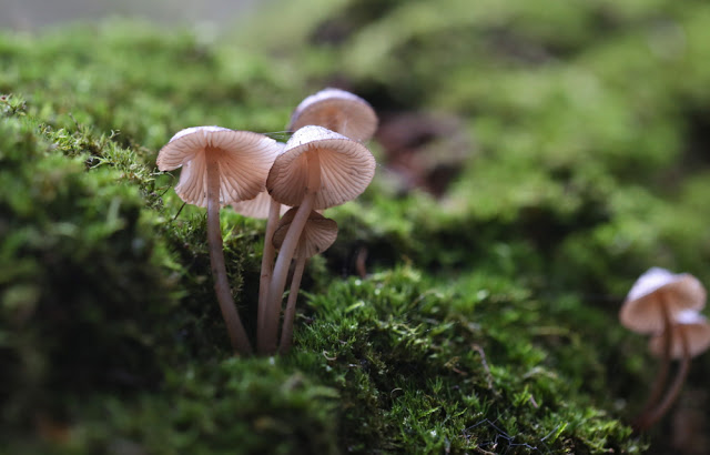
I have labelled this mycena firma. Hope I’m right
Hygrocybe miniata is my best guess for this one
Mycena interrupta. No need to guess for this one.
I’m pretty confident this is Russula persanguinea
This is a singleton of the group below, but I haven’t identified these yet
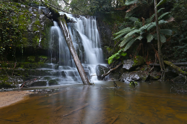
And yes, at the end of the fungi display was the waterfall, beautiful as ever. 

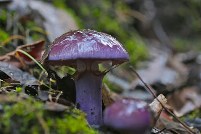
I have also included some shots I took on our way home from climbing Mt Littlechild. Our return route took us via Lilydale, so it would have been churlish not to pay these Falls a short visit. Our courtesy was repaid with a sighting of three giant cortinarius archerii specimens, fresh out of the ground and shining in their joy to see the world (see pictures under a separate LIlydale Falls blog)