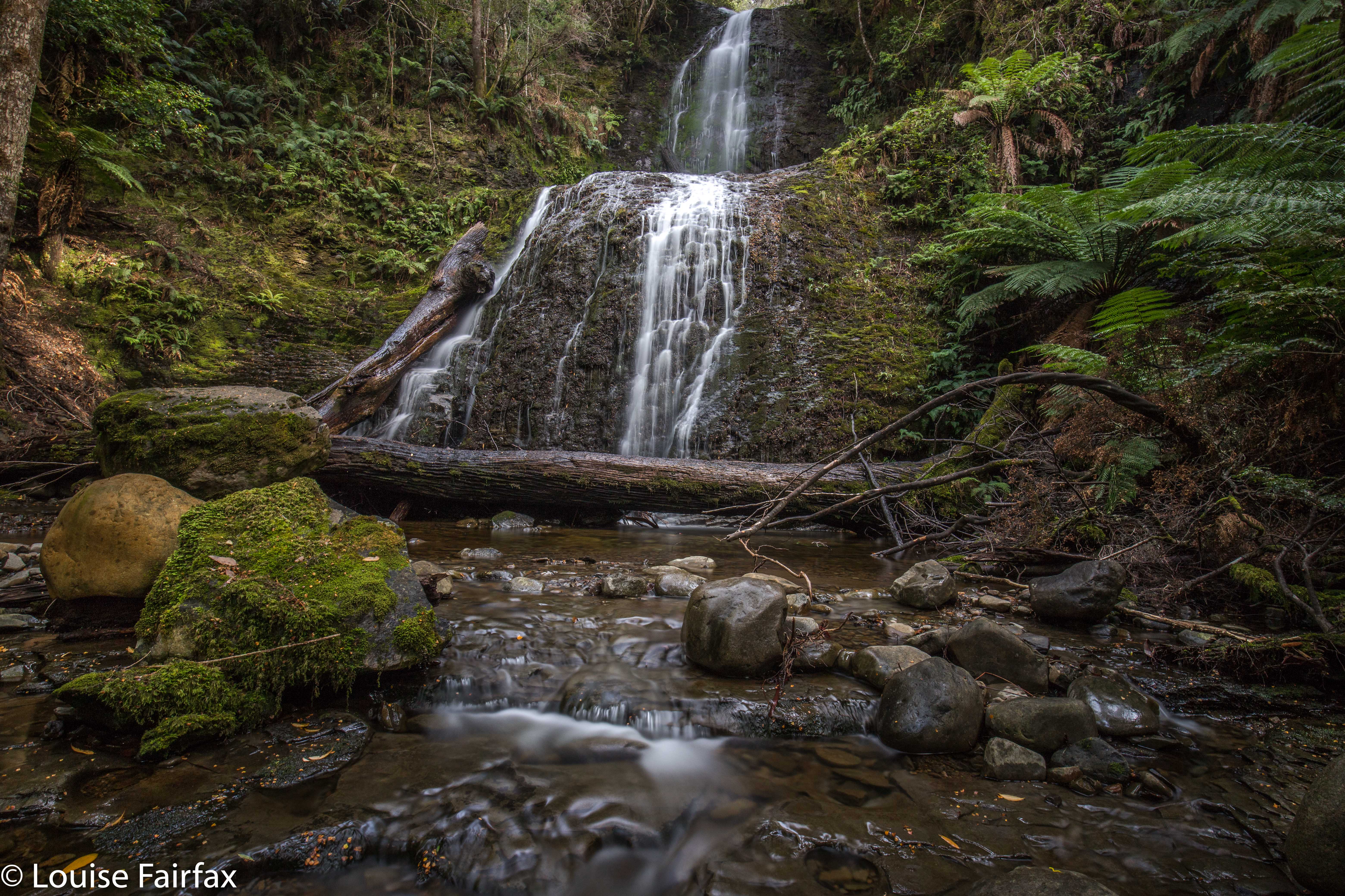
Weld Angel Falls 2018 May
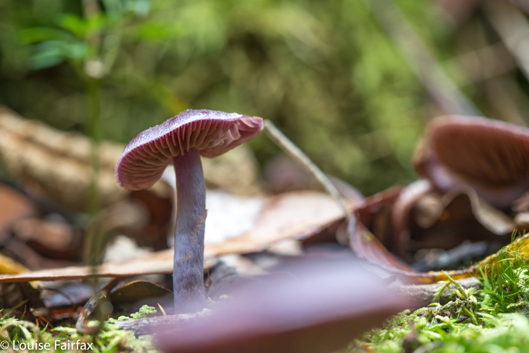
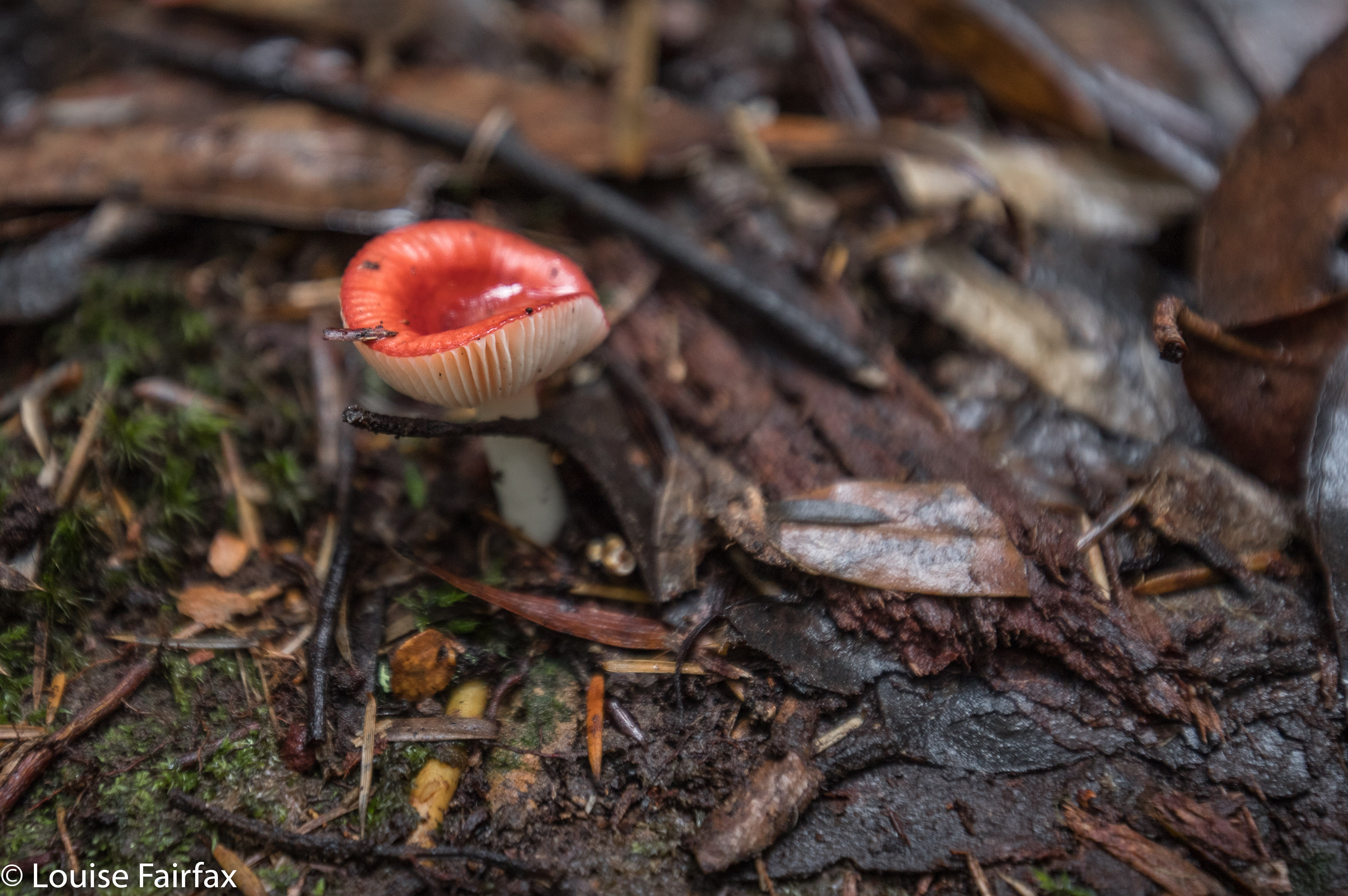
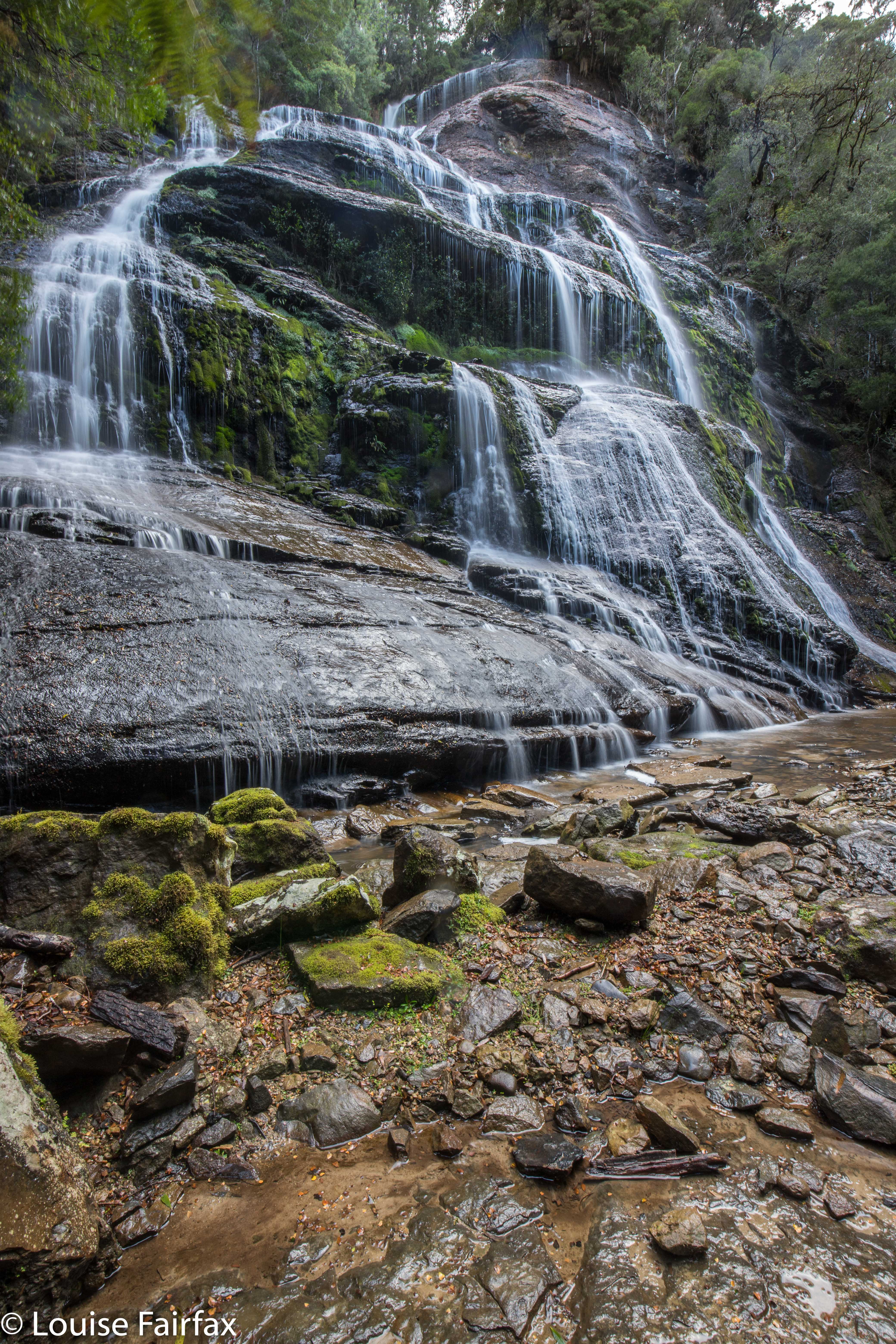
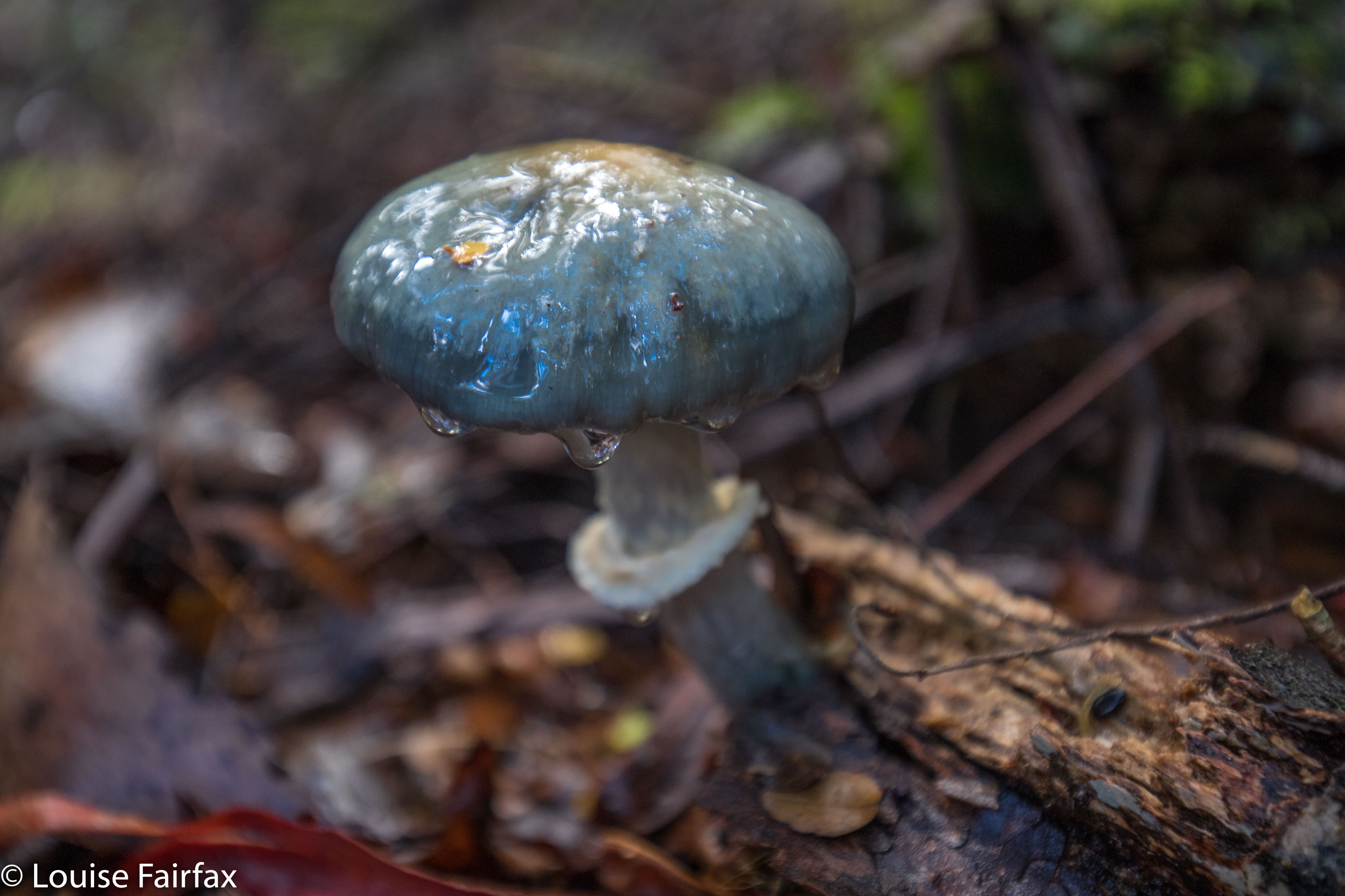
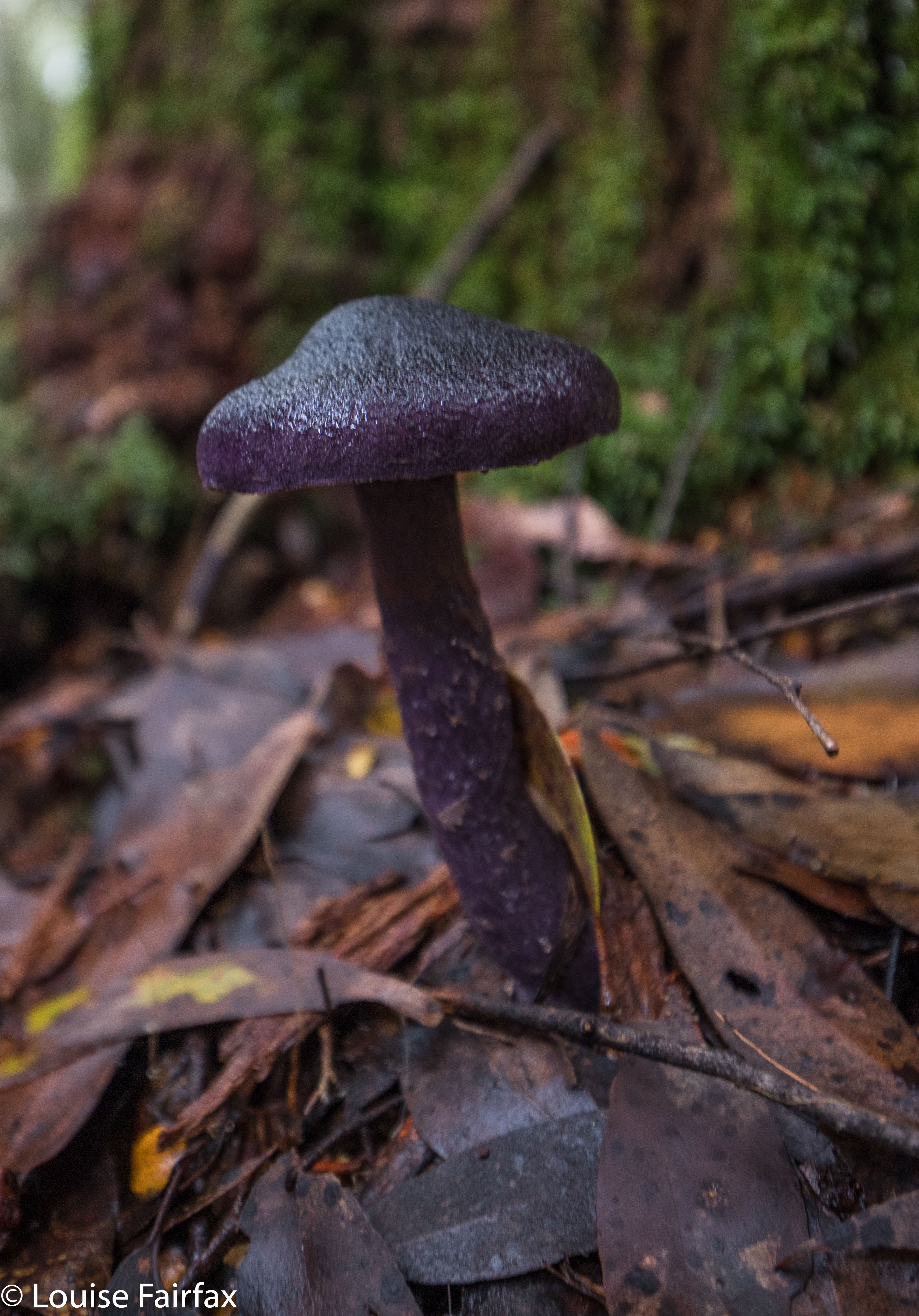
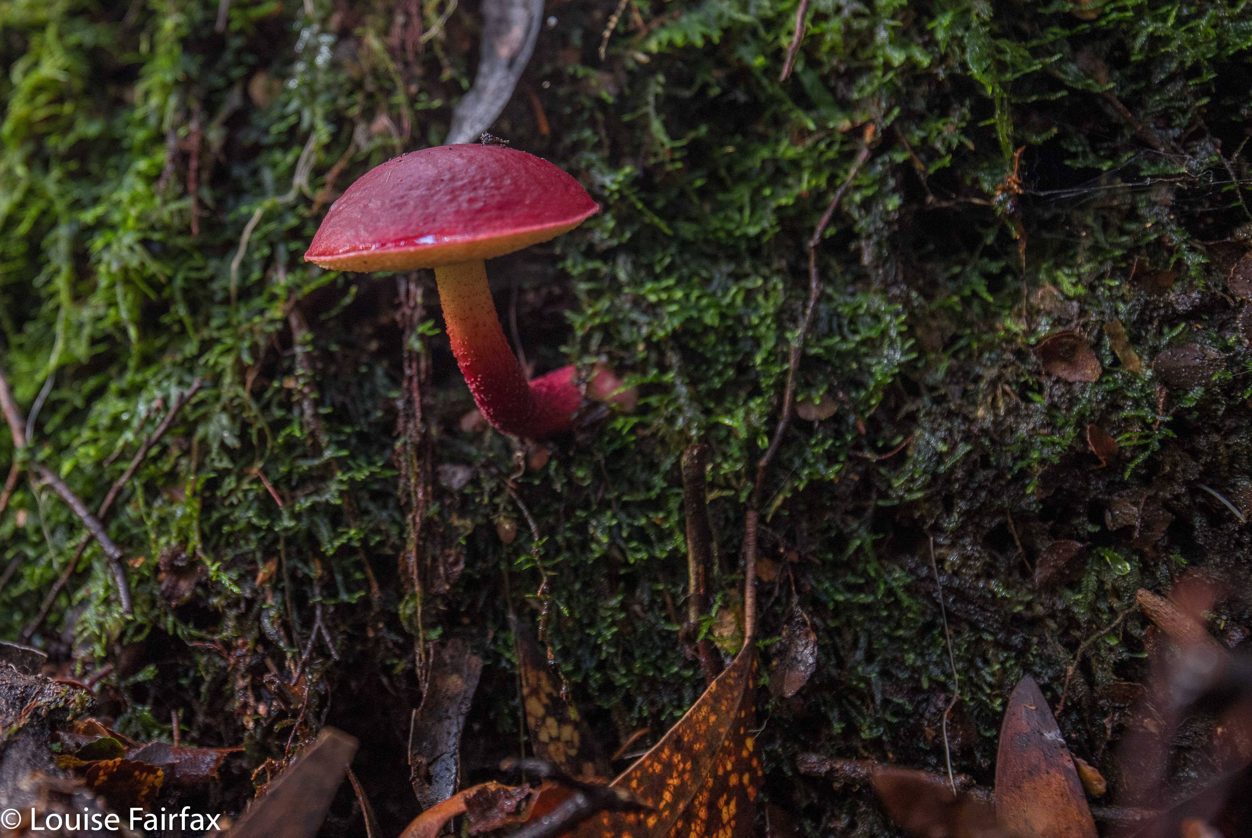
I loved climbing Mt Weld a few years ago, remembering the forest as being particularly lush and green, and full of beautiful fungi. I was really looking forward to visiting the Angel Falls, or, the Weld Angel Falls as Craig Doumauras of the Waterfalls of Tasmania website likes to call them, to distinguish them from the Angel Falls that are below Mt Sarah Jane near Mt Anne. It’s good to have two different names to avoid confusion. Besides, the Weld Angel wasn’t just any old angel: she was specific to the Weld area, and to the battle to preserve it from the axe, so why not call her by her full name. The falls are just a nameless line on the map, so there is no official name at this stage. The creek they are on is also nameless – an anonymous tributary of the beautiful Weld River running at right angles below. Imagine being that beautiful and still lying in anonymity.
I had read Dennis’s blog in https://hikinginsetasmania.blogspot.com/ and marked waypoints on my phone map in readiness for when I would go one day. The big drive put me off. It’s a long way from Launceston. Eventually, Craig and I agreed to go to coincide with a conference he had in Hobart. That way, I would only have to do the Launie to Hobart section of the drive. Yippee. And Craig and I always have fun when we waterfall bag together. Meanwhile, a new ingredient was to be added to the stew: southern waterfall bagger extraordinaire, Caedence Kueper, was to join us as well. Three waterfall maniacs in the one car. Would it cope? It belonged to Craig, so it had to be used to it.
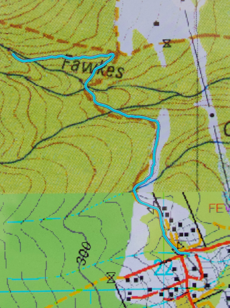
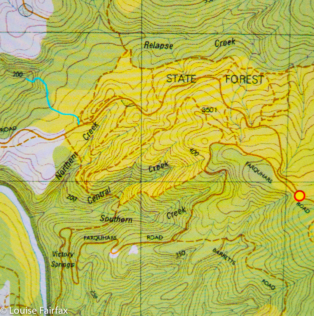
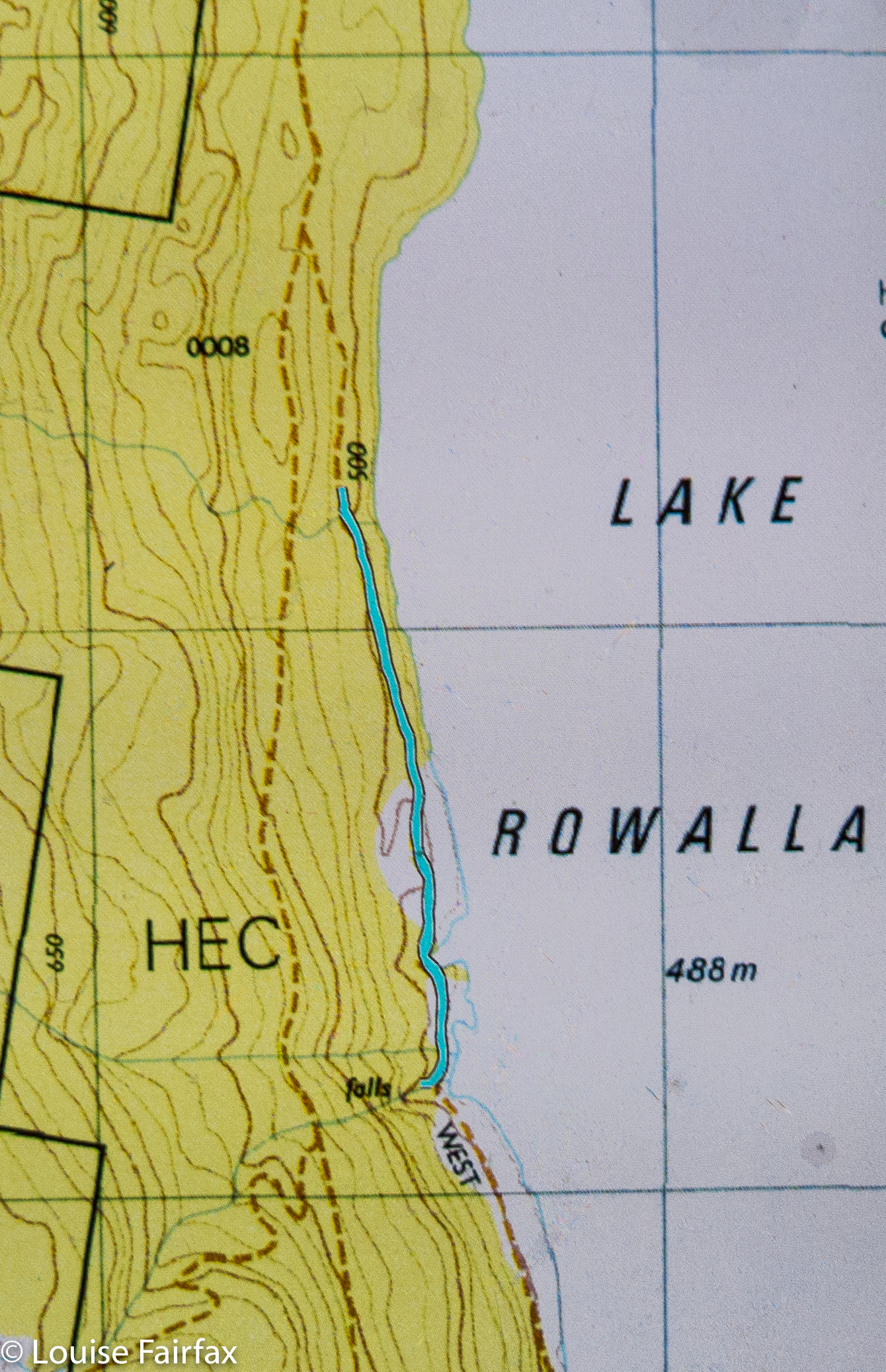
We turned off at Geeveston (having become a trio at Huonville – following coffee stop number two within the confines of an hour), travelling towards the Tahune Airwalk on C632, Arve Rd. However, we didn’t continue left down Arve Rd near the Walk, but went straight ahead on a road, Southward Rd, that seems to go forever, and turned around many times. We crossed the Huon River while still on this road, but not too long thereafter, turned left onto Eddy Rd, Next turn was a left again, this time onto Fletcher Rd, and we were on this to cross the Weld River. Fletcher Rd eventually comes to a T-intersection, where we turned right onto South Weld Rd, which takes you eventually, if you are very patient, to a collapsed bridge and whopping hole in the road. Do not even think about following these instructions without a gps device. You won’t find cute road names out there. I’ve given you names to help you read the map.
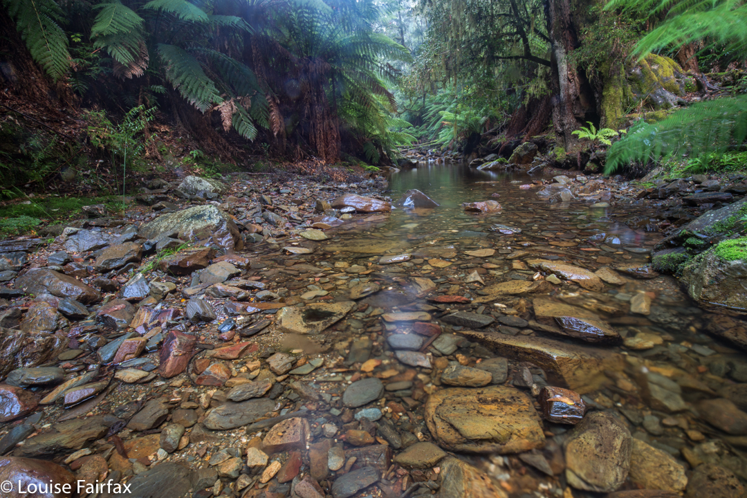
There’s a little shelf that you can walk along to get past the humongous hole that stopped you driving any further. I like looking down and seeing the creek (Isabella Creek) rushing far below.
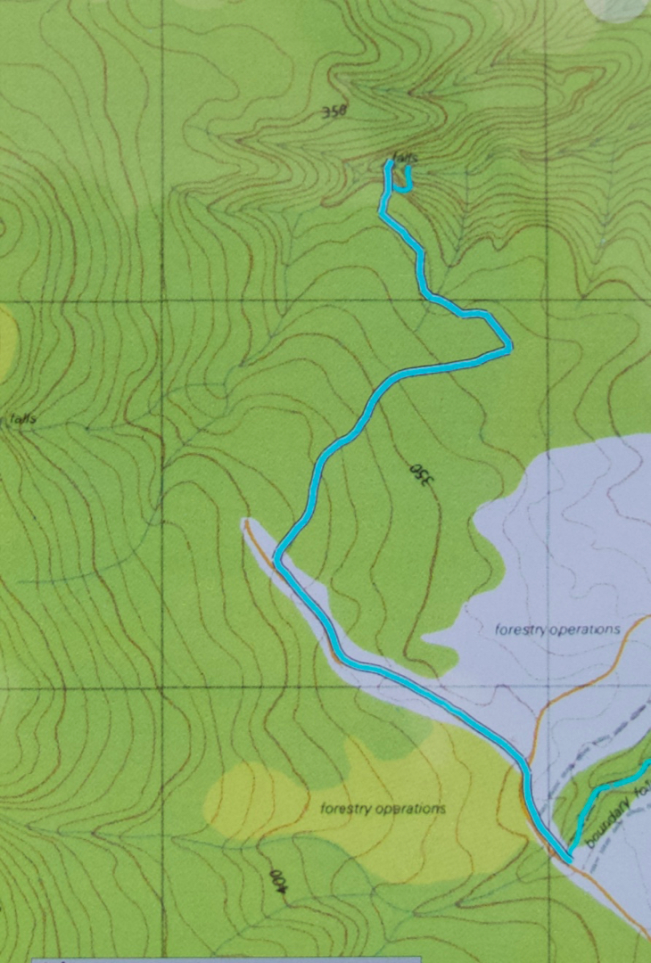
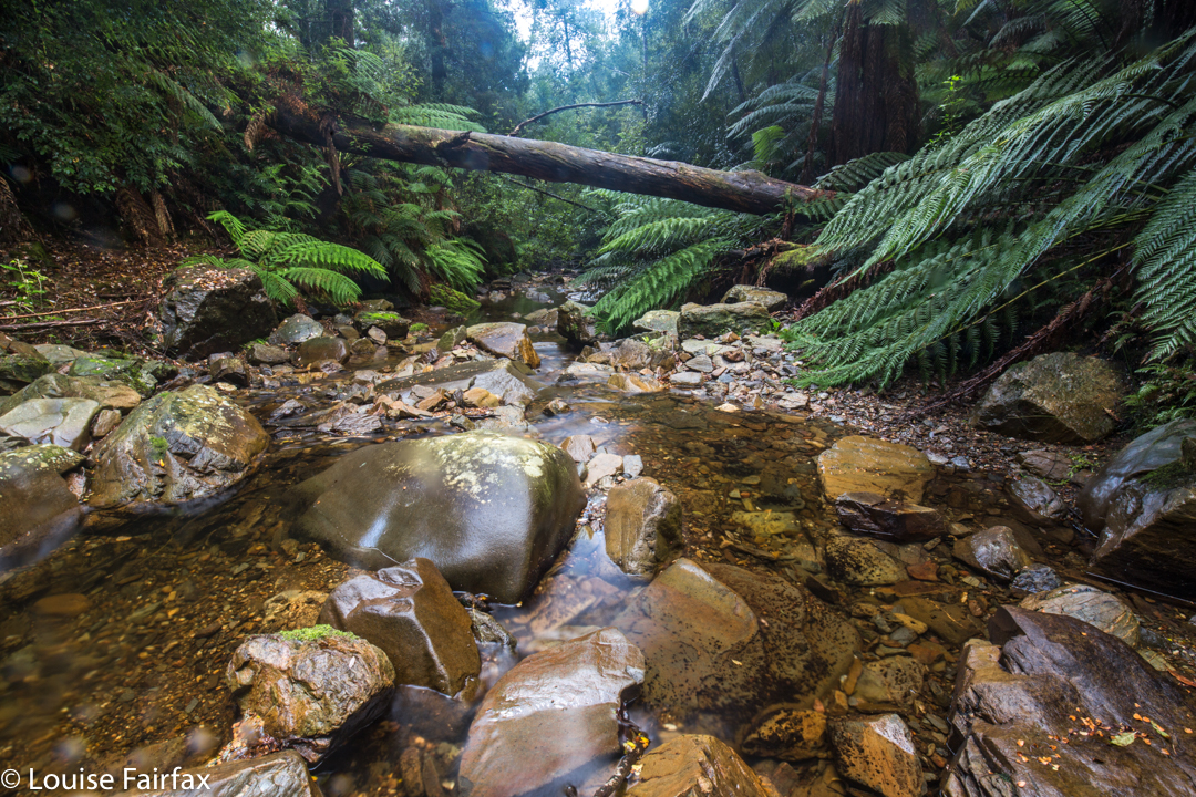
This walking part is the same as the route to climb Mt Weld. After 1.3 kms, however, we diverge right off this forestry road, in favour of a different one, now heading NNE (see map below). Where that path does a dogleg to the left (after maybe 1 km) on the map below, there is a clearing made of piles of felled timber, surrounded by regrowth – but it’s not too hard to get through. If you go over some of the logs until a path comes in off the right, and head left (W), then you’ll pick up some faded tapes that lead you through the mess until you get back to unfelled, unrefined rainforest, when you can take a deep breath and start to enjoy yourself again. You are now in heaven. As you can see from the map, you stay roughly on contour, cross a creek, go to the turning point of the spur and head down steeply north to the falls. You are now at the top. Good luck if you want to go to the bottom. It’s very steep and enormous care needs to be taken if you don’t want to ruin the forest or your own body. My rule (apart from the regulation not to go destroying moss, ferns or other aspects of beauty) is to never go down what you can’t get up. Sliding and hoping can lead to trouble. It can also cause a mini destructive landslide as you lose control.
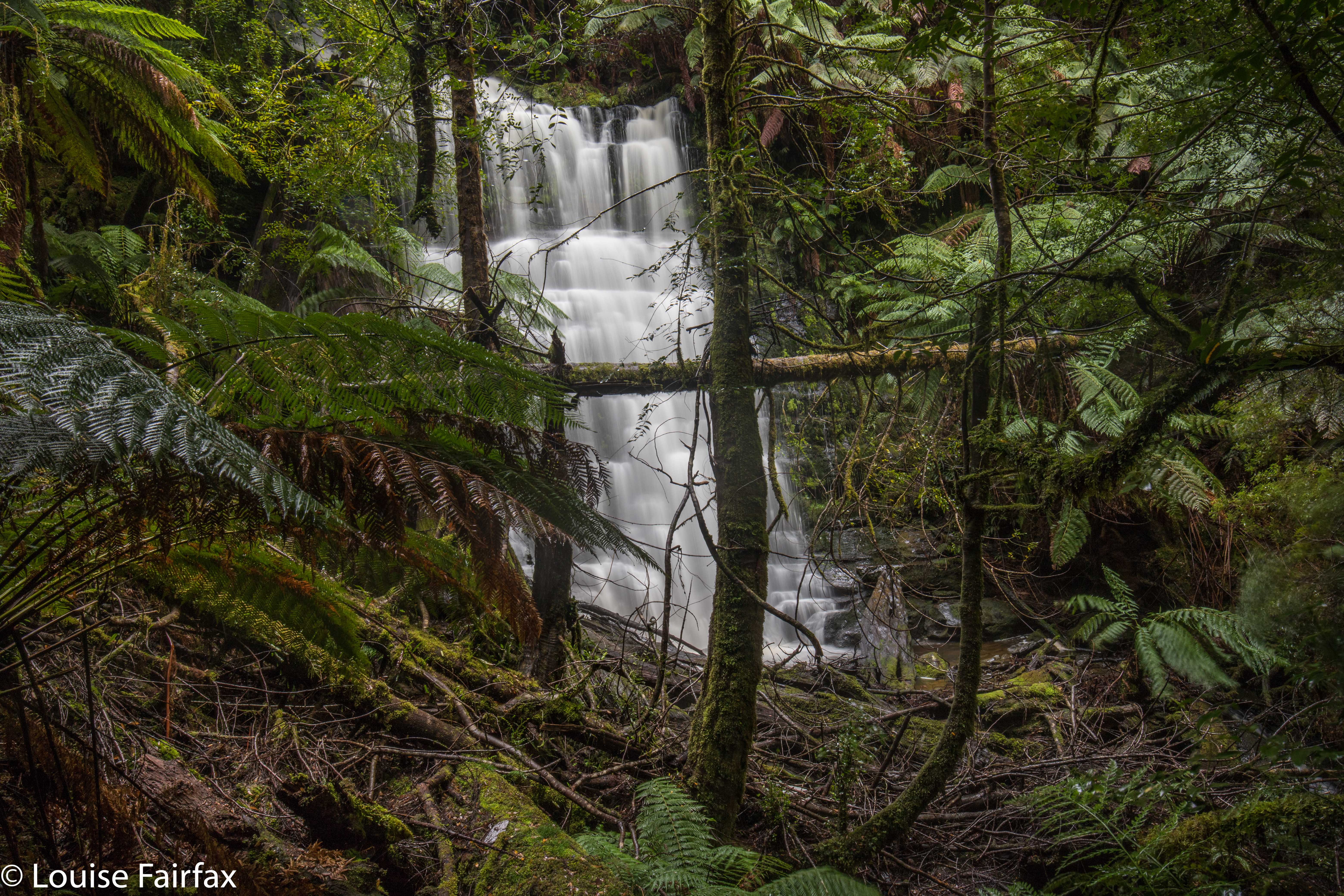
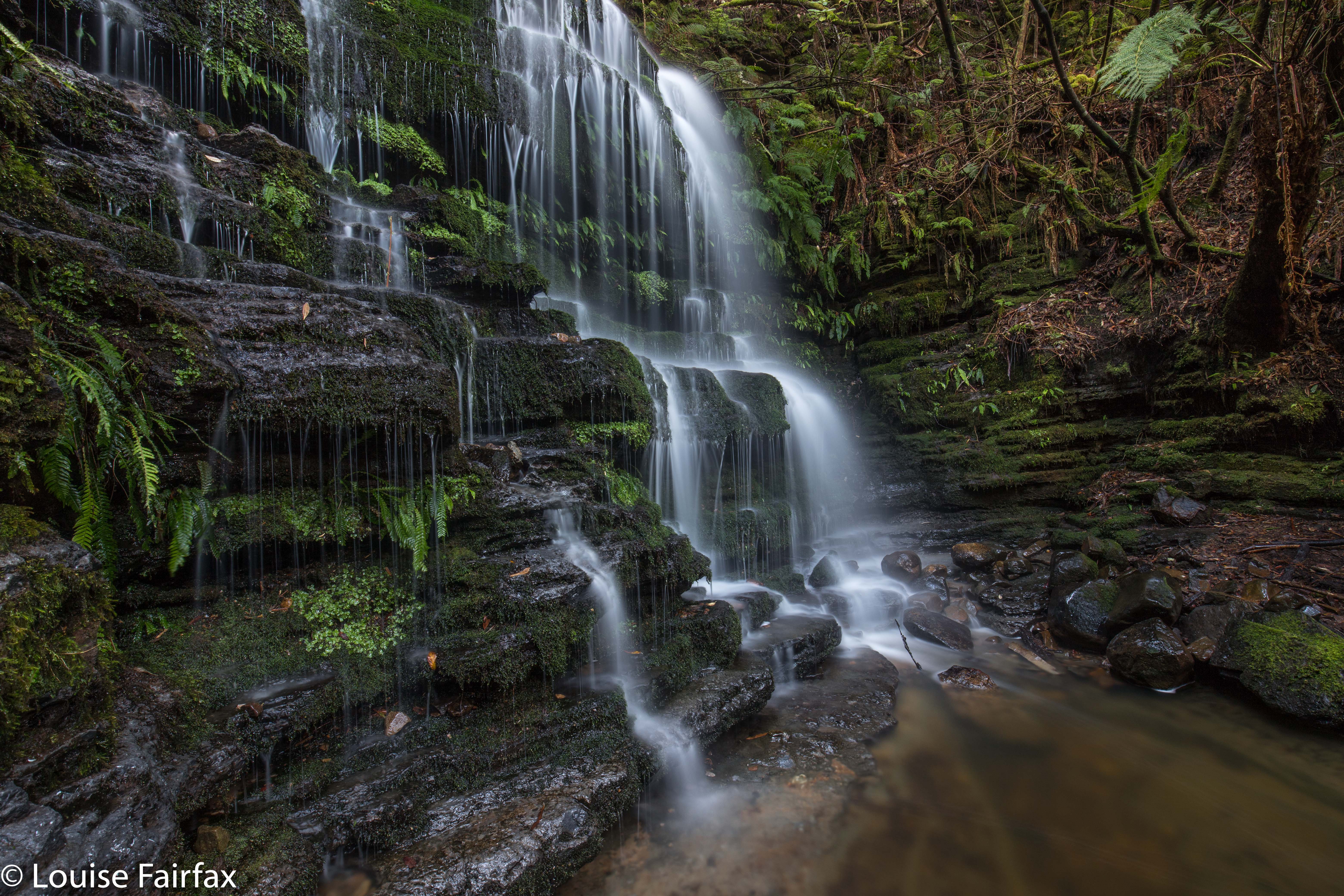
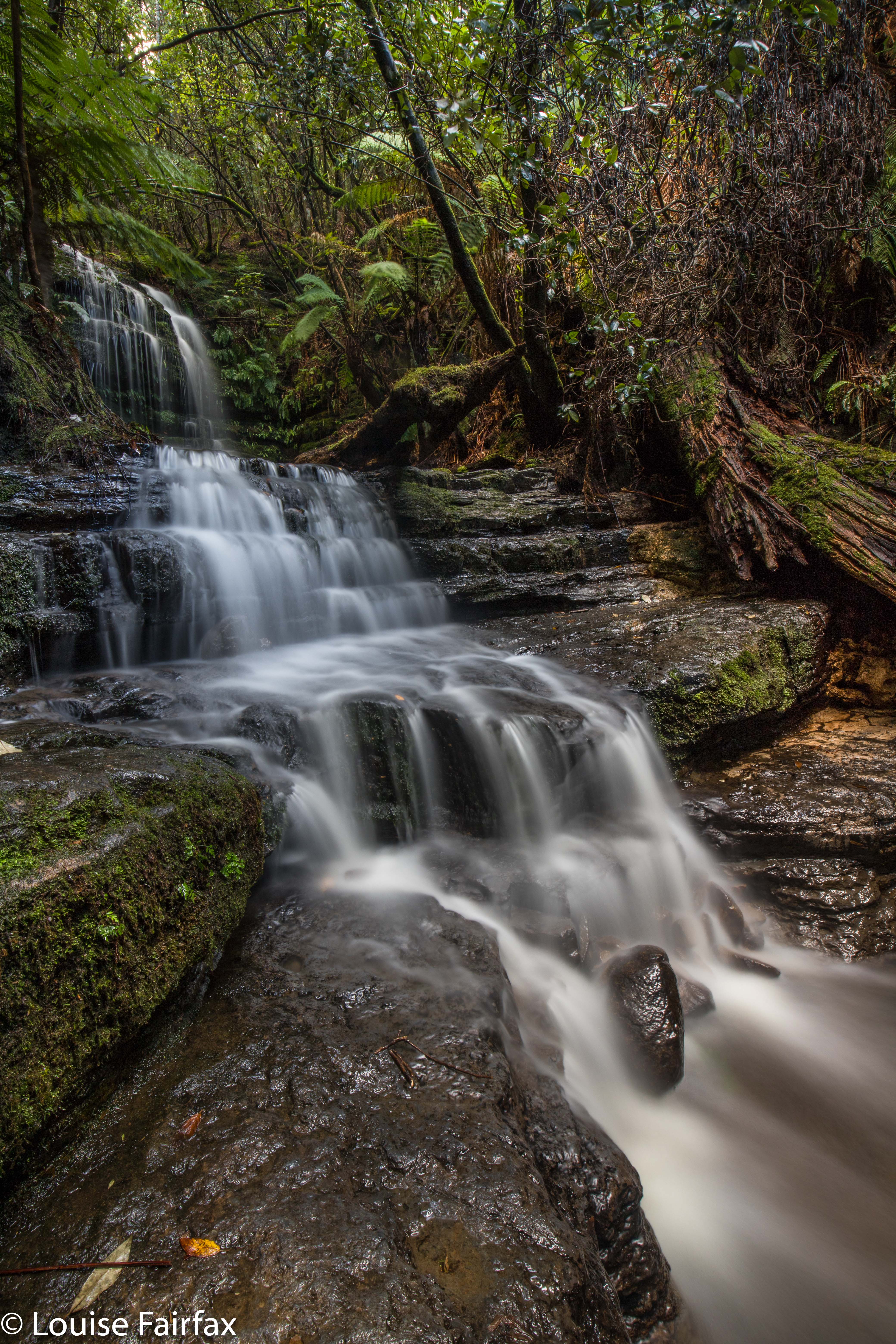
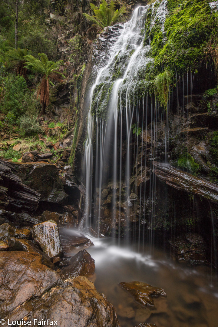
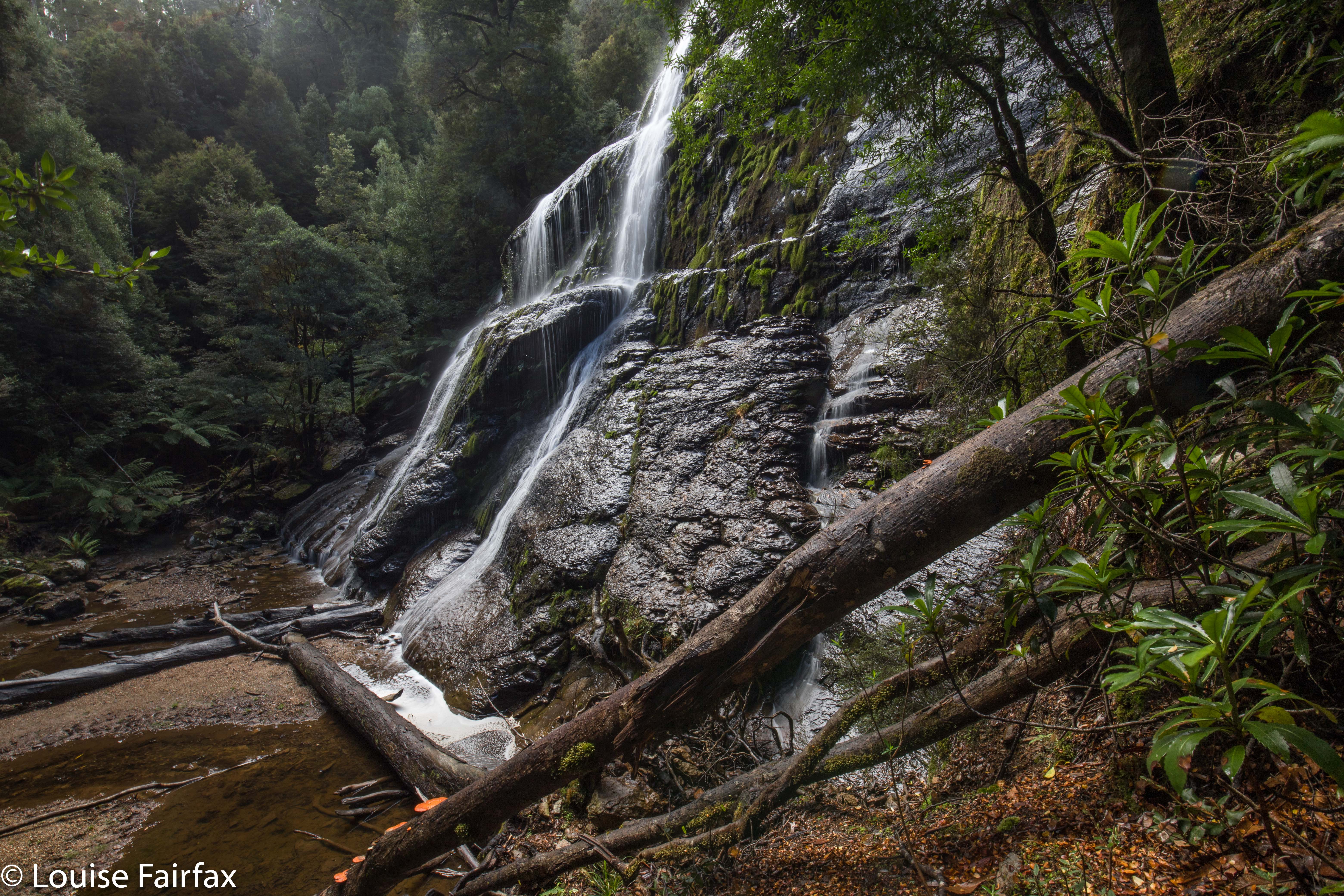
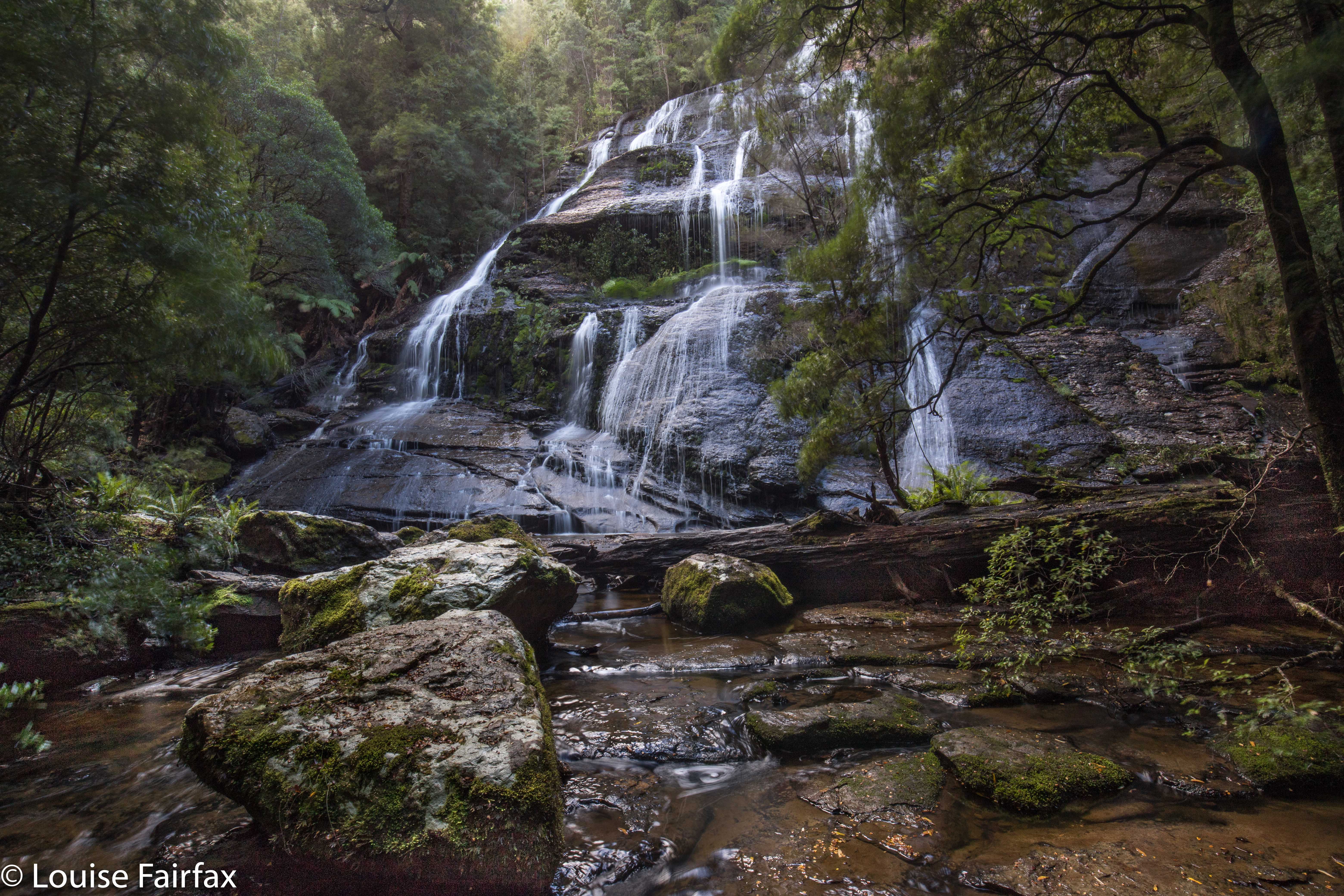
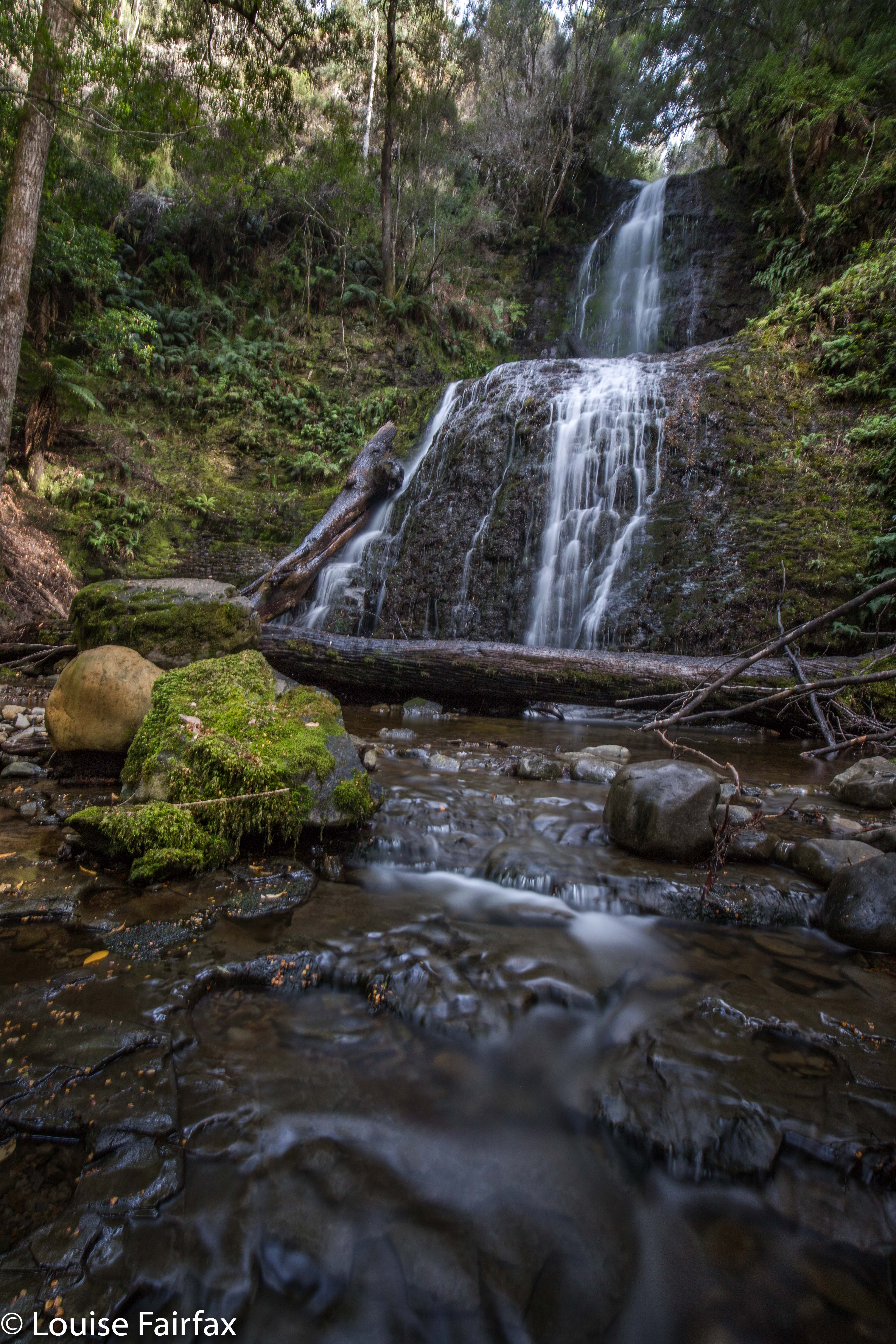
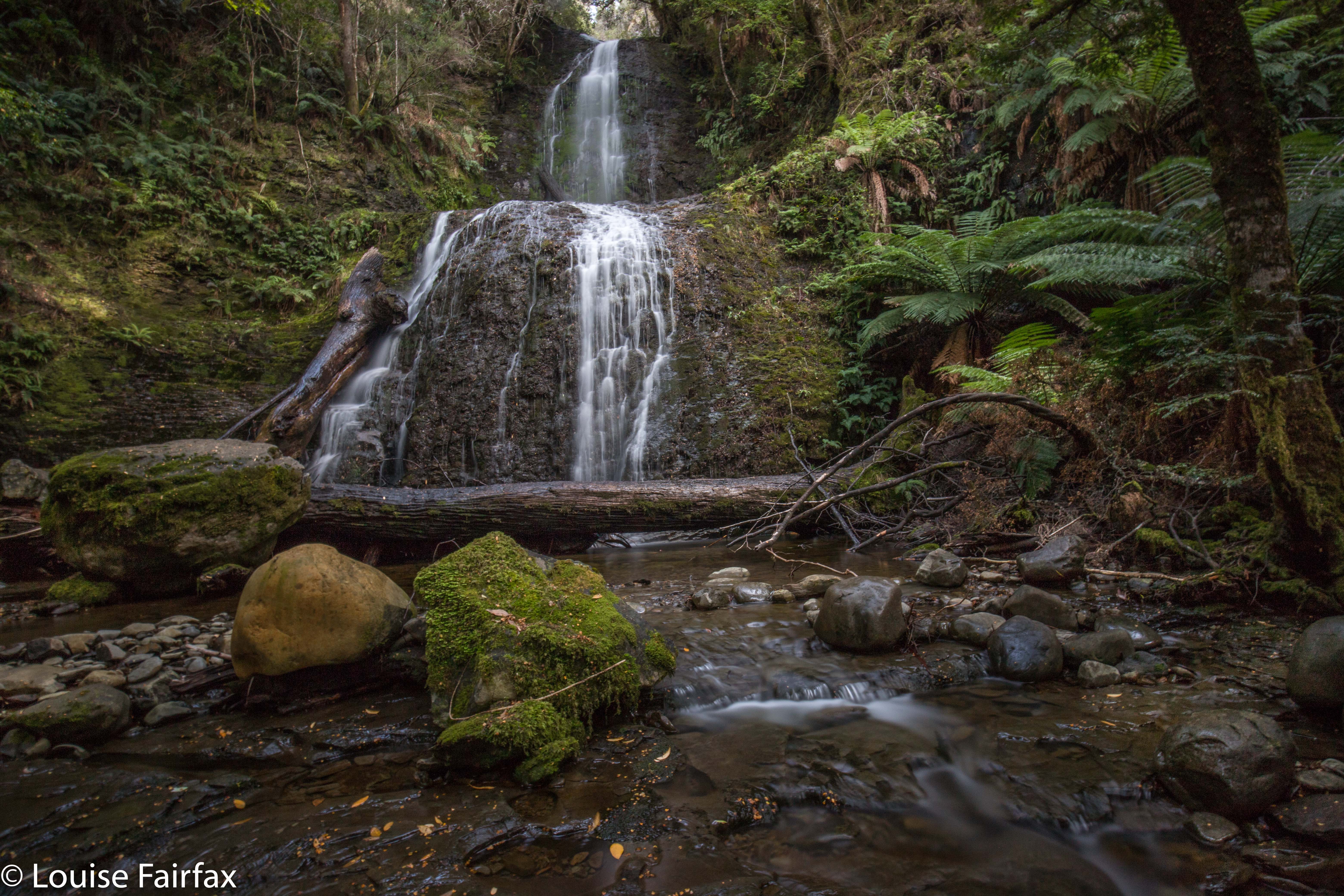
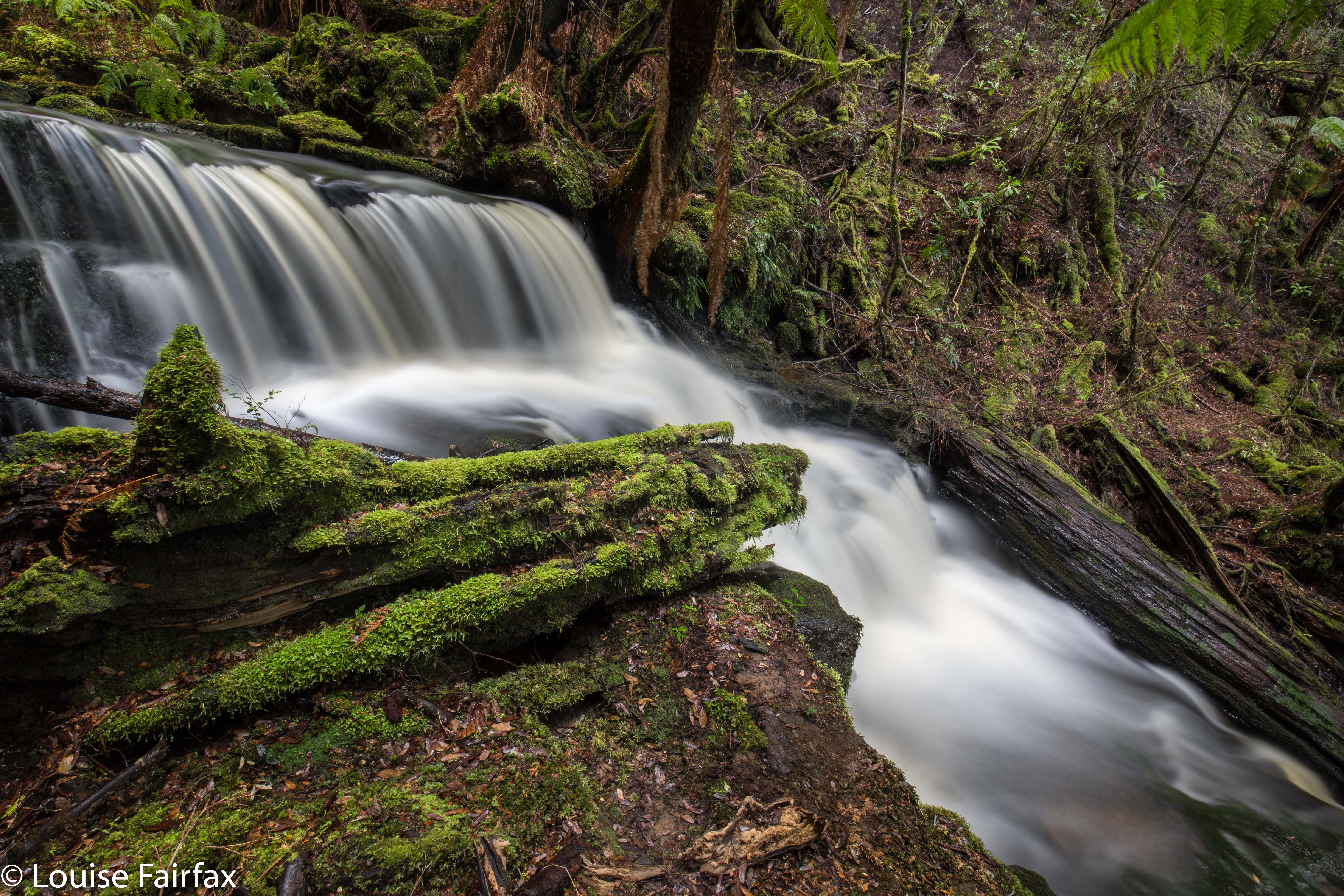
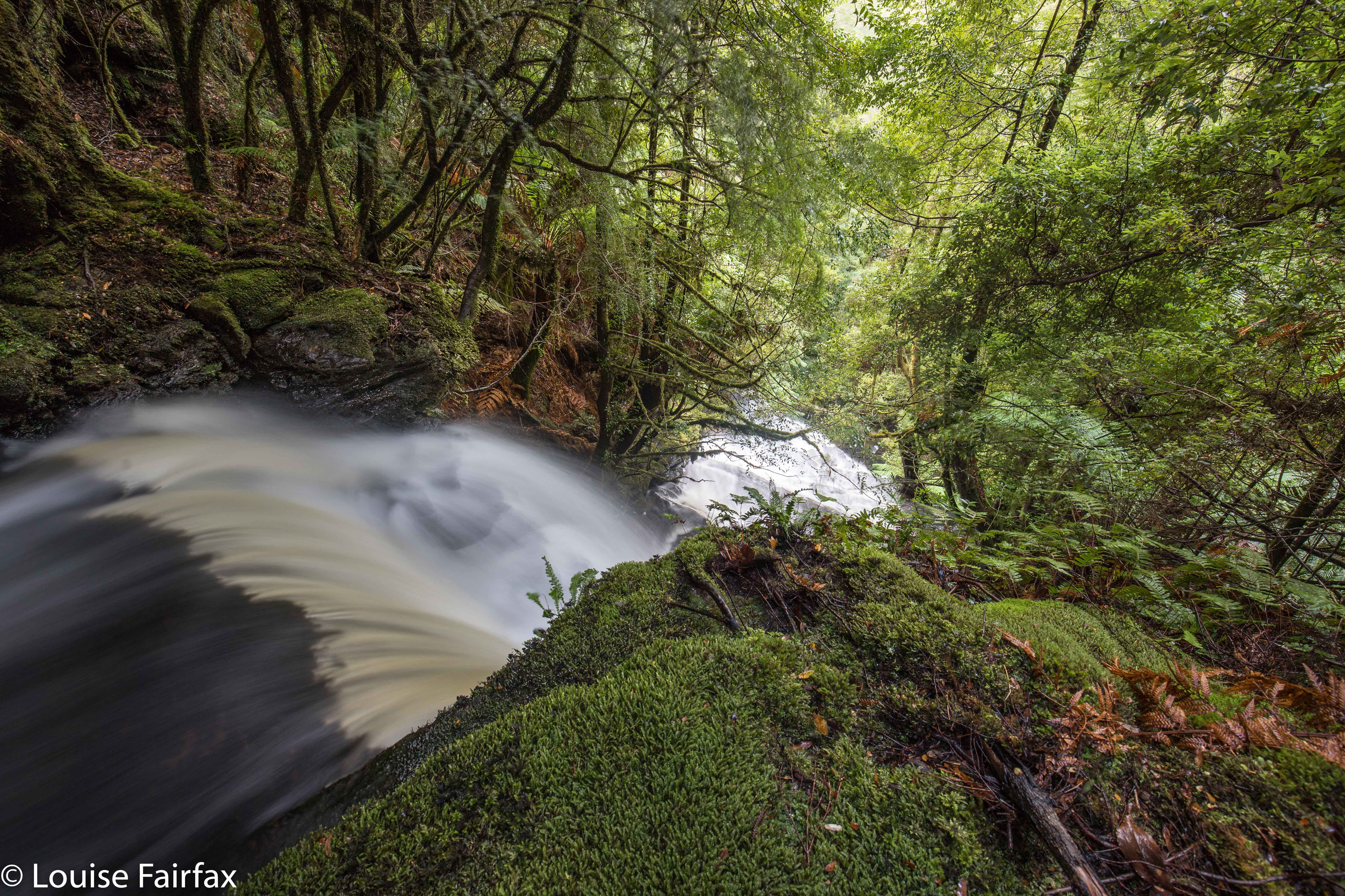
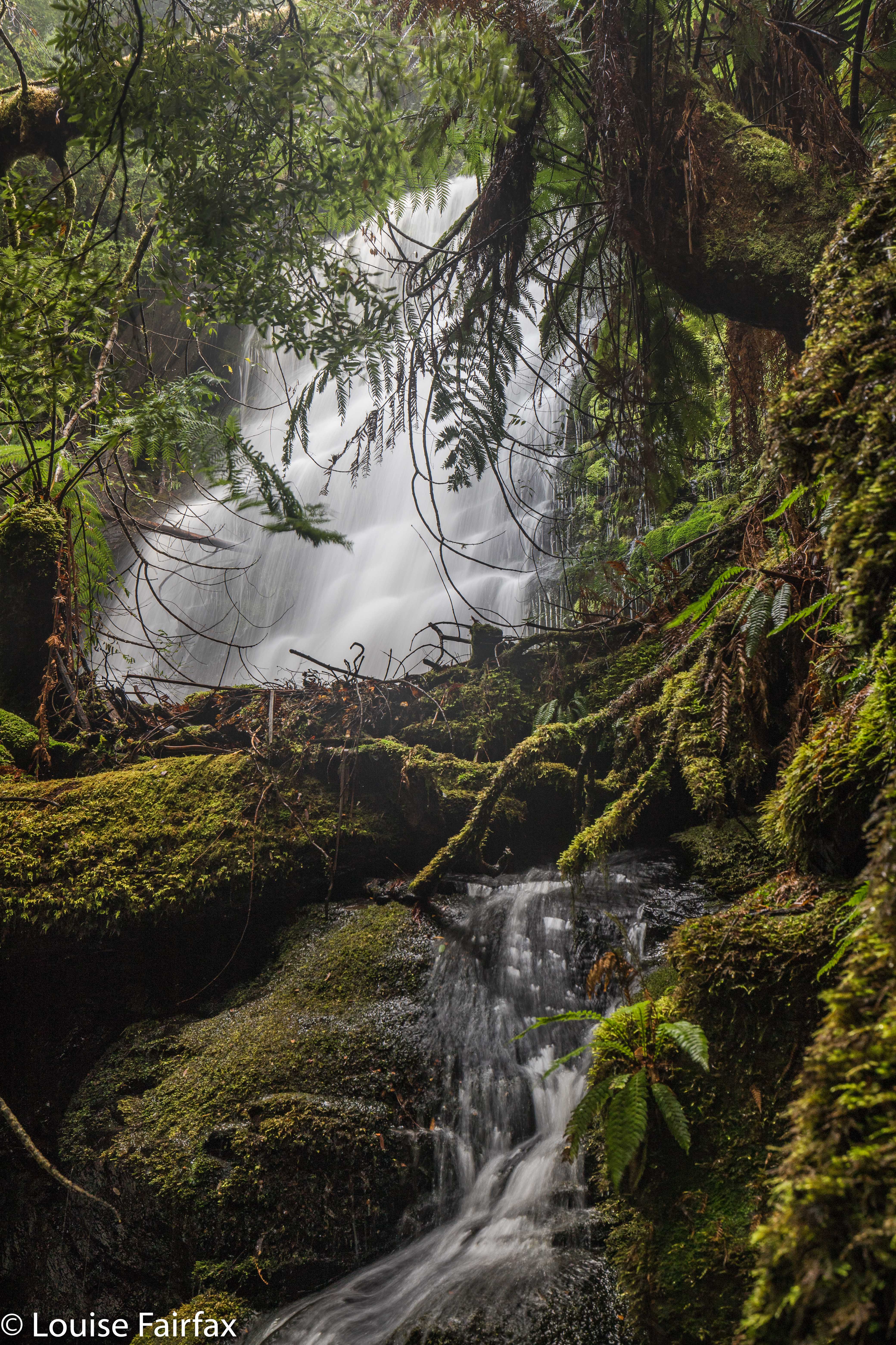
I actually loved the top of the falls more than the base, but both were well worth the visit. It was hard, however, to get an angle on the angel down the bottom, as there is a lot of debris at the base, and the fact that it was raining lightly, and that everything was wet and slippery didn’t help our cause. We had lunch in the forest back up the top, eating and chatting before moving on to our next waterfall for the day, Reuben Falls, a much easier one than Weld Angel Falls: it has a track. I like to do the harder one first; I find the harder ones more interesting anyway. Challenges are more fun than ease.