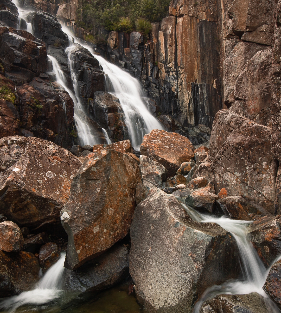
I’m afraid I have to confess that I have always regarded Doone Falls as a spoon of medicine I would have to swallow one day if I wanted to tick that box. I had seen a photo of it that did not inspire in the least, and, I have no idea why, but Sisters Beach did not have a siren call for me either. I guess I have never seen an alluring photo of it.
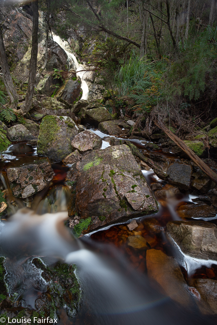
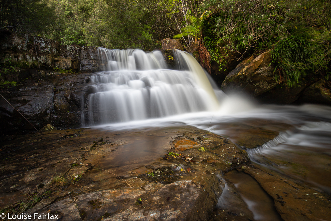
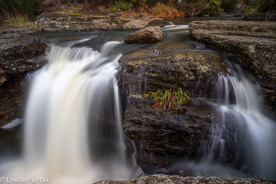
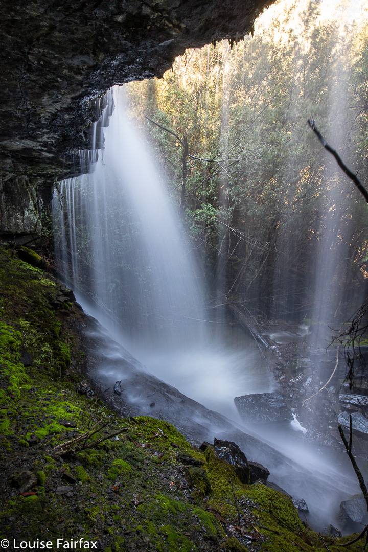
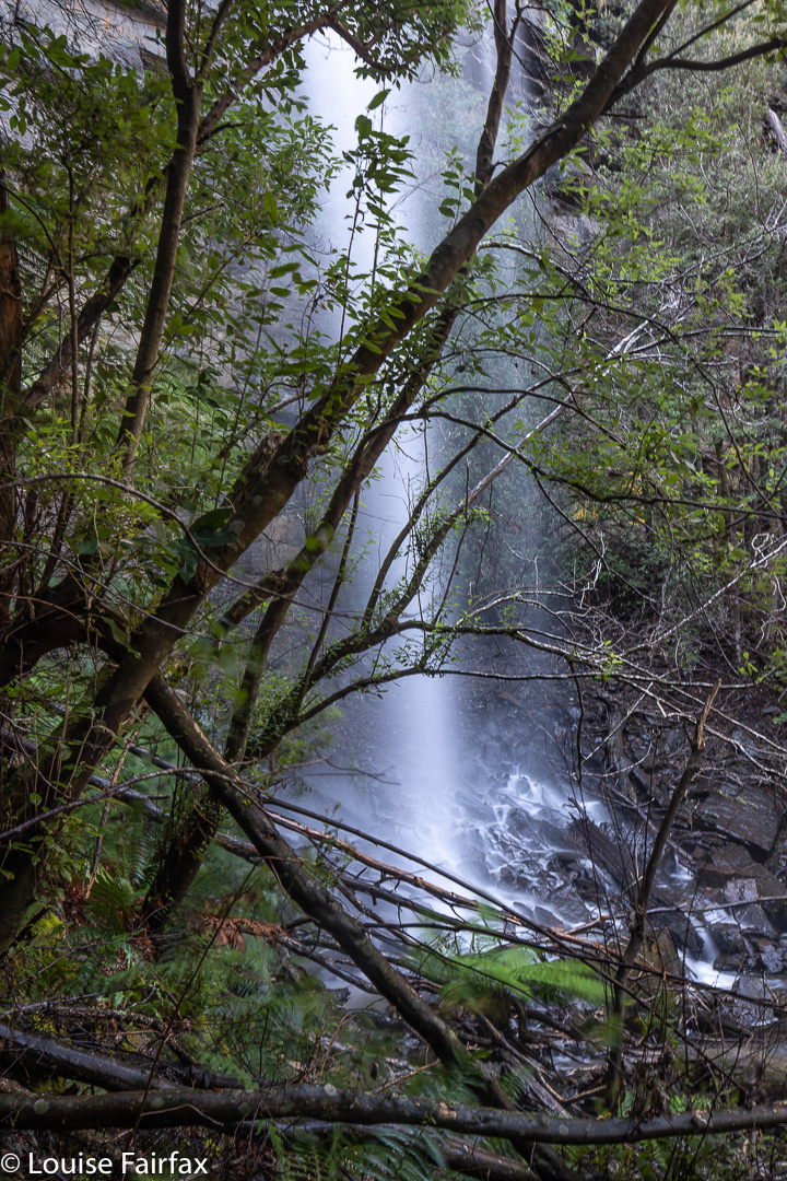
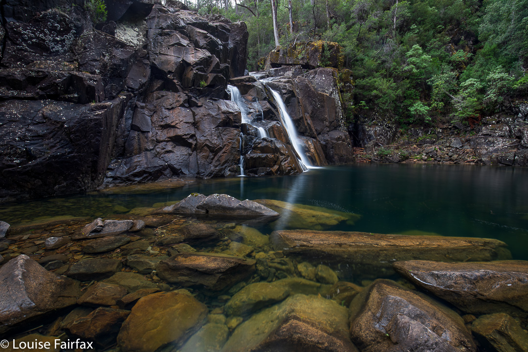
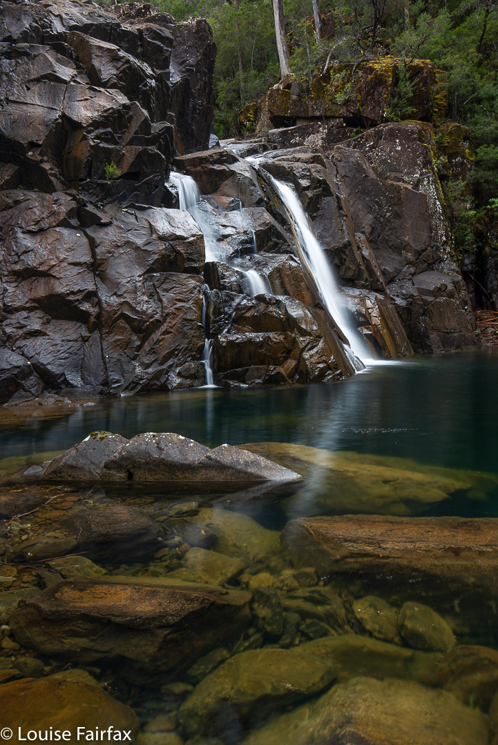
Doone Falls, Rocky Cape National Park (Tangdimmaa)
Today was a good sort of day to make my half-hearted pilgrimage to this doubtful mecca. It was a middling sort of day: cloudy but not raining. Not thrilling in any sort of way, but not bad enough to have me declare it a “sit by the window and read my (excellent) book” sort of day. I did my normal training run in the gorge, and took Tessie for her walk on the harbour before I set out, as you just didn’t know with a day like this how things would unfurl.
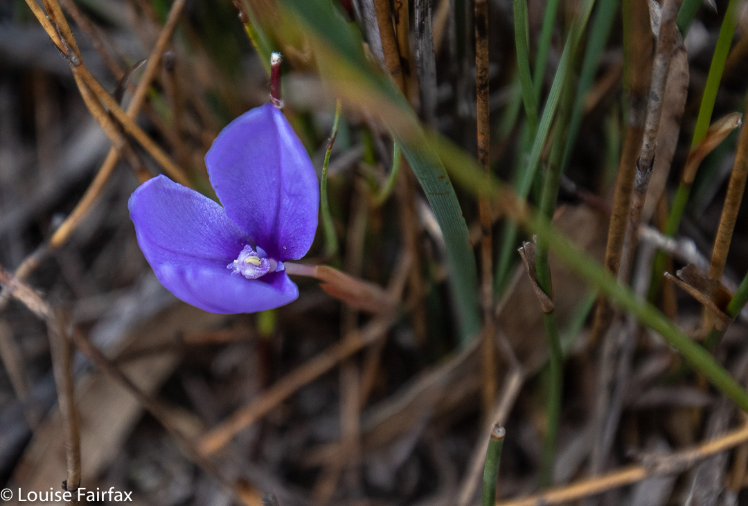
Patersonia fragilis
I know it’s churlish of me, but I didn’t like Sisters Beach in reality any more than in the anticipation. I drove slowly along the street, trying to get a glimpse of the beach, but I could not see it once. Not at all. Huge two-story houses (each with a gigantic boat on a trailer parked somewhere in the capacious yards) blocked every possibility of a sighting of the water. Eventually I reached the end, marked by one of the ugliest car parks ever, with not a tree in sight, and dumped my vehicle. Lucky for me, today was Australia’s religious fest day, so every Aussie except me was at church worshipping men in little shorts trying to get a ball to one or other end of an oval. No doubt they were having communion with beer for wine and chips for bread. This meant I had the carpark and the whole national park to myself. Wee.
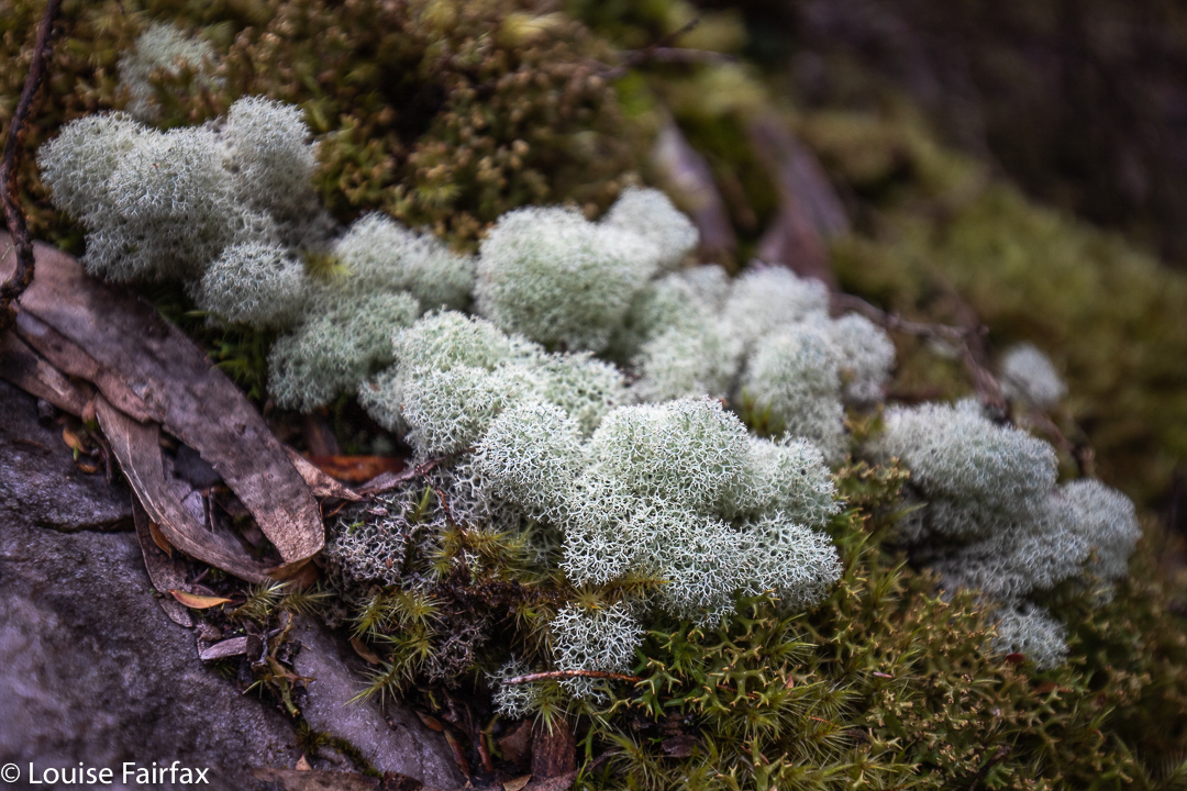
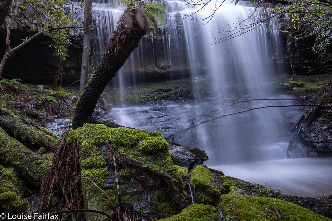
Moss and lichen nearer to the falls
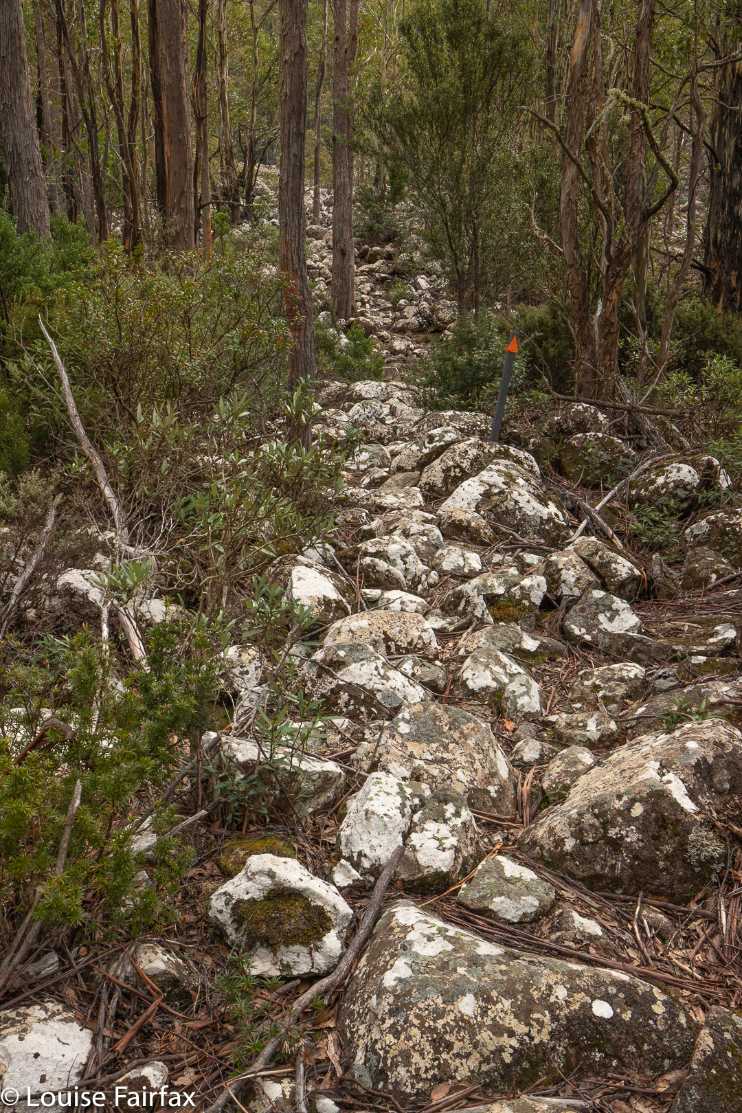
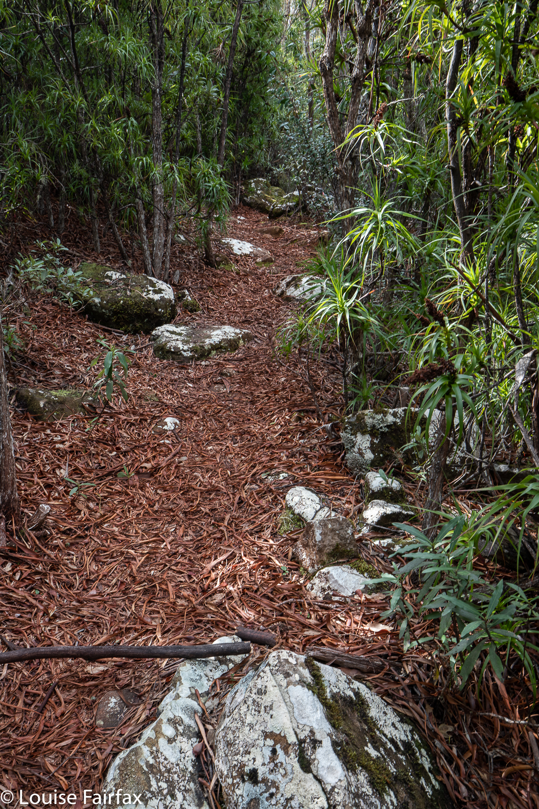
The route was unexpectedly open. I thought it would consist of dry scrub like the bush near Greens Beach, but it was more open heathland. It would be glary and exposed (to sunburn) in summer, but today was fine enough. The wind was not too strong, and it all had a Wuthering Heights kind of feel as I climbed up Broadview Hill with views to lumps and bumps around me, and the beach below. As it was early spring, there were quite a lot of heath flowers and other dainty patches of colour making their appearance. The only shady part was the final five or so minutes which marked the descent through pleasing mossy forest to the creek.
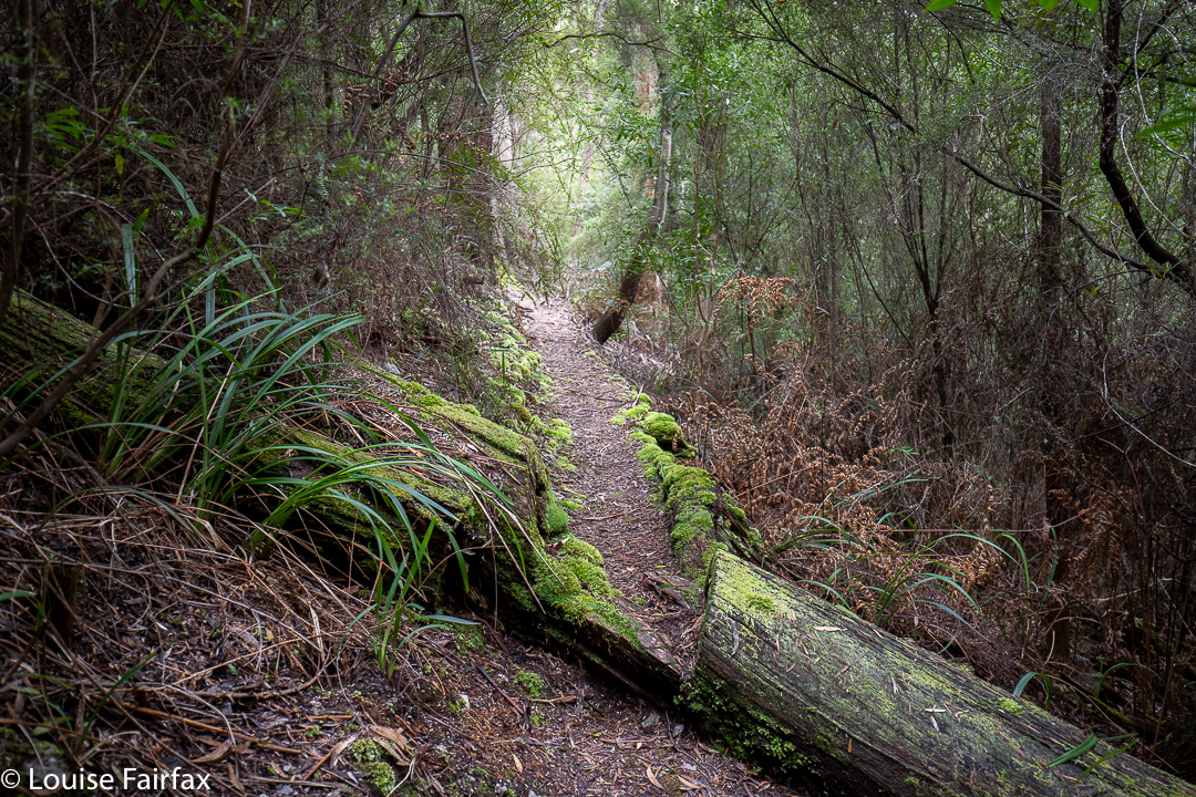
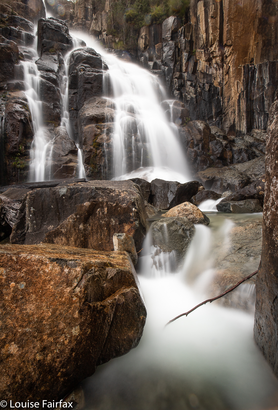
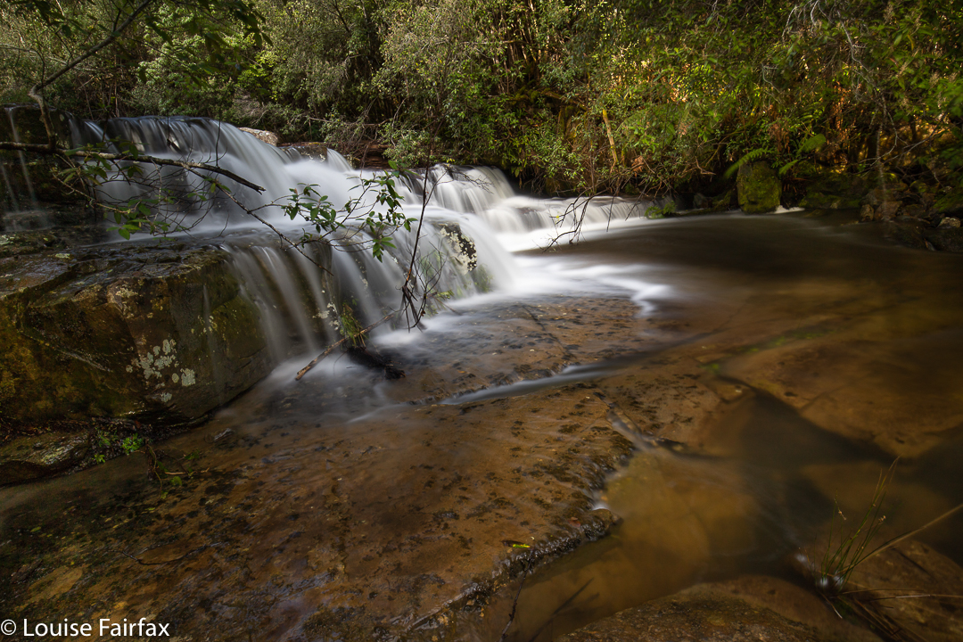
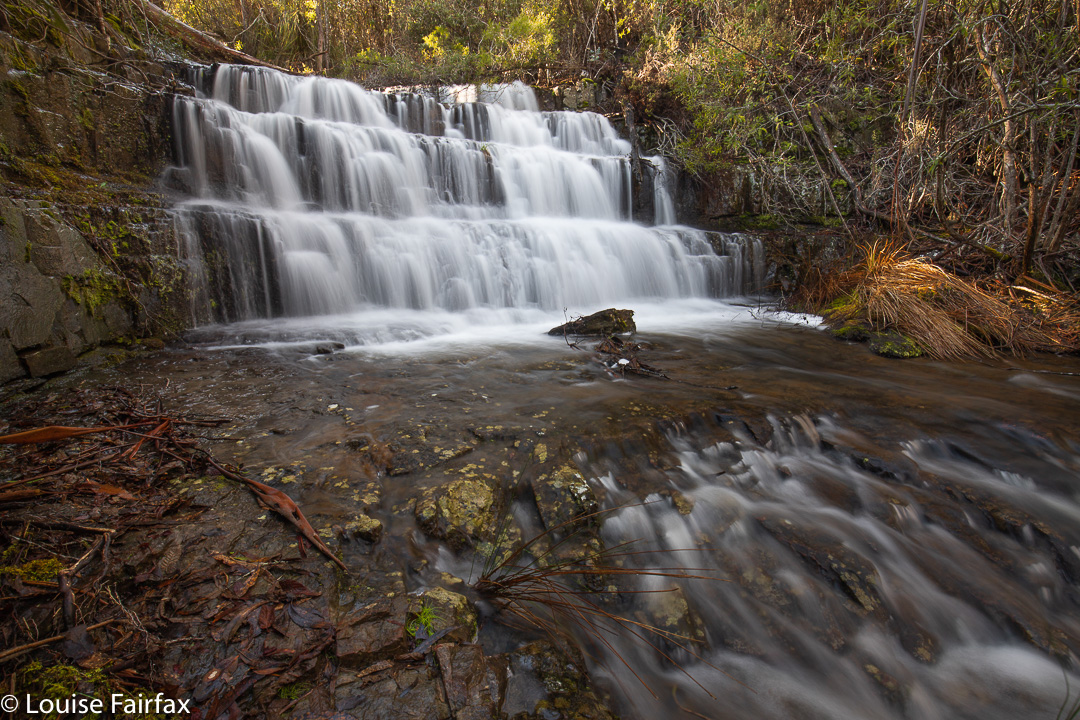
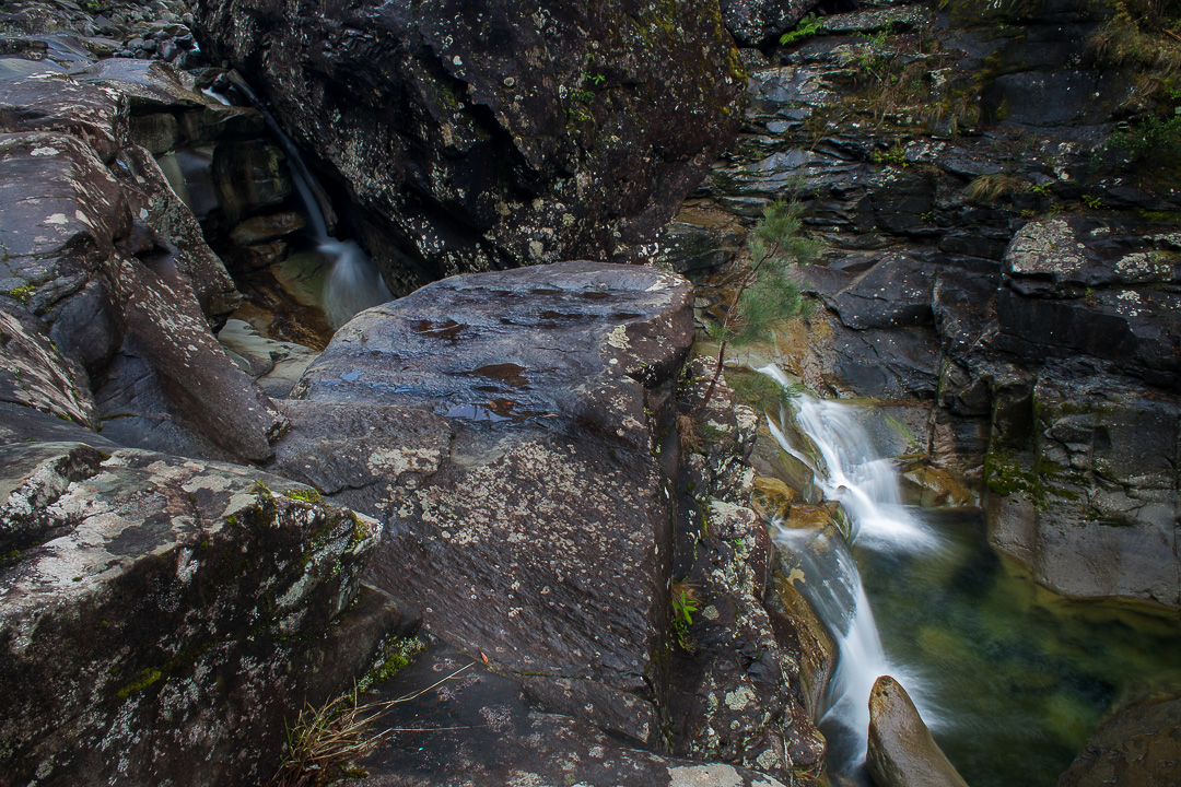
The nice part of the path, near the falls
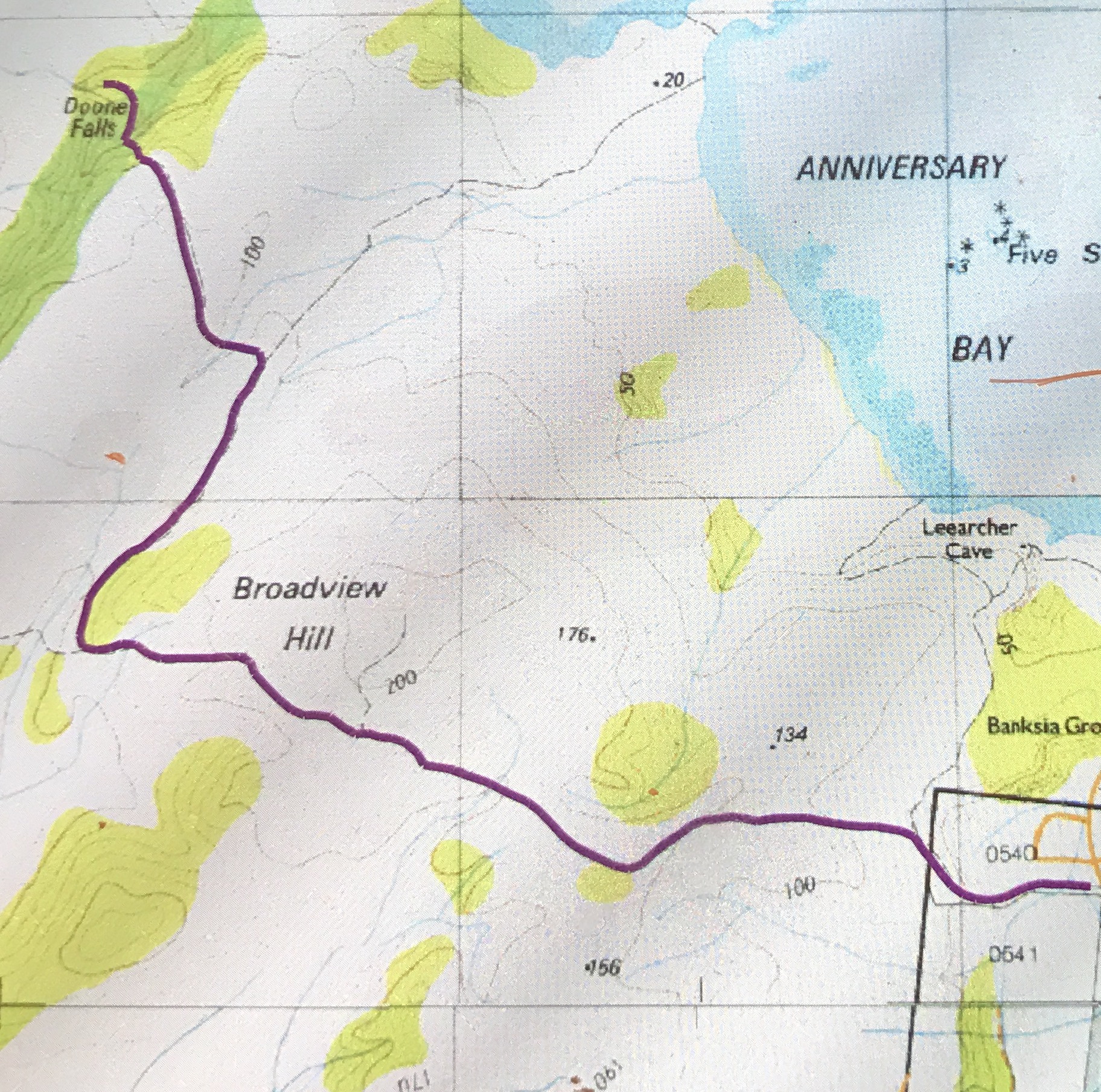
32 minutes took me to the first turn off (shortly after Broadview Hill), which was signed to Doone Falls; 8 mins 30 more were needed to the next sign / intersection, which said the falls were 45 minutes return. I had been going just a shade over half the advertised times, so I figured 12 or 13 minutes should see me at my destination, and I was right. I was thus there in a bit over 50 minutes. The way back had similar splits. I am telling you this, as the fact that it was supposed to take two and a half hours had put me off a bit, and it is good to know that it is not quite such a big time commitment as anticipated, leaving room for other adventures, or just not making for such a long day if you’ve come from Launceston. For me, it meant I could also do Betts Falls and be home in time for dinner. Two boxes ticked. I very much doubt that I will ever be back.
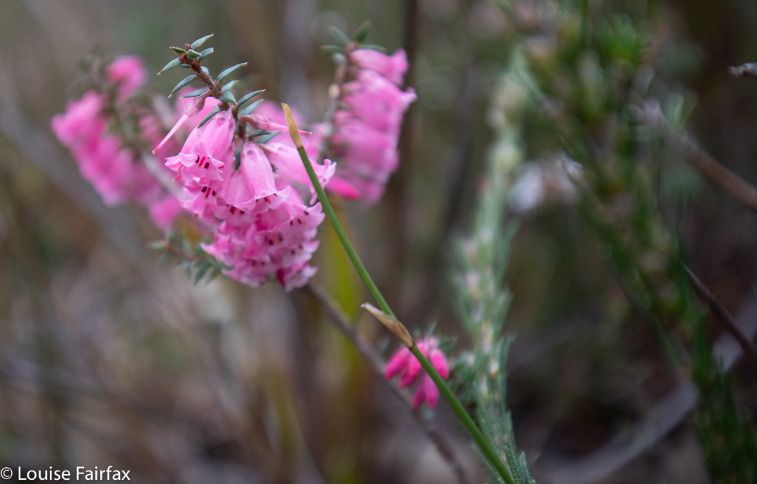
delicate pink heath flower
Rocky Cape now has dual naming. The aboriginal name is Tangdimmaa.
Prior to a few months ago, I had not seen or heard anything to tempt me to make the long and not-very-comfortable trip to Wellington Falls, on the “rear” slopes of Mt Wellington. However, a few months ago, I saw a lovely image by Bjorn Baklien that showed me the falls could look appealing. I awaited the opportunity for a day when I had a lot of time and felt like a very long walk, as I took into consideration the fact that the advertised signage indicates that this is a 7-hour trek. The distance looked big on the map, and I knew from my visit to Disappearing Tarn (en route) that the footy-sized and shaped boulders that litter the way are not “marching” territory, and have to be treated with respect if one doesn’t want to twist an ankle.
Wellington Falls
Luckily, the reality was way, way better than my expectations. Firstly, I took a shade less than 1 hr 45 in each direction, thus halving the time I had allocated. Secondly, I didn’t know in advance, but by Disappearing Tarn, I had essentially done all the footy-stones bit. The actual Potato Fields, which I was NOT looking forward to, were easy in comparison, as the rocks were larger, and very stable. In fact, today everything was easy, as the rocks were dry, and none of them moved under me. Possibly the worst aspect was that I saw my first snake of the season, underfoot where I was about to tread. I informed Mr Snake that it was only September and he should go back into hibernation. I guess he had come up from Snake Plains, as he was just after that turn off.
Wellington Falls Track
So, here’s how it all took shape: Having driven down from Launceston that morning, I went straight to The Springs, and parked at the “higher” carpark, the one just after the road divides in that area. I walked on the Pinnacle Track steeply uphill for a mere 2 minutes, after which it was time to turn onto the pretty flat Milles Track, which I followed to the left (initially SSW but then swinging nearer west) for 28 minutes, when the Snake Plain track joined the path from the left (south). Along that Milles Track section, I enjoyed fabulous views (although a little hazy, so not worth photographing, but definitely worth imbibing) out over Hobart City far below to the expansive blue waters and hills beyond.
Wellington Falls Track after the Potato Fields
A further 26 minutes of the worst part of the track – through dry forest with the footy stones underneath – saw me arrive at Disappearing Tarn, from whence the track climbed upwards through the equally dry Potato Fields (but totally firm and easy underfoot), and then entered a delightful grove of Richea dracophylla, with masses of rich brown leaves underfoot and mossy rocks. The final few minutes involved a steep descent to an intersection below, above Wellington falls with tracks coming in from other directions (one from the Pipeline Track, well below on that side, and the other from the Cathedral Rock area in that circuit, across the river). Not far from there is a side track to a lookout over the falls. I stopped my watch (1 hr 44), and then just took my time, descending to the very base of the falls, and inspecting various rocky outcrops for photographic possibilities.
Wellington Falls – half way down
The way back took in total the same amount of time as the way there, although the splits had different values due to different inclinations in the opposite direction. I had lunch in the Tavern at Fern Tree, coffee down lower at Ginger Brown, and was finished everything (i.e., all the eating) by exactly 3pm, school pick up time.
Black Glen Falls are situated on the Lachlan River, south of the hamlet of Lachlan, not too far from New Norfolk, which happens to be but a small digression from the Launceston to Hobart drag. I thus decided I could easily drive down from Launceston, visit these falls (plus the Glenorchy Falls and the New Town three Falls) and be in time for the children’s after school pick up.
Black Glen Falls 2
As with many waterfalls, the hardest part was getting to the start line. I drove south along the Lachlan Rd, as I was supposed to do, and avoided the turn to the left to Hydehurst Rd, as instructed, but after a bit more driving, I came to another turn to the left, but not one that was labelled Timbs Rd, the road I was seeking. I stopped and got out to consider this matter, and a friendly local pulled over to help me.
“I’m looking for Black Glen Falls.”
“Never heard of them.” Oh. And he’s a local.
“Hm. Have you heard of Timbs Rd? I’m supposed to find it first.”
“Yeah. That’s easy. Can’t miss it. About 2 more kilometres and you’ll see it.”
Thanks given, I continued on my way, and found Timbs Rd with no further ado.
Black Glen Falls 3
The WoT website says there is a bridge (tick) and to park there. But silly Louise thought she could drive her AWD up this 4WD “road”, which looked quite harmless, so on she went. Oh the fallings of the proud. I soon enough found myself backing about 200 ms, once the road conditions deteriorated from very bad to shocking. Next time, I will park near the bridge and walk the mere 900ms to the old car park, official start.
From the official start (allow about 12 up, 10 down), it took me 26 mins to reach the first of the falls (which is actually Falls number 2 of 5). Before that happy moment, endless pleasant cascades can be spotted, including one just near where the river should be crossed. However, the river was quite high and strong, so I elected not to cross, and had no trouble staying on the eastern bank the whole time.
Black Glen Falls 4
There is a path most of the way, and helpful tapes to guide. That said, I would not do this walk if I were not confident in the bush, as birds and more can run off with pink tape, so you need to know what you’re doing. The other problem is that the falls are not actually marked on the map, so you are basically at the mercy of the tapes to get you there, as the Lachlan River has many unnamed side tributaries, so I became very uncertain as to the whereabouts of my destination. You have to combine tapes and pad with a bit of “bush nouse” and then all is well. Use my map below to mark the spot on your gps, and you should be right.
Black Glen Falls 5
If you persevere with a bit of uncertainty, you are well rewarded at the far end. The falls – cascades plus five falls – were all a total delight. I plan on taking the children in summer, when we can picnic on one of the many rock ledges, and they can paddle or swim in the many pools. Each waterfall has its own little rock ledge. The bottom falls looked less interesting than the ones above, so I didn’t drop down to them. I photographed Falls 2 (where the track leads), and then just kept going upstream for more and more. Eventually I ran out, so hoped there wasn’t another left hidden above, and returned to the car, to make it to New Norfolk for a delicious lunch in an old church, now a Quilt Cafe.
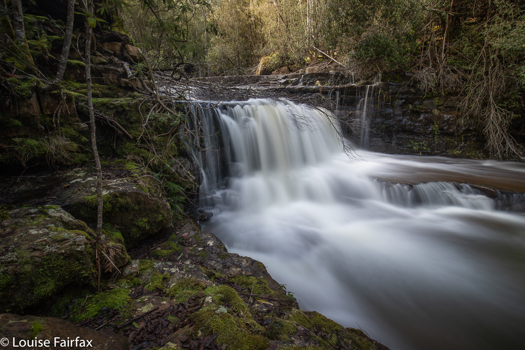
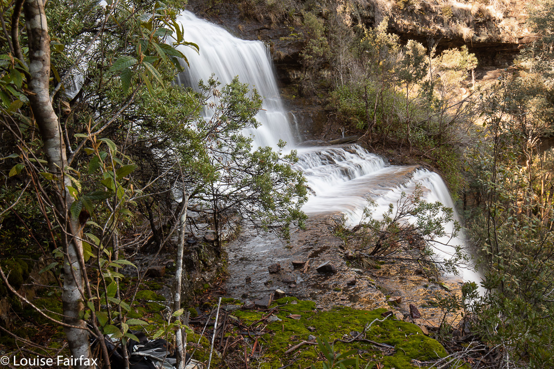
Glenorchy Falls
Glenorchy Falls were far too suburban for my liking. It was hard to ignore the concrete and rubbish that unnecessarily decorated what could be beautiful if someone put in a bit of effort. Box ticked. I won’t return.
At last I saw the New Town Falls flowing. Third time lucky, but that’s another story …. .
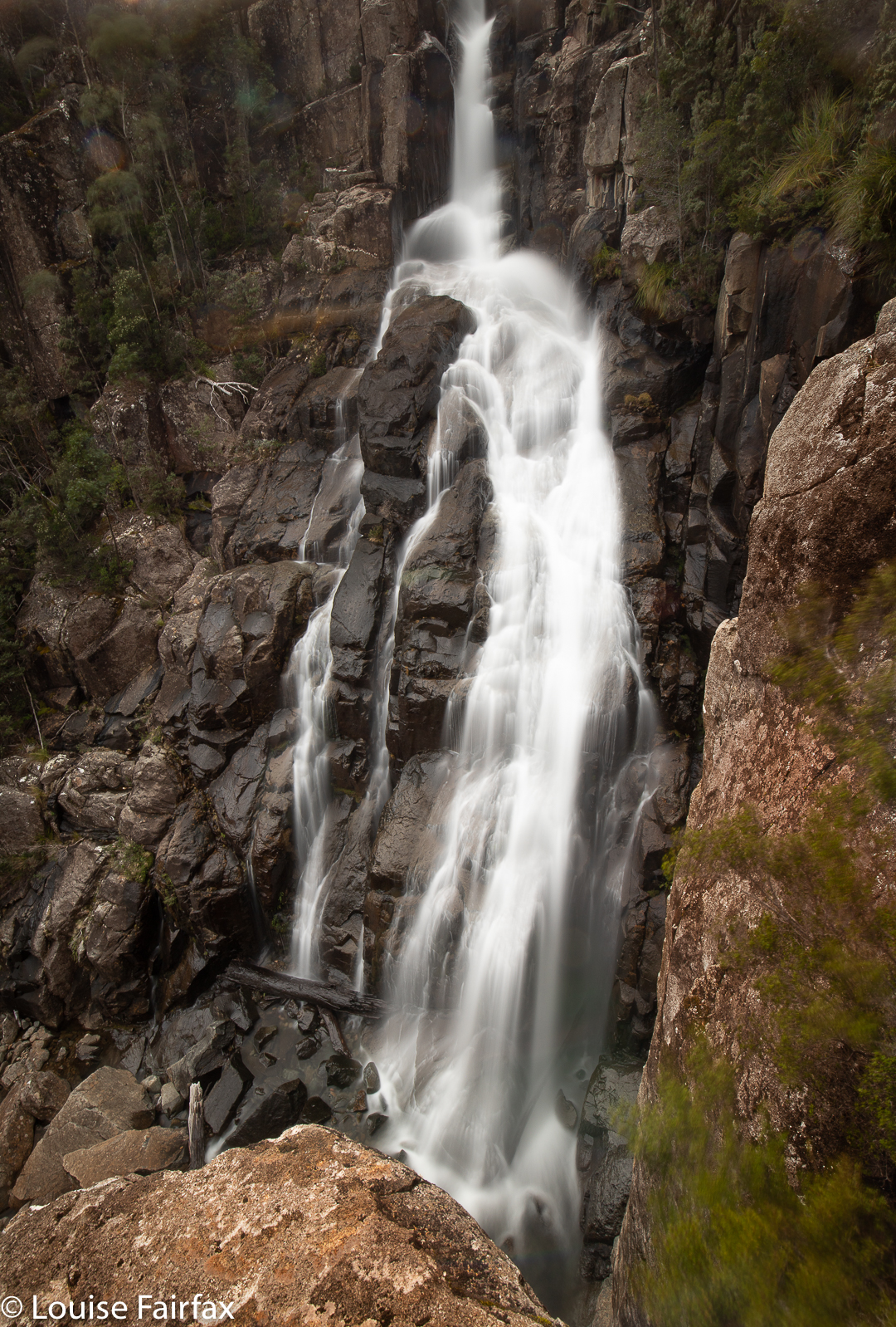
Flora Falls, being situated at quite a high altitude, do not have an expansive catchment area, and so require of the keen photographer a visit either soon after rain, or in sync with snow melt.
As we had had both rain and then snow in this last week, I felt the timing was good for a visit. This waterfall has long been on my bucket list.
Flora Cascades, Upper
As said, it had been snowing, but I was not expecting quite THAT much snow! As I drove higher, the landscape became whiter. Black ice patches appeared on the road – along with white – but both eventually ceded to pure snow, mostly with two black lines through it where others had driven. The bank-up of snow in the middle scraped the underbelly of my Subaru Forester. Driving in a 2WD would have been impossible. It felt quite isolating up there in those conditions.
Upper Flora Falls
I parked and decided to take Tessie for a walk on the “road” (where she froze her precious tootsies) before I went searching for the falls. She needed some exercise, and I thought it might give the snow some time to melt. The sun was shining, not that the temperature signified that. While we were walking along, some local residents pulled over. “Is that a Smithfield?”, they wanted to know. (Anyone who has ever owned a Smithfield can spot one at a hundred paces, and is violently in love with every exemplar they meet, it seems.) We got chatting, and, on hearing I was about to visit the falls, they assured me they were pumping, but both said: “Do be careful. It’s hideously slippery down there, and the rocks are really loose. Don’t rely on any rocks.” The guy appended: “I wish you weren’t going alone.” I added their words to my little stock of other dire admonitions. Such multiple warnings do tend to make me nervous.
Upper Flora Falls
Body now full of adrenalin, I popped Tess in the car and set out across the snow on my solitary journey with my fate today. Soon after entering the forest I could hear the creek, and duly followed it along, sometimes near, sometimes higher, as occasion demanded. Once “on the job”, my concerns in anticipation soon vanished. I was always like that before races: terrified near the start, but once the gun had fired, all else was lost in my tunnel of concentration. I took each moment as it came.
Flora Falls
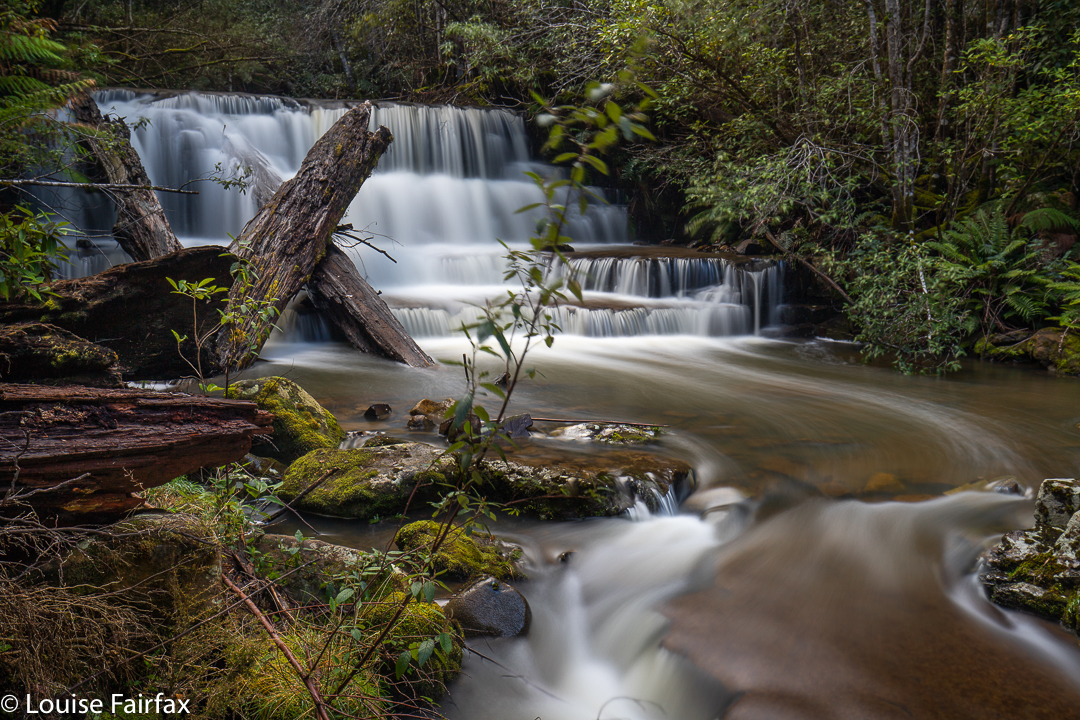
After not too long, I found a lovely cascade which I knew was not what I was looking for, but, as it was beautiful, I stopped to photograph it anyway. This would put off the moment everyone was warning me about, if nothing else. All up, I saw and enjoyed two cascades, as well as the three (I think it was) tiers of the Upper Flora Falls, and the two tiers of the Lower. I called the Cascades Upper and Middle, leaving room for a lower should it exist.
Flora Falls, between the tiers
Back at the car, I was just putting my gear in and another local driving by stopped to make sure I was OK. With that much snow on the road, he was concerned, but decided a Forester would be fine. I really appreciated the fact that two different cars stopped to check on my safety.
It was time to drive to South Hobart where my daughter had freed herself for a picnic lunch in the sun, staring up at a snowy Mt Wellington. That afternoon, I would go bushbashing along the various tributaries of the Hobart Rivulet, where I would find three new (for me) waterfalls. It was a busy – and a rather exhausting – day.
I was ridiculously anxious before I began Leeaberra Track mach 2. My bout of flu A has left an unwelcome aftermath of generalised fatigue, and when I try to run, I have heart palpitations. Was I going to make it up the taxing hills with a heavy backpack? Was I going to be a nuisance by my slowness? Were the others going to get impatient with me? Would I conk out? One thing I did know: I didn’t want to cancel out. I wanted to give it my best shot and see if I could do it.
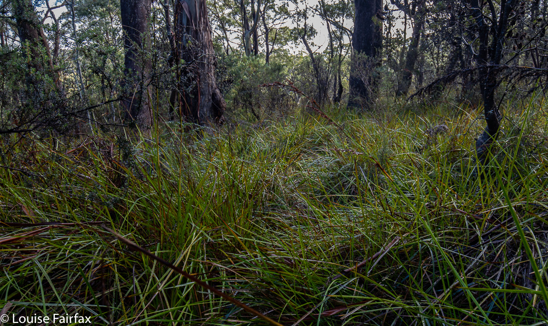
Leeaberra Track. Can you find it?
Meanwhile, the car problems facing us looked as if maybe I’d need to drop out and become a chauffeur: we couldn’t find a way of retrieving my car should I take everyone up to the start. Nobody else had a car capable of taking me back to my own at the end. It would be sad to only be chauffeur, as this walk had been my suggestion. I phoned National Parks for a solution, but drew a blank. Adrian tried the far better option of the Bicheno Tourist Bureau, and was given the number of Tiger Tours, who own a 4×4 vehicle capable of taking us all right to the very start. Wow. 0416 983 926. Brilliant innovation.
So, after breakfast in Bicheno on Saturday morning, Lynden picked us up. We dropped my car at our finishing point, and all continued together to the official start of the walk. Others have taken 3.5 hours to do what Lynden did for us in his van in less than half an hour. Who wants to walk uphill for that amount of time on an ugly old road that can’t be used any more? Not us.
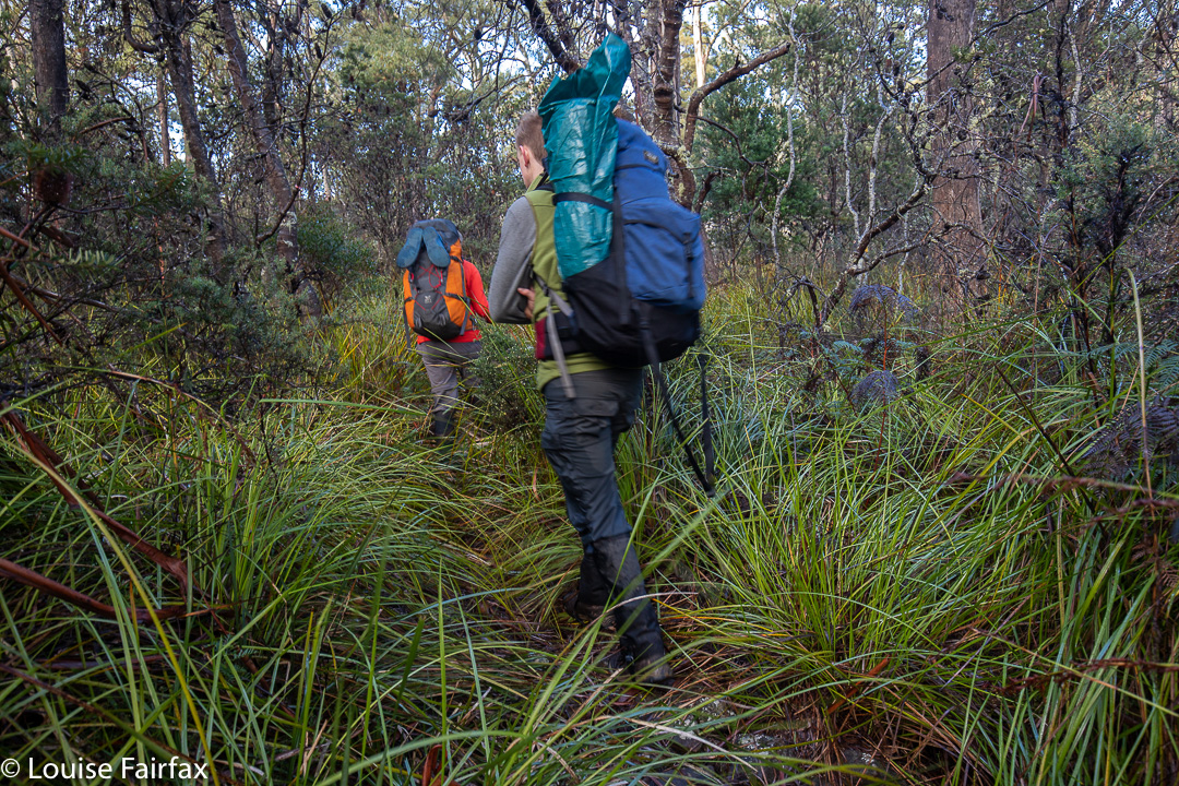
Leeaberra Track: Underway
The start was a bit of a disappointment, as the NP ranger said they’d done work on the track. We searched and searched for signs that someone had improved something, but not a hint of work could be found. We were drenched within about a hundred metres of starting because of all the overhanging branches. Cutting grass invaded and obscured the track. This was what I would have expected had I not been told of improvements, but having been thus told, I became disappointed in its lack of fruition. Although it wasn’t raining, I really should have had on my jacket and pack cover, as everything was sopping by the time we reached our pack dump point a bit over an hour and a half later.
It was great to drop the packs after this time and head to the falls. I estimated two hours. Wrong. It took us three: two in getting there and back and an extra hour for photographing all that beauty. Having not met track improvements in the first bit, I was hopeful that maybe what the ranger had spent time on was this waterfall section. Wrong again. It was still chocked with fallen limbs and branches. I felt very clumsy with my tripod dangling around my neck, but that left two hands for grabbing and climbing. The rocks themselves were very slippery indeed, so Leandra and I stayed on what used to be a track and fought all the fallen scrub. The boys felt OK about skating on a bumpy surface, so went along the rocks. But it was far from relaxing, and they chose the scrub on the rebound. Using the rocks, they had to climb back up high anyway, as there is no way over the bluff that guards the entrance to the actual waterfall. If you want to see the base, you have to climb up and over. … and then DOWN a very steep section where some people sent rocks flying, as it is also loose.
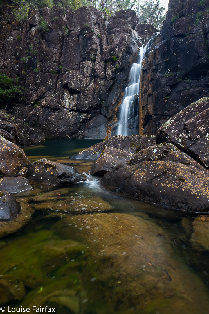
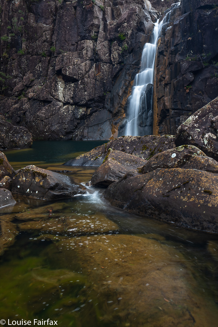
Down there in the semi-amphitheatre made by the curve in the river below us, it felt like hallowed ground. The falls dropped into a pool that was a fabulous blue, but also wonderfully transparent at the same time. Everything was super except that I was too scared to move. All rocks were angular, and they dropped into water I didn’t feel like bathing in, especially not whilst having priceless electrical equipment strapped to my body. There was nothing much to hold, and the rocks were some of the slipperiest I have ever encountered in my life. My photographic compositions were dictated entirely by safety rather than by whatever the more artistic part of me may have wanted. I chose a spot where I was kind of wedged in, so that when I slid, I would fall into a rock and not the pool. My tripod slipped downwards as well. I chose to do a series of shorter images and stack them later. That way, if and when the tripod slipped on the rocks, I wouldn’t ruin a whole long exposure. The photos you see are stacks of 3-5 images.
Despite these difficulties, I chose three angles. Caedence, more courageous, chose more. Adrian hopped from here to there, sliding with gay abandon (was this his Dutch ice-skating heritage coming out?), and Leandra mostly sat on a stable rock and enjoyed the scene from her vantage point, soaking in its beauty. It was so nice for me to be with friends who wanted to spend time at the falls. When I was here in February, the people I was with didn’t even want to go to the base with me, let alone spend time there gazing in wonder.
Everyone content and happy, on we moved to the base of Leeaberra Falls, which we could only see from the top at this stage (having gone downstream a bit). I hadn’t been to the base of this one last time, due to time pressure of the others with me who didn’t like waterfalls, so I was excited to be seeing something new. We found a safe crossing point. With the rocks as treacherous as they were after yesterday’s rain, we were lucky the water wasn’t any higher; it was possible to get across safely – even for cautious people like me – and then we climbed up over the kind of bluff the other side before dropping pretty steeply to the base of Leeaberra. As said, this exercise took, in total, an hour’s walking, photography time not included. Down here was more beauty, and a kind of repetition of the previous fall, with two setting up tripods, the third hopping about exploring many angles, and the fourth meditatively gazing in wonder. I felt very content by the time we were ready to head back. Waterfalls should be savoured like this.
Leeaberra Falls base
Back at the camp that wasn’t our camp, we had lunch before dispensing with the business end of the afternoon, namely, getting up the big Lookout Hill (highest point on the track) and descending the long, long drop to the Douglas River, our actual campspot for the night. I think everyone was glad to finish off the day. The river was lower and less scenic than last time, and the lighting less interesting, but it is still a beautiful spot to spend a night. The others ate “in” the river on rocks. I socialised a bit, but then retreated to my warmer tent. I had never dried out from the morning’s drenching, and the chill was gnawing at my innards.
Leeaberra Falls base
The next day was earmarked for Tevelein Falls, but overnight rain had made the rocks a nightmare again. It had taken me an hour in nice weather in February to reach them. I didn’t fancy my chances today in these conditions where, really, it might as well have rained olive oil over night. Leandra and I contented ourselves with lesser goals. The boys, not burdened with a female’s life preservation instinct, dashed along and got to a spot that satisfied them. I already had photos from last time, and was pleased not to have the pressure of trying to squeeze this one in under these challenging conditions today.
Tevelein Falls, Caedence’s perspective. HIs image; my editing. Thanks Caedence.
And then, it was back to camp, packing up, and setting out up the big hill to the fire trail. We were all up within forty four minutes’ walking. I had been pessimistic and thought we needed at least four and a half hours to get from camp to the end, using the fire trail exit. Adrian thought three, and it was wonderful that his predictions were correct and not mine. We did this second section in stints of, roughy 50, 50 and 30 minutes: the first break for lunch, the second initiated by the fact that Caedence came into range and thus wanted to catch up on the cricket scores, so I dumped my pack and declared it a rest. The final one finished it off. There was my car waiting for us. Now it was time for cappuccino and home. We were all so refreshed from having had time in the wilderness.