Myrtle Gully Falls 2018 May

Myrtle Gully Falls 2018 May


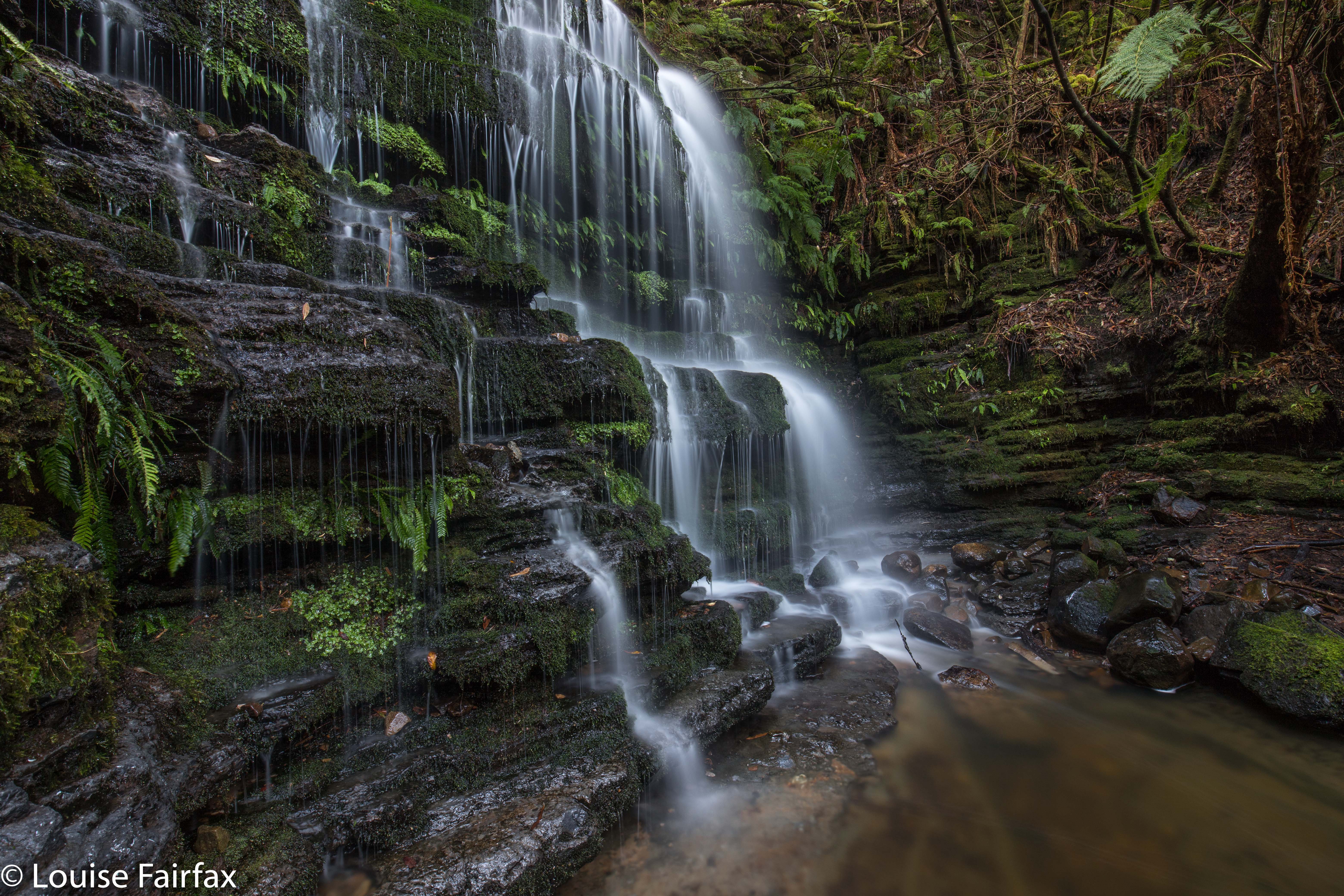
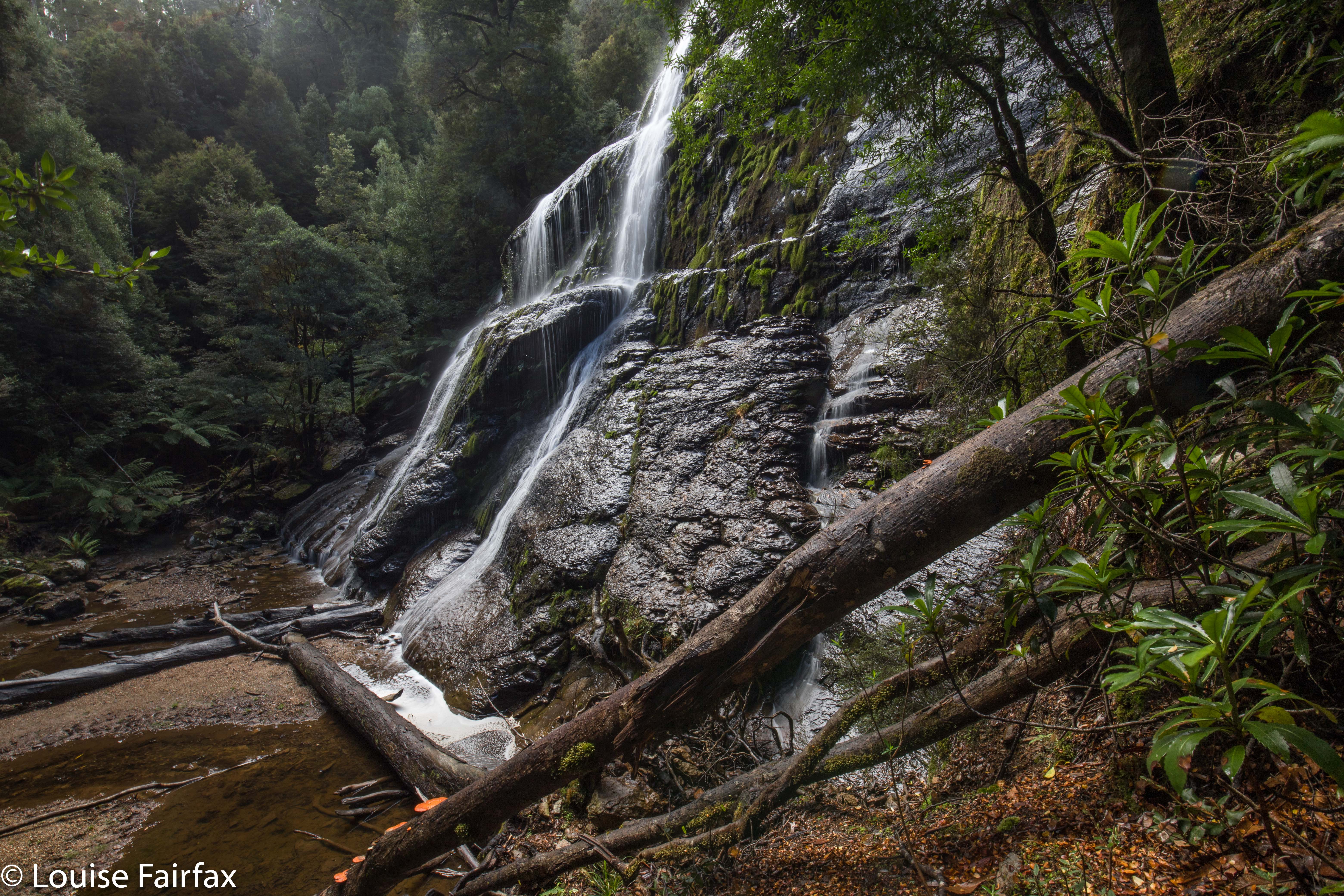
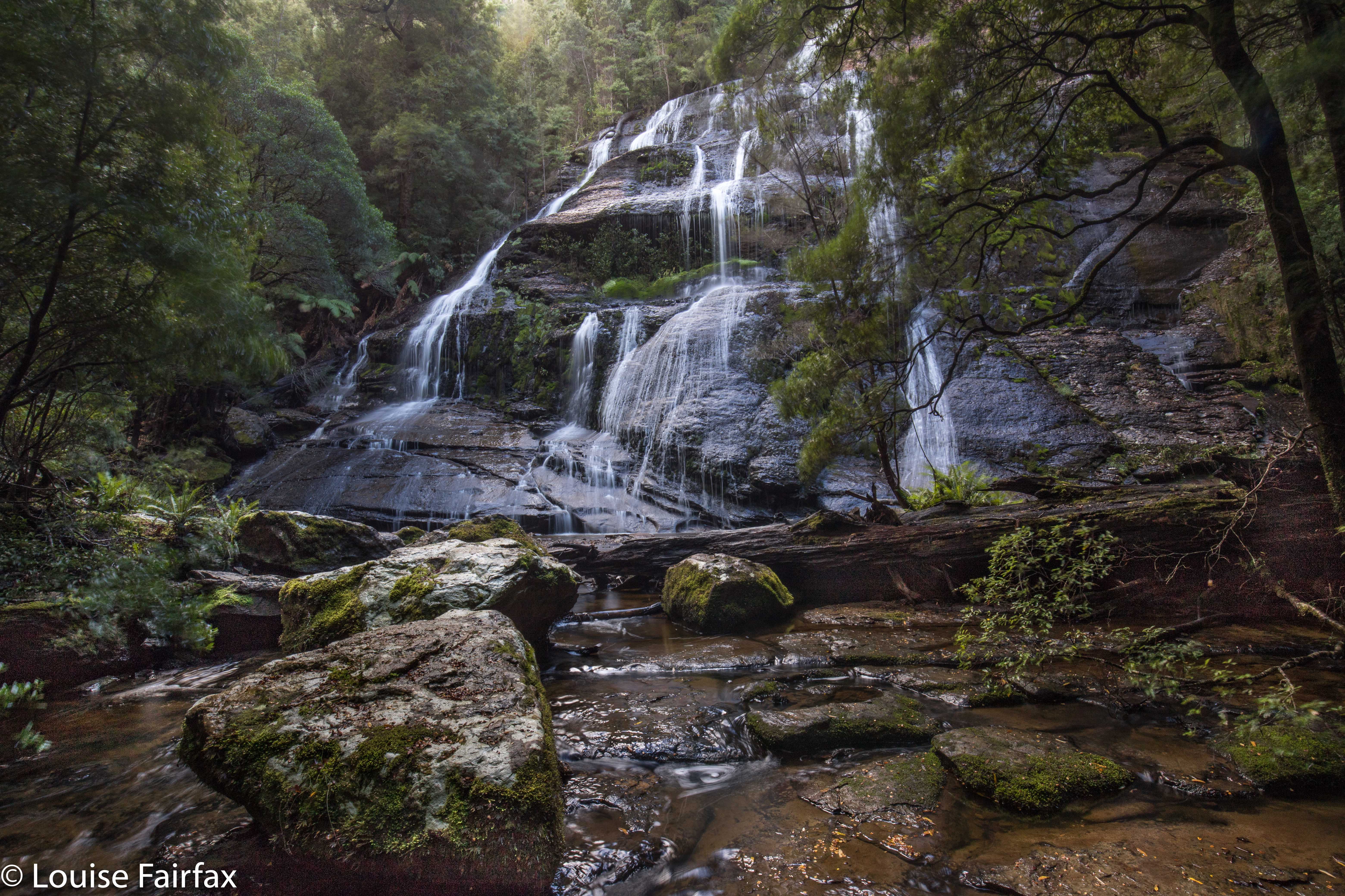
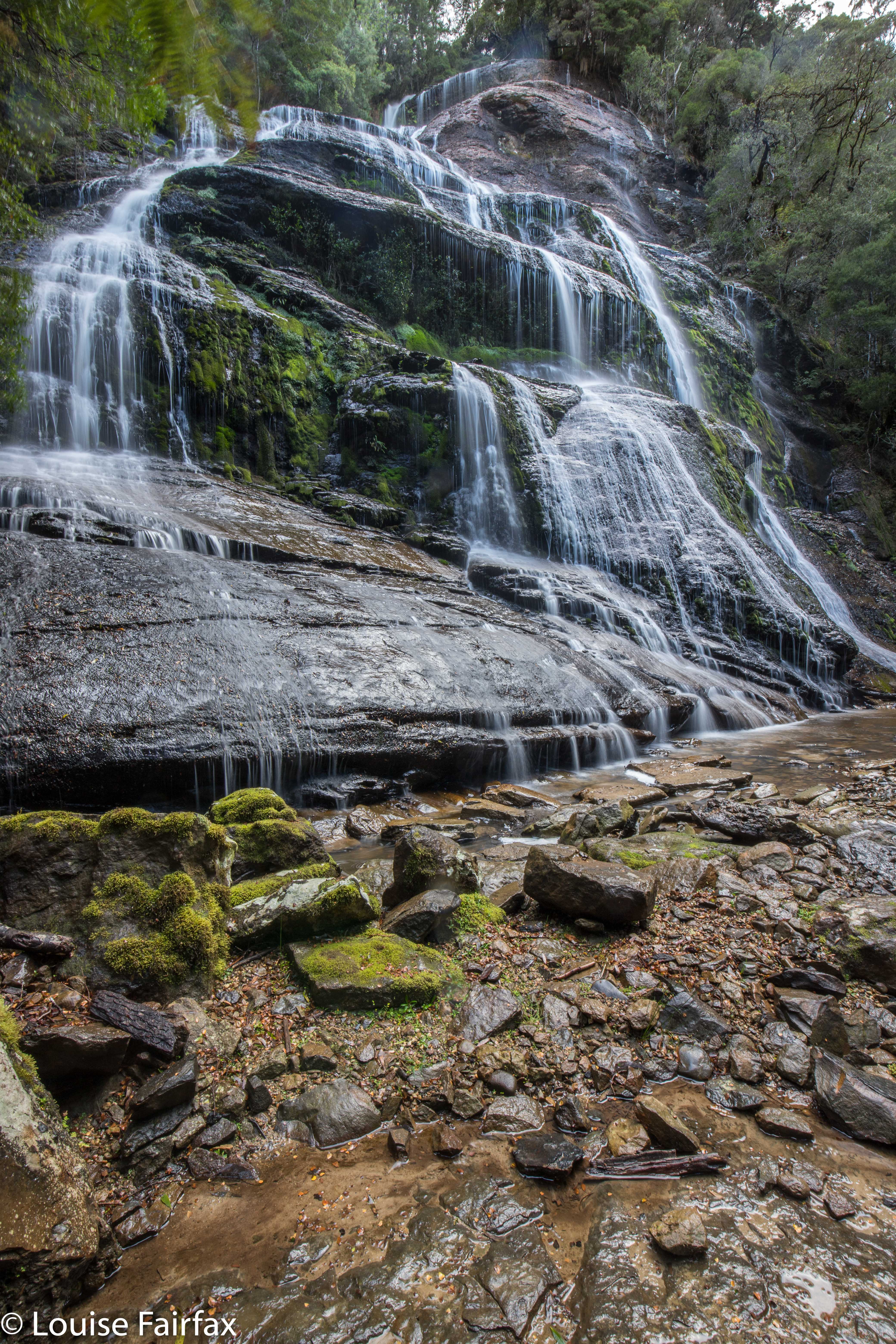
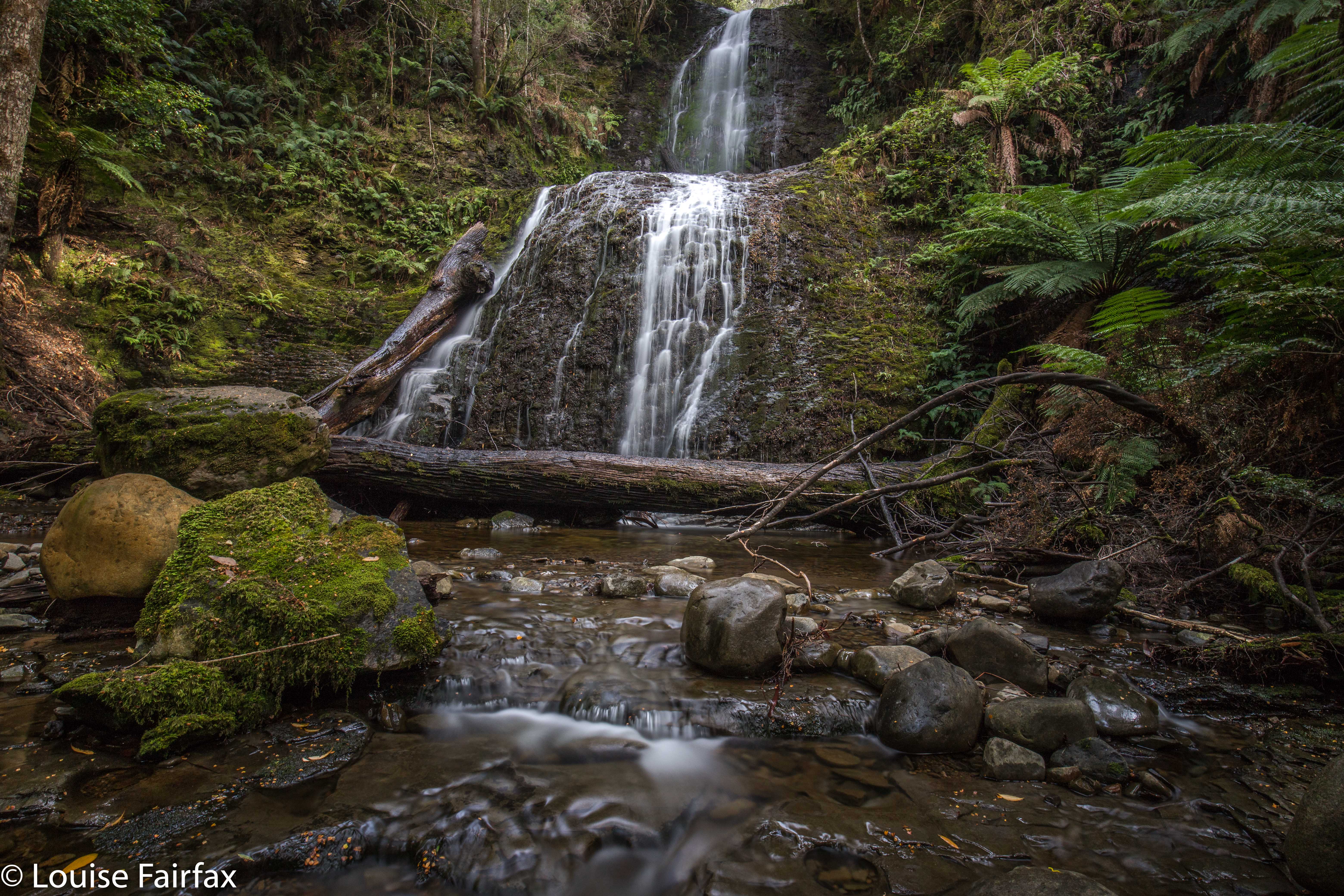
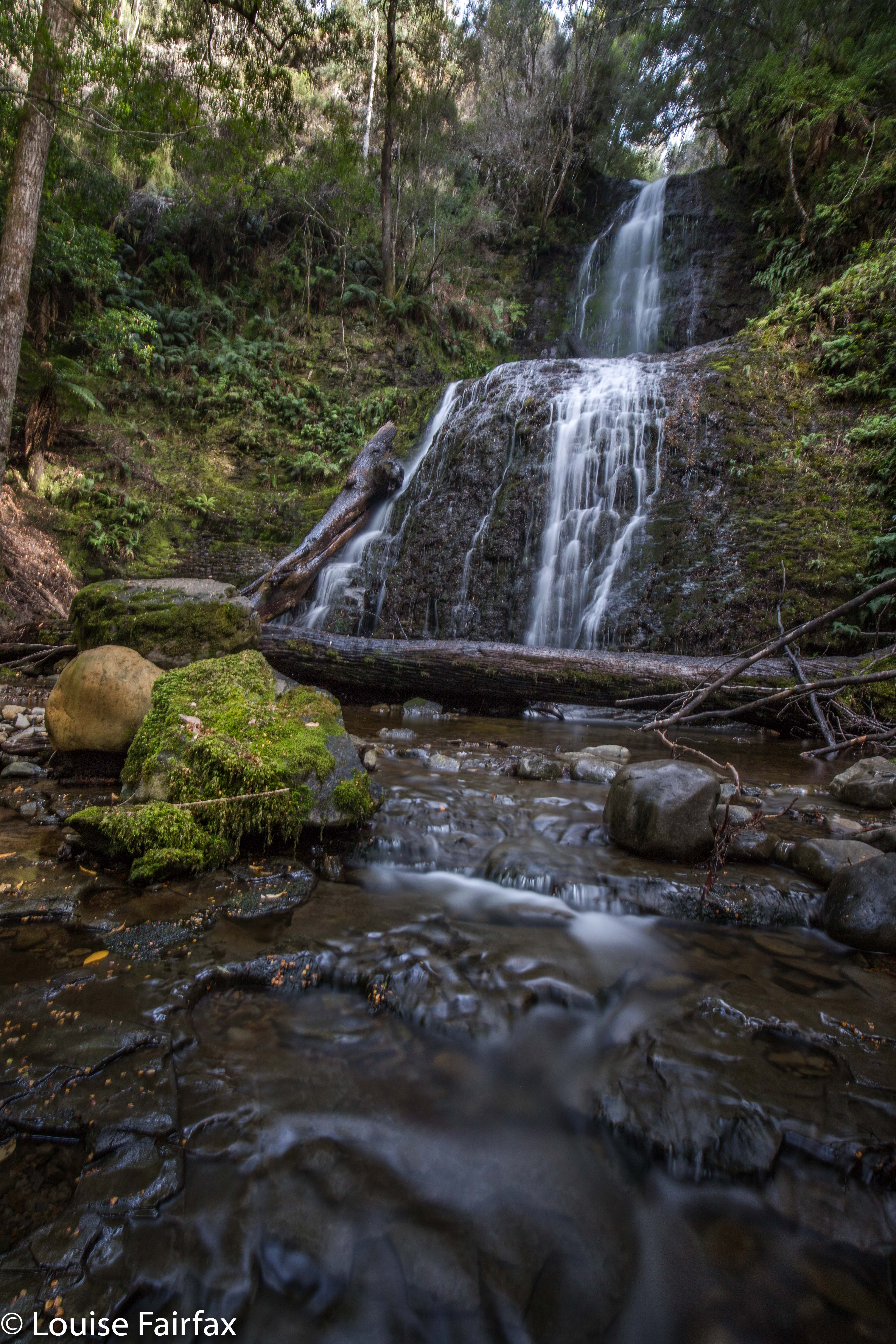
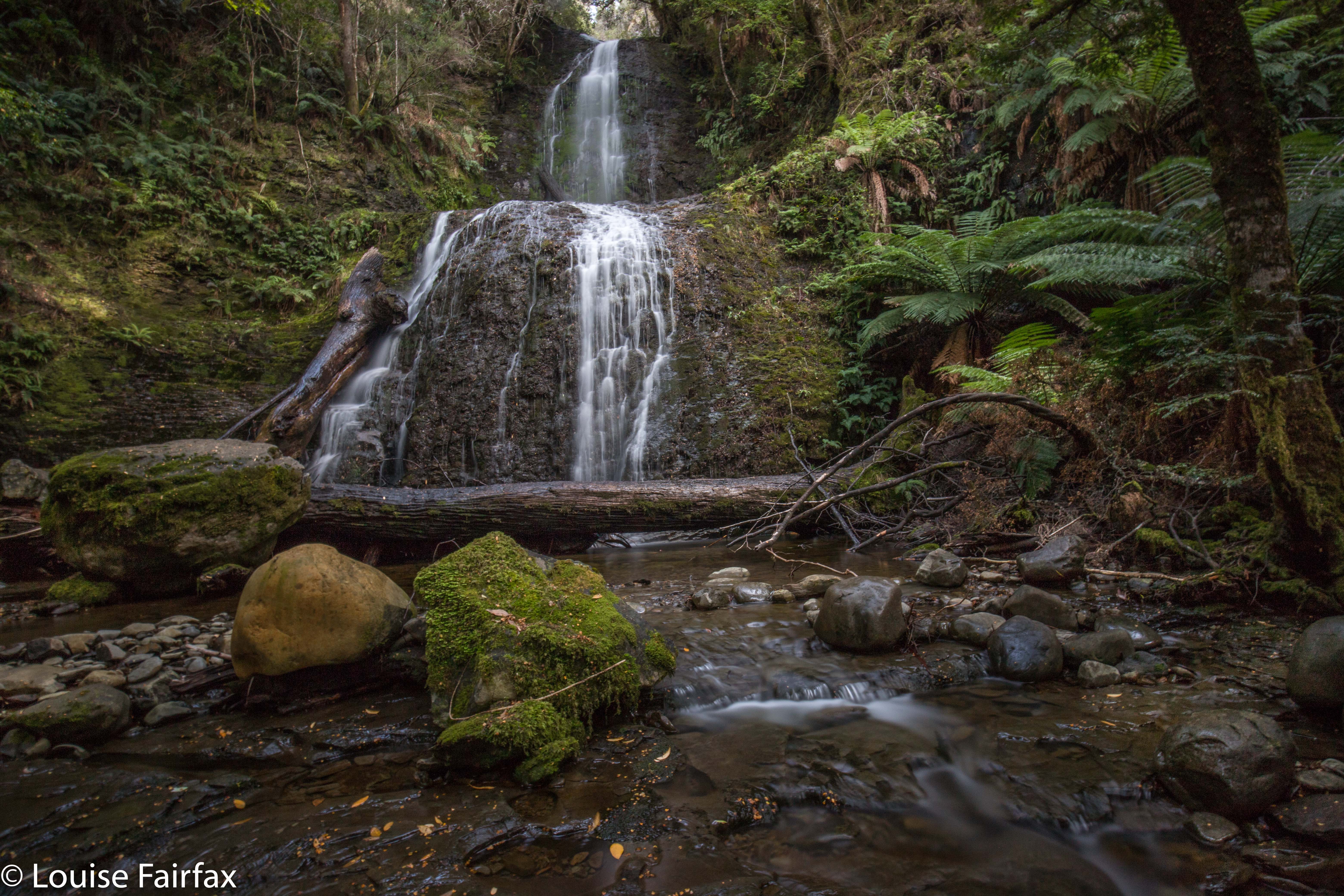
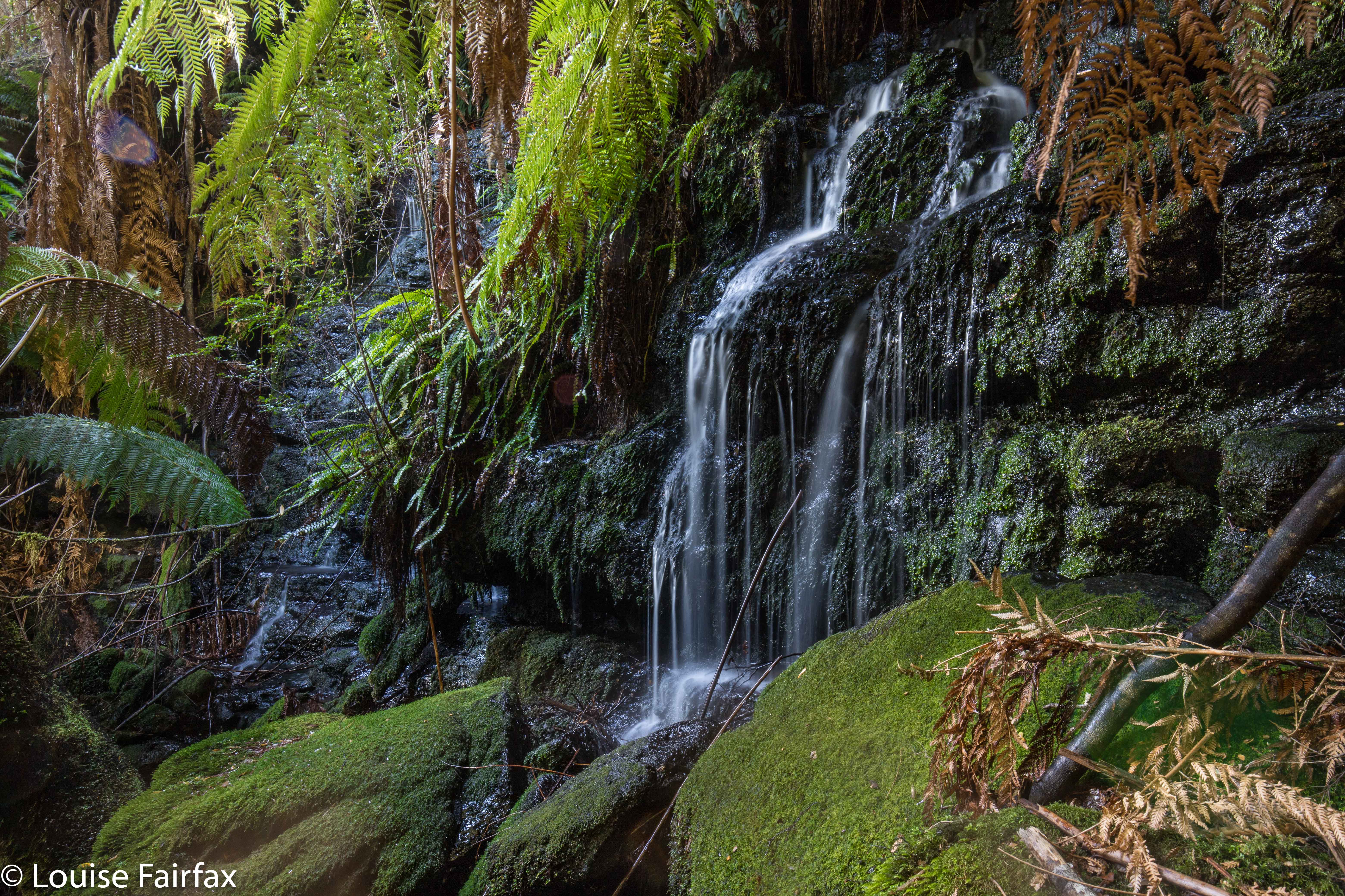
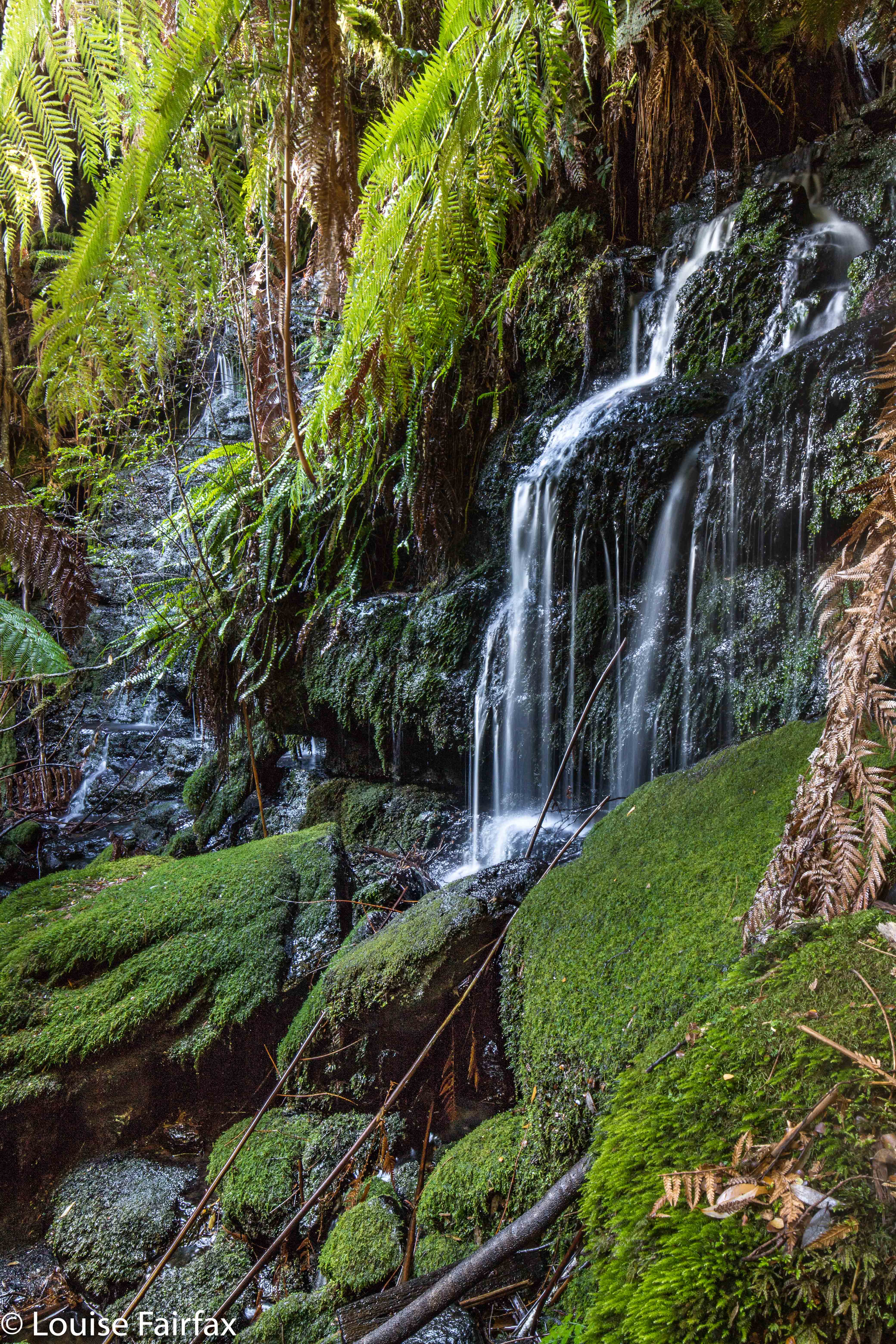
This was my third visit to Myrtle Gully Falls, but the first time that I have found any water worth finding, and thus the first time I have seen them looking like a waterfall rather than a dainty and elegant trickle. I loved them today. Thank goodness I was scheduled to be in Hobart on a “good water day” (much better than a “good hair day”).


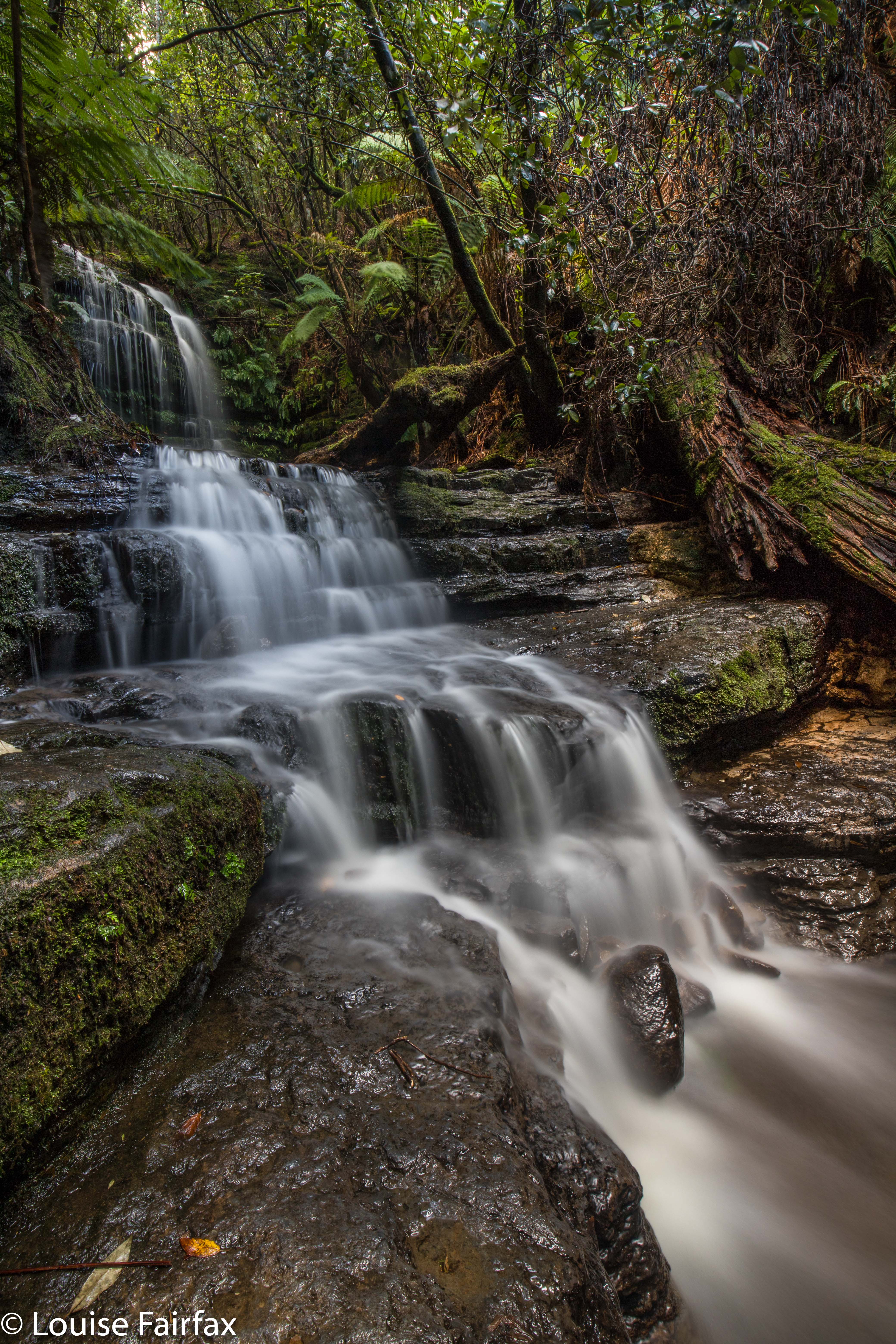
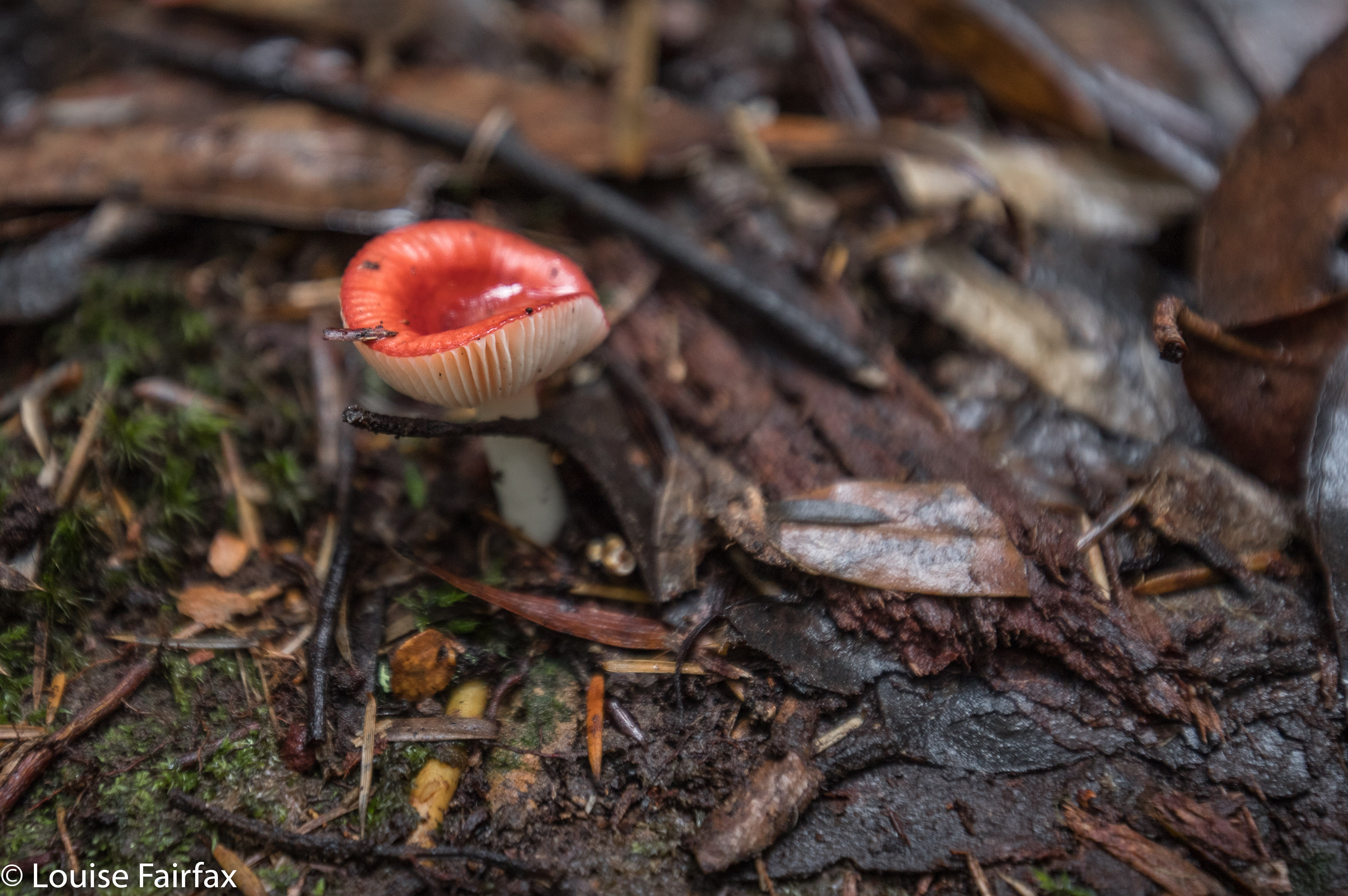
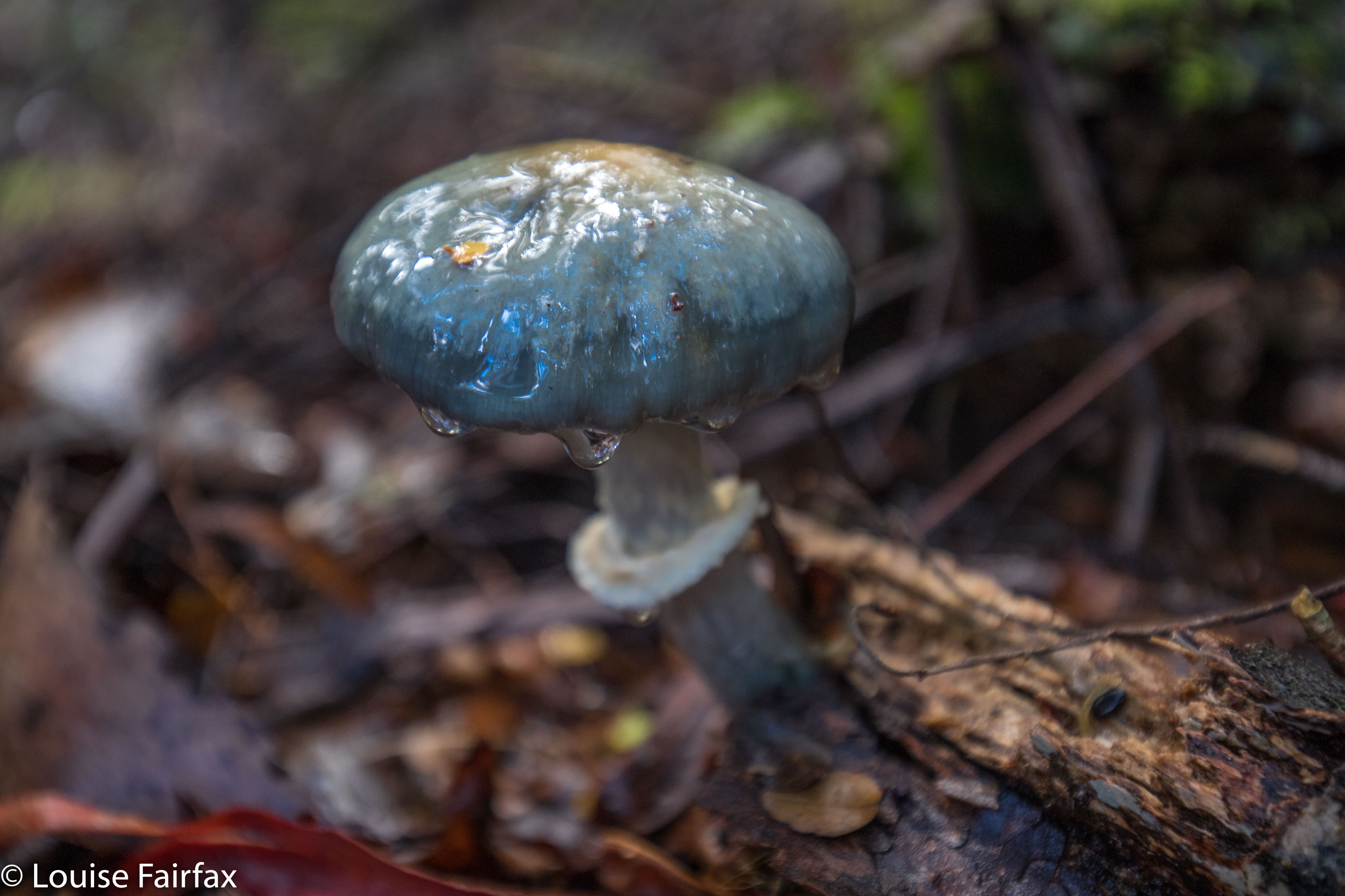
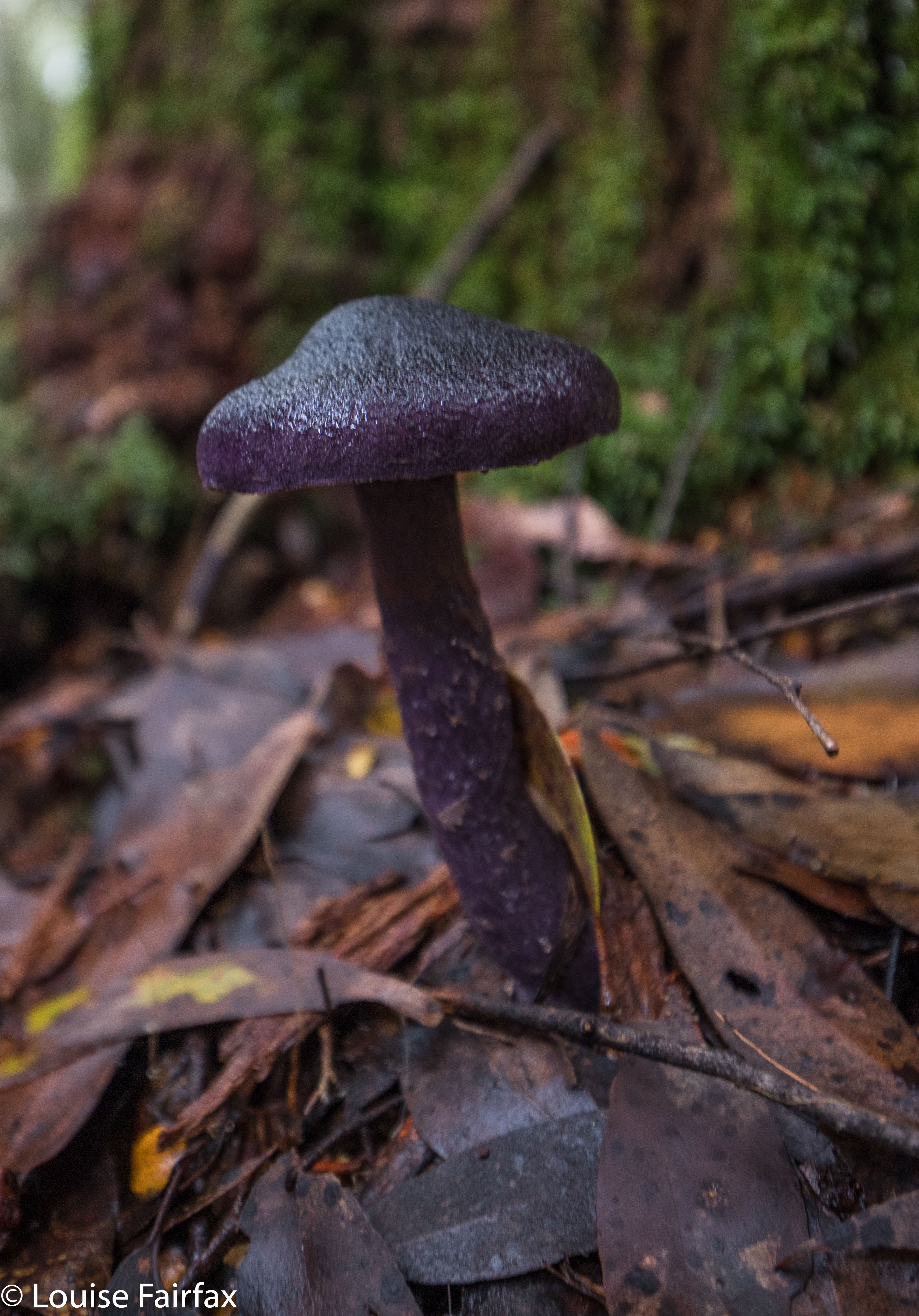
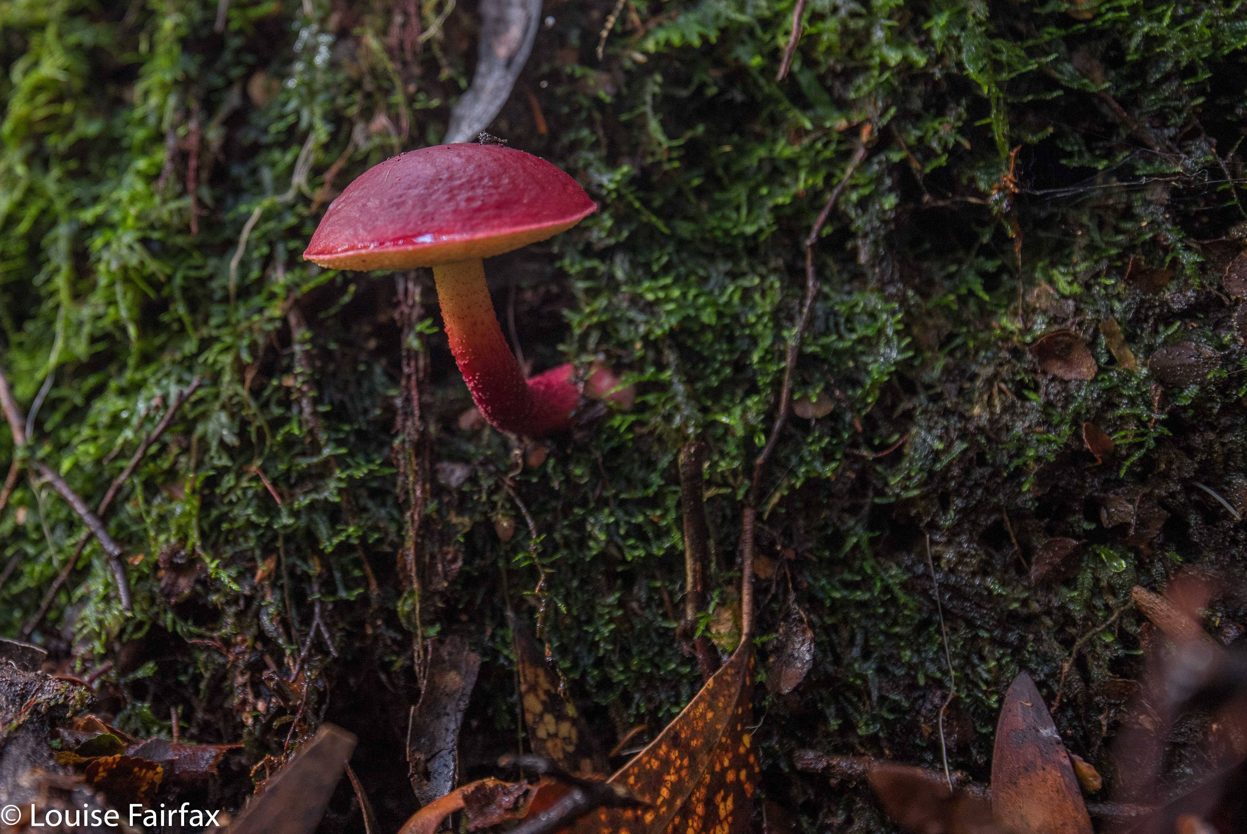
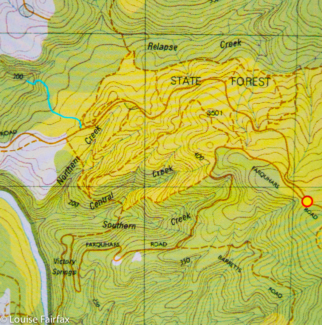
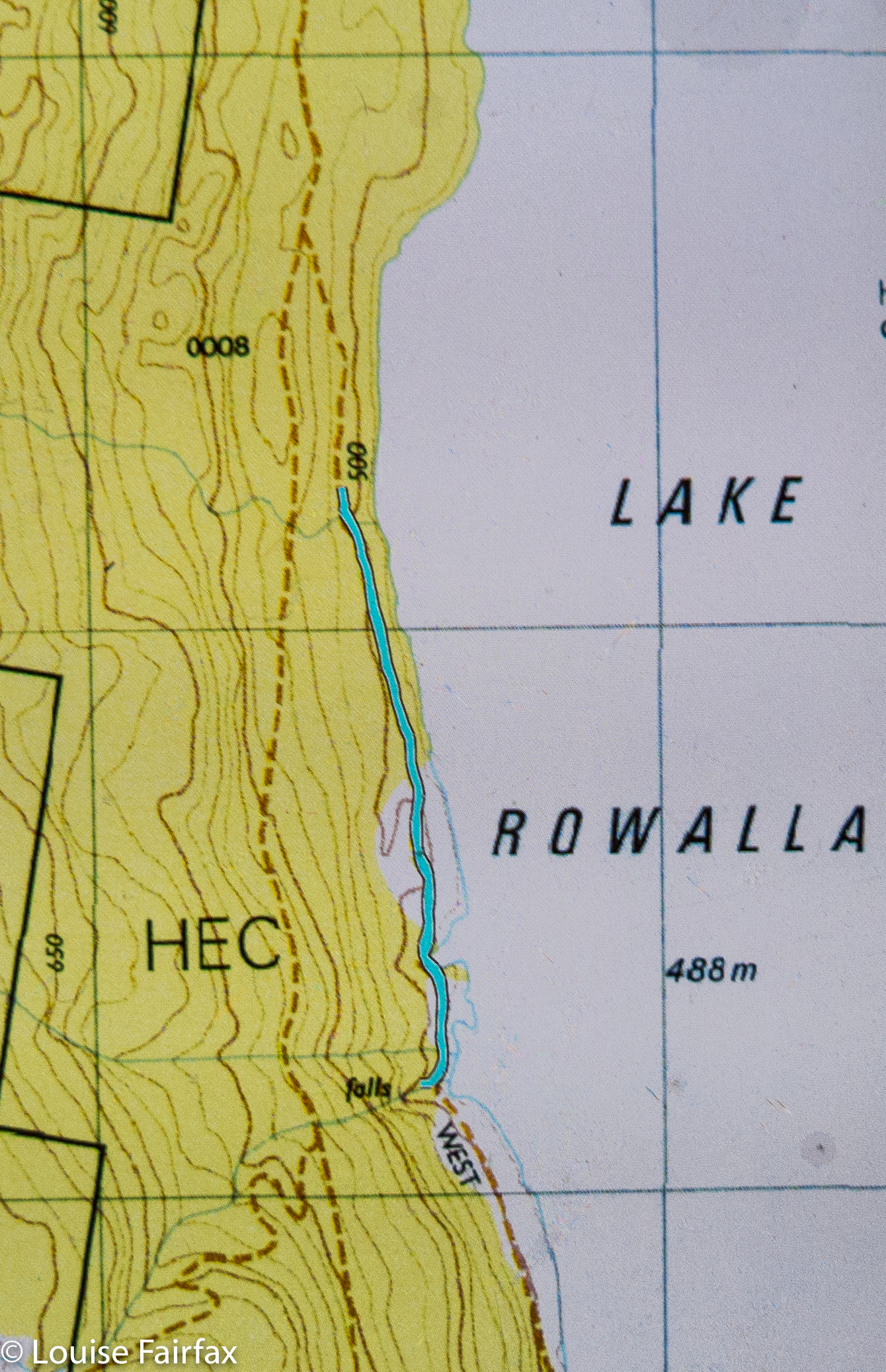
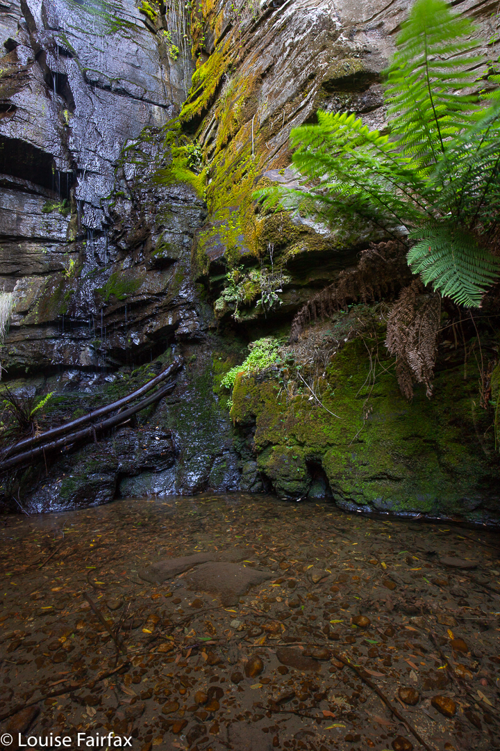
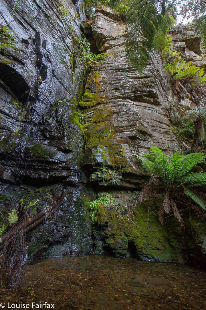
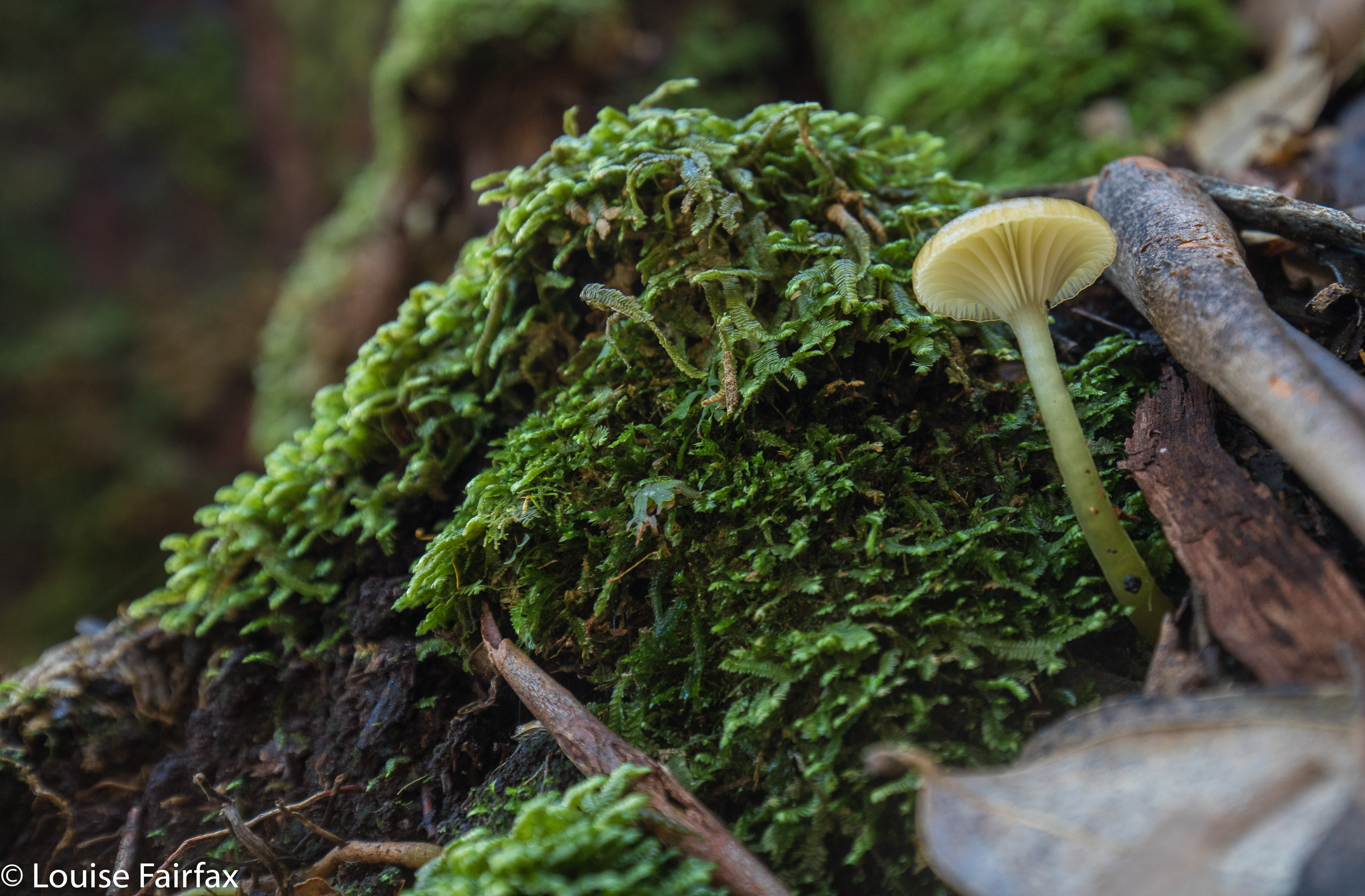
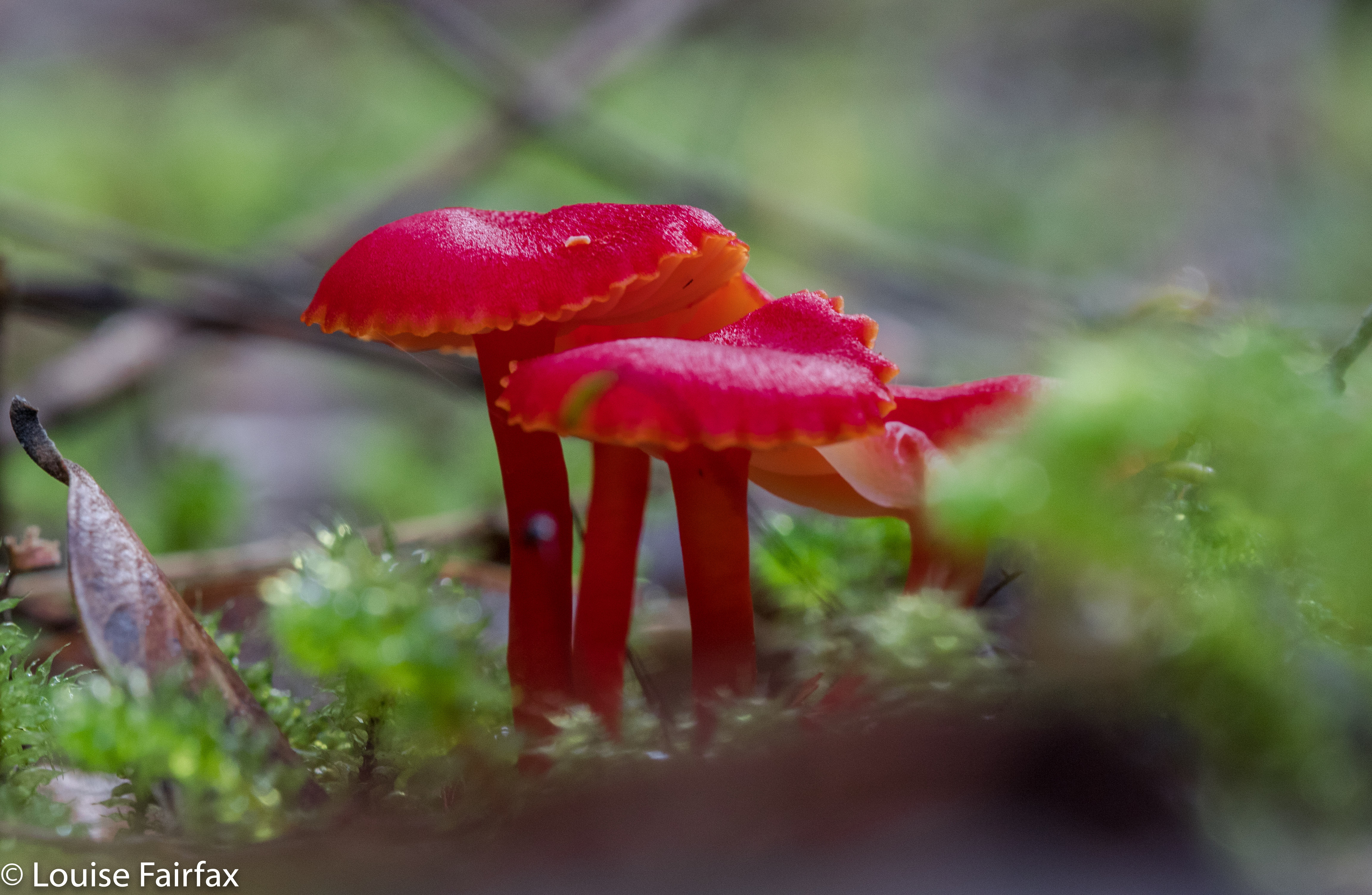
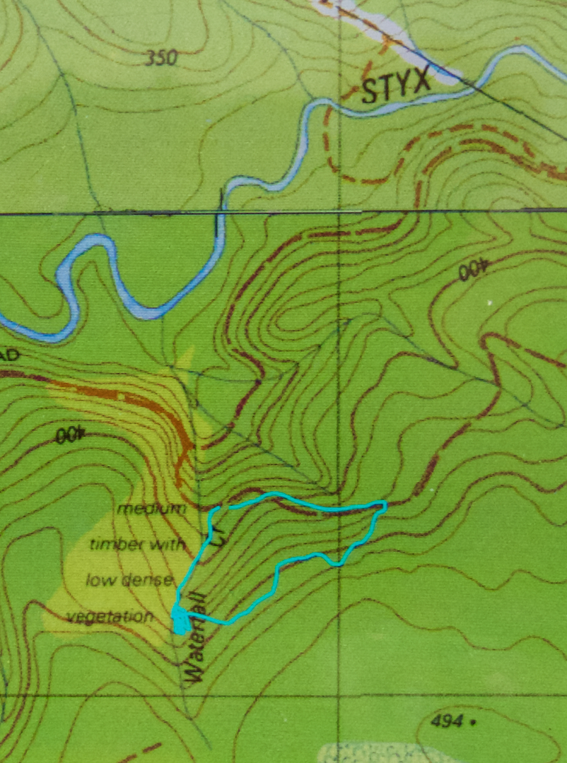
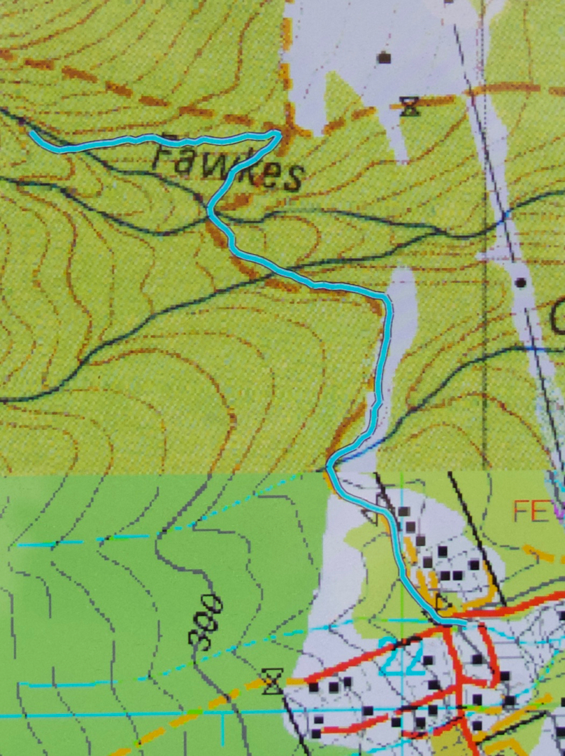
The walk is not long at all, so barely constitutes exercise, but is a nice little hike, nonetheless, even if the duration is rather short (I took eighteen minutes in each direction). I began at a right-angled bend on Strickland Road (the main road curves left going up the hill; I went through a gate, and followed a dirt road slightly uphill). It is signed as “Main Fire Trail” and leads up and down three times until it intersects with another trail that you see coming in from below right before you see that it continues up the hill (Guy Fawkes Track). Head left up the hill, and soon enough, this small path through lush green forest with moss and tree ferns swings back towards the creek that contains the Myrtle Gully Falls (Guy Fawkes Creek). The path crosses the creek at the falls. It is lush and peaceful, and a lovely place too spend an hour or so.


Apparently this waterfall is about to get a new, aboriginal, name. When it does, I will add it in here, but as web information and local lingo both use the traditional name of Myrtle Gully Falls, I will not be deleting the old name. It may not be on the LIST map, but it is the name by which the falls are known at present. We can’t communicate with each other if we don’t call things by the same name as each other. We will enter a period of transition when the new name comes into being, as people will still continue to use the name they have always known, even if DPIPWE has not chosen to bless it by putting it on the map.

McGowans Falls 2018 May

McGowan Falls, May 2018.

I had for some reason expected McGowans Falls to be a little like Lillydale or Liffey Falls, with signs, paths, picnic tables and so on. I was thus rather  surprised to discover that there was not one single direction post to the falls, no road names to give you a clue where you were, just in case you had doubts, and no “arrival status” save for a little cairn with some adorning pink tape. (Not necessarily complaining: just noting. I neither want nor like infrastructure at my falls). If you look down the track, you can see some orange tapes for variety, and even two discarded beer cans hanging in trees in the first three metres to alert you to the fact that you are there.

Russula persanguinea
The fact that these falls are not “maintained” means that the pad is an aesthetically-pleasing bush route; there are no metre-wide, levelled-out paths of fake material so you don’t slip; no handrails, and, oh joy, no bridges made out of that plastic stuff Parks now favours – and no viewing platforms to ruin the place. There was not even any rubbish. Weee. It had a magic feel to it.

Off you set down a track wide enough for cars for a couple of metres, and then you hang a left (taped) and your track becomes a narrow and appealing route through a rain-forested fairyland along to the top of the falls, and then down a steep climb to the bottom if that’s what you want. It’s not a big walk: it took Carrie and I twelve minutes to get from the car to the base of the falls. It took a LOT longer to come back up – not, as you might think, primarily because we were going upwards, but rather because we had agreed that we would go straight to the falls and then shoot fungi on the way back out. That took a VERY long time.


Cortinarius rotundisporus

Cortinarius austroviolaceus I think. If you know better, please advise.
And how do you find the magic cairn that begins this mini-adventure? Turn down the road immediately to the west of the Cam Bridge (A10. W of Burnie), and travel on it to Yolla. There, turn right heading for Takone on what is, or at least becomes, Farquhar Road (not named as such). Stay on this as it goes through “West Takone” (nothing there) and on for a few more kilometres. Ignore the (right hand), northern-pointing Pruana (unnamed / unsigned) Road, and drive until you reach an intersection that is the shape of a fairly narrow Y. Now you turn right to join Relapse Creek Road, not that there is a sign that informs you that this is the case. I marked this intersection on my gps to be doubly sure that I was where I wanted to be and turning right off Farquhar Rd at the right spot. Once you are on Relapse Creek Road, you don’t have too far to go (maybe about a kilometre) until you see the cairn and tapes on your right. The waterfall is on Relapse Creek, downhill to your right. The route from the top of the falls to the base is not for the faint of heart. There’s one “delicate and interesting” ledge section that should be avoided by people not used to negotiating such things.

Boletellus obscurecoccineus

Old House Falls 2018 Apr

Old House Falls (by Lake Rowallan), Apr 2018.
Old House Falls looked nice and simple on the map. I checked with a guy who’d been there the day before as to whether I could get my car along this road, and he said there’d be no problems. Blissfully ignorant, off I set, along the usual Mersey Forest Road I know so well from bushwalking. But, instead of crossing the Mersey and going down the normal, eastern side of the lake, I continued on the western shore, as per the map I had: on and on and on and on. Like a kid who keeps asking its parents: “Is it time yet?”, I kept consulting my map as the road got worse and worse. Is it time yet? SURELY it’s time by now. Na, came the inevitable answer each time. Not warm yet.


The pot holes got deeper, the stony bits rougher, the mud sections slipperier, the ponds I drove through murkier. How deep were they? I almost closed my eyes so I wouldn’t see my own accident as I drove through, hoping I wasn’t going to drown myself or my engine. I have a Subaru AWD, not a huge 4WD. This was nauseatingly scary. I was by now miles and miles and miles from any help should I need it, and it looked like I would need it very soon. Lucky I can run long distances. I could see a very long training run for help coming up. Tessa was pleased. She likes that.


Eventually, I came to a creek I was supposed to drive through with steep banks (for me) each side. Enough was enough. My adrenalin levels were now through the roof. I managed to execute a hundred-point turn, and, convinced NO person in a quarter of a right mind would come this way, decided a skinny car could get by, parked, and off I set. I had 1.6 kms to walk until the creek I wanted, Old House Creek. The Falls would then be about 60 metres to my right up the hill (west). The foot bit was glorious. I began to relax and enjoy the view. Why hadn’t I abandoned my car and given myself peace of mind earlier?


Just before the falls, I saw a claret coloured ute. Amazing!! Someone had got that car all the way there. It must be an abandoned car, its owners too scared to drive it out, I figured. On I went to the beautiful falls and photographed them. Just as I approached the area where the claret ute had been, I saw it leaving. Oh no. It was too fat to get past me. I waved and called. They drove slowly but continued on. Had they heard me? Oh well. The walk had taken thirteen minutes. If they took four to drive it, they wouldn’t have to wait ALL that long. On I pressed.


As I neared my car, I saw two guys, brandishing axes. Luckily I am not suspicious or paranoid, and so did not think the axes were intended for retribution delivered to my car, or, worse, to be used to punish me for being an inconsiderate twod preventing a normal citizen his right of passage. They assumed I’d broken down (how generous and kind of them) and were just going to cut their way out. Instead, I drove, with them as my backstops, until the danger was over. They, too, were waterfall baggers, so we all sat by the lake once we’d finished with mud-slides and driving through lakes of unknown depth and over fallen trees, and had a lovely time eating and chatting whilst staring at Clumner Bluff perfectly reflected in the waters of Lake Rowallan. You’ve no idea how unscary the road was when I had a backstop. Thanks to Shane and Ed, I even like these falls, and now I’ve got over my “beginner’s angst”, I may even go back one day to check them out when the flow is bigger.

Coalmine Creek Falls 2018

This blog is here for records’ sake. I got permission to go here while the former owners were in possession. However, a 2019 post script is that the private property has now changed hands. I have no idea at all as to the new owners’ willingness to have people look at the falls. They still have people staying there, and those people can still go to the falls, so theoretically there should be no issue, but Australians live in constant fear of litigation these days, so you never know. When our magistrates and judges stop awarding damages to people who sue totally innocent owners of land or minders of the surf, then we might all live in greater kindness, harmony and generosity. That day has not yet arrived.

Coalmine Creek Falls Liffey

There is a path from the little cabins going up beside the creek. Even in 2017 there were fallen trees over this path from the earlier storm, so there’s a bit of clambering to do. Not a waterfall for the agility-challenged.

Tolkien Falls 2018 Apr

Tolkien Falls, Apr 2018.


I came upon the Tolkien Falls quite by chance. Perhaps it’s embarrassing to admit it, but I was trying to find Regnans Falls at the time. I was following instructions that said to go to a Big Bend, so I went to the biggest bendiest thing on the map past the Big Tree walk on the Styx Rd, parked and walked my way through beautiful forest up the stream. The instructions said the falls should be twenty-five minutes away. At twelve minutes, I found a waterfall. I’m normally fast, so was only vaguely perplexed. The falls were smaller than those in photos I’d seen, but they were taken in winter, and lots of waterways are not pumping at present, despite recent rain.


I did find footprints once there AND a pink tape. The instructions had mentioned pink tape, but I found none until I was at the falls. As with Regnans, you could climb up the right hand side (others had done so), and there was more tape there. In fact, I could see a line of tapes, so, being a curious person, I decided to follow them. They took me past “Gandalf’s Staff” and lots of fungi, and eventually, back to the road six minutes’ walk from where my car was. This return forest section took me fifteen and a half minutes (plus the six along the road). It made for a thirty-four minute circuit before you add in an hour for photography (falls and fungi).


The last thing I saw before joining the road was a sign that said “Tolkien Track”, so I have dubbed these the Tolkien Falls. I then tested the only other bend on offer, you know, just in case, and found the falls I had been looking for in the first place, but am very happy to have added these serendipitous falls to my growing collection of photos and Tasmanian waterfalls. Unlike the case with Regnans Falls, the map does inform you that there is a waterfall on this nameless (but now called by me Tolkien) creek.


If you continue along Styx Rd past the Big Tree Reserve Walk, past the sign that tells you there will be a boom gate and you’re to go back to Maydena without collecting $200, and past where the road splits (take the upper fork), then the next bend, a very short way (100 metres?) further on is yours. Walk up the road for six minutes until you see a cairn and pink tapes on the right, and a path leading into the forest. A little sign in the forest will tell you it’s the Tolkien Track. Enjoy. (Then you can do the Big Tree Walk, and the Styx River meander, by which time you’ll be needing some food.) (To get to the Styx Rd, turn right a few kms past Maydena. There’s a big sign.)