Alberton Falls 2018 Feb

Alberton Falls Feb 2018
The web remains curiously silent on the topic of Alberton Falls, and I am an incredibly curious person who likes visiting outré places. Alberton Falls yelled out its challenge to me: “Come and get me if you can.”
I suspected that this wouldn’t be a brilliant mission with respect to photography, but, well, you never know, and we did have a huge storm last night, with a cloudy, possibly rainy day forecast for today. Of course, seeing’s we were there to photograph, the sun shone brilliantly nearly the whole day. The aim with this waterfall was, more than anything else,  just to get there and to satisfy my curiosity. Any good photos would be a bonus.

Off we set. It seemed by the sound of things that Carrie was not appreciating walking through marshy button grass in summer heat. Early on she thought she heard a snake. I forged on, trying to pacify her by saying they’d bite me first. I don’t know how convincing I sounded. It seemed she was of the opinion they could bite either of us, and more likely her, as I had on gaiters. I kept pointing to where the forest began: “See, just there. Once we’re there we’ll be in lovely forest with no snakes.” And I was right. The forest was really beautiful, and we didn’t see one single snake. Now we could both start enjoying ourselves.

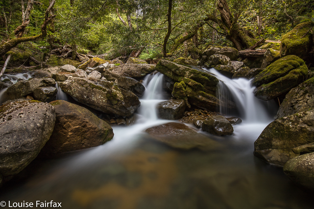
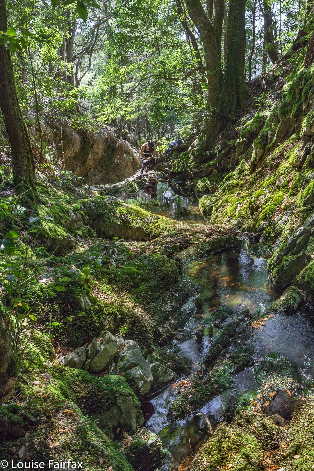
Once we were in the forest, we just followed the creek down. I spotted signs that someone had once walked this way, and Carrie, whose eyes were not so glued to the ground, started spotting old bits of faded, rotted tape, many of which were above my head in height, so I guess a kindly giant put them there. They were not to be relied upon, but that’s fine. I was navigating using the normal methods, but their reassurance was a friendly one.

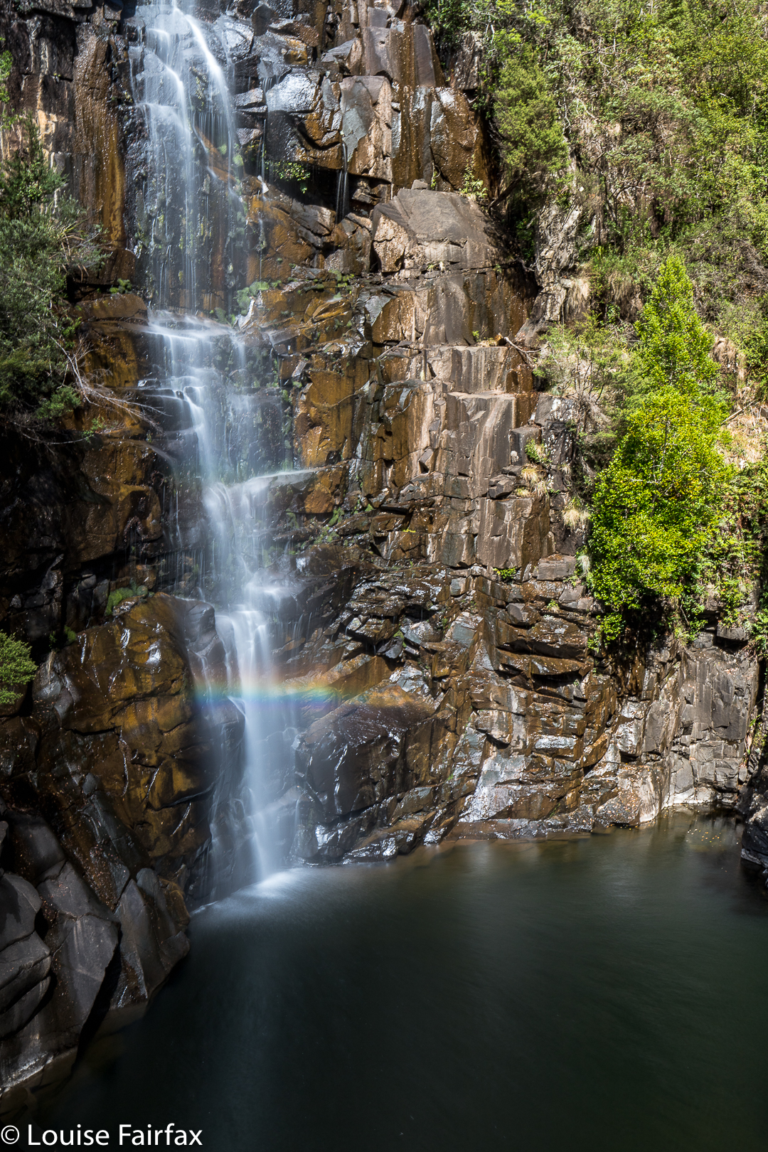
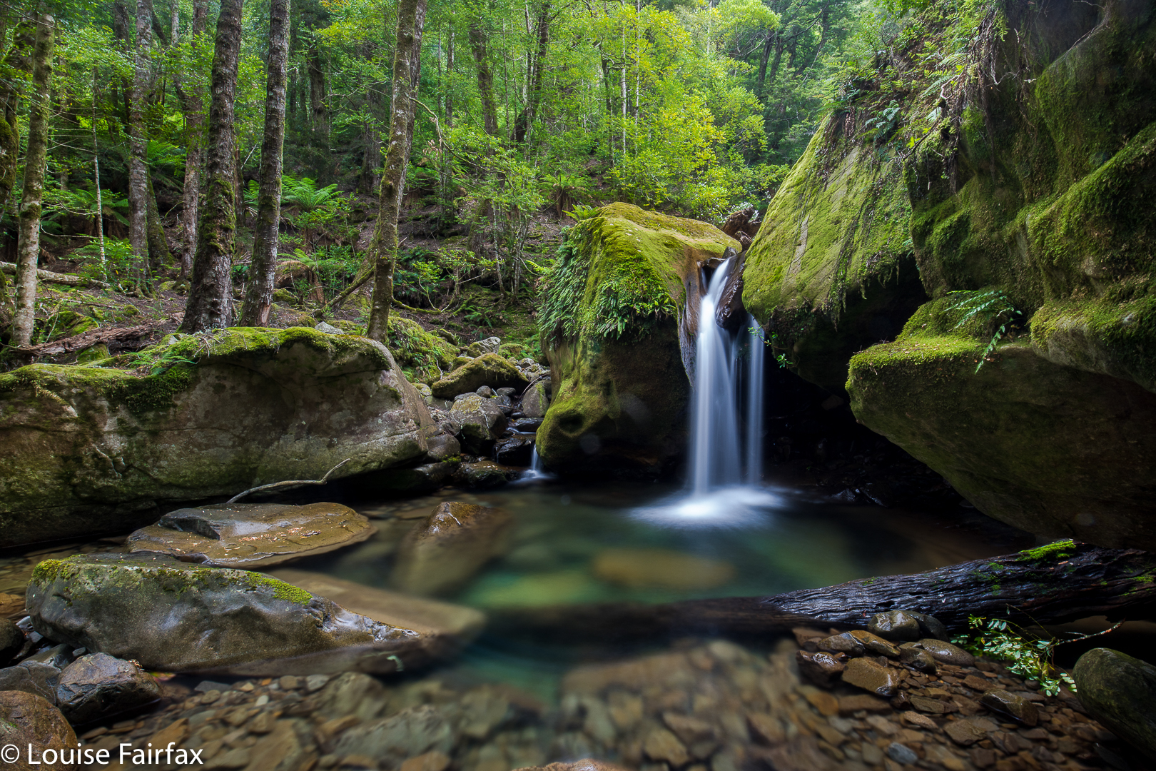
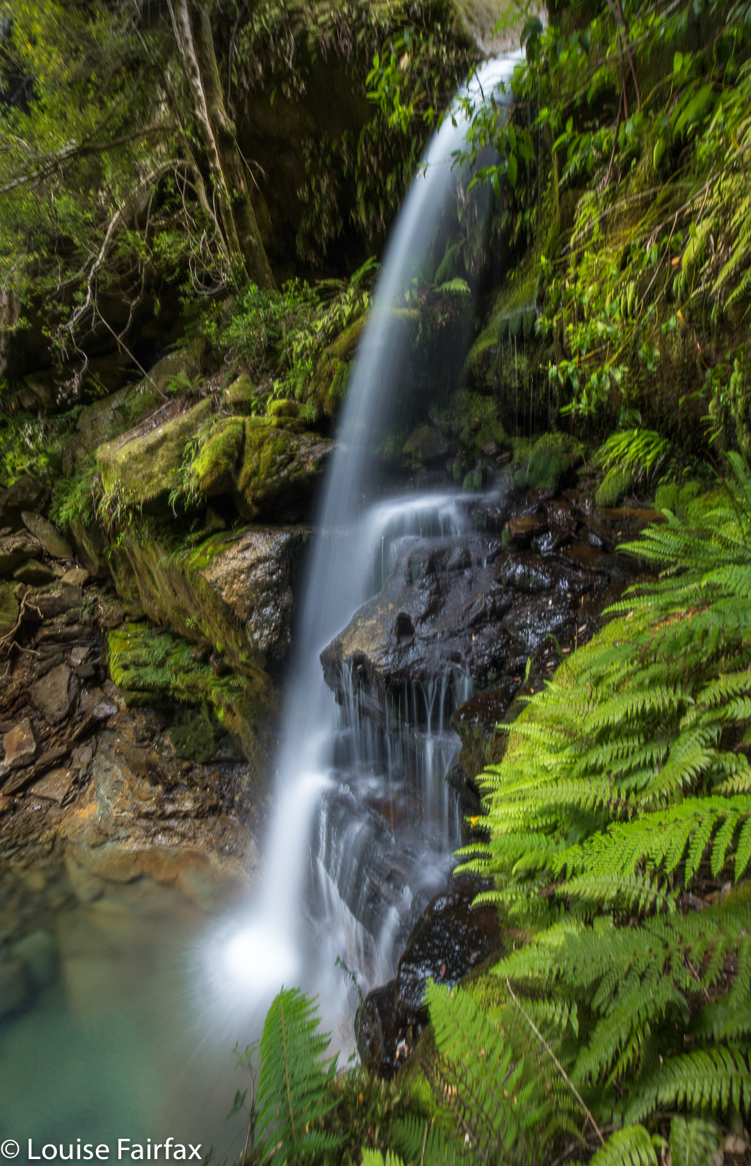
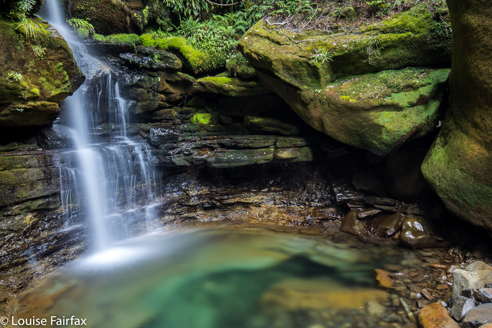
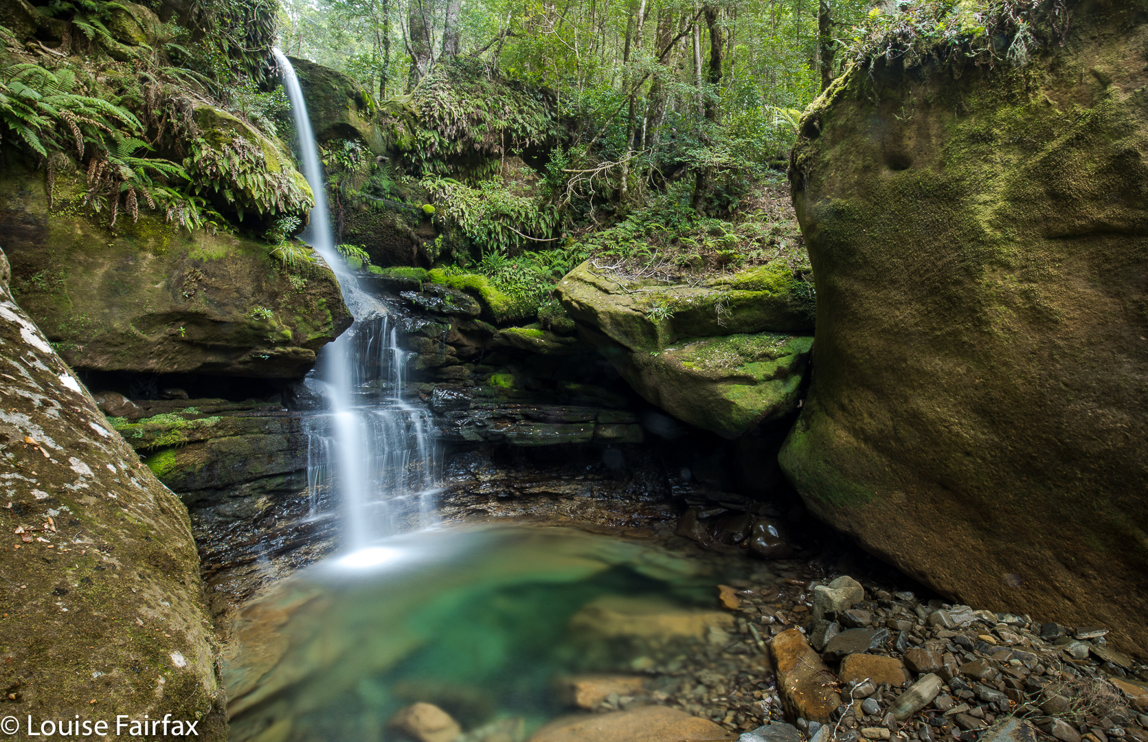
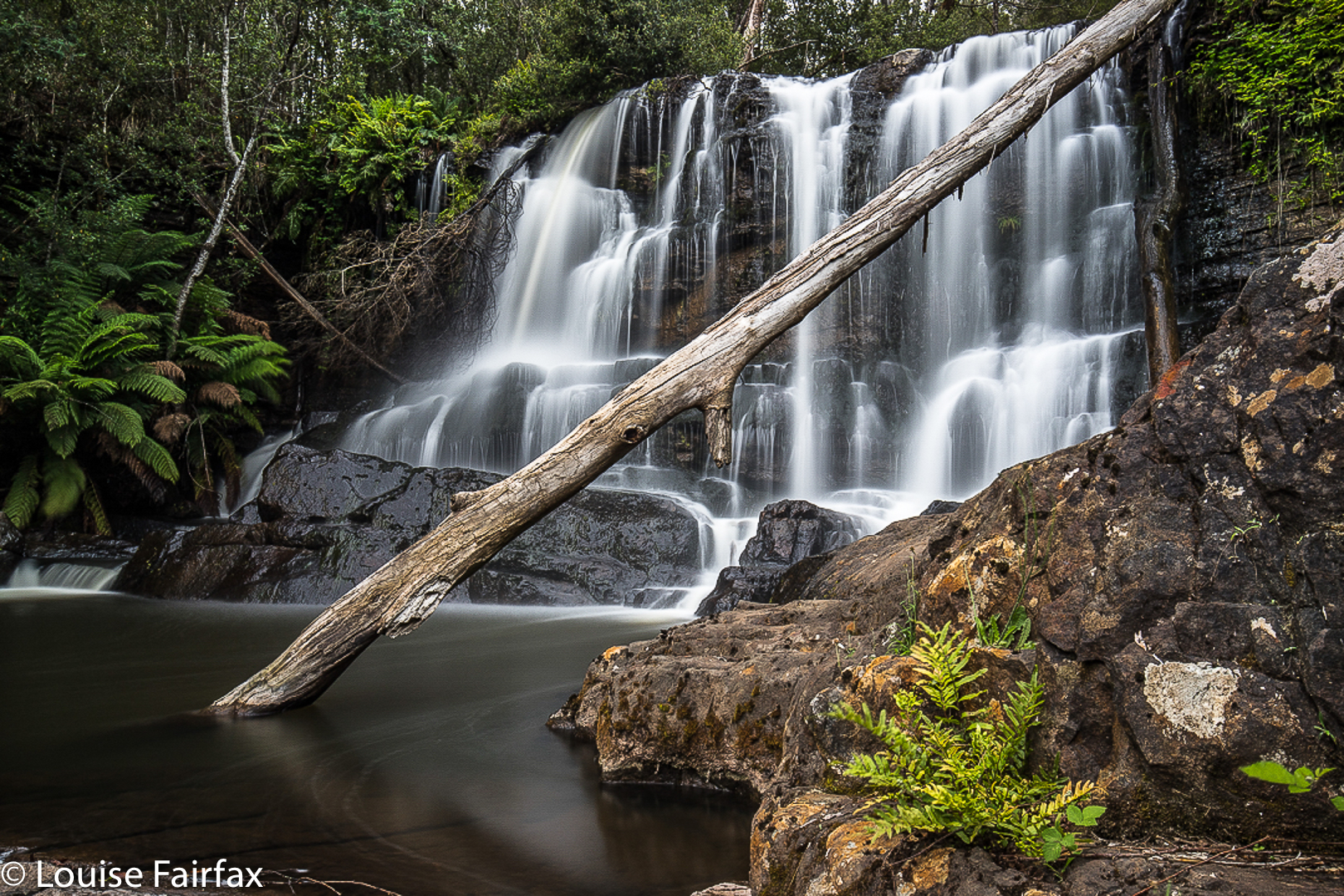
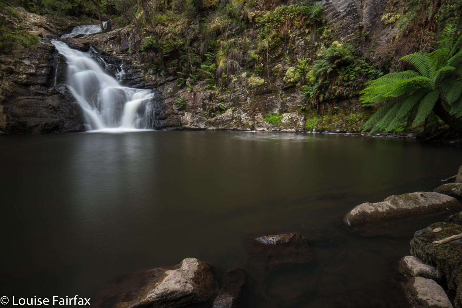
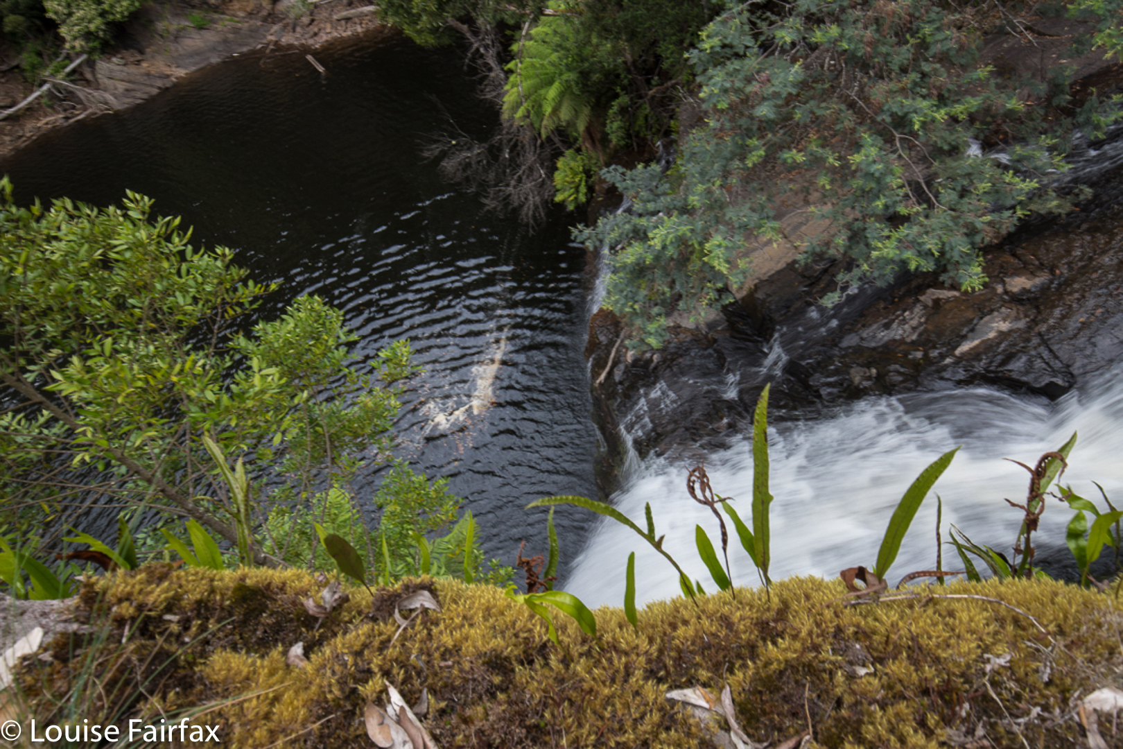
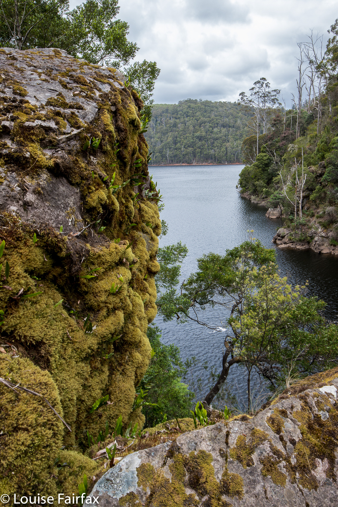
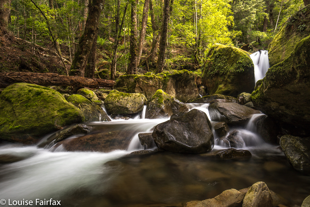
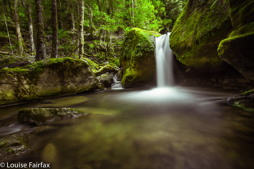
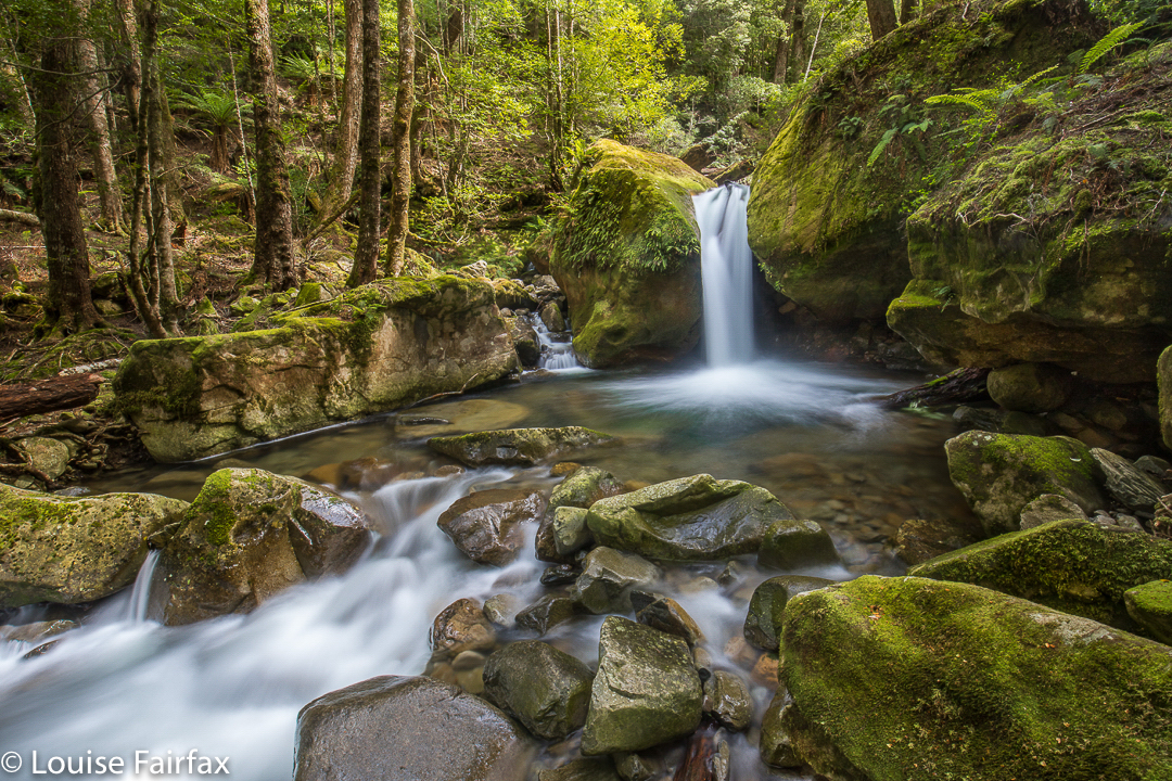
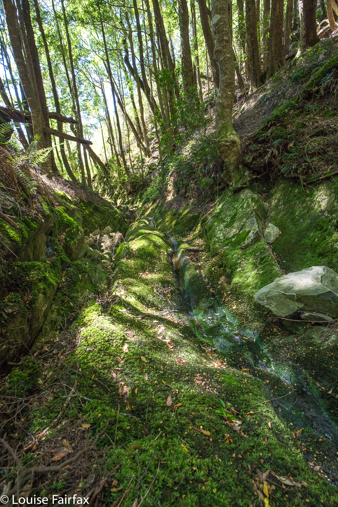
Eventually we came to the “falls” – except that nothing much was falling today. However, just as you can tell that a building was once beautiful by inspecting its ruins, you could tell that this waterfall would be a lovely one when the water was flowing. The drop away from us was huge. We looked out from where it exited the rainforest past a whopping cliff and out, out into the way way yonder. We were both determined to have some photos for our efforts, so snapped away just because that’s what you do when you’ve arrived.
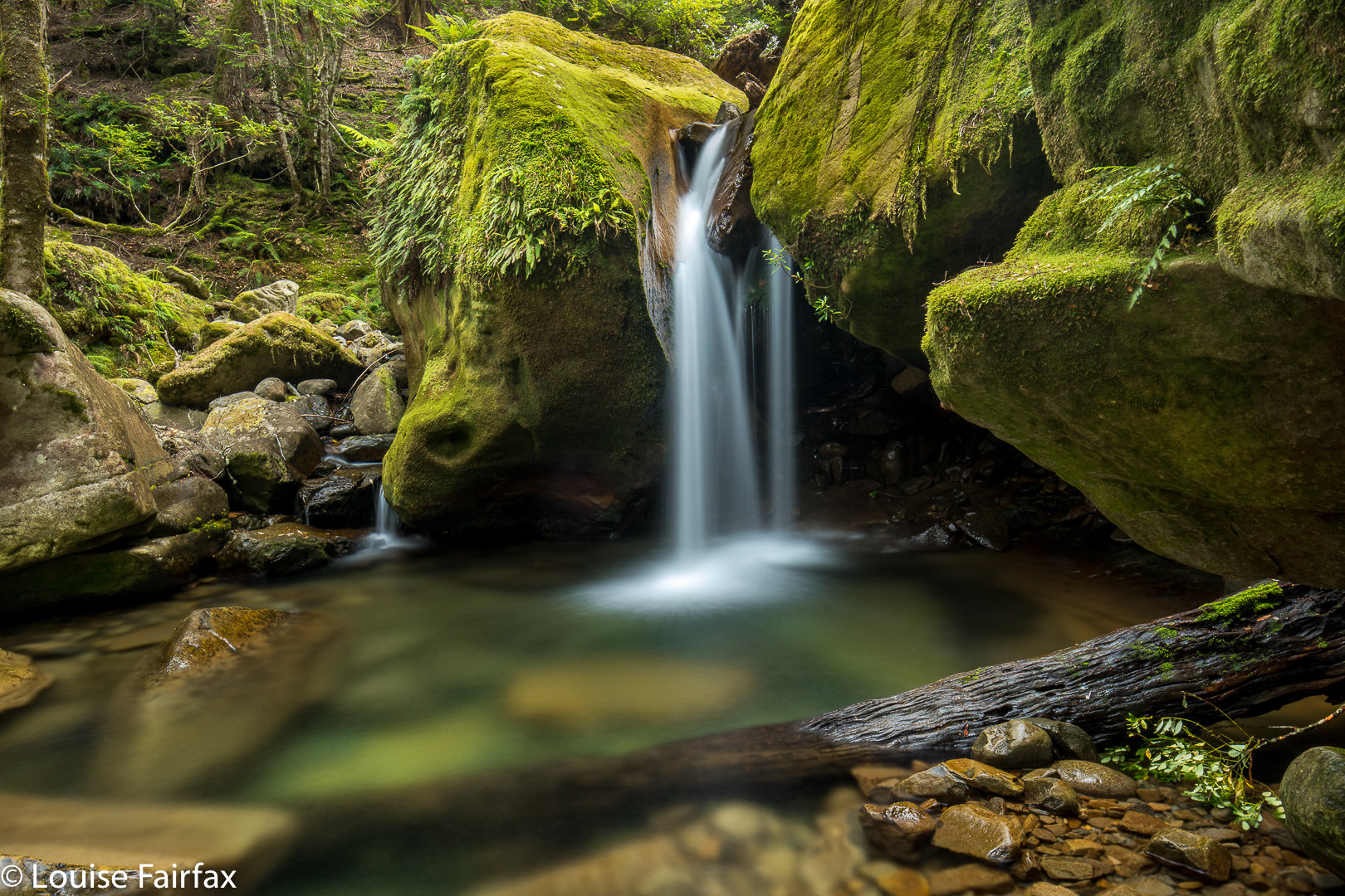
As we both enjoyed the magic rainforest, which was surprisingly open, and so beautiful that we spoke in whispers so as not to spoil the feeling of peace and serenity that prevailed, I took us on a route back to the car that maximised our time in the forest, and thus minimised our time in open land. (The crookedness of the line exists because I was using the parts of the forest with almost no undergrowth, as opposed to areas where this was not the case.) To the north, the land dropped to eternity below us. It was a gorgeous forest and a fun adventure, and we have now documented a previously web-neglected waterfall, and had the pleasure of experiencing a place that not many others have seen, one suspects.

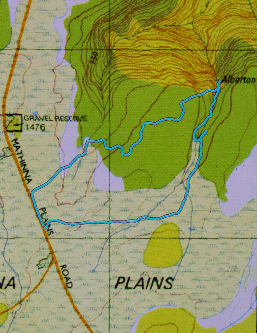
I nearly forgot to add: it took us 23 minutes to the falls, longer on the way back, due to weaving and more map consulting than on the way there.

Meetus Falls 2018 Feb

Meetus Falls (2). Tessa’s Story.
As soon as Mum let me out of the car, I was very excited: I had this feeling I had been here before with her and dad, and remembering that made me very happy. I ran here and there, sniffing, to be sure. There were some nice people having a late breakfast, so I explained to them that Mum hasn’t fed me for three weeks, and they kindly shared what they had with me.

Soon enough, Mum and Carrie were ready to go, so we went along the path that went down to the Cygnet River. I led the way, of course, as they were a bit slower. The day was quite hot, so as soon as I saw a pool in the river, I jumped straight in. That was nice and refreshing, but then I couldn’t get out, as there was this very slippery black moss, and every time I dug my claws in, they just slipped away. Mum got all frightened, which was unnecessary, as there was a full thirty centimetres’ expanse of rock before the next a big drop. Her voice got very anxious, especially when, after I finally got out of the pool, I went to the edge to see where I would have rolled if the water had carried me away. Mum seemed to think that everything was slippery, and that I should be careful. She worries about me a lot. Even she slipped a bit on the moss, so I can hardly be blamed for my problems. She called me from the edge, and on we went, heading up the river and away from where I had been last time with dad.

After a short while, we hit a sort of dead end, as cliffs came in on either side, and the water was deep. Mum and Carrie both think their cameras are very expensive, and so they didn’t want to swim. They said we had to climb a cliff, and Mum said she’d lead the way.

I got impatient, as Mum was being careful, just because the cliff was vertical and she only had a tuft of grass for purchase, which she said wasn’t very safe. She put her weight in the right position so she wasn’t really trusting the grass, and up she climbed. Carrie wanted more time to consider this, and I wanted to join Mum ahead, so I sped past her so I could help Mum see if there were any other tricky sections before Carrie climbed this one.
The next bit was actually quite embarrassing. It’s not just that I was suddenly flying through space; it was more the fact that I made such a VERY loud plop when I landed in the pool below. Mum says I need to lose some weight if I don’t want belly flops to sound like a thunder storm or a gun going off. The bang echoed around the walls. Mum said she was relieved it wasn’t Carrie, which I thought was a bit rude and uncaring, but then I realised it was because Carrie had her expensive camera.
Not long after that, Mum stopped. Now there was a big drop here. I could see that, but there was a nice, slightly sloping rock with green moss that offered an excellent view. Mum was a spoilsport and wouldn’t let me inspect. She said I’d courted danger quite enough for one day. Carrie’s voice sounded very nervous here, and she announced this was a fine spot for photography and she didn’t want or need to go any further. Mum agreed. She stayed there, and Carrie went to a spot with a bit more room, so I went there too to sit beside her while she worked. I liked that. They both took a while, but I’m used to that with photography.


Thought I’d throw in a self-portrait to liven up this blog.
At last we were off. Mum said she didn’t like the idea of going back down the bit with no handholds and the big drop, and Carrie agreed, so Mum said she’d try to find a way up the cliffs rather than go down and around to retrace our steps. She tried a few leads. Carrie did a fair bit of slipping and saying a couple of slightly naughty words that I am not allowed to say, but she was still happy – just annoyed at herself for slipping down the hill so often. We couldn’t climb the cliffs, but Mum found a good route that was a kind of compromise so we didn’t need the dangerous bit. The scrub was quite thick, but very pretty, with lots of lush green ferns. Now my confidence came back, so I tried to push ahead, but lost my grip on moss again, and landed on my backside. It is good that those people had fed me so I wasn’t skinny, as my new fat protected me. It might have hurt otherwise. I did get a little clumsy every time I tried to lead, and Mum got bossy and told me to tuck in behind her, and insulted me by saying I don’t have good bushcraft and should let her lead.

Me relaxing at home. Trying to be a star.
Somehow she managed to steer us up through the bush to where the track was, and we followed it back to the car. The other highlight of my day is that Carrie is on a diet like Aunty Lena, and eats only eggs for lunch, but she is bored with them, so gave me over half her lunch. I am not bored by eggs. Mum shared none of her interesting smelling roll. She and Carrie filled my waterbowl, chatted about what a great adventure they’d had and off we drove home. I like bagging waterfalls.

(For directions to these falls, see my first post on Meetus Falls)

Chasm Falls 2017 ii Dec

Chasm Falls, Middle and Lower Dec 2017


My daughter was getting married next day. I had been working hard for months to get everything right for a wedding in our garden, and now that everything was abuzz, and the house full of helpers, I was feeling the overload. Meanwhile, treasured friends from Armidale (where our girls were born) – in fact, Yelena’s godparents – had arrived and wanted to go running with  me. I thought a walk to Chasm Falls to show them some local beauty would be more fun. We could run in the gorge on the other days. So, a walk to a waterfall it was, and a glorious one at that.


I photographed; Robyn inspected the wonders of moss and lichen; both friends just sat and stared at the mesmerising beauty for a while; and Keith joined me for some of the trickier climbing manoeuvres. It’s nice not to be alone when on slippery, sloping rocks with rather a big drop. I wasn’t too daring, as in my new role of “walker of our precious daughter down the aisle”, I didn’t think it would be appreciated if I died on wedding eve, or even if I needed to hobble on crutches. For Lenie’s sake, I was about as sensible as I get.


Lena thought it was wonderful that I took a well-earned break, and I felt greatly refreshed for having been let off the leash for a while.


And, in case you were wondering, yes, there were tears going down that aisle: both tears of sorrow that Bruce wasn’t there to share the day, and also tears of joy that Lenie was manifestly having the happiest day of her life, even if droplets were falling a bit … and, of course, there were also big, joyous smiles. I think I even heard giggles of delight as we walked down that all too short yet eternally long passageway between the hay bails towards a waiting Jonnie, so that the two young lovers could pledge eternal faithfulness. When you have helped your husband through fifteen years of Parkinson’s disease and still kept loving each other, you know that those words: “to have and to hold from this day forward, for better, for worse, for richer, for poorer, in sickness and in health, to love and to cherish, till death shall part us” have a poignant significance. I remember the little student Louise saying those words and nearly choking on the last clause, it was such a horrid thought.

Forth Falls 2017 Upper, Middle and Forth Falls

Forth Falls Dec 2017


Upper Forth Falls
Forth Falls seemed to me a most curious phenomenon before I visited, as the web had many photos, all labelled “Forth Falls”, but many of these photos were manifestly not of the same waterfall. A bit of delving into history revealed that there had once been seven Forth Falls before the Forth River was dammed to become Lake Barrington, and the feeder creek that houses this series of falls, namely the Forth Falls Creek, had had its tail cut off, or its head drowned, whichever way you like to look at it. Three falls remain, it seems. Now, as there are three in a row, logic might dictate that these be called Forth Upper, Middle and Lower, but No. This is not the case. And neither are they called perhaps the next most logical names: viz. Forth Upper, Lower and Lowest. Apparently, their correct names are Upper Forth, Lower Forth and plain old Forth Falls. The Forth Falls flow directly into Lake Barrington, and are the most rarely seen of the three. So, at last I have clarified for myself the mysterious nomenclature, thanks to my waterfall-expert friend who seems to know all there is to know about Tassie waterfalls.

Lower Forth Falls.
Next my curiosity got me, as I was sure I had crossed the Forth River at Frog Flats when I did the Overland Track, and also when I climbed Perrins Bluff (we camped at Frog Flats on the first night). Correct. That’s a higher version of the same river. What fun. So where does it begin? Out with the good old paper map again. Ah, high on the flanks of another mountain I have climbed, Pelion West, and then it flows kind of in between that noble giant and Mt Achilles, so I guess I have inadvertently looked down on its source from two different mountains without realising.

Forth Falls.
And so, this pilgrimage to the Forth Falls that we made yesterday was one imbued with more history than most. We parked the car as instructed at the intersection of the bottom end of Buxtons Rd and Lower Barrington Rd, and followed the clear sign that pointed to the falls, and then the pink tapes that kept us on a little track / pad (it changed its characteristics from time to time). After twenty five minutes, we reached the forking in the track that the web mentioned. It said that the Upper Falls were twenty minutes away (we took ten), and that the lower were ten minutes away (we took four). I photographed, Angela explored and decided we could reach the next ones down, the Forth Falls that we’d been told you couldn’t reach without a kayak, so camera packed back away in its bag, off we set to shoot falls number three. It was a fun couple of hours.


Lake Barrington from above the Forth Falls

Chasm Falls 2017 i Dec

Chasm Falls Dec 2017


Every time I have been past Chasm Falls, I’ve been in a hurry, and have only taken hand-held shots, not wanting to hold up my companions who were keen on this or that summit. I decided it was high time to rectify this matter, and give just these falls my whole attention for an afternoon.


The walk in only took me half an hour, so I had plenty of time to devote to setting up and exploring around for a bit. The photography thus took an hour and a half. It was nice to have the leisure to explore and relax and shoot what appealed, and I felt privileged to live in a place where you can set out from home and shoot waterfalls like these in between lunch and dinner.


The route I followed was exactly the route my blog shows when I visited Mt Ironstone (www.natureloverswalks.com/mt-ironstone/). Head for Meander, try not to get worried about the fact that the council signposts Liffey Falls but not the Meander, Chasm or Smoko Falls – or Bastion Cascades, Split Rock Falls or Shower Falls, for that matter. If you have enough patience, right near the end when you no longer need a sign as you’ve sorted yourself all out, you finally get one to put you at your ease. (First you want Meander Falls Rd and then Smoko Road).


Your early task after parking at the road’s terminus is to cross the creek before you set off up the hill. There’s a kind of open area with signs – ancient wizards with lichen beards – to the left for Mt Ironstone and Chasm Falls, to the right for Smoko Falls and Mother Cummings Peak. Obviously, if your choice for the day is Chasm Falls, you head left. If that creek’s flooded, then decide for Smoko Falls instead (which are not, actually, on the Smoko  Creek, just to confuse you).

Here’s a curiosity: To get to the Chasm Falls, you follow Smoko Creek. To get to Smoko Falls, you follow the Mother Cummings Rivulet and then seek a tributary flowing into it higher up. If that’s not counter-intuitive and confusing enough, (given that it might be reasonable to expect that the falls on Smoko Creek are called Smoko Falls), further troubles arrive if you go to the bother of reading the small print on your map, for there you discover that Smoko Creek miraculously changes its name to Mother Cummings Rivulet higher up – yet, as said, Mother Cummings Rivulet is the name of the stream (so the map says) which is to the right and comes from the Mother Cummings Peak direction. One of those two entries must be wrong. Luckily there are signs to direct you left or right, and only name peepers on maps get confused. However, photographers get confused, and post images of falls that are incorrectly labelled due to the myriad other confusions to be had in this area.