Lost Falls 2017

Lost Falls 16 Aug 2017.
The Lost Falls have lost their water and probably lost all hope that I will return to them, for, if a waterfall can’t produce water when the state is drowning and all the other waterfalls are pumping away furiously, what hope does it have?


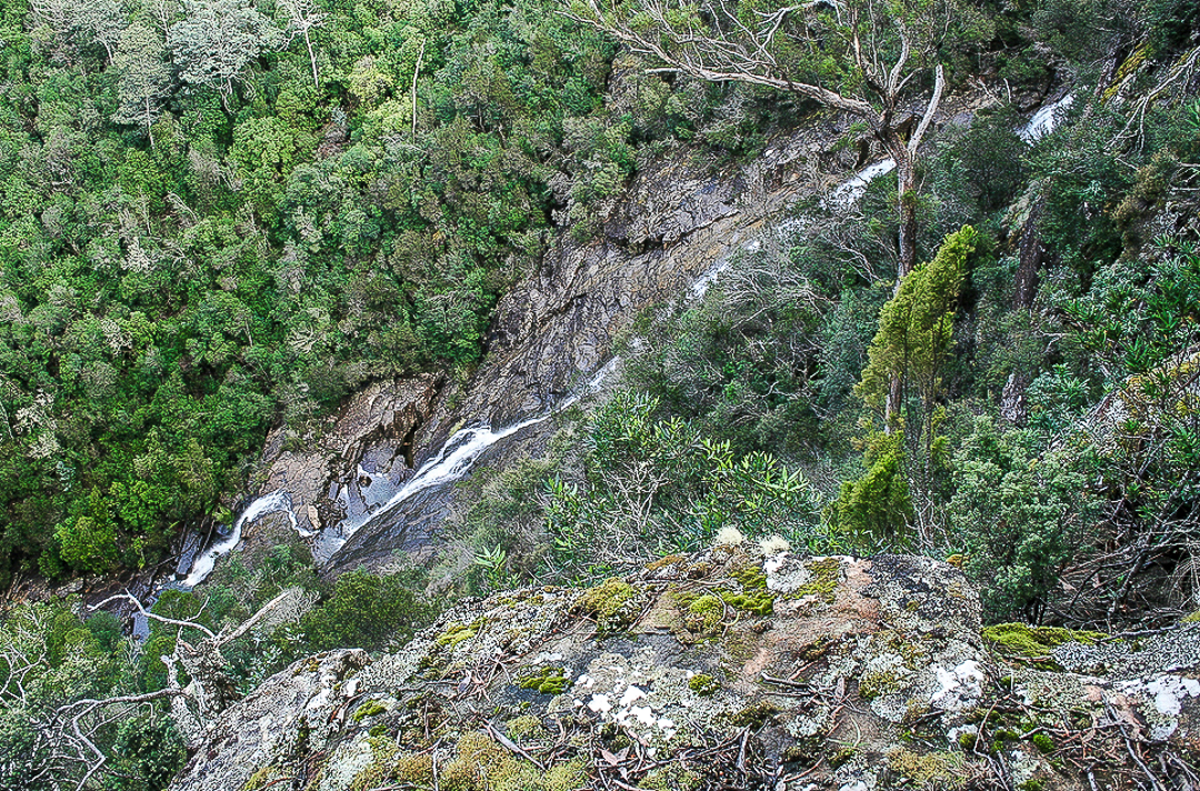
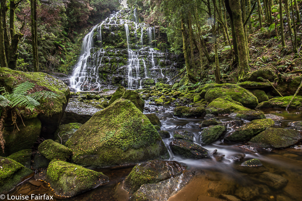
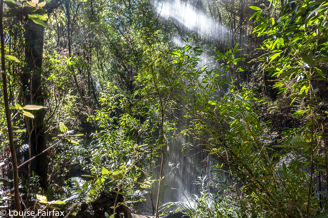
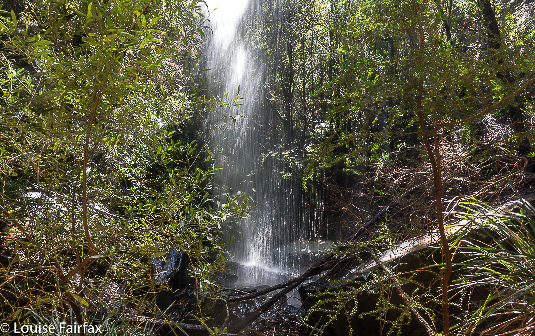
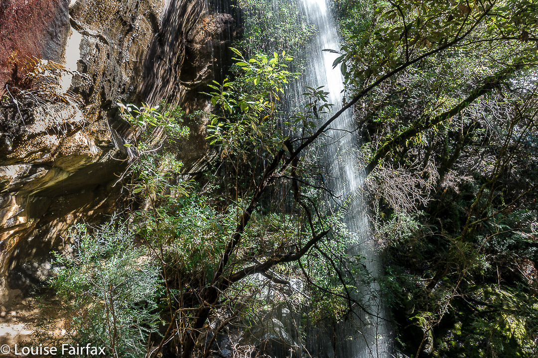
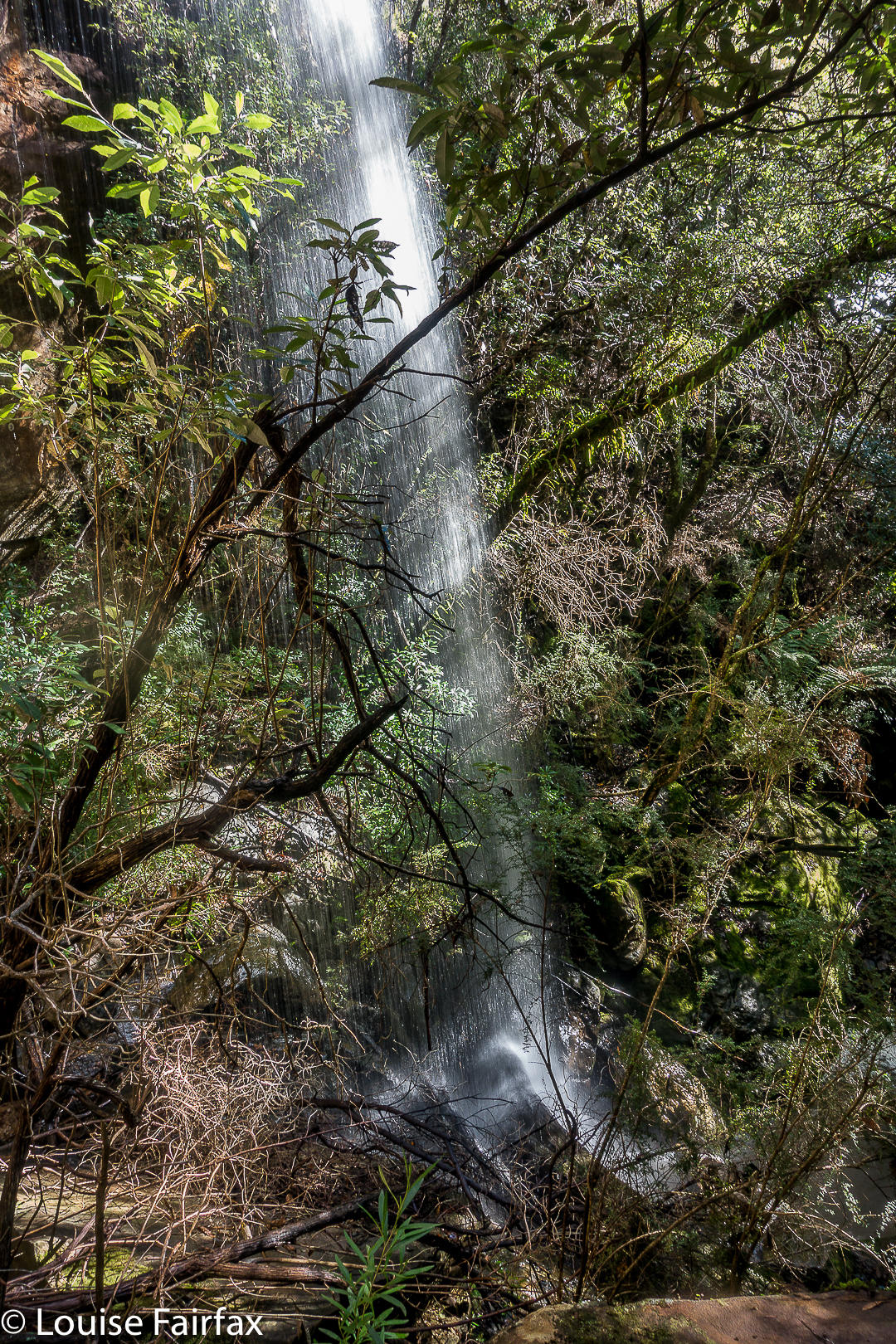
This is not my photo, although it is my edit. Cadence Kueper, and excellent photographer, had far more luck than I did when he visited. This is his shot and his copyright. I wanted to show you what you were looking for if you got a good day.
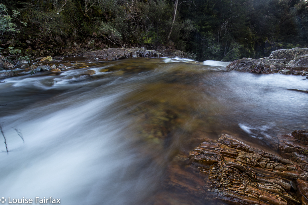
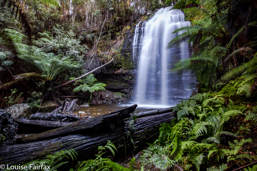
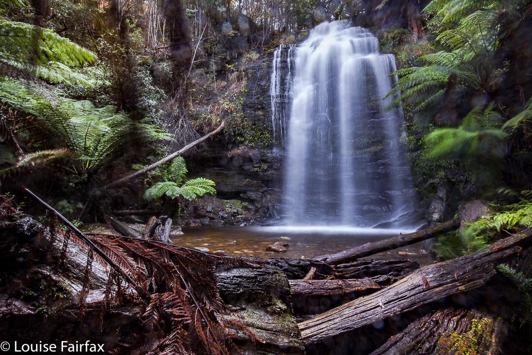
As we approached, the sun was shining to ruin my chance of a nice long exposure of the flow, and yet it was raining so as to destroy my beautiful lens, and spoil the photo with droplet smudges. Yes, yes; it was pretty silly to come out in this weather without an umbrella for my camera, but I have a lot to organise, like a dog and a husband. This was not going well. It was freezing at this location, with a strong wind blasting us as we made our hopeful way to the viewing point. Luckily, it was only five minutes from the car. The gorge is very impressive, but the lack of water was not. I didn’t bother to photograph such emptiness. I hadn’t brought my arctic gear, so we retreated quickly, and hoped the Meetus Falls would be better. They did not disappoint.


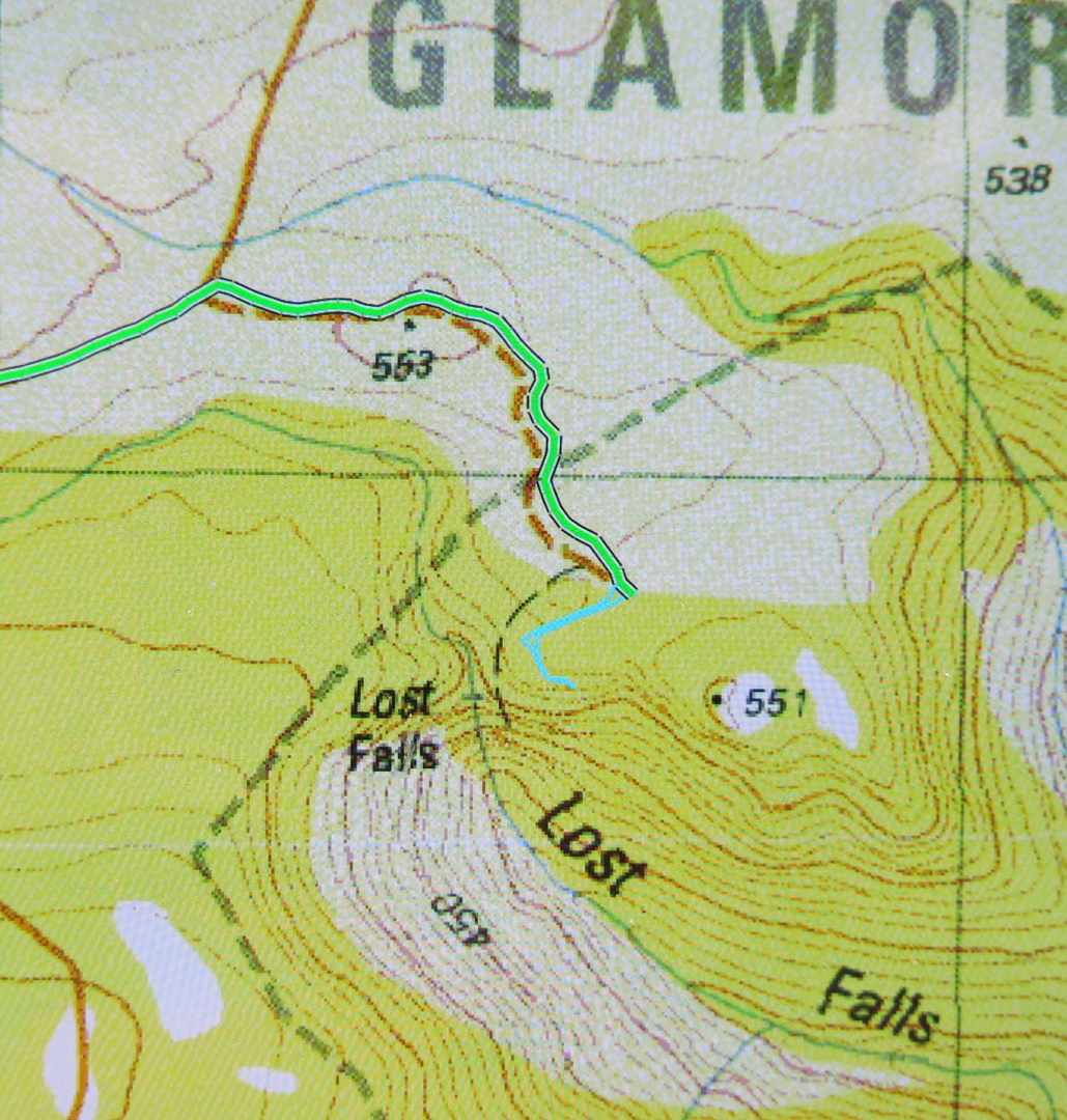
To see this Lost Gorge (I refuse to talk of Falls), drive to Campbell Town, turn east to Lake Leake Road and continue to drive past Lake Leake, and past Kalangadoo (the petrol station cum general store on the right after Lake Leake as you head east) until you reach a rather major intersection with two traffic islands to attract your attention. They’re possibly there to suggest you don’t turn at 100 kph, and that you watch for incoming trucks. For Lost Falls, turn right (South) and drive “4 kms” as the sign directs you (Lost Falls Reserve, it calls your destination). You will, after 3.3 kms, turn left and go 2.6 kms along this road until you reach the parking area which also has a shelter should you want to eat there. Just before you reach your destination, there is an unsigned fork in the road. The right hand fork will get you there (see map below). You’ve nearly arrived.


On the enclosed map, the magenta section of 3.3 kms is the first part after you’ve turned right;  the green part of 2.6 kms is the next bit after you’ve been turned left by a sign (you’ll see the fork I’m talking about near the end there); the tiny cyan bit is the section where you get to stretch your legs and see the view.
If you then want to find a waterfall that has water, go back north to the big intersection, and continue north on the same dirt road for another 11 kms until directed to Meetus Falls ( http://www.natureloverswalks.com/meetus-falls/).

Nelson Falls 2017

Nelson Falls, 2017 June


Showing Bruce these falls was part of a lovely multi-day waterfall binge the two of us had in June 2017, in which I showed my ever-weakening husband some of the areas that I had been to without him, and in which he got to eat at some of the places I made constant reference to. He retained his love of food until the end, and took particular delight in the Derwent Bridge Hotel.

Arm Falls 2017 Jun

Arm Falls 2017. June. A photo blog.


The Arm Falls were very attractive, and I enjoyed the fact that they were a falls that you reached using a tiny bush track, and without a plethora of tasteless and obtrusive signs telling me to be careful, warning me about slippery rock and all the dangers of being in the area. They were just beautiful falls, allowed to be there uncluttered by smooth, wide highway-paths, railings, notices and viewing platforms. Just how I like my falls.


Earlier in the day, I climbed Parangana Sugar Loaf with friends from NWWC (see natureloverswalks.com/parangana-sugar-loaf/)

Blairgowrie Falls 2017 Jul

First visit: Blairgowrie Falls 2017 July.


I looked out the window to see a beautiful day: crisp winter air, blue sky of a steely quality, sunshine, and not a cloud to be seen. “What a perfect day to find a new waterfall”, I said to myself. Now, if you know anything about waterfalls and photography, you will right now be questioning my photographic nouse as well as my general intelligence, because, given the hour it now was,  we would be arriving at the expected falls (IF we arrived) in the middle of the day, when the light is glary and utterly unsuitable for good photography.

What you don’t know in this unkind judgement is that my camera (the proper, full-frame one) is in hospital at present, so I don’t really care about photographic conditions. I’m stuck with using a compact today (although it does have manual controls and shoots in RAW. It’s still not the ‘real’ thing). In addition, given the weekend we’ve just had, I don’t feel like being rained on any more. I dutifully ran in the rain on both Saturday and Sunday. Today, I feel like walking in delicious sunshine. And anyway, this was only a recce. I told my husband and dog, both of whom opted to accompany me, that there was absolutely no guarantee of an arrival at these falls, and no promise of a long walk. As it turned out, we had a lovely hour and a half walk in pleasant forest, and got to both top and base of our beastie.

I really had very little to go on: I knew the location, and the name of the creek (Biddle Ck – not that that helped anything). I had never seen an image of my destination (the web is silent on this topic), and my directions were self-written, based on my reading of the map that came on my computer screen, which, unfortunately, bore only scanty resemblance to the outdated one I use in my gps device, or my paper map, similarly suffering from senility.


First tack was to try to reach it from below. I saw (off Old Bangor Tram Rd) a small private road leading to a house with a dam beside it (so the map said). Follow the creek up from there, and you have your prize. Fine. I’ll go and ask for permission at the house. As I thought all three of us might be overwhelming, I sent the other two off on a short private mission and went to the house alone. The nearer I got the more obvious it became that if someone lived here, they were … well … ‘different’. Some windows were broken, bits were falling away. It was really quite unkempt. I was rather relieved when there was manifestly no one there – not now, not in any foreseeable future. But meanwhile, I’d been rather turned off this as a means of reaching my goal. I stared at the map again and decided to try an attack from above. If that failed, at least we’d tried.

Now, attacking from above is all well and good, but with decidedly out-of-date maps, there was not a great deal of ground to map correlation. We set off up Murphys Road, with Bruce making rude comments about the Law of the same name, and used it as long as it went where I wanted it to go. At a fork (unposted) I turned left as that suited me, and followed this unnamed road to where there was a locked gate. We parked a bit further back down, and set out on foot, still with absolutely no certainty that we would reach the falls or how long failure or success would take. I guessed at 45 minutes in each direction, and we did it in 40 each way, so I wasn’t far out. The forest was very nice. We’d have a good walk, whatever else. Tessa said this road was excellent thanks. There were no signs saying Private, or Keep Out or Thou shalt not. It was all rather wonderful. And, with a boom gate that seemed permanently shut, there was also no possibility of traffic. We could amble freely. We did.

The blue line on the map below is the route we took. The only bushbashing we ended up doing was right near the end where the track on the ground was not worth searching for. On the way there (the more easterly route), we were on either clear or very indistinct tracks the whole way. There was one section where you needed pretty good tracking skills to spot where the path had once gone, but no bush bashing as such. And, stunningly, paths lead us the whole way to the falls. As these were not on my map, I was feeling pretty chuffed about happening on them.

There is even al little path leading to the base of the falls. I was certainly not the first person to visit this place, even if I do appear to be the first to publish either a photo or instructions.
The top of the falls was not an impressive area, and I was at first disappointed, albeit happy to have found them. The base made up for any displeasure on top. They were fun falls, even if their flow wasn’t voluminous. You’re standing in forest with an endless flow of water emptying into the bush next to you. Considering how wet everything is at present, and how urgently most of the waterfalls in the state are pursuing their downhill course, I wouldn’t bother visiting these falls in anything but wet season.

(Take Dalrymple Rd C809 right when Hillwood is off to your left from the East Tamar Highway heading north. Turn right onto the Old Bangor Tram Rd C812, just as you pass under a narrow (rail?) bridge. Then, after a short distance, Murphys Rd will be on your right. I wouldn’t go up there without a gps.)
See the 2020 version for my route. If you want the actual gpx route to download, you can email me. My address is in my instagram profile.

Honor Falls 2017 May

Honor Falls bagged at last. May 29 2017.
We were actually on our way to Liffey Falls to photograph fungi, but the lure of trying to actually bag Honor Falls acted as a siren pulling me in that direction once I recognised the scenery.
“I’ll just be max thirty minutes, and then we’ll be on our way to Liffey”, I assured my husband. I mean, the falls are only about two hundred meters from the bridge where I’d just parked. I failed the first time as I couldn’t balance having just been running a fever for four days. This time I was in good health, and was ready for the bush bash. I chose gumboots so I could wade once there. Optimistic choice.


Knowing how cluttered the forest was from last time, I walked along the road for about twenty metres with Bruce and Tessa before sending them on a fifteen-out-fifteen-back walk while I dashed in, photographed, and came out to meet them. I eyed up the forest. Bruce looked askance. I caught his gaze and nodded agreement. That’s @#&%.
“Let’s stay together another twenty metres or so.” (We are, all this time, on the left of the river as it goes downstream.)
The forest thinned out a bit, so I dived in, leaving the other two to their more purposeful walk. I made good time in the bush … until I hit a cliff edge that prevented me proceeding any further. Hm. I tried various options left and right of this point, but all ended in slippery, mossy drops that even with a rope would have had me dangling in mid air rather than achieving anything. Must need to be nearer to the falls themselves. I bashed my way to there, but again, met with impassable cliffs. By this time, I am wondering about these other Honor Falls baggers. What sort of heroes are these that can get through this stuff for their photo? Now I tried back even further, but met with the same problems.


So, sigh, back out to the road and try “coming in the back door”, by going further downstream and coming back at the falls. I found a spot where I could get in the bush and make some progress, painfully aware that my time was probably running out by now. The bush was thick and steep, but eventually I forged my way down to the riverbed. But this was very, very cluttered and the ferns were thick on the ground, offering zero visibility. I decided it would take at least ten more minutes to get to the base from here – IF I could. I didn’t have time for that. I also didn’t like the way that many trunks broke when I trod on them, always dangerous when solo, as you can fall when that happens. Oh well. At least I had now been to the base, kind of, and would come with more time next occasion. Up I climbed and headed for the car. There was still plenty of time to shoot fungi at Liffey.
Bruce and Tessa were not in sight (having decided to go out-forty-back-forty instead), and I had become curious about the other side of the river. I had seen no signs at all of humans having forged a way through the forest in which I’d been. I was continually making the bash, and there were no broken branches, slip marks, or signs of wear and tear that one uses for tracking. Maybe people go on the other bank. I’ll just do a quick recce, I thought, seeing’s Bruce and Tessie were still missing.


Over the bridge, down the private road, into the bush when I decided it was a good moment to go in, follow the stream along from above. Hey, there’s an orange tape. And another, and another. Human feet have definitely trodden here. Down I went. In no time at all I was on the bottom, taking two of the most hurried photos of my life before scrambling back up to greet the duo who were now, of course, waiting at the car. Had I been privy to the information I am now giving you, I could have saved myself a great deal of time – but I would have missed out on the adventure, and the sense of victory that I now have.