I was told that to get to the “real” Ford Falls, I “JUST” had to follow the Ford River down until I got to the falls. Now, if you know anything at all about this area, you will know that contours fill the map around these falls: it is very, very steep, and very rugged, with unmapped cliffs all over the place, and scoparia in between. I would personally find the word “just” to be inappropriate. But maybe this time I was mistaken. Perhaps it is not as formidable as it seems. Only one way of finding out. Hm. Maybe curiosity will one day kill this cat.
I was nervous going solo in such territory (which I treat with absolute respect), so made sure I not only had my PLB, but also lined up a friend who was primed to call SES should I not be out by 6.30. I didn’t trust my informant sufficiently to believe this would be a piece of cake, especially when his particular words mean that I doubt he has actually been there himself.
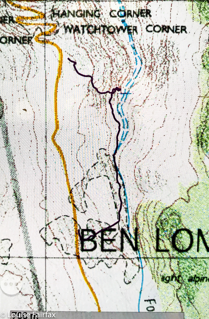
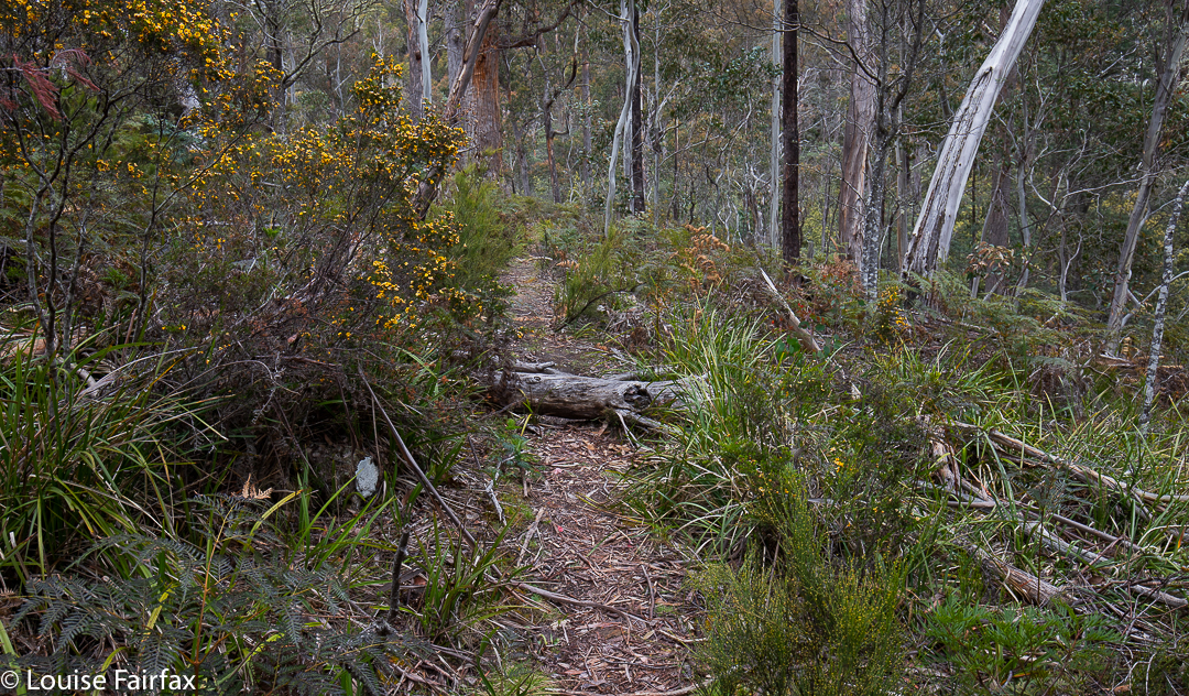
Ford Falls route
I set out from home at 2.30. I thought that meant about one hour driving in each direction, and one hour by foot to and back from the falls. Alas, the car trip took a tad longer than an hour, which then made me feel under time pressure for the foot part. Off I hurried. At first things went pretty well. The rocks were only mildly slippery, but I was not visible from the road, and the rocks are quite angled, with big drops between them, so I moved with enormous caution.
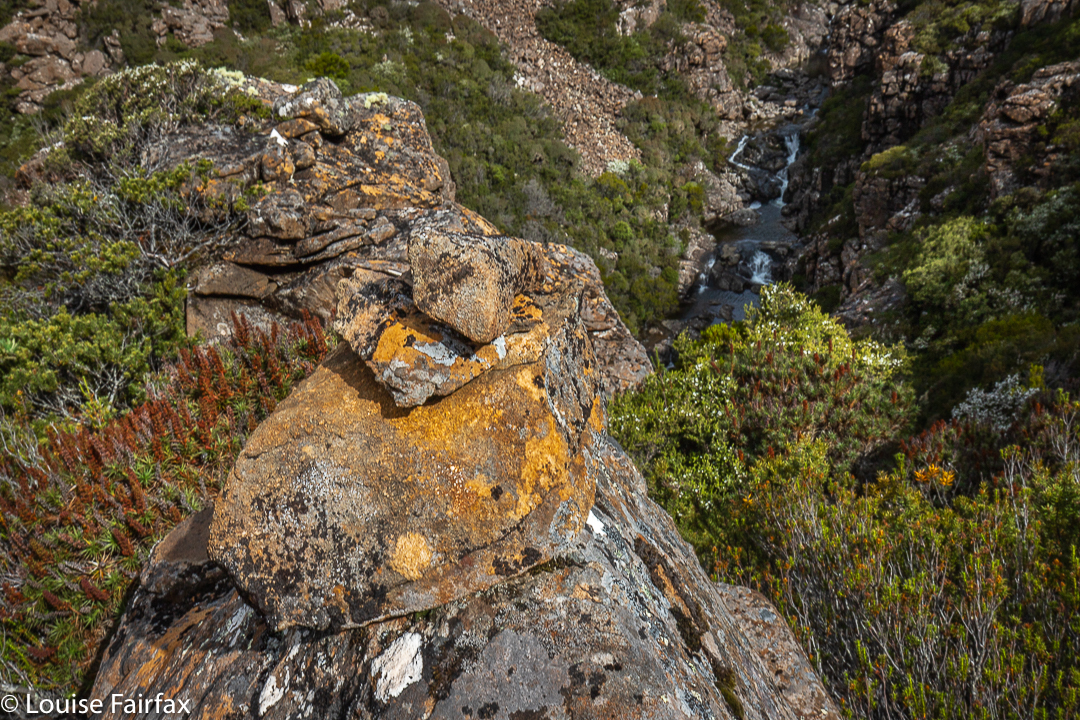
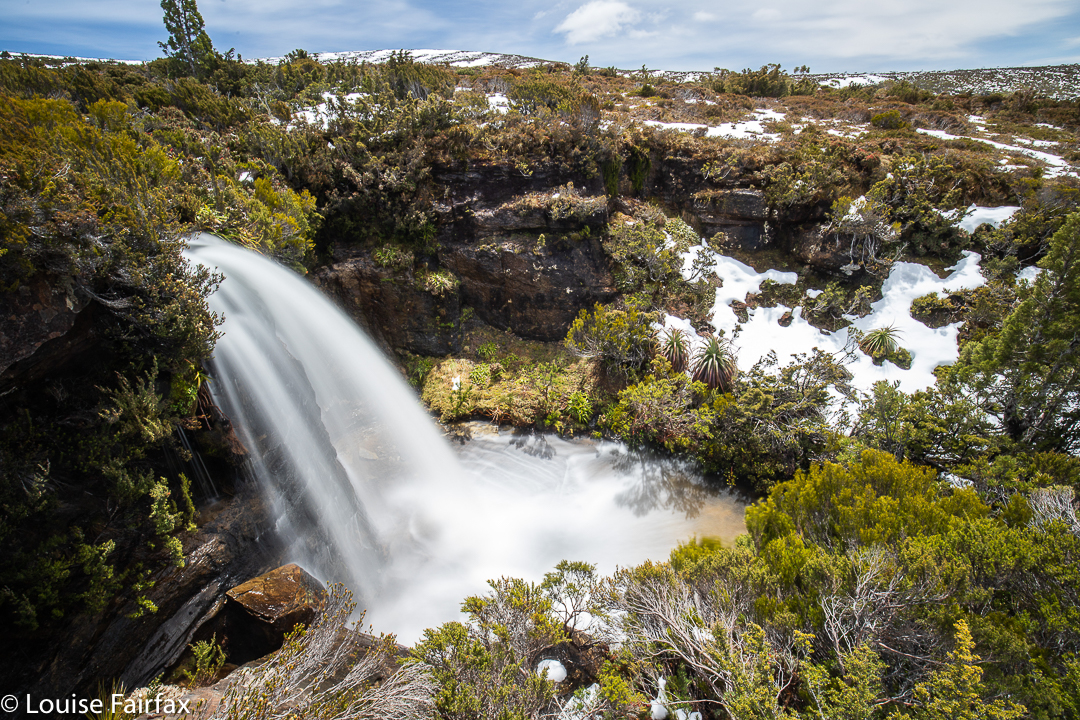
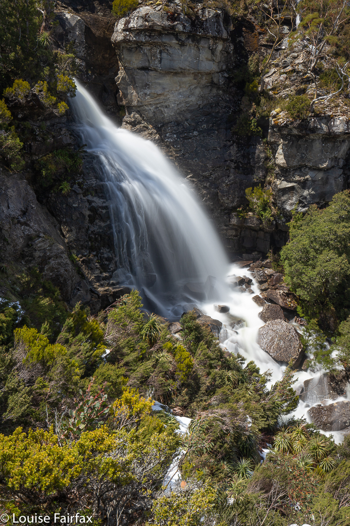
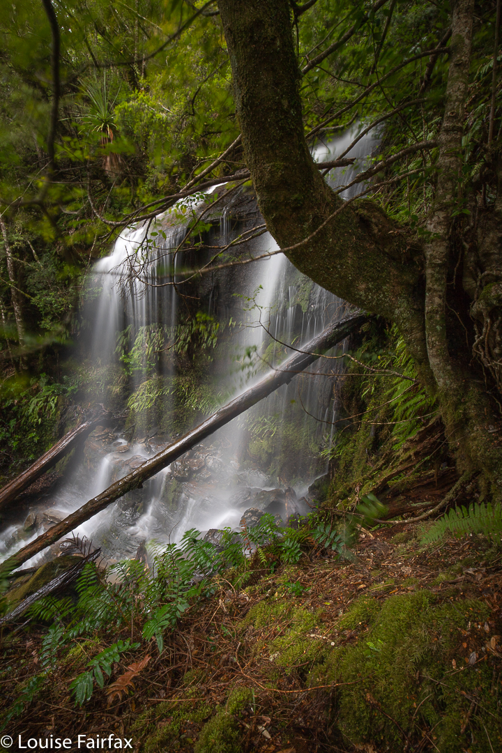
As I feared or suspected, after a few hundred metres, it became impossible to actually follow the river. Steep cliffs dropped into its waters from both sides, and I was forced back up the hill, and into swathes of thick scoparia as I wended my way forward. Higher and higher I went. Time went by. To my amazement, I then found a cairn. But where had it come from? Where was it going? I scouted around for the next cairn, but failed to find it. Its presence made me feel that I should try to go back down to the river at this stage. I tried a couple of options, but they were all too dangerous. My gps said I had arrived, so I hoped that the waterfall below me (pictured) that I was gazing at was Ford Falls REAL, photographed it, and cleared out. As you can see from my route, I just scaled the contours straight up, as I decided shorter was better at this stage of the afternoon. (It was much better, and faster!) I had been lower than this photo, as you can see from my route, but that spot gave the best view.
I drove home feeling utterly overdosed with adrenalin. I got in phone range on the way down Jacobs Ladder, so was able to let my backstop know I was out safely, even if I was drowning in an epinephrine bath.
Off I set: my goal being mysterious blue lines on the map, lying on the flanks of Mt Rufus, on tributaries that would eventually flow into mighty rivers. Now, when you set out bushbashing in quest of a blue line on a map, you have no idea (i) whether there will actually be a waterfall at the end of your rainbow, and (ii), whether it will have been worth the effort in time, energy, petrol and scratches. Thus I have (in the past) been the questionably proud discoverer of Dry Falls and Trickle Falls, to name but two of my findings. Funnily, no one has been very excited about these, even though my documentation has, at the very least, told them what’s there and informed them that it’s probably not worth their while adding that to their list of immediately pressing activities.
Rufus Falls: off we set
HOWEVER, Sunday’s journey through knee-deep mud and then thigh-deep snow with shoulder-high scoparia thrown in – and a few magic, primaeval pencil-pine grovelets with brief sections of alpine grass – (plus one tiger snake), a journey that took seven and a quarter hours in total, was absolutely Worth The Effort. I could have called the falls Wonder Falls, Speechless Falls, Gaze or Delight Falls; however, even these names diminish them somehow, reducing the spiritual experience of being there to one aspect of the experience.
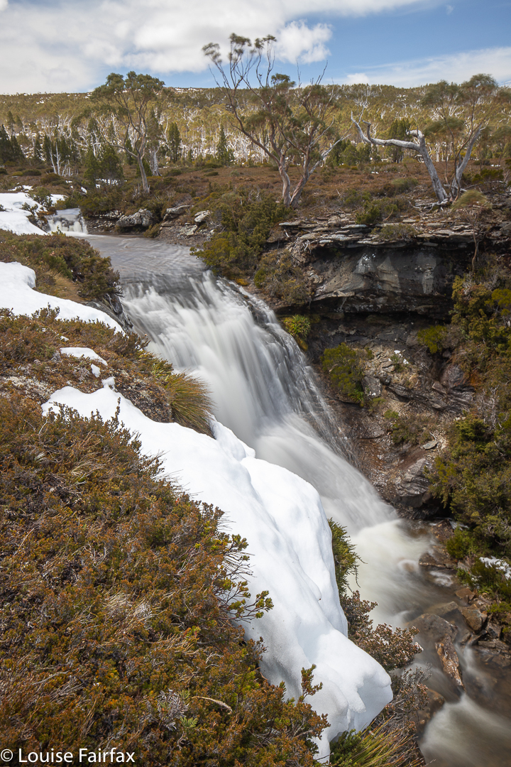
Rufus Falls. First goal achieved.
They need a name that will impart a sense of their particular place set in wilderness, a name that reaches out not in, and I think an aboriginal name is what they deserve, as it will add its own mystique, just as does the name Leeawuleena, lying not far away, “sleeping waters” … how beautiful. I have wasted hours trawling the web for a Tasmanian aboriginal dictionary, or for place names that could be vaguely related to the area, but my net remains empty. For now, English monikers will have to do: Rufus Falls, and Navarre Falls Upper and Lower. Although Rufus was a Roman poet of antiquity, whose poems none of us have heard of, and whose only claim to fame was that he was a friend of Virgil (is that not clutching at straws???), at least the name “Rufus” suggests to us Taswegians an area of wilderness with a certain feel to it. And Navarre is a former kingdom of SW Europe, established in the 9th century by the Basques. What has that got to do with us??????
Rufus falls from below
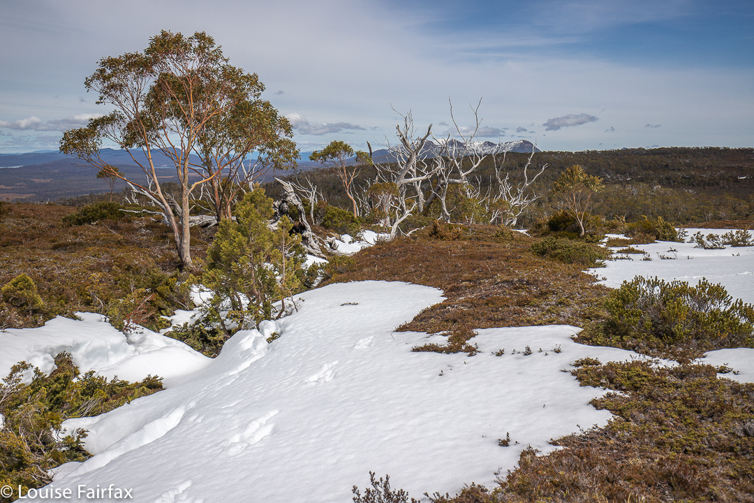
Up there near the waterfalls, the views are expansive, looking out at Mt Gell, King William I, Pitt and Mulligan, and then Slatters Peak, and the King William Range, with Frenchmans Cap thrown in, and that’s before I begin to name the ones further to the south. On this day, all were decked in snow. For me, all these are old friends and I love seeing them. Gleaming and sparkling in the distance far below us was Lake King William.
Navarre Falls, Upper – from above
It was not a fluke that this journey was undertaken with white peaks all around, and snow covering the route. I had been watching the weather maps very carefully, and chose accordingly. This was exactly what I had ordered, and I revelled in it.
Upper Navarre Falls
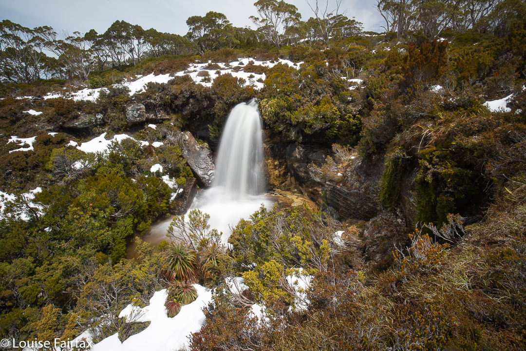
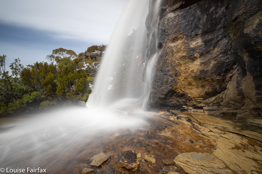
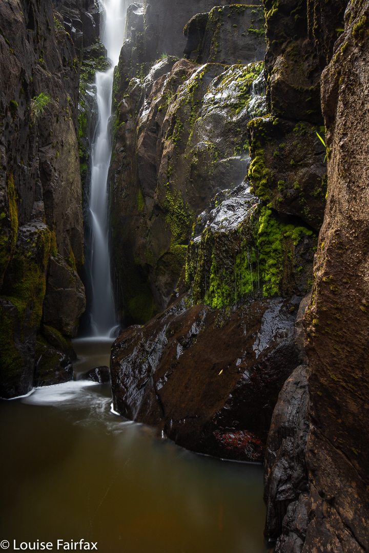
I had brought along a friend who, I knew, would appreciate being there. She had never been in real wilderness before, and was floating with delight. We giggled our way through the snow drifts, which are actually quite hard work, forcing you to lift your legs very high each step, after which you’d sink to an unknown depth, depending on what lay underneath. And then, I kind of squealed with delight, for there was a real waterfall, and it was beautiful: an attractive drop of maybe ten metres of delicate white, attended by deep clumps of pristine snow, pandanis (richea pandanifolia), with a few pencil pines, and Pherosphaera hookeriana for colour, texture and form variety. It was set in a small sandstone, cliffy amphitheatre, with striations of warm hues. We photographed from the west and the east, from above, the side and below. It was fun.
Lower Navarre Falls
Even so, I thought that my friend, unaccustomed to all I was doing, might have had enough, or been very tired by the physical effort of getting there, so I offered her the choice of turning around at this stage. To my excitement, she said she’d like to see the other two falls I had in mind. I pointed to where I expected them to lie, gave her a pessimistic time estimation and reminded her that there might nothing there (I hate overly positive promises; I would never make a politician), but still she agreed. Yippee. Off we set.
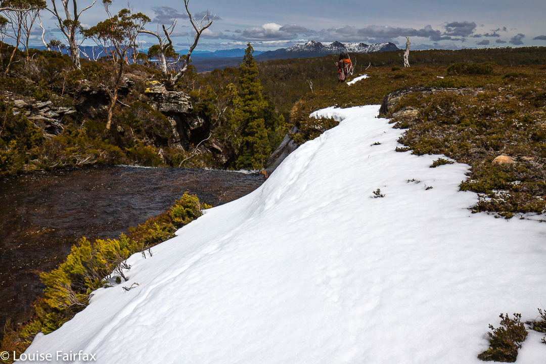
Making our own way home
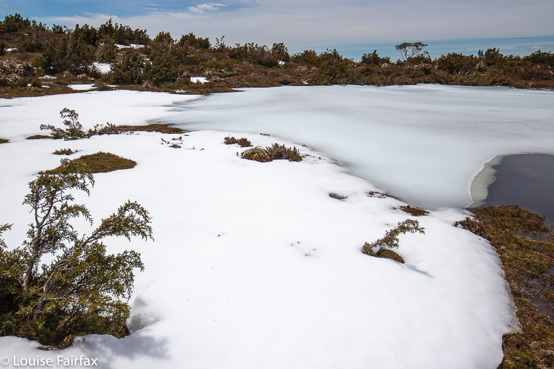
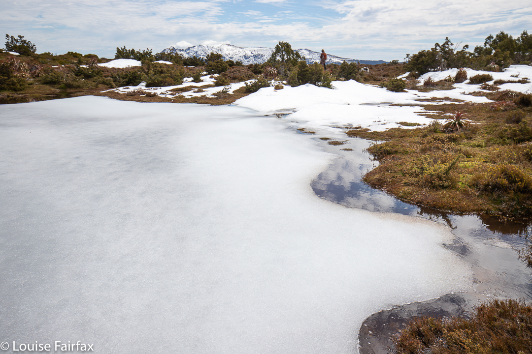
On this section, the snow was more of a challenge, with some very steep drops, and drifts of unknown depth to contend with. However, the final spur was sheer pleasure. Again I sort of squealed with shock and delight when I looked over the edge and saw what we had found. And just below, the water dropped yet again to another hidden treasure. Meanwhile, the cliffs on the way, and in the region of these falls, were marvellous in their own right. We were in heaven. We angled around to the side to inspect and photograph both, and then climbed back up for a snack beside the river and a relax, imbibing mountains, lakes and beauty, before beginning our reluctant journey homewards. Just to show off, I sent friends pictures of the frozen tarn where we also spent some time. Most of Australia is on fire at present. How amazing and fortunate to be in the snow!
Beautiful frozen tarns begged us to linger.
My friend’s shoes were sopping, and her feet numb, parts of her were no doubt scratched, but still she was in love with being in the wilderness. Both of us felt our souls had been expanded and nurtured by being in this place.
If you think you know how to get these falls, will you kindly respect people who love their wilderness wild, and leave no plastic tape and no cairns. Let others feel the total freedom we felt in this place.
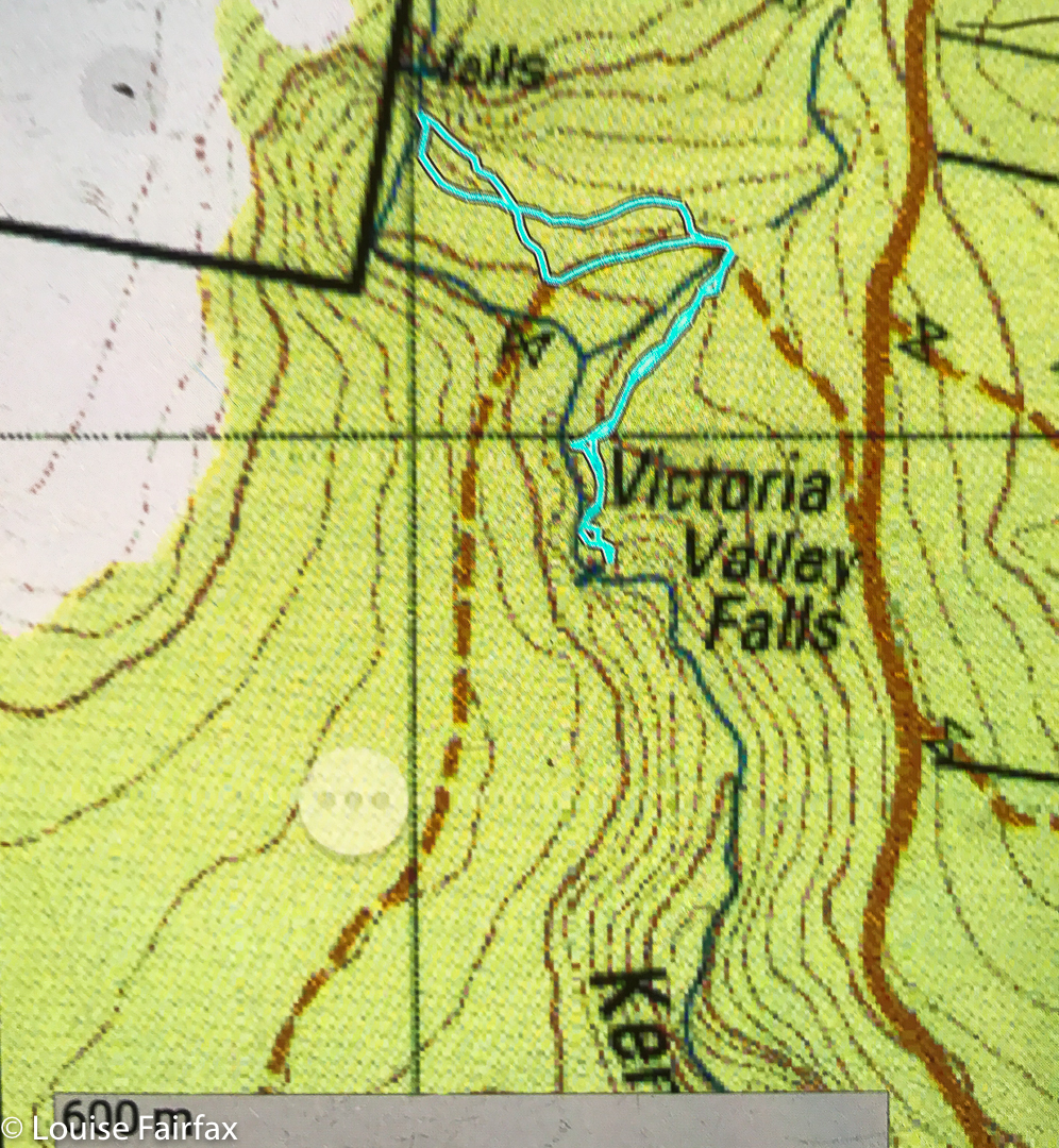
Kenmere Falls lie just to the north of Victoria Valley Falls, so if you visit Victoria Valley Falls (see blog
http://www.natureloverswalks.com/victoria-valley-falls/) near Osterley, and IF you are happy bushbashing and reading a map, then you can add this little gem on Kenmere Creek to your agenda for the day. I used the same parking area for both falls. There is no track, and the dry bush has a lot of twigs that are intent on giving you a poke as you go by, so you need to be fine with that sort of defensive and unwelcoming behaviour. It doesn’t last long. The falls themselves felt like a very special place, and I stayed there for quite along while, just enjoying being, and imbibing all they had to offer. I made it into a circular route by going pretty straight on the way there, but following the creek down until it hit the road on the way back. The return was longer, but had less bush to negotiate, and was a couple of minutes faster.
The nearest coffee I could find on the way home that looked inviting was in Hamilton, at Jackson’s Emporium, which was quaint. When they offered me instant, I switched to tea, where I got weak T2 Chai, but at least it had leaves. One spoon of leaves cost me $5; the little biscuit cost me $4, but it was gluten free ginger, and tasty. I guess they need high prices to compensate for lack of customers. Hamilton itself is very cute.
Victoria Valley Falls are very near a place on the map called Victoria Valley, in the middle of nowhere, somewhat near Osterley (which is also in the middle of nowhere). So much is Victoria Valley in the middle of nowhere, that I am not sure which house constituted the mark on the map; at least Google Maps will take you there. There were no shops or post office, pubs or public buildings, … or maybe I blinked at the wrong moment. Osterley (north of Ouse) was “there”. Insignificant in the general scheme of things though Victoria Valley may be, I nonetheless did not take it kindly when ‘Google maps’ told me on my first attempt that I need a fifteen-hour journey across the Big Waters to reach it. I eventually forced it to be a tiny bit sensible, and got a version that quoted 2 hrs and 02 minutes from Launceston. Problem 1 solved.
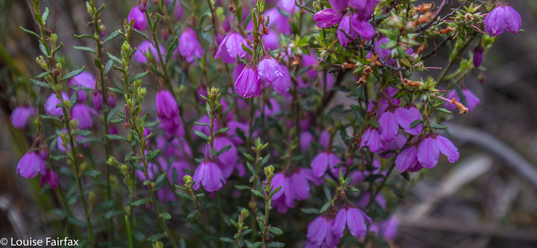
Bauera along the path
Problem 2 is that Victoria Valley is kind of out on a limb, which I guess is in tandem with being in the middle of nowhere. It’s a jolly long drive for very little reward whichever way you look at things, and very difficult to combine with anything interesting. Hm. Why do I have to be so curious, always wanting to see falls that are just a name on a map? At least there is another waterfall, unnamed, on Kenmore Ck, just to the north of Victoria Valley Falls, so I can add that to the day’s agenda. I decided I wasn’t going to get much exercise, so went running before I set out. Good move!!
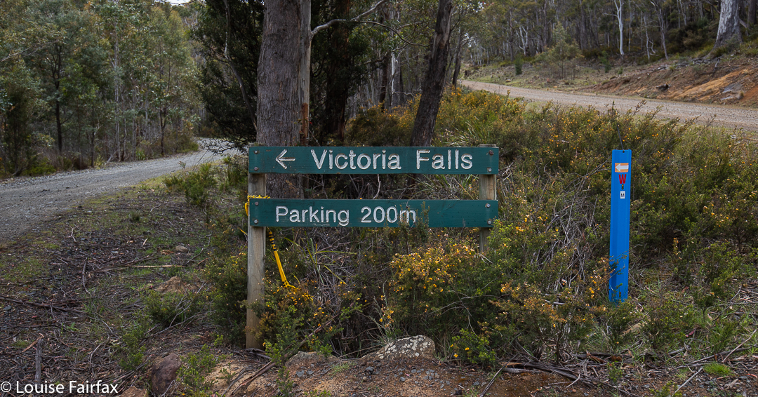
Waddamana was possibly the ugliest place I have ever seen on this entire planet, but once past it (heading south), the road got narrow, the ground less barren and greenery started growing, so I started to enjoy it. If you are coming from the south, your trip is MUCH prettier!! By the time I reached the road intersection just north of the falls, and turned onto Victoria Valley Road, I was enjoying the view out the window. I drove down that road until I reached the sign below (only truly visible for people coming from the south. If coming from the north, you get its rear end).
Oh Joy. And in 200 ms, I found this:
sign
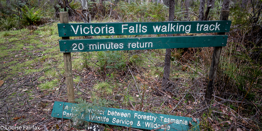
I was off, on a path that looked like this:
And the falls that I found, you have seen above. It was a lovely little walk – although only five minutes in each direction – and could be combined with something at Lake St Clair if you got an earlier start than I did. I combined it with going to nearby Kenmere Falls (see my blog: http://www.natureloverswalks.com/kenmere-falls/
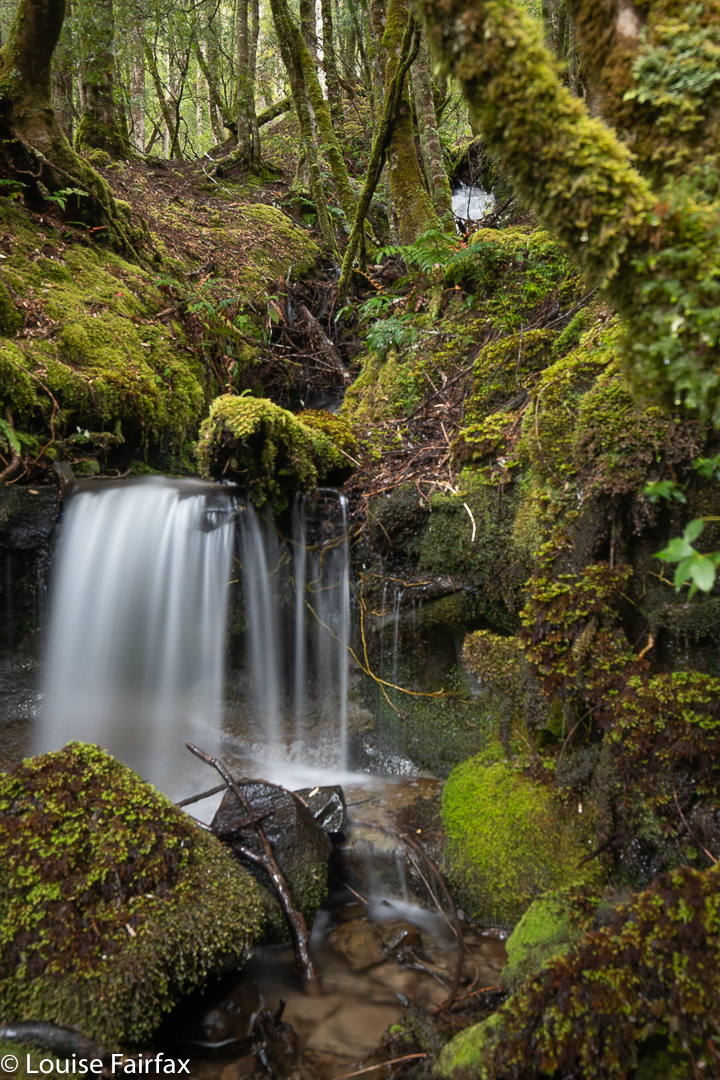
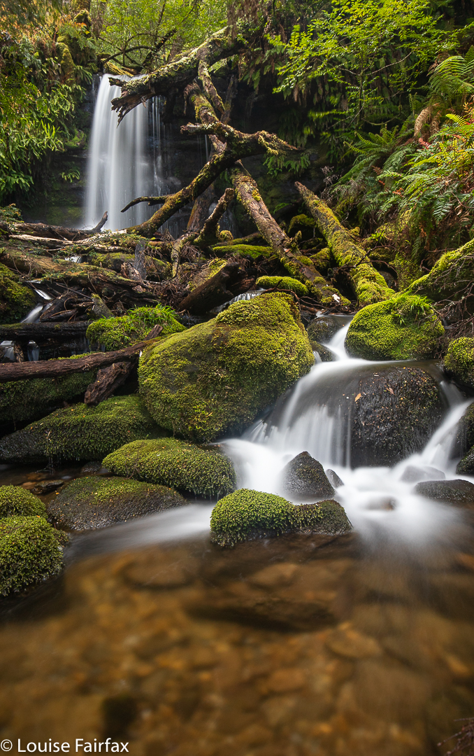
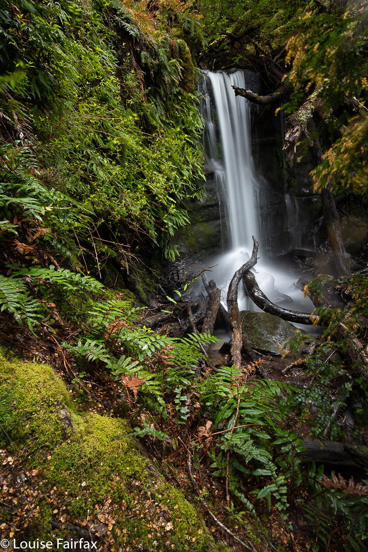
I am not normally an admirer of fat bellies, but the bulging belly of Mt Olympus is an expanse of great glory. In the folds of lurid green rainforest, with rich brown and orange rotting wood, you can find weeping waterfalls in abundance.
I noticed how especially glorious everything was looking on my way back from our Nereus trip last week, when we got snowed out of our deadlines. Because my mission regarding Nereus was the climb, I only had my phone with me, and phone-photos of waterfalls do NOT do it for me. When I look at a waterfall with my naked eye, my brain sees glorious lines of flow, gossamer threads adorning basal rocks. The phone gives me frozen, often blown-out droplets or odd streaks and blotches that fail to give any indication of the magic that attracted me in the first place. I needed to come back with a real camera to do the area justice. Saturday was the day.
I had time to get home, have a tiny bit of rest, attend to my animals and plants, try to patch my very damaged and infected feet and return. My boots were still sopping, and, as it was constantly wet feet that had caused the foot damage from Thursday, I had bandaged my wounds and wore a different pair of boots. I like to have 3 pairs of boots in use at once, so that two pairs can be drying out slowly and I still have something to wear. It’s not good for the leather to force the issue of drying.
On the day I had chosen, the forecast was for rain all day – hoorah; that’s actually why I chose that day – and I set out on the ferry in the middle of a little deluge. By the time I alighted, it was only scattering tiny droplets, most of which the canopy absorbed. You guessed it; the sun came out by the time I had all my gear ready for shooting some time later. That said, I never had to wait more than a few minutes for the sun to hide again, and the heavier falls of rain occurred at times when I was ready to move on … mostly. Other times I had to contend with rain while I was shooting, but it wasn’t too bad.
After the first series of falls, it was raining quite heavily, so I decided it would be good to drop down to Echo Point Hut and have some food inside in the dry before moving on. There were five of us sheltering and snacking in there, three of whom were were landscape photographers. I had fun meeting them (they were from VIC and SA, and were adoring the forest), and stayed far too long considering my goals, but, oh well, that’s the way it was.
It was a very sociable day, as, at the end, when I arrived at the lodge just before kitchen closure, two lovely people invited me to join them at their table, and we had a fun time chatting while I waited for, and then ate, my dinner. Even on the ferry I’d had a great time chatting, as several people on board recognised me, waving enthusiastically as I hopped over the gunnel, so, after I explained to the driver that I was not going to “chuck” my bag containing several thousand dollars worth of glass in the corner, we talked the whole way. I have decided that people who are prepared to get out and climb mountains or explore forests on a day forecast to be sodden all day, must be very nice. The rain is a kind of sieve.
There are no routes for this blog. I didn’t track anything. I just wandered and shot where I found beauty. The falls have names in my files for my own records to distinguish them from one another, but I have not named them here; they are not official. At the official level, these are unnamed and unmapped falls on unnamed and unmapped creeks. Perhaps their shy obscurity is part of their allure.