Wylly
Nescient Peak 2015 Dec
Nescient Peak. There was something incredibly tranquil about this day – perhaps partly caused by the fact that this was the first day since winter that there was a feel of summer in the air. The Examiner reported today “Summer is here”, and indeed it had arrived. Perhaps the feeling also sprang from the fact that this was a Monday, and one doesn’t normally climb a mountain on a Monday, but my friend Angela had the day off and I was free, so here we were in good spirits, ready to try the taste of another mountain on Tassie’s wondrous smorgasbord of high points.
I have decided I love climbing mountains that have received bad reports elsewhere. It’s not that I’m perverse, seeking to find pleasure where others have found pain: I think it’s just that if my expectations are set low, then reality has a good chance of bettering my anticipations, and I am left pleasantly surprised.
The writer of the Abels essay on Nescient Peak was quite clearly disenchanted: in the opening sentence of instructions on how to get there, the reader is admonished to wear scrub gloves and gaiters, as if this were the most important thing one would need to know about this mountain. I suggest the author visit the Coronets to gain a different perspective. It made us feel as if this mountain were a kind of medicine that good people had to take in order to keep healthy. As a result of the warnings, we kept commenting to each other on how easy this bush was to get through; how light and malleable the small branches.
We did have to agree that the first glimpse of our mountain was “unremarkable”, but I still found it attractive enough to want a shot from a few angles. The book insulted it by only publishing an image of the very prickly Coprosma nitida (mountain currant), as if any image of the peak would detract from the beauty of the book – like dismissing an atonal person from the choir.
Next criticisms were directed at the apparently awkward navigation (in nuce, head west, over two contour bumps and the third and highest of the contour collections is your goal), and the fact that apparently the ground was very rough underfoot. We were in the bush. The ground was neither better nor worse than any other bush. If you want a smooth highway, visit QLD. They vacuum the forest floor there at 7 a.m. in case tourists should sue them for having uneven ground (I kid you not. Pity about the hideous noise and smell of petrol in a National Park). Again, expecting the worst, we felt nothing but pleasure in not finding it. You could run through that bush (if you were an orienteer), and the rocky knolls were fascinating and shapely. I loved them, and climbed over them on purpose. “This is fun”, we agreed to each other as we climbed.
The “difficult to discern” summit stood out loud and clear to us, and even the complaint about the presence of trees fell on deaf ears. We enjoyed having a patch of shade in which to enjoy the view and have our compulsory summit-lunch, and I liked having a frame for the scene provided by leaves and trunks. I don’t want that on every mountain, but was happy to have it on this one. It seemed appropriate here. Of course we could see Mt Rogoona, but what that interested us the most was the unmentioned (by the book) King Davids Peak and Solomons Throne: it was fun to see these old friends from a different angle. Lakes Bill and Rowallan were very appealing from up there. And on the way down, once you’d started the very steep descent from the high moorland, we enjoyed views of Lake Rowallan that did not disappear, and that got bigger with each step. We’d taken, in walking time, 2 hrs 15 up; 2 hrs down, which made it a great daywalk, and meant it was short enough to have what was, for us, an uncharacteristically late start. Perhaps that also helped create the feeling of tranquility that I referred to in my opening sentence.
Confessions of a sinner, in case it helps: that ‘up time’ includes mislaying the track somehow: one minute we were on it, chatting away as we climbed, the next we weren’t. I am always a person on a mission on the way up anything, and Angela is a very agreeable soul, so I suggested we just bushbash our way south until we happen to intersect with the pad, and she agreed that would be fine. I’d much prefer that to wasting time finding a pad that you don’t really need anyway. As predicted, we did get back on to it a bit later.
Adamsons Peak 2015 Dec
The hardest part of climbing Adamsons Peak was getting to the start line, and I had always suspected this would be the case – ever since I heard that the old road was closed (and, apparently, has been closed since 2008, which seems to me rather a long time to fail to repair a road that could be well used to give tourists something to do in the Dover area. Perhaps the local council hasn’t yet figured out that modern tourists want to do something and only tourists who are nonagenarians want to sit in a car and drive all day).
Here we have a grand mountain with a track all the way to the top, a relatively simple climb – as long as you have a little fitness – and grandstand views of the coast, Federation Peak, La Perouse, Pindars Peak, Precipitous Bluff, Hartz and Snowy mountains and the list goes on. Today was quite a murky day, being a lull in between two storms, but the view was still highly enjoyable. Judging by the number of tourists who climb Queensland’s Mt Sorrow, a much steeper and harder mountain, I think it is a waste of an opportunity to keep visitors in the area for an extra day. Perhaps even a couple of ten dollar signposts directing people along the huge and odd detour one now has to make could go at least some of the way to helping provide amusement for people who would like to be energetic in the area.
So, how do you get there? Continue driving south past Dover for about four kilometres until you reach the bridge over the beautiful Esperence River. Turn right just before this bridge onto Esperence River Road, and follow this for about ten kilometres, until you see a fork that you can take to the left on Esperence Road that takes you down over the river. After you have crossed, you turn left again, onto Peak Rivulet Road, ignoring all the spur roads that lead uphill to your right, and, staying on that road, you eventually arrive at the signed start to the walk (and a point where parking is easy).
Once you have managed to find the start, the rest is easy. The steeper sections were in beautiful lush green forest, and the flatter sections contained the usual bauera, cutting grass and mud. There was an “introduction” section, then a relatively steep climb, a flatter section (= bauera etc), then another climb, where the forest type reverted to lush moss and myrtles, and then you were out on the top plateau. This took members of our group between one hour forty and two hours. The moor section has a few deeper mud baths to test you out, but these are soon dispensed with, and in not too much time, you are embarking on the final climb to the first lump you can see when you emerge on the moor, and, finally, the rocky summit itself. And then comes the reward: lunch with your well-earned view.
Please note that words like “simple” and “easy” are relative and not absolute, and are used within the context of this writer’s other experiences. If you begin a walk dubbed by somebody as “simple” and you find that you disagree with their terminology (perhaps you even doubt their sanity), it would be very wise to turn around before you land in difficulty.
Bobs 2015 ii Nov
Mt Bobs beaten.
“Thirteen, fourteen, fifteen …”
“Louise, you’re just showing off.”
“Sixteen, seventeen, eighteen … .” I would not be put off my leech count, flicking them as they ascended to my hands, pulling them out of my hair and off my rainjacket, overpants, gaiters and boots. The light rain that had persisted for much of the first day had certainly brought them out, but at last we were at the sinkhole, ridding ourselves of them before disappearing into our tents to try to slough off the array of wet layers and warm up before exploring our fascinating environs. The rain had ceased, and the sinkhole is a truly fabulous area.
Although we had never tried Mt Bobs and failed, both Mark and I had the feeling that this was an elusive mount: a hard capture. I had cancelled a couple of trips due to bad weather before I ever set out from home, and on one occasion we had gone to Lake Sydney, only to turn back before ever beginning the climb proper. People seem to speak of this mountain with certain tones of respect; some, even with something akin to fear in their voices (these being the ones, I guess, who had particularly long or difficult battles with thick forest on the way up). Certainly, the way is steep and the rainforest thick, and no possible path declares itself as you stare amongst the tangle and cliffs. You are too close, at that stage, to sort things out. With Bobs, I think, you need to have worked out your method of attack before you begin. Horror stories of being held captive in her thick bosky arms are not too difficult to find.
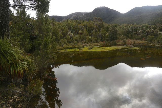
We did not treat this summit lightly, and read as much as we could before departing. In particular, we found the help of Rohan and notes he leant us from Marco to be invaluable. Thanks guys. Thanks also to Ian Ross – for our email discussions and his inspiring pictures in bushwalk.com that first sparked my interest in this mountain.
Day Two
At last ascent day dawned and we stood at the start line, ready to try our luck, determined to succeed. The sinkhole was pretty full, but we could at least get around some foreshore (left) before being forced up into the rainforest by rocky cliffs. We climbed a contour or two and then progressed parallel to the lake which already seemed quite a way below us when we got glimpses of it.
Marco’s notes mentioned climbing an obvious spur. Lots of spurs can seem obvious on the map, but not so obvious when the shape is obscured in situ by thick covering, and, conversely, small spurs in the terrain can strike you visually yet be not be represented on the map, often due to the scale or the contour interval, or because they are not detected by the photogrammetry. I was standing on a spur that seemed obvious to me, but was it obvious on a 1:25,000 map with 20m contour interval? Time to check the gps. Yes. Good. Up we went. Confidence was high, and yet the notes also said that a pad of sorts could be encountered if one is in the right spot. We were seeing signs that humans might have held this or that branch, but after a while I felt like another dose of confirmation. I turned around to Mark:
“Right now, I would give a lot for the sight of a little pink tag.”
“Yes, that would be nice.”
I turned back to continue and could not believe it. There, right in front, waving at me, was exactly what I desired. It felt like we’d spotted the summit cairn. I gave a victory dance and hugged Mark with joy. This would take us on a pad that worked as far as the scrub just short of the saddle. We didn’t need to waste time with trial and error seeing if this or that cliff was going to allow us to progress on our way in this low-visiblity forest. We wouldn’t land in a cul de sac of tangle now – well, not as long as we managed to continue finding the tags. We still, of course, had to keep navigating, but every five minutes or so, you gained a pink benison: you were doing the right thing. It was a great feeling; like spiking the control at orienteering. Despite still concentrating, we could relax our guard a little now and enjoy the forest even more than we had been doing. When you are in a fairytale wonderland, that is a good thing.
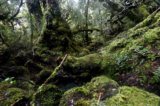
We swung a bit far in the scrub before the saddle, but didn’t lose too much time, and were soon enough standing on the turn of the land, gazing up at a cornucopia of cliffs, wondering exactly which were the “obvious” ones of the written instructions. Not quite knowing, we agreed together to head for a bushy gully between two likely contenders and play it by ear from there.
Emotionally and physically, I was pulled towards the more cliffy of the two main possibilities, so when I saw the hint of a lead through the scrub that would get us to the top of it, I took it. From there, we gazed together at our alternatives. The notes had talked of cairns. There were none for us, but in this section there is visibility, so we surveyed the scene and opted to go straight up the rocky spur in front of us, reckoning there were enough low-bush connectors to get us to a gully up high that we could see, which would give us a lead through the dominating cliffs to whatever was up there beyond. We were not on THE route but this route felt good. It was, indeed, as good in fact as it was in theory and we fair bounced up to the top in a very slick time, cresting the plateaued area by 10 a.m. This was it; we’d done it. The remainder of the stroll across the tops to the actual summit – photographing, admiring the view, delighting in the tiny watercourses, patches of snow and vibrant green cushion grass patches – was almost like a victory lap after a race.
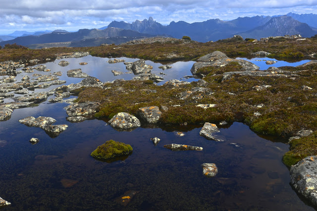
It was sunny up there as we ate a bit and gazed at Federation Peak, but we were also very aware of the gloomy weather forecast for later in the day. We had climbed in a very small window of opportunity. We thus elected not to climb the Boomerang, but rather to descend, spend a little time relaxing at the tents – even cook some warm soup to have with lunch – and head out.
When we reached the bare knoll on the way out that offers the final view of Feder, we could see it was already raining there. The clouds were quite dramatic; the front was approaching speedily and earlier than we had envisaged. The race was on. We belted down that mountain, putting in as much distance as we could before we had water dumped on us from above.
The trip ended as it began: soggy logs, covered in moisture-laden moss that drenched you if you got too close; deep mud to suck you under and wet your boots and socks; soaking bauera that made each brush with it feel like a cold, unwelcome shower; and two sodden bushwalkers. Luckily, the really punishing rains began during the drive home. We were quite wet enough with the low-intensity version of a dunking that marked the beginning of the change. Our decision to hasten out was a good one.
Gell, Hippogriff, Chimera 2015 Nov
Veni, vidi, vici? No way. We came, indeed. We saw? Never, neither from afar nor from up close. I have had to use pictures from other trips. We conquered? The gps and bit of a cairn both agreed we were at the summit, but it sure didn’t feel like “conquer”. To me it felt as if Gell just couldn’t be bothered fighting us silly ants any longer, so lay down so we could pretend to be victorious. Perhaps in deference to my feeling that I had in no way “won” this mountain, but rather floundered to the top, I never actually stood on her (or, not that I recall. Don’t worry pedants; I did touch the cairn). My lack of standing was, in reality, due to the howling wind, my frozen hands and fear of incipient hypothermia. I crouched on top, a most unvictorious pose. There were no photos: not from me; not from anyone. We all had survival on our minds. Perhaps we all own enough photos of summits in thick mist and drizzle. We all know we did it. A few gps devices no doubt recorded our presence.
From there, we made a hasty retreat to escape the wind. There was no evading the rain. I eventually ate out of duty rather than desire: I was not hungry, but I also know that eating peps up the metabolic rate, thus helping in the fight against hypothermia, so I did my duty. The thought of removing my protective shield, namely, my pack that was keeping my back a little warmer and dryer than otherwise, had no appeal. Shedding my gloves to hold my food was almost intolerable. Give me nice, dry ice and snow any day.
I had totally underestimated Mt Gell, and had only done it the courtesy of reading the report in the Abels II book, which made it sound quite a friendly jaunt. The article made no mention of the marshy web of stubborn melaleucas that guard the flanks of Lake Dixon, nor of the endless kilometres of unpleasant scrub lining both sides of the Franklin River. Not a word was said about the many cliffs that need to be avoided or climbed, which lie between the Franklin and the summit of the Hippogriff (front quarters of an eagle; hindquarters of a horse. Hm). These cliffs were actually fun on both our ascent and, quite different, descent routes, but I do think they deserve a mention.
It took our group 1.5 hours just to get from the car to the crossing of the Franklin (“walk … along a track … until more open terrain is reached”. This is definitely not our experience). It took an additional 5 hrs 13 from the river crossing to the summit of the Hippogriff. It is to be admitted that our coordinator had a very interesting navigational technique, but still, this 6 hrs 45 total is very different from the 3 hrs stated by the book as the time needed from the carpark to this point. The tarn where we camped, a nameless wonder below the summit – and easily visible from there – was a half hour’s gentle stroll downhill, making it a 7 hours 18 mins day. We pitched in the rain. I did unceasing tent exercises (crunches, sit ups, glute and quad contractions) in order to try and warm up from about 7 pm until 10.30, by which time I felt I’d got my core temperature high enough to relax and allow sleep.
The book seemed to me even more deceptive when it came to the next day, when it says: “(A)n open vale leads down towards Australia Tarn”: whoops. It forgot the thick scrub (drenched for us). “The lake edge offers camping areas”: luckily, we were not in need of one of these as we sure never saw anything that might tempt us to pitch a tent. Our glorious unnamed tarn was far superior. “An obvious ridge is followed … through scrub which decreases in density”. Now, it is true that the sodden, dense scrub eventually ceded to glorious alpine meadows with a series of transparent ponds and streams that I would adore to visit on a nice day (preferably arriving by helicopter), but there is not the vaguest hint of, or allusion to, the series of rocky knolls that are encountered along the way, one of which took us 30 minutes to get around – admittedly in mist, rain and driving, chilling wind. The book says to allow two hours from Australia Tarn to the summit. Due to our “knoll” problems (and more), we took nearly four. Luckily, our way down was much faster: less than two to Australia Tarn, and one more from there to our own tarn. My gloomy midday fears of our being benighted were thus averted.
So far, our mountain had claimed nearly sixteen hours’ hard labour, all of which was done in wet clothing with a wind chill factor that was not inconsiderable. Whether it was raining or not was almost immaterial, as the dense scrub was so full of drenching droplets that further precipitation from above could hardly make us any wetter.
The final day brought a hole in the thick grey above that ceded to sunshine by lunchtime. We made good time up and down the Chimera (Χίμαιρα: a mythical beast made of various animal parts), and cut the 5 hrs 15 mins taken from Franklin to Hippogriff down to 3 hours (not including the Chimera climb) in the reverse direction. When one incorporates that climb, this was a 7 hr 20 day, food stops not included.
All up, it took us 23 hours 17 to climb these three mountains. This was a club trip, so was naturally much slower than when one goes with handpicked friends, but I did think the times were worth mentioning to give an alternative agenda to those offered by the book, in case people are like me, and fail to realise that climbing Gell is a more serious undertaking than might otherwise appear.


