Kate 2015 Mar

Mt Kate Mar 2015

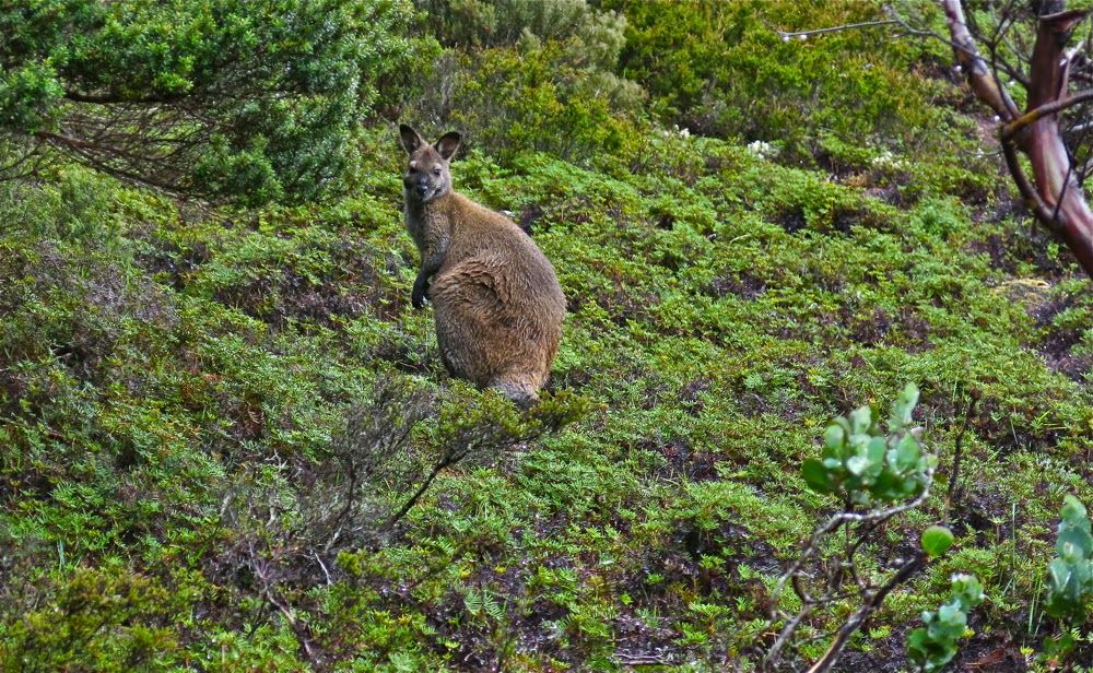
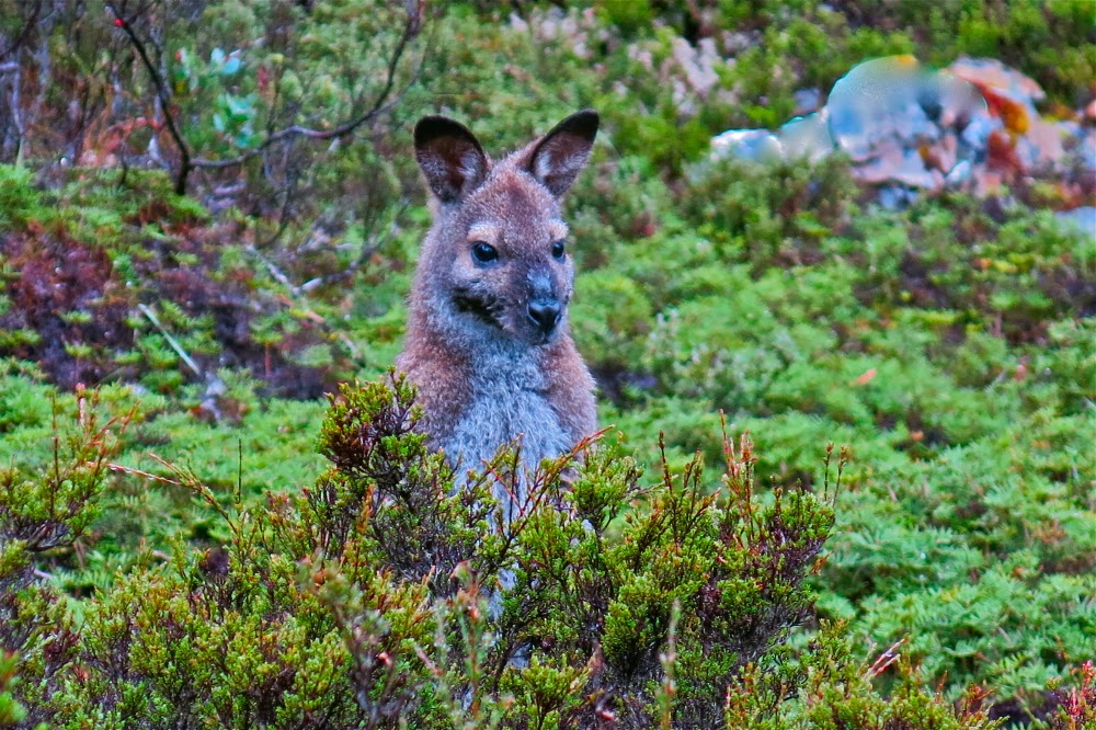
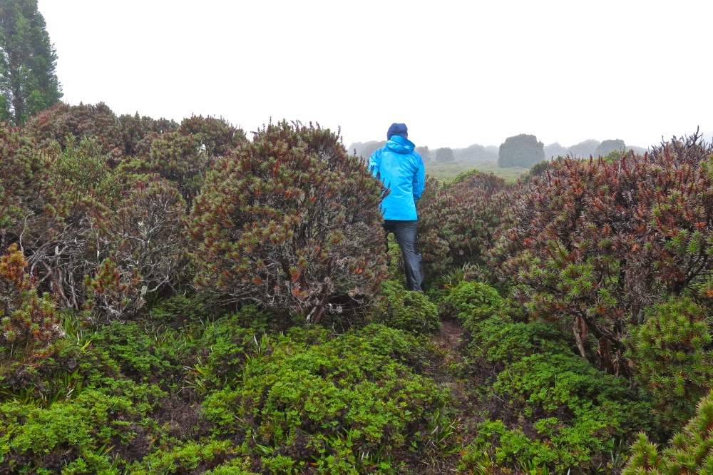
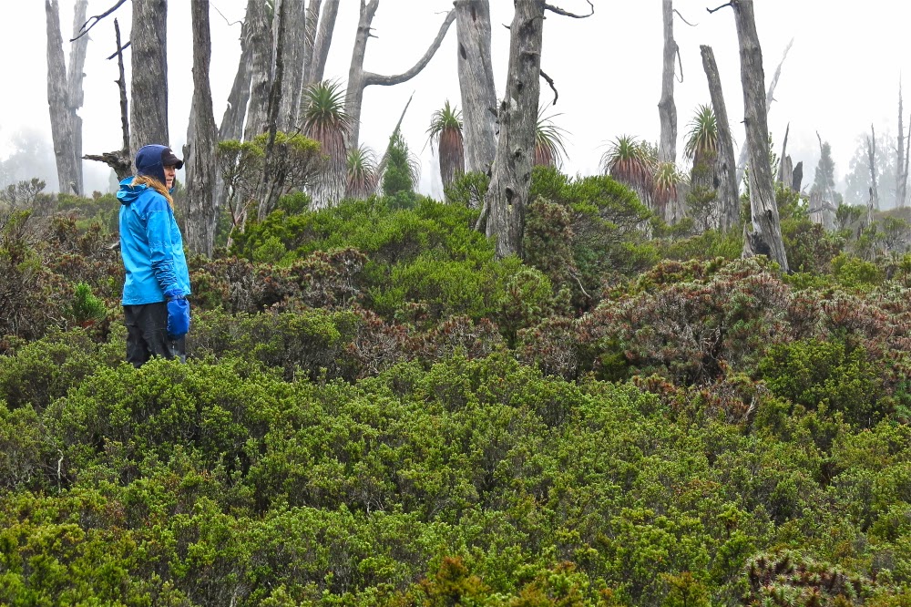
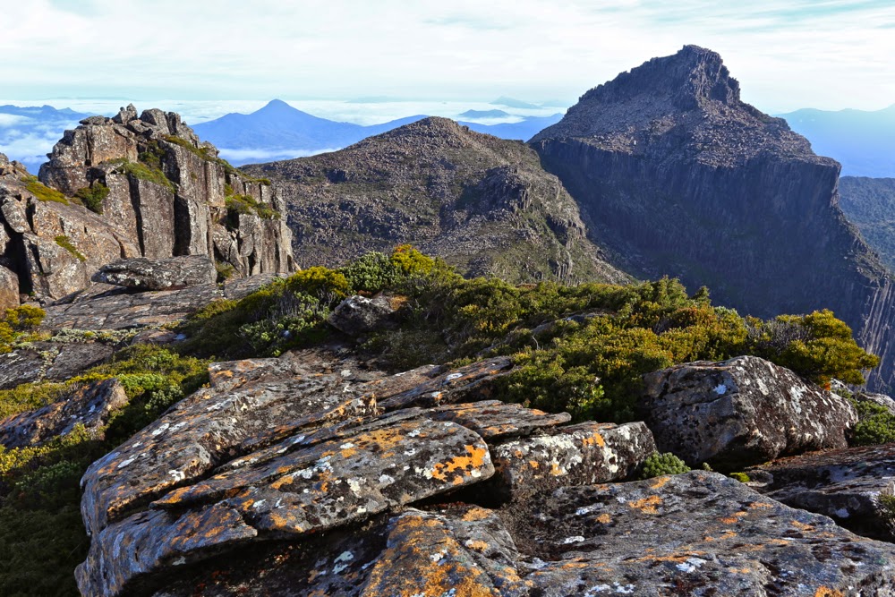
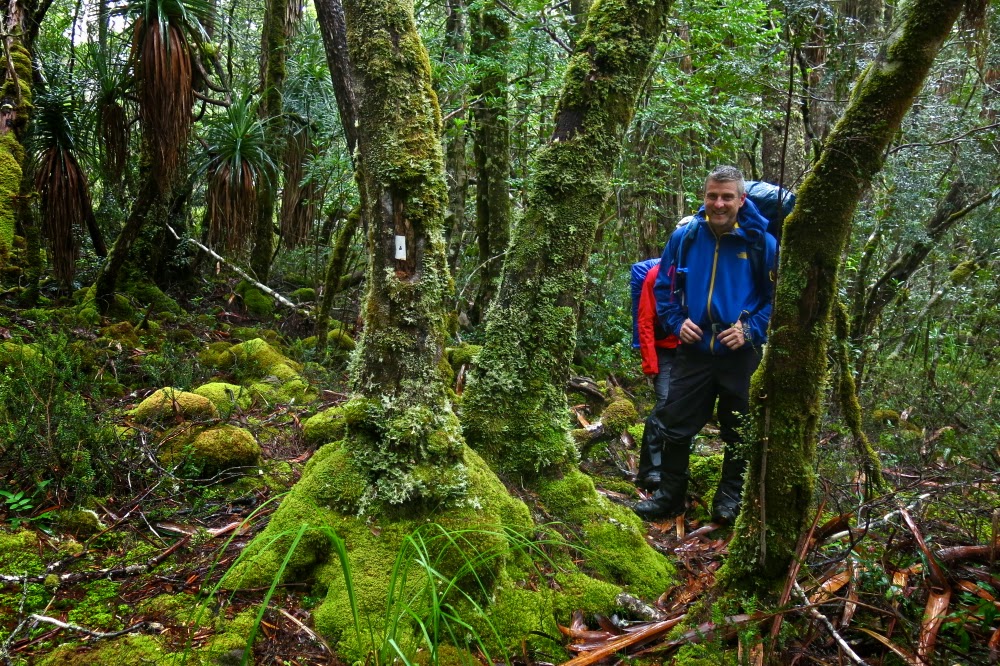
The current Abels Vol 1 book claims that Mt Kate is “uninspiring”, but I’m afraid I find that an insult. For sure, Mt Kate is no Matterhorn or Cradle Mountain with distinctive shape; she is no Lightning Ridge or Striding Edge with high drama; no north face of the Eiger offering to kill you if you slip, but if you don’t need your life filled with histrionics, then Mt Kate’s quiet beauty has enormous appeal at a different, subtler level. Possibly it helped that we climbed her in the mist and drizzle, but my daughter and I delighted in the variety of greens, the contrasting red seedpods of the Bellendena montana (mountain rocket), the shy Bennets wallabies having a peep at us from the security of a Bauera bush behind which they could retreat if needed, and the plethora of pencil pines in the area, the highlight of which was a grove in the saddle before the final collection of contours leading to the summit.

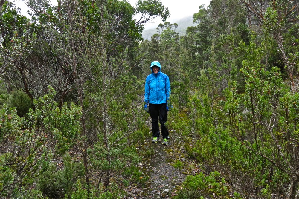
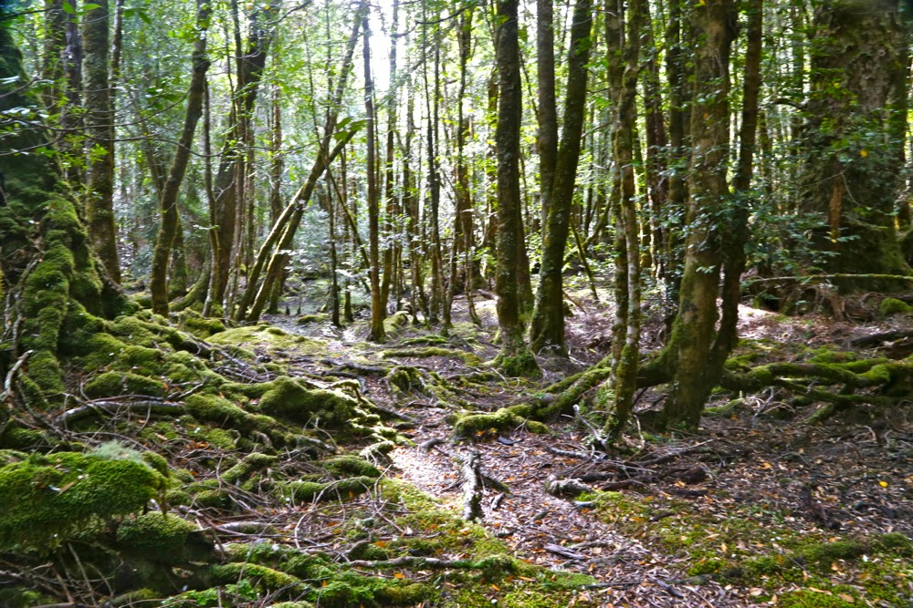
This is what the early part of the track looks like

We were rather thrilled to be climbing Kate in misty moisty gloom. The lack of visibility added to our sense of adventure. It’s fun climbing mountains with either of my daughters. Today Auntie Lena was minding Gussy; Kirsten came with me. We found the directions at the start to be a little ambiguous, and it didn’t help that I was, as usual, in a hurry to be climbing. It seemed counter-intuitive to head east when the summit was north, and to be on contour when we were there for the express purpose of climbing, an activity that we both delight in. I thus made two false moves, each time following wombat pads that headed to where we wanted to go, but which petered out after 50 or so metres. It also does not help that there is a sign that says “Mt Kate” pointing to the incorrect path, whilst the path you need says “Track closed”. Disobey all these instructions provided by the signage and you’ll get there.

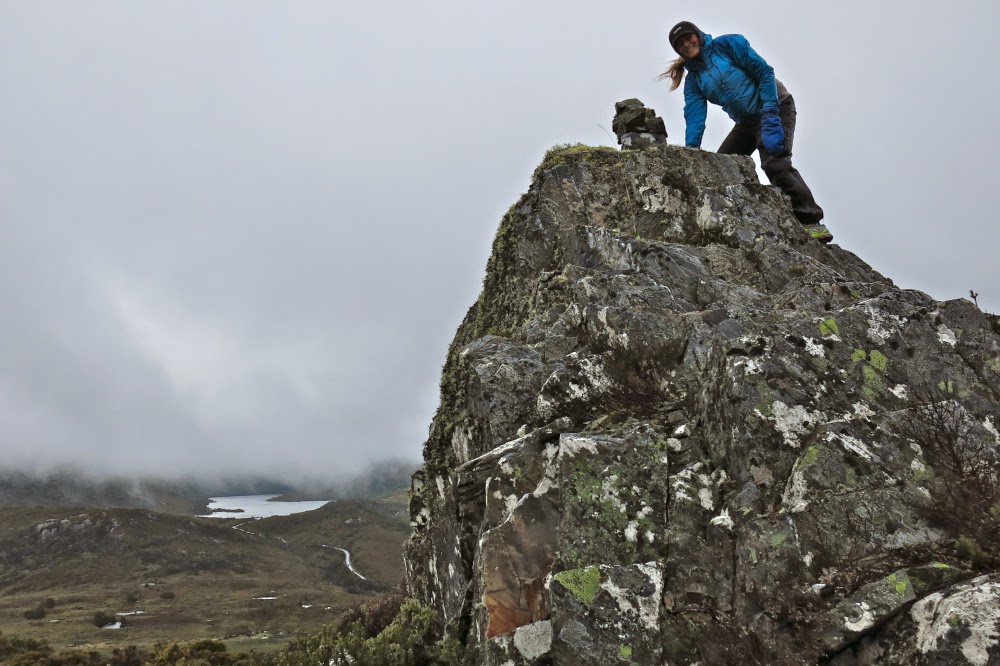
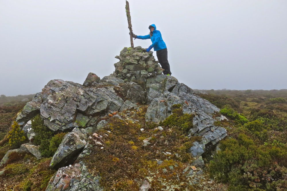
First cairn on the rocky outcrop


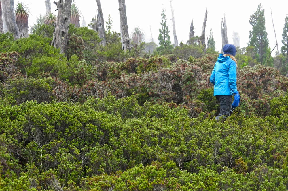
This is how it looked traversing north. Mt Kate is somewhere up ahead in the mist

So, cross the river using the car bridge. Cross it again using a footbridge and then, having taken the path that says it’s closed, you’ll cross water again – this time a small tributary. Continue on the boards until stairs appear, leading up to the second of the wooden cabins above. Turn right (east), heading more or less for a small mound. If you’re on a pad and keep your eyes open, you’ll pick up tapes soon after the mound, and then you’re on your way.

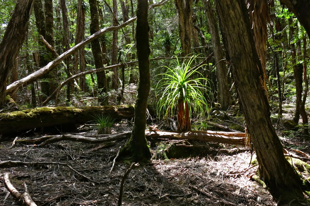
In the pine grove

After walking for maybe ten minutes, you’ll find a 30 cm high cairn and, although the old road you’re on continues east, you depart on the ribboned route heading now north and climbing up through lovely myrtle forest until you see a huge cairn on a rocky outcrop above, which announces that you’ve now finished part one of the climb.

The cairns (of which there are three) are rather fun, and even in mist with no visibility, are worth exploring. However, if you’re intent on the summit, then resist the temptation to visit the other two (or, do as I did and go there but then return to the first one). A pink ribbon assures you that the way forward is not via the other cairns, but through the shrubbery, heading north to the broad saddle through wombat-sized paths of lesser resistance.


Once in the saddle, the alpine vegetation becomes ankle high and is delightful to walk on. Wombat scats in abundance suggest this would be a great place to bring children in an evening for wombat spotting. Enjoy it while it lasts, for soon enough the bush returns to thigh high. However, a treat lies ahead, in the form of a magic fairyland grove of pencil pines, one of which had the widest girth I have ever seen: grandpa pencil pine, standing tall and proud, surrounded by lesser minions. Sadly, off to the right skeletal forms reaching for the sky suggest larger, former dimensions to the grove.

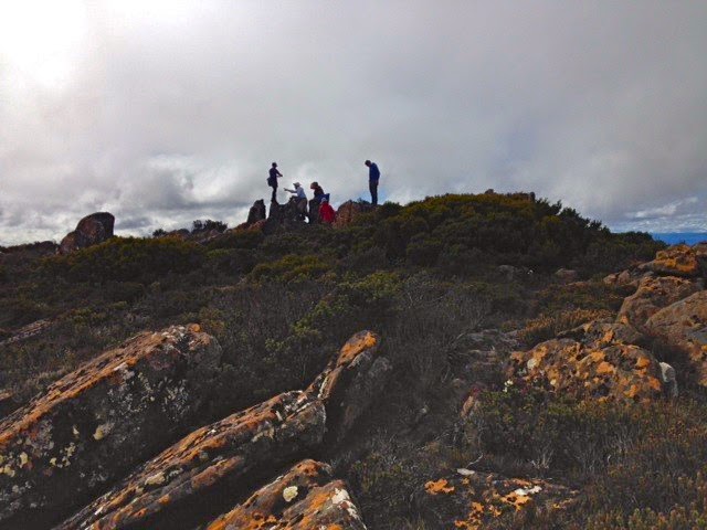
 Approaching the summit cairn

The end of the pines marks the start of the final collection of contours that lead to the summit. The dark shape of Kate was there for us, just visible through the mist, but the summit cairn took us a bit by surprise, coming earlier than we expected, but then, time flies when you’re having fun, and we were both enjoying our little adventure in our own private world, made so by the thick mist.

Returning home after the summit photos, we were aware of the potential for error. Mt Kate is so flat at the top that it would be very, very easy in the mist to be lured into the wrong direction. Don’t venture up here without map and compass, or gps. Tasmanian weather can be dangerously unpredictable. We needed to check direction several times on the way home to make sure we didn’t veer off path. There are so many wombat pads that the path you are on is not necessarily the human one heading home.


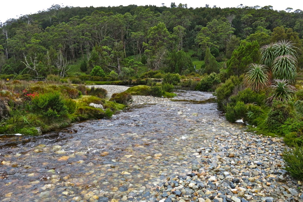
Beautiful Ronny Creek, at the end, looking up one of the ridges that leads to the summit of Kate.

I had worn old waterproofs that I’d ripped to shreds the week before on the Mt Anne Circuit. We both arrived back at our cabin pretty sodden, but very pleased to have made the acquaintance of a new mountain. I’ll be back sometime within the next year to check her out on a day with visibility, but I have the feeling that seeing views will add little to my first impressions of a happy outing on Mt Kate.

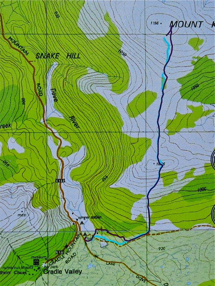
The purple track is our outward route, with errors. The cyan track is the correct route, and the way we returned – see notes above. Note, the highest point (and thus the summit cairn) is not the black dot on the map which I suspect is as random as many of the tracks are.


Anne Circuit 2015 Mar

Anne Circuit 19-22 March 2015.

Day one. Lake Judd. Anyone who was superstitious would have believed this venture jinxed on the first day. My friend and fellow fun adventurer, Monika, woke up sick and had to bail out. Next, David, a friend I was going to have great fun sharing photography with, broke his wrist when he slipped on treacherous, slimy boards only 32 minutes into the adventure and had to be taken back to Hobart. Generous Phil volunteered to miss the walk and drive him. Others had to help get his pack and camera back to the car. With such an attrition rate at the start, and with rain driving down, there was a rather gloomy feel and yet those left standing remained excited about what lay ahead: the famous Mt Anne Circuit with all its mystique. We were underway at last.

And still there were seven

Because of the delays and the copious amounts of mud – with some holes on the track being over 120 cms deep (as measured by Stacey’s pole and not her body, fortunately) – the going was slow and we elected to camp down at Lake Judd rather than climbing to the base of Mt Sarah Jane. My disappointment at not being high was mollified by getting to see Lake Judd and its beautiful surrounding rainforest, and completely dissipated later as I lay snug and cozy in my sleeping bag, listening to the sound of the howling, yelping wind up high that reached us ominously down there. On the Lake, there were waves big enough for a midget to go surfing. At one point we had all been thigh deep in water. Our boots and socks were sodden and would remain so for all four days. My dripping gear lay in a ghastly pile in the vestibule; a problem for the morrow. My camera had spent nearly all day in my pack, hiding from the rain.
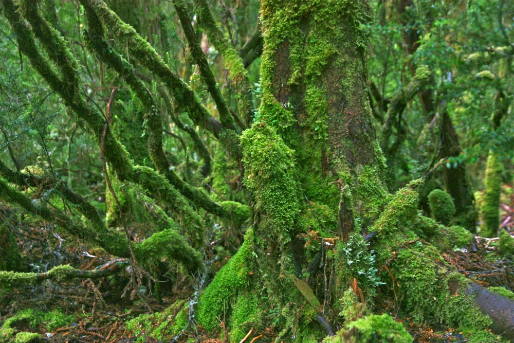
Day Two. Mt Sarah Jane, and a scary lesson.
Donning saturated, freezing clothes at the start of a day does not exactly cheer, but we got the job done and, shivering, set out back through the glorious rainforest to a track junction, and then up to the base of Mt Sarah Jane. I was cold and enjoying the climb, so when the others offered to let me go ahead, I accepted. This meant, however, that I got very cold up top in the wind, waiting. For most of the rest of the trip, I decided the warmest option was to be up the back or at least in the middle.
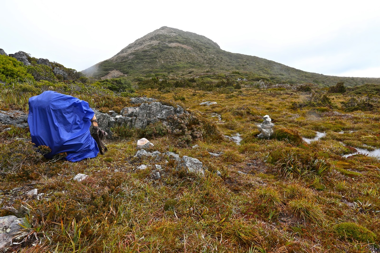
Mt Sarah Jane, awaiting our arrival. Mist is just starting to edge its way over the saddle. She looks pretty innocuous, doesn’t she. We took her for granted, so she paid us back big time.
Once you’ve climbed up to the base of Sarah Jane, the hard work is basically done. She looks much reduced in size from that position – a wee pimple of a thing – and hardly to be taken seriously. It looked as if we’d be at the top in about 20 minutes. The others agreed to summit her too, so dumped their big packs and were ready to roll. I already had my daypack on with nibbles and camera inside. Rupert popped in his gps, which seemed almost comically superfluous. I hadn’t bothered with compass or gear. She was right there and a simple undertaking. That said, I was thrilled with the company I was keeping, that they would agree to climb in this weather. Do I need to remind you about how cold we were, having feet that were still icy, despite the climb we’d just done? The day was dull and grey; views were not promising, and an icy wind bit you every few minutes. Any normal person would have said: “Not today thanks”, and left it, but these guys said they’d come. As we set out, mist gathered, obscuring our mountain, but we knew where she was.
After maybe only five minutes’ climbing, the wind gathered ferrocity. Some blasts completely flattened me, so I climbed almost lying against the rock to prevent being tossed into space, a piece of light debris for this malicious force. Shards of sago snow bit my face and stung. Each glance back I could see the coloured shapes of the others through the dense gloom, so on we proceeded, not spreading out too much. Cairns were hard to find and I felt like a blinkered horse. My balaclava was blowing in circles around my face. My pockets had been turned inside out by the wind. On we climbed, surviving, until at last the summit was reached. Up there, I was so cold I was not coping. While we waited for the others, Stacey hugged me to try to give me some of her warmth. I was now into violent shivers. The summit photo was swiftly taken and we turned around straight away. At this stage, Peter was having trouble with his coat. The wind virtually ripped it off him so he looked like a scarecrow, the coat tails flying up above his head while only the arms stayed in place.
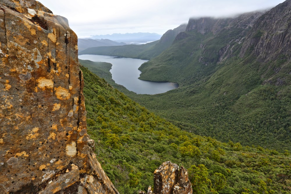
Spanner Lake, our tent site on night two, as seen next day from above.

Down we ventured. I was now too freezing to lead; I just wanted to be a sheep in the pack. Rupert kindly took on the respinsibility and off we set, groping our way in dense mist. Suddenly we could see neither the next cairn, nor the last two in the queue, who had, unknown to us, continued straight ahead instead of swinging around the mountain as we had done. We yelled and screamed, but the wind gobbled our noise. Rupert took a gps reading: our route lay 20 ms to the left. Boom. Batteries died. I was so cold I wondered if I would share the same fate. If we couldn’t find the others, that was a very real possibility. Every static moment made my core temperature drop a bit more, and yet we couldn’t abandon the other two. Relief is hardly an adequate word to describe the emotions on finding them. We hugged each other for warmth as Pete struggled with his coat and the rocks to join us. What had begun as the simplest of ambles up a slope had nearly ended in fatality. We all felt humbled by the unrealised potential for disaster we had narrowly escaped.
Compared to that epic, the rest of the day was gloriously lacking in adventure, and we continued on after a brief lunch to our camping place at Spanner Lake. As we crested the high point from which we would drop down to the lake, there was a glorious view of the Lonely Tarns below, surrounded by drama and magic. Gelid as I was, I wanted to capture this beauty, so I delayed the others while I retrieved my camera from the pack and they stood in the biting wind. Peter’s pack cover blew off, but was retrieved by Rupert. I got the camera out of the pack, but then spent five minutes struggling hopelessly, grunting impotently but achieving nothing: I didn’t have the strength to undo the simple clip that would open the bag containing it. No photo of that glorious scene. I sadly placed the camera back in the pack, and on we continued to our goal, which ended up being so awash that we found it difficult to find a spot in which to put tents that had not become a partial, makeshift lake.
Lightning Ridge with its gnarly, warty spine of rocks glared down at us (when the mist parted – briefly). Rain continued. Once more the revolting, and now smelly as well as sodden, gear was deposited in the vestibule while we attempted to warm up in our tiny tent havens.
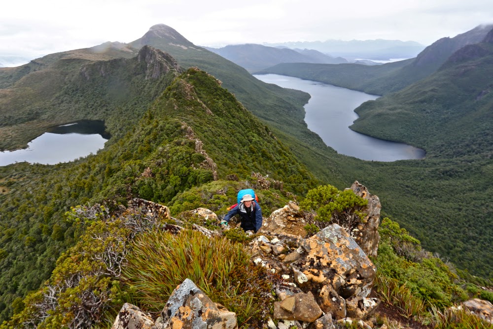
Climbing Lightning Ridge

Day Three. Lightning Ridge, Mt Lot, The famous Notch. The apex; the glory.
This was one of the most dramatic climbs of my entire life. Striding Edge (UK) eat your heart out. It’s nothing compared to Lightning Ridge. Wow, what a beauty.
The day began in a prosaic enough way, like most other days: on with the putrid, sodden gear, on with the packs, no lighter despite three days’ eating due to the wetness of the tents. Off we set, over a creek at the end of Lake Spanner (whose shape I hadn’t yet seen) and up through the steep forest, knowing that the sharp ridge we’d seen from afar would be at the end somewhere up there in the heavens. Up, up we went, through glorious, but rather surprising forest: it had been raining almost incessantly, and yet, moist and lush as the forest may well have been, there was not one drop of running water to be had. I had not even thought about carrying water: it was the sort of weather in which you just pointed your open mouth upwards if you wanted a drink, but the rain had now ceased, and the strong wind must have dried out the water channels and puddles. No worries. It wasn’t a day that demanded continual drinking. I’d find water somewhere later, and I did, in a puddle in the rocks right on top.
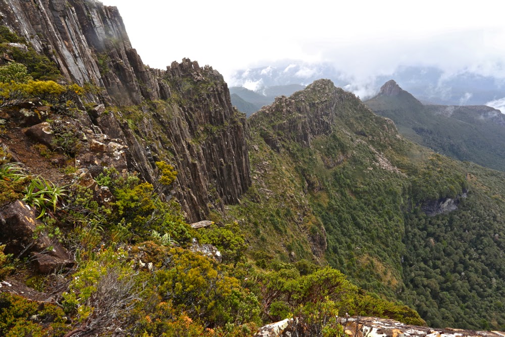
Lightning Ridge, looking back along our exciting route

Stacey and I were together at the front, climbing away when all of a sudden we just popped out into open territory: we’d reached the rocky spine and Oh what a view!!!! Now I could see the shape of Spanner Lake, and all the surrounding dolerite pillars and mountains delicately crowned in mist. It was as steep as it’s possible to be without collapsing, and utterly mesmerising. I hate holding people up with my photography, but luckily the others were far enough behind to give me time to get out the camera and happily shoot away. I was sure they’d want a break anyway – to admire the view, even if not to eat and recharge their batteries. (Still no puddles for the negligent me).

Mt Lot, the view therefrom, and our way forward along that ridge.

The climb was protracted, which I fully appreciated for safety reasons. The times various photos were taken indicate how carefully we negotiated this supremely difficult territory – and the hard section of The Notch hadn’t yet begun. Even before we’d reached this famous stumbling block, we’d needed to do several pack passes – spots where the going was tricky, with a dangerous drop below if things went askew, and where a heavy pack hanging out the back (especially if it behaved in any way unexpectedly, if a strap got caught, or if it changed position quickly for some reason) could send the sad owner on a one way trip to eternity. On they went, off they came, as we sidled around nasty corners or inched our way up or down tiny ledges. Sometimes you’d come to what seemed a cul de sac, the way ahead thin air; the drop below, momentous. “No. They can’t POSSIBLY want me to spring down there! And certainly not with a pack on.”
At one point, we breasted a mound that I thought was “just” the high point of Lightning Ridge, but Rupert announced that we had just climbed Mt Lot. I couldn’t believe it. We were on this mountain of Great Stories. I thought it was still to come. We climbed both summits, just in case, and proceeded on our way. Our mission lay further on.
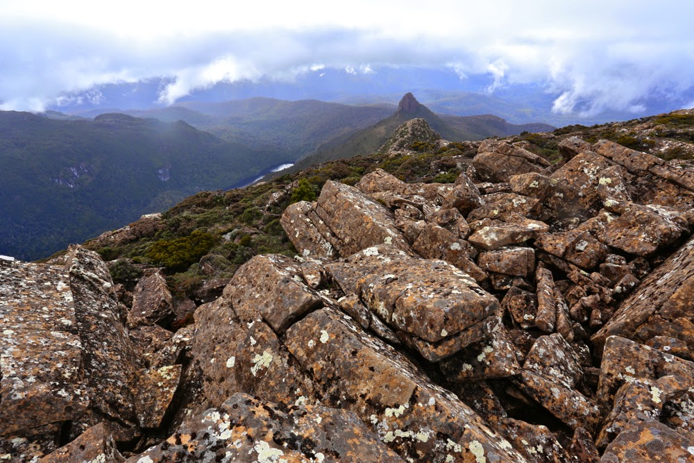
Lots Wife, as seen from Lot. He did, indeed, leave her behind.

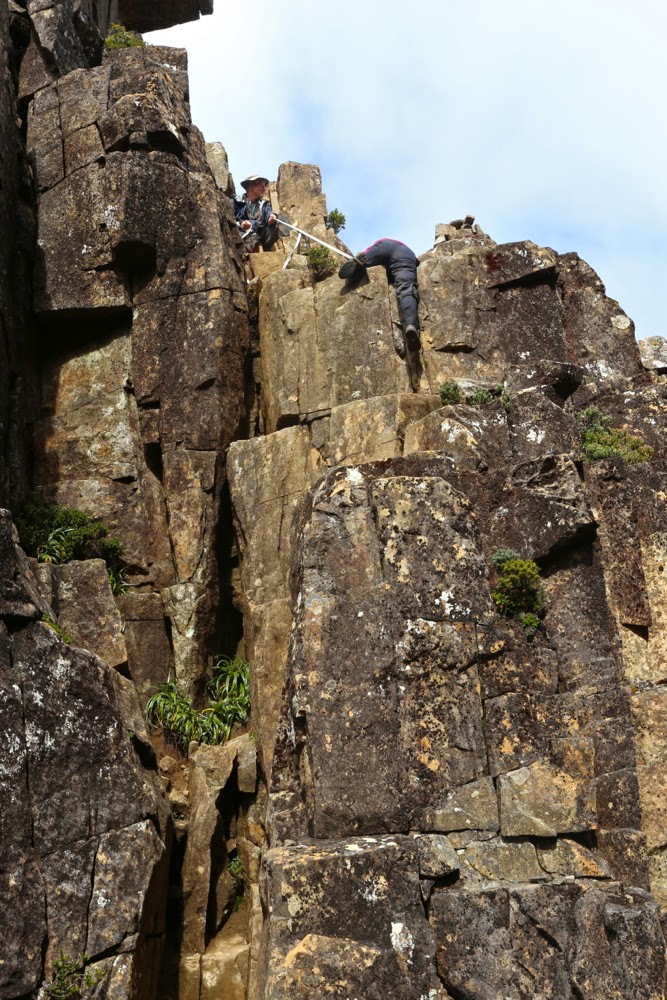
And so, eventually, we came face to face with The Notch (to be said with a slightly quaking voice), for which Rupert had been lugging a strap and carabiner the whole way. Stacey went first, and we watched her (roped) lower herself over what seemed a bottomless pit. When my turn came and I looked over the edge, however, I could see a small ledge that held little fear (seeing’s I was roped). Yes, one lowered oneself, blind, into oblivion, but with the rope, if the fall got out of control, it would be impossible to just roll forever, and after that single manoeuvre, the rest was easy. There was not even a need for rope once that first daunting leap of faith was made. Whew. I had been rather full of adrenalin anticipating this moment.

The Notch. Sue begins the leap of faith with Rupert holding the rope for her.

Once we were all safely down, and rather elated that the worst was now behind us, up we went again, sadly needing a couple more pack removals to give us the needed momentum up slopes where our arms were just not strong enough to pull us up with the extra weight. Not all of us needed this every time, but I used this technique almost every occasion it was on offer: my pack with my full-frame camera on board was very heavy, but I did not regret the weight when I considered the shots I had already taken. Perhaps the others regretted the delays, but I was happy, despite the inconvenience of the weight. I hope the shared memories the shots provide reconcile them if they were annoyed.

Playing around on High Shelf camp, waiting for dinner time. Mt Anne featured.

On we sauntered, happy now that the rain had stopped and the wind had dried us out a bit. The sun even started to make a concerted effort to appear. Suddenly Rupert announced: Here’s our spot for the night. “What? We’re finished?” Wow. It was only 4pm. The sun was now shining. We were perched on a glorious shelf with a magic view. We turned the place into a Chinese Laundry in about five minutes flat, making a desperate attempt to dry out tents, bags, anoraks, overpants and everything else before the sun set. Hot soup was an item that urgently yelled to be on my agenda. I went across to join the others who were basking in the sun, staring at Mt Anne, brewing tea or soup. “This is the life,” I exclaimed and everyone agreed. Who cares about a few wet items of clothing when you can be here, in wilderness this glorious, staring out at sublimity in every direction? The others were drying their shoes and socks, but I knew my shoes would take a week to dry (poor boots, on their debut walk – muddy, scuffed and ill-treated), and I wanted to explore our new environs, so kept my stuff on for a few more hours. Needless to say, we were blessed with a glorious sunset. I stayed outside almost until the last light went: it was just too beautiful to be in a tent with the zip done up. I was pretty freezing by the time I admitted defeat and left the pink valley below me to its own devices.
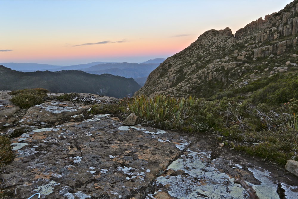
Sunset from my tent site. The Notch is visible as the gulch to the right on the horizon.

Day Four. Mt Anne for most; Eve Peak for me. Mt Eliza and down.
I was worried about the 8 a.m. departure for today, as I knew that if sunrise were beautiful, I would want time to photograph it at length. Luckily I managed to be punctual, despite being delayed by beauty. I hadn’t been so lucky during the night. I had been rather busy with mild gastro, and my frequent visits to the chilly realms outside were made worse by the fact that my tent was absolutely sodden with condensation. I was feeling very ordinary indeed, and rather weak, as we set out.

Dawn arrives at Mt Anne next morning

I am not a person who thinks that once you’ve climbed a mountain there’s no need to climb it again. Not at all. I’ve climbed Cradle six times now and am looking forward to the seventh, eighth and ninth times. Each time the view has different lighting; new features on the horizon take on new meaning. I run the Cataract Gorge route almost every day of my life and never tire of it. However, Anne has a sloping edge that I find dangerous, and I was feeling quite queasy thanks to my gastro. Meanwhile, I have never climbed Eve Peak nearby, so opted for a new peak rather than doing a walk that I find uncomfortable, to see a view that would be hazy at the top.

Off Sue sets to join the others in climbing Anne.


Anne from Eve Peak

I climbed Eve quickly, and got in a view before the mist heralding the next lot of rain started to gather strength. From the top I watched columns of mist rising, and beat a fairly hasty retreat to where I’d left my pack, remembering our Sarah Jane experience of how quickly the mist can roll in to confuse and disorient. At least this time I’d brought my compass. At about this time, the wind picked up strength again. The group had agreed to reunite on the summit of Mt Eliza. I saw no more reason for hanging around where I was. In this wind I’d prefer to be moving, so I went to our rendezvous point and hoped to find shelter. I did. Kind of. It was a long wait, but I met a few very nice people while I was perched behind a rock, and that helped to pass the time. It had been a wonderful trip: I had plenty to think about when not entertaining guests in my lair.
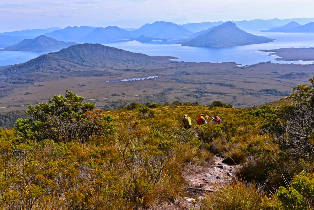
The final descent
Sorell 2015 Mar

Mt Sorrell Mar 2015.

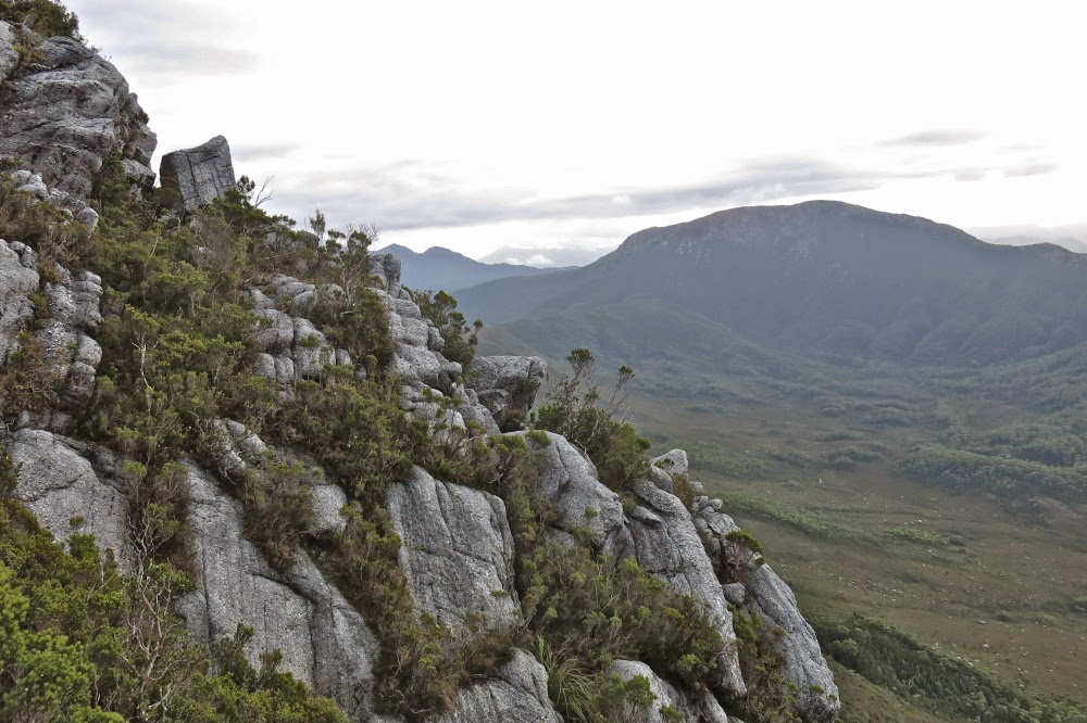
This is the slope we were negotiating

Mt Sorell has a formidable reputation. For that reason, the three men I was climbing with had left it until nearly last on the “to do” list of climbing all the Abels (peaks over 1100 ms in Tasmania). Of the 158 Abels, it was Andrew’s second last peak, and Terry’s fourth last. In fact, this would be Terry’s fourth attempt at the mountain. It does not give away its summit easily. These two men, on their first attempt four years ago, spent a whole day “punching holes in the scrub” to create tunnels of thoroughfare and laying tapes so that future attempts would be easier. They were. Because of their tapes, a couple of brave parties have gone through, finding the going much easier than they had done, and in the process, creating signs of human wear here and there (but not too much or too often) which now makes the going easier. But do not take this mountain for granted. If you think Mt Wright is too steep, then don’t bother with this one. It is not only steeper, but perilously slippery in wet weather (which we had). Route finding, even for the original tape layers, is not easy!

Another view of the kind of terrain we contended with

The forecast for our attempt was mixed: OK Saturday morning; furious rain Saturday afternoon; possibility of showers but also the possibility of clearing on Sunday. That would be our attempt day. On Saturday, we just got ourselves into position and sat out the drenching rain. Mark and I amused ourselves by counting the leeches crawling up the outside of the inner layer of our tents, calling out numbers to each other across the distance between our tents. Mark teased them, putting unattainable fingers on the other side of the fabric, but very near. Whenever either of us put a hand into our vestibule to get, say, our mug, our hands would be covered in leaping leeches before we’d even had time to grab what we wanted. I tossed up whether it was worth the price to cook dinner. Could I flick them off faster than they leaped onto me? I certainly did not dare go to the toilet. My crocs in the vestibule were covered in dancing, writhing, eager searchers for my blood.

A view from higher still … but there’s still plenty left to do.

Down below, Andrew and Terry had no leeches, but were fully occupied digging trenches and sticking holes in the metaphorical dykes to prevent the water flooding their tents. When Mark and I found that out next day, we were very glad to have camped on “Sorell heights” rather than the more protected bowl below. My tent changed shape dramatically with each blasting gust of wind, but that’s better than digging trenches in a storm.

The final saddle on the ridgeline before the summit. use that little bit on the left to climb and we’re there.

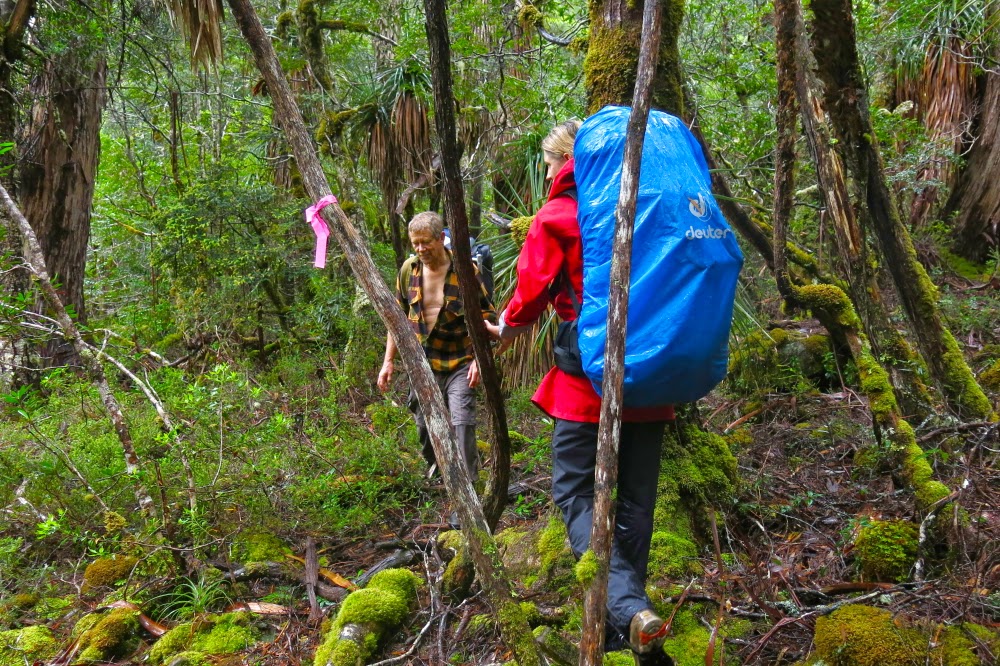
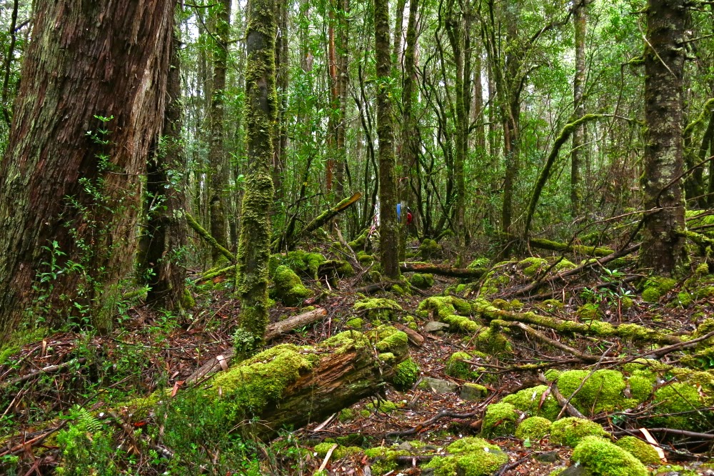
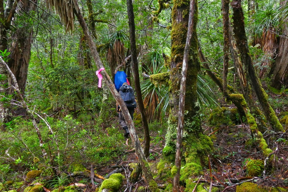
In order to make sure of the summit, our departure time was set at a sensible 7 a.m., and, as it was to be a 12-hour day, this was a good thing. We breakfasted in the dark, and set out at first light, through the wet scrub of the lower slopes. Up we climbed. It seemed pretty steep, but the experienced Terry and Andrew told us “we ain’t seen nothing yet”. OK. Mental reorientation. Soon enough we entered what they called the “tunnel of love”. This had taken them hours and hours to forge on that first, momentous trip. Now, thanks to their work, we were able with little effort to burrow through what would normally be energy-sapping, almost debilitating and demoralising scrub. One look to left, right or above and you appreciated the time and effort that had gone into this tunnel. Soon, they said, the hard work would begin. Pity. I had thought I was working pretty hard already. Then began talk of exposed rocks. Oh dear. What was this day going to bring?

Another view of the final saddle … just because I love the texture and form of rocks

Towards the end of the tunnel, we began to enter territory so steep that the next step involved hauls up 2 ms of slippery mud or sheer rock. I tugged for all I was worth on roots or bushes but sometimes that wasn’t enough. At least five times, I needed Mark’s friendly hand offered to give my muscles that extra oomph to ascend the otherwise unascendable. Oh dear. Frailty, thy name is woman. I could do nothing about it but be grateful that these guys had invited me along. Did they realise I’d need occasional help?

Summit view of the land below. (Grand vistas were, unfortunately, not well delineated thanks to the abundance of moisture in the air).

I don’t have many photos. We were very task-oriented that morning. Our goal was the summit, and the only breaks were one toilet stop for two men (whew, a chance to take photos for me) and one stop for shedding a layer (more photos for me). Apart from that, it was purposeful progress directed towards the summit. Once we breasted the ridge, with about 1.25 kms remaining to traverse the tops to the actual summit, the going was, of course, easier, and then there was a tiny climb (144 metres) up the last, pretty easy slope.

Two of the others approaching the actual summit from a rise that I had thought, whilst climbing, would be the real summit. I love photos that put tiny humans into the perspective of the grandeur of nature. 

I went right of a creek, the others set out left. The sun was in my eyes so I could see very little and lost track of whether the others had crossed over to my route or had remained left. I couldn’t see them, and no longer knew if they were ahead or behind, but figured we’d connect with each other on the summit. With excitement I viewed the trig, but didn’t go any closer than twenty metres to it. Terry and Andrew had forged the track. Without Mark’s hands I would not be where I was. I wanted to be the last to touch the actual goal of all this effort. I was the one who had done the least. I wasn’t even sure how or why I had been invited, but I did know I was exceptionally grateful.

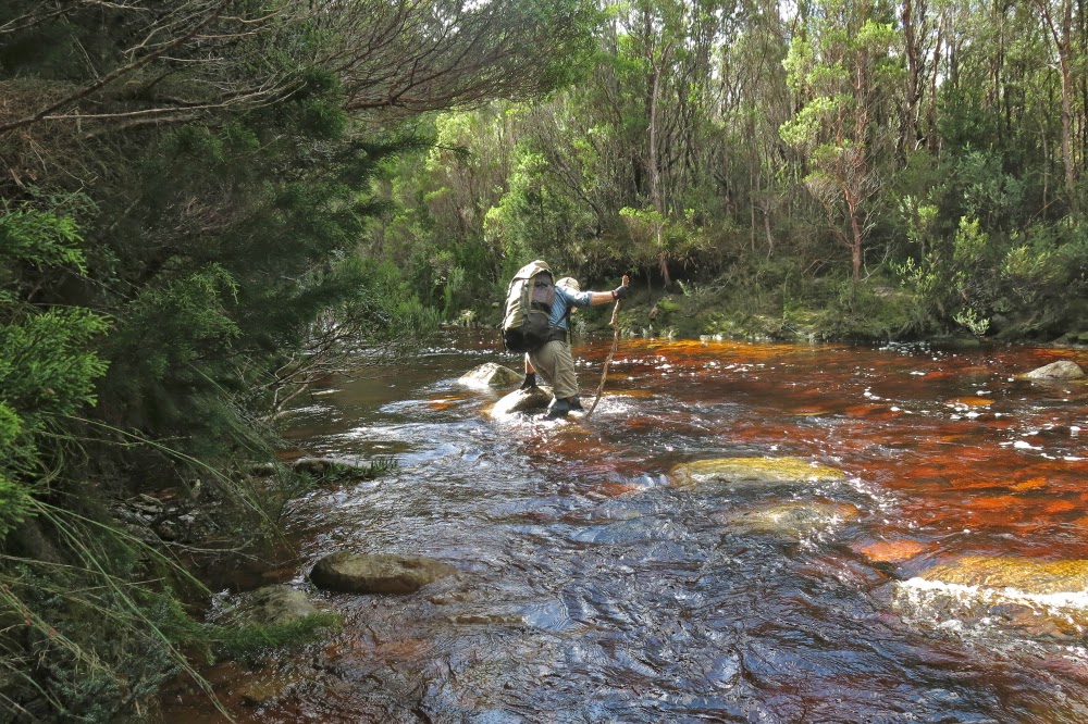
Crossing Clark River on our return

It took us four hours from the tent to the summit. We had time there to indulge in photos and food before we began our descent, but even then, we didn’t waste too much time. Our goal was won, but our job was not yet done. This was to be a big day. Luckily, the bum slide down the mountain was very quick: a mere two hours of pretty good fun, which meant we could relax a tiny bit to eat lunch and pack up our tents before the next stint of climbing back up to the Darwin ridgeline and dropping way, way down to the cars at the start, a trip that would take us 3 hours plus a couple of stops. The river had flooded a bit overnight, so some time was lost sorting out the best crossing point. I just wanted to keep my camera and sleeping bag dry (translated: I didn’t want to fall in) and was prepared to get my feet very wet in order to prevent toppling in a misguided attempt to be fancy by trying keeping my shoes dry. My boots were sodden and made rude, slushing noises for the rest of the trip.

This is the way I, too, chose to cross: maximum water logging, minimum risk of falling. I didn’t want to leap across slimy rocks.

At last we got to the cars, made it to Queenstown to find all opportunities for real food had already closed, so settled for a meat pie to fortify us for the very long trip home. I drove to the “wild life highway”, and Terry did the rest. I tried to stay awake for his sake, but rather fear my talk sounded like that of an inebriated fool – slurred and not terribly sensible. I was aware of dropping off mid sentence at times, possibly with increasing frequency as the time snuck over the midnight barrier. We pulled in at something near 1 a.m. The dinner Bruce had made, hoping for an earlier arrival, smelled good. I don’t often have midnight feasts, but succumbed this time.

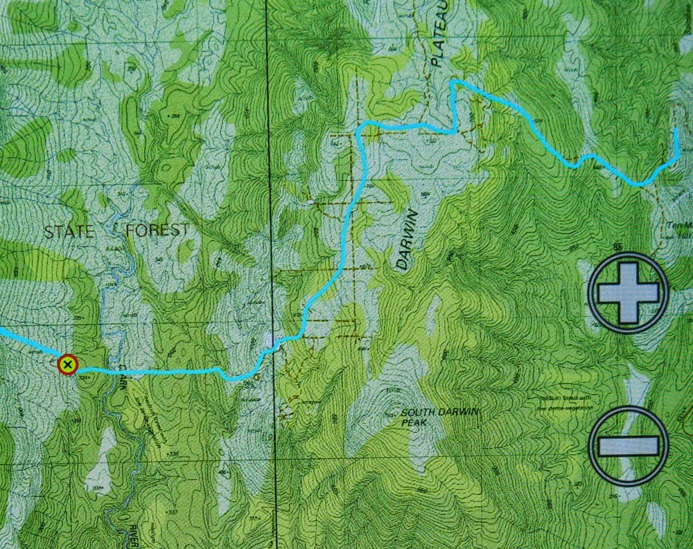
This is our route from the car to the tent site (and return later the next day


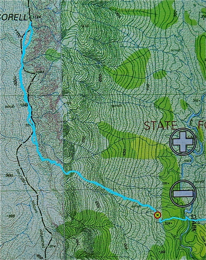
And this is our route from the tent site (waypoint) to the summit return. You will note that the contour lines are so close together they just make a brown smudge on the map.
Track data: All up, just on Sunday, we walked 17.8 kms, and climbed (and dropped) 824 ms + 467 ms. This yields a total of 30.7 km equivalents for the day.


Shakespeare, Darkes Peak Mar 2015

Mt Shakespeare and Darkes Peak

 At 3 a.m. during the night before we were due to summit Mt Shakespeare, I looked back on the day just past and imagined the moment that awaited: standing on the summit of our goal. I imagined looking with pleasure left and right at an amazing group of tenacious, strong, fit and gutsy people – people gritty enough to brave all kinds of hardships to be in that spot just for the pleasure of being there, of seeing whatever there might be to see (probably nothing), of being in the wilderness and of knowing that we now knew this particular mountain intimately.
The rain began a bit before we did: lightly at first – just drizzle – but maturing into serious droplets as we climbed through the glistening rainforest, gaining hundreds of metres of altitude as we advanced. Spirits were high. We agreed the rainforest looked glorious in its shining patina and were undaunted by the moisture now covering our gear.

The first four photos are taken during the easy, rainforest section on the way up to Wylds Craig. Thereafter I was too cold and wet to get out my camera, and on day 2 my camera wouldn’t work. Thanks ever so much to Monika who has helped me out with summit (and other) shots from the post-rainforest sections.

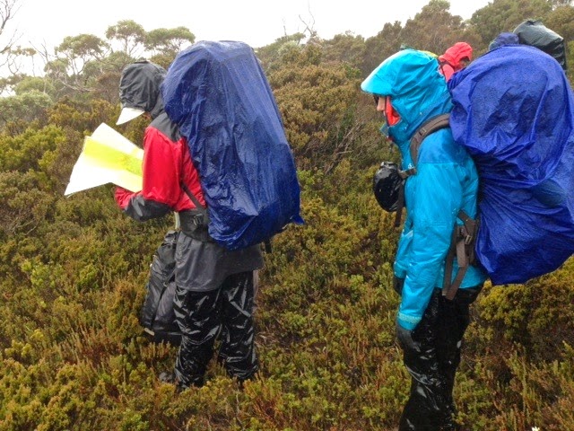
By the time we had reached 1200ms, just under the summit of Wylds Craig and ready to hive off northish along the spur (after two hours’ walking), the mist enshrouded us, obfuscating all features in the landscape. Our belief in the existence of a spur was a case of faith based on map evidence. There was no visible presence. My compass had a huge bubble and said that all directions were north. I ditched it. Others were to hand.
The spur was thickly bushed, with rocky knolls like giant warts along its spine. The wind from the west was fierce. We tried skirting the first apophysis to the east to evade the wind chill factor which was now making us unpleasantly cold. (The rain continued). Going over was impossible – or, more correctly, impossibly slow and dangerous, which amounts to the same thing. Unwillingly, we admitted that the bush on the leeward side was too dense. Wind was better than impenetrable scrub. Back we went and gritted our teeth for the blast, round “knoll one” which, even at nil distance, was a featureless dark blur in the grey.

 For one and a quarter hours we laboured along the ridge, drenched, prickled, buffeted, bashed by unresisting bushes until we were at last beyond Cunninghams Knoll.  The Ables book offers two alternative routes from here. The group voted for the more direct of the two (alas: don’t follow suit if you want a happy day). For a further one and three quarter hours we fought adamantine shrub, trying unsuccessfully to force our way through first here, then there, but the branches allowed no passage. We perhaps jokingly toyed with swimming once we were at the smaller lake: we couldn’t get any wetter. It was a ghastly battle and any possible victory would, at best, be a pyrrhic one. We were at least offered some possible relief for the return trip, however, as just as we crossed the creek separating upper and lower lakes, we spotted a cairn: hopefully it would lead us to a pad that was less frustrating and speedier than our way here. I was sure we had lost an hour in this battle.

For now, however, it was 5.40; the day was finished and it was time to pitch the tents in the continuing rain and slough off our sodden layers of weighty, smelly clothes. I sat in my vestibule, shedding, shivering, trying not to get moisture near the inner sanctum. Brrrr. The worst was, these were the very despicable clothes I would have to wear on the morrow. My friends, each in their own little tents nearby, were doing the same (with suitable sound effects). We all dreaded the moment thirteen hours from then when these loathsome items would be donned once more.
****
But now, in the middle of the night, I lay snug and warm and cozy in my fluffy down bag, floating on a cushion of soft alpine plants, listening to the rain pattering against the tent and the wind howling above us. What a tough gang I was with. I knew there would be only one dissenting voice in the morning, resisting the pull of the summit (not strongly) and I was right.


Sorting out map details is a real pleasure in these conditions

Horrid as the next day was, there we all were at 7.30, battle gear on, ready to tackle the theoretical mountain to the NE. She even came to say a brief “hello”. There would be no photos for me today: my camera had got waterlogged the day before. I would just concentrate on survival and summitting. I was not feeling at all well.
Through more scrub we went, finding the odd wombat pad to help us, until we reached the magnificent myrtles of the saddle area. I had led us from the tents to this point, but handed over here to Andrew who had a compass. The mountain had once more vanished. He did a great job.

Hoorah, the summit

Our leader chose to attack the summit via the rocky ridge (which is the route indicated in the book), so up we all went, hauling ourselves up huge slippery (mossy) boulders, fortified by thick prickly bushes between. At one stage, we were all horrified to see Colin, who had forged on ahead, hurtling down a four metre cliff head first. We all feared / assumed we were watching death at the worst, serious breakages at the best. Somehow he flipped at the moment before landing to come to a halt in a bush, landing on his derrière: possibly the first time in history that scoparia prickles in the bum have been preferred to other alternatives on offer.  His face showed the astonishment we felt when he realised he had emerged unscathed.
On we proceeded to crest a knoll that wasn’t the summit. I could visualise the map without needing to turn my screen on. Blast. We still had a way to go. Down. Round. Up the gully with more spaced contours. Hoorah. And then, at long last – almost unbelievably – the summit.

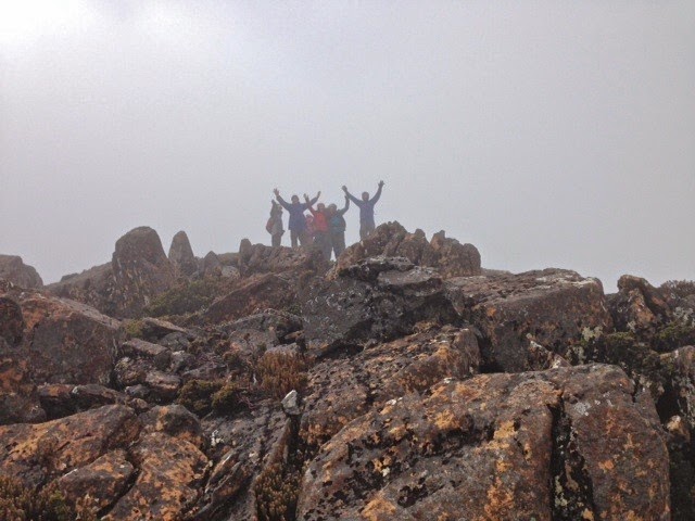
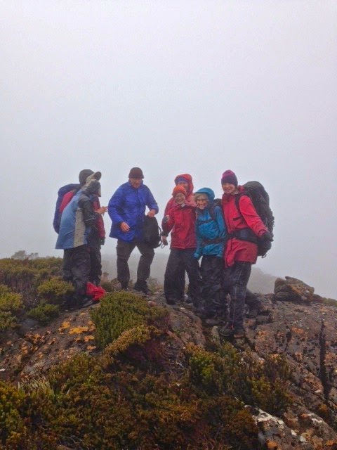
Jubilant summiters

In my dream it had been sheer jubilation and admiration for my companions. In reality, relief was added to the mix. We hugged and thanked each other for a team effort, took happy summit shots and quitted the scene which offered no vista and a dose of wind. It can get worse. The way back was much faster as we eschewed the ridge.
Back at my tent, I felt exhausted: I must have a bug in my system. We’d only been going nearly five hours at this stage. I dismally stared down the barrel at a possible further five to get out via Darkes Peak (walking time only), and began dismantling my little home.

On Darkes Peak. Pretty dark, huh?

This time we found the pad which saved us the hour I had thought it would (48 up; 1 hr 45 down). From where we emerged, Darkes Peak was a mere 12 mins up, 9 down. It now remained to plod out the section that had taken us three and a quarter hours on the approach. We were tired, but eventually we closed off our long, hard day twelve hours after we had begun it. How lucky I am to have companions who are happy to do this sort of thing with me.

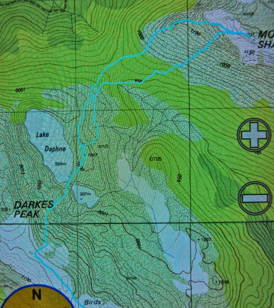
GPS track of the two important sections. (1) We went up Shakespeare by the ridge; I advise using our descent route which was WAY better. (2) I was saving battery, so did not track our route down to Lake Daphne, but here, tracked, is the route with a pad that is an hour faster than our route which left the ridge earlier and angled across more. Coming from the ridge, the top is not marked, but it emerges just before a rocky knoll, the last little rocky knoll that exists before you start ascending Darkes Peak (where we changed direction above). We left our packs at the knoll and summitted from there (untracked). 
GPS data: we walked 15 km equivalents on day 1 (100ms altitude gain = 1 km equ); on day 2, we did 30 km equivalents, most of which was through thick scrub. No wonder we were tired!

Byron 2015 Mar

Mt Byron Mar 2015 
The reason I climb mountains is because I love being up high (I also love climbing trees); I adore the physical act of climbing, and my soul delights in being with nature and gazing at sublime infinitude.

I am also, however, a task-oriented person, who likes to achieve the goal for the day. After two failed attempts at the summit of Byron in as many tries on club walks, it was time to be my own boss. I wanted success this time. I’d look up how many points I got some time or other. The summit was my goal.

First official day of autumn. Frost says “Good”.
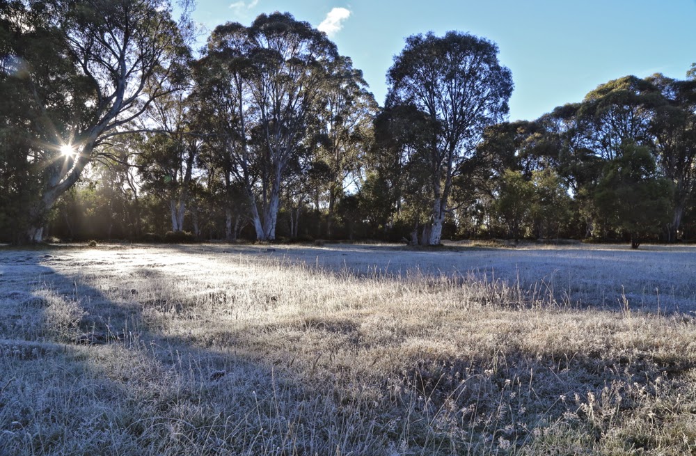
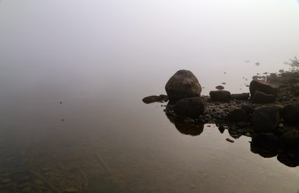
The trip to the ferry “threatened” to be the highlight of the day. Sunrise was magnificent as I drove up the Poatina Rd to the central highland; on top, autumn announced its arrival with glorious patches of sparkling frost. Lake St Clair (Leeawuleena – magnificent name) was shrouded in mist. It was going to be a gorgeous day. A temporary dampener, however, was put on matters when Steve, the cheery, affable ferry driver, informed me that he was finishing up at the end of the week. I wonder if his employers understand what an amazing asset they’re losing. Steve’s friendly and knowledgeable trips have come to be a grand entree to every expedition in the area, aiding in the excitement of each venture.
You don’t replace someone like that easily: a new ferry driver, sure, but an asset like Steve … ever?

Leeawuleena (Lake St Clair).
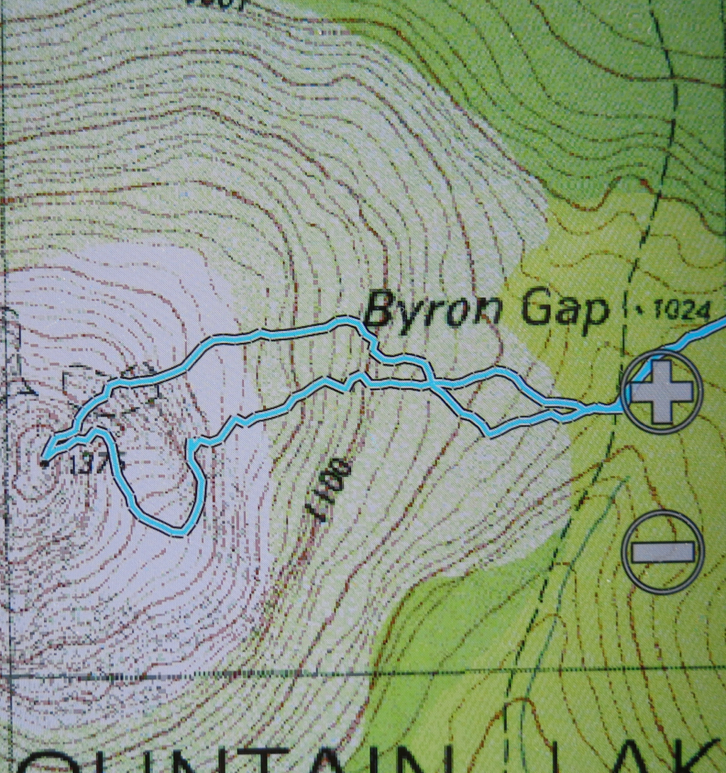
I love the forest lining Leeawuleena – always so rich, lush and vivid in its greenness. Happily I strode out, staring intermittently up at my mountain, and at all the old friends that surrounded my journey. Unfortunately the atmospheric mist had already evaporated. It took 17 mins to the turn off; and 59 more up to the top of the Byron gap, where the real work would begin. This is the third time I have walked this “track”, yet I managed to dream my way off it twice on this trip. Fortunately, the first time was right near the start, so I turned on my gps tracker in case I should need it on the way back down. The black dashed line for track on the map bore no resemblance whatsoever to the track I was marking. I was glad that I wasn’t trying to navigate myself to the line on the map for safety.

Paths like this require constant attention to stay on them.
After the gap, I had to make my own way to the top. There was talk of a cairned route if you happened upon it. I didn’t, so nosed my way to my left through pretty thick scrub and along a rather precipitous cliff-ledge until I came to a promising looking gully leading upwards. Happily, my map indicated that this could be followed to the final summit mound (which would hopefully not be fortified by more unmapped cliffs. One never knows on maps that don’t back up photogrammetry with cartography). The map certainly didn’t tell me that the rocks comprising this backdoor entrance were wash-machine size, with some heaving needed sometimes to get to the next layer. I began to worry about the return journey and the still existing possibility of getting trapped with no retreat reasonable. I hankered after a nice easy cairned route. I sensed the effects of adrenalin.

Byron’s pandani forests are a delight
The mound ahead looked as if it could contain the summit, but I didn’t dare invest too much hope in this. Too often such mounds lead to a view of the next, higher one. This one, however, offered my approaching form a sighting of three little rocks perched atop one another. I had made it.

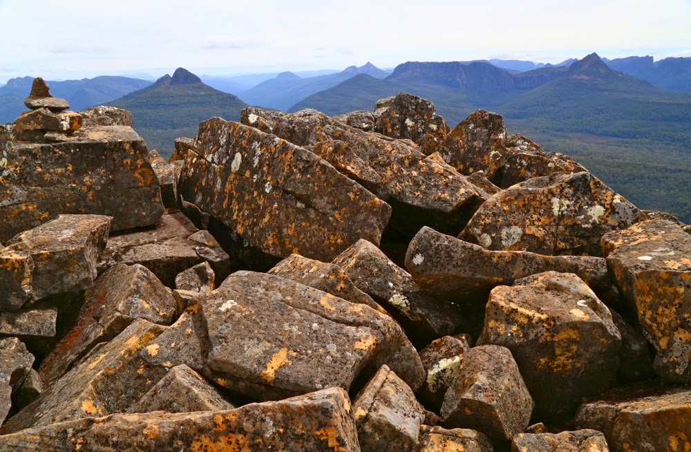
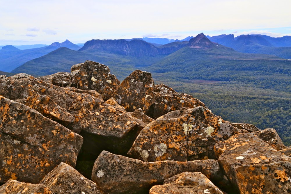
Looking at Manfred, Horizontal Hill, Guardians, Gould, Geryon et al
I actually felt nauseous with anxiety, as the descent still lay before me. I didn’t linger on top like I normally do, just in case I needed lots of time to find a way down. Besides, lunchtime hadn’t quite arrived yet. I took photos and then set out to try my luck on the return journey. This time was different. I happened on a cairn on my chosen early section, and one cairn led to another. Eureka. This route was SO easy. It was 30 mins faster than my way up – most unusual for me. I usually ascend faster than I drop, due to my eagerness to see the top and my hatred of stopping before I’m there. I am not normally happy to leave, so dawdle a bit.
View to Horizontal Hill, Guardians, Gould, Geryon and more
In the safety of the saddle, all work behind me, I enjoyed my lunch, looking out at Frenchmans Cap.  I was easily in time for the afternoon ferry, except that it had been cancelled. I was the only customer. Now began the long walk home. No matter. The forest is wonderful. I slotted into my rhythm, walking and singing my way through fairyland back to the visitor centre, where I enjoyed a delicious veggie curry before embarking on the drive home in the fading light, shooing countless conferences of wallabies, all sitting erect in the middle of the road chatting, unwilling to have their colloquies interrupted by a mere vehicle. I stopped to let each group finish its important discussion. My speed ranged from 0 to 50 km.p.h in deference to their need to converse on dirt road.
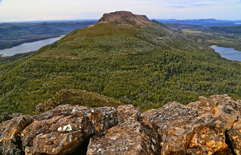
An unusual perspective on Olympus, with Leeawuleena and Lale Petrarch balanced on its outstretched arms.
The challenges of the day, apart from driving, climbing, and avoiding garrulous marsupials, involved walking 36.5 “kilometre equivalents” (where 100 ms climbed = 1 km equiv). Quite an active day.

The more southerly route is me fumbling my way to the top, edging around cliffs. The northern one is the cairned route. which I happened upon up the top.