Eastern Arthurs 2016 ii Federation Peak attempt and East Portal

Eastern Arthurs II. Federation Peak attempt and East Portal.     A personal perspective.

The big one of the Eastern Arthurs, yea, of Tasmania: Federation Peak. Gulp. It’s not the highest, but it is the biggest in stature and in everyone’s minds. Summit day dawned: a white-out. Start time was put back for at least an hour … or more. Whatever it took to give visibility. The air was cold and damp and we appreciated the extra time in our cozy, warm sleeping bags, chatting across the tent space. We’d all eaten and were ready to pull down the tents in minimum time when it became appropriate. I wasn’t impatient. It was not suitable to climb in this.

Federation Peak, all close and personal.

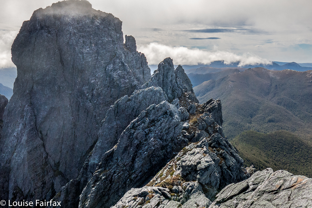
The call to move came to me like a call for battle. So. This was it. Here was our destiny, which, in a worst case scenario, could be our death. You fall on a certain section of this rock face, and you die. Damit basta. This was, contrary to my original understanding, to be a ropeless climb. No one told me that the rope we were bringing was not for humans, and I had made assumptions. However, had I known, I would still be here, exactly where I was, waiting to see what could be seen; waiting to experience whatever it was that lay directly ahead.

Cautious movement along the Southern Traverse.

There is no intended blame here. If you don’t know how to tie the right knots, attach a rope properly to a fixture and belay with correct technique, then it is utterly inappropriate to have the responsibility of doing it in a situation such as this thrust upon you. I am merely saying that the absence of this safety net altered my attitude to the climb that lay ahead.
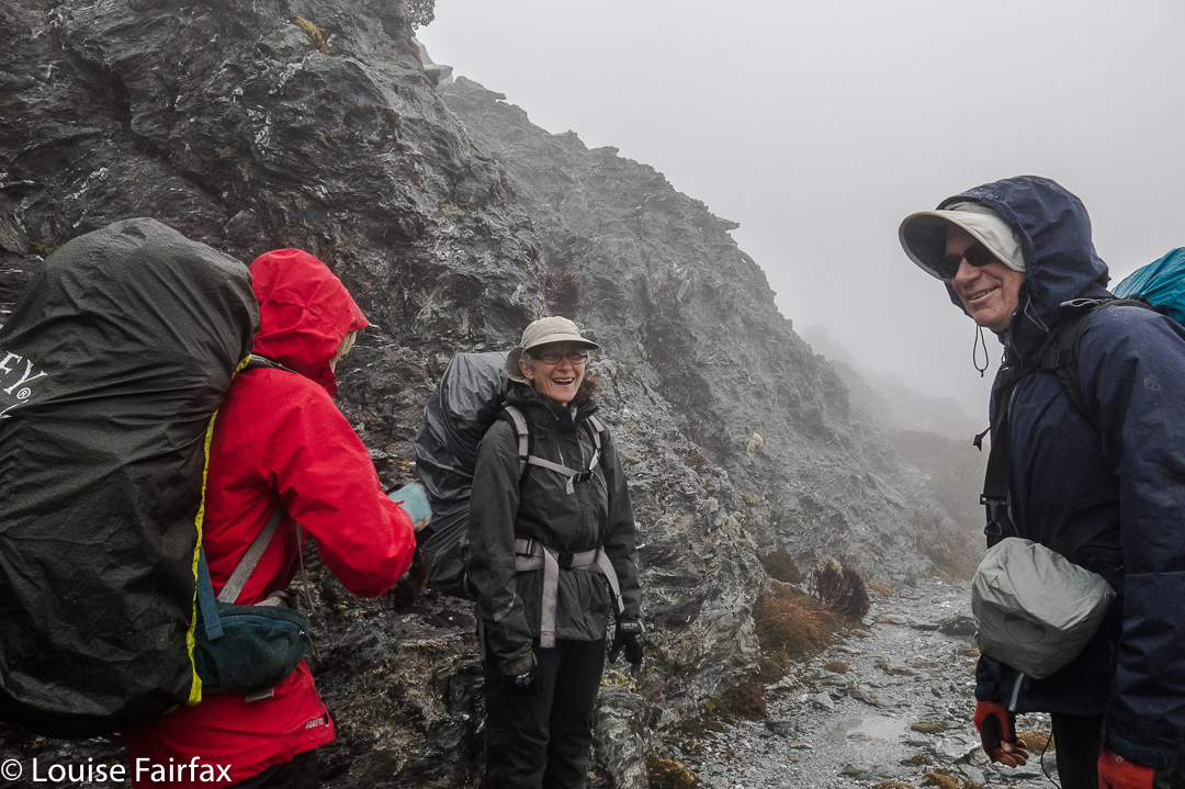
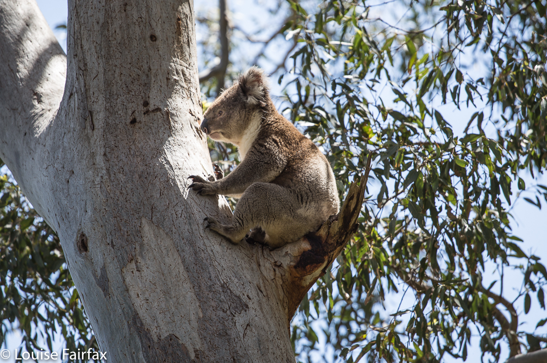
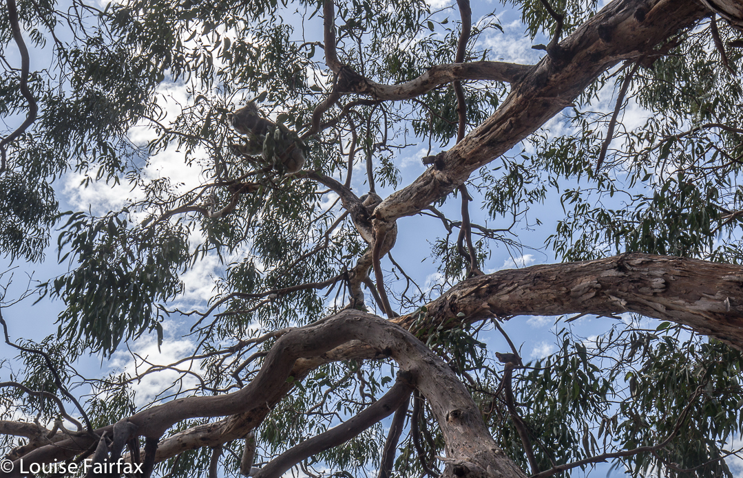
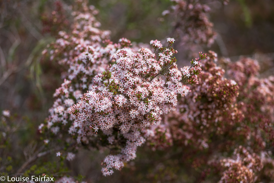
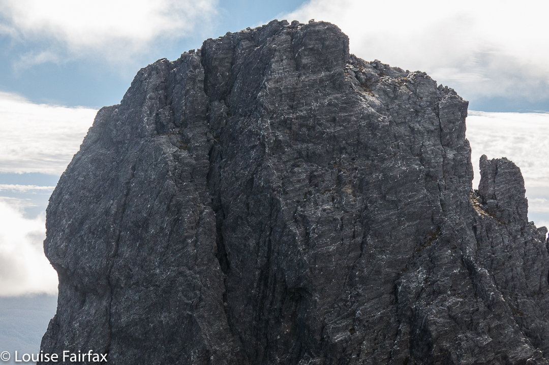
Cute, isn’t she.
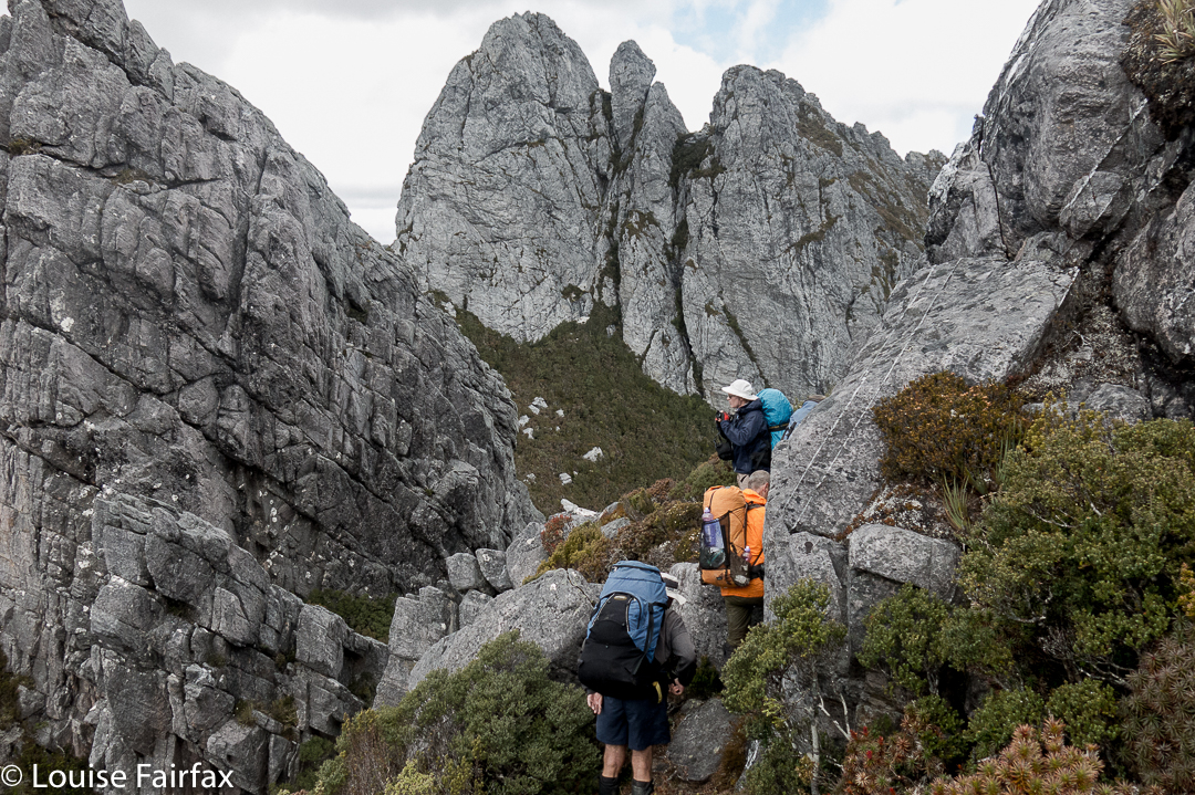
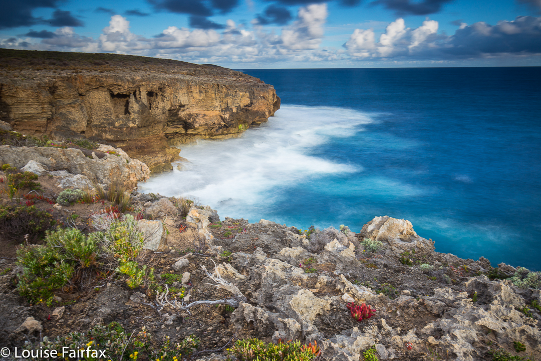
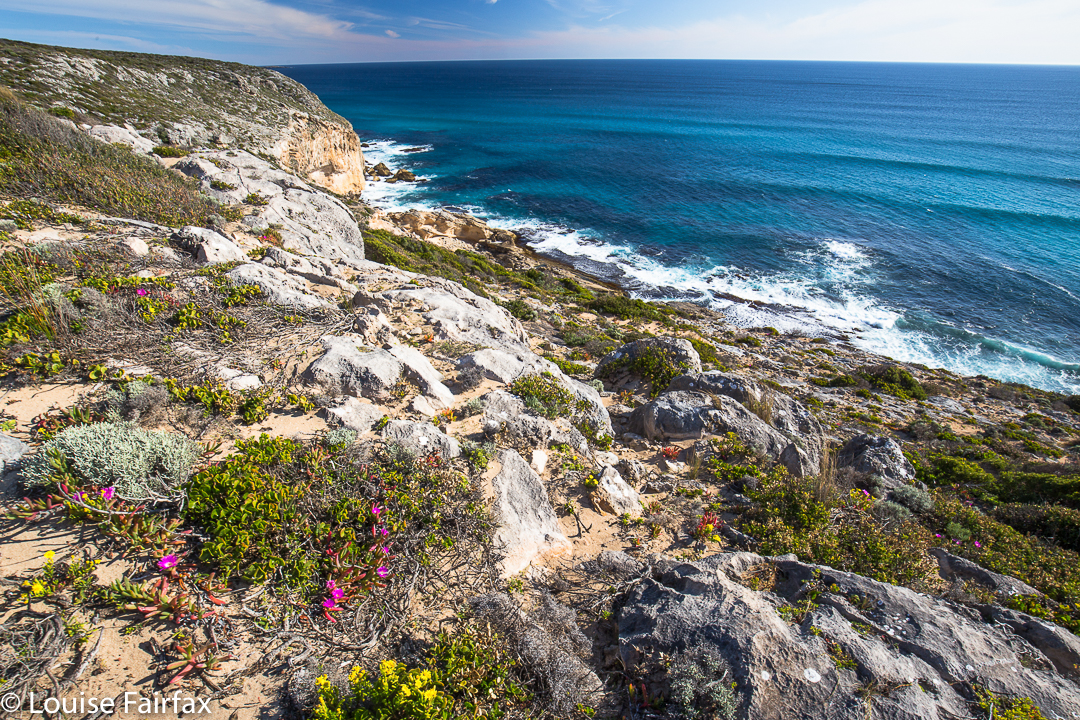
On we pressed, negotiating our way along the famous (or, infamous, considering the recent death on it) Southern Traverse. In this section, I was actually enjoying the dramatic drops down to the lake several hundred metres below, as there was at least 30 cms of ledge, and that’s plenty for me to be comfy. I was wondering which was the section where the girl fell to her death, but didn’t like to ask.

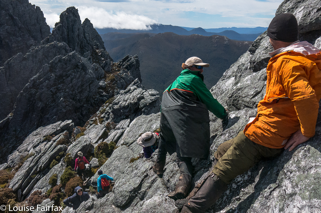
Eventually, however, we reached a sloped section where a fall would break some minor bone (leg, arm, hip) if you landed badly. You’d be terribly unlucky for anything worse than that, so it was not shatteringly scary, but neither was it a breeze if you enjoy your bones being in one piece, as I do. I realised that for me, any mountain is a prelude to all the ones that will follow, and no one mountain is worth the sacrifice of even a season’s bushwalking, let alone anything worse. The others were being very tentative as they edged themselves down with nothing much to hold on to.

A beautiful sunset the night of our attempt. This trip only offered rare moments of joy, but this sunset was sure one of them!

My foot slipped on the wet rock here. I sized up the slope. I could get down without falling, I figured, but to get back up later, I could possibly need some help in the form of a hand from above or a shove from below. I didn’t like the idea of attempting it solo. I also knew in that single moment of slippage that there was no way I was going to trust the rock on the dangerous section that day. This bit was only an appetiser for the main meal. I considered my options. If I backed out now, I could easily return to other, interesting zones and have some fun while I waited for the others, but if I proceeded beyond this point, I’d be a prisoner, possibly bored and cold, playing what could be a very long waiting game. Snap decision. I announced my withdrawal. The leader nodded and on went the group. I perched there, watching for a short while, not particularly sad as I felt I had made the right decision on this day. I will try some other time, when the rock is dry, and when I am in the company of someone who knows how to use rope.
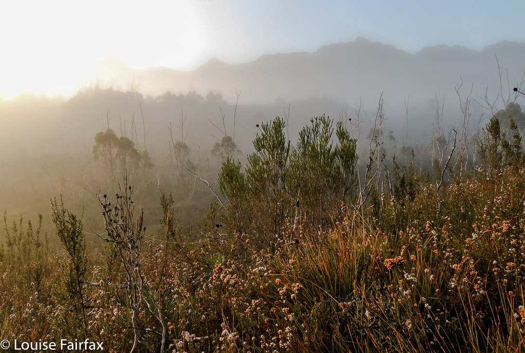
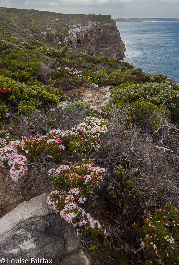
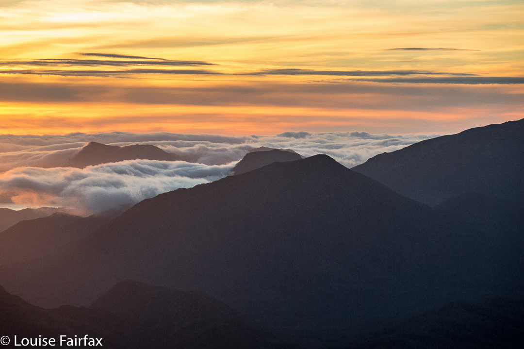
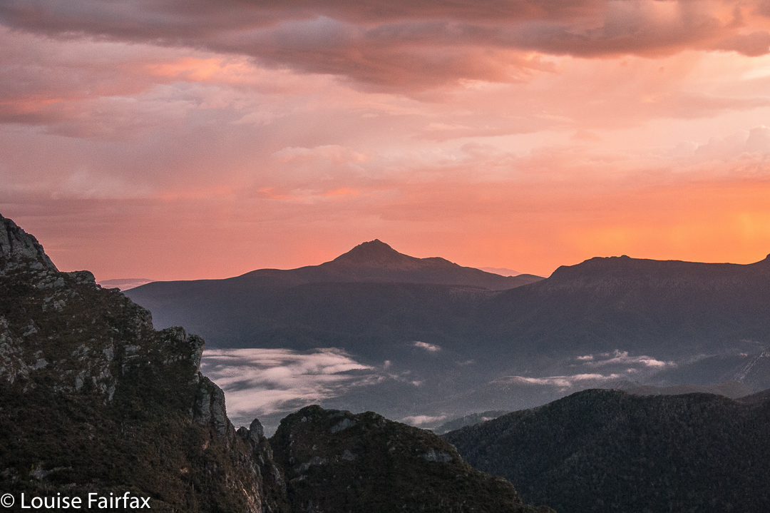
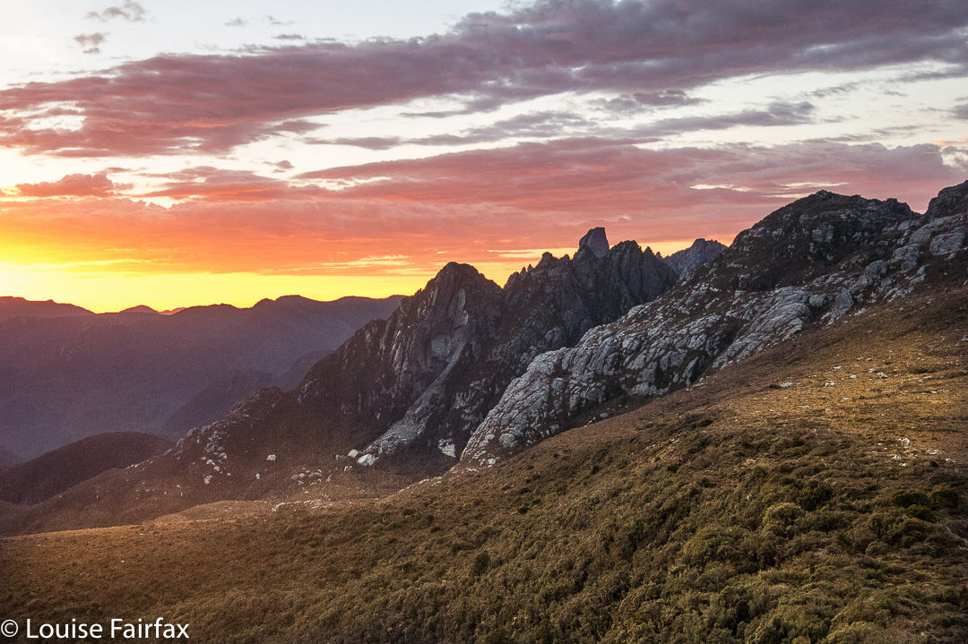
Dawn. Perfect.

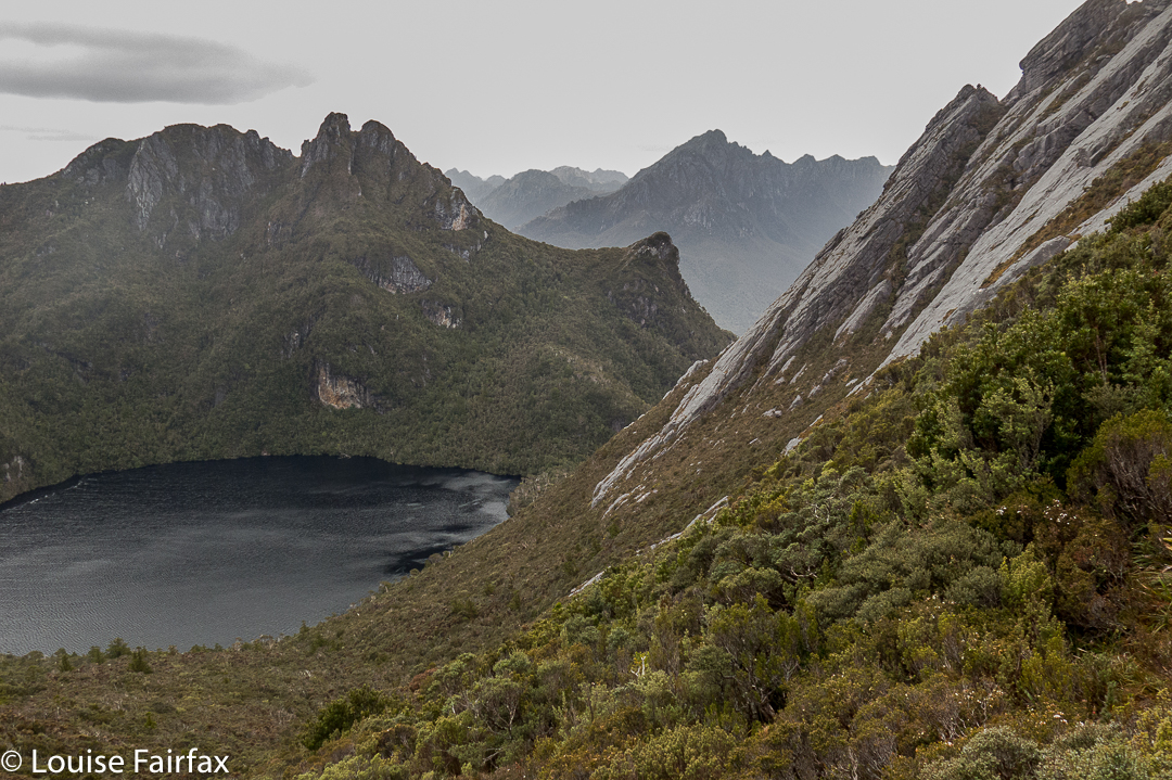
I turned, and climbed the first high thing I came to. I had a fantastic view straight across to the face of Feder (where I searched in vain for my friends). My mountain even had a big summit cairn. Is this mountain ‘Consolation Feder’, I wondered. I tried to phone my family to tell them any danger was behind me. My youngest darling was the only one to answer. She whooped with delight when I told her I was safe and would remain so. Her joy made me happy.

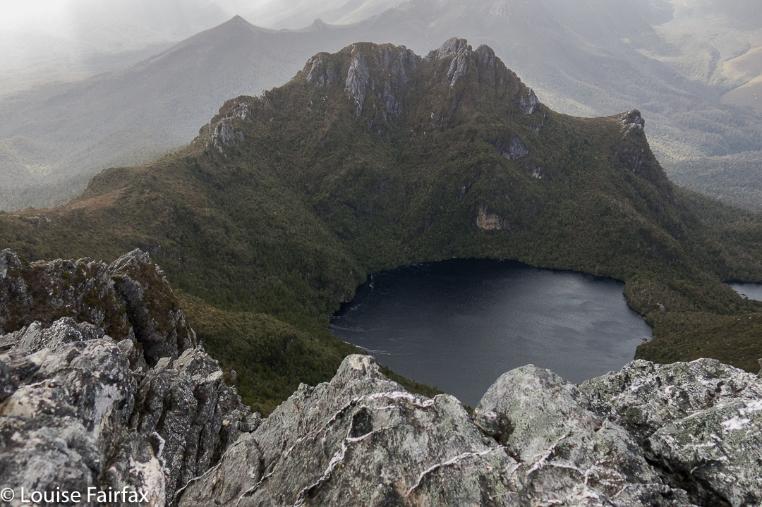
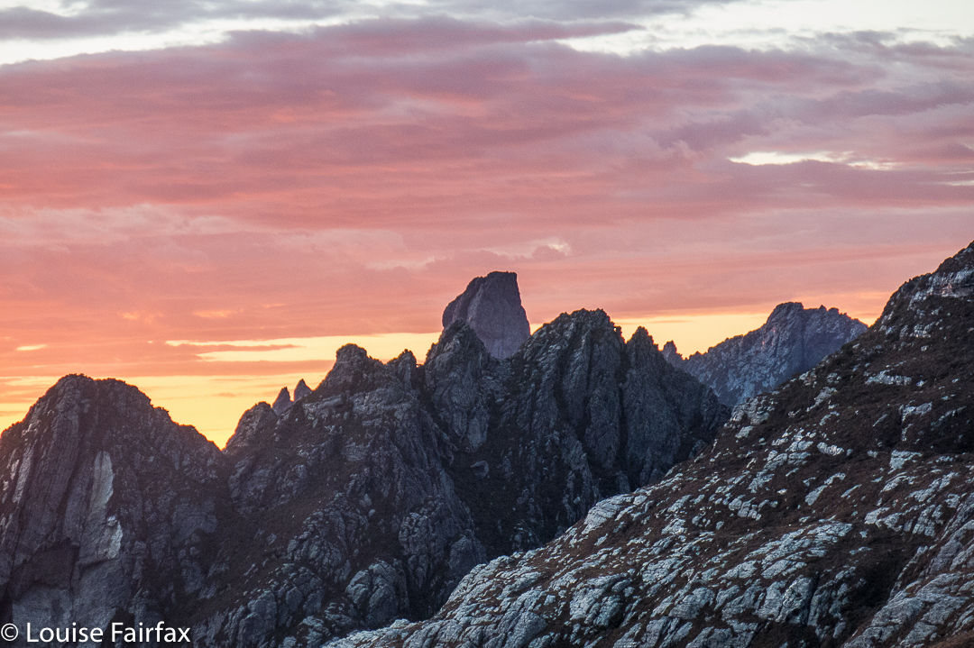
How can you order a morning like this? Feder towering above her neighbours and a pink sky to grace her beauty.
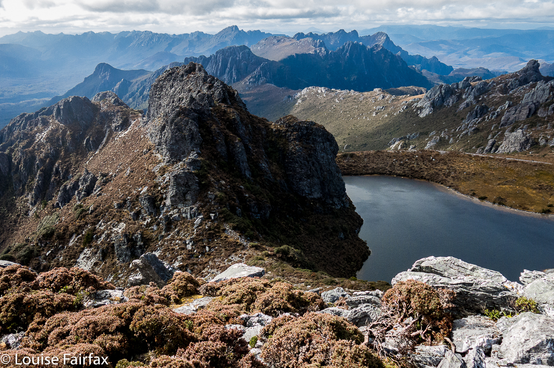
I filled the remaining time climbing an assortment of lumps and bumps in the area, building tiny cairns for each. (Sorry, but not really, purists who don’t like unnatural things like cairns. I’m no engineer and the wind will probably destroy them over time. They’re quite cute, only three tiny stones high apiece).

The others didn’t get to the summit either. The water was flowing down the chute of the direct ascent and the rock was slippery and dangerous. The following day, the group going in as we came out, carrying ropes and harnesses, did get up, but the leader slipped and fell, landing – miraculously – on a ledge (not the normal scenario) and breaking his leg. The group was helicoptered off the mountain, lucky to all be alive

A storm is brewing. I thought of Catherine and her friends due to climb that day.

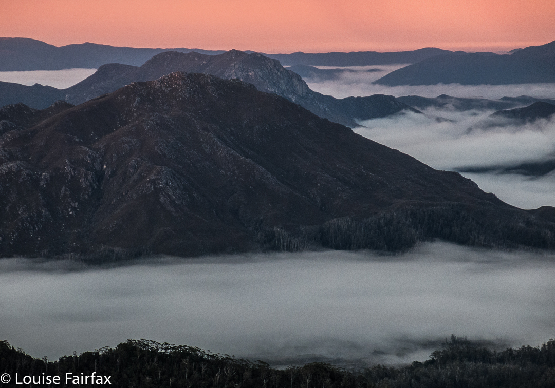
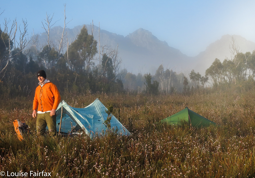
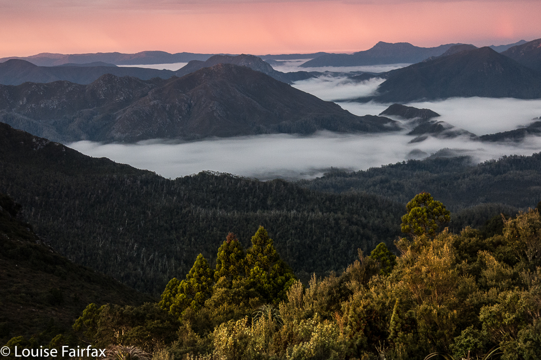
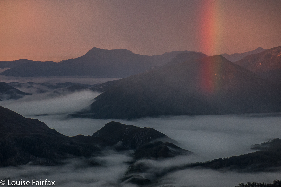
Back we went to Goon Moor, to a camping area I didn’t particularly like but which serves a purpose. Sunrise and sunset from this spot (well, nearby) were stunning. My camera had stopped working that afternoon, but gave one last fling that enabled the photos below before calling it quits. It has a fairly temperamental opening mechanism. I was more grateful than you can imagine to be given this little reprieve. Louise without her camera is in a far worse condition than a smoker without her fags. I relate to the beauty of the wilderness creatively through a lens, even when, as in an expedition such as this, it has to be a compact one. Anything longer than six days, I need to switch to this smaller, lighter camera. At least it shoots in RAW.

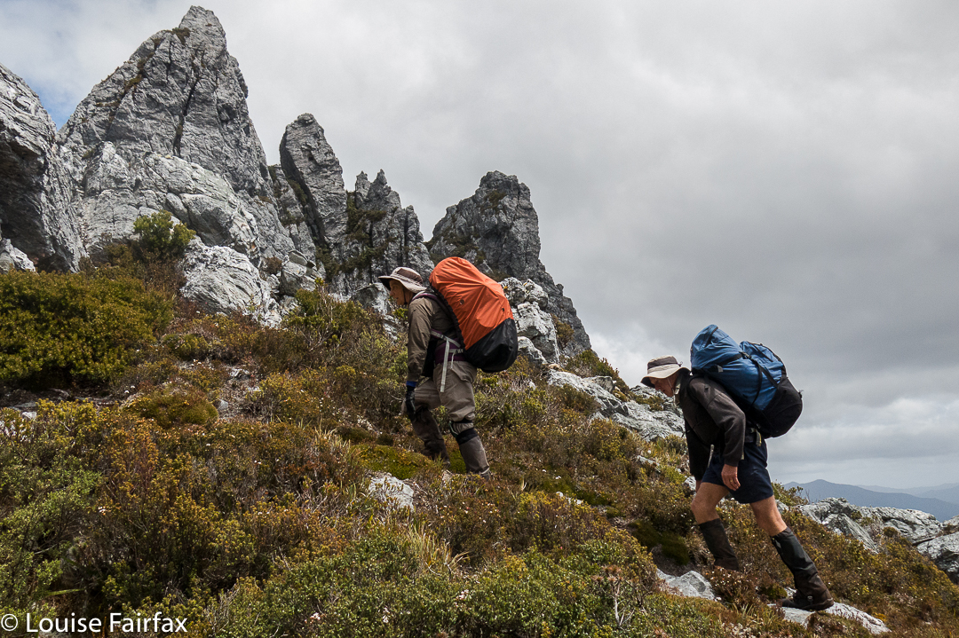
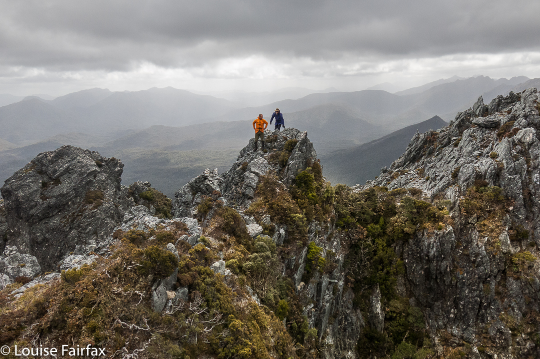
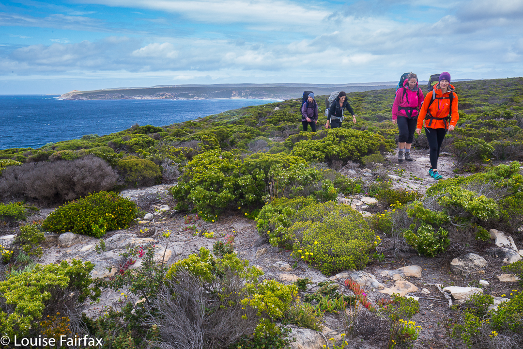
On the final climbing day before the walkout along the plains, we summitted East Portal. Only Angela had done any research on this climb, and she had Chapman’s “wise” words on her phone, viz, that we should follow the rocky ridge around to the summit. This advice is hilarious if you are on the mountain. Short of growing wings, it is useless. We tried left, then right, then left again, further left this second time, down into a chasm and then up, nearer to the ridgeline, but not on it (still to its left). Only at the second last summit of the many points did we get onto what would be the central line of the ridge.

Now. Ahem. How much do you pay to get THIS?? 

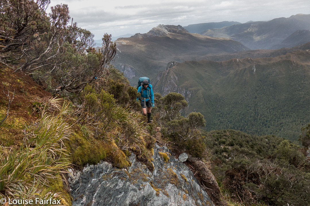
The final climb had a narrow-ledged section of hold-your-breath-and-hope (i.e., some exposure), fierce winds at times, and a very narrow summit area, from which being accidentally bumped off was a distinct possibility. We could see nasty weather coming in from the north. We were very businesslike on top: no groupie photos, no visible joy. It was touch the cairn, take a few shots and let’s get out of there before that rain makes the ledge worse. I thought of Catherine on Federation and wondered how the group was going. I thought the fact that I hadn’t seen or heard a helicopter was a good sign. I guess I was concentrating too hard on our own task, or buried deep in shrubbery at the relevant moment when the rescue was being carried out. Maybe the wind drowned out the noise.

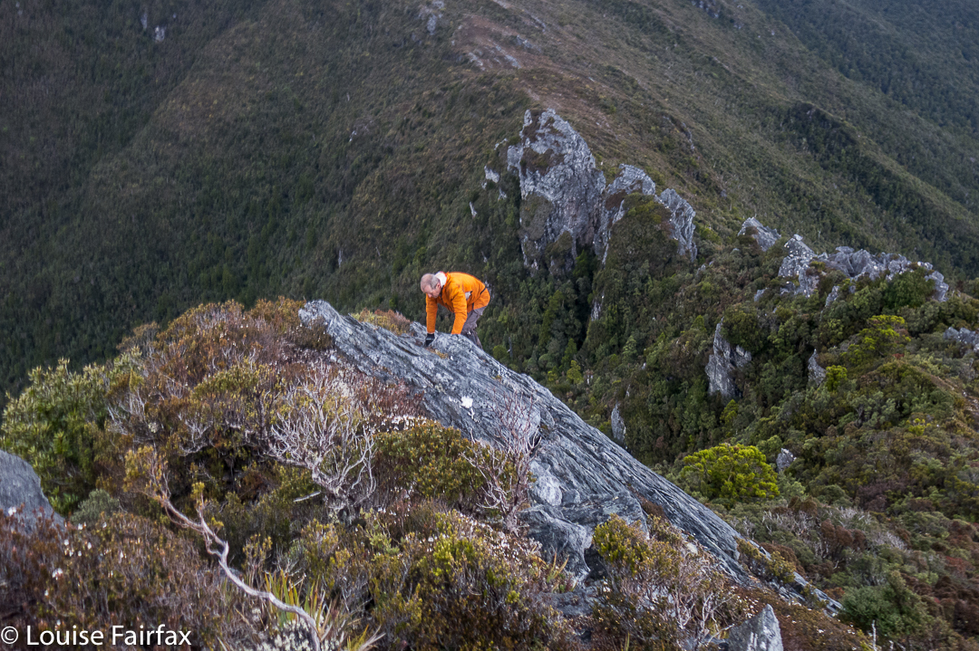
Climbing East Portal
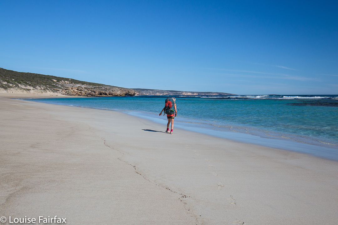
Soon after this ascent, we began the long trip down onto the plains, which marked the commencement of the less-than-thrilling, one-and-a-half days’ walk along the flatness to exit the area. My feet had been wet for a week, and had gone soft and tender and mushy. Big blisters were starting to form underneath. It was SO good to finish and take those wretched boots off.

I ate like Miss Piggy at the Possum Shed, delighting in food that had a recognisable taste, and revelling in cappuccino and home-made cake.

Over the next couple of days, I enjoyed our garden and the small things of life with greater intensity, as if I’d been given life anew. I hadn’t had a brush with death, but even its vague possibility makes you appreciative of all the countless fabulous things that make up life when all is going well. Federation will wait for me if and when I get back with some good weather and a rope.

Eastern Arthurs 2016 i Needles and Geeves Bluff

Eastern Arthurs part 1: The Needles and Geeves Bluff.

The Eastern Arthurs connote wild, remote beauty; beyond that, I wasn’t quite sure what to expect, but I was looking forward to seeing and experiencing whatever it was that lay ahead. I hoped to climb Federation Peak, although didn’t have my heart set on it, and unequivocally wanted to climb The Needles, (an Abel as yet unclimbed). That, I thought, should be a pretty definite possibility. Apart from that, great views and that special feeling fostered by deep wilderness lay on the agenda.

On the first day, we began after lunch and no one seemed in a hurry, so we didn’t make violent distance before calling it a day, and pitching our tents on a broad spur just past Two Mile Creek. We were rewarded next morning by scenes as in the two photos above. One of the features of bushwalking in the wilderness that I love best is precisely that ability to say, “Let’s camp here”, and just drop your bundle and pitch your little tent with views to die for.
On this occasion, however, doing that delightful thing had the downside that it meant a bigger-than-expected second day across the hot plains that left some of our members rather exhausted. We developed the cute habit of leaving two members behind at every campsite for a while after this. Eleven became nine by the time we arrived at Goon Moor for the third night. But I have jumped ahead. First we need to leave the plains, pretty as they are in the pictures of our first night in the above two photos, and climb up onto the range.

The above two photos are of some of the creek crossings before we began climbing. As you can see, water levels were high but not at all dangerous – and there was plenty of deep mud in case you’re wondering. Legs, clothes, gaiters and boots were all sodden and filthy by the first night, and remained so for the eight days we were there. Most of us stoically donned wet socks again each morning. Some optimists changed to dry ones, to have them generously receive the gift of water from the wet boots not long after. It felt good while it lasted.

After Pass Creek (our second campsite), we climbed up onto the range via Luckmans Lead, on a route that takes you past a rock formation called the Boiler Plates. Above, you can see the group about to pass through what I call Boiler Plates saddle. As you climb, the Plates are up and to your left. At the mini saddle, you swing left to skirt along their backside.

On the far right of this photo, you can see the backside of the Boiler Plates. Below left is Lake Leo, and behind, the famous East Portal, object of our quest on the return journey. For now, however, we are intent on reaching the campsite from which we will make our attempt on Federation Peak, viz, Hanging lake, so will not spend time or energy on longer, distracting climbs, although we did do a few smaller ones en route.

Kathy and Tony climbing as we make our way to the Stuart Saddle. Those are The Needles above, which several of us will climb after lunch.Angela, climbing towards the saddle at which we will dump our packs before climbing The Needles.

Dale and Wayne coming along the route that we later abandoned due to its dramatic plunge between two Needles. I’m glad we climbed these lesser Needles as well, as the views were fabulous.

The Louise that took the picture above was a very happy one. We had dropped our packs in the saddle suggested by the Abels book, and now were on our way to the summit of The Needles. However, this route involved a descent between some of the Needles that several members of the group were not comfortable with, so we actually ended up returning to the saddle and going back down the track until we were just short of being underneath the Needle that constitutes the summit. Even from here, the climb was not without its challenges.

The Needles, summit view. We are looking at Lake Leo and East Portal below.

Wayne, Angela and Dale went right of a rocky spur that gave them a route that was very steep and felt a bit loose in places. I went left of this spur, followed by courageous Kathy. Our route was great except for the final lunge for the summit, where we were clinging to minuscule pieces of rock with a very daring and not exactly pleasant drop straight into the  lake below. I concentrated on clinging to rock and tried not to see what was in my peripheral vision. Kathy says she is scared of heights, so I was very proud of her when she emerged onto the summit space having dared that route too. I was NOT looking forward to climbing back down that way, so was greatly relieved to discover that the route the others had taken didn’t involve exposure of that nature. We all went down their route.

Having a breather climbing the Four Peaks. Rain does not seem to be dampening our spirits.

On day four, we climbed around the Four Peaks, trying to get past the many and varied obstacles before reaching Hanging Lake. We have now left two more members behind to climb other things, so are reduced to being a team of seven. We had to pack haul on three occasions on this route, more because we could not squeeze ‘human plus big pack’ in the space provided than because we needed to get clear of the weight. There just wasn’t enough space to fit us.

Geeves Bluff, view

After we arrived at Hanging Lake, several of us climbed Geeves Bluff. Here is one of the many views on offer from the summit. Wayne and Dale were busy making telephone calls on top. I tried to join in the fun, only to discover that my phone had accidentally been bumped on, and was now nearly out of battery. I never found a spot from which I could send a message to say I was still alive, so gave up. Such a message, if I could send it at all, would have to wait for tomorrow, the day on which we hoped to climb Feder. The forecast seemed good – early mist but then clearing. Hopefully conditions wouldn’t be too wet. Time would tell. This story will be continued next blog. What a tease.

Kangaroo Island Wilderness Trail 2016 Oct

A thrilling start to day one.

What a welcome addition the Kangaroo Island Wilderness Trail (KIWT) is to our nation’s list of possibilities for long distance walking – and what better than a primarily coastal path. As any follower of my blog knows, I love getting out into “Type A” wilderness (no paths, no infrastructure: just pristine nature), but that does NOT mean I spurn paths and trails; what I especially love is a track where everyone is doing the same route and so shares a common pilgrimage.

The scenery on day two was my favourite

I once walked a long distance trail of my own design in Grand Paradiso National Park (Italy), where there were abundant paths and possibilities, but not one person I met shared my destiny. The instantaneous camaraderie of a set route was never there, and this track holds no place in my emotional psyche. A route like KIWT offers the chance to meet fellow travellers of shared interest.

I just don’t tire of colours like this (Day two cont)

I could almost be called a multi-day coastal path junkie, having walked the South Coast Track (TAS), the South West Cape Track (TAS), the Thorsborne Trail (QLD), the Coast Track of the Royal National Park (NSW), the old version of the Three Capes (TAS), the South West Coast Path (ENG), the Pembrokeshire Coast Path (Wales), Wilson’s Prom (VIC) and the Abel Tasman Track (NZ). I feel I’m thus qualified to place a judgement on this track, and my verdict is that it can hold its head high. I have adored all these trails. There is something special about wild cliff tops overlooking vast expanses of ocean with the wind in your face and a proper pack on your back. The presence of seals on this track as you gaze south gives a very exotic feel. Beaches that you have taken a few days to walk to and that are inaccessible to the madding crowds are also very special places. Note, I said a “proper pack”, by which I mean a full-sized, laden one. Daypacks just don’t do it for me. A real pack is a symbol of freedom and adventure, heavy though it may be. I think the weight is part of what bonds walkers when they meet each other. Here is another person willing to endure this kind of burden in order to have this kind of encounter with nature.

Beach walking, day two

So, why do I find this particular track such a welcome addition?
First, it provides a possibility to walk a distance trail in the driest state on the driest continent on earth, yet with the guarantee of water at the end of the day. Kangaroo Island is a very special place, but it would be a very uncomfortable walk without the provision of a campsite with water at the end of each day. This is not something to take for granted.

I arrived here in time for sunset at the end of the day 2 section. 

Second, the diversity of scenery is thrilling, from scrubland of taller eucalypts to coastal mallee sections, a fabulous river mouth as the Rocky River enters the sea, the brilliant cliff and beach sections, the spellbinding rock formations, the lagoons, and finally, the sinkholes near the end.

And here is the highlight for me of day three: The Remarkable Rocks

Third, the diversity of plants adds to this already stimulating variety. See the blog I have already published (below) for a full list of the wildflowers I identified in the first two days on the track. You will find about 45 listed. Even if you grouped them into colours – mauve, yellow, pink, white, red, orange – you would then need to discuss size, colour intensity, shape and all the other factors that make each one different and a pleasure to look at.

On day three I also enjoyed my side trip to Sanderson Beach

Fourth (but not in fourth position by any means), how can one not mention the animals? On the first and final days, I had the extreme privilege of seeing wild koalas doing their thing in the trees above me (so, sleeping or eating). I saw big KI Roos on all days except the second, with some putting on a boxing display during dinner on the fourth night. Goannas were plentiful on the first day, and I saw an echidna or two. Equal in pleasure for me with the koalas were the seals at the end of day 2 at Admirals Arch. I especially loved the pups who looked up at me with their endearing, huge eyes. I spent ages watching seals.

On the afternoon, and again in the evening of day 3, I also walked out to the cliffs 15 mins from the campsite to enjoy their drama.

There were a lot of cliffs on the journey (days 2, 3 and 4). Maybe you think that one cliff line is like another, but cliffs are like people, and each one is different – in rock type, or formation, in the aspect or the particular way it drops into the ocean or the way its rocks catch the light or in the view along the coast each provides. There’s always something to entertain.

Sanderson cliffs. LOVE them.

The beauty of this path is not weather dependent. I should know, as I experienced everything other than snow. I began rugged up from the cold, but had stripped down to singlet and shorts by the first afternoon. Day 3 brought a literal gale, where I was blown off the path several times. Days 4 and 5 had rain – sometimes heavy – and hail, along with very high winds at times, but nothing detracted from the fun of the journey, even though at a theoretical level I would have preferred to have been warmer. The communal cooking areas (with sheltering roof, windbreak and guarantee of water) made a huge difference, as you could socialise there with other walkers, and not be confined to the prison of your tent in the presence of rain. You can sit at table and chat to others, and you can even, as the girls I met and I did, play games under the shelter.

Day 4. Here are Helen, Kirsty, Jules and Mary walking along the cliffs. Being and to the left is a unique view of the Remarkable Rocks, not offered to car drivers.

I had connected with the four others who had started the track when I did – the first to do the track following the Premier’s official launch the day before – by the third night when I returned from a sunset photoshoot on the nearby cliff line. It was cold enough for some of us to cocoon ourselves in our sleeping bags while we sat at the table, but we had great fun meeting each other and talking and laughing our way through the evening.

Hanson Bay Day four.
The worst part about doing this trail is finishing. As I hugged farewell to Kirsty, Helen, Mary and Jules, and later, to Alison, the wilderness trail manager, I was filled already with a terrible nostalgia for the walk and all it represented. I would have happily begun it all over again straight away.

Great Walks magazine is publishing an article I have written on this walk in its December-January edition, where I give a day by day description of my walk. I have deliberately kept this blog different, and more general, to provide two alternative approaches to the story of the trail. I have also tried to provide different photos to give you variety. For a day by day account, please buy this great magazine. Buy it anyway, not just that issue. We need to keep bushwalking magazines alive. I hate the way airports offer you motoring and cycling and fishing, but no walking. Give me bushwalking pictures and stories, please.

Kangaroo Island Wilderness Trail Wildflowers

Kangaroo Island Wilderness Trail, wildflowers.

Pig face (carpobrotus) and hibbertia sp along the coast, day 2

Kangaroo Island Wilderness Trail abounds in wildflowers. Here are the names of some I have been able to identify that I saw as I walked along the trail. The length of the list speaks volumes for the fabulous diversity to be found. Thanks to the fabulous Alison Buck for checking and helping me with the list. Any errors are mine, not hers. (On Monday I will post my account of walking the trail).

acacia paradoxa (this filled the scenery for several early sections of day 1)

boronia edwardsii (broder leaf than the one below)
boronia filifolia (fine leaf, sandy section)

calytrix smeatoniana (a paler calytrix than the one below)
calytrix tetrogona (wonderful pale pink)

carpobrotus rossii (pigface; bright pink)

chamaescilla corymbosa (blue squill, or blue stars; wonderful delicate mauve flowers. A tuberous herb with grasslike leaves)

cheiranthera alternifolia in early forested section – another delicate mauve flower

Calytrix tetrogona, seen on most of the days.

correa decumbens

dampiera lanceolata

daviesia asperula (one of many ‘eggs and bacon’ pea flowers)

euphrasia collina (mauve pea family; eye bright)

goodenia blackiana
goodenia ovata

grevillea quinquenervis (pink spider plant)
grevillea halmaturina (white spider flower)
grevillea rogersii (just two spider legs in kind of pairs, darker red)

hakea rostrata (delicate white spider flower with needle leaves)
hakea vittata (hooked needle wood; low growing)

hibbertia riparia
hibbertia acicularis
hibbertia virgata

Orthrosanthos multiflorus 

lasiopetalum discolour (velvety leaves, mauve) (sorry, refuse to spell colour the american way, especially when it is an Aussie flower)
lasiopetalum schulzenii (hanging bells of cream)

leucopogon parviflorus (divine smell. How I wish I could preserve it. It filled the air with its delicacy at times on day 1).

olearia taretifolia (tiny white daisy flowers on a bush)

orthrosanthus multiflorus (mauve morning iris)

pimelia sp (there are several species of pimelea on the island)

pomaderris obcordata (small [20 cm high mostly] clumped pant covered in with tiny white or pinkish flowers)

prasophylium elatum (snake orchid – near campsite at the end of day 2)

prostanthera spinosa (dark mauve; prickly leaves)

pultenaea daphnoides  (large leaf pea flower; egg and bacon colouring; beautiful perfume)
pultenaea scabra (a different egg and bacon flower

More calytrix lining the path
scaevola linearis

senecio lautus (yellow daisy flower)

stackhousia aspericocca

swainsona lessertiifolia – a small mauve pea flower with many erect stems

Tetratheca halmaturina (see below)

thelymitra epipactoides (delicate mauve sun orchids)

wahlenbergia multicaulis

xanthorrhoea semiplana

Tetratheca halmaturina with grass-like stem and leaves, crawling here up a Petrophile multisecta.

(My favourite of the several ‘koala trees’ was eucalyptus viminalis cygnetensis – great for humans to climb, too – which not many eucies are). I also enjoyed the huge eucy camaldulensis exemplars, especially those on the last day growing by the river, and, to a lesser degree, the cup gums, sugar gums and coastal mallee gums that decorated our walk.

Proteus 2016 Jun

Mt Proteus

Dawn, summit day
Angela had three days clear (as did I); we decided Mt Proteus was a suitable mountain for this time of year and that time span. We knew Maureen needed Proteus on her way to completing all the Abels, so invited her too, and an expedition (albeit a little one) was born. Off we set excitedly on the Arm River track, heading west, and then the Overland Track heading north until our camping spot, just north of Pelion West (Pine Forest Moor). What lay in store for us? For the moment, light drizzle and not much of a view. Happy to have the day completed so we could get cozy in our tents, we filled up with water from the idyllic creek below, so lush you almost needed sunglasses to cut the vibrance, and retreated to our colourful homes among the pencil pines (Athrotaxis cypressoides – which grows between 700 and 1300 ms asl and has nothing to do with the pine family at all [or with pencils]. Homesick early settlers called anything evergreen “pine”). It was protected enough there under cover for us to have a relatively leisurely setting up process, and to spend a little time carefully choosing our piece of real estate for the night.

Frosted button grass, with Pelion East, Mt Ossa and Paddys Nut behind.

You should have heard me gasp with delight when I emerged into the open on the morning of the second (summit) day and saw the expanse of white depicted in the two photos above. I was thrilled with the freshness and delicacy of it all. This is the terrain we had to cross for many kilometres to meet our mountain. We found it tiring, as we had to lift our legs very high to get over that grass, sometimes unexpectedly falling in holes – often filled with water – hardly a welcome outcome on a morning such as this. We had had to don wet socks and boots at the start of the day, so accidental soakings were not quite as disastrous as might be imagined, but our toes were numb and frozen nonetheless. There were also two bands of pretty dense bauera bush, but they didn’t last very long, being narrow, and just as I was starting to wonder if it was going to be a fight the whole way, the vegetation became calf high, and we had easy access to the summit, now not far away.

Angela (L) and Maureen (R) at the summit cairn. Maureen looks very happy to only have ten Abels left to go.

It had taken 2 hours 38 to reach the summit. The book had said two; I had feared three, so this was a pretty good compromise. I had allowed for a possible ten-hour day when I asked the others if they minded starting at 7.30, so maybe we had won a little time. Off we set on our return journey. Once we knew which type of undergrowth in this area fared better (scoparia scattered amongst fern grass was faster than button grass, which we managed to mostly avoid on the rebound), we were able to cut a bit off our time, and after a tidy 2 hrs 7 mins we were back at our wonderful fairyland campsite, ready to relax with a cuppa before packing up our tents and moving on.

Angela photographing Ents at our campsite.

We squandered a little of our won time by being a tiny bit slow at packing up (I’d allowed an hour), and we were not ready to set out before 3.15. Maths said it would probably be dark by the time we reached Pelion Hut. Maths was unfortunately right, but we knew this was likely. I wanted a tiny break for a drink at Pelion Creek, and another for photography at Frog Flats. I also couldn’t resist a set of photos as we rounded a corner and saw Pelion West in the clear afternoon light. Cathedral mountain also looked a treat. These things take time …. Angela had predicted that we’d be able to do without head torches until 5.45 and she was right to the exact minute. By this stage it was becoming downright dangerous, as the boardwalk has steps that you couldn’t see in the dark, and falling would have been treacherous. Also, many of the boards lacked chicken-wire, and the ice of the morning had lingered on boards and leaves the whole day, turning the Overland Track into an elongated skating rink. The final twenty minutes were done by torchlight.

Paddys Nut and Mt Thetis as evening approaches from Frog Flats

I was hoping for another lovely frosted morning next day, but thick mist regaled us in our waking moments. At least it meant I didn’t hold the others up with too much photography. Off we set into the mist, hands burning with the cold, hoping that the climb to the high point on this track would warm us up.

The high point on the Arm River track, and the sun breaks through
We had only been going one and a half hours, but I was starving. Besides, some photos were in order!!! Don’t be put off by Angela’s shorts. It’s FREEZING.
Mt Pillinger bursting into the blue realm above.
A different tarn on the way home. I didn’t say I took NO photos – just not as many as I might have done.
It was all downhill from there, and thus ends another perfect little expedition. Mt Proteus is a wonderful mountain to have in my collection, and already the happy memories of our time there circle and recircle in my contended mind as I relive moments of beauty and wonder.