
Willies Falls 2018 Oct
 The sign at the start of Jeffries Track, leading (kind of) to somewhere near Willies Falls, did say you needed a quality 4WD and warned of ditches and bogs, but the way ahead seemed innocuous enough, and surely that was a notice for wet winters and not this dry October. We would drive as far as I could, and then stop. That seemed a good plan. Ha. The first few ruts were sort of bearable and well, by the time we realised we were in trouble over our waists, we were actually in over our necks. I just had to keep going forward and hope against hope to get as far as the intersection on the map where turning was possible. I was a bundle of shaking nerves by the time I parked. Meanwhile, my daughter was eyeing up the thick scrub and hating all that she saw. I assured her the bit nearest the light was always thickest, and that it would be much better once we got into the forest proper. I forced my way through the dead branches and cutting grass with merry bravado to encourage her.
 The forest really was lovely once you got properly inside, but my daughter’s concerns turned from her lovely tights that were endangered by this scrub to the fact that the cliffs were so steep and the grip on her shoes so minimal that falling and not being able to play the next game of touch football was a danger. “You didn’t mention bushbashing”, she accused gently. “Well, plan A didn’t have any, but we took so long to get here that I had to change to plan B …. which does have just a little.” I tried to wriggle out of this as we lowered ourselves precariously through amassed contours. Her face told me all I needed to know about the level of enjoyment she was experiencing.
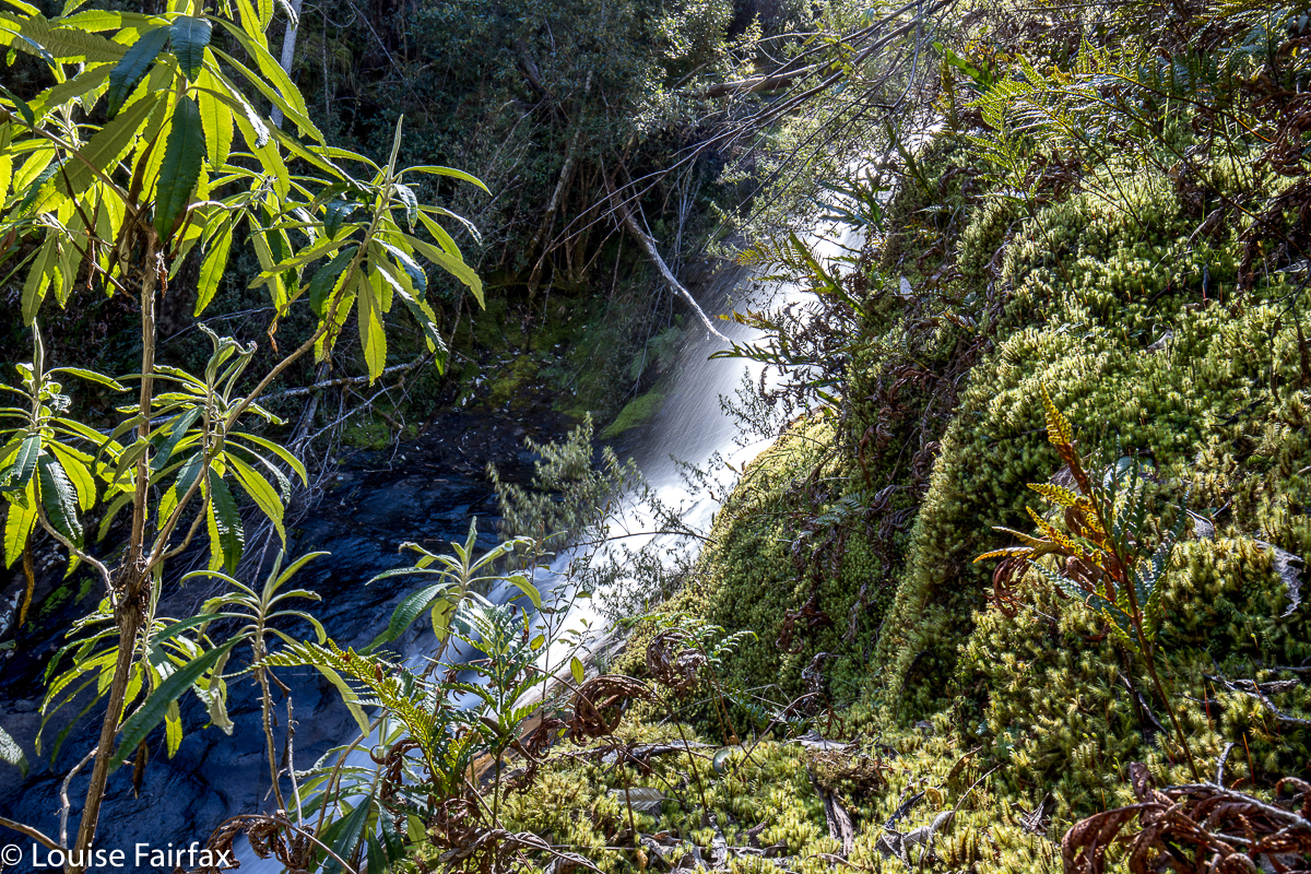
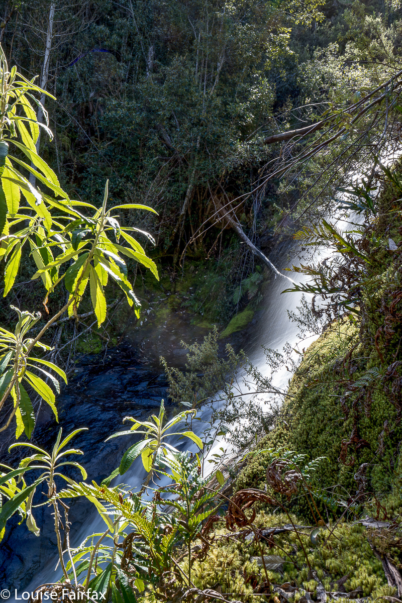
At last we got to the base, except, because my map didn’t actually have the falls marked, I had to “aim left” (downstream here) and then work my way up to where the falls were, so as to be sure, which meant the bashing lasted longer. She was reconciled when she saw the lovely falls, and took it all in with good grace, even agreeing that it was beautiful down there – although not volunteering to ever return. She felt much better about the way back up, knowing what lay ahead, and so was more secure about things. It will be a long time before she goes “bush bashing” again … if she ever does.
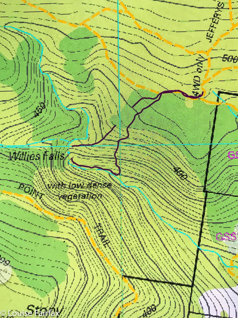
I’ve put this route in dark magenta for a change as there seemed to be too much cyan on this map. The breaks in the line are just the gps turning itself off by mistake. The route is still clear if you join the lines in your head. The first line stops at the base of the falls. The second begins near the top and then has a random break in it on the way back up the spur that we followed.
(These falls are on the southern part of the Mt Wellington Reserve.)