
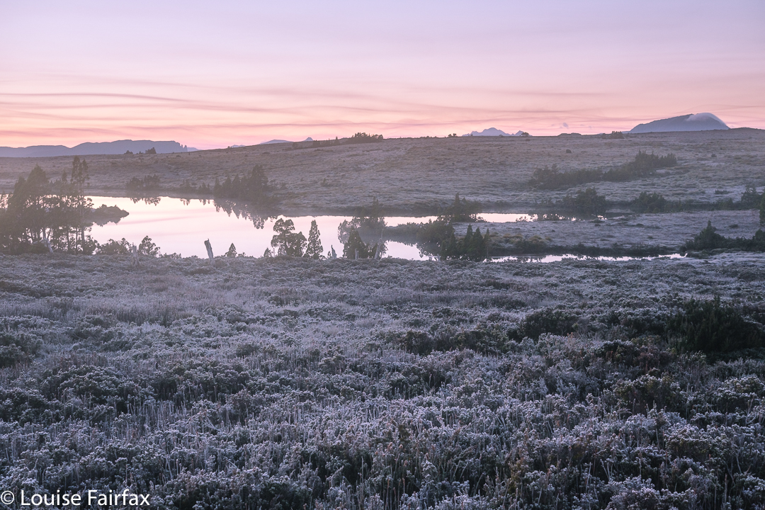
Day 3 dawned, as cloudless as the preceding two clear days, which meant another dusting of white ice on all the bushes, and pink hues on the horizon at dawn. As on the other two days, we would set out just before sunrise, which meant I ate my porridge at 6 a.m. to a view of dark silhouetted pencil pines against a backdrop of red glow. Sunrise itself – later (7 a.m.) – was a far more pastel affair.

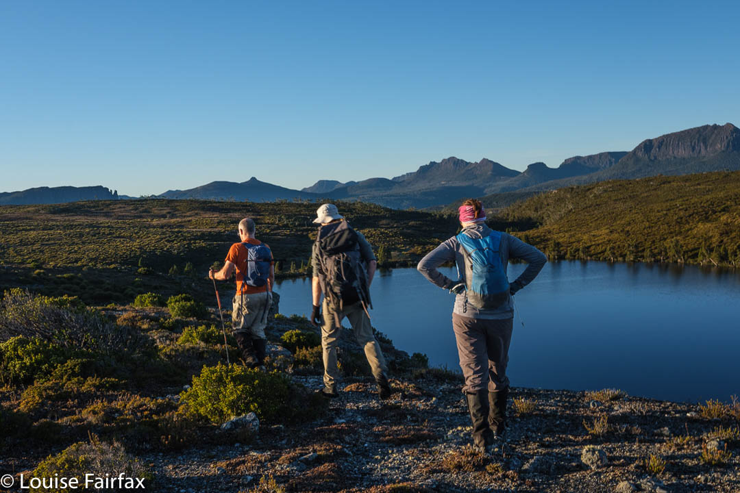
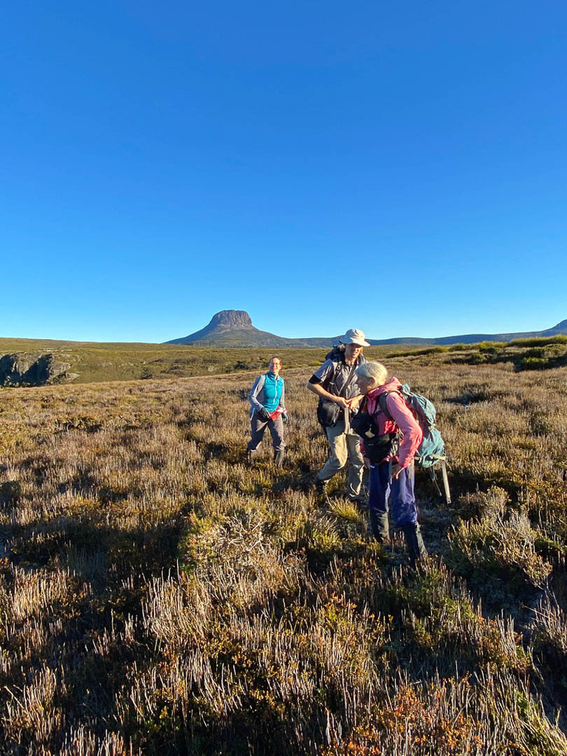
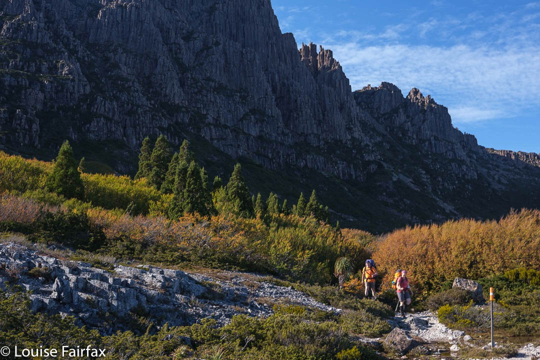
This day we would explore an area to the east, heading into the rising sun with its golden hues. The backside of Cradle was on our left. To our right as we made our way across the button grass plains, were glimpses of Mts Oakleigh, Pelion East, Ossa, Paddys Nut, Thetis and Pelion West, with others playing more insignificant roles. Barn and Inglis were behind us if we looked back. Emmett was a lump between us and Cradle. These are all my old friends, and just as seeing the spine of a favourite book helps you to recapture the feeling of reading it, so seeing these old friends sparks many happy memories of other trips.
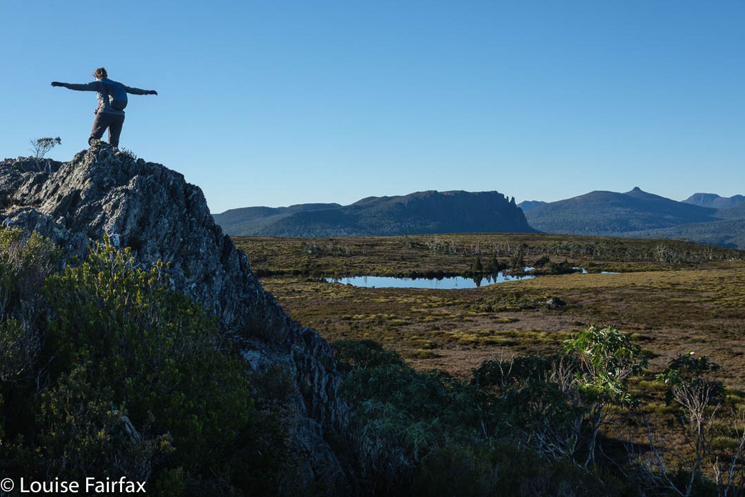
Our first goal that had any significance other than “broad expanse of alpine scrub dotted with pencil pines and tarns” was Lake Agnew. So large was the seemingly featureless route in between us and this lake that, when I thought I was going to be doing this solo, I had marked a waypoint on my map, just to have something to head for. We said “Hello” to my waypoint en passant. I hadn’t any information on Agnew other than that people who crossed it on its outlet stream side had trouble finding a good spot to do so. Adrian and Caedence were all for passing it on the uphill side, which gave us two streams to cross, but as they were more uphill, they were merely passages of water to jump over. Meanwhile, we had the added bonus of walking along dramatic cliff tops overlooking the lake, with views later to Lake McRae further north. I loved those cliffs.
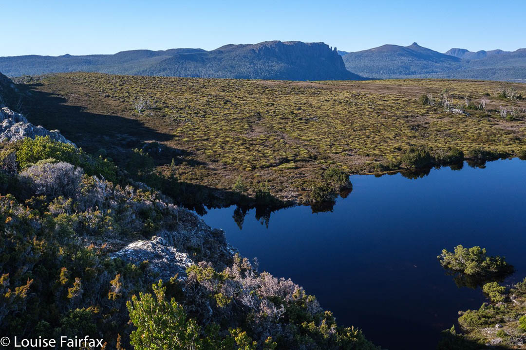
We had to drop down from the cliffs in order to cross the first stream, but that was also problem free. Up we headed to a feature I have called Spine Ridge for obvious reasons. Here the view was so fantastic we stopped to have a snack and just enjoy the vista for a short while.
Now, Caedence gets a little antsy when he sniffs that he is near a waterfall, and so urged us to take a straight line for the first falls of the day, labelled Razorback on the map. He felt that would be the fastest way there. I did mention a good route from the hut to the falls below (not these, but nearby), but my arguments fell on deaf ears. I also pointed out that the shortest route is not always the fastest. What do I say? I merely advise you to listen to what I said, and don’t take the “short cut” unless you feel like a really engaging bush bash where the forest will throw everything it can at you to retard your progress. Of course, we didn’t know that at the time, and Caedence was so eager to at last see water falling we all took the hypotenuse … and lost a bit of time. The day was still long. It was only 10.10.
These falls are actually interesting, as, although they are labelled Razorback on the map, they do not match Stephen Spurling’s photo of falls he calls Razor Back.
In case you don’t know your early Tasmanian explorer and photographic history, Stephen Spurling III, 1876-1962, stands out as a glorious photographer of his era. His photos form the earliest extensive record of the Cradle Mountain and Western Tiers area. (He was quite an explorer, and now that we have seen some of the falls he shot, I can add he was an excellent bushman. The falls are not in easy terrain.) He took the first known shots of the Gordon and Franklin Rivers, as well as the earliest known aerial photos in Tasmania from 1919. Although many of his photos remain, some are unlabelled, or unclearly labelled, so we are left to guess some things, and join some of the dots. It seems to us, however, that the waterfall labelled Razorback on the map (the first ones we visited) were not the ones labelled Razor Back in his photo.
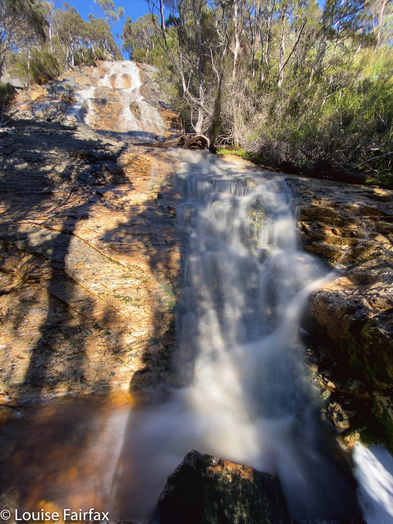
The others believe the first waterfall we visited (above here), labelled as indicated in that last sentence, was therefore Myra Falls, not Razorback, and that the second falls we visited, near the old mine downstream, match the photo labelled “Razor Back”, and hence my caption of the first waterfall as “Myra labelled Razorback on the map”. The second waterfall, which we feel strongly is his one labelled Razor Back, is merely a blue, unlabelled line on the map. I have labelled it “Real Razorback Falls”. I guess there was a transcription error by a clerk in an office somewhere when maps were being made. It is not the first and will not be the last such error.
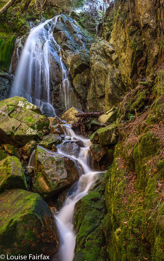
Having had a big bushfight to get to these falls, we were not entirely lusting after more of the same to reach the next. Luckily, it wasn’t as bad, and we knew the next falls would lie in rainforest. We longed for mossy green after that dry, thick scrub, and we got it. My first shot was taken at 11.09; my last around 11,30, so it wasn’t quite lunchtime, but breakfast had been early, and this place was very beautiful (also having many fungi), so we sat by the cool stream and had lunch before climbing up to the high land above and Hydrographers Hut that we wanted to see.
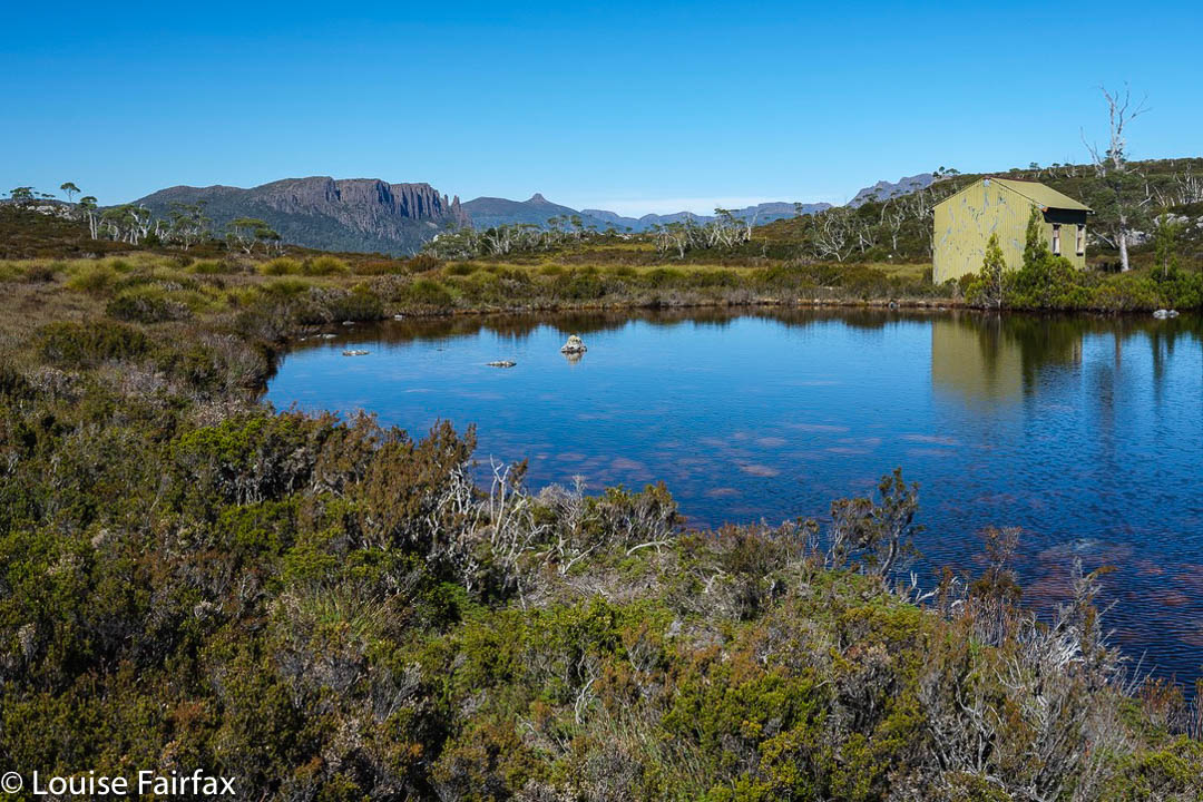
Although still a student, poor Caedence also has this awful thing called a job, and, worse still, the pay for Anzac day was going to be just what he needed to amass some savings, so he left us at Hydrographers Hut to make a dash for the tent and an early depitch and exit. But, it was a truly magnificent day, and we remaining three had no pressing commitments for Anzac Day (the morrow), so we chose to enjoy the lake around the hut and the scenery on the way back at a more leisurely pace. We had thought of moving the tents nearer to the cars, but decided we would stay put another night in the end. Adrian had another swim. Louise stayed dirty.

For the third night in a row, there were no clouds, and ice decked the ground and our tents in the morning. We enjoy our early departures, but on this day it was a mild problem in that the tents were absolutely sopping with the condensation from our moist breath during the night. Drying them out would take hours and a massive effort, so we popped the weighty wet lumps in our packs and just put up with the extra kilo or so of water.
As ever, it felt weird to land back in the area of masses of people on the trails once we got near to Cradle. We stopped at Marions to marvel at the Overlanders, sweating and grumpy of face, dressed in black to make them hotter than necessary. It was only maybe the fifth group that actually said “Hello” to us and looked a bit cheerful. I hope their enjoyment of the wilderness increased as they went along.
For Days 1 and 2, see http://www.natureloverswalks.com/cradle-area-waterfalls-days-1-2/
What glorious weather; such beautiful places. Definitely makes the heart sing. Thanks for allowing me to explore vicariously.