Nescient Peak 2015 Dec

Mt Rogoona from the valley which we climbed up to. The shoulder of Nescient, which we used to ascend her, is on the right there.

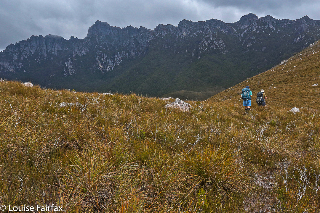
Nescient Peak. There was something incredibly tranquil about this day – perhaps partly caused by the fact that this was the first day since winter that there was a feel of summer in the air. The Examiner reported today “Summer is here”, and indeed it had arrived. Perhaps the feeling also sprang from the fact that this was a Monday, and one doesn’t normally climb a mountain on a Monday, but my friend Angela had the day off and I was free, so here we were in good spirits, ready to try the taste of another mountain on Tassie’s wondrous smorgasbord of high points.

There is another shoulder of Nescient. I am toying with you … hiding her to arouse curiosity. Angela taking a welcome drink from the tarn. The day was hot.

I have decided I love climbing mountains that have received bad reports elsewhere. It’s not that I’m perverse, seeking to find pleasure where others have found pain: I think it’s just that if my expectations are set low, then reality has a good chance of bettering my anticipations, and I am left pleasantly surprised.

OK. Here she is. Ta da. Nescient peak in all her glory, given a photo at last.

The writer of the Abels essay on Nescient Peak was quite clearly disenchanted: in the opening sentence of instructions on how to get there, the reader is admonished to wear scrub gloves and gaiters, as if this were the most important thing one would need to know about this mountain. I suggest the author visit the Coronets to gain a different perspective. It made us feel as if this mountain were a kind of medicine that good people had to take in order to keep healthy. As a result of the warnings, we kept commenting to each other on how easy this bush was to get through; how light and malleable the small branches.

A summit cairn that leaves you in no doubt that you’ve arrived

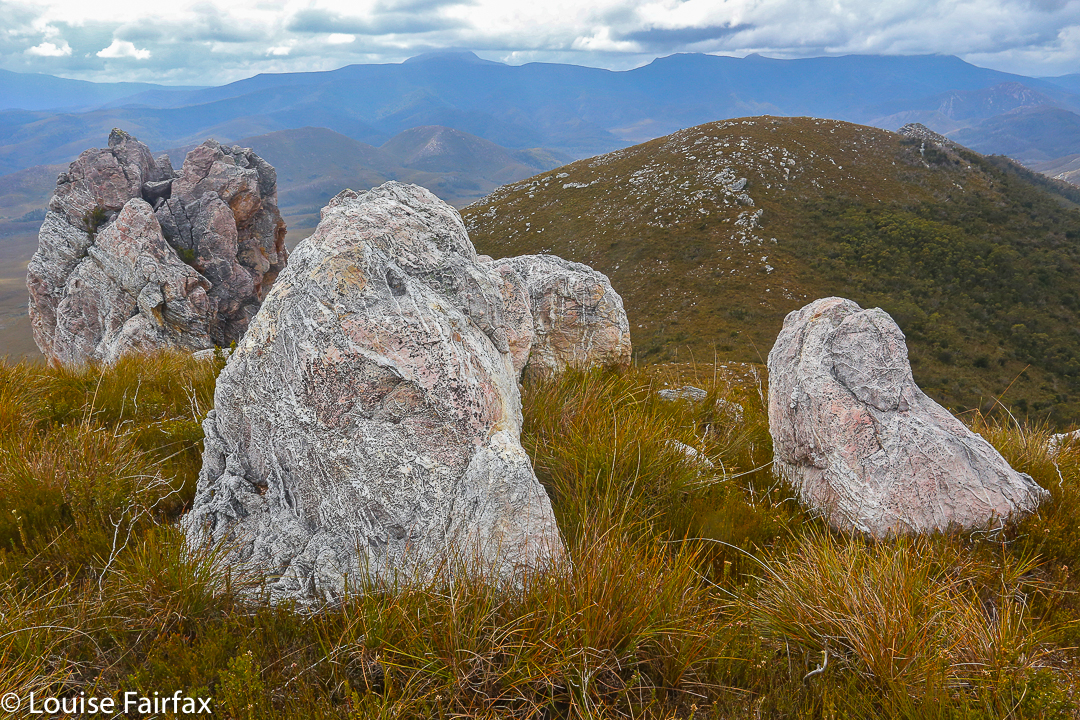
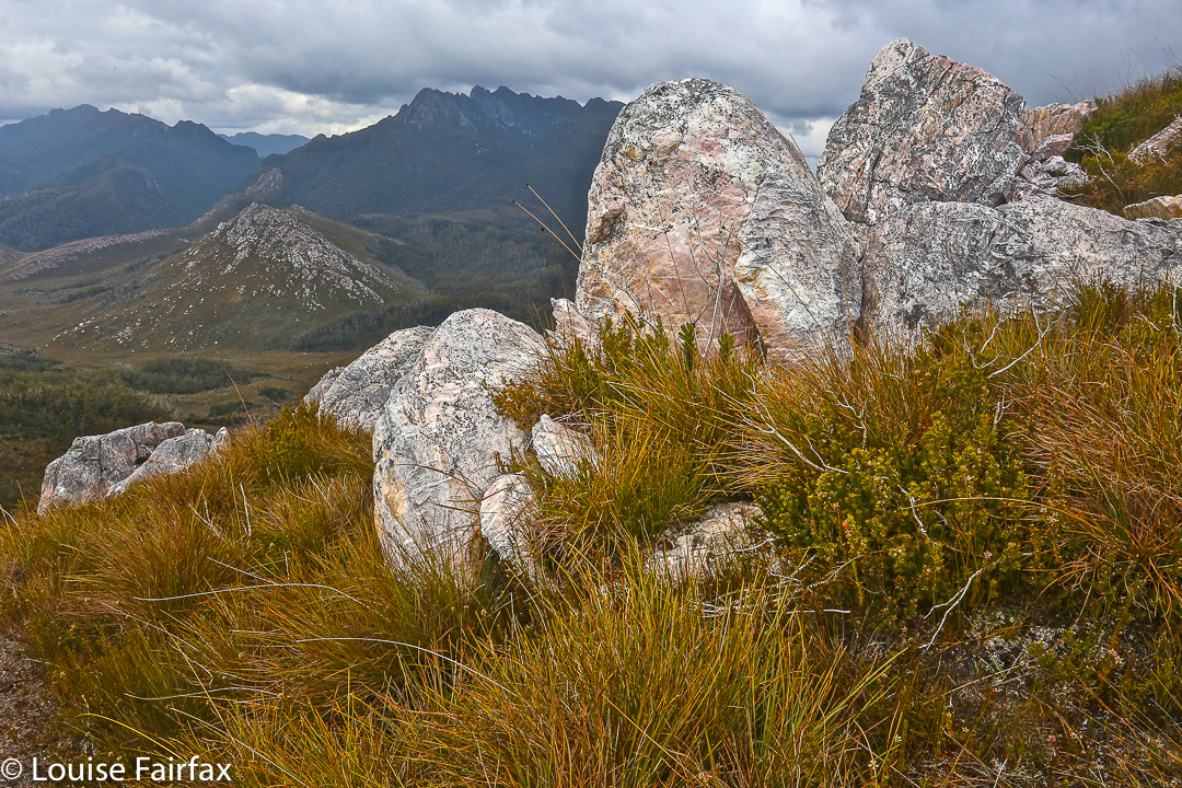
We did have to agree that the first glimpse of our mountain was “unremarkable”, but I still found it attractive enough to want a shot from a few angles. The book insulted it by only publishing an image of the very prickly Coprosma nitida (mountain currant), as if any image of the peak would detract from the beauty of the book – like dismissing an atonal person from the choir.

We enjoyed our lunch spot beside the cairn with moss and flat rock to sit on, and a spot of welcome shade.

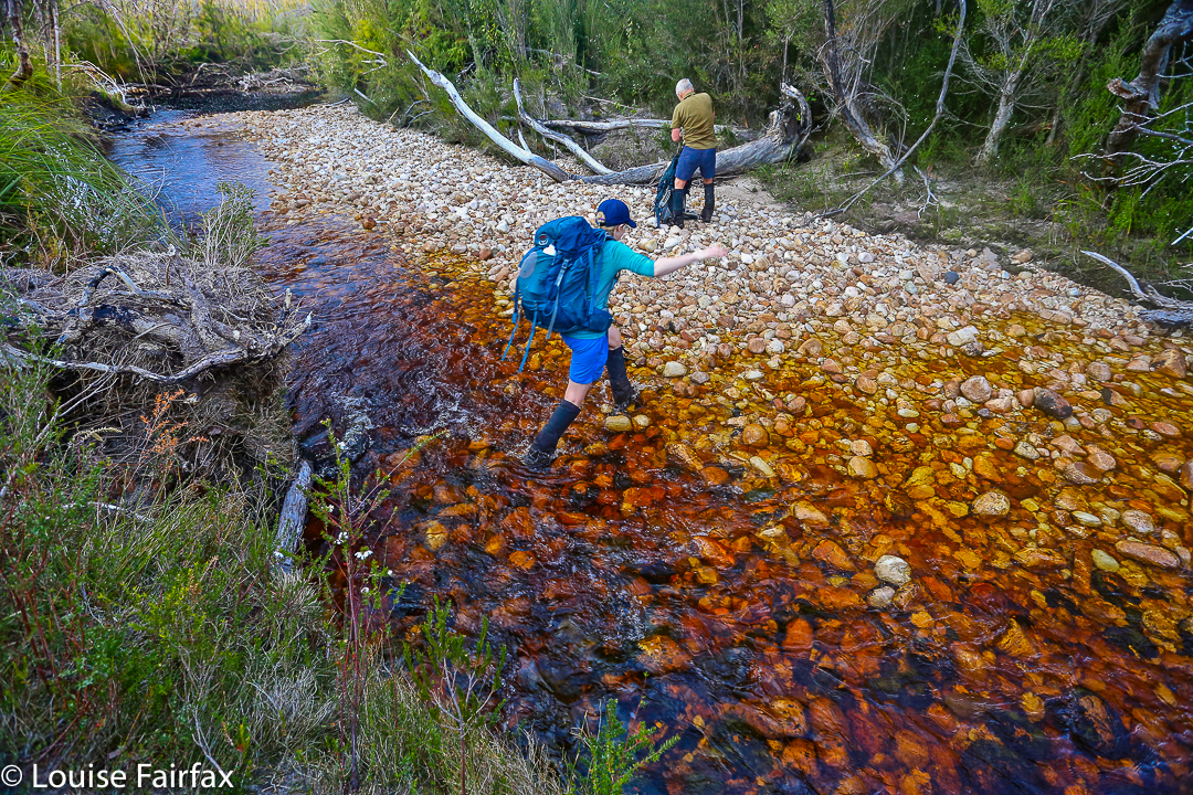
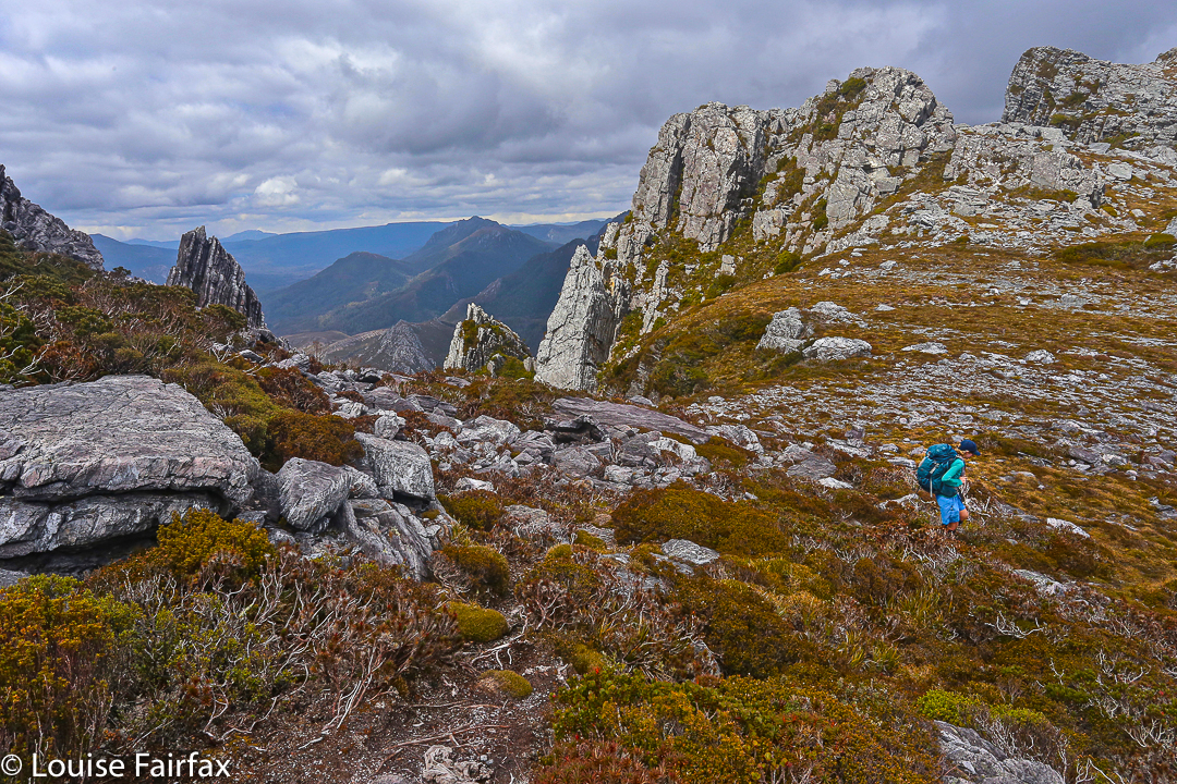
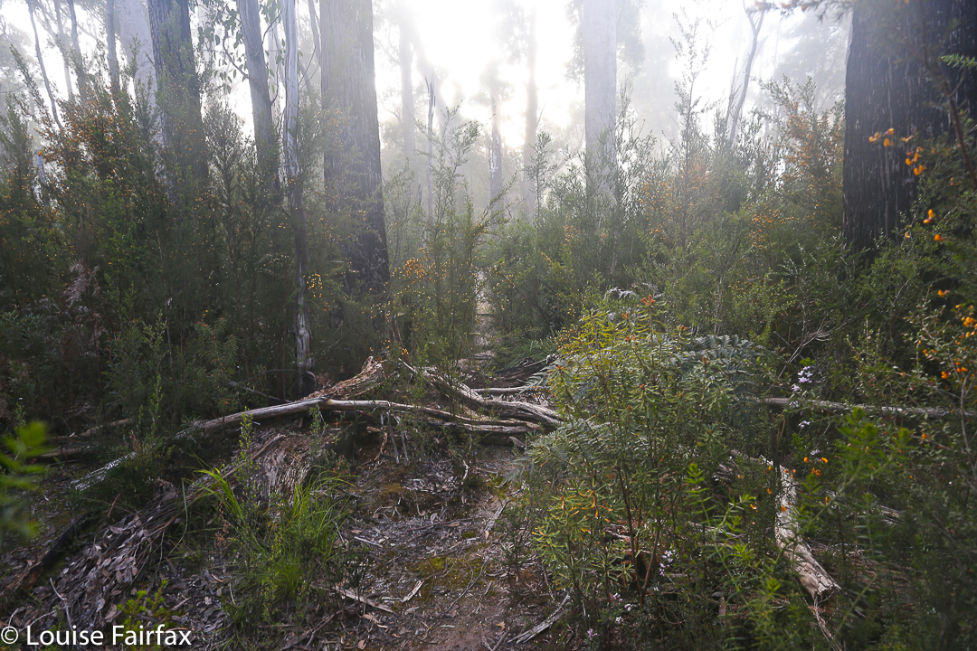
Next criticisms were directed at the apparently awkward navigation (in nuce, head west, over two contour bumps and the third and highest of the contour collections is your goal), and the fact that apparently the ground was very rough underfoot. We were in the bush. The ground was neither better nor worse than any other bush. If you want a smooth highway, visit QLD. They vacuum the forest floor there at 7 a.m. in case tourists should sue them for having uneven ground (I kid you not. Pity about the hideous noise and smell of petrol in a National Park). Again, expecting the worst, we felt nothing but pleasure in not finding it. You could run through that bush (if you were an orienteer), and the rocky knolls were fascinating and shapely. I loved them, and climbed over them on purpose. “This is fun”, we agreed to each other as we climbed.

Summit cairn and teasing trees

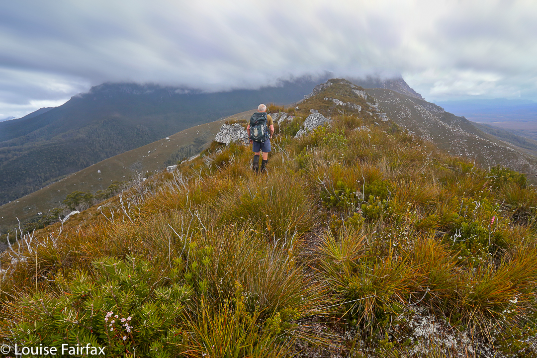
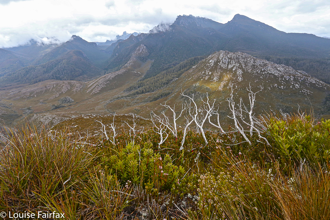
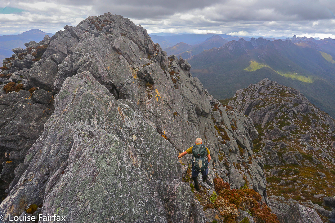
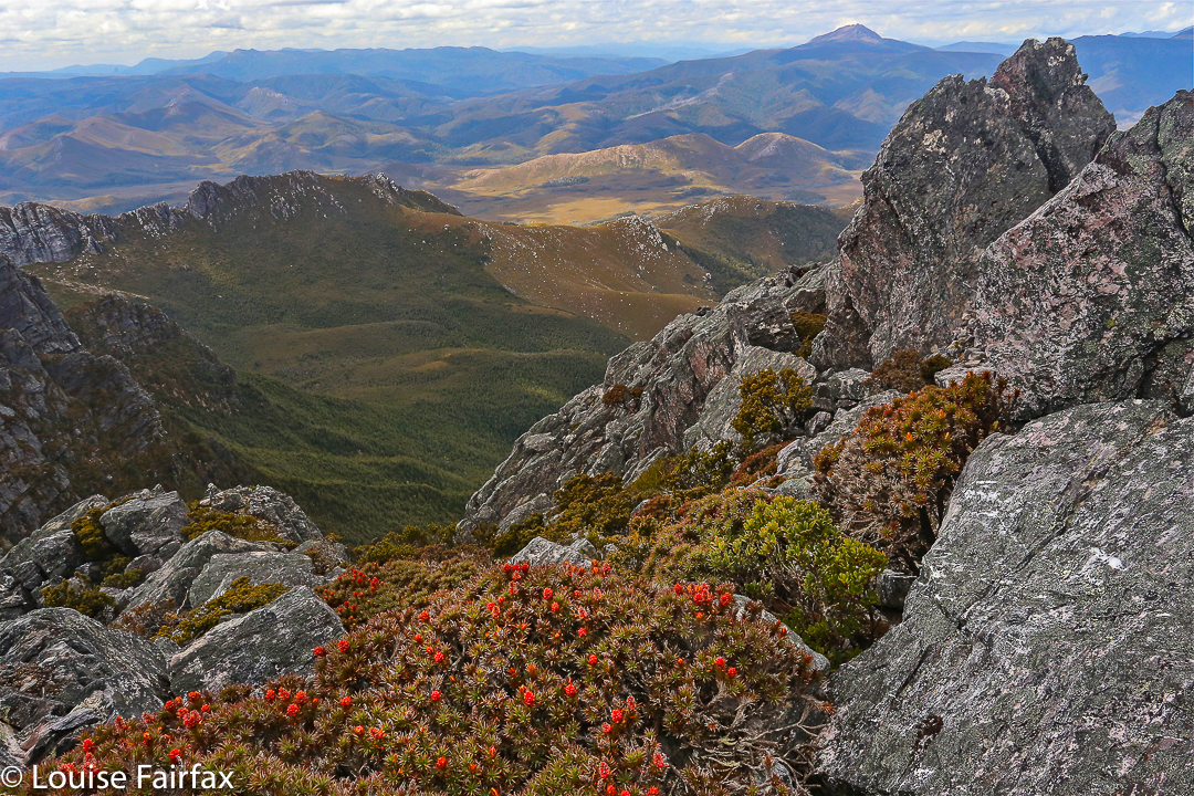
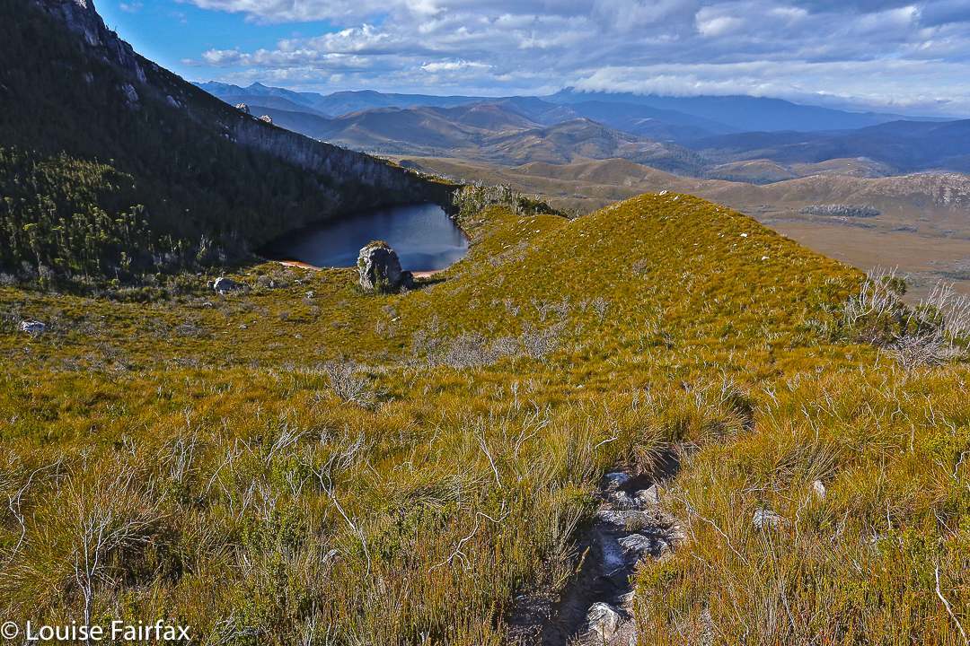
The “difficult to discern” summit stood out loud and clear to us, and even the complaint about the presence of trees fell on deaf ears. We enjoyed having a patch of shade in which to enjoy the view and have our compulsory summit-lunch, and I liked having a frame for the scene provided by leaves and trunks. I don’t want that on every mountain, but was happy to have it on this one. It seemed appropriate here. Of course we could see Mt Rogoona, but what that interested us the most was the unmentioned (by the book) King Davids Peak and Solomons Throne: it was fun to see these old friends from a different angle. Lakes Bill and Rowallan were very appealing from up there. And on the way down, once you’d started the very steep descent from the high moorland, we enjoyed views of Lake Rowallan that did not disappear, and that got bigger with each step. We’d taken, in walking time, 2 hrs 15 up; 2 hrs down, which made it a great daywalk, and meant it was short enough to have what was, for us, an uncharacteristically late start. Perhaps that also helped create the feeling of tranquility that I referred to in my opening sentence.

And a parting shot of Rogoona

Confessions of a sinner, in case it helps: that ‘up time’ includes mislaying the track somehow: one minute we were on it, chatting away as we climbed, the next we weren’t. I am always a person on a mission on the way up anything, and Angela is a very agreeable soul, so I suggested we just bushbash our way south until we happen to intersect with the pad, and she agreed that would be fine. I’d much prefer that to wasting time finding a pad that you don’t really need anyway. As predicted, we did get back on to it a bit later.

Our route from the pad on the marshy land below to the summit

Bobs 2015 ii Nov

The view from my tent window of the sinkhole

Mt Bobs beaten.
“Thirteen, fourteen, fifteen …”
“Louise, you’re just showing off.”
“Sixteen, seventeen, eighteen … .” I would not be put off my leech count, flicking them as they ascended to my hands, pulling them out of my hair and off my rainjacket, overpants, gaiters and boots. The light rain that had persisted for much of the first day had certainly brought them out, but at last we were at the sinkhole, ridding ourselves of them before disappearing into our tents to try to slough off the array of wet layers and warm up before exploring our fascinating environs. The rain had ceased, and the sinkhole is a truly fabulous area.

Sinkhole view, different direction

Although we had never tried Mt Bobs and failed, both Mark and I had the feeling that this was an elusive mount: a hard capture. I had cancelled a couple of trips due to bad weather before I ever set out from home, and on one occasion we had gone to Lake Sydney, only to turn back before ever beginning the climb proper. People seem to speak of this mountain with certain tones of respect; some, even with something akin to fear in their voices (these being the ones, I guess, who had particularly long or difficult battles with thick forest on the way up). Certainly, the way is steep and the rainforest thick, and no possible path declares itself as you stare amongst the tangle and cliffs. You are too close, at that stage, to sort things out. With Bobs, I think, you need to have worked out your method of attack before you begin. Horror stories of being held captive in her thick bosky arms are not too difficult to find.

Sorry, but it’s rare to have such a fabulous scene from the shelter of my tent

We did not treat this summit lightly, and read as much as we could before departing. In particular, we found the help of Rohan and notes he leant us from Marco to be invaluable. Thanks guys. Thanks also to Ian Ross – for our email discussions and his inspiring pictures in bushwalk.com that first sparked my interest in this mountain.
Day Two
At last ascent day dawned and we stood at the start line, ready to try our luck, determined to succeed. The sinkhole was pretty full, but we could at least get around some foreshore (left) before being forced up into the rainforest by rocky cliffs. We climbed a contour or two and then progressed parallel to the lake which already seemed quite a way below us when we got glimpses of it.

Looking back at my tent once we went exploring

Marco’s notes mentioned climbing an obvious spur. Lots of spurs can seem obvious on the map, but not so obvious when the shape is obscured in situ by thick covering, and, conversely, small spurs in the terrain can strike you visually yet be not be represented on the map, often due to the scale or the contour interval, or because they are not detected by the photogrammetry. I was standing on a spur that seemed obvious to me, but was it obvious on a 1:25,000 map with 20m contour interval? Time to check the gps. Yes. Good. Up we went. Confidence was high, and yet the notes also said that a pad of sorts could be encountered if one is in the right spot. We were seeing signs that humans might have held this or that branch, but after a while I felt like another dose of confirmation. I turned around to Mark:
“Right now, I would give a lot for the sight of a little pink tag.”
“Yes, that would be nice.”
I turned back to continue and could not believe it. There, right in front, waving at me, was exactly what I desired. It felt like we’d spotted the summit cairn. I gave a victory dance and hugged Mark with joy. This would take us on a pad that worked as far as the scrub just short of the saddle. We didn’t need to waste time with trial and error seeing if this or that cliff was going to allow us to progress on our way in this low-visiblity forest. We wouldn’t land in a cul de sac of tangle now – well, not as long as we managed to continue finding the tags. We still, of course, had to keep navigating, but every five minutes or so, you gained a pink benison: you were doing the right thing. It was a great feeling; like spiking the control at orienteering. Despite still concentrating, we could relax our guard a little now and enjoy the forest even more than we had been doing. When you are in a fairytale wonderland, that is a good thing.

Typical of the forest we climbed through

We swung a bit far in the scrub before the saddle, but didn’t lose too much time, and were soon enough standing on the turn of the land, gazing up at a cornucopia of cliffs, wondering exactly which were the “obvious” ones of the written instructions. Not quite knowing, we agreed together to head for a bushy gully between two likely contenders and play it by ear from there.

Mt Bobs summit area views

Emotionally and physically, I was pulled towards the more cliffy of the two main possibilities, so when I saw the hint of a lead through the scrub that would get us to the top of it, I took it. From there, we gazed together at our alternatives. The notes had talked of cairns. There were none for us, but in this section there is visibility, so we surveyed the scene and opted to go straight up the rocky spur in front of us, reckoning there were enough low-bush connectors to get us to a gully up high that we could see, which would give us a lead through the dominating cliffs to whatever was up there beyond. We were not on THE route but this route felt good. It was, indeed, as good in fact as it was in theory and we fair bounced up to the top in a very slick time, cresting the plateaued area by 10 a.m. This was it; we’d done it. The remainder of the stroll across the tops to the actual summit – photographing, admiring the view, delighting in the tiny watercourses, patches of snow and vibrant green cushion grass patches – was almost like a victory lap after a race.

Mt Bobs to Federation Peak in all her glory

It was sunny up there as we ate a bit and gazed at Federation Peak, but we were also very aware of the gloomy weather forecast for later in the day. We had climbed in a very small window of opportunity. We thus elected not to climb the Boomerang, but rather to descend, spend a little time relaxing at the tents – even cook some warm soup to have with lunch – and head out.

Cascades on top of the waterfall along the way both up and down

When we reached the bare knoll on the way out that offers the final view of Feder, we could see it was already raining there. The clouds were quite dramatic; the front was approaching speedily and earlier than we had envisaged. The race was on. We belted down that mountain, putting in as much distance as we could before we had water dumped on us from above.

Lazing in the sun by the tents while the billy boiled for lunch

The trip ended as it began: soggy logs, covered in moisture-laden moss that drenched you if you got too close; deep mud to suck you under and wet your boots and socks; soaking bauera that made each brush with it feel like a cold, unwelcome shower; and two sodden bushwalkers. Luckily, the really punishing rains began during the drive home. We were quite wet enough with the low-intensity version of a dunking that marked the beginning of the change. Our decision to hasten out was a good one.

Mt Bobs: Our route from the campsite to the top. No, we didn’t go swimming. I guess that blip is the gps objecting to the thick forest cover, trying to find a satellite. 


West Portal in Three Days 2015 Oct

“West Portal in three days Mark? You’ve got to be kidding.”
“Oh well, we’ll pack for four, but hope for three. I reckon we can do it.”
I’m glad he was confident. I’d try my best. Let the tale begin …….
Day One.
“We’re here,” I heard Mark say up ahead. Apart from hearing my husband or daughters say “I love you”, these felt like some of the best words I have ever heard in my life. Electric shock tingles were coursing across my left shoulder from the weight of my pack; the ball of my right foot felt bruised; my socks had bunched up at the front of both my boots causing discomfort; my hips felt very tender and I was, quite frankly, tired.
We’d walked 27.4 muddy kilometres in 8 hrs 52 mins, within a total ten hour timespan. That’s a lot of work and not much rest; but at last Mark’s words meant it was over for the day. It was still nice and light. It actually hurt to remove my pack from my aching shoulders, I was so stiff. Like wooden dolls we tottered down to the Cracroft River at the crossing where we were camped to admire its beauty and collect water for the next few meals. It was time to relax.

West Portal trip Day 2. Crossing Strike Ck

I pitched my tent, slowly, partly because I could barely move, and partly to try to accustom myself to its little ways (it’s relatively new), before joining the other two for soup. Oddly enough, at a mere 8.15 pm I thought the idea of turning in for sleep was exceptionally appealing. You don’t often find me in bed at that hour. I impressed the other two with the size of the two large pink swollen lumps I had – one for each hip bone – before I disappeared. Sleep would be like a divine ambrosia.

Day Two.
This was to be the day on which we attempted the summit. I wasn’t confident of my own ability to do this, but it made me feel better to hear the other two say they were tired too. At least we’d be in a similar situation. However each of us felt as individuals, we were there to give this our best shot. I set small goals: it would be great to see Lake Rosanne; marvellous to reach the high point on Lucifer Ridge; amazing to walk across the Crags of Andromeda; and, well, let’s not get disappointed by thinking about that far-off, hideously high summit, buried in the clouds right now. One step at a time.

Lucifer Ridge is gained

We still had another hour and a half along the flats before we began our climb proper. Over the Razorback Range we went, dropping into the squelching, muddy Arthur Plains, which we followed until beyond Strike Creek. We took the hypotenuse shortly after crossing it, heading up to the first high bump on the Lucifer Ridge, which jeered at us from above, as its namesake would also no doubt do. The gradient was so steep that the land was almost in our faces. We pulled on tufts of grass to yank ourselves up. Once my body started screaming, I led us on a kind of slaloming zigzag to lessen the severity a bit.

Lucifer Ridge view

With relief we crested a mini bump on the way to the one we wanted – some rocky wart – and took a two-minute breather before continuing on to meet the point where the vague pad from the longer ridge rose up to meet us. Every down was resented as it meant a loss of hard-earned altitude; every up endured with pain until we gave ourselves another tiny break to enjoy the view. We couldn’t rest for long, however, as our goal, although getting easier to see, was still a long way off. However, when the delightful Lake Rosanne appeared below us, we had to stop and admire her. We had a drink and muesli bar and took a time split at this point, as a pad came in on our right, coming to us from the lake. We’d done nearly two hours’ climbing since leaving Strike Ck.

On Lucifer Ridge

For yet another hour we climbed steadily (except when the wretched pad dropped to get around cliff lines) and steeply. We were nearly at the top, but we found a puddle of water, and I was starving, so we called another break and had a drink and snack before continuing. I stole some savoury food from my lunch rations, as muesli bars were not doing it for me. All of a sudden I had energy again. Let’s go!

West Portal from Lucifer Ridge. Oh dear. It still looks a long way away and we have already been working for hours.

We “topped out” a mere eight minutes later, entering delightful “sound of music country”: a wide, open ridge with short grass and expansive vistas in all directions. We could see the Western and Eastern Arthurs, the Mt Anne Range, Lake Pedder, Mt Picton and more. It felt like we could see everything. I dropped momentarily behind to take a few photos and hastened to catch up. Today was about the summit, not about photography, and too much of the latter could scupper our chances of the former.

Topping out at the Crags of Andromeda

On we hastened – if rushing snails can ‘hasten’ – for another hour and a half (nearly), travelling over the Crags of Andromeda and via the first, false summit (excitedly assuming it was “the one” until we saw the challenger to the throne a bit further on) to that glorious cairn that was ours. At some point in there as I traversed the Crags, chasing the others as I’d been indulging in a little more photography, I realised we were actually going to make it. A tear trickled down my cheek, I was so overwhelmed. The only other two mountains I’ve cried on have been Ossa because the view was so beautiful at sunset, and Mont Blanc, which I’d circumambulated, because I was – and still am – madly in love with her huge white magnificence, and I was grieved to leave her.

That’s her, the summit of West Portal: the highest thing you can see ahead. At last we’re closing in – but there’s an impassable gulch between summit B that we’ve just visited and the one we want. We need to go down to get up.

This mountain here has a special aura for me, and I had not conceived of success. People who have climbed her have always seemed to me to be “real” bush people: accomplished traversers of the challenging Tasmanian wilderness, and mostly (but not always) males. I couldn’t believe that I was going to stand on such a summit. I know there are much harder mountains to climb that lie in wait for me (they seem to me right now to be impossible), and I am not trying to claim anything for myself here; I am just saying the effect this particular icon had on me.

West Portal Summit. Richea scoparia enjoys some of the best views scoparia can have anywhere.

We ate our lunch on top, oggling at the wonderful view in every direction around us. This is the highest peak in the Western Arthurs, and it commands a vista commensurate with its title. I particularly loved the rugged Crags of Andromeda with their dramatic weathering patterns; of course, we delighted in the cornucopia of peaks with jagged edges bespeaking nature’s infinite power and fury. It had taken us 6 hours (and four minutes) to summit. We’d now relaxed on top whilst eating. Mathematics said it was time to turn our heads concertedly for home.

Lake Rosanne seen from the way down

Luckily, we descended more quickly than we had climbed, having ironed out a few of the glitches in our approach. Angela had brought her jetboil, so once the pressure was off – near Razorback saddle – we all had a cup of soup to fortify us for the last leg home. We arrived at the tents as darkness fell. Any later and we would have needed those headlamps we’d been carrying all day. The climb had taken us a total of 11 hours 40 mins’ walking plus food breaks added on. We’d covered 27 kms again, only this day we’d also climbed 1,000 ms (= 37 km equivalents) in tough terrain. Three exceptionally satisfied friends sat in a circle cooking and eating dinner. We were not looking forward to the long day on the morrow, but we all had four days’ gear with us, so if we couldn’t manage, it didn’t matter; we’d just camp at one of the many creeks along our 27.4 km path.
Day Three.

Cracroft Crossing campsite on the morning of day three. A nice misty day to begin with, but it became clear and hot later.

We didn’t need the extra day. We took fifteen minutes more walking time to reach the car on the rebound, and our breaks were longer, mostly to please me. My shoulders would not have gone the distance otherwise. We cooked soup to make lunch more interesting and relaxing, and had a cup of tea before the final long leg from Junction Creek to the car. I even went wading. It was wonderful sitting beside amber creeks in green groves with the friends with whom I’d just shared so much, soaking in the bush with the satisfaction of having achieved our goal. This is the life.

Seven Mile Creek, a refreshing food stop place

The route. Overall,  we covered 91.8 km equivalents, in three very tough days.

Dundas 2015 Jun

Mt Dundas June 2015

For some reason – well, actually, for a very good reason – I was a bit scared of Mt Dundas. As you may have gathered from photos, ice and snow dominate our scenery at present. Fine. Beautiful. The trouble is, this mountain begins with a river crossing, and we were under the impression the water would be knee deep at best (thigh at worst) and rushing. I would be climbing in snow with sodden feet, a sure recipe for personal misery and possible hypothermia. I was so anxious I even had nightmares as darkness morphed to dawn. Gulp. Here comes day: my moment of testing.

Monika negotiates the rocks near the summit

Down we went to inspect the infamous creek, scene of my sure doom. Hey. There was a branch I could clutch and swing from – Tarzan’s wife – over the slippery, slightly submerged rocks. I didn’t need to get my feet wet.

I don’t know why I had imagined that Dundas wouldn’t have rainforest at its base like almost every other mountain in Tasmania. Perhaps because nearby Tyndall is not impressive in this aspect. All I did know was that there was an old road one followed for a while after crossing the creek, and that it was “very overgrown”.  Well, yes, it was … a bit … but not so much that it was a problem. Up we climbed through glorious, lush, mossy forest to the point where “road” became pad, replete with tape in several hues. My favourite section was the stand of King Billy pines that rendered the path a carpet of textured needles in various shades of brown. My second favourite was when this was replaced by a different study in brown and ochres made by fallen fagus leaves.

Kent and Monica on the summit

Once we mounted the top of this ridge, the land flattened out for a section of tiny wombat pads through low lying scrub, one pad of which was used by humans. The final climb was now visible, but the summit still seemed a long way off – both in terms of vertical and horizontal distance. It seemed to me that it was too far away to be achievable on this short winter’s day. I pessimistically predicted failure to my two companions who betted on the contrary that we’d be there by half past one. I owe Kent a cake at Zeps, I am very pleased to say. I like placing bets that I hope to lose.

Here comes Jack

Not at all deterred by the possibility of having to buy cake, on we continued, taking especial care in the snow. I happened to be the one making the footprints in the end game, and needed to be particularly careful: it’s easy to assume there’s a rock under the snow and to fall and hurt yourself if there isn’t. Aware as I was of the dangers in this section, I was simultaneously aware of how grateful I was to Rupert for putting on the walk, and to HWC for enabling me to connect with others who are crazy enough to find climbing a mountain in mist and snow to be a fun idea. I know we are not the norm.

I was thrilled by the thwarting of my own pessimism when at last out of the gloom a mound appeared that was definitely the summit. Several false promising ones had made their appearance as we climbed, but this one had no shapes beyond. At last there really was nothing higher to climb, and Kent and Monica had even been a half hour too pessimistic in their own estimation of when we’d get there. Every member of the party had reached the top before one, and in fact, we had descended a bit and finished (a very quick) lunch by one thirty. The reason for the speed was not gluttony, but rather freezing fingers and toes that made picnicking in the snow a little less than pure delight. Moving was the best solution to the freezing problem.

Cold it may well have been, but I feel very privileged to have seen and climbed Dundas in the snow. I loved this mountain, and will return one day to admire her summer outfit and linger longer on the top.

A real, paper map will give you the context of where that lower waypoint is – scene of road end and where we parked the car. We then followed the obvious road until a cairn (NOT very far) indicated the path down to the river. After crossing, the old path that will lead you upwards is to be found on your right, and is indicated on the map above by the more easterly path which followed the road the whole way. The upper waypoint (2 of 3) is where the old road ends and the pad begins; basically, if you are heading up to the sharpest part of the spur you can’t miss it.

Alma 2015 Jun

Mt Alma. 4 June 2015

The lookout towards King William I, Pitt and Miligan as seen from the highway, not too far from where we started.

 Dark shapes appeared out of the mist as I drove towards the Western Tiers, heading for my render-vous with my HWC friends at Derwent Bridge. The skeletal forms of wintry trees floating in the mist were very beautiful, but I had no time to stop for them. As I expected, the bends on the Poatina road would rob me of the extra minutes I had allowed. 10 kms/hr was all I dared as I negotiated sharp turns of pure ice. The land up top was white and perfect, but again, I had no time to spare. I just had to admire it as I continued on my way. I’d left half an hour early, but was perhaps now running a little late.

Looking towards Mt Rufus as we drove to our destination.

Phew. There they were waiting for me. Now we could proceed further towards our goal, Mt Alma, on the other (northern) side of the road to Frenchmans Cap and along past the car park to where the main southern spur from Alma intersects the highway. Our mountain from the road was, as is often the case, a matter of belief in maps rather than something we could see for certain. She lay back there, up there somewhere.

Part way up the first rise

Up we climbed in good spirits brought on by a new adventure, through the frozen grass that melted and saturated when it came into contact with our warmer bodies. The views back towards Frenchmans were splendid, especially as we were lucky enough to have wisps of clouds below us and a snowy white beret on the famous French gentleman.

The white-bereted gentleman himself

After morning tea at the first hilltop, we dropped, past fascinating rock formations to a saddle, from whence the final climb began. The going was slow, as the bush in this section became quite dense. It seemed odd to climb up from grassy slopes into thick forest. On this particular day, every time you bumped a bush, it threw snow at you.

One of many fascinating rock formations on the first section of the climb (before we dropped to the saddle).

Already we could see and feel the day changing and clouds were rolling in. Unfortunately, by the time we reached the summit and got to picnic and enjoy the fruits of our labour, the interesting detail in the landscape had all but vanished and outlines were smudged; pleasing lighting effects were nonexistent. I didn’t even bother to photograph the summit, and stood for lunch, preferring not to eat sitting in snow. The trip down was very quick indeed. I think everyone wanted to finish the mountain’s work before the rain began. The views on the way up were definitely the climax of this mountain.

That bend where we parked the car is the second bend after the Frenchmans Carpark, but if you can’t read maps well enough to locate it, please don’t climb this mountain unless you are with a club. There is no path to guide you. You’ll see that we went beyond the “black dot” marking the mountain on the map. That’s because where we went was the highest point on the mountain, but we visited the black dot as well, so as to say “hello” to both points. Quite frankly, the lower black dot was a more interesting place than the highest point, and offered what I thought was a better view.