Claude 2016 Apr

Mt Claude Apr 2016.

The view to the left before you leave the track to embark on the rocky climb
In terms of having intricate directions in the final stage of the climb, Mt Claude is one of the trickier mountains, so instead of my usual sort of entry, I am going to try to provide extra details in words and pictures to augment the already excellent instructions we had from www.bushwalk.com, the bushwalking forum. Despite their helpfulness, we did have two “detours” where we managed to stray, so hopefully the pictures and text below will help others who want to use this much safer route of climbing Mt Claude. I came across it last week and thought it looked fun. Angela agreed, so off we set.
Follow the main path (that begins on Olivers Road at the Lookout, and that, after you leave it, continues on the northern side of Claude, heading for Van Dyke) for about three kilometres, turning right and slightly down (ESE) where an arrow tells you to, rather than heading for the tower. We had a diversion to the tower due to not quite understanding the instructions. I’m not sad that I had the extra climb. It was quite interesting, but the excursion gave us a huge warning about how very slippery the conglomerate was today. I had already felt how greasy the rock was, but still got a horrid shock when I saw Angela’s foot come unexpectedly away from her in the descent back to the track, and she began gathering momentum as she fell. I watched in horror as her first attempt to grab something to arrest her fall failed. Luckily the second obstacle worked as I did not like the speed with which she was dropping. Of course, all this occupied maybe a single second, but it felt like an eternity as audience.
Back on the track we went to the south of the tower clump, and along to the flat saddle before the actual summit block. Below is a picture of where, in that saddle, you leave the path that continues more NE to drop down below the northern side of the impressive summit boulders. This little pad here goes to a slot that you climb up. There’s a cairn at the top, and the cairns were generally close enough to follow.

This is the pad you follow to exit the main track
Below you can see Angela climbing a slope, because I called her up. However once we were both up and consulted the notes from bushwalk.com she’d copied into her phone, we saw that we weren’t supposed to be lured by this steep, narrow path, so went back down. It was quite a nice little climb – not slippery like the rest of the day. However, if you get this view, you know you’re wrong.

Along and up we went, consulting the forum notes quite heavily now. They warned us not to proceed along the likely looking trail, pictured below, tempting as it is.

 Instead, the notes say, head for the sky, so that is what you can see Angela doing in this next image.
The notes then say that on the right, just a bit below where Angela is in the picture above, there is a turning to the right. Take it, and it leads to the entrance of the infamous cave. We were both a little apprehensive about how this rope section was going to be in such slippery conditions. Angela was worried about her knee that she’d hurt in the fall, and I wondered if my upper body could drag me up, if that was required, as I had had an operation the previous week and even running still hurts a bit, so my torso’s strength is compromised. Oh well, there was one way to find out.

When we looked into the cave, it was dark and foreboding. At first our eyes couldn’t make out anything at all, but gradually the rope that we’d been promised could be discerned. I could see that it had knots and loops in it, so that would help. The entrance was very narrow, and we didn’t have a clue what lay ahead, so both decided to leave our packs behind – a very sad decision, as that meant no camera, and no food on top. The entrance was so narrow that we wondered, not for the first time that day, how large people managed to use this route. I took the rope, put one foot in the loop, and set out, feeling in the dark for the next loop. It was too much trouble to get my foot in, and my upper body was coping, so I used my knees against the rocks – they had better traction than my boots – and hauled myself up. The series of knots gave good grabbing points, and my knees found indentations in the rock that held me. It worked, although that method hurt Angela’s injured joint. Once up, the summit was very close, and we happily touched it. Thick mist was now rolling in, rising to engulf us. We wanted to see to try to find our way down this slippery dip of a mountain, so set out pretty quickly. I was starting to feel nauseous with anxiety at choosing a route blind. I also didn’t know how it would be lowering ourselves on the rope when the rock offered absolutely no grip at all. It was a long way to fall. However, on the descent, I found I could decelerate by leaning my back into the wall above, creating a bit of pressure to combat gravity.

Hoorah, soon we were down and gathering packs again (Angela is buttoning hers up in the picture above). I wanted to get below the rock section before stopping for our snack so as to ensure visibility. It was with enormous relief that we sat with the view below, still rocky enough for beauty, but by this stage, all the potentially tricky route finding had been accomplished, and, although we were cold, we made time to eat. I needed to eat to relax more than to fill my stomach, I think.

Snack view, down low and out of danger of further falls
In front you see the pad that we followed to do the climb. Angela is standing at the pad-path intersection waiting for her friend who is now taking rather a lot of photos.

Goodbye pretty boulders. They really are wonderful if you’re not climbing up them when they’re moist.  Down we climbed, both looking forward to the food we were anticipating at the Raspberry Farm, which is fast becoming a traditional calorie replacement station.

I’m not happy with the clarity of this. I’ll add a map of just the last section in the morning. Hopefully that will give better detail.

Philosopher Falls 2016 ii Apr

Philosopher Falls 2016 ii Apr

We set out from home late, not reaching Waratah until a bit after lunchtime. We were now in a rush. In the Tourist Bureau, a man overhears that I’m on my way to the bottom of Philosopher Falls and asks if he can join in. He’s already had a failed attempt. I size up his physique for the likelihood of rapid movement. No obvious problems. Jeans. Confident enough to have at least made a failed attempt (the average tourist stays on the track).
“Yeah. Sure, as long as you can keep pace.” (I have driven several hours to be here. I don’t want my attempt scuppered if he can’t keep up with us. He is a total stranger, after all).
“Are you certain?”
“Yeah, that’ll be fine as long as you can keep pace,” I repeat.
He joins us in the carpark at the falls. He’s changed, out of jeans and into boots (good) … and pants that you’d wear out to dinner. Hm.


Off we set, me in the lead, hubby and Man following obediently, down the track to the point where we depart and go bush, from whence I head off on contour along the gps’d track I made last time. Man follows Gretel and Hansel through the forest, repeating oft that he could never do this by himself, and neither could he find his own way back. I stop after 7 minutes to check on how closely the tapes that have now appeared are sticking to the route I marked in last time. He is panting heavily. From exertion or fear? I decide both. Should I take him back and lose time that I don’t have? Not time to give up yet. He makes strongly panicky noises to my husband while I sort things out on the next short stop. Bruce is unsure what to say. What if he encourages him only to find out I’ve decided to take him back? Or if he agrees with the man (that we should turn around) when I’ve decided I can get him there despite the panic? Bruce makes equivocating mumbles. (He’s expert at that).


For the present I continue, believing I still have enough light to get them down. Coming back up will be tricky, but I think things are still OK (apart from the obvious angst) for now. Terror noises grow in volume and frequency. After 20 mins I head back in the direction from whence we came, ending back on the precious path. Man is overjoyed to see it. He totally ignores the fact that we have failed to reach our destination and celebrates his safety. No one gets to see Philosopher Falls (bottom) that day.


I photograph some pretty cascades elsewhere on the Arthur River, still accompanied by Happy Man, who is effervescent now we are near a navigational handrail he can relate to (flowing water). We then part, he returning to Waratah, while we continue on to Corinna. He tells us the road is shocking and will take us two and a half hours. We take this with a grain of salt, and do it in one. We have no booking and are very hungry on arrival. Luckily, this story has a happy ending today (unmitigated pathos is hard to endure). There is room for us at the inn, and we even get to eat a hot dinner.

Rats Castle 2016 Apr

Rats Castle. April 2016

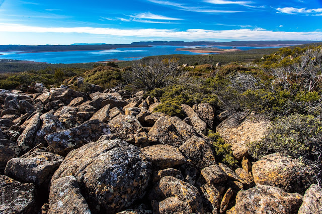
Unfortunately the wide-angle lens has flattened things out a bit. This shot is taken over 300ms above the lake.
In a long-gone era, when orderliness and reason were supreme values, mountains – with their jumbly chaos, their “hideous” height and irregular form – were so hated and feared that they were regarded as part of an angry God’s judgement on a sinful earth. Others argued that such undigested heaps of confusion could not come from a God of order and beauty, but from some other chaos. These jumble haters would have sure hated Rats Castle!

Preferring to invoke Norse mythology than these myopic understandings of God, when in a landscape such as that provided by this citadel for rats, I picture Thor in his fury, smashing stones like marbles in his wrath, tossing slabs of rock about the place in a wild mess.

From Rats Castle, near the summit

I thought of this image as Angela and I spent the best part of an hour negotiating the upper part of the ridgeline that leads to Rats Castle. We had adhered to the instructions in the book and forum, following an old fence, then climbing to the top, and finally following the ridge south to the summit. The junky rocks were exactly as those commentators on reason had depicted in their rather jaded, moralistic accounts. As we tiptoed through the field of discarded, ossified footballs, we had time for such musings. It took a little less than an hour to gain most of the height we’d needed, but another hour to traverse the mess, weaving in and out and around about, dextrously avoiding scoparia and other obstacles of a more jagged nature.

Summit view from Rats Castle
Three things saved the area, I decided, as we sat on top enjoying a leisurely … whatever the meal is called when it’s not lunchtime yet but you’re hungry, so eat your lunch ’cause you’re on top anyway:
(1) an amazingly blue lake (Great Lake) below, with patterns of mirror and ruffle on the shimmer (hardly the “blue scrofulous scum” as the mountain-hating Charles Cotton called a lake in 1681. It seems he was not keenly alive to the beauty of lakes either);
(2) tiny shapes we could recognise way in the distance: the Acropolis and Geryon to the west; Ben Lomond to the east, with Arthur and Saddleback rising out of localised clouds even further afield;
(3) the knowledge that we should make the most of this view, as the chances were highly unlikely that we would ever be back this way again. It wasn’t horrid or anything: it just lacked any “wow” factor that lifts the spirits, and life is short. On the smorgasbord of mountains, when I’m choosing second and third helpings, other treats will be more on my mind.
Sitting up there, chewing our cud, we could see no good reason at all for the oddly-shpaed route we had been advised to take, so opted for a direct descent and take whatever consequences came. The only one that did was a descent that was half an hour quicker than the inward journey. Angela, knowing what a rebel I am in every other way, asked what had ever possessed me to adhere to instructions on this occasion. I had no adequate answer for that unprecedented and unwarranted conservatism that had momentarily taken over.
Conservative ascent, following advice (top); creative descent, going for it (bottom / south).

Dasher Falls 2016 Apr

Dasher Falls Apr 2016
We did Dasher Falls in combination with Redwater Creek Falls Upper and Lower – a pleasant short trip from Launceston.
(See www.natureloverswalks.com/redwater-creek-falls/ )


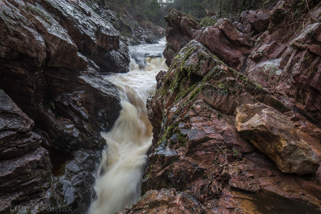
Dasher Falls
How to get there:  Driving from Sheffield, we turned towards Beulah at the intersection, along a road that the map (but not the signage) calls Bridal Track Road. We followed this along until there is a road off to the right at the bottom of the hill with a sign that says Lower Beulah 3 kms. This road crosses the Dasher River within 20 metres of the intersection. The falls are now about 400 ms upstream. You can either park there and walk up the road, or be lazy and do what we did and drive back up the hill for about 200+ ms until you see a pine tree with a pink tag on it. Parking there is fine pulling over to the left from this direction (but parking coming from the other direction and trying to spot tape etc didn’t appeal to us). From this tree, follow tapes towards the river, and then upstream to your right. Soon enough (a mere 100ms or less) you’ll see the falls. Today, after the heavy rain we’ve had, the mud and rocks were slippery, and my husband and dog both backed out of actually gong to the falls, settling for a walk back along the river on safer ground. I would not under any circumstances bring a child here unless it was on a lead! Maybe the picture is enough to tell you why. I was too scared to look over some edges.
After you’ve visited the falls, you can turn around by putting your nose into a dirt track that is on the right shortly after the pink-taped tree.

Gear List

Gear List for bushwalking.
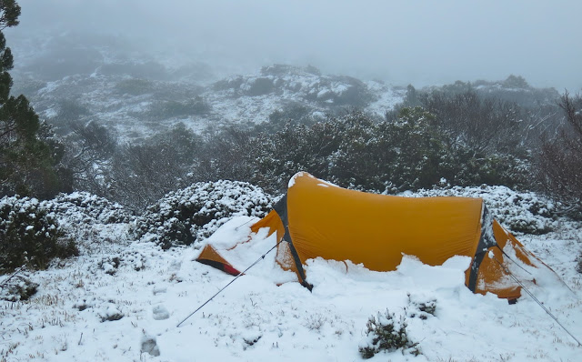
Are you ready for this? It can happen in January

Some of my followers on IG and blog have asked if I could give advice on packing – of clothes and food. I am happy to oblige, and will begin with gear. Before I do so, however, I need to stress a couple of matters that seem important to me, and that should be borne in mind when reading this.

A different snow squall, different place – any time of year

(1) Individuals differ from each other in the extent to which they feel the cold. What is good and necessary for me might be insufficient for you. In the case of ‘the cold’ that is actually unlikely, as I am a renowned wuss, but thought I’d better mention it.
The most important thing is to know your own body, and know it well before you step into the wilderness. Being in the wilderness is as much an experience of self learning as it is one of seeing beautiful wild places.

If you count on getting saturated, then you won’t be disappointed.

(2) Begin simple, so you can learn from your mistakes without killing yourself. I have heard of first-timers who want to start their ‘bushwalking career’ with the Mt Anne circuit or the Western Arthurs. This is like a beginner in high jumps setting the opening bar at 2 metres.
When we wanted to take our 6- and 8-year-old daughters on the Overland Trail, we first took them on the 33 km Freycinet Peninsula walk as a warm-up – both for them and for me, the provider. I weighed and measured everything in those three days to learn for double that number.
If you have never experienced even a daywalk on a Tasmanian exposed mountain in a black mood, how can you plan for five? I once took a Swiss friend to Cradle, insisting he pack certain precautionary clothes. He was indignant, and scoffed: “I live higher than the summit of this mountain, and you’re telling me what to bring?” He didn’t get past Hansons Peak, and had the grace to apologise. The incident points to the fact that height is not felt in the same way in all circumstances, and height on top is very different from the same height in a valley.
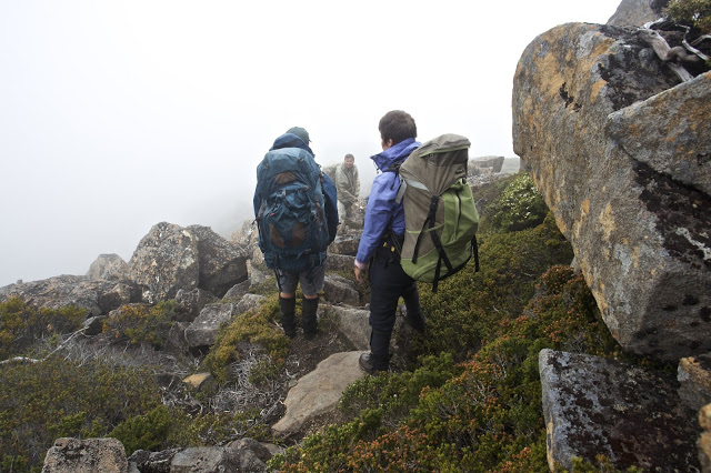
More soaked walkers – it’s a recurring theme

(3) You need to be prepared to be tough and uncomfortable if you don’t want to burden yourself with a pack full of wet gear. Most (all?) of us put on wet clothes each day (in continually raining conditions) rather than wet a different outfit each day, only to have the new outfit wet after five minutes. This means, of course, that your daytime get-them-wet clothes need to be made of a fabric that is comfortable and warm when wet, and that will dry quickly if given quarter of a chance. I use icebreaker gear next to my skin, supplement it with a thermal or icebreaker long sleeve top, then have a third layer of a padded jacket that is warm when wet (mine is a macpac Pulsar hoody, not down for day), and over that, my Anorak (rain jacket). Even so, I need to keep moving to keep warm. PS Now I use an Arc’terx hoody instead of a macpac Pulsar, as it’s warmer.
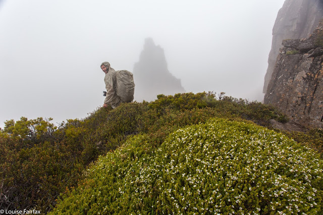
Perhaps another theme – comical – is to be careful of your company. Do we assume cause and effect (or post hoc ergo propter hoc fallacy) if I tell you every photo above was taken on an LWC walk? It does make the incidental point that clubs get out there and do it, even when the weather is not kind. I have stood on many a misty, freezing summit huddled with LWC or HWC members, penguin style, warming each other up (hopefully). 

(4) You must have a complete dry set of everything for nighttime, when it is imperative that you warm up and sleep dry. This includes nighttime woollen socks, gloves, beanie and undies; i.e., double up on everything. (In summer, you can sometimes get away with one thermal top and long johns – but even then, you can get caught out, as I have been; better to be safe).

(5) Have a bag of warm, dry clothes in the car. Assume you’ll arrive back cold and wet. Anything else is a bonus.

You can pack a baby if you wish

My Gear List.
Tent                                         Sleeping bag
compass                               map

stove                               gas
matches                                 inner sheet?
Sleeping mat                        blue carpet underlay for extra insulation
2-3 prs wollen socks        crocs for camp
headtorch                              phone for gps / navigation
Camera gear                        spare batteries? (camera, torch, phone)
water sac / bladder           EPIRB
water bottle                          cup / mug
penknife with scissors     2 spoons (1 to use, 1 to lose)
tiny towel                                 wetex to wipe wet tent
walking shirt, quick dry     walking pants or shorts
Thermal top x 2                    Thermal long johns x 2
waterproof pants x 2         3 prs gloves (fleece, wool + possum)
scrub gloves                           anorak (ie, rain jacket)
boots                                         gaiters 
icebreaker singlet               day pack for day climbs from base                   
beanies – 1 for day, 1 night     silk balaclava   
lip cream                                   sun hat
paper for writing                   pen                 
3 prs undies (1 of wool)      crop top
Arcteryx jacket (for night)   extra jacket (Pulsar) warm when wet for day wear
face cream                               sun cream
sunglasses                                pack cover
Toothbrush                              Toothpaste
Blister gear (Compeed)      Panadol
Anti-inflammatory tabs      tinea cream          
food (to be discussed later)      whistle (if Osprey pack, it’s part of your pack)           
book?                                       If you are on any medication, then those tablets.
Some need electrolyte tablets to replace salt lost in sweat.
light spade for toilet use        toilet paper (please have mercy on the bush and     use only when necessary. Leaves can be an excellent substitute for quality).
I also take 2 pegs and a bit of chord. You never know what can come in handy.

Plaster can mend trousers as well as legs.
You have no idea how handy doubling up can be. On a ten-day expedition I went on:
I forgot toilet paper, but W had 2 rolls and gave me one;
M forgot his hat, but J had two;
B lost his sunglasses, but J had two pairs;
S broke his stove, but A had two;
C broke her spoon, but I had two;
Someone tore their pants, but C had a sewing kit;
W broke his pole, but S had a pole repair kit;
My tablets for pain were dated 2007, which A informed me would not work in 2016, but she had spare.
The list goes on, for sure. This is all I can remember.
Helping out and being helped in mutual working towards the goals is the theme.