Dasher Falls 2016 Apr

Dasher Falls Apr 2016
We did Dasher Falls in combination with Redwater Creek Falls Upper and Lower – a pleasant short trip from Launceston.
(See www.natureloverswalks.com/redwater-creek-falls/ )


Dasher Falls
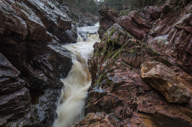
How to get there:  Driving from Sheffield, we turned towards Beulah at the intersection, along a road that the map (but not the signage) calls Bridal Track Road. We followed this along until there is a road off to the right at the bottom of the hill with a sign that says Lower Beulah 3 kms. This road crosses the Dasher River within 20 metres of the intersection. The falls are now about 400 ms upstream. You can either park there and walk up the road, or be lazy and do what we did and drive back up the hill for about 200+ ms until you see a pine tree with a pink tag on it. Parking there is fine pulling over to the left from this direction (but parking coming from the other direction and trying to spot tape etc didn’t appeal to us). From this tree, follow tapes towards the river, and then upstream to your right. Soon enough (a mere 100ms or less) you’ll see the falls. Today, after the heavy rain we’ve had, the mud and rocks were slippery, and my husband and dog both backed out of actually gong to the falls, settling for a walk back along the river on safer ground. I would not under any circumstances bring a child here unless it was on a lead! Maybe the picture is enough to tell you why. I was too scared to look over some edges.
After you’ve visited the falls, you can turn around by putting your nose into a dirt track that is on the right shortly after the pink-taped tree.

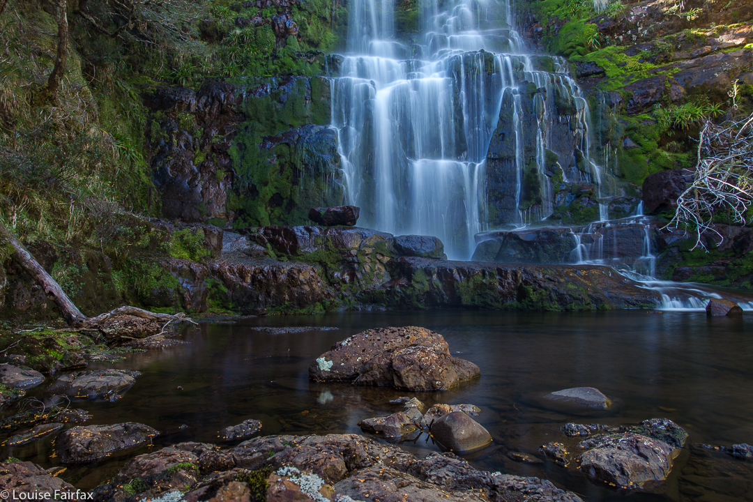
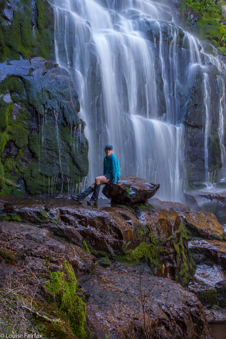
Orites Falls 2016

Orites Falls 2016.
The real story of Orites Falls is actually the story of the Cheyne Range, which can be found scrolling down to C on the right here, by an internal search or clicking:
http://www.natureloverswalks.com/cheyne-range/


I have done a separate heading for those who are solely interested in waterfalls, and in seeing a very unusual one. However, if you are not interested in “real” bushwalking with a pack on your back and an overnight stay in your tent, then this one is only for window shopping. You also need to be able to navigate to get to these falls, as tracks will only help you for about the first hour. The going is rough and tough, but the rewards are great. I was upset that I couldn’t bring my tripod on this trip, but I found an obliging rock that allowed me to use it for exposures of a couple of seconds.


Our route is in the Cheyne Range entry. I haven’t repeated it here in order to emphasise that this waterfall is only for very experienced members of  bushwalking circles.

Hyperion 2016 Mar

Mt Hyperion March Long Weekend 2016

What is it about a mountain like Hyperion that demands our respect and makes it impossible for us to take it for granted? Sometimes it’s the shape, sharp and steep, where no easy way seems possible from afar. Other times, it may be the stories we are told of it, or warnings we are given. I had received plenty of these with regard to Hyperion: “Don’t do that one solo, Louise”; “Don’t climb it in mist. You want to be able to clearly see the dangerous drop-offs”; “It’s very airy up there”; “Hm. You and Angela are very short, I’m not sure you can do it. Maybe if you help each other you can”. Some people give a slight (very reassuring for me, the listener) shudder when they recall the exposure. I was certainly not going to take this one lightly.

It is now cool enough for fungi. Yippee. 

If you want to see quaint, tasteful bridges like this in the Lake St Clair area, you’d better hurry. Pukes and Wildspite are ripping them out and replacing them with monsters made of synthetic material, a metre or more wide and giant handrails, of course, because if we fell into the water we might get our tootsies wet and sue them. I weep for the loss of the rustic, picturesque and natural. They are even thinking of replacing darling Pine Valley Hut with something bigger – perhaps something as utterly unsuitable, chilling and unwelcoming as the Bert Nichols Hut. Who knows? If they think it will get more tourist dollars, that’s what they’ll do.

I set out a little in awe of what might be my fate on this mountain of the stories and warnings, and rather anxious. Rock chutes, and reaches that are challenging do not scare me, but the possibility of toppling to my death from a ledge in a moment of carelessness does, and not just because of the recent accident of Feder. Ledges bother me. Could I summit this mountain? I don’t usually doubt my ability to get to the top, but with Hyperion, I was unsure, AND I certainly did not welcome the last-minute change in the weather forecast that now promised us rain and mist every day of our possible attempt.

En route. I have dubbed these “Geryon Base Camp Falls”

The first day was so wet and gloomy that we, a group from NWWC plus the Fairfaxes, stopped short at Pine Valley Hut, thus allowing us to keep our tents dry (and lighter) for a bit longer before the climb. Any excuse to spend time in this valley is a good one, and Bruce (my husband, still with us at this stage) and I enjoyed wandering and photographing in the light drizzle of the afternoon.

Russula sp coloured the forest

Next day, we climbed in mist and rain, up through glorious forest and onto the Du Cane Range, ultimately descending to Lake Helios for our campsite, pitching our tents shortly after 3pm. We all expressed astonishment and pleasure while we set up camp at the brief appearance of the sun. Our leader, Greg, announced that if we were to make a summit attempt, as soon as our tents were up was probably the best moment, as we did not know what the morrow would bring. This was a great call. The next day, we now know in hindsight, would not have been suitable.

Climbing to our base camp at Lake Helios.

The group gains height on the Du Cane Range

The beautiful Lake Helios, perched under Hyperion, our goal.

I didn’t find any particular moment of the climb itself (the manoeuvres involved) to be scary. What concerned me was the weather, which closed in and fogged us up so that good routes up the next stage were harder to sight. I feared the unknown that lay ahead, and I was anxious about the time, as it was getting later than I liked should we have trouble getting back down. I think we all probably harboured our own little anxieties as we forged on upwards, hoping it would work.

The final stage lies ahead. We can get there.
Six happy summiters. The group minus me. I was too cold, and in too much of a hurry, to use auto timer and find a rock to balance my camera on.

When anticipating summitting Hyperion, I always thought I would be joyous and whoop with delight when I reached the top. In fact, all I did was heave a sigh of relief, grab a few photos in the icy wind, and clear out of there, back down to safety. Tempered joy would come later. Relief is still the dominant emotion.

Clouds await us below.
An aspect of the ascent that interested me was that I was hit by (another) falling rock, this time on the thumb. I have always thought that if this happened, I would lift my hand in pain, lose my grip and possibly fall from my position. I am delighted to report that the worst that happened was pain and that I did not let go. This is quite a comforting thing to know. I had to keep moving so the pain didn’t overwhelm me, and the others understood. Movement took my thoughts away from my thumb onto things I could control, like making the next climbing step. I was fine for now.
Sunrise next day. I hope you like this shot. I had nearly as much hand pain taking this as I had from the falling rock. Temperatures were sub-zero while I took this tripod long exposure with no gloves on.
The next morning, it was so cold we had to wipe sheets of ice from the tents. Rocks were slippery. Climbing Hyperion would have been treacherous.

We exited through the Labyrinth, making an attractive circuit, and descended to my husband, who had climbed the Acropolis while we were away.

Mt Ossa and Pelion East from the northern end of the lake shortly after dawn.

Rogoona 2016 Mar

At last, after nearly 1 1/2 hours walking, I sight my goal

Mt Rogoona. A day walk.
Yesterday afternoon I was double checking my list of Abels so I could post it for people who want to use it (it is here in my blog – “Abels: alphabetical” – when I discovered that five Abels were missing, one of which I hadn’t climbed. As my count works backwards rather than forwards, this meant that I had climbed one less Abel than I thought I had. I either had to subtract one from my number (terrible), or go climb an Abel today to turn myself into an honest woman. Luckily my work commitments for the day had been cancelled, so I chose the latter ploy, of course.

And better still, after 2 1/2 hours I get a view from the summit area (actual summit is still three knobs away)

I opted for Mt Rogoona, hoping I had enough time to fit it in. The story in Wildtiger has more hours to climb than I had available. I was also hoping to undercut the time mentioned in The Abels, but I was gambling on my route working, as I decided not to use any of the suggestions on offer in web or book, but devise my own. This freedom to choose one’s own route is part of what I love about bushwalking. I didn’t really care if my route was not the best way (as long as I got back to the car in time to get me home for dinner): it was my way, and I like exercising my independence and autonomy – as well as freedom and creativity. To me, following someone else’s purple line on a garmin screen is a denial of many aspects of walking that I love. Walking is about so much more than bagging a summit.

Rocks plus water really do it for me

And so I drove through the charred landscape of black and fallen trees due to the January fires, until I reached the end of the road beside Lake Rowallan. Despite the burned debris, the old track to Chalice Lake could be made out with concentration until it crossed a bridge (after 12 mins from the car). From here, I could see no trace of a track, and I was not going to Chalice, so set off up Jacksons Creek, keeping as near to the water as possible until the creek forked.

Weee, there is Geryon (and the Acropolis (et al).

At this stage, I let the terrain decide my route. I feared getting trapped in a waterfall if I took the very steep left fork, and didn’t know if waterfalls were also on the right one, so decided to climb the cliffs up the middle. This worked fine, although I did have misgivings about finding a suitable passage on the rebound. That was a problem for later. I got up the steep section, bullied a little by the thick scrub in one part, but then made my way south east until I intersected with the track between Lakes Bill and Myrtle. From here it was only a bit over a km to the lake (Myrtle).
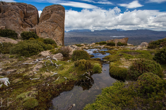
The book talks about following a track between this lake and the next (Lake Meston), but it was going away from my mountain, and I could see no possible reason for such a deviation, so just went straight up. I had reached the summit cairn in 2 hrs 50. It was cold and windy up there, so I opted for lunch down by the lake, and after the obligatory series of photos, headed back down, choosing a route even more direct than my way up had been, arriving at the point where you cross the creek at the end of the lake in 57 minutes from the summit cairn. Now it was time to eat, although I didn’t spend too long doing that, as I was unsure about how descending through the cliffs was going to be.

Farewell lovely mountain. I’ll be back to spend the night with you one day. This was just a recce.

As I was departing, I noticed a little pad continuing around the lake on the opposite shore. I decided to follow it, reasoning that, as it was going westish, I could use it as long as I wanted, and then head north, or else, if it swung north where I wanted it to, I could use it the whole way. I like “circuits” (or whatever you call this), so happily followed it, noting that someone had cut branches quite recently. All this zone at the top, you will be pleased to note, was untouched by the fires, which affected the steeper areas down lower. I figured the pad would be pretty impossible to follow once I hit the charcoal, but funnily enough, you could still sometimes see marks on the ground, or old sawn bits of timber, and occasionally even tapes – not melted ones. Someone has been out and put nice new ones there. Thank you, whoever you are. I got “dumped” by the tapes lower down, but I knew where I wanted to go, so just went there, rejoining my original route in at the bridge. The route down, summit to car, took 2 hours 20. I liked my circuit, so much quicker than other routes I’d read about.
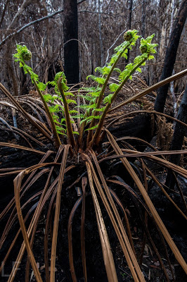
The black scenery from the fires was both depressing and sickening at first, but as I walked through it, I was filled with wonder, for the bush is already on the move: nature is fighting back. Even myrtles have new leaves, as well as the eucalypts (of course). Tree ferns were flourishing, as were ground ferns and bracken. Of course it won’t be the same as it was, but the tree ferns looked fabulous in their bright green crowns, and it was great to see that the bush could begin to recover. Lots of trees I used to pull myself upwards had some give in them. They’ll grow green too with a bit more rain. My face was predictably black by the end. Wild Woman hit Mole Creek for afternoon tea, but the cafe had closed at 3pm. Who eats afternoon tea before 3? Bitterly disappointed, and dreaming of the hot chocolate with cream and cake I’d been denied, I drove the rest of the way home.

My route
Caveat: it surely goes without saying, that this route is only for people experienced in navigation and in forging their way through untracked bush. If you are not confident in these matters, then there are tracks you can use. They are longer, but perfectly adequate.