Inglis 2014 May

Mt Inglis. 6 May 2014

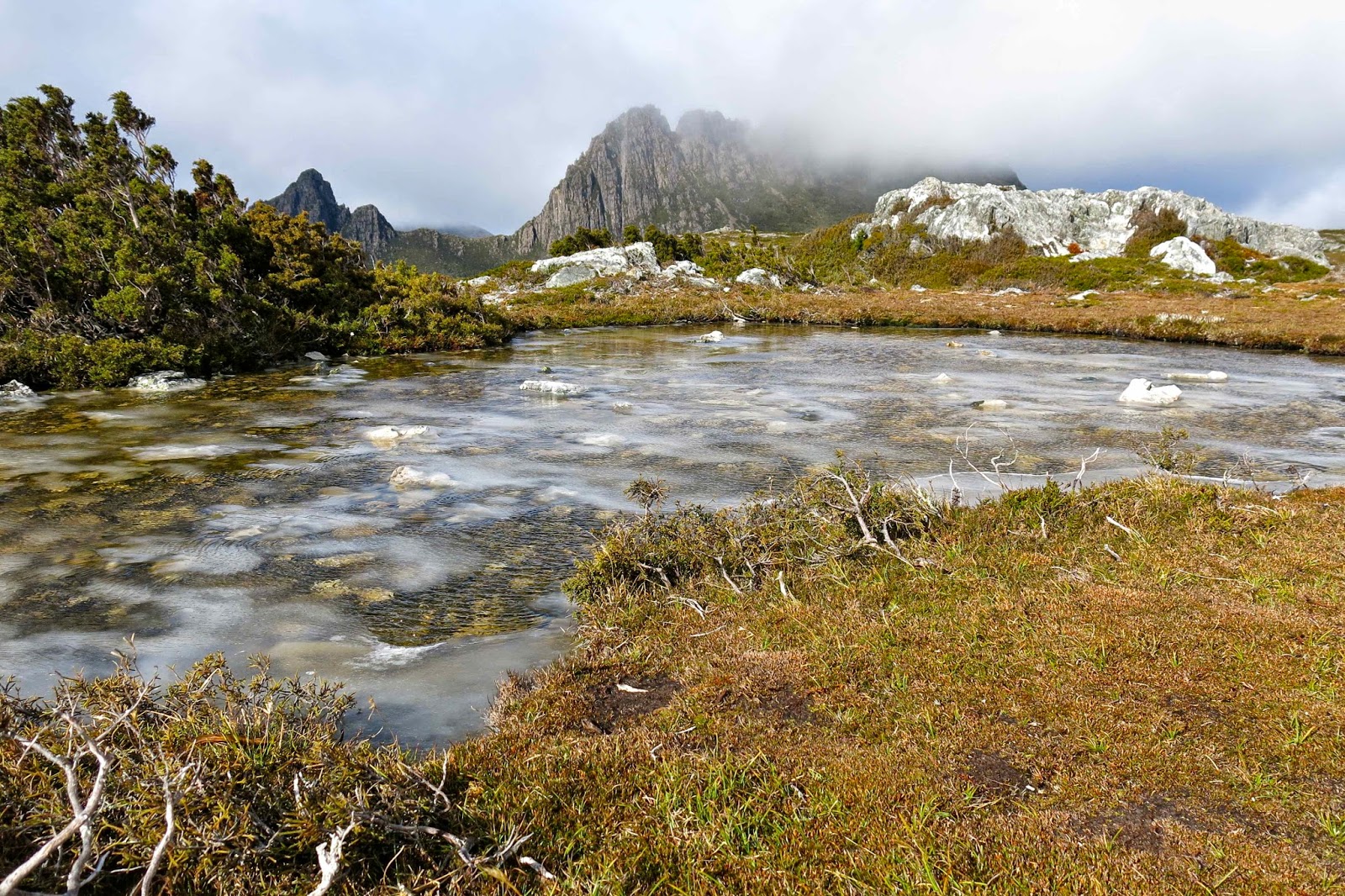
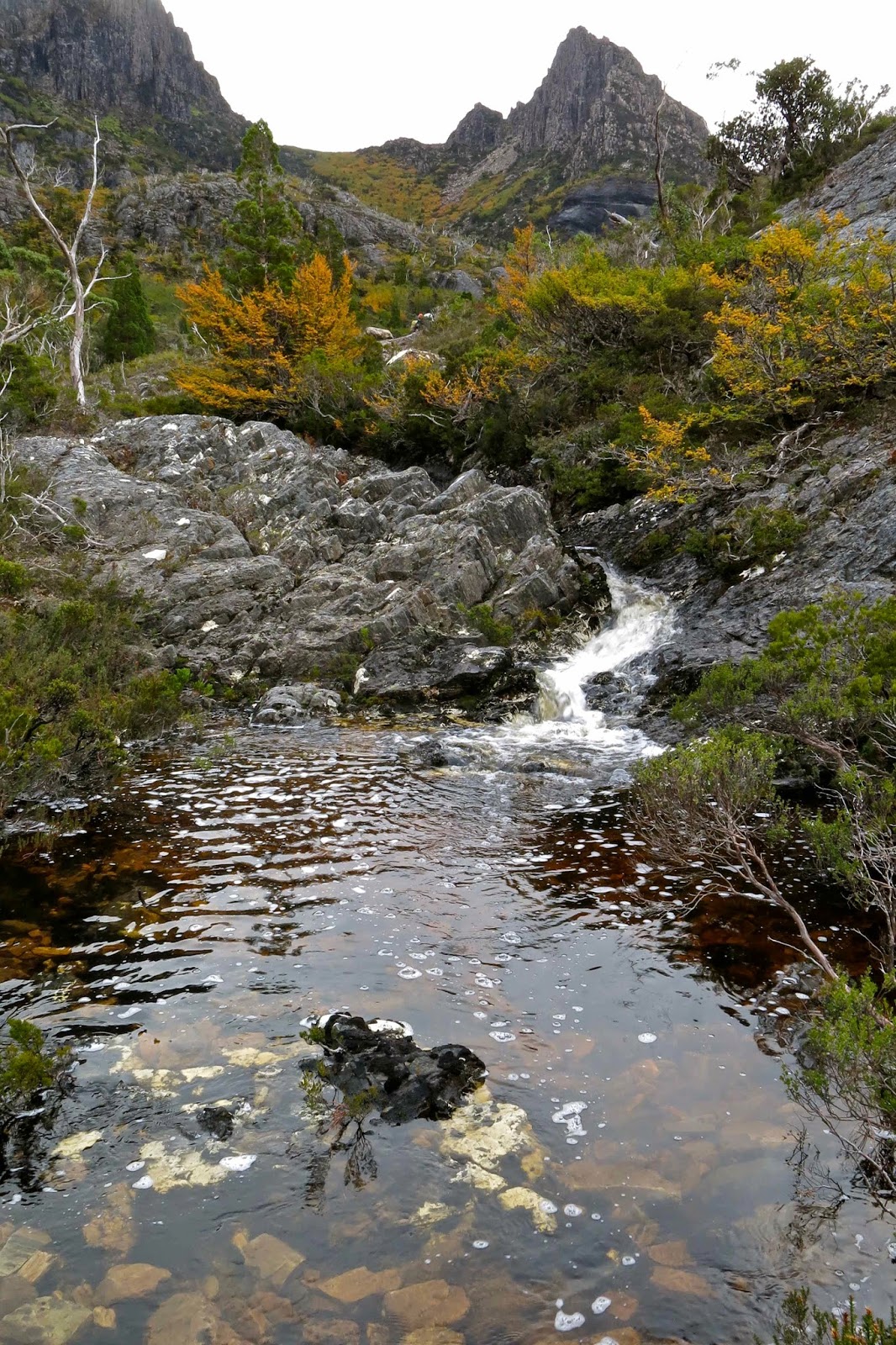
This is where I feel the start of the route to Mt Inglis begins – at the rocky part of Barn Bluff, where you first leave the track up to the Bluff, and start contouring around its belly instead.
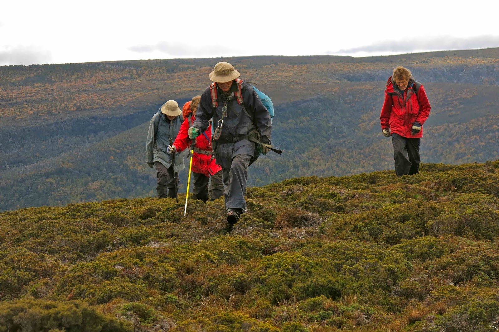
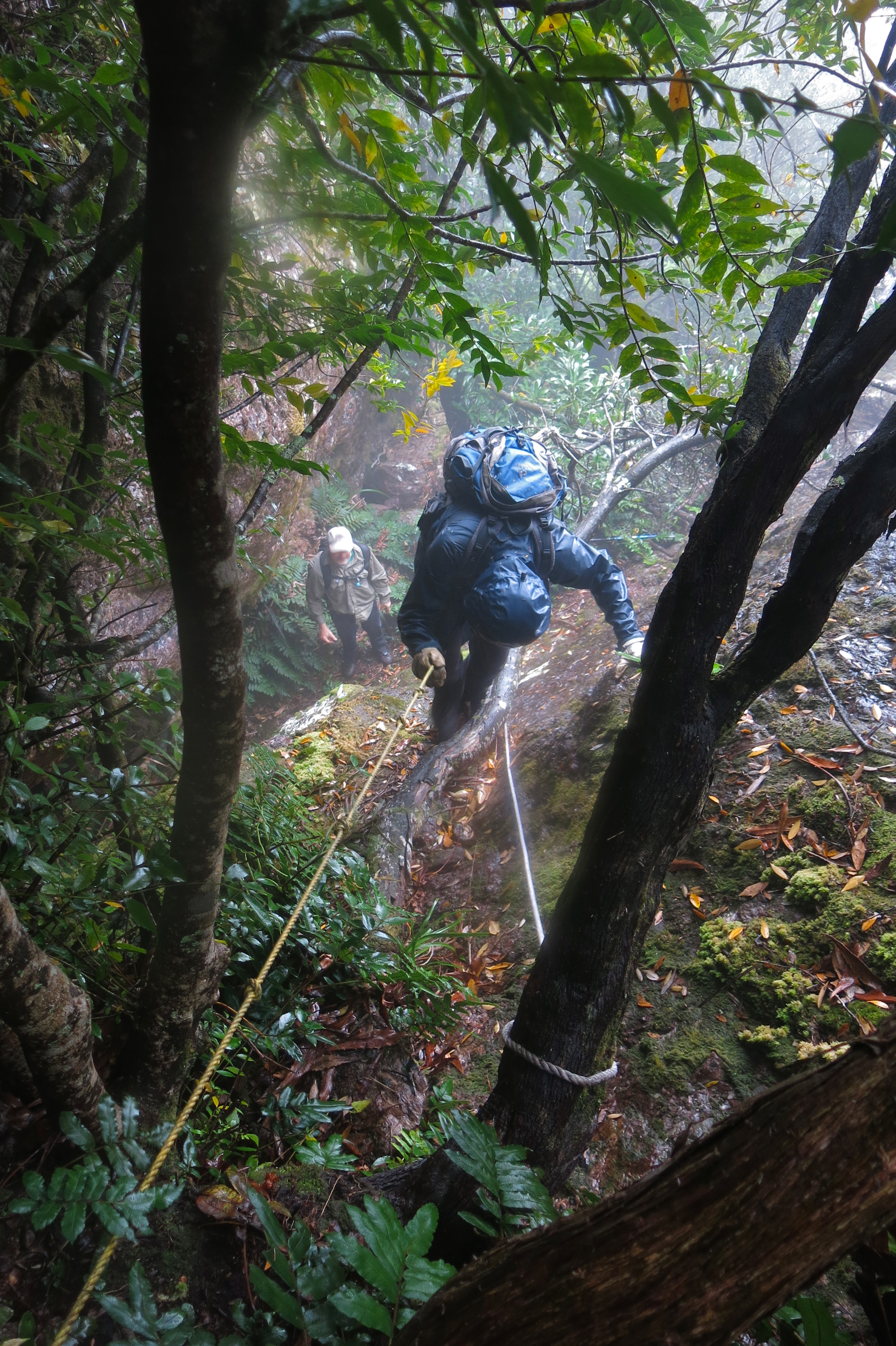
Summit day for Mt Inglis delivered thick mist, but no rain, so off the seven of us set, some with more enthusiasm than others on what promised to be a very demanding day, and one that would be more of an endurance test than a pleasure if it began to rain again. Group momentum prevailed. I think I heard Rupert later report that his gps data indicated that we covered 23 kilometres with 1200 metres total climb – giving us a 35 ‘kilometre equivalent’ day. It was certainly a long one, beginning at 8.10 a.m. and finishing at 5 p.m. (later for some; I rushed the last bit to get out of the icy wind on the Cirque – and because I felt like a stride-out after all that goose-stepping).

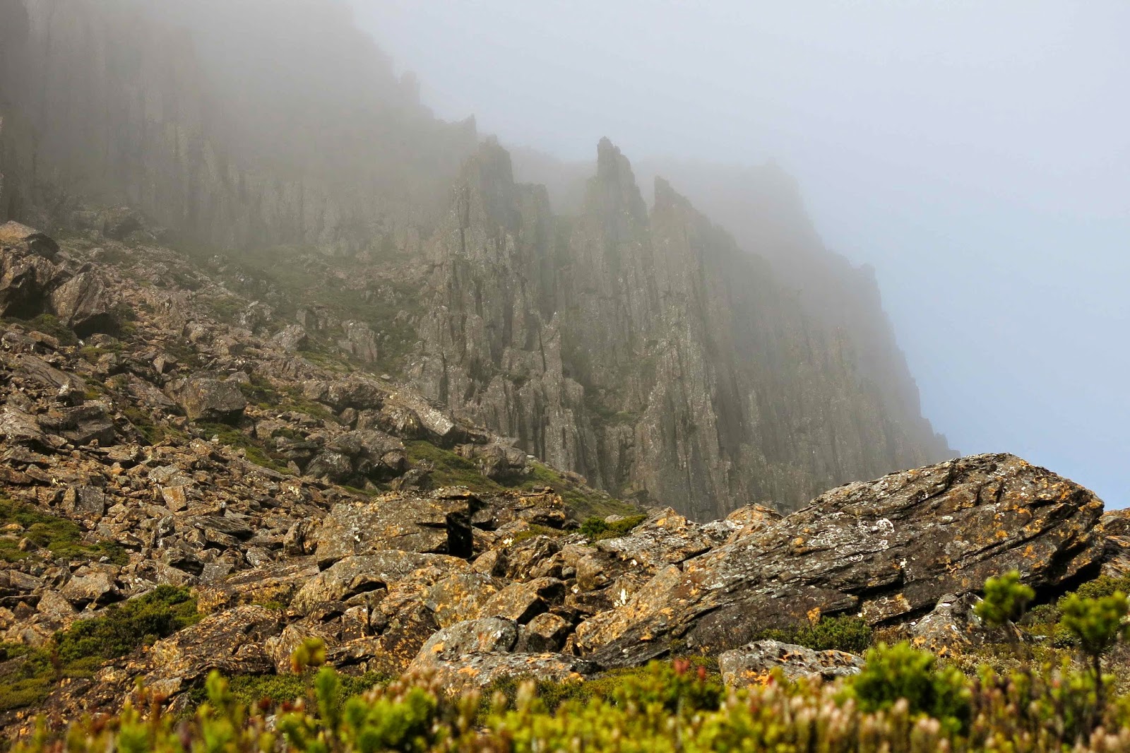
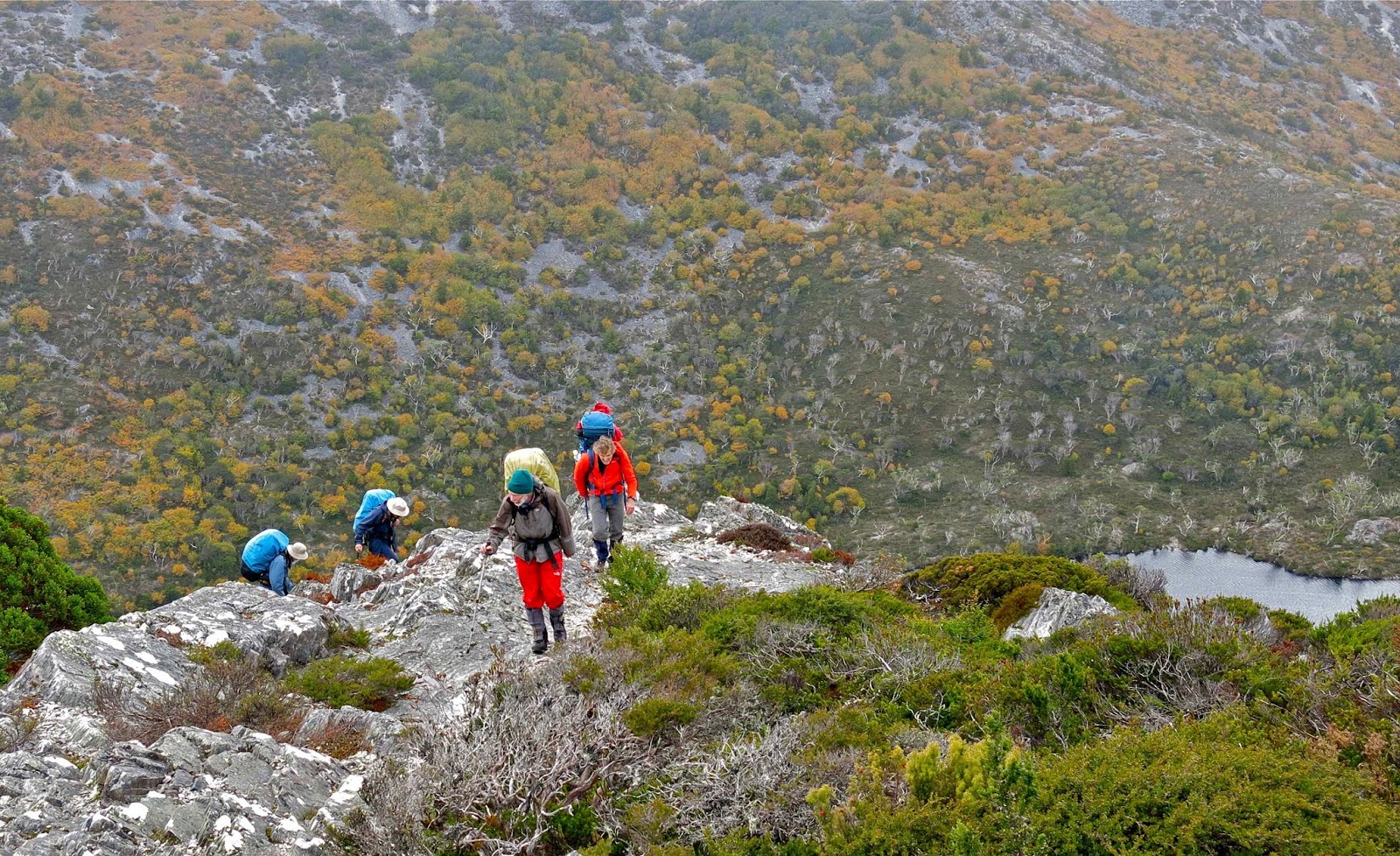
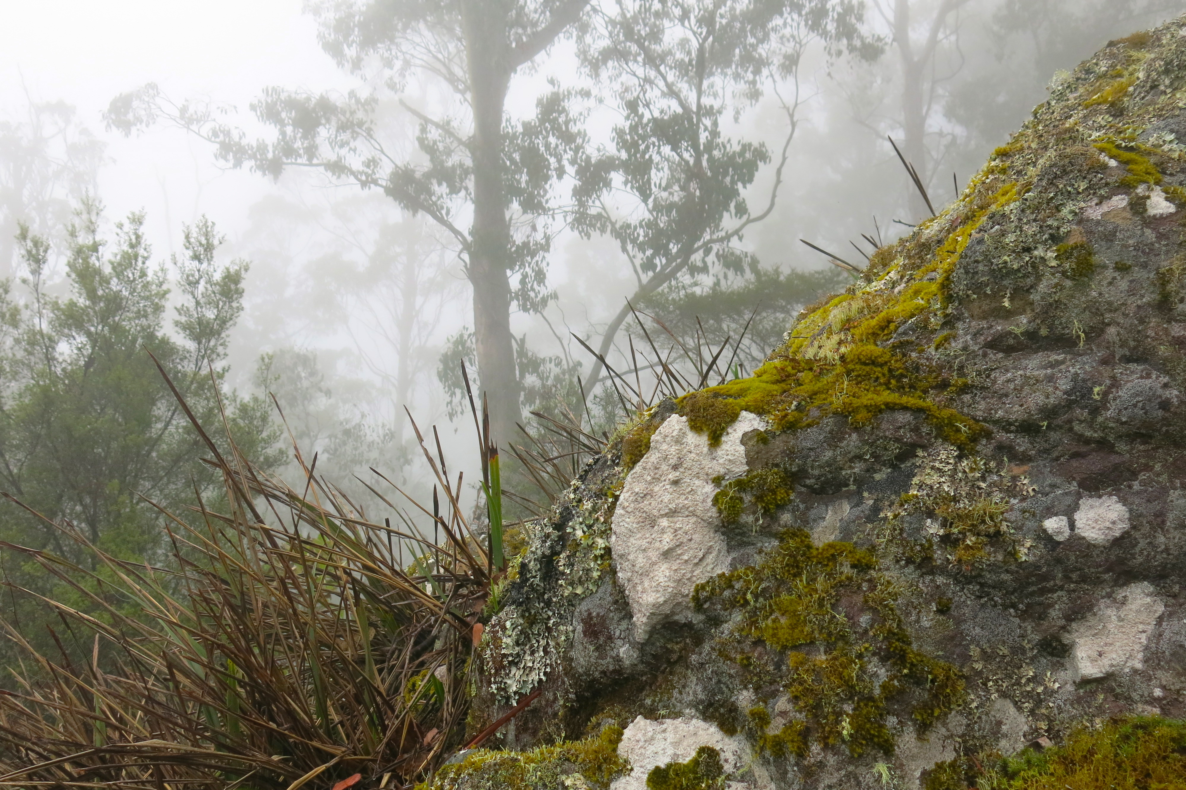
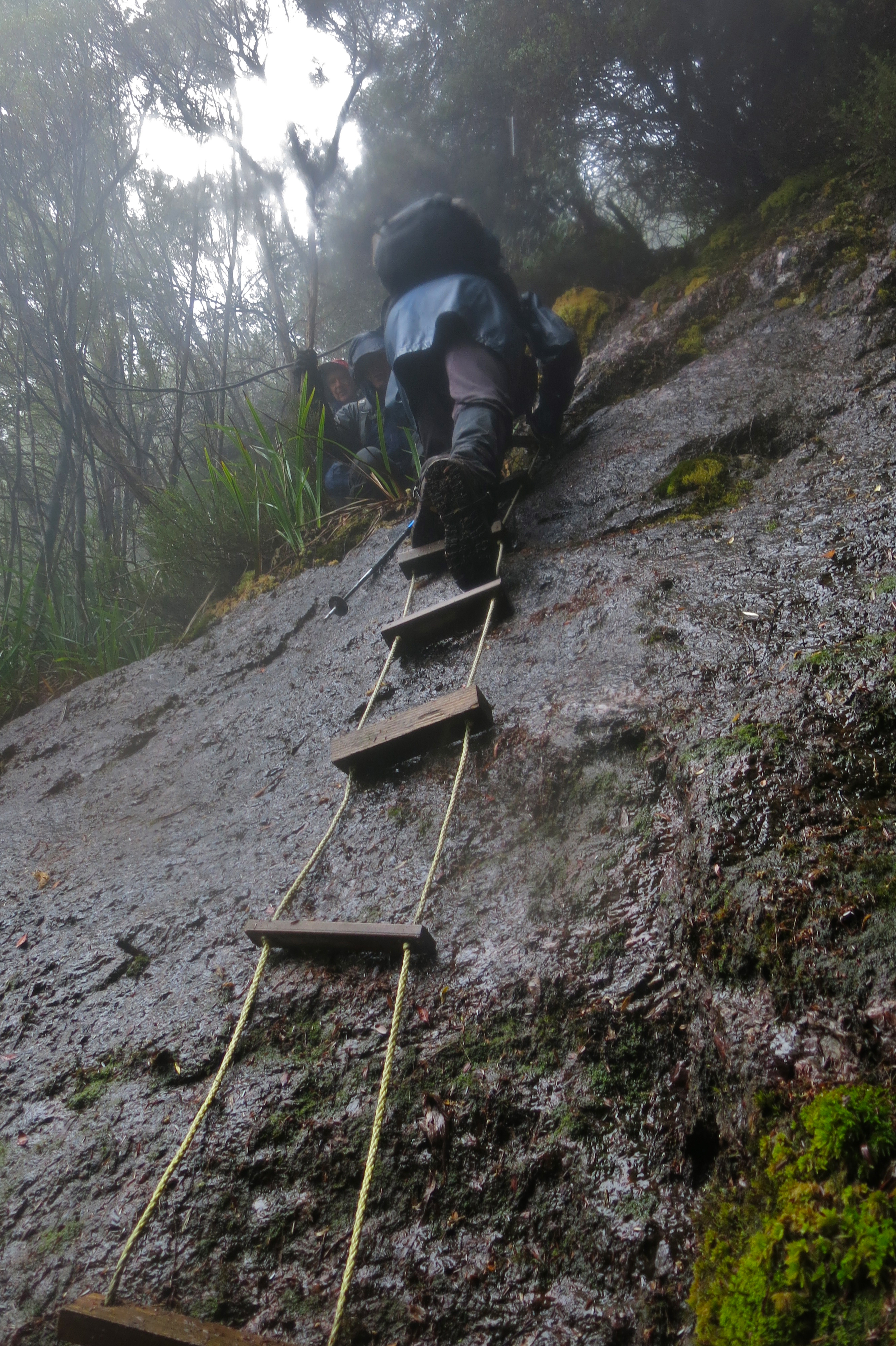
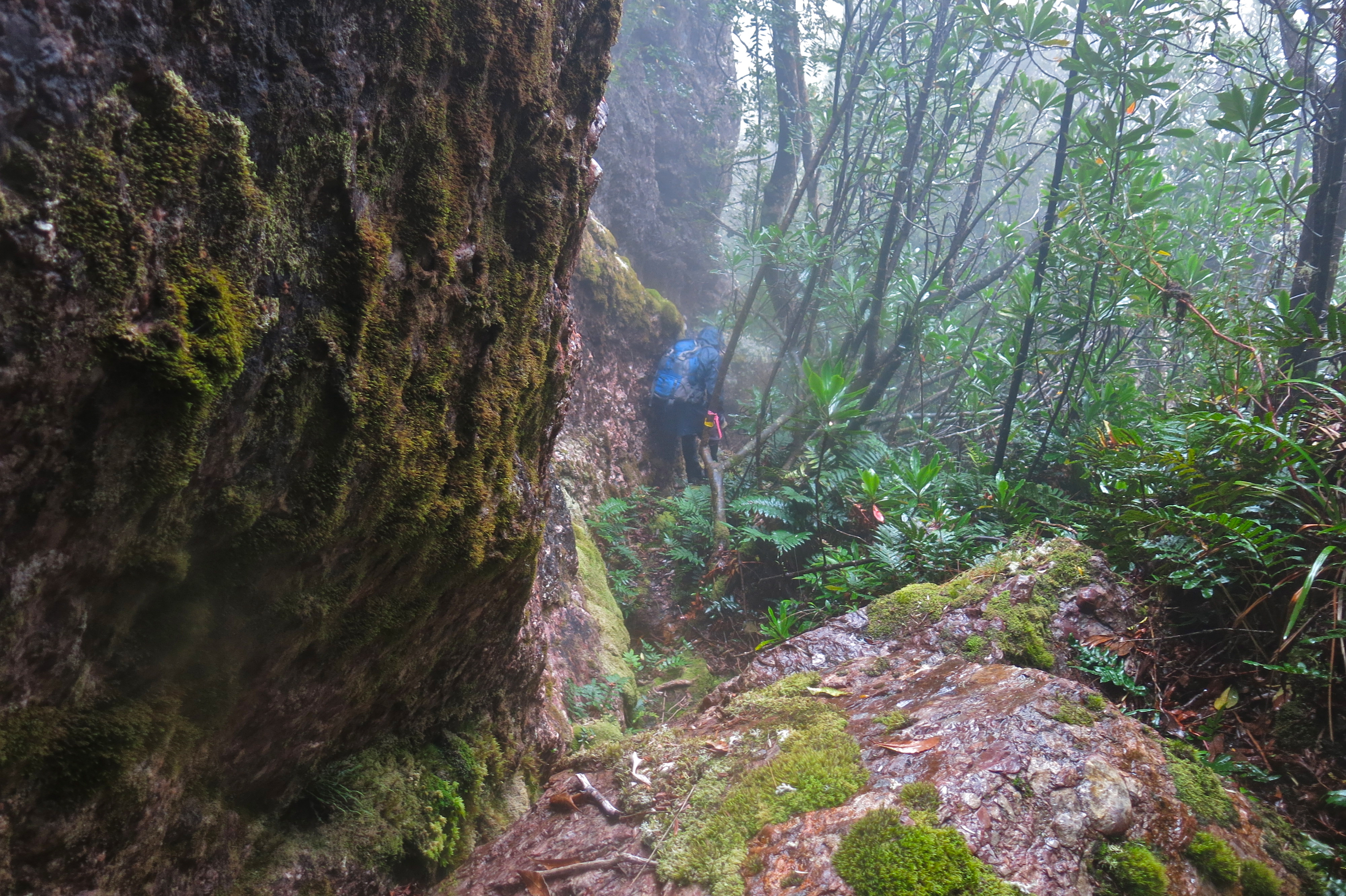
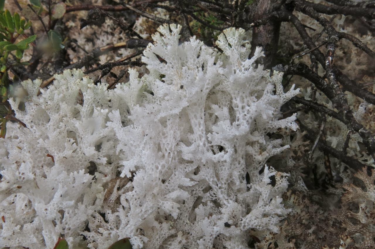
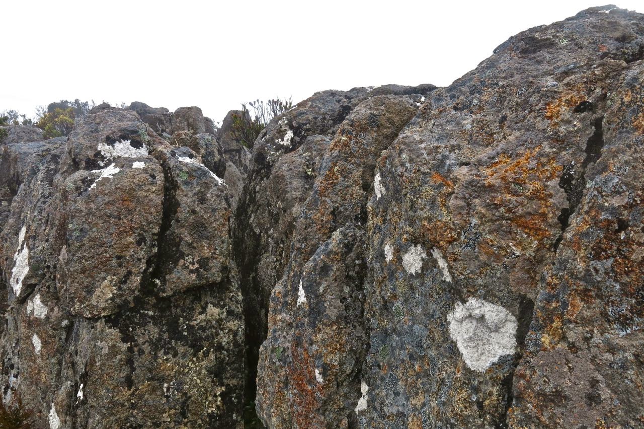
The first (and last on the rebound) part of the route is on the track, firstly up to the Cirque and then part way up Barn Bluff until one hits the rocky face, when it’s time to contour, either on the rocks or a bit lower in the scrub. We began on the rocks, and everyone was following me on my route, so I stayed there until the rocks finished, and a scrubby spur led down to another cirque. The others voted for the scrub on the return journey, however. It actually took a fraction (just a couple of minutes) longer, but they preferred it to the slip factor of rock rubble covered in slime that was growing moist again, and were very happy with their choice. In the mist, we could see little, and I hadn’t had a good look at the map. I was silly enough to think that the next thing we climbed was Inglis. Ha ha. There was still a very long way to go and we were not yet half way there. We had been underway (not counting morning tea and waiting breaks) one and a half hours at this stage.

Pelion West dominates this particular view. Achilles lies to the far right.

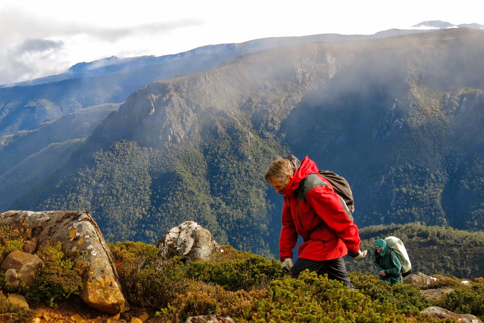
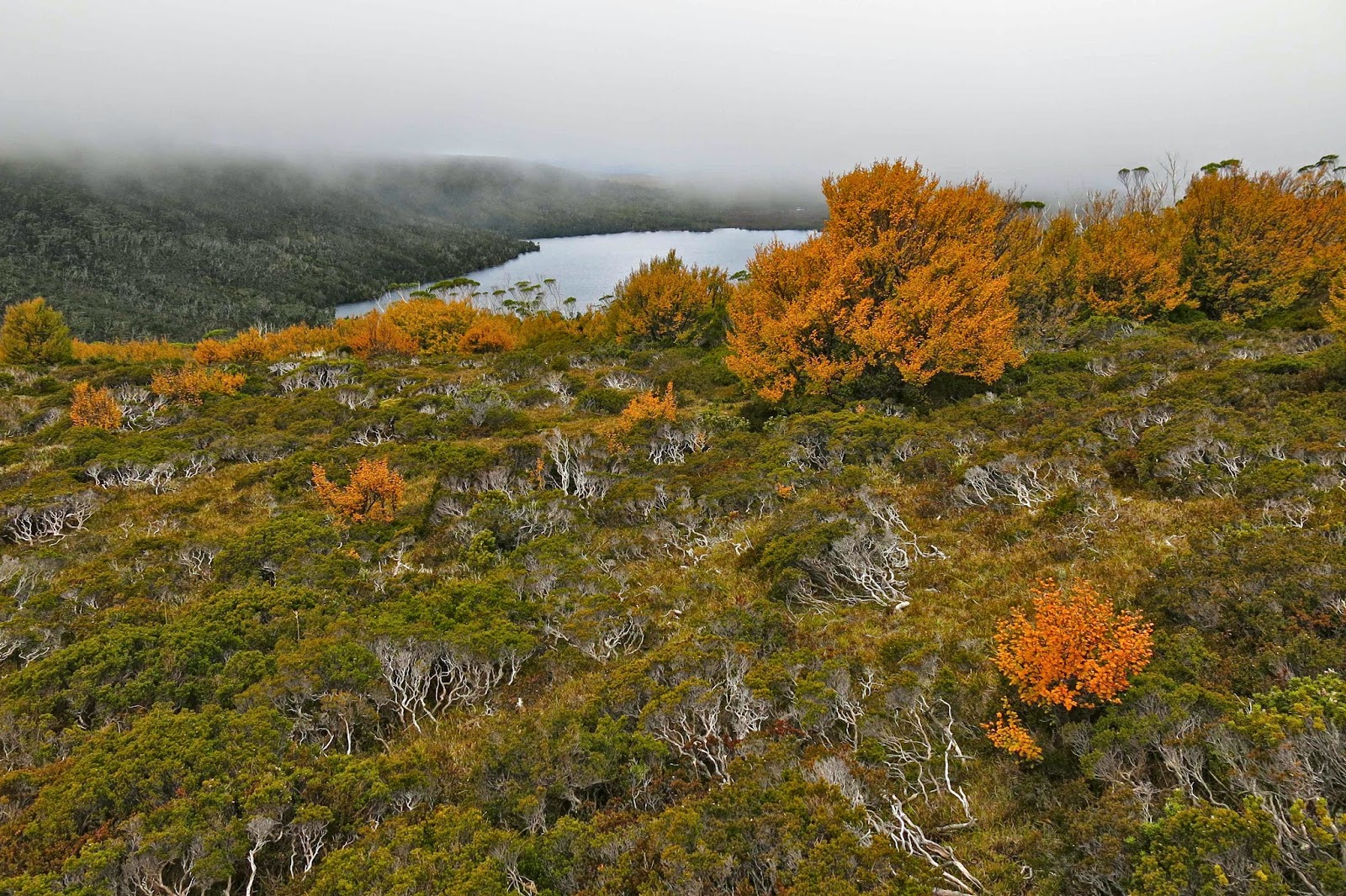
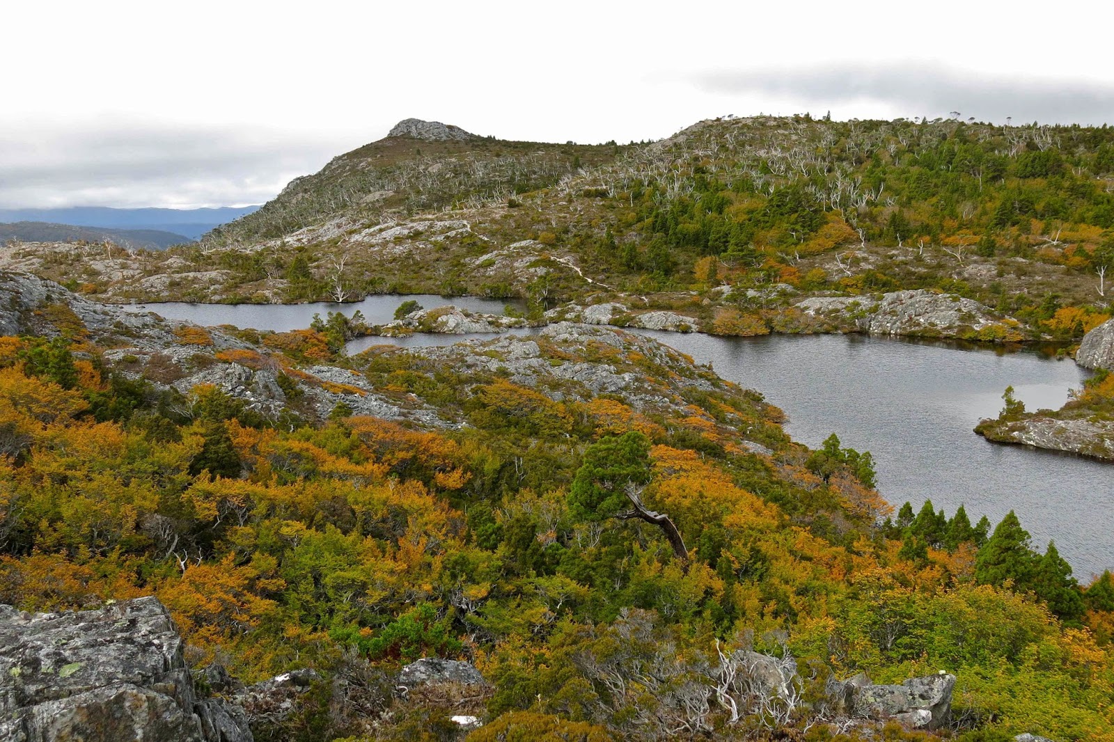
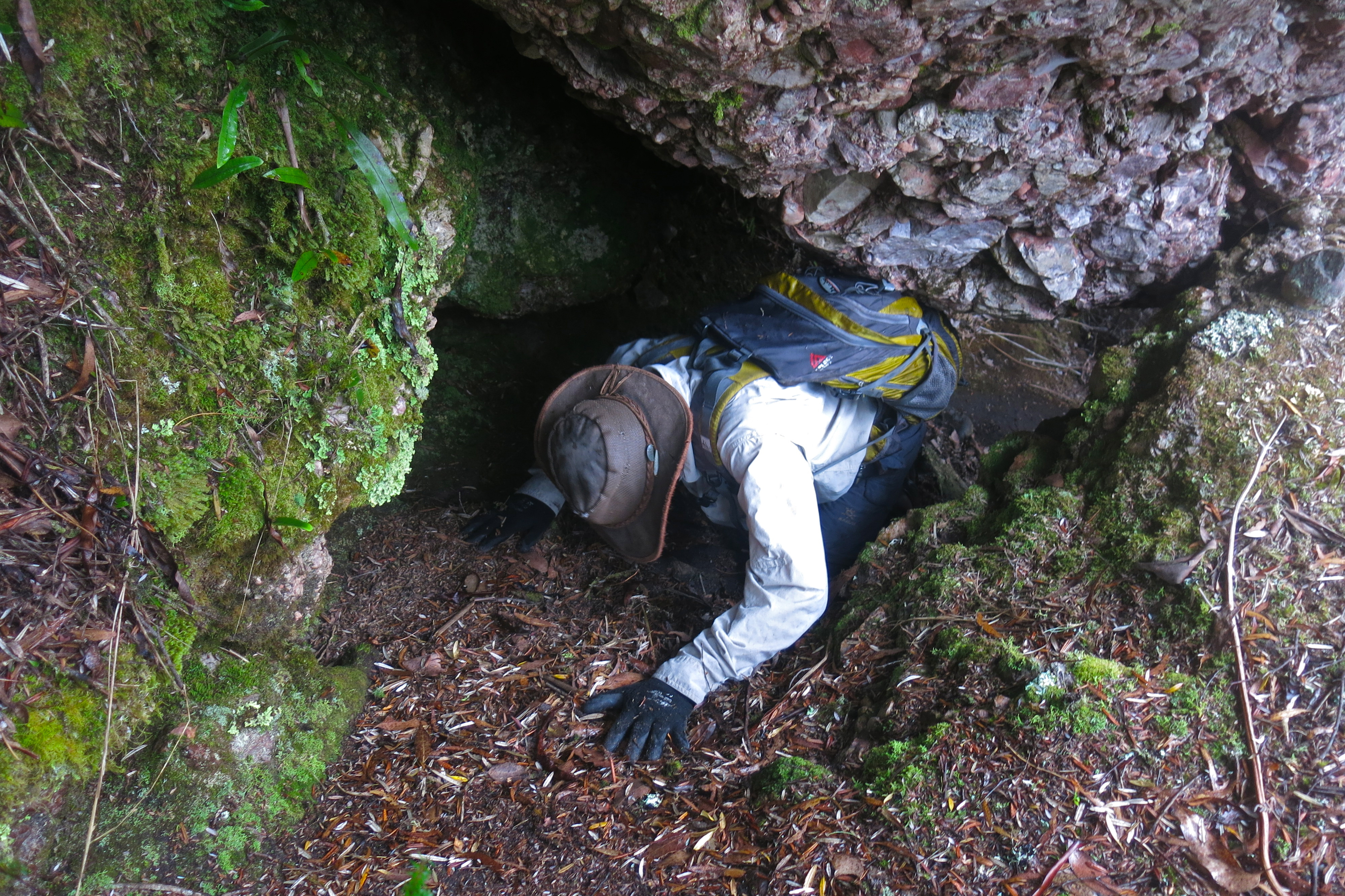
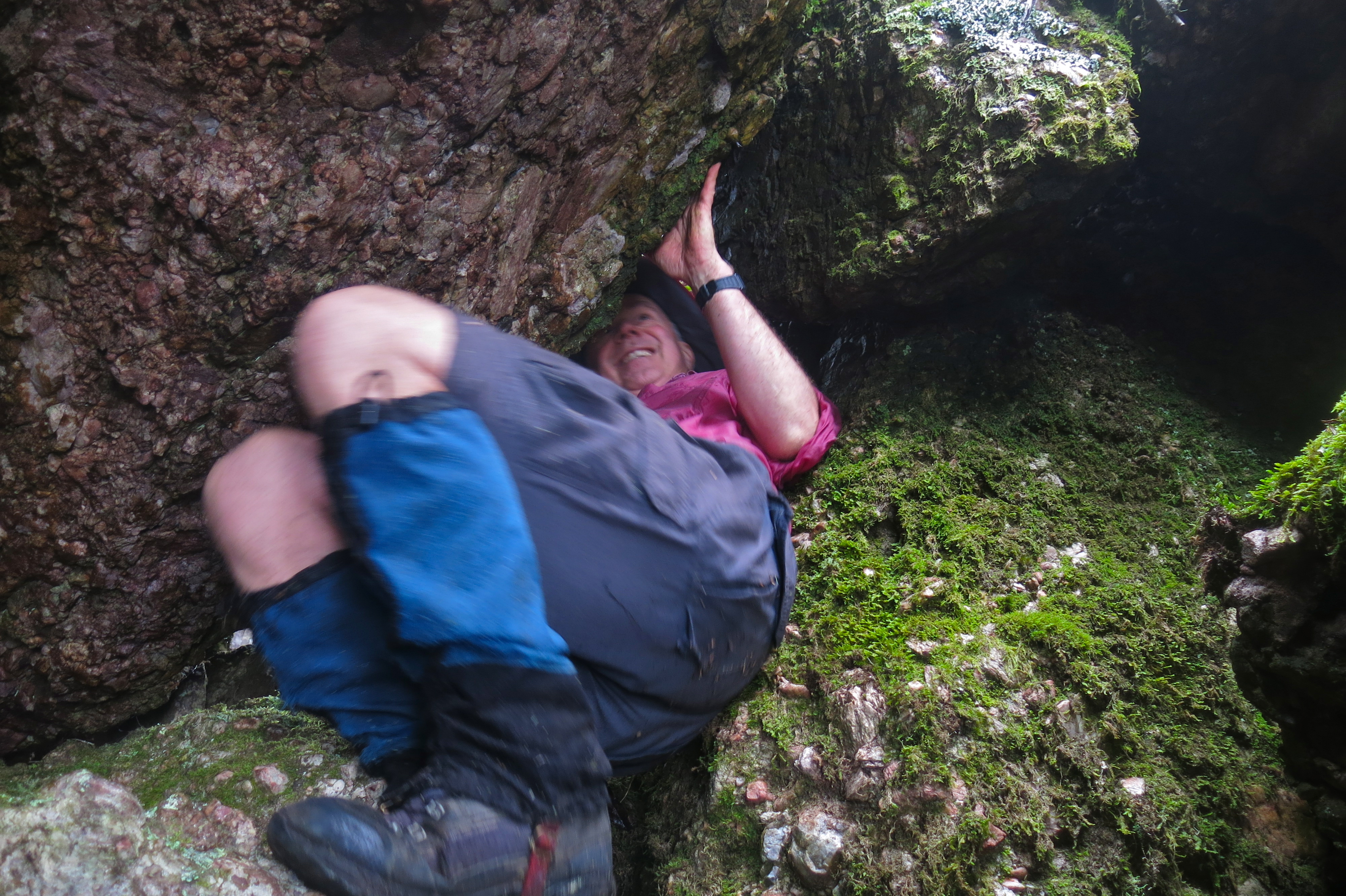
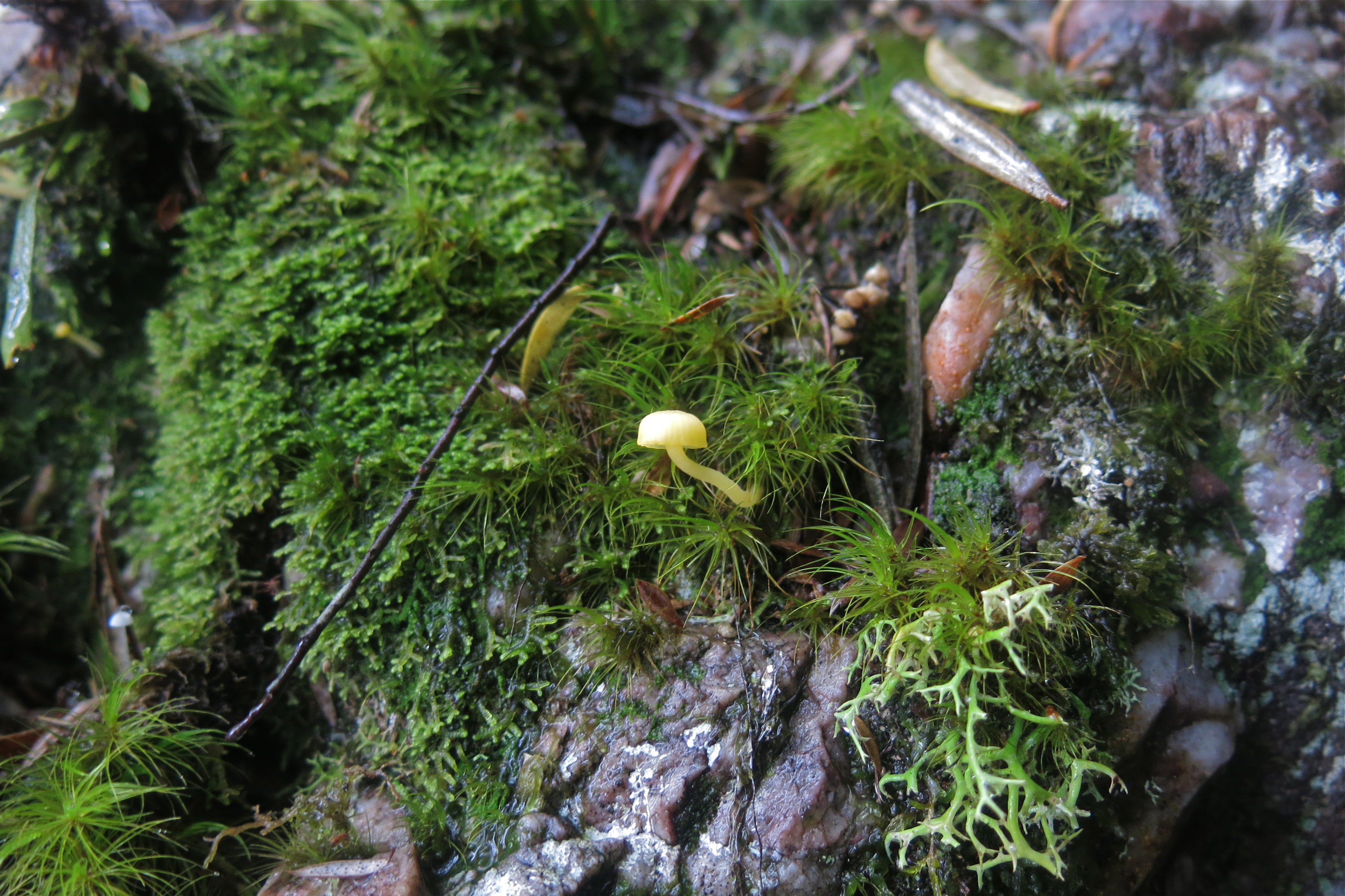
Ahead of us lay not only our hill, but also a large moor area that looked fine from above, albeit rather expansive in its proportions, but which was a bit tiring in reality, as it required high lifting of the legs. The others were moving well, and when I stopped to fill my husband’s drinking bottle for him and then carry two packs, it took me at least ten minutes to catch them. I was sweating when I at last joined onto the tail end, just as we all began to negotiate the next patch of over-headhigh scrub that offered stirling resistance to our best efforts. Relief came when we happened on a beautiful patch of myrtle forest that was not only delightfully green but also open enough to allow easy passage.

Fury Gorge and the backside of Barn Bluff and Cradle as seen from the summit.

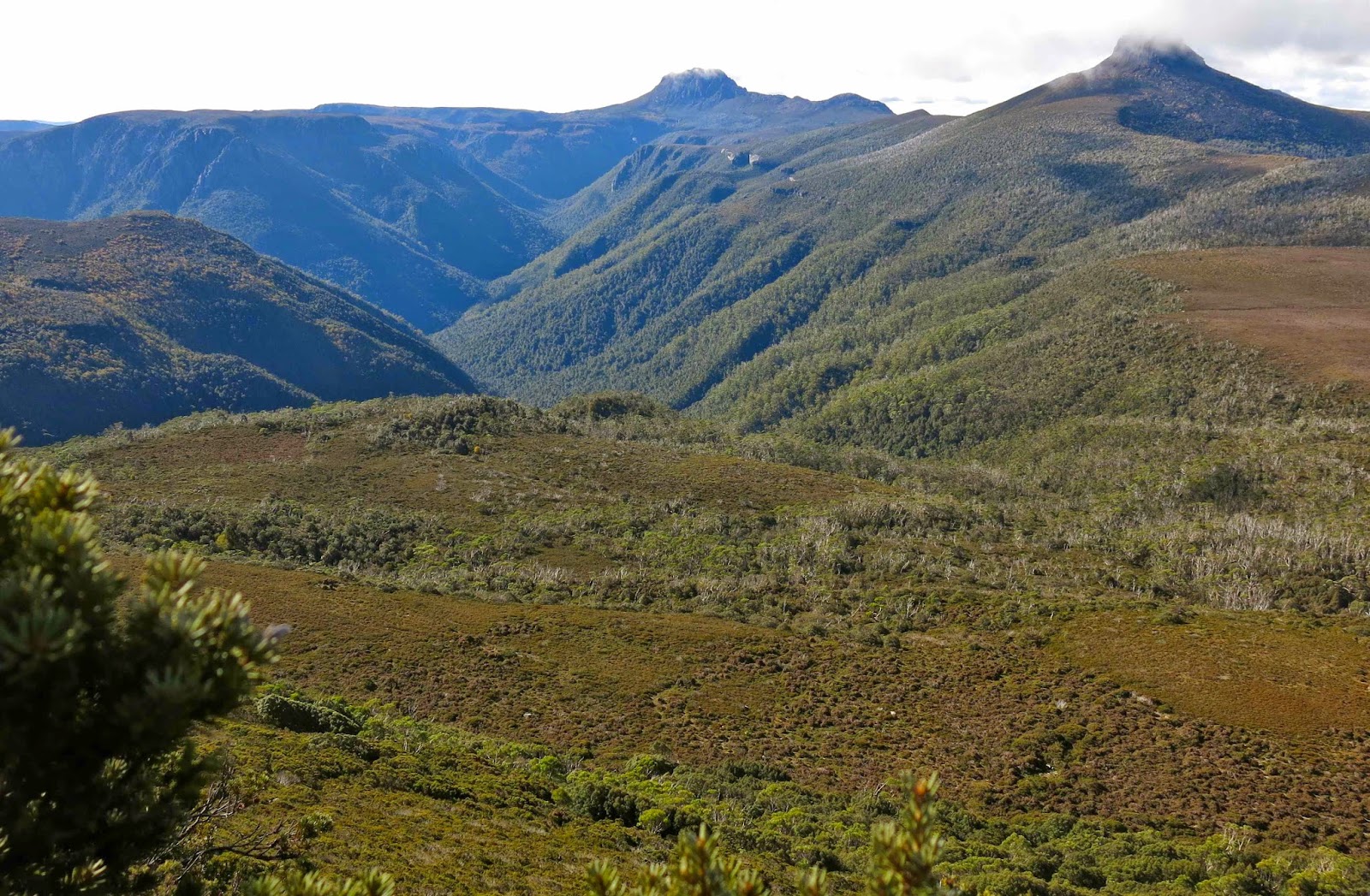
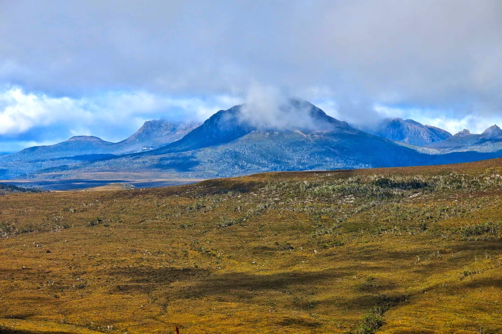
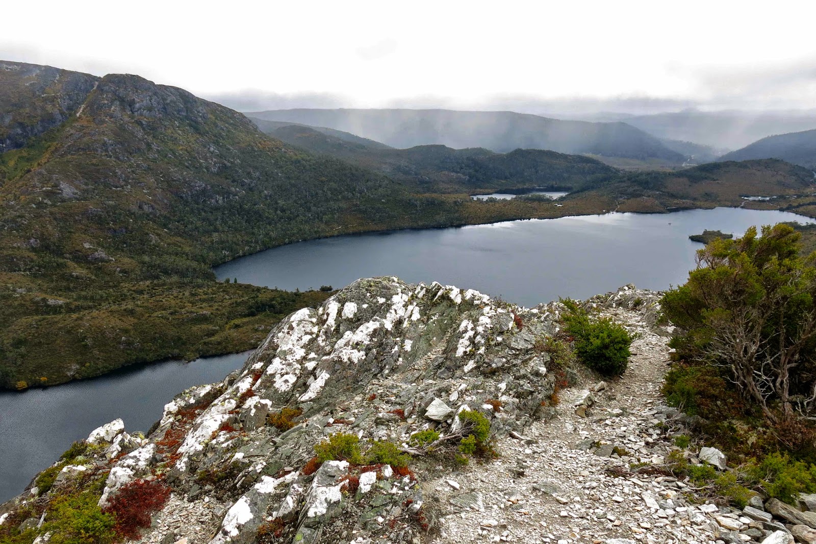
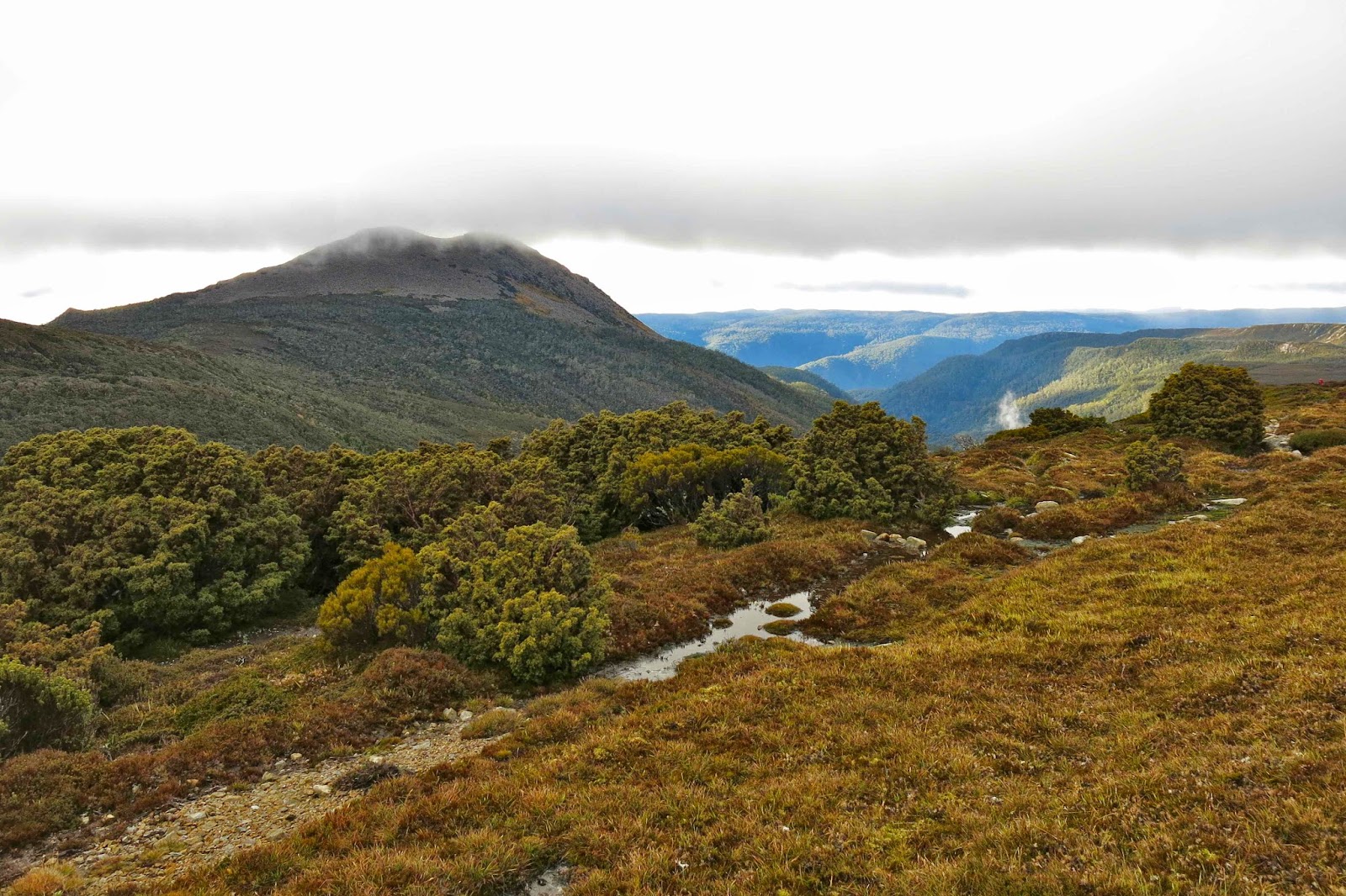
Up until this point in time, Mt Inglis had kept running away from us, and remained a matter of faith based on a belief in map accuracy. At last as we emerged from the myrtles onto an open table top, we could see the summit, although we were now too close to see the overall shape of our beasty. I never did see it as a whole mountain.

The group strides out; no loitering on this day!

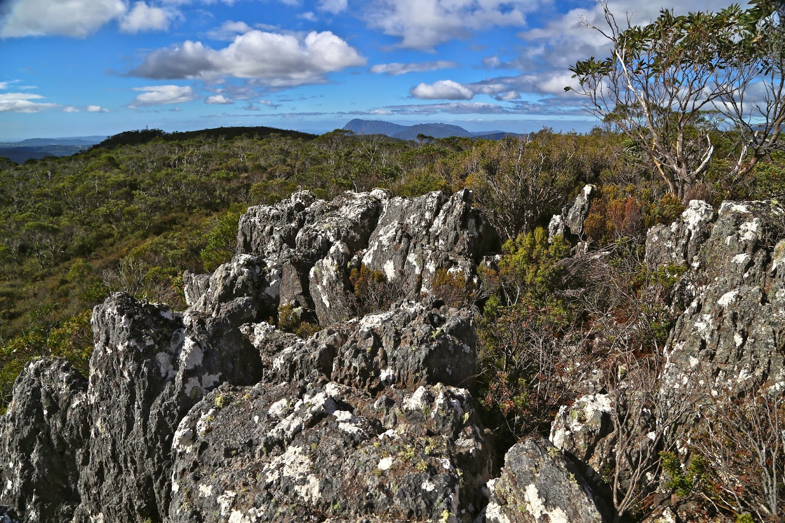
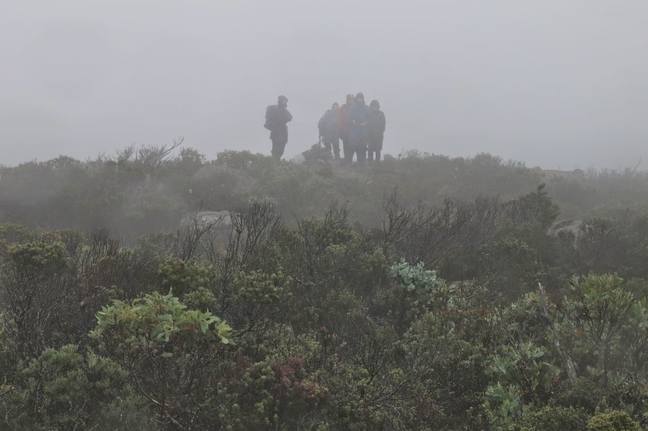
Our turn-around time was now a mere 45 minutes away. Not seeing the height of the scrub that lay ahead and thinking the green was nice ankle-high alpine vegetation, I guessed at 20 minutes to the top from there. Another fast walker reckoned 30. Either way, we could do it if we hurried. Off we set as quickly as we could so as not to be timed out of our mountain. Neither of us was quite correct in our guesswork, but four of us were on the top in 24 minutes, and everyone was at the top before we all turned into pumpkins. We even got time to sit up there and photograph, survey the view and appreciate the sense that we had the whole world laid out before us while we took a rather hurried lunch break. The mist even obligingly cleared. It was truly beautiful up there, and, due to the vast stretches of low moorland separating us from the other mountains of our purview, it seemed as if we could see forever.

Looking down on Lake Will from the Fury Cirque on the rebound.

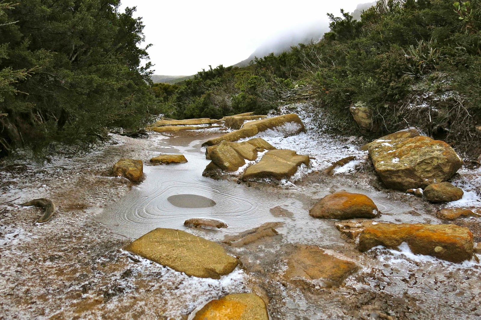
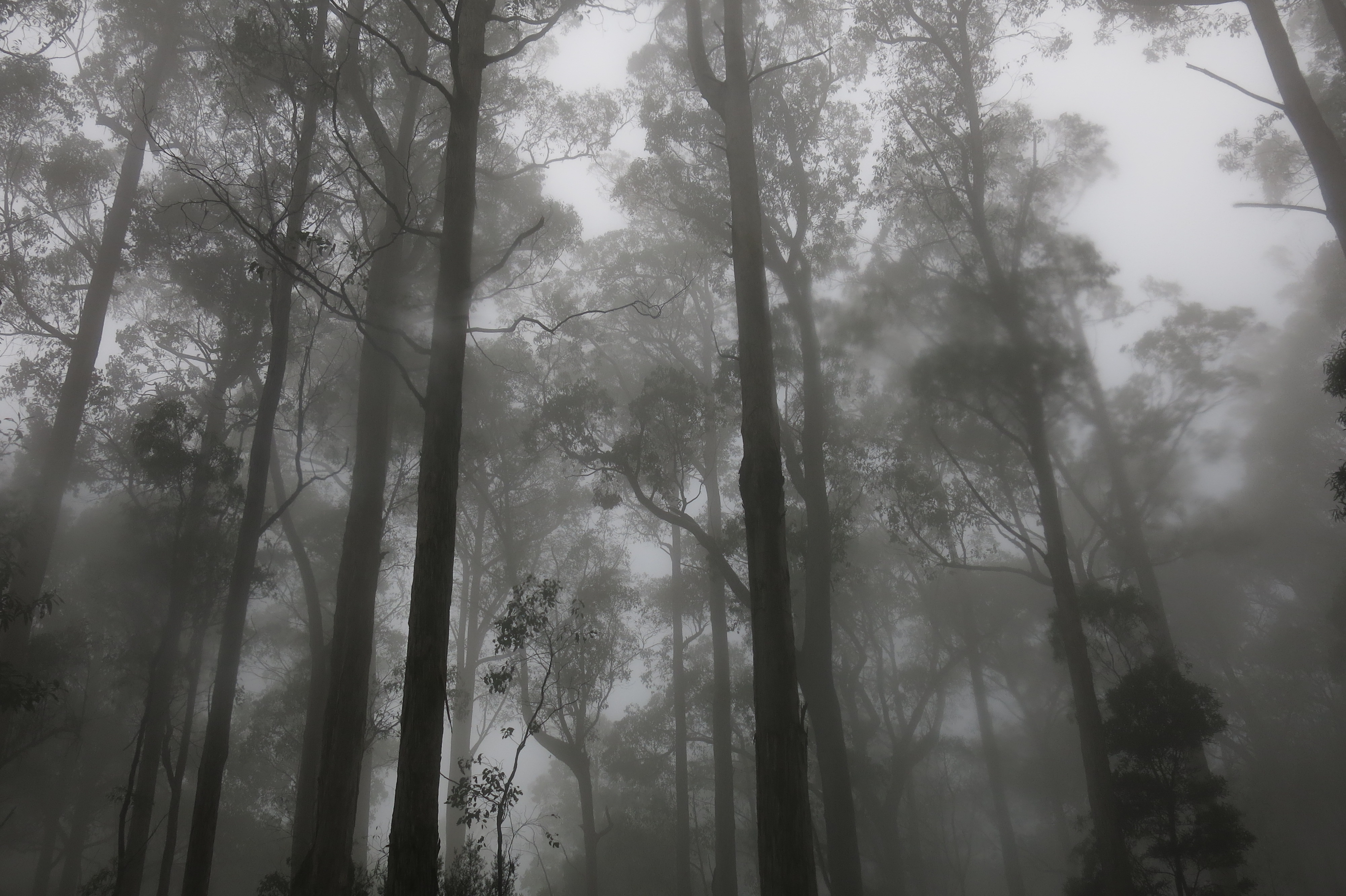
Again on the descent, everyone worked hard and well, and we made the rocky section below Barn Bluff in good time considering the terrain. It was getting dark quickly, so it seemed much later than it was, but the darkness rising was in fact due to the louring mist rather than the lateness of the day. Despite the freezing conditions, I think all of us were sweating from the toil. The wind was really beginning to rip up a frenzy and the temperature was dropping, but we also knew we were on target to be back before night fell. The wind was so strong as we hit the final tracked section that I started to get a headache, so dashed ahead to get myself out of it (with permission). As I cleaned my teeth by the tank after dinner, light sleet was falling: white drifting sago against the blackness of the night.

Icy path on the final day.
The underside of Hygrocybe schistophila

Next morning, the first words I heard were: “Be careful going to the toilet that you don’t slip on the snow.” That got me out of my warm sleeping bag; I wanted to see the sight of Waterfall Valley with a light dusting of icing sugar. Beautiful.

Ice floats on Kathleen’s Pool
I was lucky enough to go up the track first and thus got to follow the pristine line of white ice and snow crystals as I walked and photographed. I was amazed at how many animals make use of the Overland Track boardwalk! The only indentations offsetting the neat white grains were the quaint paw prints of quolls, wombats and wallabies. Fungi and fagus provided colour. What a great trip.

Emmett 2014 May

Mt Emmett

We had not set out intending to climb Mt Emmett on this trip: instead, Mts Inglis and Proteus were on our agenda. However, the dismal weather forecast had us altering our plans. The worst day was to be our second one, so it was decided that we’d only go as far as Scott-Kilvert hut, behind Cradle Mountain, on the first day (instead of to the tarn on the moorland past the belly of Barn Bluff), and see just how much rain was going to fall thereafter before we finalised Plan B.

Approaching Hanson’s Peak, day 1

Day two was as bad as predicted, so the new plan was to climb Mt Emmett on this day, and then move to a better location for attacking Inglis the next one. 

 
En route, day 1

To the average person, Mt Emmett is not a name that means a lot. If you get out the appropriate map, you’ll find it sitting beside Cradle Mountain, minding its own business, looking nice and harmless as a bunch of smooth brown elliptical lines. When seen from the Cirque between Cradle and Waterfall Valley hut, it looks like a nicely rounded and gentle scree slope, much like many of the English Fells that you can dash up at a run. Before I knew better, I had once planned on sleeping on the top. 

A beautiful autumn bonsai Fagus plant on Hanson’s Peak

 Cradle from Hanson’s Peak
Unfortunately, the reality of this cozening deluder is that this is a mountain of angular boulder rubble, which could have been part of some story of angry gods throwing fridge-sized stone missiles at enemies and then cursing them so that they became covered in slimy black moss to destroy any approach efforts of hapless humans.

Twisted Lakes in autumn glory

We had already had one failed attempt on this mountain, admittedly due to snow (see my other Emmett entry: http://www.natureloverswalks.com/mt-emmett/ ) and I had not entertained the notion of taking my husband with Parkinson’s disease back there. My plan was to do it in summer on a nice dry day (without him), probably solo as this is not a popular mountain that anyone I know volunteers to do twice. However, the group was doing it in the rain, and my husband said he could do it too. Should a wife tell her husband he’s mistaken and make him stay behind for his own safety and the good of the group? (He laughed and said “Yes” when I read him that sentence.) “Not this time; not yet,” was the equivocating conclusion I came to after long reflection during the night as I listened to the insistent rain.


The moist mist swirled around as we left the hut the next day. We had elected to camp the previous night rather than stay in the hut, so were lugging a wet tent up the slope, but we love our tent, so that’s OK. I stayed at the back of the train, observing my husband’s progress, trying to read from his movement whether I should exercise some power of veto here. I was genuinely worried about this mountain – but again I let him have the call, not wanting to cramp his style with my own anxieties for his safety. 

Laccaria sp near our tent

Even highly competent and experienced walkers find Emmett with a water film over the slime to be a challenge (see rockmonkey’s blog) but we nonetheless set out over the slippery rocks that presented a line rather than a flat plane as their uppermost surface. I hoped that if Bruce ran into trouble, it would be in the first hundred metres to enable an easy exit. He seemed to be coping as well as some of the others in the group, and as he often goes much better if I’m not there as a backstop, I went on ahead, having fun crabbing my way on all fours across the slippery obstacle course, whilst checking behind at regular intervals to make sure he was coming, though the thick mist meant that, at best, I could see people who could see people who could report that he was progressing steadily.

Deceptive Mt Emmett from the Cradle Cirque next day

There were no commanding views to be had in the fog that day, but the best view for me was that of my husband approaching the summit of what I thought was his most challenging mountain yet. Bravo B. It snowed lightly (sleet really) before we began our descent. The weather was so bad I had not even bothered to bring my camera to the top; I have plenty enough photos of people in a grey, obnubilating veil labelled as this or that peak. 

Ramaria ochraceosalmonicolor beside the track

The trip down was as careful as the ascent had been and we all got there uninjured, picked up the heavy packs that we’d deposited in the Cradle-Emmett saddle, and made our way further on to Waterfall Valley hut where we could attempt to dry out our sodden gear before the next day’s demanding adventure (see natureloverswalks.com/mt-inglis/).

Minnow Falls 2014 April

Minnow Falls April 2014.


Some time ago, I used to watch a TV show with my daughters called It’s a Knockout, in which the contestants had to race up rope ladders, negotiate tricky objects, and slither through tunnels. I always wanted to have a go, thinking it looked like great fun.
This week at Minnow Falls, I got to do a similar obstacle course, only in the lush green of natural rainforest rather than the sterile environment of a TV studio. And it was, as I knew it would be, enormous fun.


Rod emerging from a small cave


Phil squeezing himself up through a hole in the rocks. This was not a trail for the overweight.
The location of this natural amusement-park – Minnow Falls – is beyond Mole Creek (see end for more detail). There was formerly a track up to the falls and back, but thanks to Bill Shepherd, this has been extended to become a complete circuit, in which, after an initial climb on an old road cum track, one heads into the bush following Bill’s (mostly) pink markers, ever climbing.


David descends one of the rope ladders
The TASTrack comments about the old route seem appropriate at this stage: “This steep, rough-cut track climbs the eastern side of Mt Roland, [gaining] 545 ms in 3.5 kms.” In fact, our route climbed even more: 600ms according to my gps.


Descending a roped section
At times our noses nearly touched the slope we were ascending. It was a great all-body work out, as arms and hands pulled on trees to haul ourselves upwards, or as we oomphed our way up rock ledges, pulling on tiny handholds to gain the next bit of height. Occasionally we found metal ladders, or rope for hauling on to avoid sliding backwards when there were no footholds possible. Sometimes we had to squeeze through narrow holes between huge boulders, or proceed along caves and rock tunnels.


On the way back down, there were a couple of rope ladders hanging from trees to keep us alive as we descended slimy rock slabs. I had a ball. In order to hoist ourselves upwards or to stay high between two walls of rock, we had to push our packs up first so we could wedge our backs against the rocks for pressure.


Minnow Falls. This was the best view I could get. Perhaps I need to come back to see the real thing under better conditions.
Not only was the physical side of the adventure engaging, but the forest itself was magnificent. Recent rains had been lapped up by the mossy banks and ledges so that rocks and trees were coated in a lush covering of bright green. The mountain laurels shone as in moonlight. Fungi were also responding to the recent rains and cooler weather, and I saw many varieties, both large and delicate (Russula persanguinea, several camarophyllopsis yellow and more). Invertebrate life was also out and about, with the advantage that I saw many “land planarians” (bright yellow members of the flatworm class [Turbellaria]). The negative aspect of this response to moisture was that the leeches were also present, and hungry after a long, dry summer.


Leucoagaricus or Lepiota sp. (Thanks Dr Genevieve Gates).


Camarophyllopsis yellow


Atmospheric forest at the end

 If you look at the gps route above, it looks as if I never made it back to the car, as you will see a small gap in the blue track bottom right. I left it like that intentionally so that you could see exactly where we parked. A continuous circle would have confused that issue. (We did the route clockwise). I would not drive to where we parked without a 4WD (just abandon car earlier and walk a bit more). I would also, of course, not undertake a pad like this without being a confident navigator, as pink ribbons can dump you in the middle of nowhere if you don’t know exactly what you’re doing.


So. How do you get to the start? If coming from Launceston, go through Mole Creek and head up towards Paradise. If coming from the north, turn off the Claude Rd (C138) onto the Paradise Rd (C137). Follow until its intersection with  a road that heads east (L) to Lower Beulah. You go south continuing on the C137. Turn right after a short distance towards Paradise Plantation. After a river, turn first lefthand drive very steeply up Rising Road. This is the one that I would not go the whole way up if driving myself. At the top, the forest track and tapes begin. Good luck.

Stormont 2014 Apr

Mt Stormont, Apr 2014

Climbing after the rainforest has ended

Like so many mountains I end up climbing, I had never heard of this one until I saw it on the peak baggers’ guide. A friend told me that a group she belongs to was going to climb it, and that it normally had access difficulties, being situated on private land. This seemed like an excellent opportunity to have someone else make phone calls and arrangements on my behalf, so we signed up. The land owner was most obliging and welcoming, and we were soon parking the cars in squelching mud up to the top of my boots, and then ‘swimming’ through the red ooze to the forest which was fortunately only across the road and down a bit. 

View from ‘fake summit 2
The forest that begins the walk is the wonderful, lush rainforest that I love so much, and I shouldn’t be surprised by the fact that I saw at least eight different fungi genera in the first two minutes. I longed to photograph the delicate colourful forms, but didn’t want to hold people up, so said hurried greetings in passing and strode on. Mt Stormont is 1007 ms high, and my gps says we begin at 450 ms asl, so I guess we climbed a bit, but I can’t say I noticed, as I was mostly intent on trying to spot more fungi. The forest dried out as we climbed, but then we approached the best part of the ascent – a “dragon’s spine” section, which was more knife-edged than the famous Striding Edge of England. I was proud of my Parkinson’s-affected husband negotiating it with aplomb. It was fun. 

From summit 2 (Mt Roland in the background)

Unfortunately, I dropped my lens hood whilst photographing, and watched it roll about 20 metres down the almost vertical cliff-face to an invisible place below. That seems most unfortunate given the expense of such items, but in fact the story ends happily in that two of us came back after lunch and the summits, faster, on a route that could enable finding it, and, as part of the search I got to re-climb the dragon spine from a new angle to indicate to my friend below exactly where the fall had taken place. The permissible speed and the fun of the hunt were the best part of the day for me. The fact that our search met with success was a bonus.

Cortinarius archeri

Stormont has two summits: a real one at 1007 ms, where one can find, if one searches, the scabs of an old trig marker (sawn off iron at ground level, and the remains of concrete), and a false one at 1005 ms, over 500 ms away, where there is a beautiful old cairn – an historic relic presumably built by early explorer Henry Hellyer, who also erected the nearby cairn on the Black Bluff Range. That cairn is recognised as the oldest intact piece of evidence of European colonisation in the western half of Tasmania.

Entoloma panniculum

The Monument Australia website says that at the time of building (1831), the half of Tasmania west of the meridian that passes through Port Sorell was uninhabited by Europeans except for small settlements. (Those doomed to live in crowded cities would probably say that that is still the case, but I merely report what was said). I must say that if you are only chasing a peak-bagging point, and stop at the first, real summit, then you will be missing the better of the two views. I took no photos at the first one, but five or six at the second. Does that not say it all?

laccaria sp
And my fungi were there at the end waiting for me. Below is a gps reading of our route.


Marriotts Lookout 2014 Apr

Marriotts Lookout April 2014.

Mt Field National Park, where I camped in order to enable an early start to climb Marriotts Lookout.
Can anyone who has done their research actually look forward to Marriotts Lookout? The Abels book describes it as “a poor relation and ugly duckling”, covered in “dense, wiry scrub”. Further descriptors are “dark” and “uninviting”, and the book promises cutting grass, bauera, tea tree (all bad words for those in the know), stumbling over hidden logs, scrub that can exceed manageable proportions if one doesn’t happen on the best route, and a peak “that cannot be described as photogenic from any angle”. (The only photo the book offers is that of an unfurling fern frond, proof of the statement). Apparently the view redeems it from total disgrace – but I was to climb it in a grey-out with barely fifty metres visibility.


Coral lichen near the top
Not wishing to spend the rest of my unfortunately shortened life irredeemably skewered by thick scrub, hanging by my plait from a hook of bauera with not even a nice view for consolation in my last lonely moments, I elected neither to do this mountain solo nor to give my husband the dubious pleasure of following me through such barricades, but instead I signed on the dotted line of an HWC venture to the summit. If it’s going to be thick and boring, then let’s see if conversation and company can redeem the bosky fight.


The rock we sheltered behind for lunch after summitting.

The mist settled in as we drove to the start. I was not far behind the car in front, but the driver still couldn’t see me. Light drizzle fell. We hardy bunch of soldiers equipped ourselves for battle with the usual layers – for me, an icebreaker under layer, then a thermal, a long shirt, then a fleece, a super-duper event anorak, and then another old gortex outer anorak that cannot be damaged any further, having socialised too often and too closely with scoparia. I never moved fast enough to warm up, and just got colder as the day progressed.

Obligatory summit shot
After morning tea in light drizzle, we pushed on to the summit, lunched in thick mist hiding from the wind behind a rock, and then began the journey home. My fleece gloves were sodden and my fingers started to ache. My overpants were so drenched they started falling down, which made climbing over high logs interesting. Our movement to elapsed time ratio was rather alarming, but that’s how it is in bush like that.

Russula persanguinea 

I’m glad to have a tick beside the name “Marriotts Lookout” in my book, and pleased to have amassed another big point for my effort. However, as the view had nothing to offer by way of any other redemption for the outing, I sought mine in the small things of life: fungi have returned to the forests after a long, dry summer (the Hypholoma fasciculare and Russula persanguinea were wonderful); the outer leaves of some fagus trees were beginning to yellow; the mist on the huge glowing waxberries (Gaultheria hispida) made them even more beautiful and noticeable than they normally are (the fruit reminded me of miniature albino apples with pink tips); moss and lichen never fail to thrill me, and were to be found in the couple of patches of rainforest that we chanced on; and I always enjoy the yellowy softness of the particular green of cutting grass, which, if it can be forgiven for hurting, can be admired for its colour and the contrast in both hue and texture it provides to a forest scene.

Hypholoma fasciculare var. armenicum (Thank you Dr Genevieve Gates for help with identification)
And then, of course, there was the all-important afternoon tea at the Possum Shed, which some declared to be the reason for the venture. I had pear and honey cake with cappuccino, and the warmth of the room and the food almost thawed me out, although my hands took nearly six hours before they stopped aching.


Our route showing both directions. I think we dropped quite low on the way out, to get the lovely rainforest, but on the way back decided that drop was unnecessary.