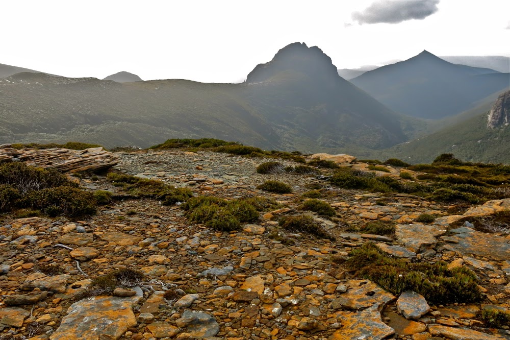
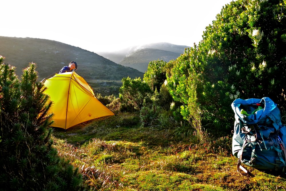
ITALY Dolomites AV2 (Alta Via duo) 2015

AV2 July 2015
AV2 is more demanding than its more easterly and popular sibling, the AV1. As my husband has had Parkinson’s disease since 2002 – an illness that robs its victim of full coordination and spatial awareness – I never originally intended bringing him on the AV2, but trying to please more people than just us, I agreed to do it with an acquaintance at the start of our European trip, which meant he would be there. As usual, I had masses of Plan Bs up my sleeve in case my husband should find it too hard.
Day 1. Excitedly we set out from Bressanone in the northern Dolomites, heading for the first hut on the route, the Plosenhütte (or Rifugio di Plosen in Italian, the second language for the region). I was on holidays, and for me, holidays mean freedom: freedom from set plans and bookings, and the release to walk at my own “happy pace”, which doesn’t seem to cooincide with anyone else’s happy pace, but I like climbing by myself and singing; it’s what I’m used to, and the way Bruce and I always operate in Europe. He knows I’ll wait for him at any significant spots. I felt so very happy to be here at last, walking in the mountains. Hopefully everything would turn out well. 

Afternoon Day 1. Staring across to the Afener Odel Gruppe that we were about to climb over 
By lunchtime at Plosenhütte, we’d done the first stage of AV2 and were about to do the second – not a bad effort for a man with indifferent health who had stepped off the plane from Tasmania the previous night. First, however, it was time to taste of the delicious wares the menu had to offer.

Evening Day 1. Nearing Schlütterhütte for our first night Day 1
It was grand to be there with vistas all around. The forest had smelled wonderful en route, and I was already enjoying the alpine flowers. I was totally in my groove climbing; the regularity of my steps clears my mind in an almost hypnotic way, just like the regular plash, plash of arms through the water used to do when I did swimming training. Exercise is one of the most peaceful and relaxing things I ever do. Meanwhile, Bruce and D had not been too far behind. The world was good. Way in the distance, our next pass was visible; I pointed out the afternoon’s goal to the other two, just so they didn’t relax into lethargy in the glorious sunshine and in the feeling of elation created by this lunch spot.

The scene along the tops was “sound of music” territory: open mountain slopes, easy walking until our compulsory descent, wonderful shapes and peaks and lighting all around. I had already done the official route and felt it could be improved by staying higher longer. The total loss and gain in altitude would even be reduced with this self-made variant. All three of us loved the route that resulted. Eventually, however, we had to do the necessary and drop down off our own mountain Gruppe, cross the stream in the valley below, and climb the pass that took us to the other side of the Afener Odel that we had been staring at since lunchtime.
Time was ticking by, and I was getting worried about our chances of securing lodging for the night (and, me being me, more importantly, of making sure we weren’t going to be too late for ordering dinner, normally 6pm). I wasn’t going to enjoy things any more until I knew for sure we’d get three places. The others agreed that I would climb speedily ahead, score the beds and food, and then come backwards. It was lucky I didn’t wait for them in the pass as I would normally do, as I had to do a fair bit of debating to convince the hut manager to take us in when they were already overflowing. Our beds were matresses on the floor in the corridor en route to the toilet, but that didn’t matter. Successful in my mission, I was then free to go back along the track, convey the good news and enjoy the now golden hues of the light as it gave definition to the peaks around and highlighted the colours in the grass and flowers. My husband had done two days of the AV2 straight off the plane. Everything was working out superbly.

Scene from the variant on day 2

Day 2 brought another variant to the main route, this one not invented by me. Having already done the official route, which I knew was too demanding for a man with coordination problems and vertigo, I opted for the longer, safer official variant that would add an extra day to our journey. It was beautiful, and enjoyable for me to see some new scenery.

Climbing a via ferrata, day 2

Even this route, however, was not without its challenges, and I feared even this would overtax my husband. However, slowly yet miraculously, he coped with drop-offs to the side way below ones that I expected greatly exceeded his tolerance levels. At one point we passed a school group all wearing helmets (I hoped he wasn’t noticing the helmets). This queue then followed us up the first of his via ferratas. I think it helped him to be thus sandwiched in. They sweetly congratulated him at the top and we left them behind as we eagerly forged ahead to a late lunch at Rifugio Troier that we could see below. D won on the menu here with the most delicious penne cacciatore, hot in its cooking pan. I had shocking food envy, although my own lunch was also very tasty.
It was only a very short stretch from here to Ravensburgerhütte (/ Rifugio Firenze) where we were greeted by cows, and where we had time to relax, wash clothes and eplore a bit before dinner. I had a superb plate of mixed forest fungi cooked in butter, followed by delicious apple strudel – a meal that turned out to be one of the best we’d have on the AV2.
Day 3 began with a glorious dawn, giving fire to the mountain, as below.

Glorious sunrise from the Regensburgerhütte (Rifugio Firenze). on Day 3.
After a fabulous breakfast (complete with real and multiple cappuccinos – rare for a hut), we set out up the beauiful valley, ever approaching the pass for today. Had I known in advance how difficult this was, I would never have brought Bruce, but sometimes ignorance is an advantage (in this case, for both of us).

Early morning light before we set out. Day 3
Once more, inching his way through the tricky bits, he made it to the pass itself, and then suggested a rest, possibly more from fear than physical exertion.

Climbing the via ferrata on the menu for day 3.

However, I didn’t want him to rest until the worst was behind him, so pointed to a high bit we had yet to reach, and said we’d rest there, not realising how exposed the next ten minutes would be for him on a via ferrata with narrow shelf and big drops, with maximum penalty for failure – but it was too late to back out now. He said he was OK, so I went a smidgeon ahead and talked him through the challenging parts, reminding him to only look at the next step ahead and the steel coil.
Relaxing on top with an Italian couple decked in helmets, karibiners and slings, I evaded Bruce’s questions about the following section.
“Where were we going next?”
“Oh, somewhere over there,” I swung my arm in a broad arc that happened to include the next part, but also encompassed many gentler possibilities. I could see the thin band on the steep scree slope that constituted our next move. No point in evoking panic ahead of time.
We left the Italians behind and forged on to the next hut, with Bruce once more mastering his justifiable fear. He was dropping badly behind at this stage, and as I walked and saw the distance between us increasing, I made the decision to call it quits at the hut we would arrive at before lunch. I booked us three beds on arrival.

After lunch, I climbed this while the others slept. There’s always plenty to do in the afternoons.

Bruce’s face at lunch was spent, but showed definite delight when I announced the new plan. After lunch, probably more emotionally than physically exhausted, he slept and I climbed some extra mountains. D did a combination. He was even relaxed enough next morning to come climbing with me for sunrise photos. I was stunned that he’d made it here to Rifugio Puez.

Sunrise next day (Day 4)
Day 4. As I predicted, with the trickiest via ferratas of this section mastered with aplomb, the passes for the first half of this day presented no problems at all, and we could all relax and enjoy the drama of the rocky shapes that guard the entry to the wonderful Passo Gardena, full of flowers as its name suggests.
 
Off Bruce sets for a much easier day 4


On the way down to Val Gardena
However, as we neared the pass, I decided Bruce needed a break from extreme fear, and I knew the next section was very technical. I would have enormous fun, but I knew it would terrify him if he attempted it. Thus, while we ate apple strudel in the pass, I suggested he take a bus to Passo Pordoi and stay the night at the fabulous Hotel Col di Lana (where the staff took solicitous care of him and fed him like a prince), while we went up high. We would join him the next day.
We saw him off on the bus, and then began the hugely fun climb using the via ferrata, up to Rifugio Pisciadu, nice and high.  Scaling those cliffs was possibly my favourite part of the route.

    
Near Rifugio Pisciadu, afternoon of day 4.
I arrived at Rifugio Pisciadu at the top of the climb hungry and very ready for the delicious lunch I was served. I was surrounded by snow and ice and huge rocky pylons. I was in love, and had fun, as usual, exploring my surroundings as friends dribbled into the hut. My Norwegian friends even went swimming amongst the mini icebergs. It was too glary for photography, so I mostly chatted and read, waiting for the next instalment of delicious food, and for sunset. I had high hopes. The mood at dinner was one of elation. Everyone had climbed there, and all were excited.

Sunset, Rifugio Pisciadu
Day 5. At the start of the day, another via ferrata had to be negotiated to take us even higher on this Sella massif. I adore the slight risk and demanding nature of these sections, and once I’d made sure that friends old and new were past the hardest section, bounced along happily at my own pace, eager to see Bruce again at the far end of the rocky bulk where he would meet me at the next rifugio, having caught a téléphérique up. The only thing to stop me on my way was a nice mountain worth climbing shortly after the via ferrata (Cime Pisciadu), a fun little scamper. I’d save Piz Boé for later in the day when it wasn’t so glary, and after I’d connected with Bruce.

The hut itself, bathed in sunrise light


We climbed up that gulch to reach the refuge
Whilst the once more united husband and wife shared lunch, clouds rolled in, causing me to doubt whether we should bother staying up high. The pleasures of a shower and good food in the valley were calling fairly insistently at this stage. However, I decided I’d be disappointed later if it cleared and we’d gone down for mere bodily comforts. So we stayed where we were, at Rifugio Forcella di Pordoi.

Day 5 sunset

The resulting sunset and sunrise photos show that the call was a good one! We were very excited by the views after dinner. I am so very glad I experienced that sunset and later sunrise with Bruce!! Who knows how many such glorious moments we have left to share. You never know what the future holds, but especially so when your partner has Parkinson’s.

More day 5 sunset
 It is, after all, a degenerative disease, and you have to be fit and strong to climb this high. I cling to each special moment that comes our way. It was good to have to work for the sunset; we’d been fed to near bursting point at dinner time. I’m amazed we could get up the slope. It was so beautiful, I really didn’t want to come back down to sleep.
Day 5 sunset
Day 5 is drawing to a close. I don’t want to leave this place.
Day 6. Here we had a bit of a problem. I dearly wanted to stay at the Hotel Col di Lana in Passo Pordoi to taste its delicious wares (well known to me from last time), but it was only about fifty minutes away – less for the other two who took the téléphérique.


How can you call a halt after so little exercise? I devised a circular daywalk once we’d settled in to justify the location, and we were all happy. It was great to wash our hair and to eat such splendid food, and the daywalk was very beautiful.
Just before I left to climb a ridgeline after lunch, Bruce joked about my “consolidation of the rest day”.

Dinner and breakfast were as delicious as the food was plentiful, which was a good thing. Little did we know what lay in store for us the next day – events so dramatic they need their own separate story.


Dawn Day 6

Day 7. The Great Hail Storm. (My camera was tucked in my bag in a bag in a bag, where it could come to no harm. There are no photos from this day. I will thus include more photos from the wonderful dawn of Day 6).

The valley had been hot and oppressive. Now we were high again, breathing was easier, but it felt decidedly humid. I could see that my husband was starting to fade, so I called a quick chocolate stop so we could all refuel in case of rain. Eating in a downpour is not fun, and neither is running out of energy before the top. We were only about 15 minutes away from the pass at this stage – whichever pass it was. It was hard to tell from where we stood, greedily munching, but there were only two possibilities, and both were in our sights.


As the delicious choco-marzipan combo did its work, the rain began. Fast and heavy. We threw on our coats for a second time and shouldered our packs to be moving and keep warm. We assumed that, like the last downpour, this one would last maybe15 minutes. Loud thunder started rolling around us, and the rain was so heavy it was hard to see. Soon lightning began flashing at us, all too near. It was unnerving, and each time the thunder boomed, it made us jump with its ferocity. I looked for a friendly rock or anything that could serve as a shelter but there was nothing.
Soon we came to an expected fork in the path, with one narrow line of dirt heading up to the pass 100 vertical metres above to the right, the other contouring more before climbing to the pass slightly left of straight ahead. Flash, boom. The rain poured down on us. There were no signs at the fork, and I couldn’t get out the huge, unwieldy map. It would be papier mâché by the time I’d unfolded it and worked out our location. (We had just walked onto this map at the last town, so I hadn’t yet unfolded it or highlighted our route. These maps are bigger than ballgowns, and in this weather, it would take all three of us to hold it down. It had been so mild and peaceful in the valley I had never anticipated a need such as the one we were now in). Not wanting to destroy the map, I made a snap decision in favour of the lower of the two passes. None of us wanted to get nearer to the lightning by going any higher. It even looked as if we could walk out of the storm if we went to the pass on the left. 
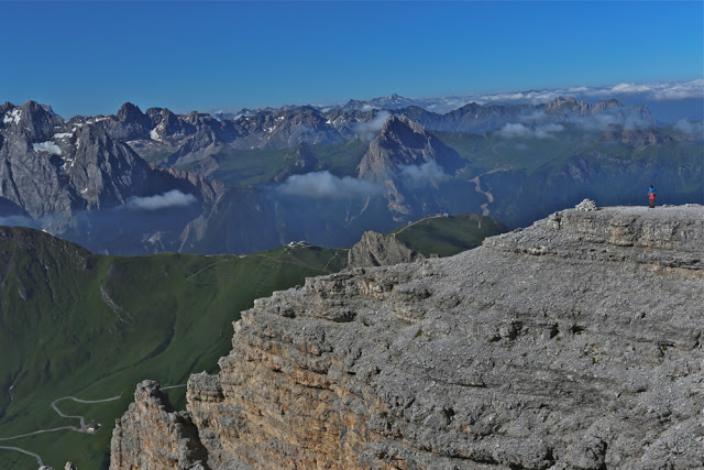
Can you find my daring husband?
Boom, crash. Now lightning and thunder were worryingly close together as we hastened along the trail, which, like all high alpine passes, offered no hint of protection. Our heads were bent low to keep the weather off our faces, shoulders hunched in some kind of protective mechanism against the blast. We reached the pass to read its name. Damn. Wrong name. Our pass had been the first, higher one. We looked back to it with its even angrier clouds and nastier flashes of lightning and did not regret the decision to be in this pass at all. The problem now, however, was how to eventually link with the path we should be on. We agreed this was a problem for later, to be solved in a valley in shelter, and the important job for now was to get out of our current location and lose height. In a rare lull in the rain, I pulled out the map, unfolded the monstrosity and ascertained that if we kept forking right at all options, things would be for the best. As I refolded her up, the thunder, lightning and rain began again. 

For maybe two minutes, the path on the other side was a good and clear one, after which it disintegrated to become a vague, ten-centimetre wide, muddy line, only discernible if you were searching for it in the long grass. This obviously wasn’t a well-frequented route, although sheep used it. We were now heading for what was the top of a monstrous cliff where half the mountain had fallen away. It looked amazingly dramatic, especially as sheep were grazing precariously on little grassy islands that seemed to be balanced on thin air. Below was a drop to infinity off the other side, so, whatever this track was going to do, it was not going to continue in its present direction. How I wanted a photo of those sheep on their funny islands, oblivious to the fact that if they took one step more, they’d drop six or seven hundred metres to their deaths.

Before we descended, day 6

Slowly I angled us along the slope which had a drop even on this side that I hoped my husband had been too busy following my steps to notice. D stayed with him, kindly encouraging him as he cautiously inched his way along, and I went on about twenty metres ahead of the train so I could suss out the best route, for now the tiny path had become a dangerous mud slide; we were on a dramatically steep slope, angling through the slippery grass, clutching more grass to stabilise ourselves. Had we tried the “path”, it would have been a record-breaking trip down the slope. Being ahead, I had time to peep over the precipice while I waited for him to get to the next move I’d made. Wow, what a drop, and what dramatic weathering in the rocks – almost vertical. Half the mountain had quite literally fallen away.
On a declivity between two grassy islands perched on the edge of this precipice, grew three little larches. I suggested we have other quck chocolate break to keep up our energy. The rain had abated a little, and the others seemed glad to have a short refuelling pause. As we chewed two minutes later, however, the hail began – huge, grape-sized bullets of ice, falling in sheets so vast that the landscape rapidly went white. Despite our little troika of trees, we felt very unprotected here, so as soon as the drop rate decreased (but didn’t cease) we set out again to lose height. Now there were giant ballbearings of white ice to negotiate as well as a muddy slope that made your average slippery dip seem to have a very gentle gradient.

The first half of day 7 was benign enough. It was only after lunch that the weather began turning.
The going was painfully slow, and then the hail gathered force again. Ouch, bang. Every time these projectiles landed on your body the pain was extreme. I began to fear that we would be knocked unconscious by their force. There was another larch ahead, bigger than the last babies, so I ran there to put my head under where the trunk bent a bit. The others followed, so we were soon in a tiny, shivering huddle, protecting our bodies against this onslaught. I was freezing, but opening my pack to get clothes was impossible. I couldn’t take off my pack or undo it, and the thought of taking off my anorak, even for a second, was unbearable. Fortunately, D took contol of me, and steered me into her spare jacket, tugging to get my wet, stiff arms into the sleeves. Sheets of ice continued to spear us.

Underway on day 7, with the famous Marmolada to delight us

As we waited for a decrease in fire, we noted that we were now nearing the tree line, which brought  some comfort. Surely there’d be shelter in the forest. When the ice barrage lessened its intensity, we made another downward dash. I tore down the slope to the next tree but looked back after less than a minute’s running to see Bruce way behind, gingerly feeling his way through the ice. I hadn’t anticipated his being quite that slow in this new obstacle. The ferocity picked up once more. I could see the other two choosing a tree pair with space in between. I had chosen a baby Christmas bush (no trees were available where I was waiting) and tried to cover my head with branches to stop being knocked out. By now the ground was 10-15 cms deep in iceballs, and any sign of a track had disappeared. I had to choose the most logical route down and hope that the track was underneath.
Once the fussilade had abated again, I once more went slightly ahead to concentrate on route finding, letting out whoops of joy if ever I spotted an indication that the route I was choosing for us converged with the official one. The slope was still perrilously steep and Bruce was having trouble enough on the “official path” without adding the complication of free-lancing into the wilds.
Eventually I let out another whoop. The line we were following widened ahead. We were going somewhere, but were too cold and wet to care where. “Somewhere” was going to have shelter. Now we were happy as we continued to lose height.

The last photo I took on the AV2, shortly before the rain began.

Just when we thought our trials were over and that dry, warm conditions were coming to greet us, our widened path – by this stage of four wheel drive dimensions (we really were getting near ‘civilisation’ now) – had to cross the stream. But the stream was now a raging brown torrent of unknown depth. I found a route across, but the other two were a lot more cautious, and baulked at following me. Eventually, however, we had all three on the other side of the latest obstacle. Unfortunately, we had to repeat this cute manoeuvre three times before we were finished.
We also had to deal with being given false directions to where accommodation lay, but ultimately we found what we needed, a town with a hotel (Felice – how appropriate was that name). Food, hot showers, fluffy towels, duvets. Bliss.

And I finish with a sunburst from night 5, a sign of bright things to come

The next morning I knew it was time to give up. I was stunned that Bruce had coped so well with so much danger and fear, but, well, I had never really thought AV2 was for him. We;d undertaken it under pressure because I hate saying “No” to people.  I had been proven right. It was time to switch to the much less threatening AV1, where Bruce could relax a bit more. Bravery has its sensible limits.

FRANCE-SWITZ Haute route 2012

FRANCE-SWITZ Haute route: Chamonix to Zermatt 2012 July
The Haute Route from Chamonix to Zermatt is such a classic and famous high-level walk, you would think it would leave an indelible mark on my psyche, would fill me with waves of nostalgia for its beauty as many of the other paths I’ve done have the capacity to do, and yet, there is a certain something that is lacking in my emotional response to this route. It was filled with beauty, indeed, and we met some great people, but I guess the problem is that, unlike on almost every other trail we’ve done, we did not meet anybody at all who was doing our particular version of this route, and the friends that we made were only with us for two to three days at most before our paths diverged – a byproduct of the many options on the haute route. There was no air of shared excitement or pilgrimage; everyone doing it was pretty matter-of-fact about the task. It was just another route. Also, several people had guides, and it seems to be the case that people with guides form their own, closed circle and don’t readily mix with others. I have learned that beautiful scenery is only one of many components of a great walk.

Once we crossed into Switzerland, everything changed. Here is the first hut after the hotels at Champez du lac – Cabane Mont Fort. We felt it looked like something out of a fairytale, perched high there on that hill, and yet it felt strange. Not one person spoke to us. We wondered who was doing our route, as there had been walkers going in every direction from Champez, although nearly all of them were doing the Tour du Mont Blanc. Now our route had its own funnel. The hut was crowded, but we were alone.

Sunrise from the next hut, Cabane Pflafleuri. We still hadn’t made any friends, or met anyone who was doing the haute route.

Friends or no friends, the sunrise was beautiful. but the lack of friends made me realise that, much as we think beauty sustains us, we are, au fond, social animals, and beauty combined with meaningful human contact and fellowship is the best recipe for an enjoyable experience. Normally I make heaps of friends in the mountains, so this was a new experience.

After Cabane Pflafleuri we climbed up and over the Col des Roux, to emerge at a window revealing this beautiful valley, at the end of which  was our next cabane, Cabane des Dix. On the way, we made our first friend, a Parisian, Fabrice. At last there was someone else to share the joy of the journey with, to laugh with and to get to know.

Nearing the cabane des Dix

Rugged beauty, but nothing too challenging for a man with Parkinson’s Disease.

And there on a rock was the Cabane des Dix.

The beauty thus struck me as a lonely beauty, even though my husband was there with me. On other trails, the beauty remembered as the years go by is one that sits within the context of the camaraderie of the other friends we made doing our route. In addition, we have never found Swiss huts to be as friendly as their French or Italian counterparts, where ad hoc rough and tumble are more the order of the day. We didn’t enjoy the strict regimentation that came with the world of Swiss mountaineering, being told exactly which bed to sleep in, which table to eat at, and being rationed out one pat of butter, one tiny packet of jam and two slices of stale bread to furnish us for a hefty day’s hiking. The bread is always stale in mountain huts, but at least in most places it is plentiful

Sunset that night was a treat.


At breakfast, Fabrice ran into trouble with the gardien. He didn’t want one sachet of instant coffee for breakfast; neither did he want one tea bag. He requested hot chocolate instead (like I had somehow received, also refusing the other two items). He was told chocolate is only for children (me?) and that he had to imbibe an adult’s drink. He was not amused. We chewed our stale bread in discontent.

After the Cabane des Dix, you have a choice of two passes, both of which contain elements of risk and danger. One has loose stones with a big drop off. The other has monstrous ladders reaching into the sky. I wanted to take the latter, but had decided to take my husband down to the valley first, as neither pass was suitable for him. British climbers overheard this, and came up to me and offered to rope Bruce up, if I could get him over the glacier and the ice bridge with mini-chasm below it first. We set out ahead of them to enable this, and there was Fabrice, who also wanted to come with us. We appreciated his company as much as he did ours. This is a pass that is better negotiated in company than solo!! We were there waiting for the Brits (I think that surprised them), who roped Bruce up. He bounced up the ladders like an adept monkey: all he needed was the confidence to know that if he fell, he wouldn’t die, and, knowing that, of course he didn’t fall.

Approaching lac bleu with Fabrice
Fabrice wanted to visit lac bleu, reputedly very beautiful. I had been unsure, as it is on a chemin difficile. However, we were enjoying his company, so put lac bleu on the list, and brought our accommodation forward a bit so as to spend the time in his company (we never make bookings). Our paths would diverge next day, when we went back up to high ground, and Fabrice stayed low. It was sad parting. We’d had fun. I can still hear him at times telling me not to tread on the beautiful flowers in the field (when there was nowhere else to tread). I love a man who cares that much about flowers.

Bruce swimming in the freezing lake.
The next day we climbed back up into the snowy stuff again. The hut we had chosen was higher than on the official route, but we wanted to be there as the views were said to be good. It was truly amazing. Below is Bruce in the early stage of the climb.

And below again, he is sitting looking out at the most amazing view I have ever seen from a hut. This hut sold nice cakes, and we had a tasty dinner, even if we were told exactly where we had to sit and with whom we were permitted to talk.

Cabane de Moiry 

Sunset was pretty spiffy

Early next morning, I was up, as usual, to photograph whatever there was to see. Lots of climbers were setting off already.
Leaving this hut next morning, I had one of my less happy experiences of the trip. We had to cross a  band of ice about 20 cms wide, with a big drop into frozen realms below. I got Bruce to wear our one pair of crampons, so I was in shoes with little grip, and carrying his pack which is way too big and which threw me off balance a little as my back is very small, so it came down and bashed my legs. I didn’t have it done up in case I fell into the lake below and needed to rid myself of it, so it swayed around and the ice was slippery. I was shaking when I’d finished this bit.

View from the cabane Bella Tola, two nights later
Down we went to a dam where the lady didn’t want to serve us. There we met our second friend on this trail, who was also denied service. I can’t remember why. Perhaps we were not there in regulation hours. Somewhat hungry, the three of us set out up the steep pass, each at our own speed. I like to treat a mountain pass as a decent workout. It can be cold waiting in the wind at the top, but I just can’t resist a nice fast climb. When Bruce joined me, our new friend was a speck in the distance, and I was frozen, so we didn’t wait, and plummeted down to the valley (Zinal) where we were staying the night. I think that’s another reason why this route doesn’t thrill me as much as many others. Too many nights were spent in hotels (very nice ones) in valleys rather than in huts high in the mountains, which is where I want to be. Mostly, we were high in the middle of the day, and down low for the part of the day that matters. I’d prefer it in reverse, but it wasn’t possible, as the huts weren’t there.

Climbing toward Meidpass
The towns at the bottom are quite small by town standard, but big enough to lose friends in. We didn’t see the friend we’d made until the next day, after he’d finished and was hiking without his pack just to finish things off. It seemed a rare thing to be doing the whole route.

Bruce near the Weisshorn on our descent to Gruben for another valley sleep. The weather was changing. I didn’t take any photos at all in the final stages of the trip, as clouds closed in, and there was no point taking photos of Zermatt in anything other than ideal conditions. I used to live and train there each year during racing season. I have myriad photos of the town dressed for the ball.

Senecio doronicum

Flowers in the fields near Cabane Bella Tola. The flowers between Zinal and Zermatt were numerous and glorious.  By then, the route had dropped out of the rock and snow and was primarily in the high pastures.
It was fun for me to walk part of the Sierre-Zinal race that I used to compete in – run in a daze reading my body and the bodies of my competitors, concentrating hard, monitoring breathing and energy. Now I could just relax and sniff the flowers and enjoy things at a more leisurely pace.
Alas, Zermatt and Taeschtal were anticlimaxes for me, as I knew them so well, and they were drab in that grey outfit they chose for our arrival. No matter. The point for us hadn’t been the arrival at the end, it had been the journey, and we had seen many wonderful mountain sights.
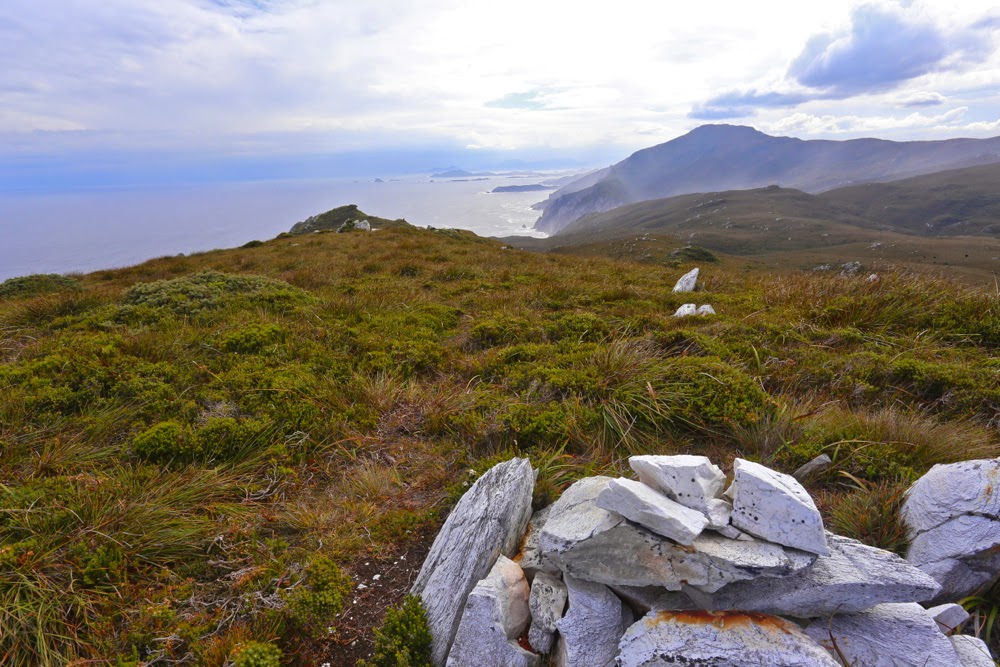
South West Cape Trail 2015 Mt Karamu, New Harbour Range, Smoke Signal Hill

South West Cape Track.

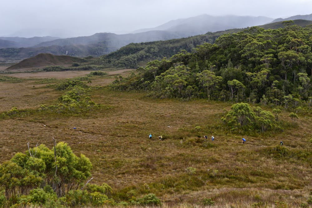
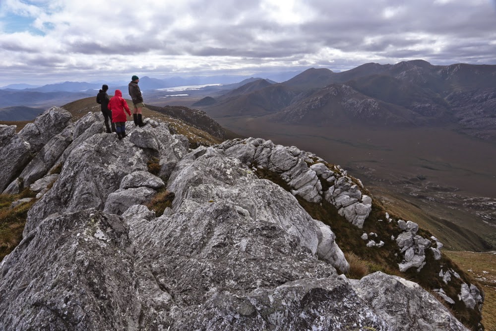
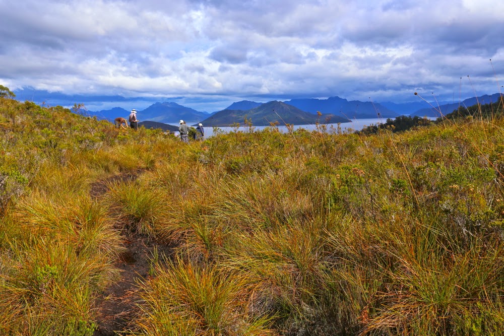
South West Cape Track: hard or easy? It depends on your expectations as created by your experience and the context within which the word is used. Pictured are the others walking along the path that most found easy. I added challenge by climbing little thises and thats along the way.  Warning: the blog this week is not easy :-).

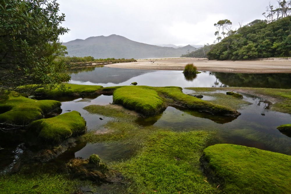
The entrance to New Harbour
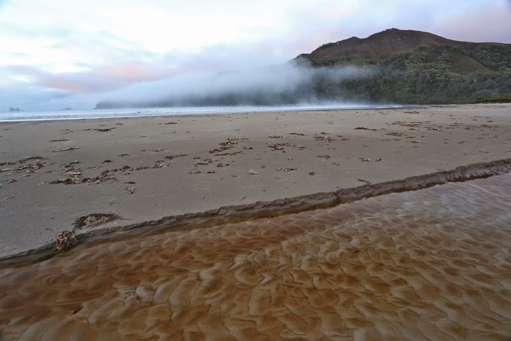
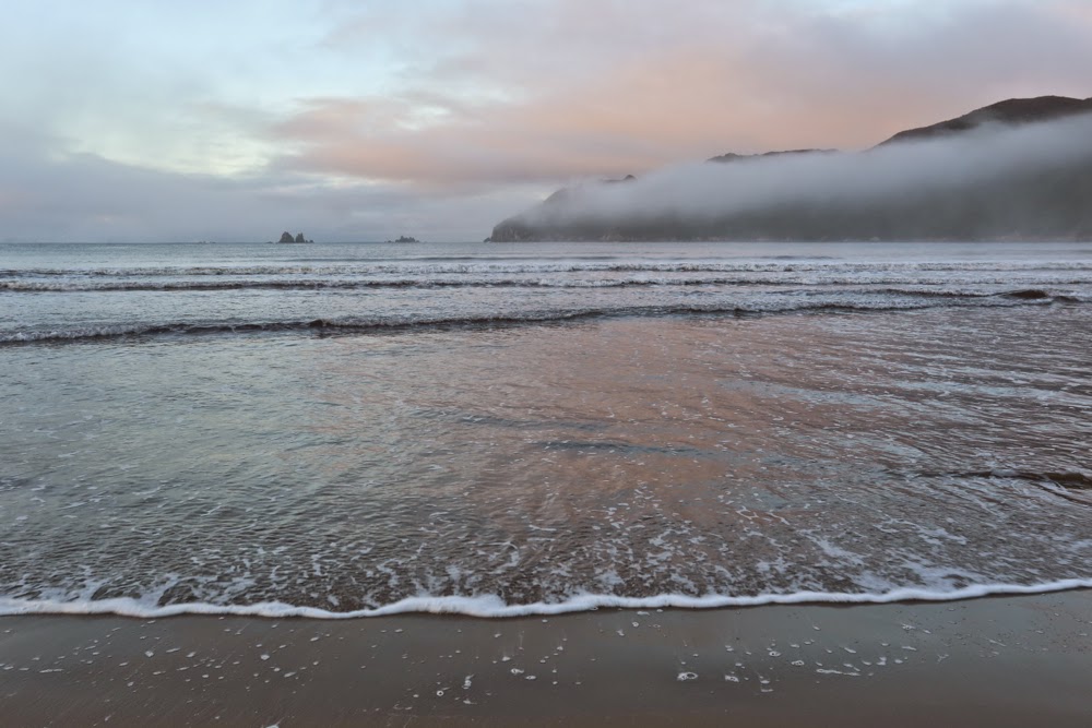
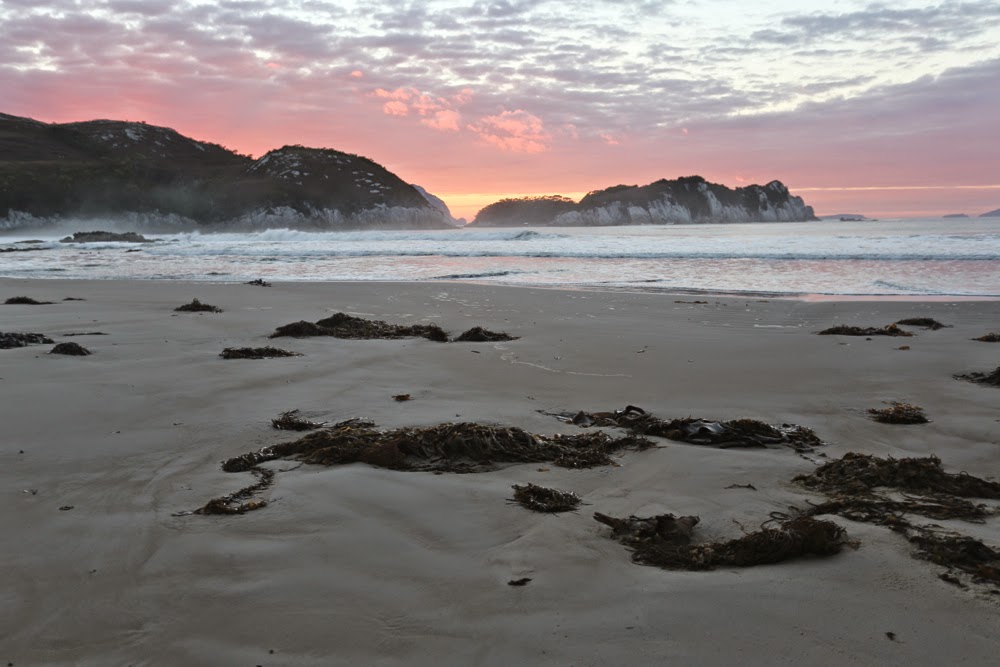
Dawn on Day 2, New Harbour. 
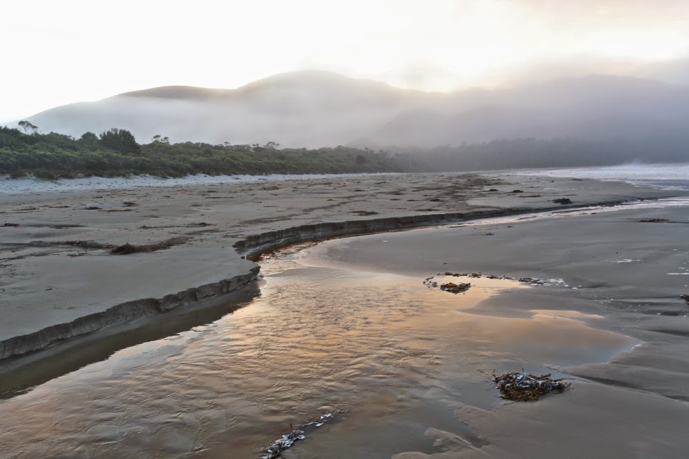
Same, looking in the other direction (east)
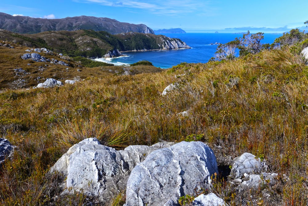
Looking mostly south. This is also the view out my tent on the final evening / morning

I stood on the summit of New Harbour Range, mesmerised by the view, my spirit reaching out towards Antarctica to the south, South America to the West, New Zealand to the east. Infinite space; infinite glory; infinite peace. My being was no longer coterminous with my epidermal layer but transcended to a space beyond, which could not be numbered. One of the three companions who had climbed with me turned to me and said, most aptly: “You know, I’m  not a religious person, Louise, but this here is the nearest I get to a religious experience.”

Day 2. Rising above New Harbour (en route to Hidden Bay, then Ketchem Bay), and looking back to Smoke Signal Hill and the New Harbour Range behind. Both of these would be climbed by four of us on our return leg.

He is, of course, so right, but his words had a bitter sting in our current political context, as we bushwalkers are, basically, fighting for our right to have experiences like this in this area we called wilderness, to keep these areas accessible yet untarnished by the sound of jet skis, the sight of grand luxury tourist hotels and cable cars. Liberal governments, both state and federal, make the assumption that spiritual connection to the land – a transcendental experience that is prompted by place – is something that only indigenous people can experience, and that if a non-indigenous person has what might be called a soul, then they should go off to a dark and musty church building made by human hands in order to connect with the eternal. I am sure there must be somewhere bushwalkers who are only there because it’s “sport” and a challenge to be had in nature, but the ones I mix with are there in the wild places because it is precisely in such infinite beauty that we find freedom and peace, and that these are things we need to keep happy and sane.
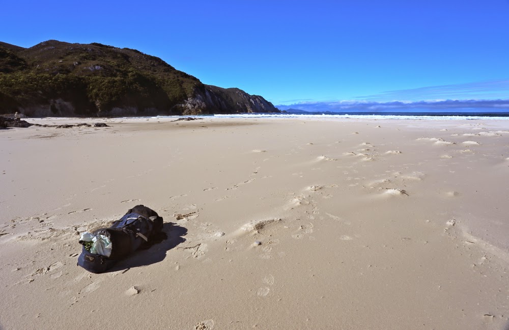
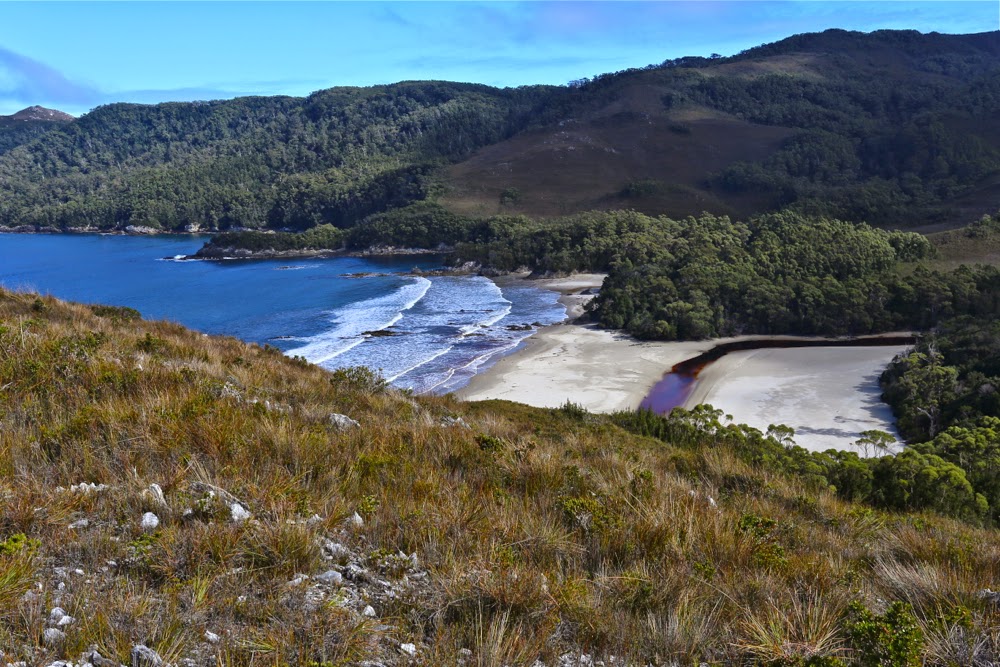
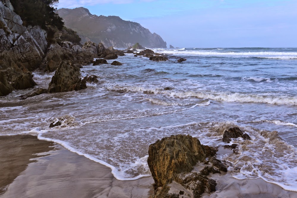
A pack. A wild beach. Does it get any better than that? (Hidden Bay).


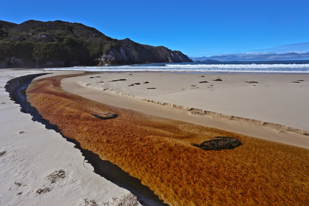
Further along Hidden Bay, where we had an early lunch having inspected the elephant seal that we hoped was just exhausted but that we feared was dead.
 But let me begin at the beginning, which I guess is when I read “Mt Karamu” on the Hobart Walking Club trip list, checked out the coordinates of this peak, and signed up with record-breaking speed, hoping I hadn’t delayed too long to be given a place. And several months later, there we stood on the

Denny King airstrip at Melaleuca, ready to venture into this part of the state that I have long coveted but never had the opportunity to explore.

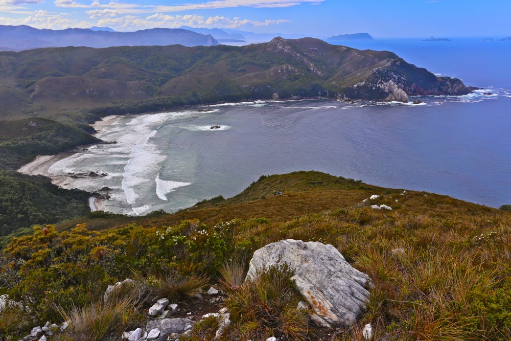
Same Day. Now we’re above Hidden Bay and about to get our first glimpse of Ketchem.
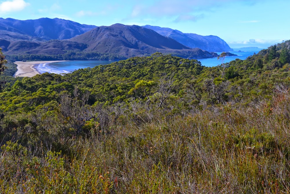
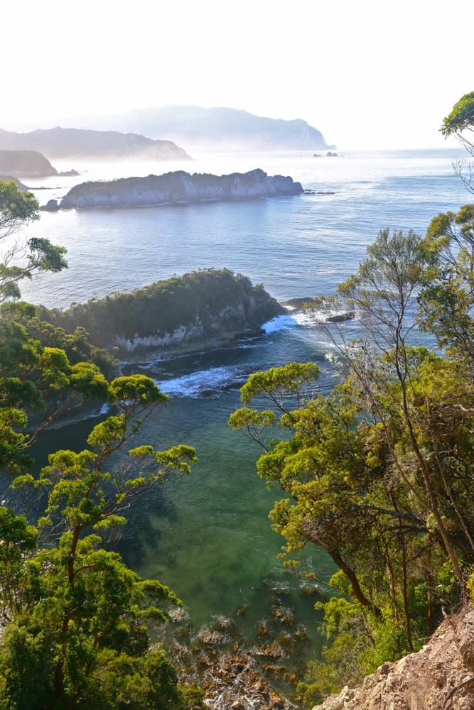
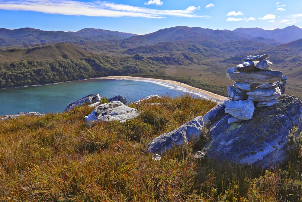
First sighting of the fabulous Ketchem Bay with its rocky islands and caves, nooks and crannies: our camping spot for the night.
What does the word “wilderness” mean to you, I wonder. To me, it suggests vastness, ruggedness, remoteness, and ruthless nature with no attempt to be tamed by audacious and pretentious humans. If this exposure to the unleashed forces of nature in all its sublimity is what you desire, then the ne plus ultra in a Tasmanian context must surely be the South West Cape of Tasmania. Even the flight in to utterly isolated Melaleuca, perilously near to rocky faces that can kill you with a single kiss, fills you with a frisson of delight. 
Ketchem Island from Ketchem Bay. Dawn breaks on Day 3.

As I reclined in my tent on the final evening, gazing out past rainforest trees at the endless variety of the patterns of force as the waves crashed on the sand about 120 metres from my bed, I thought about our governments and their concept of luxury, for to me there is no greater luxury than the liberty to have this sight. I let my eyes wander in the direction of Antarctica to the south, a place that I could not see, but just knowing that it was the next expanse of land was enough to thrill – like reading on a menu the process of marination and the herbs and spices that have gone into the dish you’re about to eat. The very knowledge adds flavour that you would not otherwise experience.

Day 3. So far, we are avoiding the shepherds’ warning of the dawn and are enjoying glorious weather for our climb to Mt Karamu. Here we are looking back east as we head for Wilsons Bight.


Now this bit was NOT easy. See those rocks there lining the headland to the left? They were the scene for one of the best games of my life: an adult version of musical chairs + What’s the time Mr Wolf? Dinner time, or the moment the music stopped, was the time the next huge wave approached. On cue, you had to rush post haste to the nearest rocky island, usually about 1 metre high and 1.5 long. Perched up there you waited, usually 7 waves long, for the next opportunity to advance a square. If you missed, you got drenched and risked being taken places you didn’t want to go to by the force of the incoming tide. I was pleased to emerge at the end as dry as a bone, but not all my friends had the same happy fate.

I thought about how simple our needs become in the wilderness. Do you want to know what I thought of as other luxuries? Not a glass of champagne on a pontoon with fake palm trees and facile conversation with others whose world revolves around money. No. Here is my list of “negative luxuries” if you will: dry boots at the end of a day; packing up the tent without rain falling on you; putting your hand out the tent flap without having leeches jumping onto it; feeling free to use toilet paper rather than leaves (a self-inflicted hardship I employ to help protect the environment); food that has not been dehydrated; fresh undies each day. “That sounds horrid”, do I hear you say? These little pleasures are so often taken for granted yet they also indicate tiny hardships we take on board for the greater luxury of being there in the midst of such unattenuated beauty, and the beauty is so overwhelming that we just laugh together at what we go through to be there.

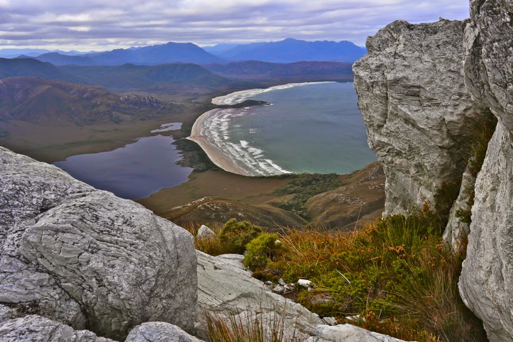
Wilsons Bight far below now. This shot is taken not far in vertical metres from the summit, although in horizontal metres there was still quite a bit of ground to cover, as Karamu has a long ridge leading to its highest point, which is right at its northern tip. Plenty of time to enjoy expansive views to left and right, and to gaze down on SW Cape – obviously, with a name like that, the furthest point to the south west of our island state.
The view to the north from the summit of Karamu
Much as I adore wilderness and was looking forward with eager anticipation to this trip, I was a little worried about the tiny amounts we would be walking each day. I looked at the map, and did my maths, and saw that we would not be advancing up this board with staggering speed. The advantages of this, of course, would be plenty of time to explore each beach and to photograph as the mood took me. The disadvantage for a person with my restless spirit and uncontrolled energy was that I ran the risk of exploding like a saucepan on the boil with the lid kept on. Would I cope? I couldn’t tell in advance. I thought of taking runners, but didn’t want the extra weight. I’d just have to tough it out.

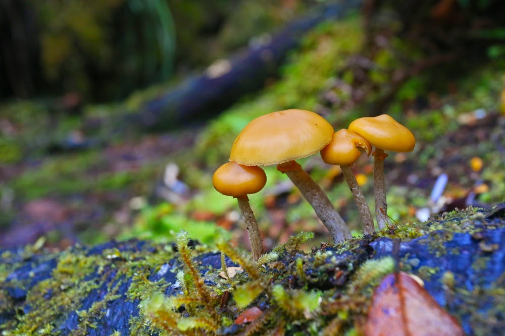
Autumn has only just arrived, but there were young fungi out in many sections of rainforest we walked through.


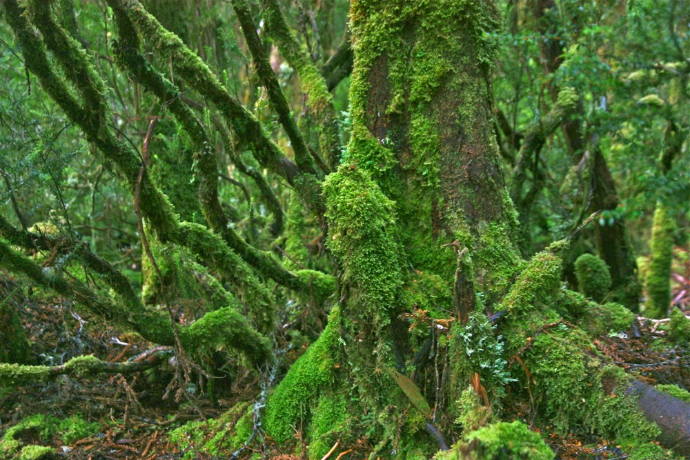
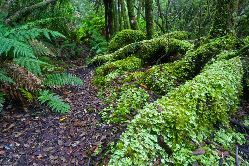
I hadn’t realised how very often we would be walking through glorious rainforest. When not walking along beaches, we were often in fairyland. Here is the forest behind Ketchem Bay where I went to play if I wanted a change from infinite beach. 
This brings me to another issue that interested me this trip: the relativity of how we perceive experiences. It is always so hard to imagine that someone else might dislike what we love. I am still stunned that my neighbours actually hate trees. I don’t mean they don’t love them like I do. I mean they actually hate them. Here on this walk, we had a person who did not relish the experience in the way the rest of us did. The situation reminded me of CS Lewis’s busload of people from hell who go to visit heaven and hate it there, or William Blake’s phrase in his glorious poem about love (The Clod and the Pebble), how one can “build a Hell in Heaven’s despite” (and one can also “build a Heaven in Hell’s despair”).

Day 5. The summit of New Harbour Range. For me, the equal highlight of our trip. I preferred its view to that of Mt Karamu, but enjoyed the utter remoteness of the latter. Each had so very much to offer.


New Harbour Range summit, looking north to Melalauca, where the adventure began. We have nearly come full circle.
Tut. I have not described our route or what we did, other than gaze at beauty. The route is on the map – a little red line – or in Chapman’s guide. The mountains are mentioned and discussed in my photos above. What did we do other than gaze at wondrous beaches and climb heavenly mountains? We walked some more, pondered much, stared with wonder heaps, chatted, ate dehydrated food, sheltered in our tents from rain or sang glorious songs (well, I did) when the sun came out. We explored the minute detail of the superb wild beaches. I paced up and down, up and down said beaches. K collected bags of rubbish washed ashore by irresponsible and selfish boat people. C also paced the beaches, photographing little marine items that captured her attention. Mary sketched the most exquisite line drawing of Ketchem Island that quite literally took my breath away with its expertise, artistry and beauty; T did crosswords and trotted around the campsite in her new trendy shoes – two left crocs, way too big for her – that we salvaged from debris (she had regretted not brining camp shoes); V manufactured chairs out of other scraps of debris (perhaps her frypan chair was the most innovative), and served up gourmet food to her husband and J and V spent a great deal of time trying to dry their tent fly and sodden clothes on makeshift clotheslines.

Looking back down to New Harbour from Smoke Signal Hill.


Back down at New Harbour.

“Do I want to return to civilisation?”, (odd word when one considers how very uncivilised most humans’ behaviour is, a point teased out superbly in David Malouf’s An Imaginary Life), the caretaker of Melaleuca asked me. “Yes”, I replied. There is a moment for everything. Wilderness is a glorious time out, but I also enjoy the rough and tumble of normal twentieth century life, and enjoy many of the luxuries it has to offer, like long, hot showers, lights to read by, chair backs to make reading comfortable, a fire in my hearth and real food and wine on my table, which nearly always has a candle burning at meal times and a flower from my garden to decorate it. If we keep technology as our slave rather than becoming enslaved to it, it has much to offer us, and I embrace many of those opportunities. Next week I’m off to Sydney to see Aida on the Harbour and the ballet, Giselle, at the Opera House. Many philosophers regard culture as the antithesis of nature. I love both.

My room with a view and all my worldly needs for six days.


Anne Circuit 2015 Mar

Anne Circuit 19-22 March 2015.

Day one. Lake Judd. Anyone who was superstitious would have believed this venture jinxed on the first day. My friend and fellow fun adventurer, Monika, woke up sick and had to bail out. Next, David, a friend I was going to have great fun sharing photography with, broke his wrist when he slipped on treacherous, slimy boards only 32 minutes into the adventure and had to be taken back to Hobart. Generous Phil volunteered to miss the walk and drive him. Others had to help get his pack and camera back to the car. With such an attrition rate at the start, and with rain driving down, there was a rather gloomy feel and yet those left standing remained excited about what lay ahead: the famous Mt Anne Circuit with all its mystique. We were underway at last.

And still there were seven

Because of the delays and the copious amounts of mud – with some holes on the track being over 120 cms deep (as measured by Stacey’s pole and not her body, fortunately) – the going was slow and we elected to camp down at Lake Judd rather than climbing to the base of Mt Sarah Jane. My disappointment at not being high was mollified by getting to see Lake Judd and its beautiful surrounding rainforest, and completely dissipated later as I lay snug and cozy in my sleeping bag, listening to the sound of the howling, yelping wind up high that reached us ominously down there. On the Lake, there were waves big enough for a midget to go surfing. At one point we had all been thigh deep in water. Our boots and socks were sodden and would remain so for all four days. My dripping gear lay in a ghastly pile in the vestibule; a problem for the morrow. My camera had spent nearly all day in my pack, hiding from the rain.

Day Two. Mt Sarah Jane, and a scary lesson.
Donning saturated, freezing clothes at the start of a day does not exactly cheer, but we got the job done and, shivering, set out back through the glorious rainforest to a track junction, and then up to the base of Mt Sarah Jane. I was cold and enjoying the climb, so when the others offered to let me go ahead, I accepted. This meant, however, that I got very cold up top in the wind, waiting. For most of the rest of the trip, I decided the warmest option was to be up the back or at least in the middle.

Mt Sarah Jane, awaiting our arrival. Mist is just starting to edge its way over the saddle. She looks pretty innocuous, doesn’t she. We took her for granted, so she paid us back big time.
Once you’ve climbed up to the base of Sarah Jane, the hard work is basically done. She looks much reduced in size from that position – a wee pimple of a thing – and hardly to be taken seriously. It looked as if we’d be at the top in about 20 minutes. The others agreed to summit her too, so dumped their big packs and were ready to roll. I already had my daypack on with nibbles and camera inside. Rupert popped in his gps, which seemed almost comically superfluous. I hadn’t bothered with compass or gear. She was right there and a simple undertaking. That said, I was thrilled with the company I was keeping, that they would agree to climb in this weather. Do I need to remind you about how cold we were, having feet that were still icy, despite the climb we’d just done? The day was dull and grey; views were not promising, and an icy wind bit you every few minutes. Any normal person would have said: “Not today thanks”, and left it, but these guys said they’d come. As we set out, mist gathered, obscuring our mountain, but we knew where she was.
After maybe only five minutes’ climbing, the wind gathered ferrocity. Some blasts completely flattened me, so I climbed almost lying against the rock to prevent being tossed into space, a piece of light debris for this malicious force. Shards of sago snow bit my face and stung. Each glance back I could see the coloured shapes of the others through the dense gloom, so on we proceeded, not spreading out too much. Cairns were hard to find and I felt like a blinkered horse. My balaclava was blowing in circles around my face. My pockets had been turned inside out by the wind. On we climbed, surviving, until at last the summit was reached. Up there, I was so cold I was not coping. While we waited for the others, Stacey hugged me to try to give me some of her warmth. I was now into violent shivers. The summit photo was swiftly taken and we turned around straight away. At this stage, Peter was having trouble with his coat. The wind virtually ripped it off him so he looked like a scarecrow, the coat tails flying up above his head while only the arms stayed in place.

Spanner Lake, our tent site on night two, as seen next day from above.

Down we ventured. I was now too freezing to lead; I just wanted to be a sheep in the pack. Rupert kindly took on the respinsibility and off we set, groping our way in dense mist. Suddenly we could see neither the next cairn, nor the last two in the queue, who had, unknown to us, continued straight ahead instead of swinging around the mountain as we had done. We yelled and screamed, but the wind gobbled our noise. Rupert took a gps reading: our route lay 20 ms to the left. Boom. Batteries died. I was so cold I wondered if I would share the same fate. If we couldn’t find the others, that was a very real possibility. Every static moment made my core temperature drop a bit more, and yet we couldn’t abandon the other two. Relief is hardly an adequate word to describe the emotions on finding them. We hugged each other for warmth as Pete struggled with his coat and the rocks to join us. What had begun as the simplest of ambles up a slope had nearly ended in fatality. We all felt humbled by the unrealised potential for disaster we had narrowly escaped.
Compared to that epic, the rest of the day was gloriously lacking in adventure, and we continued on after a brief lunch to our camping place at Spanner Lake. As we crested the high point from which we would drop down to the lake, there was a glorious view of the Lonely Tarns below, surrounded by drama and magic. Gelid as I was, I wanted to capture this beauty, so I delayed the others while I retrieved my camera from the pack and they stood in the biting wind. Peter’s pack cover blew off, but was retrieved by Rupert. I got the camera out of the pack, but then spent five minutes struggling hopelessly, grunting impotently but achieving nothing: I didn’t have the strength to undo the simple clip that would open the bag containing it. No photo of that glorious scene. I sadly placed the camera back in the pack, and on we continued to our goal, which ended up being so awash that we found it difficult to find a spot in which to put tents that had not become a partial, makeshift lake.
Lightning Ridge with its gnarly, warty spine of rocks glared down at us (when the mist parted – briefly). Rain continued. Once more the revolting, and now smelly as well as sodden, gear was deposited in the vestibule while we attempted to warm up in our tiny tent havens.

Climbing Lightning Ridge

Day Three. Lightning Ridge, Mt Lot, The famous Notch. The apex; the glory.
This was one of the most dramatic climbs of my entire life. Striding Edge (UK) eat your heart out. It’s nothing compared to Lightning Ridge. Wow, what a beauty.
The day began in a prosaic enough way, like most other days: on with the putrid, sodden gear, on with the packs, no lighter despite three days’ eating due to the wetness of the tents. Off we set, over a creek at the end of Lake Spanner (whose shape I hadn’t yet seen) and up through the steep forest, knowing that the sharp ridge we’d seen from afar would be at the end somewhere up there in the heavens. Up, up we went, through glorious, but rather surprising forest: it had been raining almost incessantly, and yet, moist and lush as the forest may well have been, there was not one drop of running water to be had. I had not even thought about carrying water: it was the sort of weather in which you just pointed your open mouth upwards if you wanted a drink, but the rain had now ceased, and the strong wind must have dried out the water channels and puddles. No worries. It wasn’t a day that demanded continual drinking. I’d find water somewhere later, and I did, in a puddle in the rocks right on top.

Lightning Ridge, looking back along our exciting route

Stacey and I were together at the front, climbing away when all of a sudden we just popped out into open territory: we’d reached the rocky spine and Oh what a view!!!! Now I could see the shape of Spanner Lake, and all the surrounding dolerite pillars and mountains delicately crowned in mist. It was as steep as it’s possible to be without collapsing, and utterly mesmerising. I hate holding people up with my photography, but luckily the others were far enough behind to give me time to get out the camera and happily shoot away. I was sure they’d want a break anyway – to admire the view, even if not to eat and recharge their batteries. (Still no puddles for the negligent me).

Mt Lot, the view therefrom, and our way forward along that ridge.

The climb was protracted, which I fully appreciated for safety reasons. The times various photos were taken indicate how carefully we negotiated this supremely difficult territory – and the hard section of The Notch hadn’t yet begun. Even before we’d reached this famous stumbling block, we’d needed to do several pack passes – spots where the going was tricky, with a dangerous drop below if things went askew, and where a heavy pack hanging out the back (especially if it behaved in any way unexpectedly, if a strap got caught, or if it changed position quickly for some reason) could send the sad owner on a one way trip to eternity. On they went, off they came, as we sidled around nasty corners or inched our way up or down tiny ledges. Sometimes you’d come to what seemed a cul de sac, the way ahead thin air; the drop below, momentous. “No. They can’t POSSIBLY want me to spring down there! And certainly not with a pack on.”
At one point, we breasted a mound that I thought was “just” the high point of Lightning Ridge, but Rupert announced that we had just climbed Mt Lot. I couldn’t believe it. We were on this mountain of Great Stories. I thought it was still to come. We climbed both summits, just in case, and proceeded on our way. Our mission lay further on.

Lots Wife, as seen from Lot. He did, indeed, leave her behind.

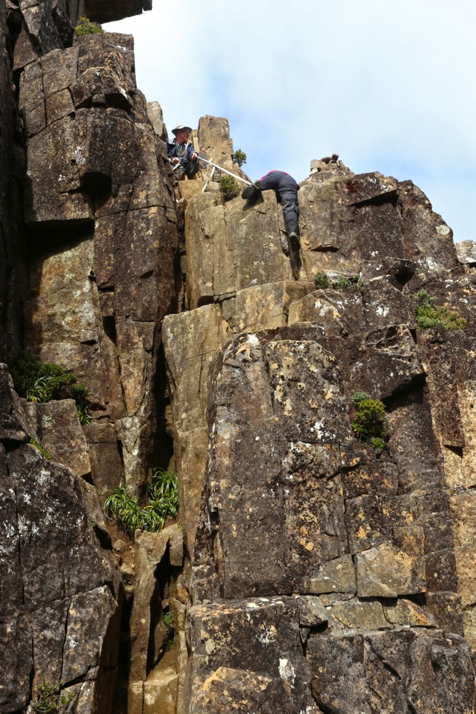
And so, eventually, we came face to face with The Notch (to be said with a slightly quaking voice), for which Rupert had been lugging a strap and carabiner the whole way. Stacey went first, and we watched her (roped) lower herself over what seemed a bottomless pit. When my turn came and I looked over the edge, however, I could see a small ledge that held little fear (seeing’s I was roped). Yes, one lowered oneself, blind, into oblivion, but with the rope, if the fall got out of control, it would be impossible to just roll forever, and after that single manoeuvre, the rest was easy. There was not even a need for rope once that first daunting leap of faith was made. Whew. I had been rather full of adrenalin anticipating this moment.

The Notch. Sue begins the leap of faith with Rupert holding the rope for her.

Once we were all safely down, and rather elated that the worst was now behind us, up we went again, sadly needing a couple more pack removals to give us the needed momentum up slopes where our arms were just not strong enough to pull us up with the extra weight. Not all of us needed this every time, but I used this technique almost every occasion it was on offer: my pack with my full-frame camera on board was very heavy, but I did not regret the weight when I considered the shots I had already taken. Perhaps the others regretted the delays, but I was happy, despite the inconvenience of the weight. I hope the shared memories the shots provide reconcile them if they were annoyed.

Playing around on High Shelf camp, waiting for dinner time. Mt Anne featured.

On we sauntered, happy now that the rain had stopped and the wind had dried us out a bit. The sun even started to make a concerted effort to appear. Suddenly Rupert announced: Here’s our spot for the night. “What? We’re finished?” Wow. It was only 4pm. The sun was now shining. We were perched on a glorious shelf with a magic view. We turned the place into a Chinese Laundry in about five minutes flat, making a desperate attempt to dry out tents, bags, anoraks, overpants and everything else before the sun set. Hot soup was an item that urgently yelled to be on my agenda. I went across to join the others who were basking in the sun, staring at Mt Anne, brewing tea or soup. “This is the life,” I exclaimed and everyone agreed. Who cares about a few wet items of clothing when you can be here, in wilderness this glorious, staring out at sublimity in every direction? The others were drying their shoes and socks, but I knew my shoes would take a week to dry (poor boots, on their debut walk – muddy, scuffed and ill-treated), and I wanted to explore our new environs, so kept my stuff on for a few more hours. Needless to say, we were blessed with a glorious sunset. I stayed outside almost until the last light went: it was just too beautiful to be in a tent with the zip done up. I was pretty freezing by the time I admitted defeat and left the pink valley below me to its own devices.

Sunset from my tent site. The Notch is visible as the gulch to the right on the horizon.

Day Four. Mt Anne for most; Eve Peak for me. Mt Eliza and down.
I was worried about the 8 a.m. departure for today, as I knew that if sunrise were beautiful, I would want time to photograph it at length. Luckily I managed to be punctual, despite being delayed by beauty. I hadn’t been so lucky during the night. I had been rather busy with mild gastro, and my frequent visits to the chilly realms outside were made worse by the fact that my tent was absolutely sodden with condensation. I was feeling very ordinary indeed, and rather weak, as we set out.

Dawn arrives at Mt Anne next morning

I am not a person who thinks that once you’ve climbed a mountain there’s no need to climb it again. Not at all. I’ve climbed Cradle six times now and am looking forward to the seventh, eighth and ninth times. Each time the view has different lighting; new features on the horizon take on new meaning. I run the Cataract Gorge route almost every day of my life and never tire of it. However, Anne has a sloping edge that I find dangerous, and I was feeling quite queasy thanks to my gastro. Meanwhile, I have never climbed Eve Peak nearby, so opted for a new peak rather than doing a walk that I find uncomfortable, to see a view that would be hazy at the top.

Off Sue sets to join the others in climbing Anne.


Anne from Eve Peak

I climbed Eve quickly, and got in a view before the mist heralding the next lot of rain started to gather strength. From the top I watched columns of mist rising, and beat a fairly hasty retreat to where I’d left my pack, remembering our Sarah Jane experience of how quickly the mist can roll in to confuse and disorient. At least this time I’d brought my compass. At about this time, the wind picked up strength again. The group had agreed to reunite on the summit of Mt Eliza. I saw no more reason for hanging around where I was. In this wind I’d prefer to be moving, so I went to our rendezvous point and hoped to find shelter. I did. Kind of. It was a long wait, but I met a few very nice people while I was perched behind a rock, and that helped to pass the time. It had been a wonderful trip: I had plenty to think about when not entertaining guests in my lair.

The final descent

Southern Ranges 2015 Alexandra, Hippo, Lake Mt, Knife Mt, Maxwell Ra, La Perouse

Southern Ranges 6-9 Feb 2015

The Southern Ranges and I don’t have what might be termed a “good relationship”. Here’s where we stand:
Trip 1: with my husband. Blown off the range by winds that sounded like a dozen steam trains.
Trip 2: cancelled due to foul weather before it began.
Trip 3: Nov – nearly summer – but we were attacked by a vigorous blizzard. Everything looked beautiful decked in white but we climbed nothing meaningful in winds gusting over 100 kph
Trip 4: cancelled due to bad weather
Trip 5: I bailed out as the promised storms would have drenched the pins holding my hand together that were not allowed to get wet. The group that went in climbed only one mountain and spent most of the time hoping for better things.
Trip 6. This trip. Could I maintain my unblemished record of atrocious weather? Time would tell.

Friday. Off we set with blue skies … through the enchanted rainforest, ever upwards, climbing steeply from nearly sea level to a height where forest cedes to scrub and thence – at last – to alpine meadows and gardens. Some call it Heidi country; others harken to the Sound of Music. Up here, the air is clear, the vistas vast, the grass is verdant and the cushion plants a magic, lush green that quenches your thirst just looking at it. An array of other mountains cozens, and to the south the sea calls, beaches and waves visible even from this height. Down there and along some more is Antarctica. The path does descend intermittently into scoparia and bauera but not for long, and there is a way through: you’re not bashing your route.

Some members of our group were unwell and feeling the heat badly, so it was with joy all round that we finished the day and set up camp on Moores Bridge, which emanates from the northern belly of hill 3 and leads roughly north in the direction of Mt Alexandra. The sun was still stinging our faces as we ate dinner together later, but that could hardly attenuate our joy at such beautiful surroundings. As sunset reddened the sky, we abandoned our circle of happy chatter to photograph the marvellous light.

Close of Day 1: Enjoying dinner together
Evening falls

Saturday brought another glorious day and off the healthy three quarters of our group set for our first goal, Mt Alexandra. There were some small patches of scrub, but mostly this was a delightful amble along a high rounded ridge that joined our goal to Moonlight Ridge (with a couple of minor twists). Views were as extensive as our spirits were high and we walked gazing at an infinitude of beauty. Federation Peak said a very clear “Hello”. The actual summit of Alexandra was mildly fortified with scrub, but nothing too bad on a relative scale, and it was exciting to at last be on a real summit in this area that had closed its doors to me for so long.

The day was parchingly hot, and the unwell members of our party had not improved in our absence. They elected to stay put, so after lunch back at base a reduced group packed up tents to move to Pigsty Ponds. We three girls were very keen to climb The Hippo, so hived off from the male remainder of the group in the saddle between Hills 3 and 4, exchanging our laden rucksacks for daypacks. This quartet had bagged The Hippo long ago, so continued on to Reservoir Lakes, planning to meet us there. We contoured around to pick up the ridge (above Agnetes Garden) leading out to our goal. The Hippo might not be the highest mountain on the planet (or even in the state), but it sure has a dramatic look to it, and it has been evading me for a long time. At last I was standing on top of it with excited friends. Geoff, who had generously offered to stay the night with the suffering in ‘camp 1’ had come directly from there, but we had all converged before the final assault up the chute. This mountain was, for me, the highlight. It is the most “climby” of any mountains that we did, and it was from here that we got the best views of the trip. That said, the view out to sea was not perfectly clear: the area was preparing itself for the kind of conditions I was more accustomed to.

Mt Alexandra from a knob we inventively named “Alexandra south”

At last we three girls reached Pigsty Ponds, satisfied but tired. The Alexandra excursion had involved 3 hrs 40 walking plus stops. The Hippo was 50 mins from the saddle and 1 hr 10 back, and in addition we’d walked from camp. The total was only 5 mins short of 7 hours walking, to which breaks are then added. It was meal time; we looked down at where the guys were camped way below and resented the possible loss of precious contours; we looked at the thick bush we’d have to bash through and felt fatigued. We didn’t want to do any more and we did want to eat right now. Besides, we thought Pigsty Ponds was a beautiful area, replete as it was with glowing tarns in the evening light. We called out to the guys below that we wanted to camp up there. Sweetly, Rohan and Paul came up to show us a less bashy way down, but we had made up our minds and they were cool with our decision so chatted a while while we pitched and then parted for the night. The wind picked up while we cooked our eagerly-awaited dehy’d concoctions.

Geoff climbs the final part of The Hippo

On Sunday morning, the promised rain and wind had arrived in force. I awoke later than intended, heard the beating rain and called out to the others that it would be very nice to stay in bed longer and climb later. They agreed. We lay in our bags chatting and laughing across zipped tents.

The view south from The Hippo

“Oh no”, I cried as I heard the sound of the guys punctually arriving at 8, ready to begin our jaunt and expecting us to be ready. With enormous good will they hung around while we got our act together as quickly as we could (we had at least eaten by this stage).

Playing with edges near the Maxwell Range High Point

I can’t tell you much about the route for this day: it was a case of burying my head from the weather and passively following the boots in front (usually Rohan’s). We had a quick drink at Ooze Lake and after another bit of a climb, departed the track and began the climb proper – a very easy one, with the only difficulty being the slashing wind that stung my wet hands. Funnily, when we arrived at a summit cairn, I was so lost in my world of cold that I thought we’d climbed Knife Mountain, but this was just Lake Mountain. We were here after 2 hrs 02 of walking (plus breaks). Another 32 mins of rock balancing and scrub pushing saw us arrive at Knife mountain. On both mountains I was too cold to take a photo. I’m hoping to get one from someone else to record my presence on top.

Surveying the drop with wind flapping clothes everywhere
Precipitous Bluff from Mt La Perouse

The drop back down to the track in the rainforest below was very quick indeed, ably led by Paul. It was great to eat an early lunch under the shelter of pandanis and giant, 4-metre high scoparia bushes (just how I like them. They have very beautiful bark).

On the descent of La Perouse it was satisfying to have the scene clear a little and see Knife Mountain there beside the more obvious Pindars Peak. We hadn’t seen a thing whilst climbing it.

The route back was much faster – not only because it was downhill except for going over Maxwell Range, but also because we were not climbing Lake Mountain, so took a direct line. We were, however, significantly delayed by beauty on the return journey. The path up Maxwell warmed us up marginally – well, enough to not be dying of the cold – and the strong wind on top was exhilarating in its wildness rather than threatening. We all thus elected to visit the actual Maxwell Range High Point. It was fabulous to stand on top, be buffeted by it, court disaster with the cliff edges and watch Paul’s overpants billow out hilariously as they became spinnaker-like under the force. Luckily they didn’t sail him over the precipice.

Looking down on Pigsty Ponds from the descent of La Perouse. Our tents are near the lake at centre, hidden in trees

At the La Perouse turnoff, we three girls once more opted to climb whilst the guys mostly opted for a quick exit. Again, they’d climbed this mountain before and were not tempted by the conditions to do it again right now. Tony, however, opining that action was more interesting than bed, decided to turn our troika into a tetrad and off we set.  La Perouse was sure to offer different views today than it had given him fifteen years ago when he last climbed it.

The glorious Hippo, as seen on the way out

It was a lovely march to the top and exploration of the flat expanse and various views once we were there. We could see a murky SE Cape to our left; PB and Pindars Peak (and occasionally “our” Knife) to the west when the veil of cloud shifted to give us a peep. Once more we returned to the tents starving. We had, after all, climbed four mountains that day.

Packing up on the final morning

The weather cleared for the walk out next day. It’s funny, I had just climbed six mountains and negotiated boulders and scrub with only one hand, but the hardest part of the walk for this temporarily one-handed me was silly tasks like stuffing my sleeping bag into its sack, or my gear into my pack, or lifting the pack one-handed. Plaiting my hair is still out of the question. Still, I was only about five minutes late in the morning, and off we set up Hill 4 on our way out. Five of us lingered at the last of the tarns before our compulsory descent to lower lands at the base of Hill 1. It was time to savour our wonderful experience. We girls had felt most privileged to share this walk with some of Tasmania’s best bushmen whose tales we enjoyed and whose experience we valued. Thanks guys for a brilliant trip and especially thanks to Rohan for organising it.