
Tolkien Falls, Apr 2018.
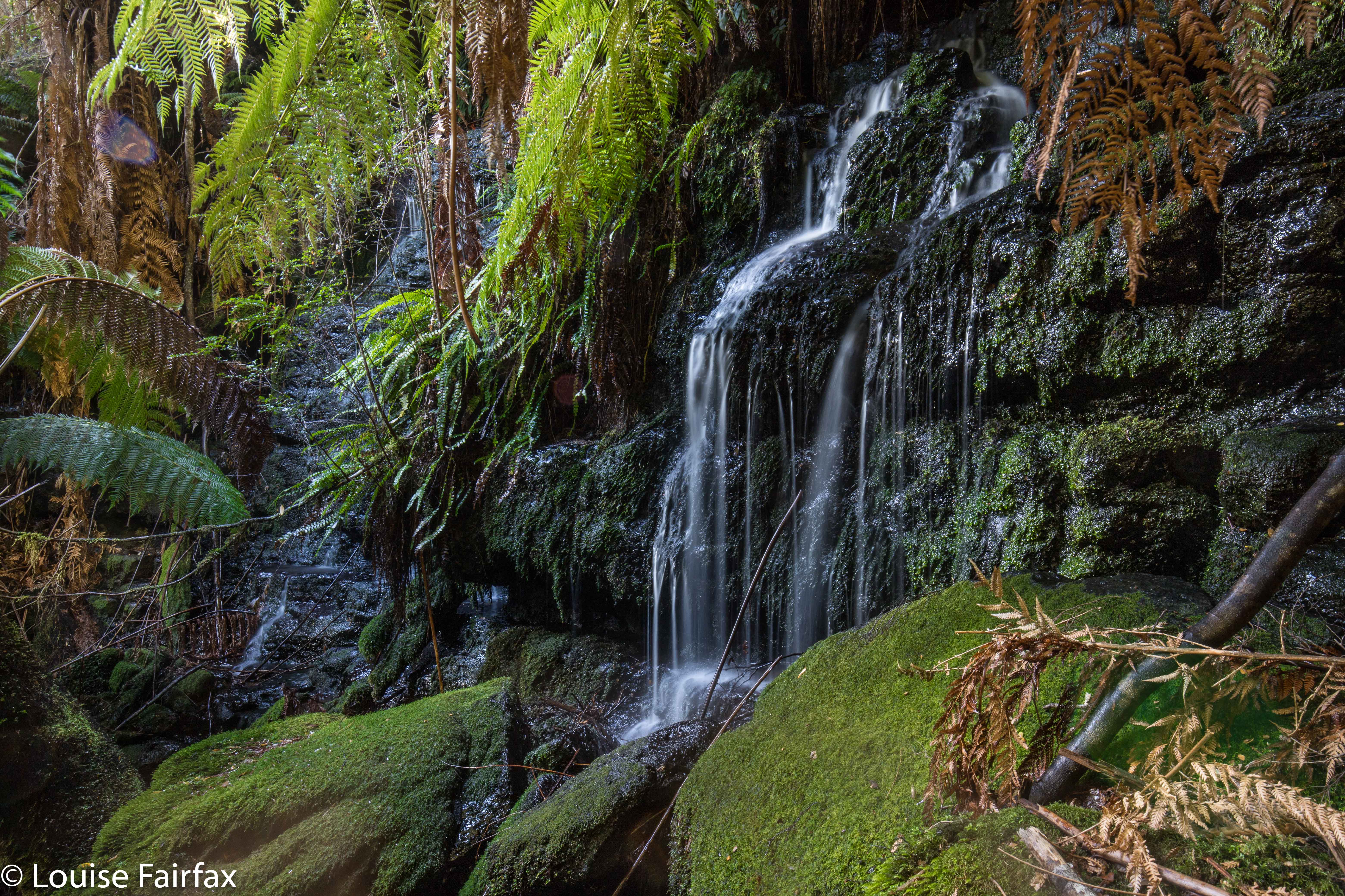
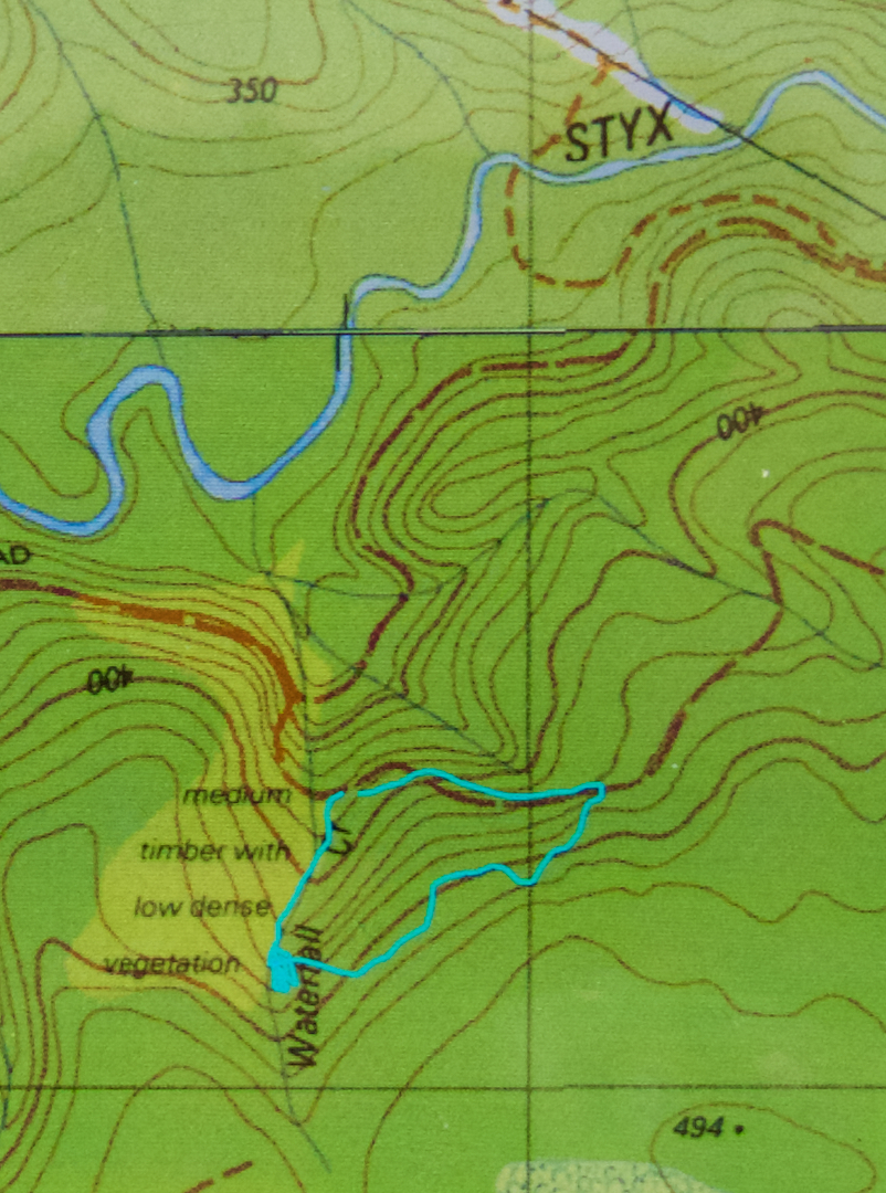
I came upon the Tolkien Falls quite by chance. Perhaps it’s embarrassing to admit it, but I was trying to find Regnans Falls at the time. I was following instructions that said to go to a Big Bend, so I went to the biggest bendiest thing on the map past the Big Tree walk on the Styx Rd, parked and walked my way through beautiful forest up the stream. The instructions said the falls should be twenty-five minutes away. At twelve minutes, I found a waterfall. I’m normally fast, so was only vaguely perplexed. The falls were smaller than those in photos I’d seen, but they were taken in winter, and lots of waterways are not pumping at present, despite recent rain.
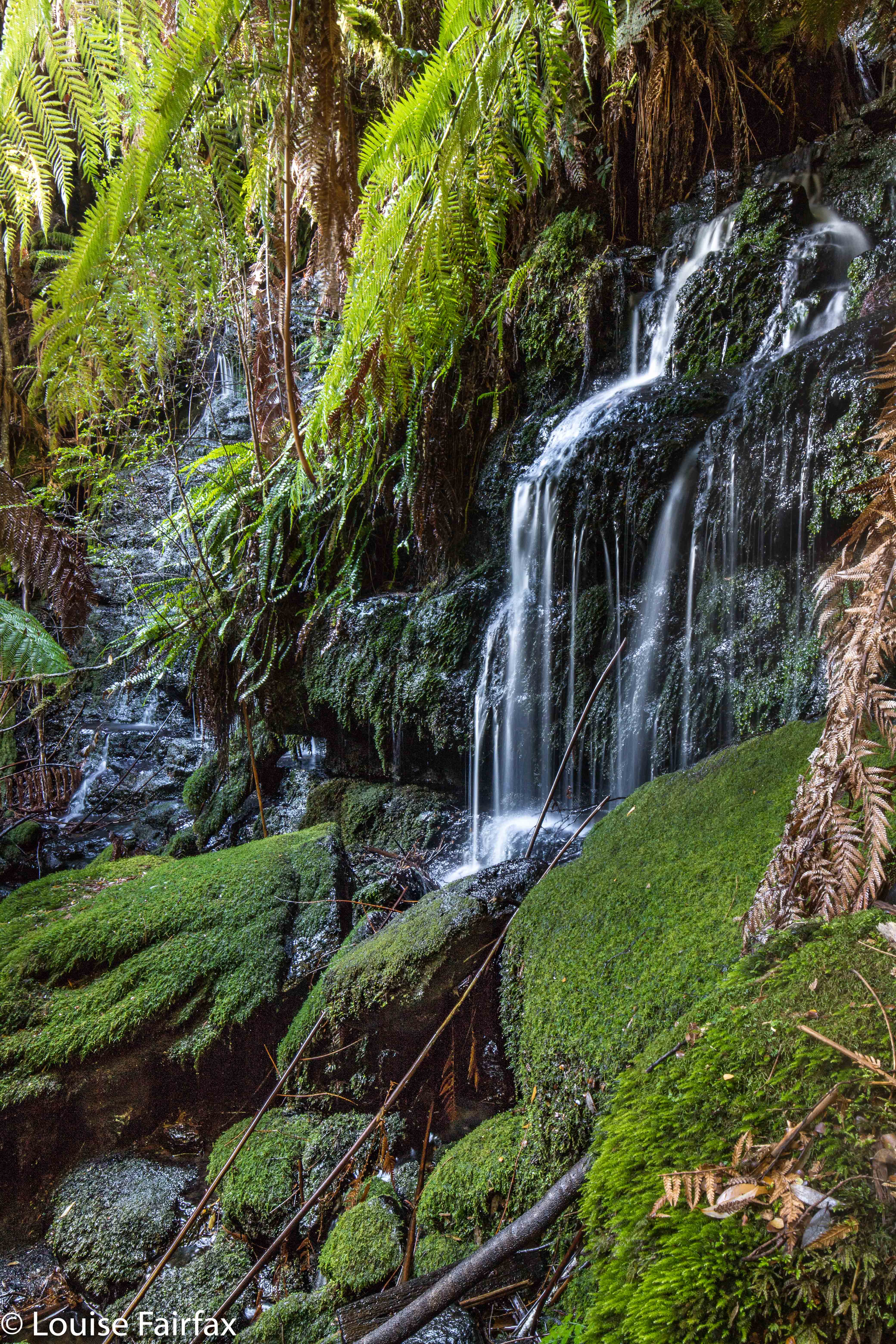
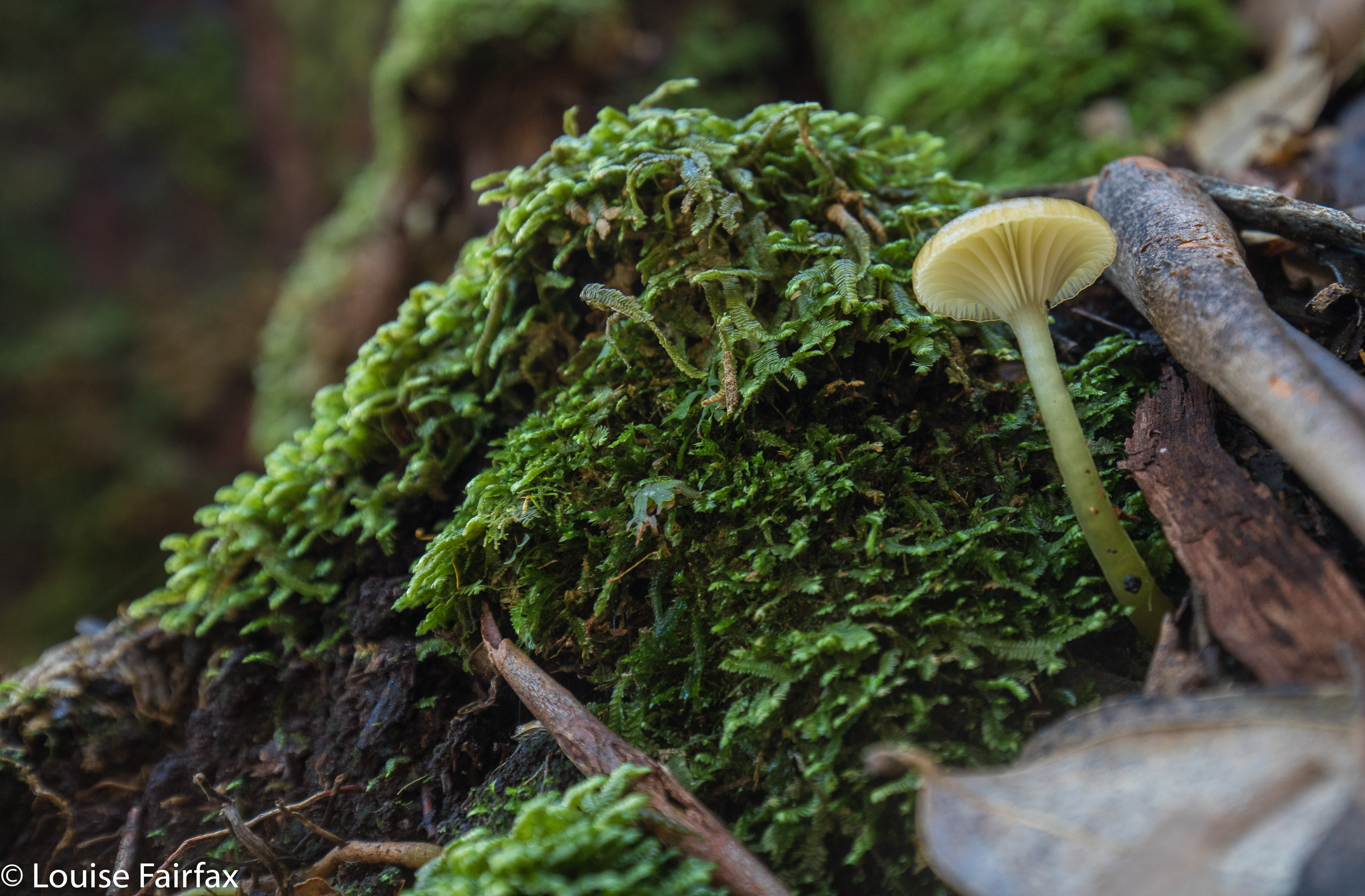
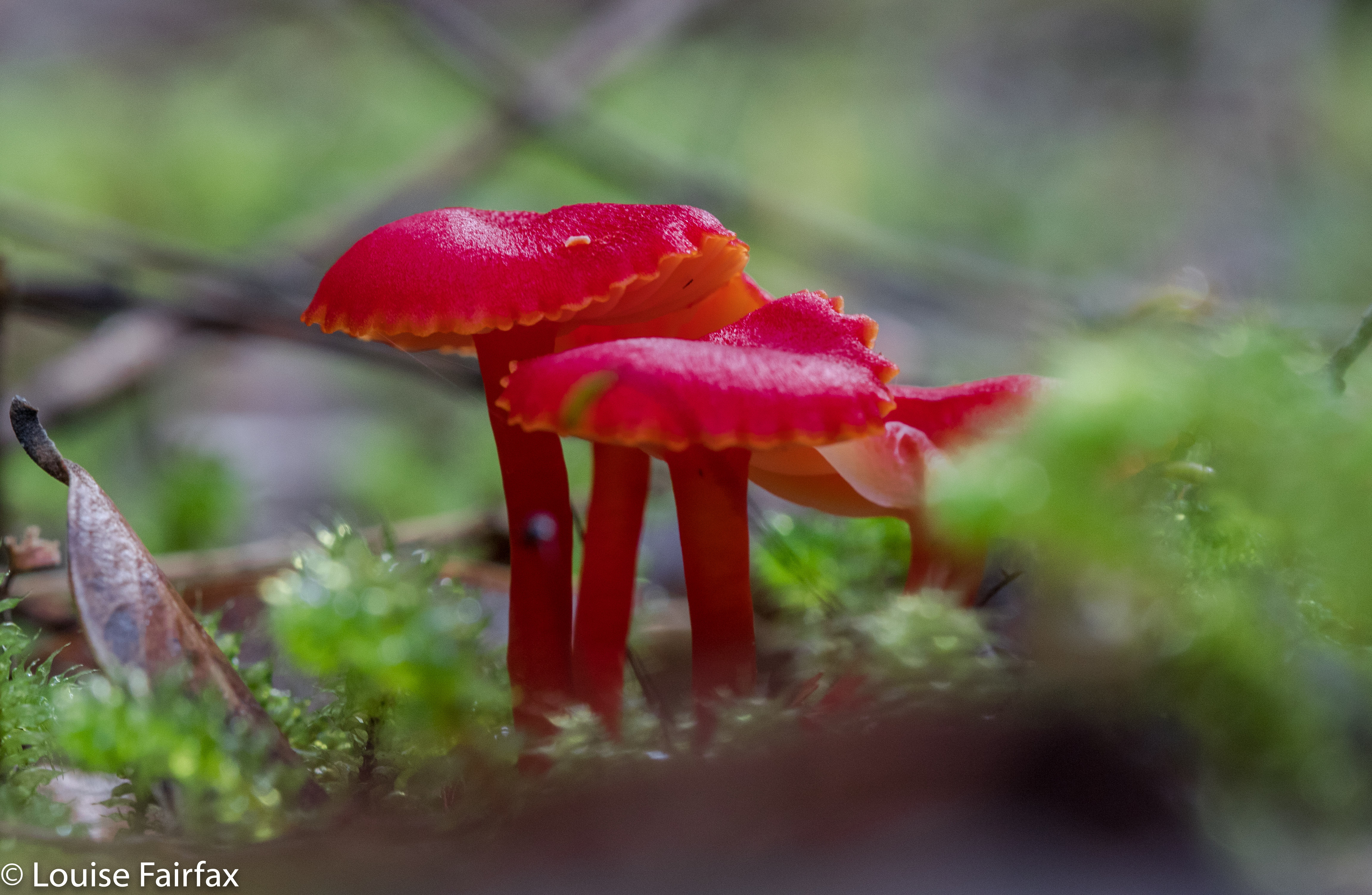
I did find footprints once there AND a pink tape. The instructions had mentioned pink tape, but I found none until I was at the falls. As with Regnans, you could climb up the right hand side (others had done so), and there was more tape there. In fact, I could see a line of tapes, so, being a curious person, I decided to follow them. They took me past “Gandalf’s Staff” and lots of fungi, and eventually, back to the road six minutes’ walk from where my car was. This return forest section took me fifteen and a half minutes (plus the six along the road). It made for a thirty-four minute circuit before you add in an hour for photography (falls and fungi).
The last thing I saw before joining the road was a sign that said “Tolkien Track”, so I have dubbed these the Tolkien Falls. I then tested the only other bend on offer, you know, just in case, and found the falls I had been looking for in the first place, but am very happy to have added these serendipitous falls to my growing collection of photos and Tasmanian waterfalls. Unlike the case with Regnans Falls, the map does inform you that there is a waterfall on this nameless (but now called by me Tolkien) creek.
If you continue along Styx Rd past the Big Tree Reserve Walk, past the sign that tells you there will be a boom gate and you’re to go back to Maydena without collecting $200, and past where the road splits (take the upper fork), then the next bend, a very short way (100 metres?) further on is yours. Walk up the road for six minutes until you see a cairn and pink tapes on the right, and a path leading into the forest. A little sign in the forest will tell you it’s the Tolkien Track. Enjoy. (Then you can do the Big Tree Walk, and the Styx River meander, by which time you’ll be needing some food.) (To get to the Styx Rd, turn right a few kms past Maydena. There’s a big sign.)
Good recce Louise. I also had the info in the book from Rod and Raelene Newell as well, but, as I am up in Devonport, it’s a bit harder to do the southern stuff. One day. Yes, it’s all very frustrating isn’t it.. the lack of good info on waterfall access. But you are doing a superb job with your blog, so keep it up. Craig Doumouros from WOT is very good too, but it’s good to get the whole picture from various sources. I’m a Tolkien fan from way back, so this area has a special interest for me. I knew about the falls past Gandalf’s Staff, but only that it existed. But now, with your track records, it’s a whole lot better. I concur with your names for the creek and falls. So be it. Oh.. I think the Bob Brown book was called “Valley of the Giants”, and was printed in 2000 and reprinted in 2004. I seem to have misplaced my copy, after many house shifts. It’s more of a pamphlet than a book. Quite informative on the Styx valley. Julia falls is named after one Julia Masterman, a Wilderness Society member who passed away in 2000. Some comments, by me, on Julia falls that might be useful..
Julia Falls-Bob Brown Coords? Are these exactly accurate? No.
This waterfall is not indicated on the 1:25,000 Listmap Topo Map, or Tasmap..
Mentioned by Bob Brown. Named after an activist colleague.
Location is Skeleton 756584. This is true, but very misleading!
These figures only make any sense if you have a copy of the topo map in front of you.
They should more properly read (in absolute figures);
UTM Zone 55, E476500 N5258400.
This translates (via Redfearns formula – Grid to Geographic) into…
-42d 49′ 35.6782″ E146d 42′ 5.33682″.
This is where the “exact” figures suggest the falls is located. But.. I have some doubts, as the topo map contours, and neither google earth or Listmap State Aerial photo layer show a watercourse here!!. It is near the top of a spur, and doesn’t match up with the access he gives via track and foot.
They are more likely located in the gully 350m to the ENE of this point.
(Plotting this out on google earth will give a better idea of where I think they are..).
Good luck.
Cheers.. Steve Garth.
To Louise re Julia Falls.. I can give you a graphical overview of the location I drew up in google earth. tracks, colours distances etc. Email me and I can send you a copy, if you want. It might shed more light on this tricky one.
Most maps do not name the creek, but if you zoom in on the Listmap Topographic Basemap, it is appropriately named Waterfall Creek.
Ah, thanks for that extra information Brett